
Search for another town





Free U.S. delivery 7 to 10 days after you order
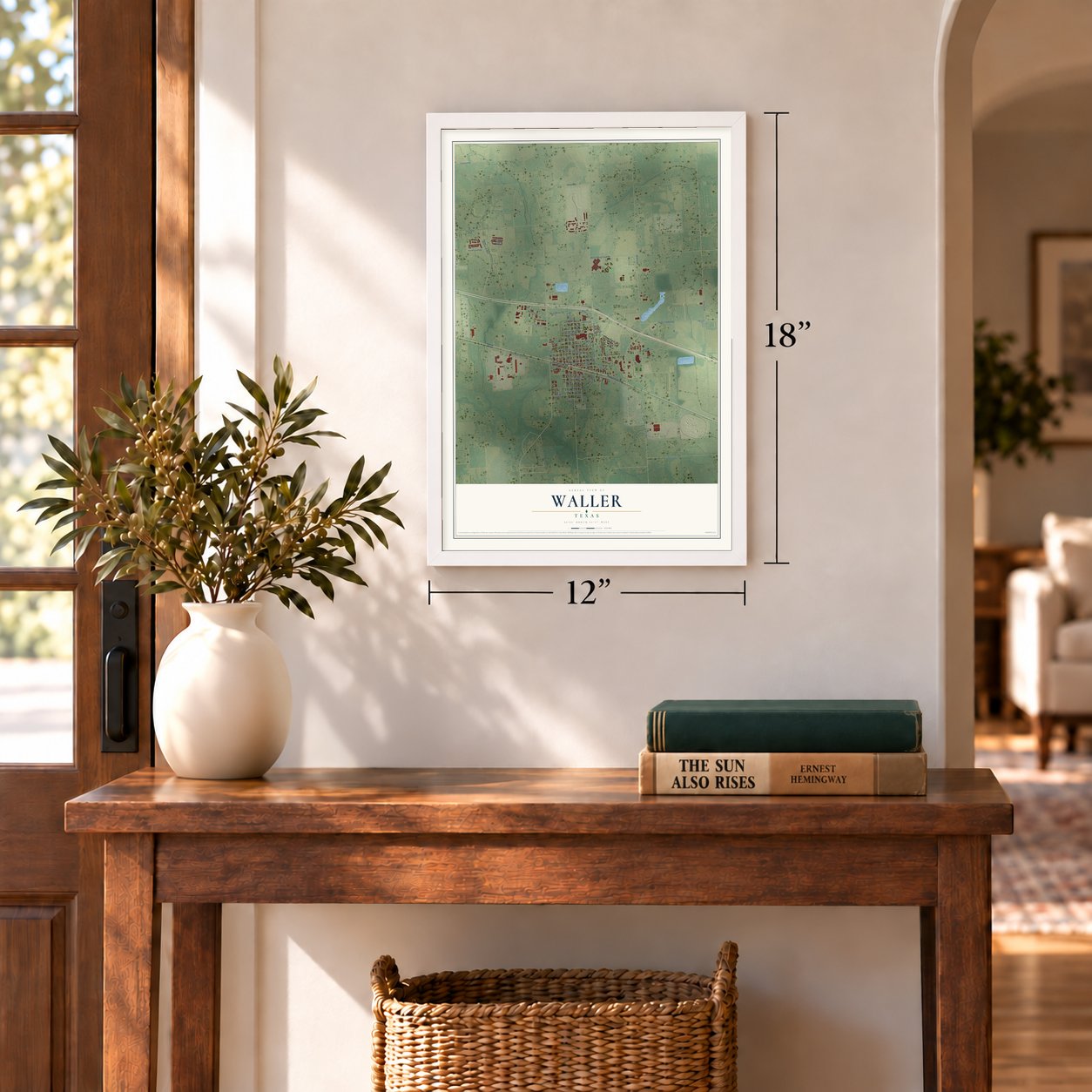
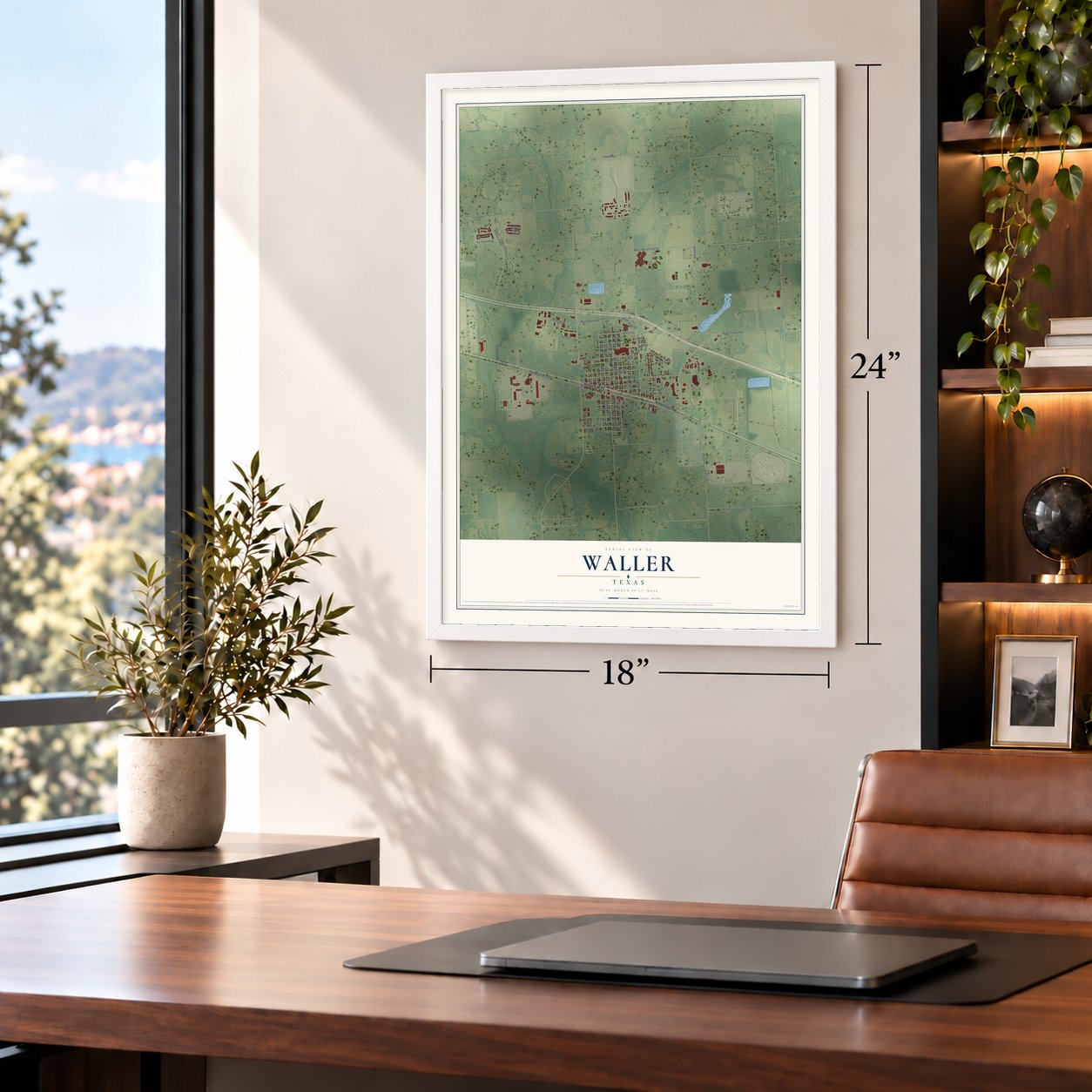
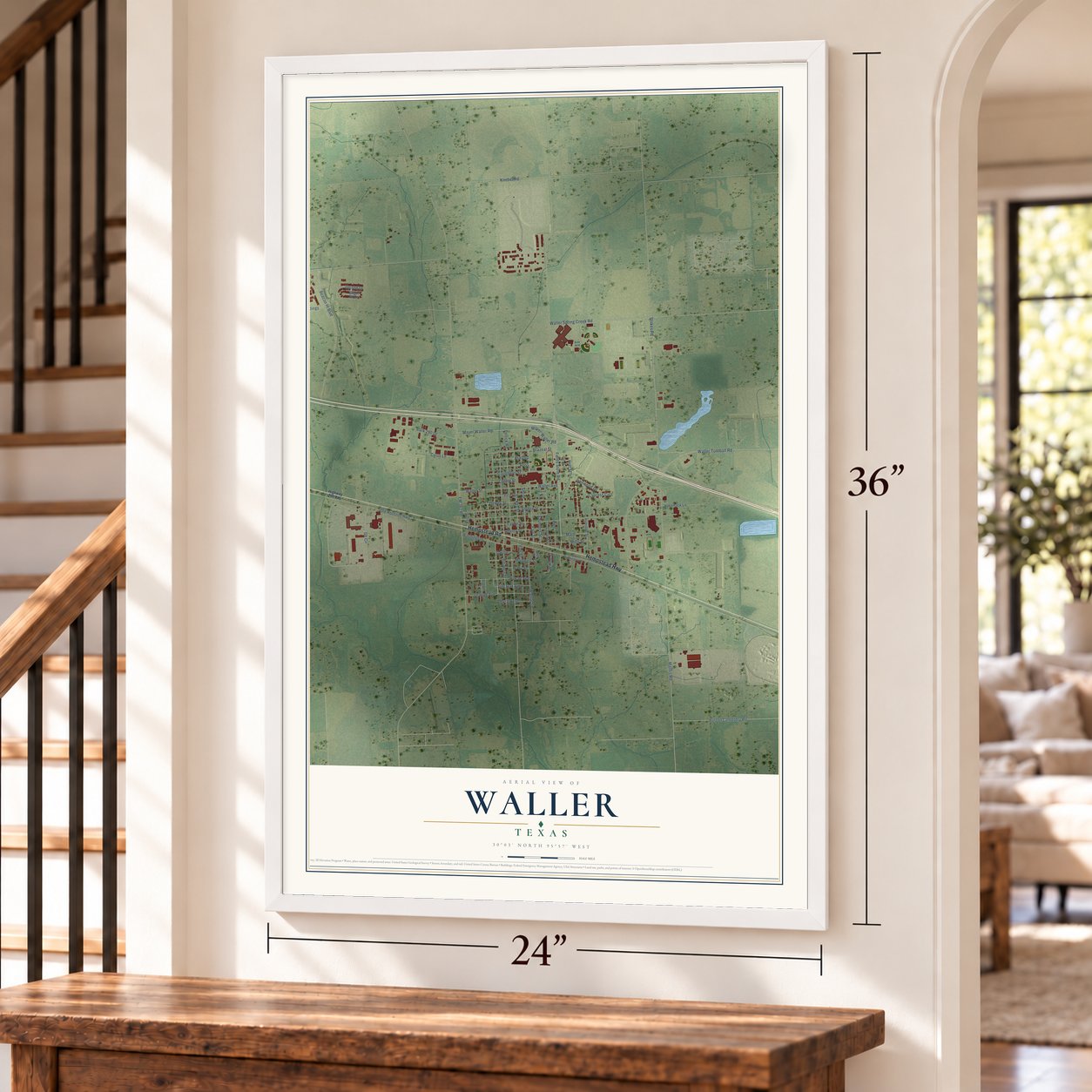
Waller, Texas Map Art
Building by building, with labeled streets and shaded relief.
12" x 18" Archival Matte Print
A Map of Home. A Work of Art.
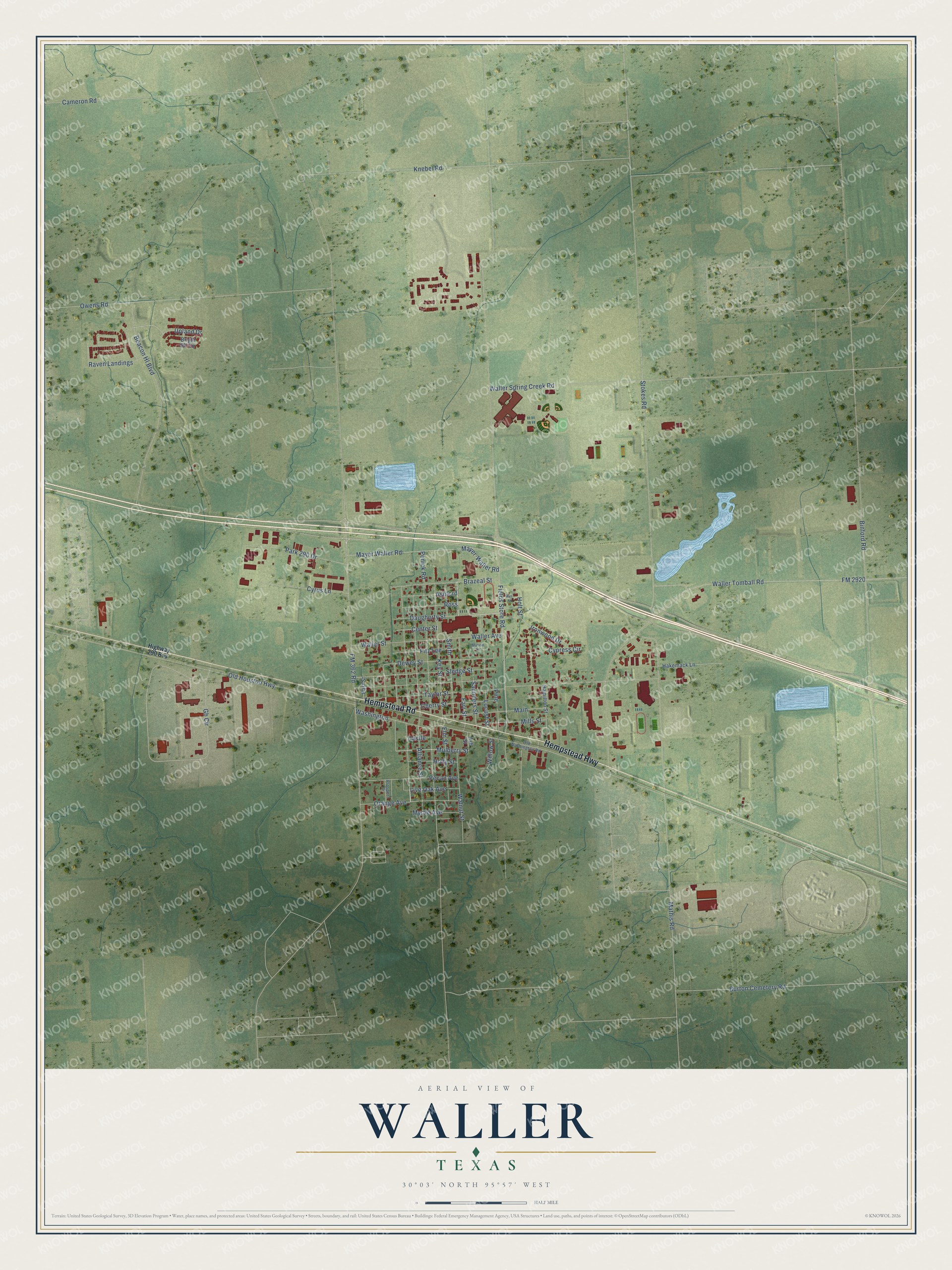
Explore Waller, Texas from a whole new perspective. Created using aerial imagery and detailed geographic data, this map captures Waller building by building, with labeled streets, familiar landmarks, and shaded topographical relief that highlights the natural contours of the landscape.
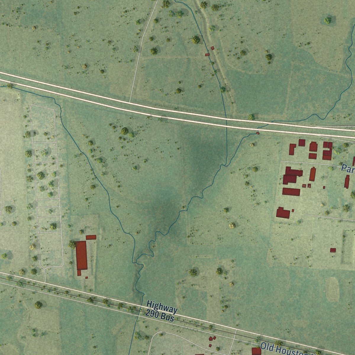
Combining modern data with the timeless character of a vintage atlas, this map is just as interesting up close as it is beautiful on the wall. Whether you grew up in Waller, spent memorable years there, or call it home today, this unique map is a great way to celebrate a place that means something to you. Zoom in on the preview to look for your street, and then order a print to put your memories on the wall.
Three ways to hang it
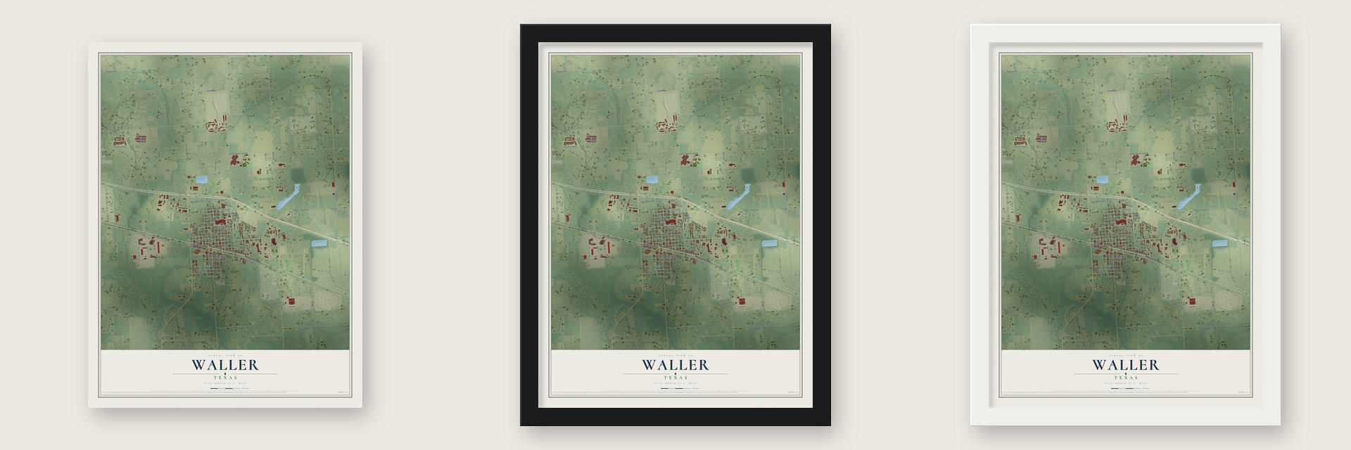
Unframed archival matte, a black wood frame or a white wood frame.
Up close
Geography Worth Displaying
This map was created using accurate cartographic data and authoritative geographic sources, including the U.S. Geological Survey and the Census Bureau. The map brings together terrain, waterways, roads, and building detail. The majority of the streets are labeled, houses are accurately depicted, and the topography is derived from government sources. Combining local data with carefully composed color and shading leads to this beautifully detailed Waller artwork for your wall.
Rather than simply showing street outlines, we’ve included as many of the street names as we could reasonably fit on the map while keeping their names legible. Zoom in on the high resolution preview to see exactly what’s on the map. We truly set out to create a statement piece for anyone who loves Waller. So whether it’s for you, or a gift for someone you love, we hope this map of Waller brings back fond memories.

Find your street
Names on the Waller map
Every name below is printed on this map. Look for your street, your school, the park where you played, or the pond down the road.
Streets and roads69
- Hempstead Road
- Hempstead Highway
- Farr Street
- Daugherty Street
- Mulberry Street
- Fields Store Road
- Brazeal Street
- Upland Drive
- Locust Street
- Mayer-Waller Road
- FM 362 Road
- FM 2920
- Waller Tomball Road
- Stokes Road
- Gh Circle
- Penick Road
- Owens Road
- Alliance Street
- Beacon Hl Boulevard
- Old Houston Highway
- Washington
- Waller Spring Creek Road
- Key Street
- Sledge Street
- Taylor Street
- Waller Street
- Dewey Street
- Smith
- Cherry Street
- Main
Show all 69 streets
- Binford Road
- Orange Avenue
- Park 290 Drive
- Mayer Waller Road
- Knebel Road
- Pecan Avenue
- Cameron Road
- Cyrus Lane
- Raven Landings
- Fitz Lee
- Burton Cemetery Road
- Elm Street
- Mills Street
- Walnut Street
- Mathis Road
- Ashford
- Saunders Street
- Ross
- Cypress Circle
- Holt Street
- Live Oak Avenue
- Holly Street
- Myrtle Avenue
- Ironwood Drive
- Pine
- Center Street
- Willow Street
- Waller Avenue
- Castle
- Hamilton Street
- Hakemack Lane
- Bright Blf Circle
- East Street
- Ash Street
- Highway 290 Bus
- Old Washington Road
- Prospect Drive
- Hall Street
- Marion Lane
Names are listed as they appear on the printed map. Zoom into the product photos to find them.
About Waller, Texas
Waller is a city of 2,682 people in Waller County, along U.S. Highway 290 northwest of Houston, and it reaches into Harris County too. K. H. Faulkner filed a plat for the town on January 11, 1884, and named it for Edwin Waller. A post office opened within a month, and soon afterward "Uncle Doc" Sanders started the first general store. The public school opened in 1887 and finished its first year with eighty students.
Waller was finally laid out in 1889, when its boundaries were pushed wider. Eight years later about 500 people lived there, with a bank and a newspaper of their own, while nearby farmers grew cotton, corn, berries and small fruits. Trains on the Houston and Texas Central Railroad stopped in town. The town asked to incorporate in 1947, chose Jim Haney as its first mayor, and counted 712 people in 1950.
“by the spirit of Christ which is Love, Mercy, and Self denial.”
- God's Mercy StoreAround 1918, A. D. Purvis opened a general store unlike any other in Waller. Each item was priced at what it cost him, and shoppers added whatever profit they thought was fair. The system worked: the store made money and was still open in the late 1920s.
- A college lost in 1900The South Texas Baptist Conference founded South Texas Baptist College in Waller in 1898. Two years later the Galveston hurricane of 1900 tore through town and badly damaged many buildings. The college was among them, and it shut down and was never rebuilt.
- Bread from the Houston marketIn the 1920s local farmers formed the Cooperative, a place to gather as well as a way to sell their crops. Its members ran a store that sold produce in town and a truck that hauled some of their goods to Houston, returning with loaves of bread.
- From livery stable to FordTravelers and salesmen who got off the train at Waller had no way to get around town. Early in the twentieth century the brothers Ed and Bob Robertson solved that by starting a livery stable. The brothers later bought Waller's Ford Motor Company dealership from a Mr. Llewellyn.
- City hall in 1967After a drop in local cotton growing in the 1950s, the Boettcher Cotton Gin closed, but Waller kept growing. The town put up a building for its fire station and city offices in 1953, then built a modern brick city hall in 1967.
Keep exploring Texas
Waller is one of 2,049 Texas towns we've mapped. Every dot on the map is a print of its own.
The search covers every state, Texas first.
Near Waller
Order 2 or more town maps and save 10%. Shown in the size and finish you picked above, so they hang as a set.
- Prairie View 12" x 18" / Archival Matte Print $39.99
- Fields Store 12" x 18" / Archival Matte Print $39.99
- Pine Island 12" x 18" / Archival Matte Print $39.99

More maps nearby: Hempstead, Todd Mission, Stagecoach, Magnolia and Cypress.
The art of mapping a place
How This Map Was Made
Real places. Remarkable detail. Discover the layers that turn geographic data into a map of home.

The view from above
Aerial imagery reveals the character of the land: woodland, open fields, and the patterns of a place.

The shape of the land
Elevation data brings hills, valleys, and subtle changes in the landscape into view.

The details of home
Roads, waterways, and building footprints come together to make the map feel unmistakably local.

Geography becomes art
Considered color, shading, and typography bring the layers together in a map made for your wall.


Process illustrated with Mendon, Massachusetts. Aerial imagery: USDA NAIP. Terrain: USGS 3D Elevation Program. Map details and finished artwork: KNOWOL.
The Details
About This Print
Choose an archival matte print, or a black or white Ayous wood frame. The archival matte print is unframed.
Select your size and finish above to see the matching product image and price.
Materials & Craftsmanship
A contemporary map with the character of a classic atlas, printed on archival matte paper. Optional frames are made from Ayous wood.
Your printed map does not include the watermark shown in the full-map preview.
Shipping & Delivery
Free shipping within the United States. Every print is made to order in the USA.
Buying a gift? Add a note in your cart and we'll include it. We never put prices in the package.
Prints ship within 2 to 3 business days. Allow 7 to 10 days total from ordering for delivery. Timing may vary during holidays or periods of high order volume.
Read our shipping policy.
Returns and damaged prints
Each print is made to order. Change-of-mind refunds are not available after production.
If your print arrives damaged, misprinted or incorrect, contact support@knowol.com within 30 days of receiving it. Include your order number, photos and a description of the issue.
Read our full refund and replacement policy. For questions about your order, email support@knowol.com.