
Search for another town





Free U.S. delivery 7 to 10 days after you order
Walnut Creek, California Map Art
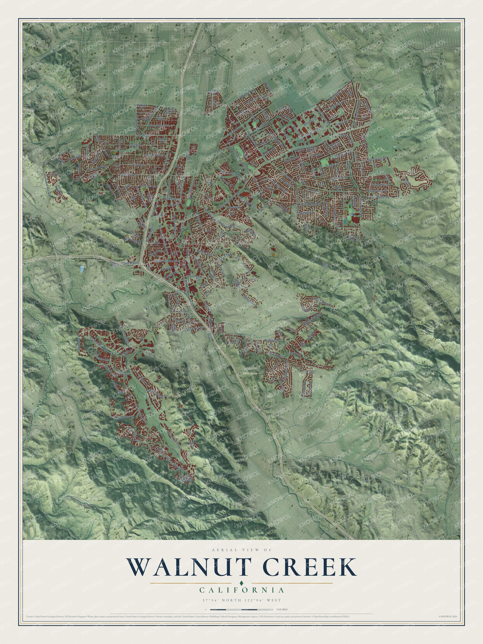
A new map of Walnut Creek, California, made in 2026 and printed to order on thick archival matte paper.
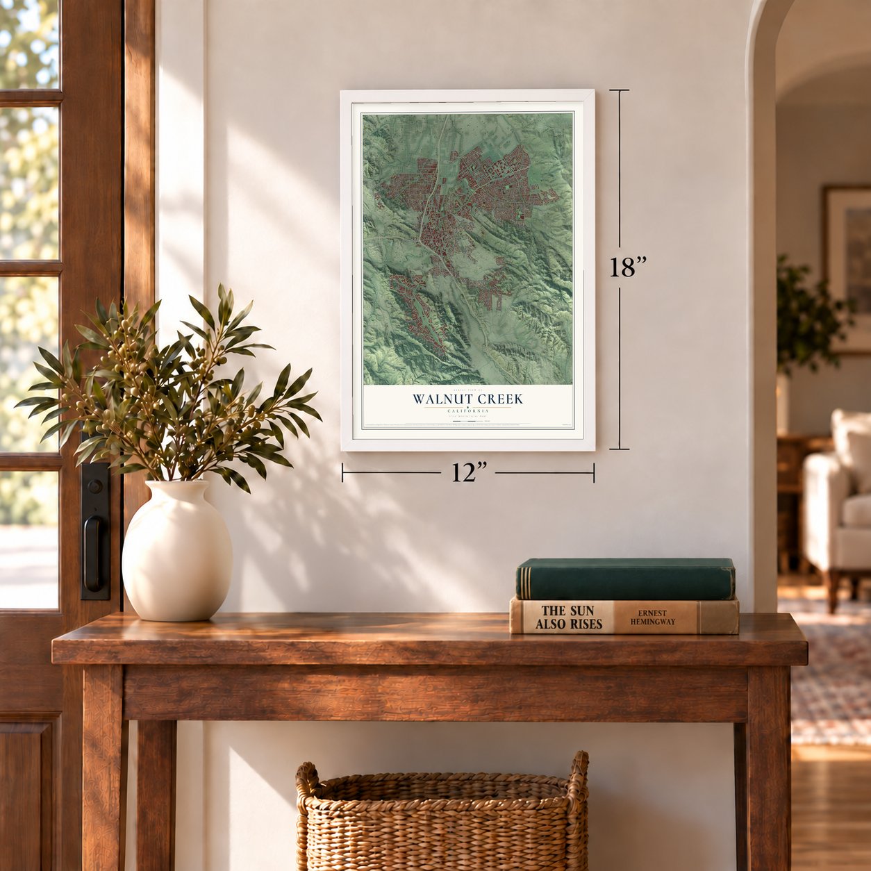
12" x 18" Archival Matte Print
A Map of Home. A Work of Art.
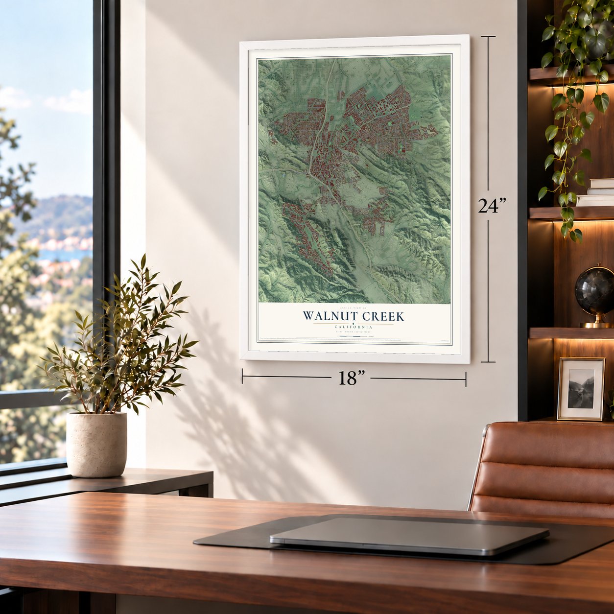
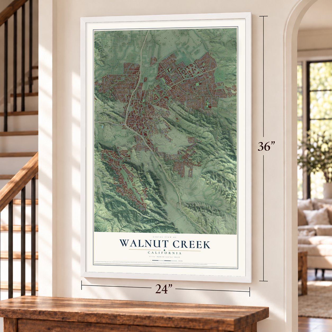
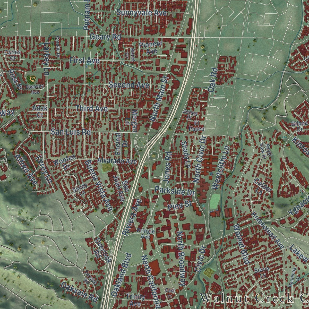
Explore Walnut Creek, California from a whole new perspective. Created using aerial imagery and detailed geographic data, this map captures Walnut Creek building by building, with labeled streets, familiar landmarks, and shaded topographical relief that highlights the natural contours of the landscape.
Combining modern data with the timeless character of a vintage atlas, this map is just as interesting up close as it is beautiful on the wall. Whether you grew up in Walnut Creek, spent memorable years there, or call it home today, this unique map is a great way to celebrate a place that means something to you. Zoom in on the preview to look for your street, and then order a print to put your memories on the wall.
Three ways to hang it
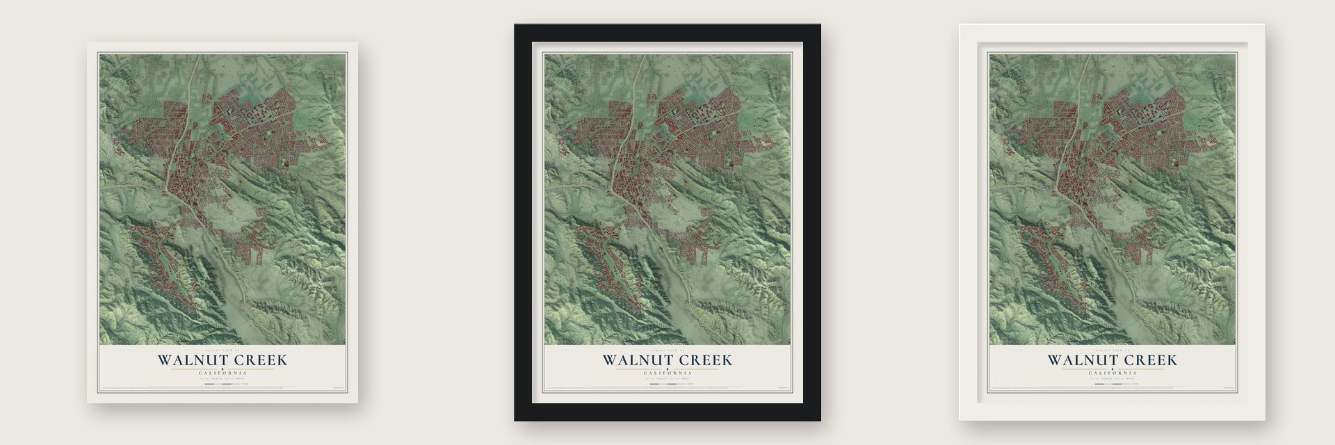
Unframed archival matte, a black wood frame or a white wood frame.
Up close
Geography Worth Displaying
This map was created using accurate cartographic data and authoritative geographic sources, including the U.S. Geological Survey and the Census Bureau. The map brings together terrain, waterways, roads, and building detail. The majority of the streets are labeled, houses are accurately depicted, and the topography is derived from government sources. Combining local data with carefully composed color and shading leads to this beautifully detailed Walnut Creek artwork for your wall.
Rather than simply showing street outlines, we’ve included as many of the street names as we could reasonably fit on the map while keeping their names legible. Zoom in on the high resolution preview to see exactly what’s on the map. We truly set out to create a statement piece for anyone who loves Walnut Creek. So whether it’s for you, or a gift for someone you love, we hope this map of Walnut Creek brings back fond memories.
Read the story behind this map of Walnut Creek, California from 2026.

About Walnut Creek, California
Walnut Creek is a city of 70,127 people in Contra Costa County, below the western slopes of Mount Diablo. Bay Miwok bands lived here, among them the Saclan in the hills, the Volvon near Mount Diablo and the Tactan along San Ramon Creek. Later the land fell within four large Mexican land grants. One was the 18,000-acre Rancho Arroyo de Las Nueces y Bolbones of Juana Sanchez de Pacheco, named for the creek and its native walnut trees. Her grandson Ygnacio Sibrian built the valley's first roofed house around 1850.
After California became part of the United States, a settlement called The Corners grew where the roads from Pacheco and Lafayette met. That spot is now the corner of Mt. Diablo Boulevard and North Main Street. William Slusher was the first settler, and he built a home beside the creek, which Americans first called Nuts Creek in 1849. Milo Hough of Lafayette opened the Walnut Creek House hotel there in 1855, and a blacksmith and a store soon followed. A post office named Walnut Creek opened in December 1862.
- Downtown streets from 1871Homer Shuey was a pioneer whose family ran large cattle ranches. In 1871 and 1872 he platted the downtown streets on part of one ranch, and the town has kept that street pattern ever since.
- The county's 8th citySouthern Pacific trains reached Walnut Creek in 1891, and the town grew around the railroad. On October 21, 1914, the town and the land around it incorporated as Contra Costa County's 8th city. The Southern Pacific branch ran until the late 1970s, and part of its route became the Iron Horse Trail.
- A shopping center in 1951The Broadway Shopping Center opened downtown in 1951 as the county's first major retail center, and it is now Broadway Plaza. Suburbs spread after the war, and in ten years the town roughly quadrupled, counting 2,460 residents in 1950 and 9,903 by 1960.
- Hillsides saved in 1974In 1974 voters approved a $6.7 million bond to protect open space, and the city bought 1,800 acres of hillsides, ridges and park sites. Walnut Creek now owns more open space per person than any other California community, including parts of Lime Ridge, Acalanes Ridge, Shell Ridge and Sugarloaf.
Find your street
Names on the Walnut Creek map
Every name below is printed on this map. Look for your street, your school, the park where you played, or the pond down the road.
Places and landmarks6
- Walnut Creek City Hall
- Lime Ridge Open Space
- Shell Ridge Open Space
- Sugarloaf Open Space
- Bancroft
- Las Juntas
Streets and roads254
- Tice Valley Boulevard
- Mount Diablo Boulevard
- San Miguel Drive
- North California Boulevard
- Pleasant Hill Road
- Whitecliff Way
- Cam Diablo
- Valley Vista Road
- North San Carlos Drive
- Rock Oak Road
- Rock Spring Place
- Ygnacio Valley Road
- Arbolado Drive
- North Main Street
- Walnut Boulevard
- Oak Grove Road
- Rossmoor Parkway
- Rudgear Road
- Tice Creek Drive
- Golden Rain Road
- Terra Granada Drive
- Bancroft Road
- Walnut Avenue
- Geary Road
- Buena Vista Avenue
- Wiget Lane
- Cactus Court
- South Main Street
- Broadway
- Oakland Boulevard
Show all 254 streets
- Treat Boulevard
- Lariat Lane
- San Luis Road
- Larkey Lane
- Citrus Avenue
- Marchbanks Drive
- San Carlos Drive
- Dapplegray Lane
- Gill Port Lane
- North Broadway
- Ptarmigan Drive
- Comistas Drive
- Stewart Avenue
- Parkside Drive
- Perada Drive
- Second Avenue
- San Antonio Drive
- Trotter Way
- Lakewood Road
- First Avenue
- Las Lomas Way
- Castle Rock Road
- Arkell Road
- North Civic Drive
- Oakmont Drive
- Jones Road
- Mallard Drive
- Third Avenue
- Minert Road
- Cam Verde
- Shadelands Drive
- Lancaster Road
- Sunnyvale Avenue
- Quiet Place Drive
- Dover Drive
- Snyder Lane
- Whitehaven Drive
- Montego
- Ebano Drive
- Deerpark Drive
- North Wiget Lane
- Peachwillow Lane
- Cedro Lane
- Lavender Drive
- Via Appia
- Belford Drive
- Olympic Boulevard
- Skycrest Drive
- Castle Hill Road
- Civic Drive
- Wimbledon Road
- Oak Road
- Oro Valley Circle
- Walker Avenue
- Kinross Drive
- North Gate Road
- Sugarberry Lane
- Saklan Indian Drive
- La Casa Via
- Mitchell Drive
- Putnam Boulevard
- Lennon Lane
- Alfred Avenue
- Rockledge Lane
- Stratton Road
- Robb Road
- Arlene Drive
- Eccleston Avenue
- Holland Drive
- Savannah Circle
- Pine Knoll Drive
- Stinson Circle
- Westcliffe Lane
- Clyde Drive
- Fenway Drive
- Via Monte
- Muller Road
- Vallecito Lane
- Glen Court
- Conejo Way
- Velvet Way
- Leroy Lane
- Fyne Drive
- Eckley Lane
- Botelho Drive
- Shuey Avenue
- Indian Hill Drive
- Grover Lane
- Parish Drive
- Natchez Drive
- Riviera Avenue
- Oakvale Road
- Pine Street
- Sorrel Drive
- Weaver Lane
- Via Verde
- Youngs Court
- Overlook Road
- Homestead Avenue
- Stanley Dollar Drive
- Newell Avenue
- Bowling Green Drive
- Oak Knoll Loop
- El Camino Corto
- Horsemans Canyon Drive
- Creekside Drive
- Firestone Drive
- Cafeto Drive
- Hutchinson Road
- Alvarado Avenue
- Carriage Drive
- Huston Road
- Beacon Ridge Lane
- Ramsay Circle
- Lilac Drive
- Trinity Avenue
- Sutton Drive
- Autumn Drive
- Via del Sol
- Grey Eagle Drive
- Shady Lane
- Venado Camino
- Banbury Road
- Mc Nutt Avenue
- Pleasant Valley Drive
- Arlene Lane
- San Juan Avenue
- Shady Glen Road
- Comstock Drive
- Winton Drive
- Quail Crest Drive
- Ellesmere Drive
- Ross Place
- Fox Circle
- Encina Camino
- Gladwin Drive
- Sitka Drive
- Nob Hill Drive
- Pioneer Avenue
- Camel Lane
- Melillo Drive
- Andrea Drive
- Cypress Avenue
- Mayhew Way
- Purson Lane
- Saranap Avenue
- Encinal Drive
- Spring Creek Lane
- Wooten Drive
- Morgan Lane
- English Court
- Calder Lane
- Adak Court
- Erb Court
- San Benito Drive
- Rudgear Drive
- Deer Valley Lane
- Candelero Drive
- Cheyenne Drive
- Banyan Circle
- Santa Rita Drive
- Mi Elana Circle
- Cascade Drive
- Avenue Sevilla
- Las Juntas Way
- Dorsch Road
- Castle Gate Road
- Tupelo Drive
- Arbutus Drive
- Carlos Court
- Jeep Trail
- Sierra Lane
- Danville Boulevard
- Via Loma
- Broadway Plaza
- Biscay Way
- Pringle Avenue
- Gilboa Drive
- Caravelle Drive
- Whitecliff Court
- Cortez Court
- Capwell Lane
- Palmer Road
- Bridle Lane
- Sunny Court
- Kristin Way
- Jones Place
- Fraser Drive
- El Paseo
- Dover Court
- Sandy Lane
- Bont Lane
- Upper Golden Rain
- Monarch Ridge Drive
- Naranja Drive
- Stratton Circle
- Hacienda Drive
- Camino Verde Circle
- Countrywood Court
- Los Banos Avenue
- Old Oak Drive
- Hudson Avenue
- Chinook Drive
- Waterford Lane
- Orchard Lane
- Monet Circle
- Terrace Road
- Essenay Avenue
- Scots Lane
- Chives Way
- Spring Drive
- Alice Avenue
- Mount Pisgah Road
- Coralie Drive
- Royal View Drive
- Alwin Road
- Pazzi Road
- Fairlawn Court
- Hillrise Place
- Eckley Place
- Rock Oak Court
- Kevin Court
- Perra Way
- East Street
Names are listed as they appear on the printed map. Zoom into the product photos to find them.
The art of mapping a place
How This Map Was Made
Real places. Remarkable detail. Discover the layers that turn geographic data into a map of home.

The view from above
Aerial imagery reveals the character of the land: woodland, open fields, and the patterns of a place.

The shape of the land
Elevation data brings hills, valleys, and subtle changes in the landscape into view.

The details of home
Roads, waterways, and building footprints come together to make the map feel unmistakably local.

Geography becomes art
Considered color, shading, and typography bring the layers together in a map made for your wall.


Process illustrated with Mendon, Massachusetts. Aerial imagery: USDA NAIP. Terrain: USGS 3D Elevation Program. Map details and finished artwork: KNOWOL.
The Details
About This Print
Choose an archival matte print, or a black or white Ayous wood frame. The archival matte print is unframed.
Select your size and finish above to see the matching product image and price.
Materials & Craftsmanship
A contemporary map with the character of a classic atlas, printed on archival matte paper. Optional frames are made from Ayous wood.
Your printed map does not include the watermark shown in the full-map preview.
Shipping & Delivery
Free shipping within the United States. Every print is made to order in the USA.
Buying a gift? Add a note in your cart and we'll include it. We never put prices in the package.
Prints ship within 2 to 3 business days. Allow 7 to 10 days total from ordering for delivery. Timing may vary during holidays or periods of high order volume.
Read our shipping policy.
Returns and damaged prints
Each print is made to order. Change-of-mind refunds are not available after production.
If your print arrives damaged, misprinted or incorrect, contact support@knowol.com within 30 days of receiving it. Include your order number, photos and a description of the issue.
Read our full refund and replacement policy. For questions about your order, email support@knowol.com.
Find your town
Looking for another city?
Find a map of home in our California collection, or any town in the country.
Nearby
Maps of towns near Walnut Creek
Know someone from one of these towns? Their map makes a great gift.
 Shell Ridge
, California
From $39.99See the map
 San Miguel
, Contra Costa County, California
From $39.99See the map
 Contra Costa Centre
, California
From $39.99See the map
More maps nearby: Acalanes Ridge, Castle Hill, Saranap, North Gate and Alamo.