
Search for another town





Free U.S. delivery 7 to 10 days after you order
Washington, Washington County, Pennsylvania Map Art
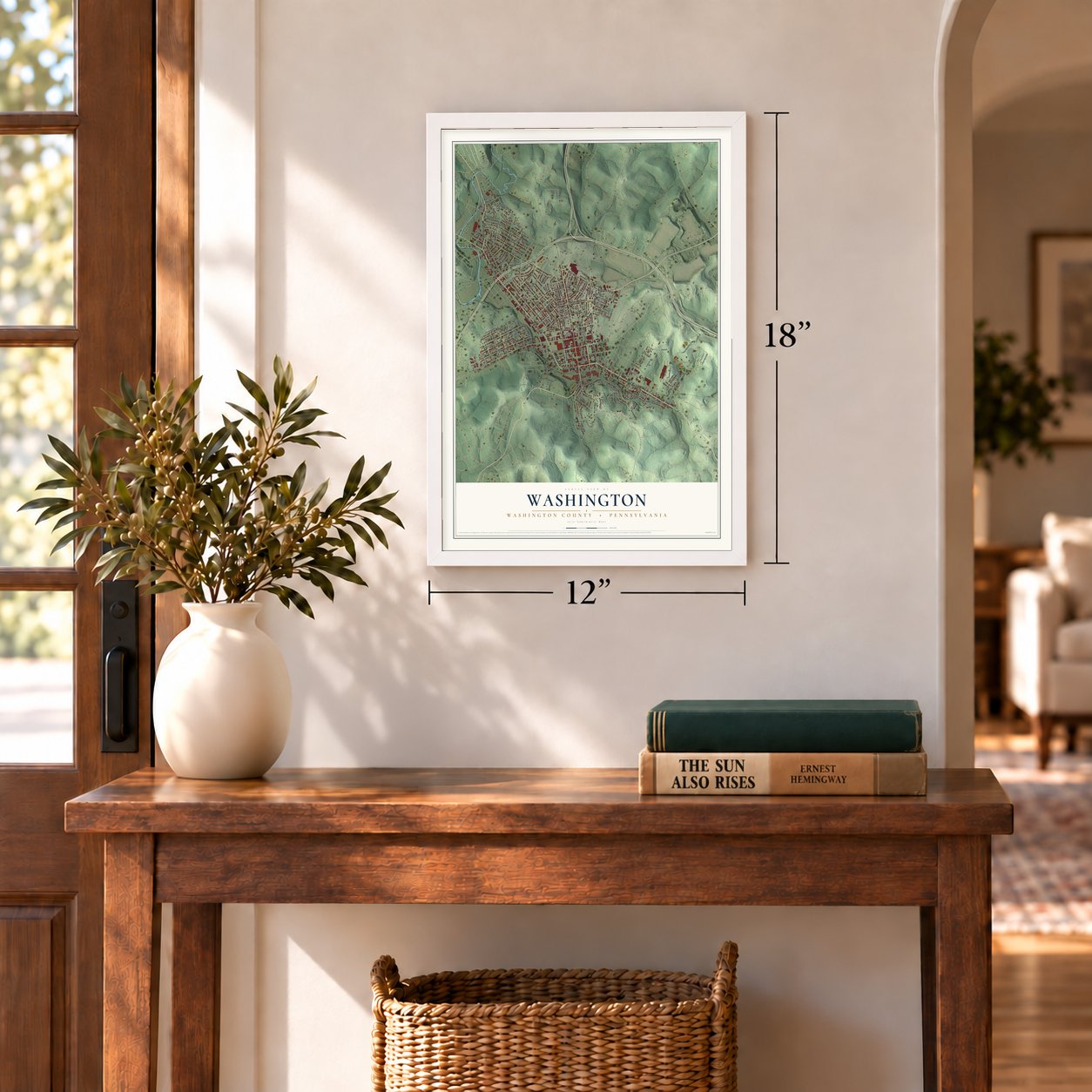
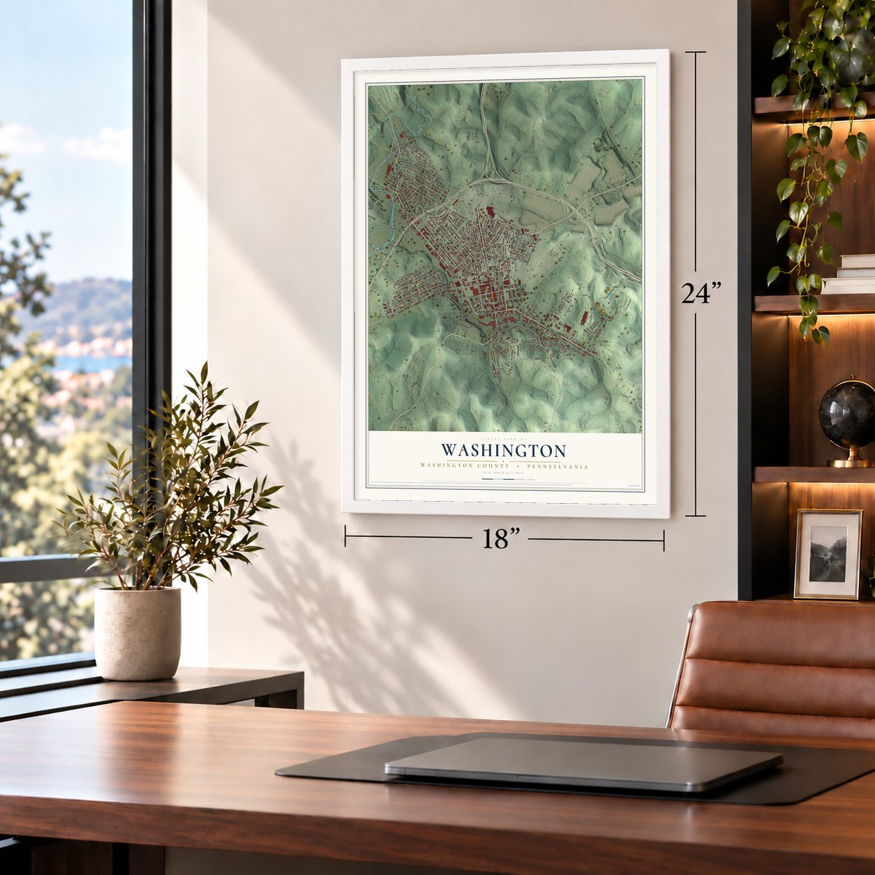
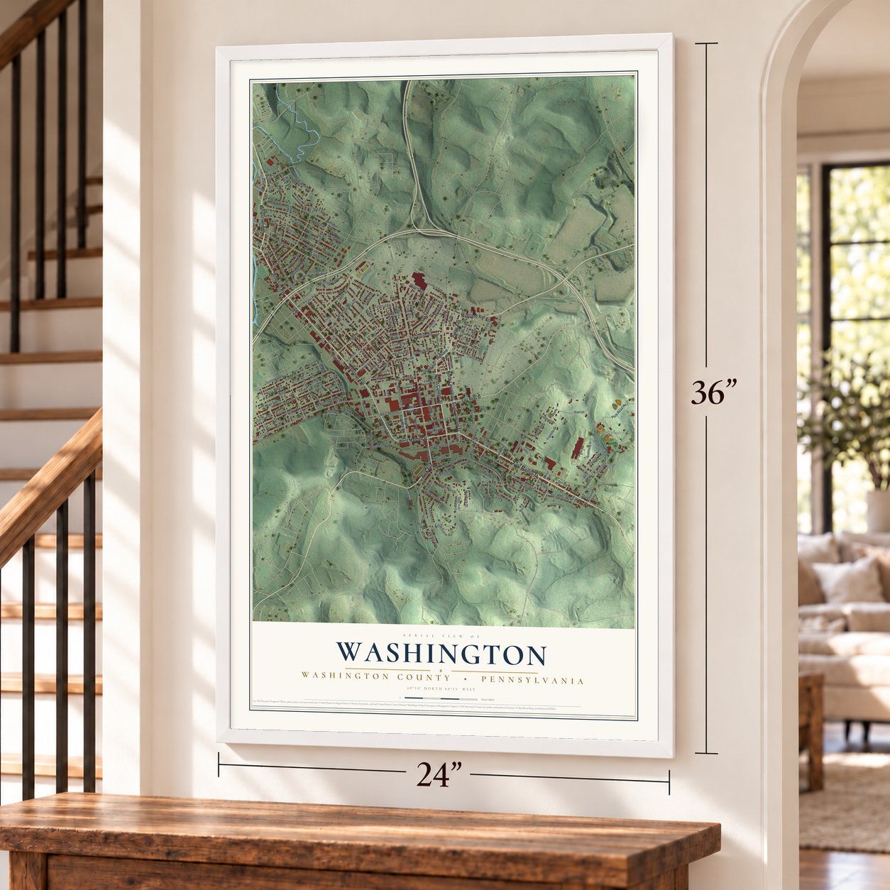
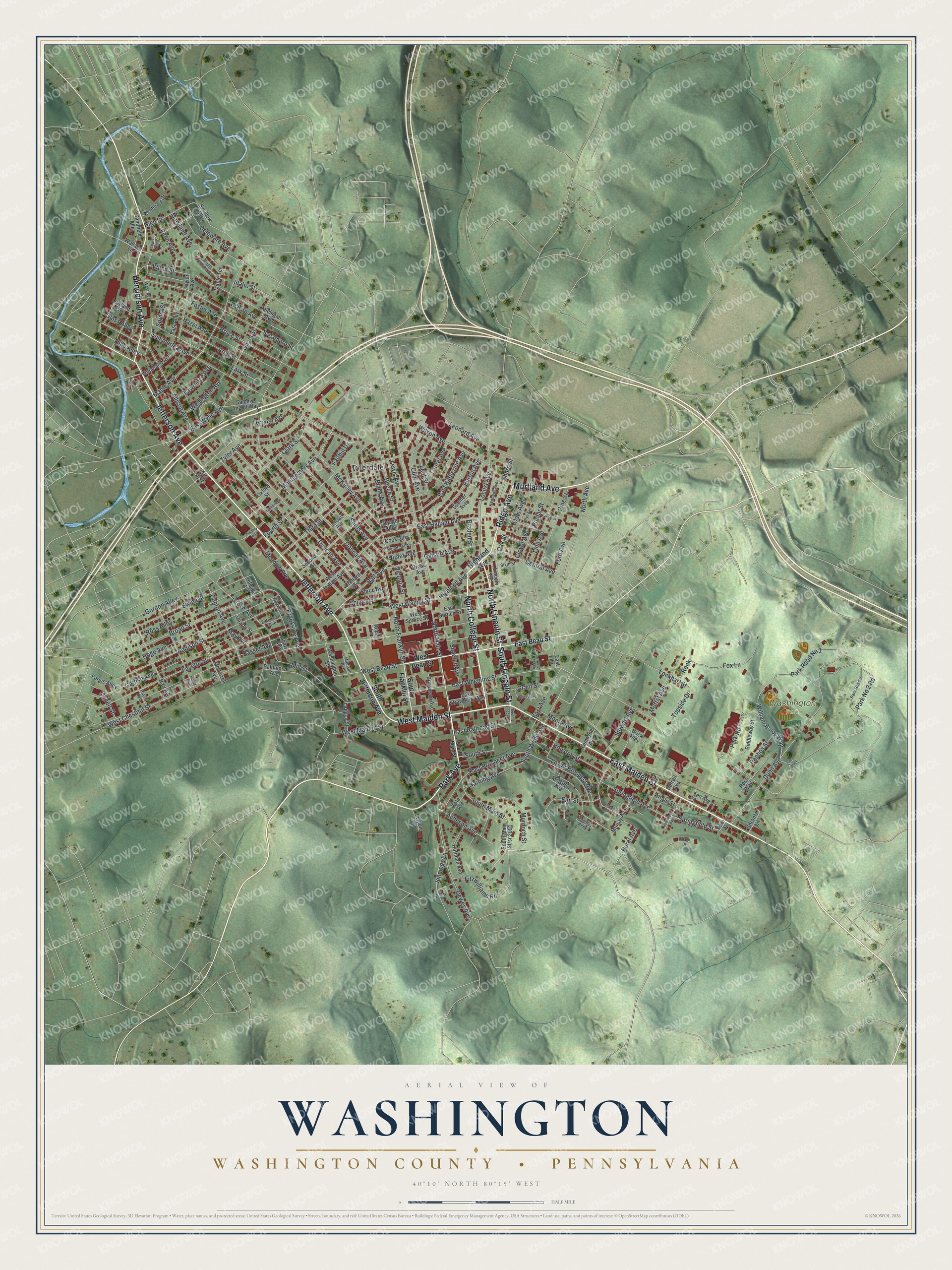
A new map of Washington, Washington County, Pennsylvania, made in 2026 and printed to order on thick archival matte paper.
12" x 18" Archival Matte Print
A Map of Home. A Work of Art.
If you grew up in Washington, look for your old block on this print. It's a modern aerial view of Washington in Washington County, Pennsylvania, made with modern data and a vintage feel. Zoom in on the preview and look for your block.
Three ways to hang it
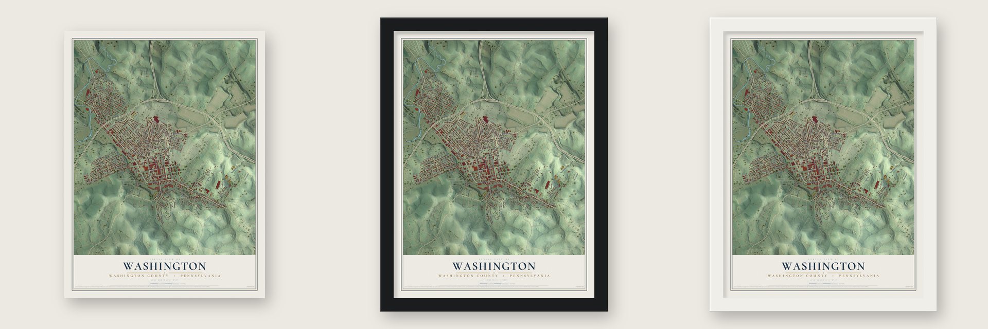
Unframed archival matte, a black wood frame or a white wood frame.
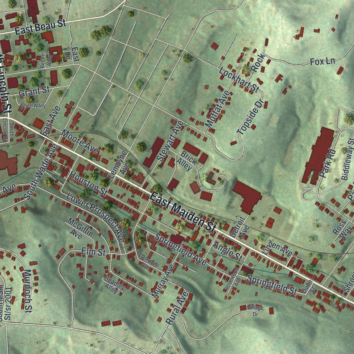
Up close
Real geography. Art worth displaying.
This map was created using accurate cartographic data and authoritative geographic sources, including the U.S. Geological Survey and the Census Bureau. The map brings together terrain, waterways, roads, and building detail. The majority of the streets are labeled, houses are accurately depicted, and the topography is derived from government sources. Combining local data with carefully composed color and shading leads to this beautifully detailed Washington artwork for your wall.
Rather than simply showing street outlines, we’ve included as many of the street names as we could reasonably fit on the map while keeping their names legible. Zoom in on the high resolution preview to see exactly what’s on the map. We truly set out to create a statement piece for anyone who loves Washington. So whether it’s for you, or a gift for someone you love, we hope this map of Washington brings back fond memories.
Read the story behind this map of Washington, Washington County, Pennsylvania from 2026.

About Washington, Washington County, Pennsylvania
Washington is the county seat of Washington County and had 13,176 residents at the 2020 census. Settled around 1768, the community became a borough in 1810 and a city in 1924. Its civic landscape includes Washington & Jefferson College, Washington Park, and historic places associated with the Whiskey Rebellion and abolition.
- County Seat and ScaleWashington covers 3.3 square miles, all land, and serves as the seat of Washington County.
- Whiskey Rebellion CenterWashington became a center of the 1791 Whiskey Rebellion, and leader David Bradford's South Main Street house is now a museum.
- Charles F. WestCharles F. West played quarterback in the 1922 Rose Bowl, a first for an African American, before joining the 1924 Olympic pentathlon team and practicing medicine for 50 years.
- A College LegacyWashington & Jefferson College traces its roots to three log cabin schools founded in the 1780s and took its modern form through an 1865 merger.
- PONY League TraditionWashington hosts PONY Baseball and Softball's headquarters and its annual World Series for 13- and 14-year-old players at Lew Hays Field.
Find your street
Names on the Washington map
Every name below is printed on this map. Look for your street, your school, the park where you played, or the pond down the road.
Places and landmarks2
- Washington Park
- Tylerdale
Streets and roads208
- Jefferson Avenue
- East Maiden Street
- West Maiden Street
- Park Avenue
- Murtland Avenue
- Henderson Avenue
- Ridge Avenue
- North Lincoln Street
- South Lincoln Street
- North College Street
- South Main Street
- West Beau Street
- Central Avenue
- Hall Avenue
- Mill Street
- East Wheeling Street
- Topside Drive
- Murdoch Street
- Rural Avenue
- Allison Avenue
- West Chestnut Street
- Meadow Avenue
- Donnan Avenue
- North Main Street
- North Franklin Street
- Summerlea Avenue
- Fayette Street
- Dunn Avenue
- East Prospect Avenue
- Addison Street
Show all 208 streets
- Duncan Avenue
- Bruce Street
- Sycamore Street
- Maple Avenue
- Lewis Avenue
- Park Road No 1
- William Amos Way
- Hoge Avenue
- Tyler Avenue
- Basset Avenue
- Catfish Avenue
- Dewey Avenue
- Broad Street
- Elm Street
- Springfield Avenue
- Third Street
- Burton Avenue
- Ewing Street
- Ross Alley
- Foster Avenue
- Locust Avenue
- East Hallam Avenue
- Shirls Avenue
- Lark Street
- Park No 2 Road
- Wayne Avenue
- Wilson Avenue
- McKinley Avenue
- Grove Avenue
- Montgomery Avenue
- Hazel Avenue
- Fitzwilliams Road
- Cuhl Avenue
- Arch Street
- East Wylie Avenue
- Brookside Avenue
- Houston Street
- Fourth Street
- West Walnut Street
- Harding Avenue
- Park Road
- Canton Avenue
- Gordon Alley
- Pine Street
- Beech Street
- Glenn Street
- Stewart Avenue
- East Katherine Avenue
- Tube Alley
- Linn Avenue
- Fox Lane
- Clark Street
- South Wade Avenue
- Poplar Street
- Maryland Avenue
- East Railroad Street
- Shaefer Avenue
- Leonard Avenue
- Grant Street
- Oak Street
- Oats Avenue
- Acheson Avenue
- Delaware Avenue
- Lower Prospect Avenue
- Wilna Street
- North Avenue
- Church Street
- Leet Street
- Springfield Street
- Terrace Avenue
- Wellington Avenue
- Gibson Avenue
- High Street
- Penn Avenue
- Clover Avenue
- Lockhart Street
- Moffat Avenue
- Paphos Street
- Blank Avenue
- Lawrence Avenue
- East Avenue
- Isabell Street
- Fairhill Drive
- Moore Avenue
- Victoria Street
- Jennings Lane
- Highland Avenue
- Laurel Avenue
- South Street
- May Avenue
- Ford Avenue
- Angle Street
- Violet Avenue
- Glass Alley
- Idaho Street
- Braden Street
- Spring Street
- Sharp Street
- Rock
- South Jefferson Avenue
- East Beau Street
- South Franklin Street
- Wallace Lane
- West Hallam Avenue
- Sumner Avenue
- Second Street
- McCarrell Avenue
- Hart Avenue
- West Spruce Street
- Woodland Avenue
- Michigan Avenue
- Brick Alley
- McGiffin Avenue
- Osage Alley
- Taylor Avenue
- Orchard Avenue
- East Spruce Street
- Huffman Avenue
- Washington Street
- Baltimore Avenue
- Biddleway Street
- Swallow Alley
- Brownson Avenue
- Maple Terrace
- Ross Way
- Sammy Angott Way
- Murray Avenue
- Shrontz Lane
- East Strawberry Avenue
- Sandfield Alley
- Lowland Avenue
- Prose Avenue
- Lincoln Terrace
- Lemoyne Avenue
- Kentucky Street
- Shrub Avenue
- Forgie Alley
- Hillside Avenue
- Oregon Street
- East Alley
- Linden Avenue
- Cook Alley
- Quarry Street
- Oxford Street
- Detroit Avenue
- Shaw Avenue
- Ruple Lane
- Tate Avenue
- Legion Lane
- East Lane
- Beck Avenue
- Baird Avenue
- West Avenue
- Park Road 2
- Hayes Avenue
- Weaver Avenue
- Seminole Avenue
- Maple Terrace Vw
- Kennedy Avenue
- Sixth Street
- Extension Avenue
- Headley Alley
- School Avenue
- Madison Avenue
- Cario Drive
- Dunn Street
- Rye Avenue
- Erie Street
- Shell Alley
- Rosewood Avenue
- Circle Alley
- Campbell Avenue
- Cambridge Street
- Village Drive
- Becker Alley
- Armour Street
- Factory Way
- Line Alley
Names are listed as they appear on the printed map. Zoom into the product photos to find them.
The art of mapping a place
How This Map Was Made
Real places. Remarkable detail. Discover the layers that turn geographic data into a map of home.

The view from above
Aerial imagery reveals the character of the land: woodland, open fields, and the patterns of a place.

The shape of the land
Elevation data brings hills, valleys, and subtle changes in the landscape into view.

The details of home
Roads, waterways, and building footprints come together to make the map feel unmistakably local.

Geography becomes art
Considered color, shading, and typography bring the layers together in a map made for your wall.


Process illustrated with Mendon, Massachusetts. Aerial imagery: USDA NAIP. Terrain: USGS 3D Elevation Program. Map details and finished artwork: KNOWOL.
The Details
About This Print
Choose an archival matte print, or a black or white Ayous wood frame. The archival matte print is unframed.
Select your size and finish above to see the matching product image and price.
Materials & Craftsmanship
A contemporary map with the character of a classic atlas, printed on archival matte paper. Optional frames are made from Ayous wood.
Your printed map does not include the watermark shown in the full-map preview.
Shipping & Delivery
Free shipping within the United States. Every print is made to order in the USA.
Buying a gift? Add a note in your cart and we'll include it. We never put prices in the package.
Prints ship within 2 to 3 business days. Allow 7 to 10 days total from ordering for delivery. Timing may vary during holidays or periods of high order volume.
Read our shipping policy.
Returns and damaged prints
Each print is made to order. Change-of-mind refunds are not available after production.
If your print arrives damaged, misprinted or incorrect, contact support@knowol.com within 30 days of receiving it. Include your order number, photos and a description of the issue.
Read our full refund and replacement policy. For questions about your order, email support@knowol.com.
Find your town
Looking for another city?
Find a map of home in our Pennsylvania collection.
Nearby
Maps of towns near Washington
Know someone from one of these towns? Their map makes a great gift.
 East Washington
, Pennsylvania
From $39.99See the map
 North Franklin
, Pennsylvania
From $39.99See the map
 Laboratory
, Pennsylvania
From $39.99See the map
More maps nearby: Meadowlands, South Strabane, Wolfdale, Canton and McGovern.