
Search for another town





Free U.S. delivery 7 to 10 days after you order
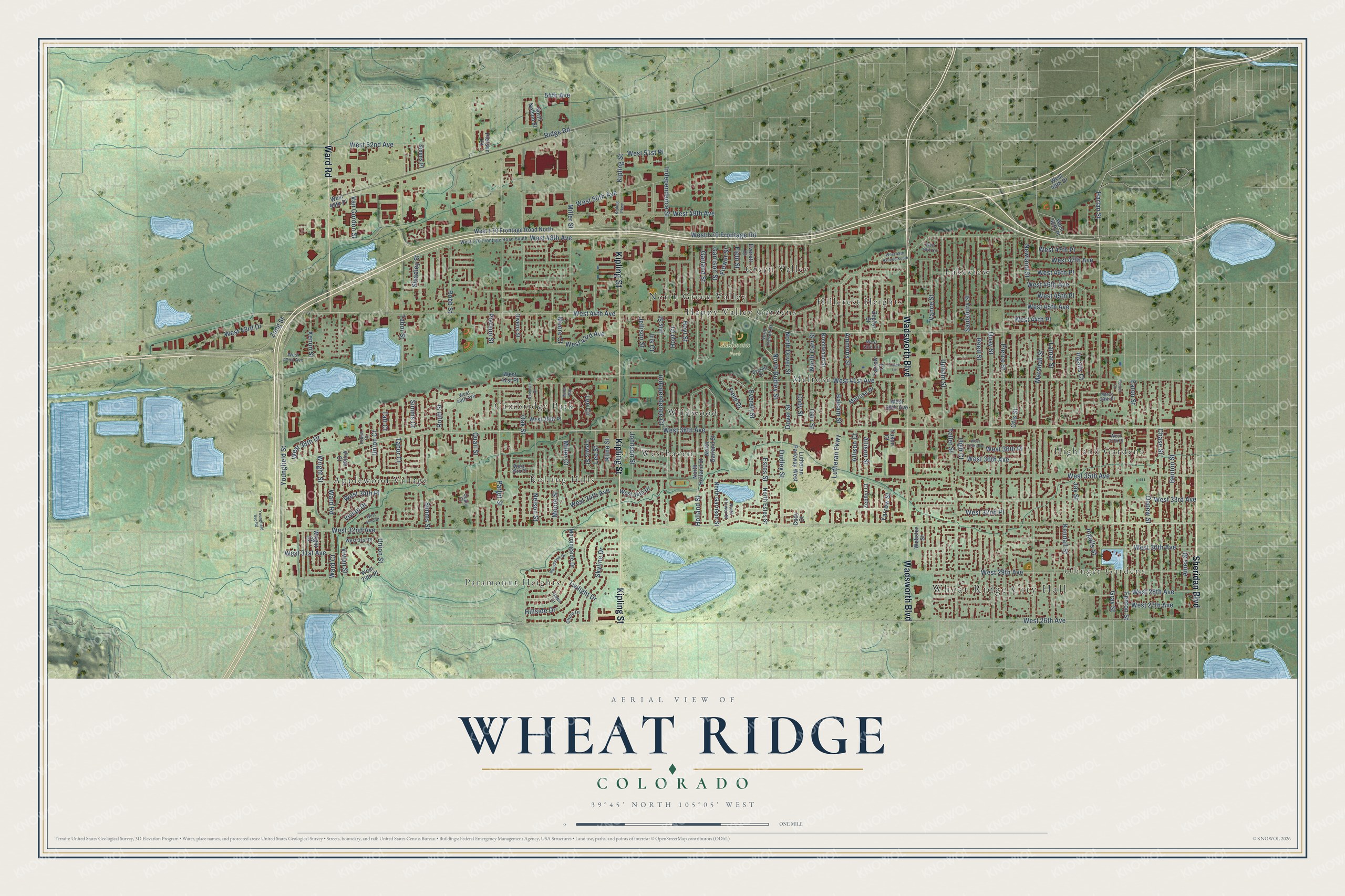
Wheat Ridge, Colorado Map Art
A new map of Wheat Ridge, Colorado, made in 2026 and printed to order on thick archival matte paper.
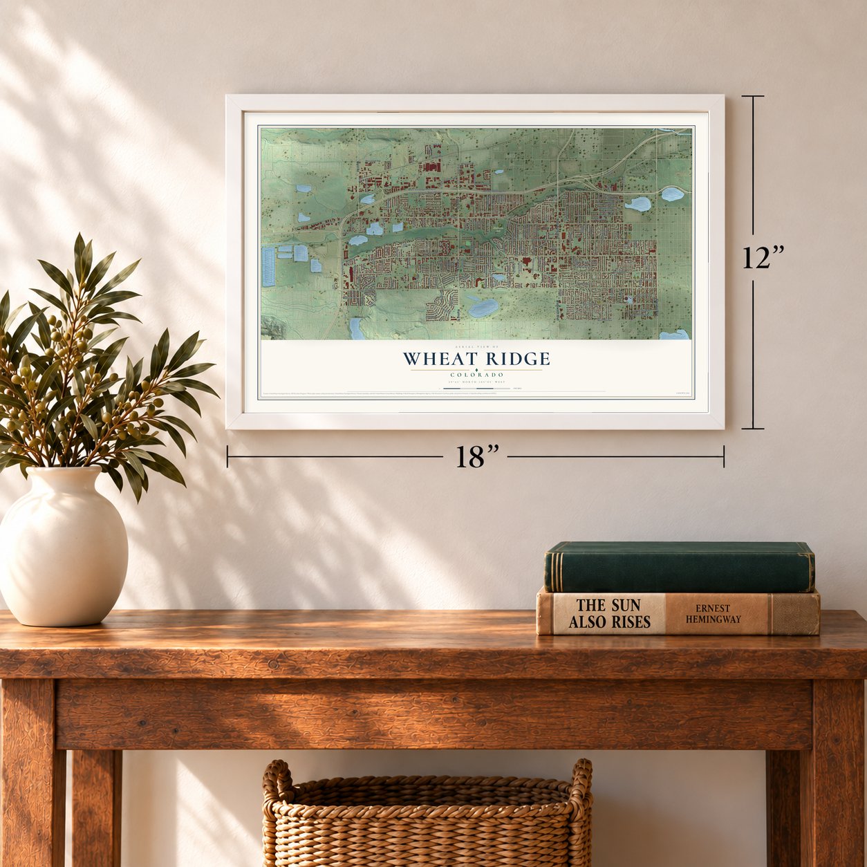
12" x 18" Archival Matte Print
A Map of Home. A Work of Art.
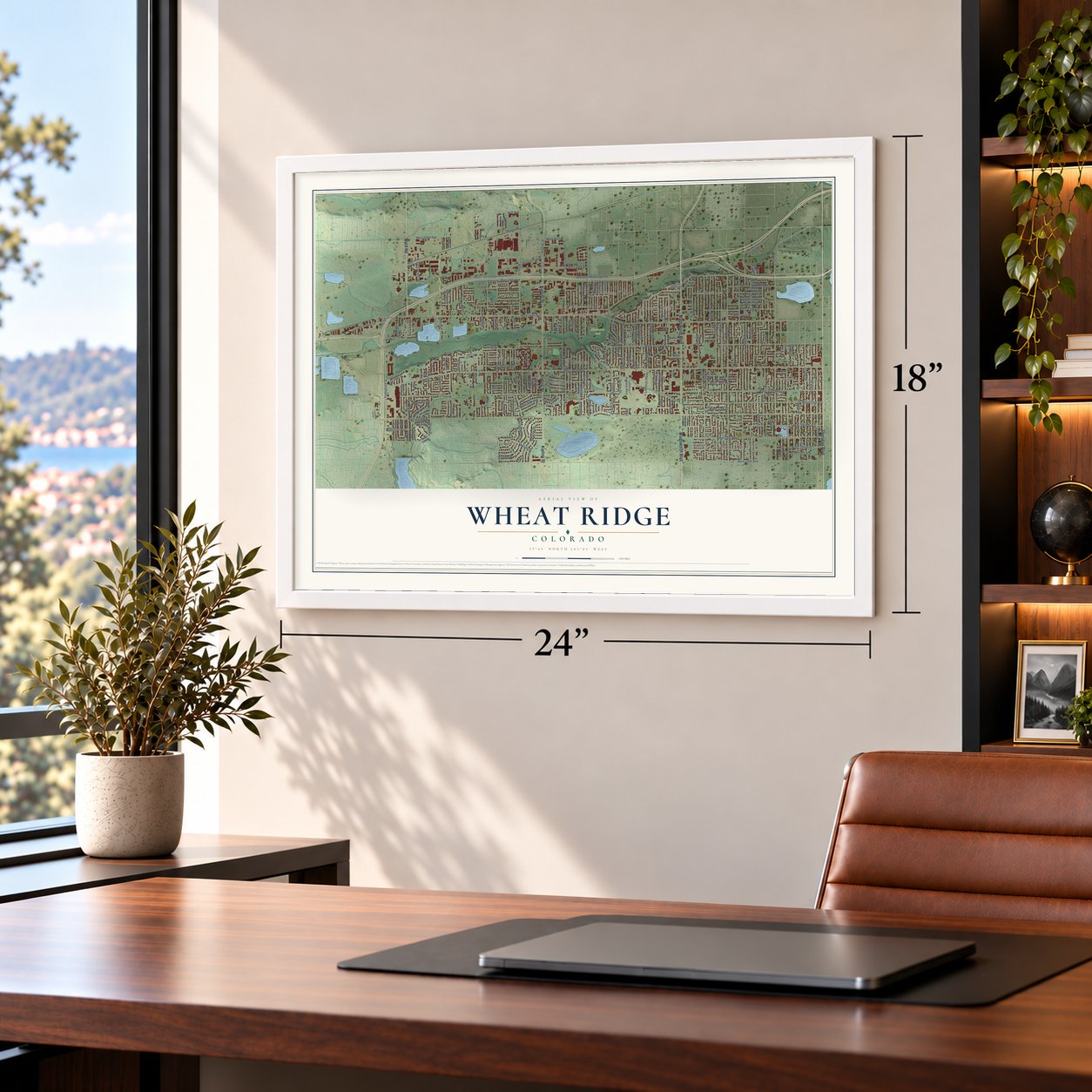
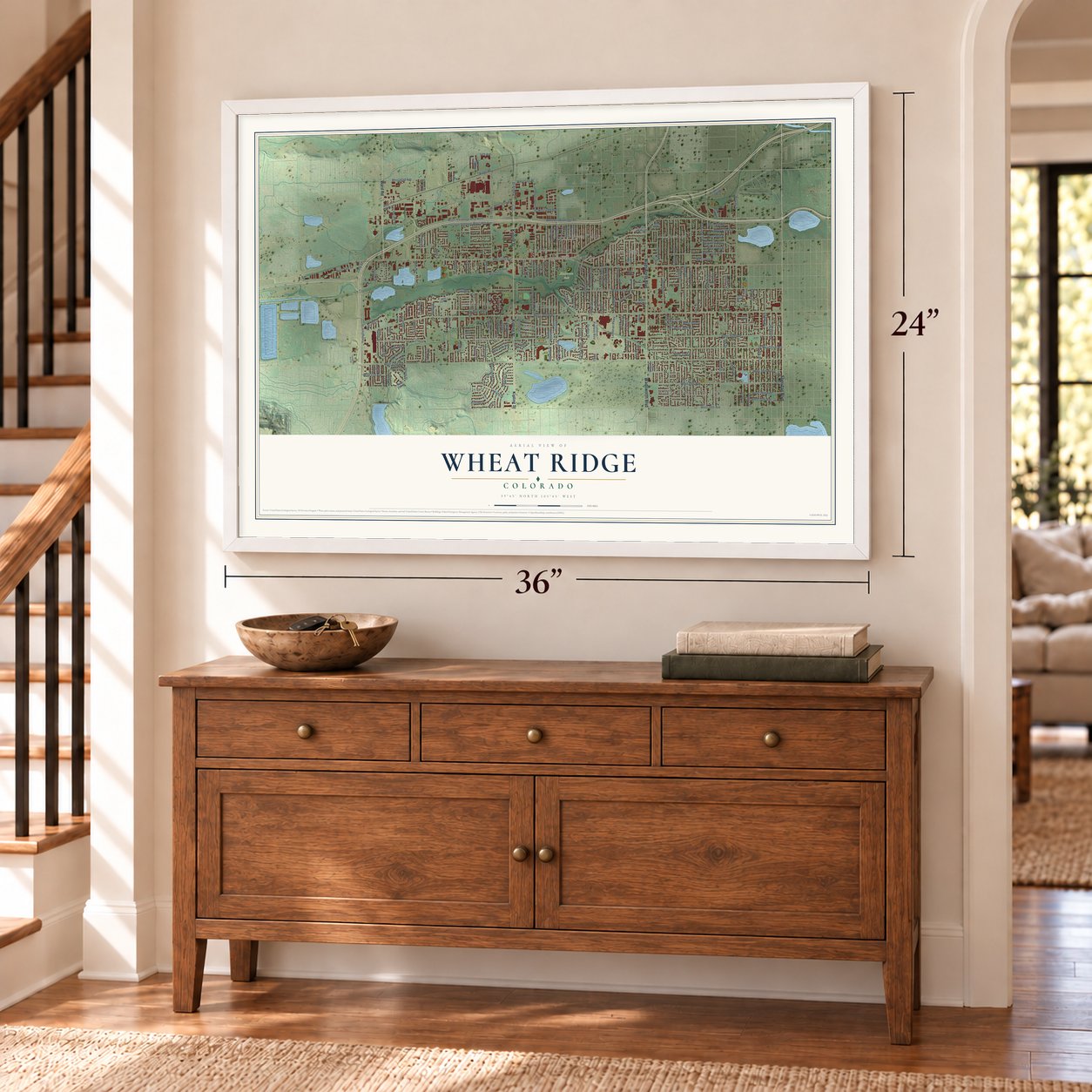
Explore Wheat Ridge, Colorado from a whole new perspective. Created using aerial imagery and detailed geographic data, this map captures Wheat Ridge building by building, with labeled streets, familiar landmarks, and shaded topographical relief that highlights the natural contours of the landscape.
Combining modern data with the timeless character of a vintage atlas, this map is just as interesting up close as it is beautiful on the wall. Whether you grew up in Wheat Ridge, spent memorable years there, or call it home today, this unique map is a great way to celebrate a place that means something to you. Zoom in on the preview to look for your street, and then order a print to put your memories on the wall.
Three ways to hang it
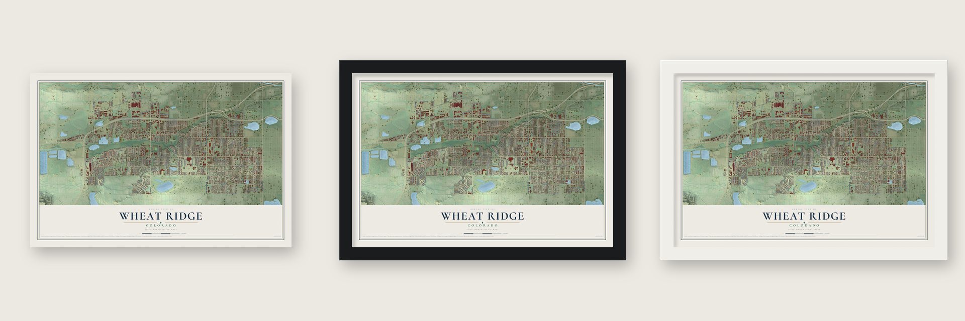
Unframed archival matte, a black wood frame or a white wood frame.
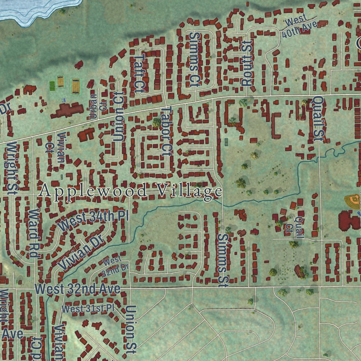
Up close
Geography Worth Displaying
This map was created using accurate cartographic data and authoritative geographic sources, including the U.S. Geological Survey and the Census Bureau. The map brings together terrain, waterways, roads, and building detail. The majority of the streets are labeled, houses are accurately depicted, and the topography is derived from government sources. Combining local data with carefully composed color and shading leads to this beautifully detailed Wheat Ridge artwork for your wall.
Rather than simply showing street outlines, we’ve included as many of the street names as we could reasonably fit on the map while keeping their names legible. Zoom in on the high resolution preview to see exactly what’s on the map. We truly set out to create a statement piece for anyone who loves Wheat Ridge. So whether it’s for you, or a gift for someone you love, we hope this map of Wheat Ridge brings back fond memories.
Read the story behind this map of Wheat Ridge, Colorado from 2026.

About Wheat Ridge, Colorado
Wheat Ridge is a city of 32,398 people in Jefferson County, just west of Denver, with Clear Creek flowing through it. During the Gold Rush of the late 1850s, travelers heading for the mountains made it a favorite place to rest, and the farms that grew into the town were started in 1859.
Orchards and crop fields covered the area, with homes and shops scattered among them. In the 1950s, new neighborhoods spread across unincorporated Jefferson County to house people who worked in Denver, and businesses lined the main roads leading out of the city. Utility and fire districts brought city services, but neighboring cities kept pressing to annex the land, so Wheat Ridge incorporated in 1969.
- The Carnation CityAfter World War II, growing carnations became a local industry, and by the mid-1900s Wheat Ridge was known as the Carnation City. The city remembers that trade every year with the Carnation Festival in early August at Anderson Park. A nonprofit group runs it, admission is free, and most of the money it raises goes back into the community.
- A log cabin inside a farmhouseJames H. Baugh's house started as a hand-hewn log cabin in 1860, and around 1904 a frame farmhouse was built around it. The Wheat Ridge Historical Society restored it, with support from the state's historical society and from the city itself, and it joined the National Register on August 14, 2012. It stands among other old buildings in the Wheat Ridge Historic Park.
- Farming back in townFarms defined Wheat Ridge until the 1960s, before houses, stores and offices filled most of its land. In May 2011 the City Council adopted Ordinance 1491, which opened every zone district to community gardens, farmers' markets and produce stands. Homeowners can now grow and sell produce and keep bees and chickens.
Find your street
Names on the Wheat Ridge map
Every name below is printed on this map. Look for your street, your school, the park where you played, or the pond down the road.
Places and landmarks16
- Wheat Ridge City Hall
- Olinger Gardens
- Anderson Park
- Applewood Village
- Cambridge Park
- Green Valley
- Happy Valley Gardens
- Highland Gardens
- Hillcrest Heights
- Lakeview
- Melrose
- North Green Valley
Show all 16 places
- Paramount Heights
- Rolling Hills
- Westhaven
- Wildwood
Streets and roads182
- Wadsworth Boulevard
- Kipling Street
- Sheridan Boulevard
- Ward Road
- West 32nd Avenue
- Harlan Street
- West 48th Avenue
- Ames Street
- Chase Street
- Lamar Street
- West 38th Avenue
- West 35th Avenue
- Newland Street
- West 30th Avenue
- Oak Street
- West I-70 Frontage Road
- Tabor Court
- West 43rd Avenue
- Miller Court
- High Court
- West 29th Avenue
- Upham Street
- Simms Street
- Eaton Street
- Taft Court
- Ward Court
- West 44th Avenue
- West 41st Avenue
- West 33rd Avenue
- Pierce Street
Show all 182 streets
- Miller Street
- Teller Street
- Parfet Street
- West 45th Avenue
- West 26th Avenue
- Jay Street
- West 46th Avenue
- Reed Street
- Quay Street
- West 47th Avenue
- Garrison Street
- Marshall Street
- Youngfield Street
- Ingalls Street
- Fenton Street
- Depew Street
- Otis Street
- Dudley Street
- Independence Street
- Tabor Street
- Kendall Street
- Garland Street
- Nelson Street
- Benton Street
- West 50th Avenue
- Holland Street
- Vance Street
- Quail Street
- Estes Street
- North Dudley Street
- West 49th Avenue
- Everett Street
- Carr Street
- Balsam Street
- Gray Street
- West 36th Avenue
- Allison Street
- West 46th Place
- West 45th Place
- West 34th Avenue
- Dover Street
- West 34th Place
- Ridge Road
- Robb Street
- Moore Street
- Wright Street
- Saulsbury Street
- West 32nd Place
- West 31st Avenue
- West 28th Avenue
- Hoyt Street
- Yarrow Street
- West 27th Avenue
- Hillside Drive
- Field Street
- West 43rd Drive
- Swadley Street
- West 44th Place
- Moore Court
- Lutheran Parkway
- Cody Street
- Skyline Drive
- West 36th Place
- Independence Court
- North Dover Street
- West 52nd Avenue
- North Carr Street
- Pierson Street
- Ammons Street
- Xenon Street
- West 47th Place
- Vivian Street
- Routt Street
- Flower Street
- Twilight Drive
- Union Street
- Field Drive
- Lee Street
- Hoyt Court
- Iris Street
- Lee Circle
- Van Gordon Street
- Jellison Street
- Kline Street
- Vivian Drive
- 54th Avenue
- Johnson Street
- West 51st Place
- Simms Court
- Iris Court
- Allison Court
- Ingalls Court
- West 38th Drive
- Union Court
- Lewis Street
- Zang Street
- Zephyr Court
- West 38th Place
- West 34th Drive
- Cody Court
- West I-70 Frontage Road North
- West 39th Avenue
- North Estes Street
- Brentwood Street
- North Garrison Street
- Morningside Drive
- Webster Street
- North Garland Street
- Yukon Court
- Zephyr Street
- Lutheran Parkway West
- North Holland Street
- Owens Street
- West 29th Place
- Yarrow Court
- Wright Court
- Everett Court
- West 49th Place
- Pierson Court
- West 49th Drive
- Vivian Court
- Melrose Drive
- West 41st Place
- Simms Place
- North Nelson Street
- West 48th Place
- West 39th Place
- Everett Drive
- West I-70 Frontage Road South
- West 42nd Avenue
- West 37th Place
- West 40th Avenue
- North Everett Street
- West 35th Place
- West 31st Place
- Dawn Court
- West 43rd Circle
- Urban Court
- Quail Court
- North Flower Street
- Circle Drive
- West 37th Avenue
- Kipling Parkway
- Rangeview Drive
- Youngfield Svc Road
- Newman Street
- West 48th Avenue South
- West 32nd Drive
- 3 Acre Lane
- West 48th Circle
- Fenton Court
- Miller Way
Names are listed as they appear on the printed map. Zoom into the product photos to find them.
The art of mapping a place
How This Map Was Made
Real places. Remarkable detail. Discover the layers that turn geographic data into a map of home.

The view from above
Aerial imagery reveals the character of the land: woodland, open fields, and the patterns of a place.

The shape of the land
Elevation data brings hills, valleys, and subtle changes in the landscape into view.

The details of home
Roads, waterways, and building footprints come together to make the map feel unmistakably local.

Geography becomes art
Considered color, shading, and typography bring the layers together in a map made for your wall.


Process illustrated with Mendon, Massachusetts. Aerial imagery: USDA NAIP. Terrain: USGS 3D Elevation Program. Map details and finished artwork: KNOWOL.
The Details
About This Print
Choose an archival matte print, or a black or white Ayous wood frame. The archival matte print is unframed.
Select your size and finish above to see the matching product image and price.
Materials & Craftsmanship
A contemporary map with the character of a classic atlas, printed on archival matte paper. Optional frames are made from Ayous wood.
Your printed map does not include the watermark shown in the full-map preview.
Shipping & Delivery
Free shipping within the United States. Every print is made to order in the USA.
Buying a gift? Add a note in your cart and we'll include it. We never put prices in the package.
Prints ship within 2 to 3 business days. Allow 7 to 10 days total from ordering for delivery. Timing may vary during holidays or periods of high order volume.
Read our shipping policy.
Returns and damaged prints
Each print is made to order. Change-of-mind refunds are not available after production.
If your print arrives damaged, misprinted or incorrect, contact support@knowol.com within 30 days of receiving it. Include your order number, photos and a description of the issue.
Read our full refund and replacement policy. For questions about your order, email support@knowol.com.
Find your town
Looking for another city?
Find a map of home in our Colorado collection, or any town in the country.
Nearby
Maps of towns near Wheat Ridge
Know someone from one of these towns? Their map makes a great gift.
 Lakeside
, Colorado
From $39.99See the map
 Mountain View
, Colorado
From $39.99See the map
 Edgewater
, Colorado
From $39.99See the map
More maps nearby: Fairmount, Applewood, East Pleasant View, Berkley and West Pleasant View.