
Search for another town




Free U.S. delivery 7 to 10 days after you order
Whiteville, North Carolina Map Art
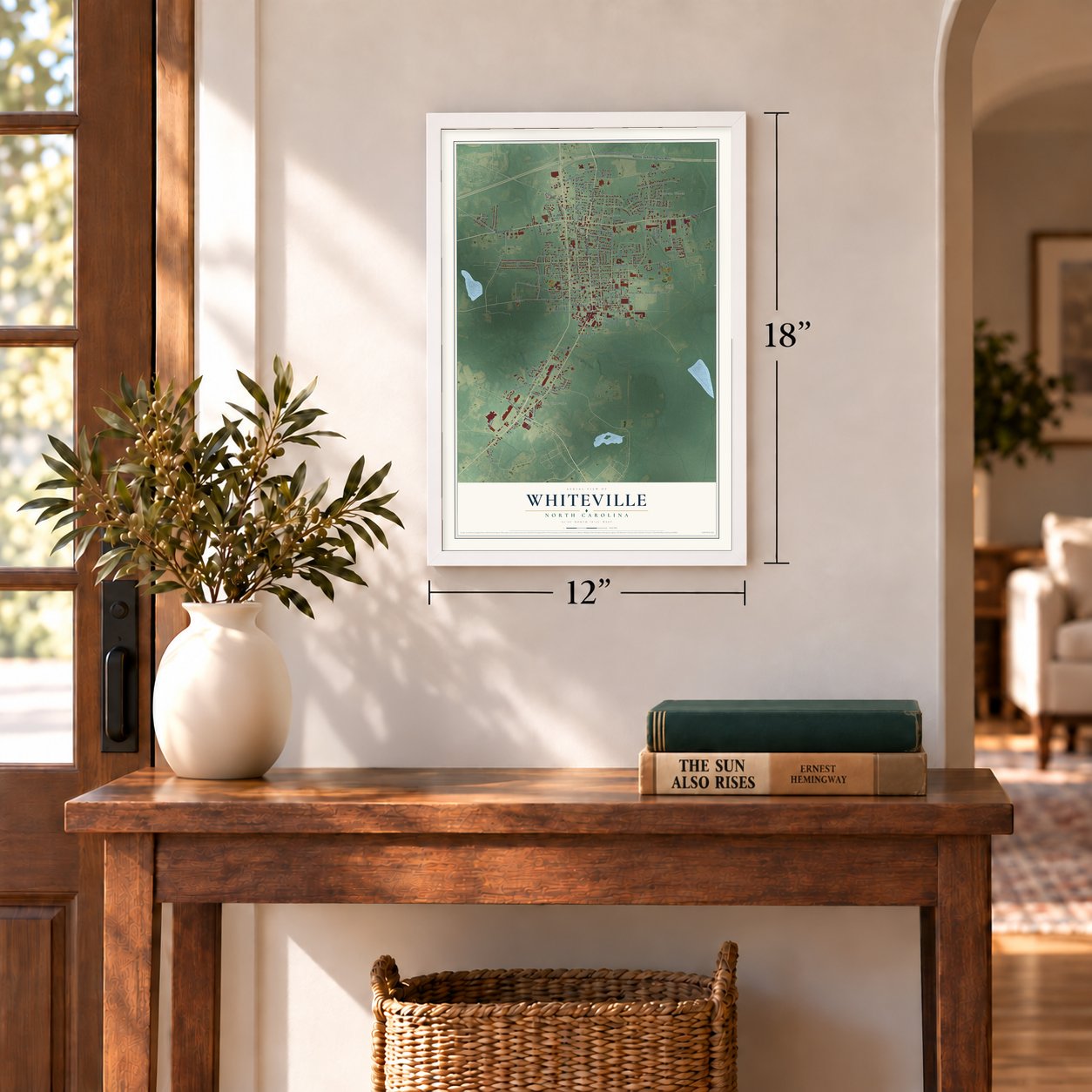
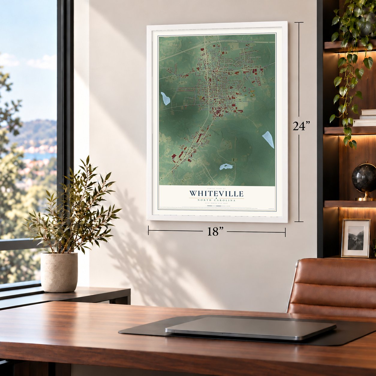
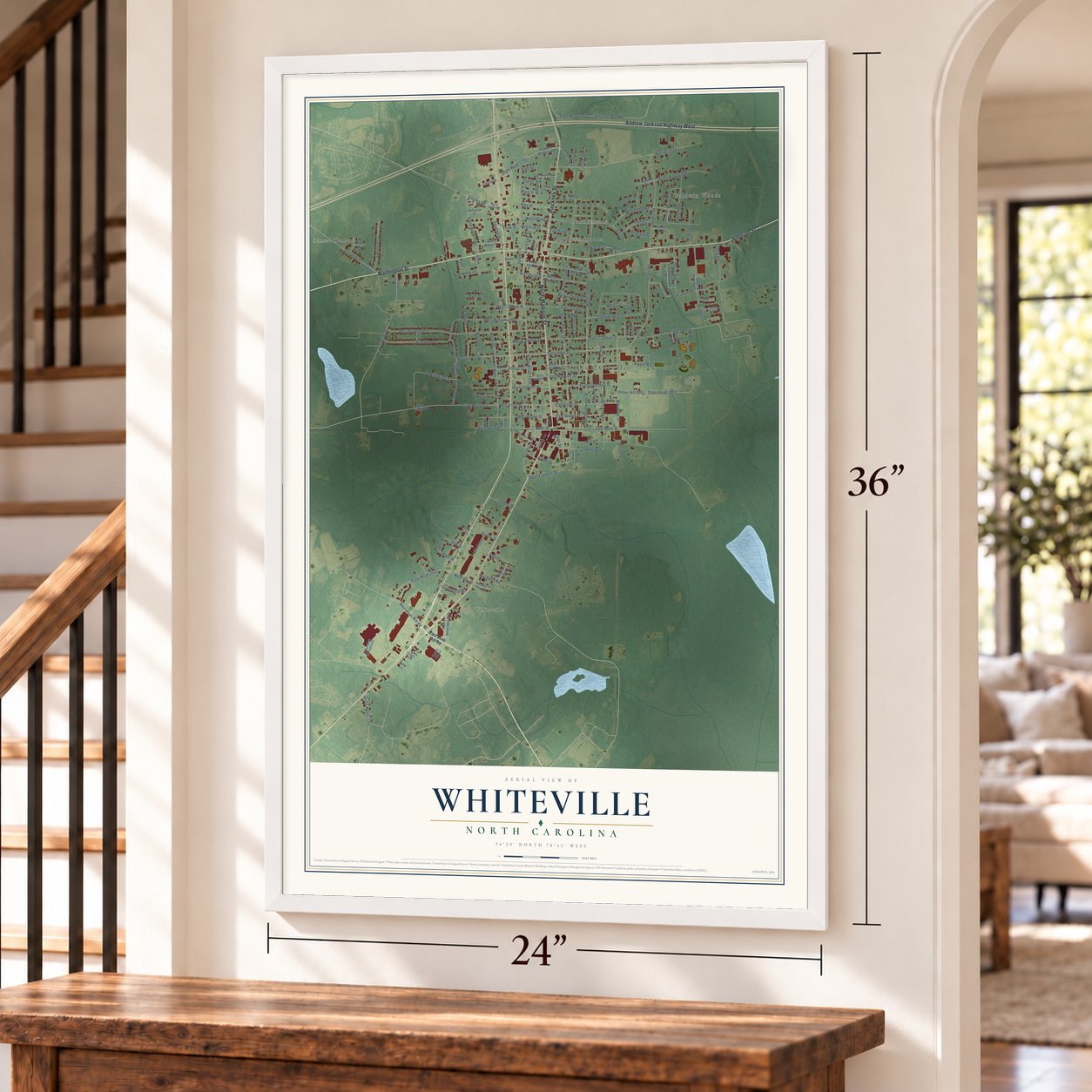
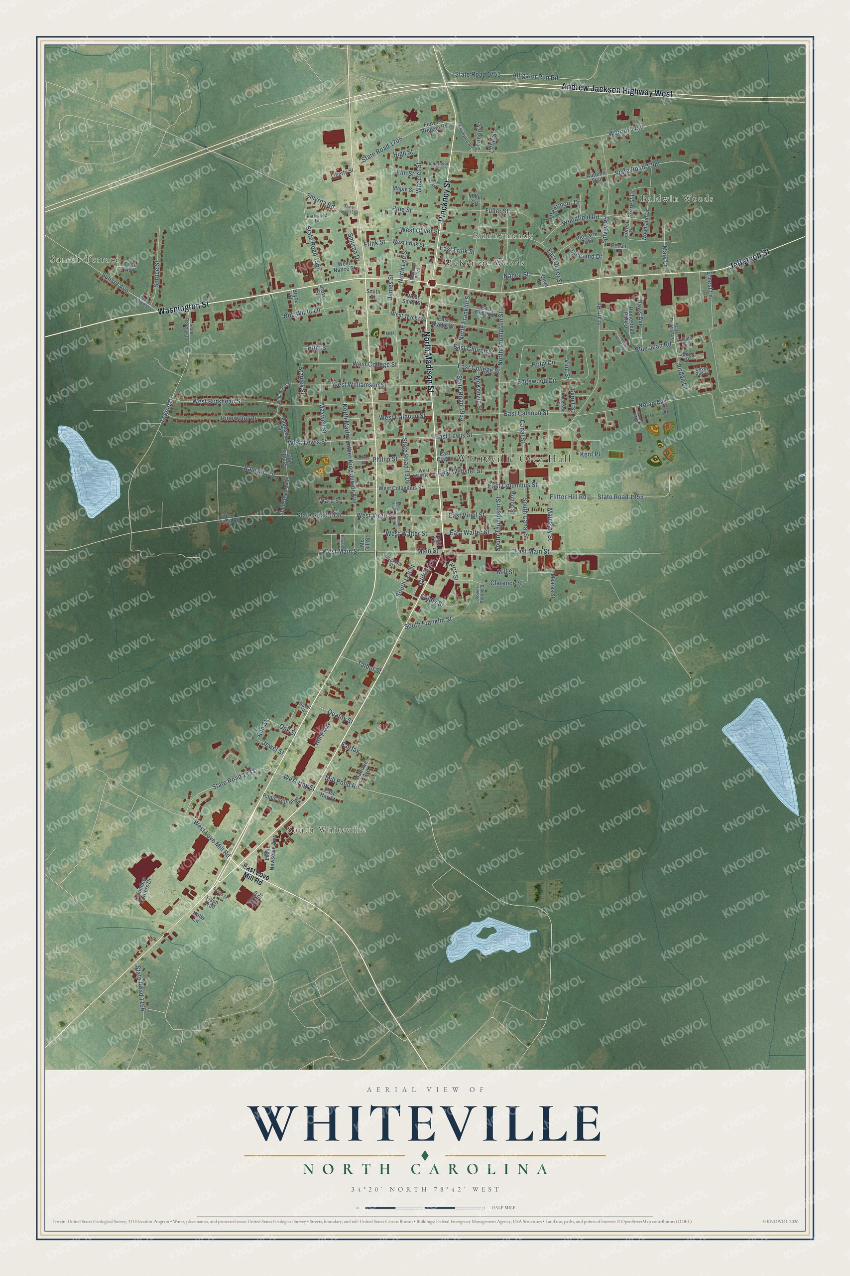
A new map of Whiteville, North Carolina, made in 2026 and printed to order on thick archival matte paper.
12" x 18" Archival Matte Print
A Map of Home. A Work of Art.
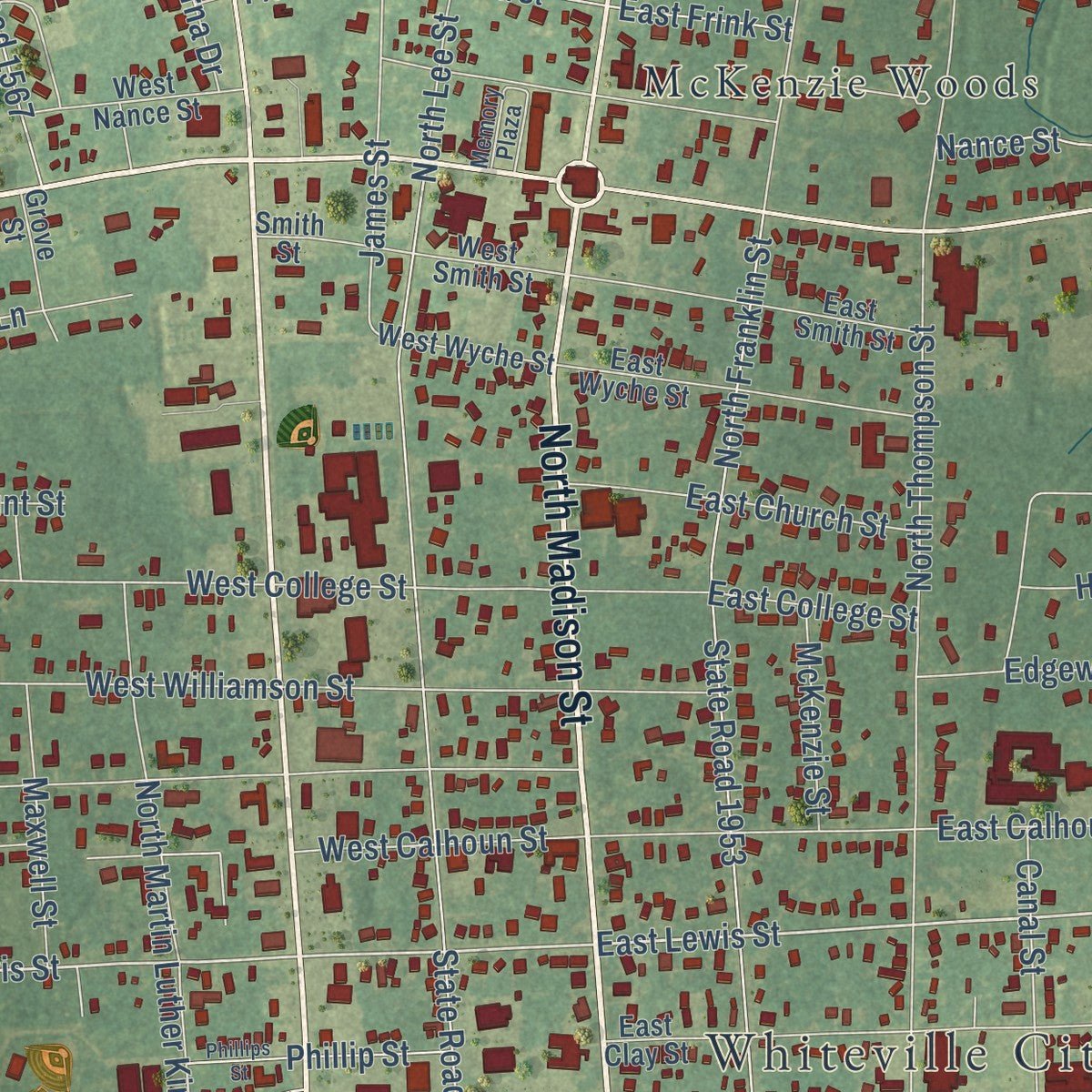
Explore Whiteville, North Carolina from a whole new perspective. Created using aerial imagery and detailed geographic data, this map captures Whiteville building by building, with labeled streets, familiar landmarks, and shaded topographical relief that highlights the natural contours of the landscape.
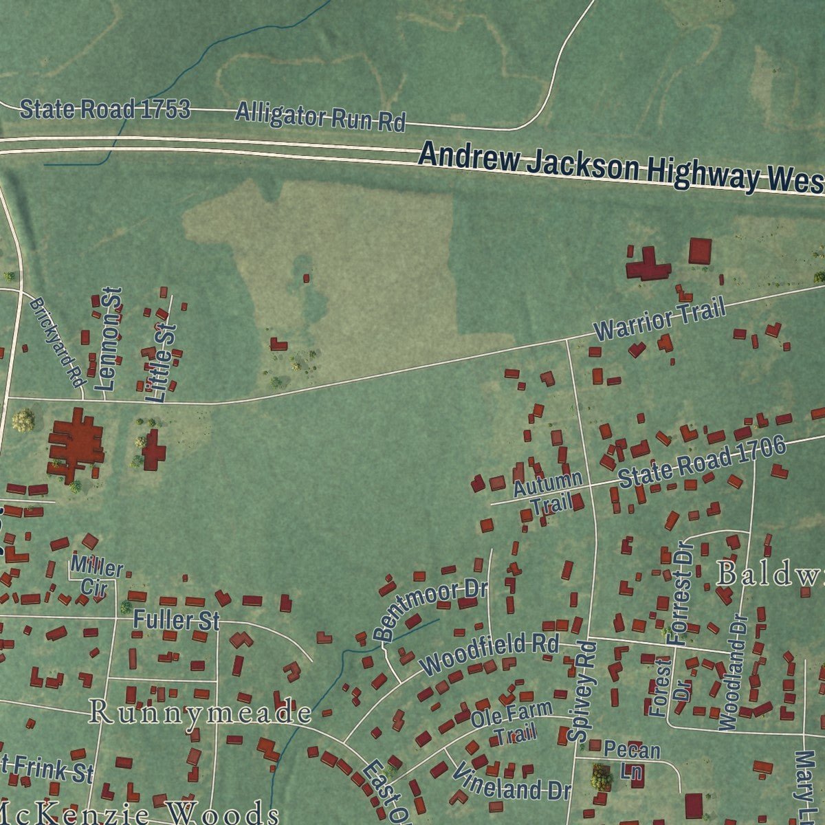
Combining modern data with the timeless character of a vintage atlas, this map is just as interesting up close as it is beautiful on the wall. Whether you grew up in Whiteville, spent memorable years there, or call it home today, this unique map is a great way to celebrate a place that means something to you. Zoom in on the preview to look for your street, and then order a print to put your memories on the wall.
Three ways to hang it
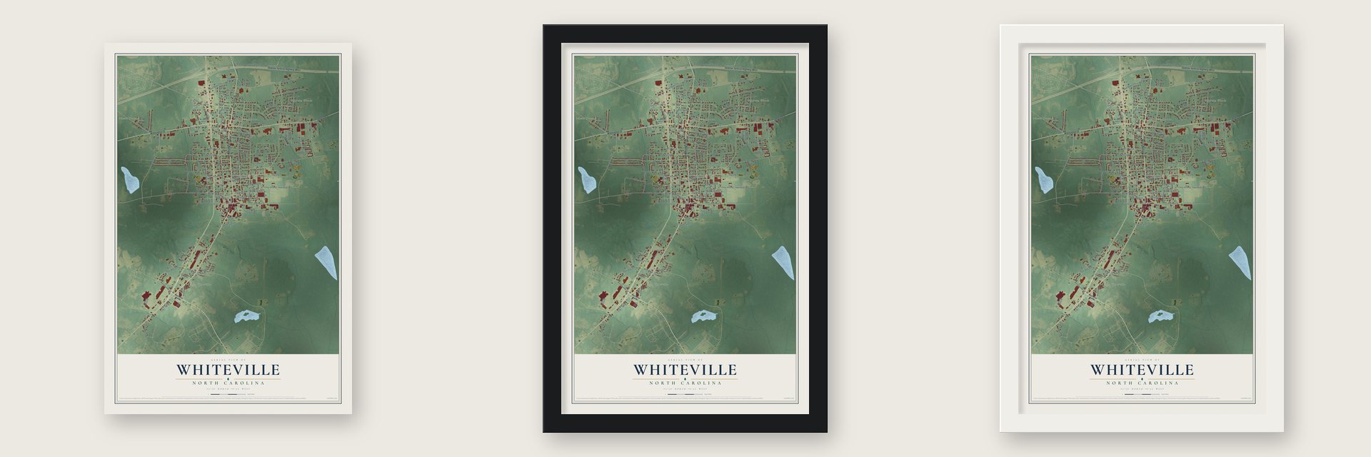
Unframed archival matte, a black wood frame or a white wood frame.
Up close
Geography Worth Displaying
This map was created using accurate cartographic data and authoritative geographic sources, including the U.S. Geological Survey and the Census Bureau. The map brings together terrain, waterways, roads, and building detail. The majority of the streets are labeled, houses are accurately depicted, and the topography is derived from government sources. Combining local data with carefully composed color and shading leads to this beautifully detailed Whiteville artwork for your wall.
Rather than simply showing street outlines, we’ve included as many of the street names as we could reasonably fit on the map while keeping their names legible. Zoom in on the high resolution preview to see exactly what’s on the map. We truly set out to create a statement piece for anyone who loves Whiteville. So whether it’s for you, or a gift for someone you love, we hope this map of Whiteville brings back fond memories.
Read the story behind this map of Whiteville, North Carolina from 2026.

About Whiteville, North Carolina
Whiteville is a city of 4,766 people and the county seat of Columbus County, which the state created in 1808. Two years later, in 1810, a state act allowed James Bunbury White to lay out a town on his own land, at the spot picked for the new county's public buildings. The act named Warren Baldwin, William Burney, Arthur Simpson, John Wingate and Isaac Powell as commissioners to mark off the lots. Only White could sell those lots, and the town was to be called Whitesville.
The town got its post office in 1821. Union troops sacked it near the end of the Civil War, and the town carried on as the seat of county government. For decades the official name kept its extra letter, until the U.S. Post Office changed Whitesville to Whiteville in 1889.
“About a mile south of the courthouse stood Whiteville's train depot, so removed from town because residents did not want the noise of the trains bothering their livestock.”
- The founder in the senateJames Bunbury White, who gave the land and the name, was elected Columbus County's first North Carolina state senator. U.S. Route 701, which runs through the county, is called the James B. White Highway in his honor.
- The Whiteville Tobs, 1950In 1950 Whiteville had its own professional minor league baseball team, the Tobs, in the Class D Tobacco State League. The club played a single season, and when the whole league broke up, the Tobs went with it.
- The News Reporter since 1896The News Reporter, the official newspaper for Columbus County, has been published in Whiteville since 1896.
- 19 state titlesThe Whiteville High School Wolfpack has won 19 state championships. Nine came in baseball, from 1983 through 2018, along with football titles in 1965 and 1987, basketball titles in 1969, 1999 and 2000, a team golf title in 1986 and four individual track championships.
- A courthouse fire on filmFilmmakers came to Whiteville to shoot the scene of a courthouse burning for Bastard out of Carolina, the 1996 film made from Dorothy Allison's novel.
Find your street
Names on the Whiteville map
Every name below is printed on this map. Look for your street, your school, the park where you played, or the pond down the road.
Places and landmarks6
- Whiteville City Hall
- Sunset Terrace
- Baldwin Woods
- South Whiteville
- Runnymeade
- McKenzie Woods
Streets and roads170
- North Madison Street
- Washington Street
- Pinckney Street
- Jefferson Street
- Andrew Jackson Highway West
- East Lewis Street
- West Love Mill Road
- West Lewis Street
- State Road 1433
- West Hay Street
- Sunset Avenue
- Tram Road
- South Franklin Street
- South Canal Street
- Clarence Street
- West College Street
- Smyrna Road
- North Franklin Street
- South Lee Street
- James Street
- West Williamson Street
- Mill Street
- West Oliver Street
- Main Street
- West Virgil Street
- Nance Street
- High Street
- Ann Street
- State Road 1916
- State Road 1953
Show all 170 streets
- West Burkhead Street
- Warrior Trail
- North Lee Street
- North Thompson Street
- Edgewood Circle
- Nolan Avenue
- East Main Street
- State Road 1437
- Ernest Lane
- Pinewood Drive
- North Martin Luther King Junior Avenue
- State Road 1705
- East Calhoun Street
- Spivey Road
- Alligator Run Road
- State Road 1753
- Flitter Hill Road
- State Road 1955
- Maultsby Street
- West Main Street
- Frink Street
- Davis Avenue
- East Oliver Street
- South Thompson Street
- Blue Jean Road
- East Webster Street
- East Columbus Street
- East Virgil Street
- East Walter Street
- West Walter Street
- Fuller Street
- State Road 1567
- Kent Place
- Baldwin Circle
- State Road 1706
- Stanley Street
- State Road 1166
- Spruce Street
- Woodfield Road
- Maxwell Street
- East Church Street
- West Calhoun Street
- East College Street
- Legion Drive
- Fairfax
- Smyrna Drive
- Bob White Lane
- Wheeler Street
- Canal Street
- Phillip Street
- Mary Lane
- Caldis Street
- Mill Pond Road
- Pine Street
- Bentmoor Drive
- Jordan Lane
- Holly Circle
- Forrest Drive
- McKenzie Street
- Quality Street
- Talbot Street
- Clifton Lane
- Vineland Drive
- East Frink Street
- Hill Plaza
- Ward Street
- Vine Street
- Oak Street
- Jewel Street
- Lennon Street
- Little Street
- Harris Street
- Elm Street
- Hunt Street
- East Love Mill Road
- West Virgil Road
- West Wyche Street
- Forest Drive
- Columbus Corners Drive
- West Smith Street
- West Columbus Street
- East Clay Street
- Flowers Pridgen Road
- State Road 1438
- West Frink Street
- Woodland Drive
- East Wyche Street
- East Smith Street
- West Nance Street
- Ole Farm Trail
- Leslie Newsome Avenue
- Homestead Park Drive
- Radio Station Road
- Jones Place
- Maultsby Drive
- Pecan Lane
- Green Hill Drive
- Marlowe Avenue
- Smiths Alley
- Smith Street
- Grove Street
- East Hay Street
- Bryce Street
- Britton Street
- Maple Street
- Autumn Trail
- Meares Street
- Liberty Street
- Garrell Street
- Tison Trail
- First Avenue
- Miller Circle
- Todd Lane
- Halls Lane
- Mc Gill Street
- Olive Drive
- State Road 1554
- State Road 1439
- Covey Run Lane
- Williamson Street
- Memory Plaza
- Brickyard Road
- West Webster Street
- Richardson Street
- Magnolia Street
- State Road 1743
- Anderson Street
- Parkwood Drive
- Power Station Street
- Knights Cv
- Duval Street
- State Road 1442
- State Road 1552
- Phillips Street
- Tucker Street
- Moore Street
- Sellers Street
- Powell Street
- Sandy Ridge
- Best Alley
Names are listed as they appear on the printed map. Zoom into the product photos to find them.
The art of mapping a place
How This Map Was Made
Real places. Remarkable detail. Discover the layers that turn geographic data into a map of home.

The view from above
Aerial imagery reveals the character of the land: woodland, open fields, and the patterns of a place.

The shape of the land
Elevation data brings hills, valleys, and subtle changes in the landscape into view.

The details of home
Roads, waterways, and building footprints come together to make the map feel unmistakably local.

Geography becomes art
Considered color, shading, and typography bring the layers together in a map made for your wall.


Process illustrated with Mendon, Massachusetts. Aerial imagery: USDA NAIP. Terrain: USGS 3D Elevation Program. Map details and finished artwork: KNOWOL.
The Details
About This Print
Choose an archival matte print, or a black or white Ayous wood frame. The archival matte print is unframed.
Select your size and finish above to see the matching product image and price.
Materials & Craftsmanship
A contemporary map with the character of a classic atlas, printed on archival matte paper. Optional frames are made from Ayous wood.
Your printed map does not include the watermark shown in the full-map preview.
Shipping & Delivery
Free shipping within the United States. Every print is made to order in the USA.
Buying a gift? Add a note in your cart and we'll include it. We never put prices in the package.
Prints ship within 2 to 3 business days. Allow 7 to 10 days total from ordering for delivery. Timing may vary during holidays or periods of high order volume.
Read our shipping policy.
Returns and damaged prints
Each print is made to order. Change-of-mind refunds are not available after production.
If your print arrives damaged, misprinted or incorrect, contact support@knowol.com within 30 days of receiving it. Include your order number, photos and a description of the issue.
Read our full refund and replacement policy. For questions about your order, email support@knowol.com.
Find your town
Looking for another city?
Find a map of home in our North Carolina collection, or any town in the country.
Nearby
Maps of towns near Whiteville
Know someone from one of these towns? Their map makes a great gift.
 Brunswick
, North Carolina
From $39.99See the map
 Hallsboro
, North Carolina
From $39.99See the map
 Chadbourn
, North Carolina
From $39.99See the map
More maps nearby: Lake Waccamaw, Clarkton, Cerro Gordo, Evergreen and Boardman.