
Search for another town





Free U.S. delivery 7 to 10 days after you order
Wilmington, North Carolina Map Art
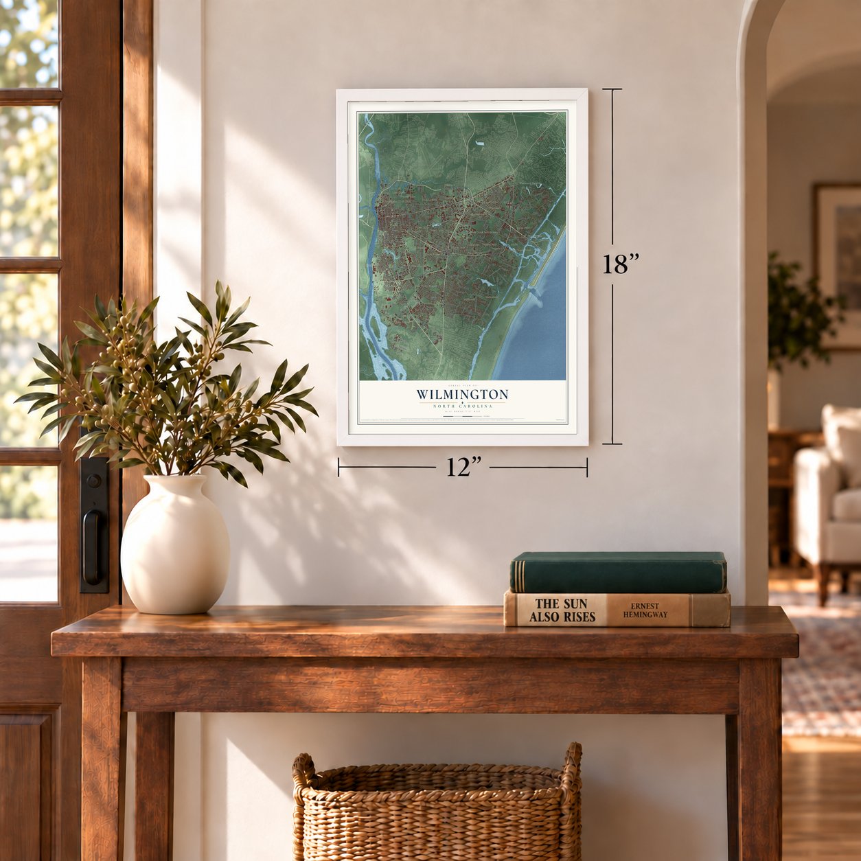
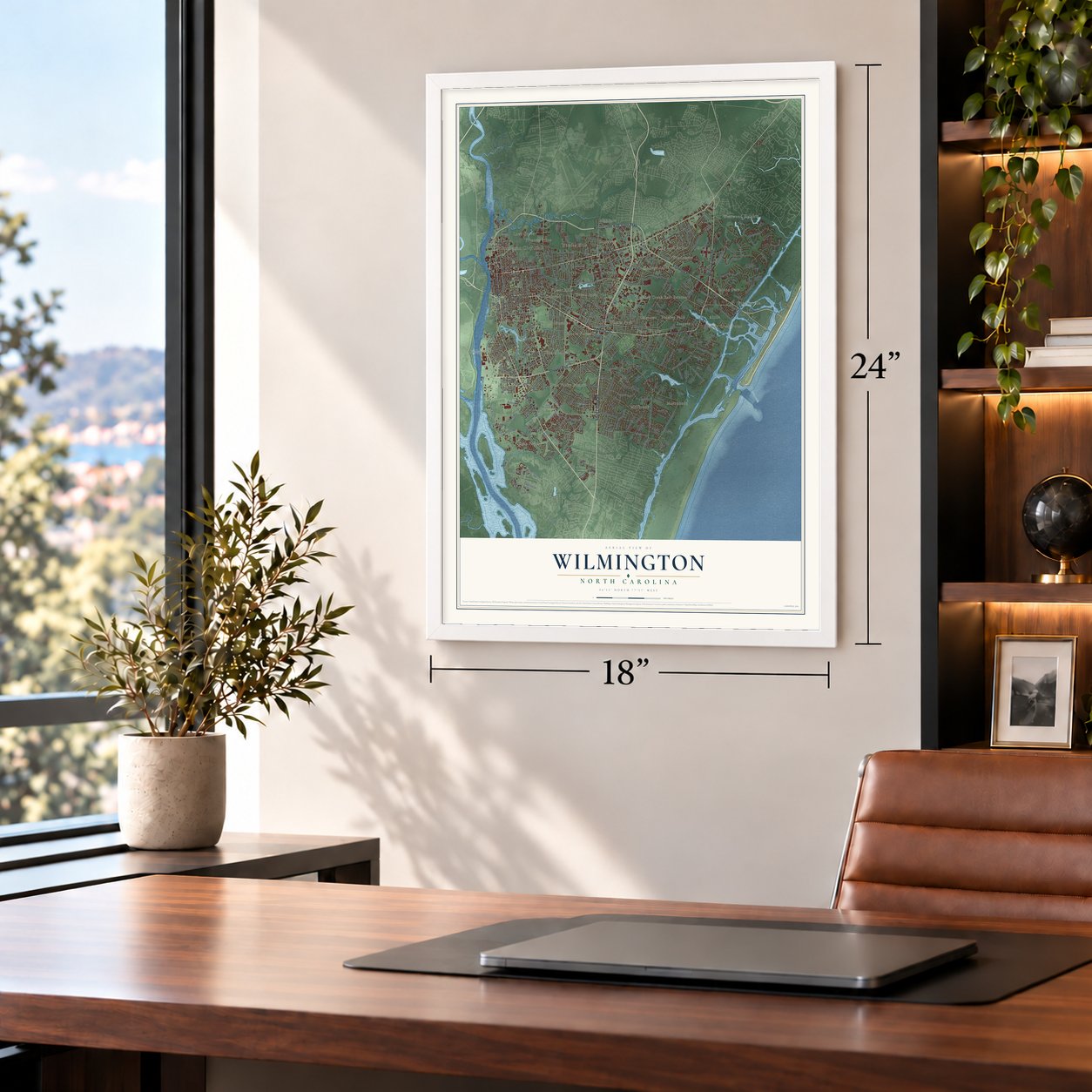
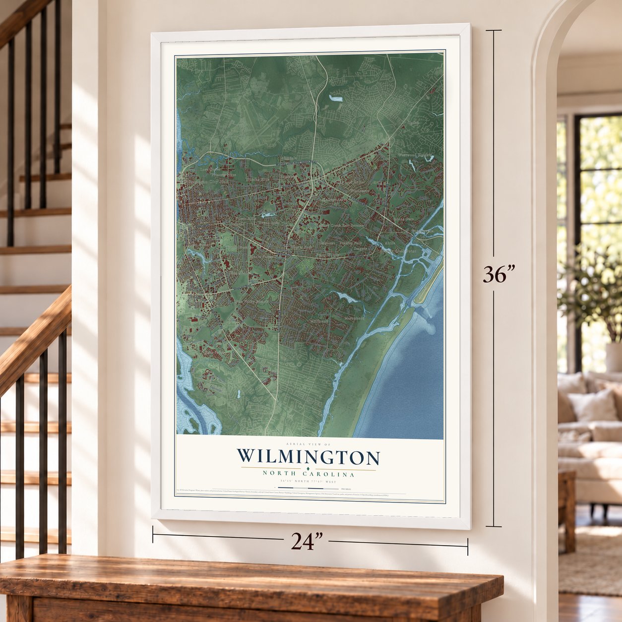
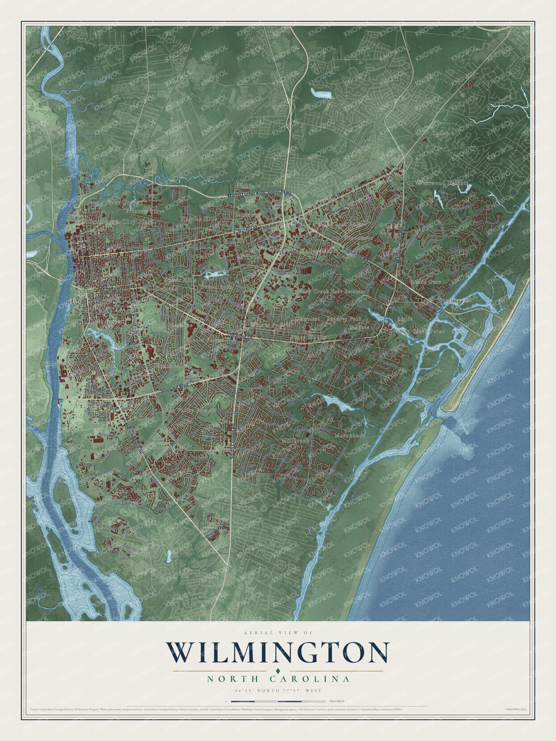
A new map of Wilmington, North Carolina, made in 2026 and printed to order on thick archival matte paper.
12" x 18" Archival Matte Print
A Map of Home. A Work of Art.
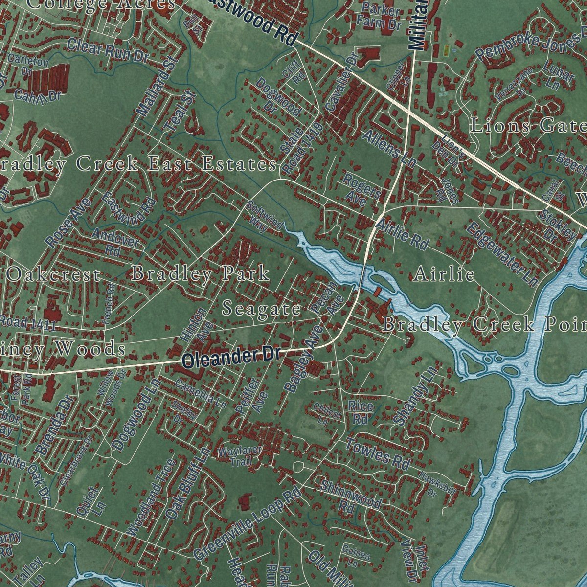
Explore Wilmington, North Carolina from a whole new perspective. Created using aerial imagery and detailed geographic data, this map captures Wilmington building by building, with labeled streets, familiar landmarks, and shaded topographical relief that highlights the natural contours of the landscape.
Combining modern data with the timeless character of a vintage atlas, this map is just as interesting up close as it is beautiful on the wall. Whether you grew up in Wilmington, spent memorable years there, or call it home today, this unique map is a great way to celebrate a place that means something to you. Zoom in on the preview to look for your street, and then order a print to put your memories on the wall.
Three ways to hang it
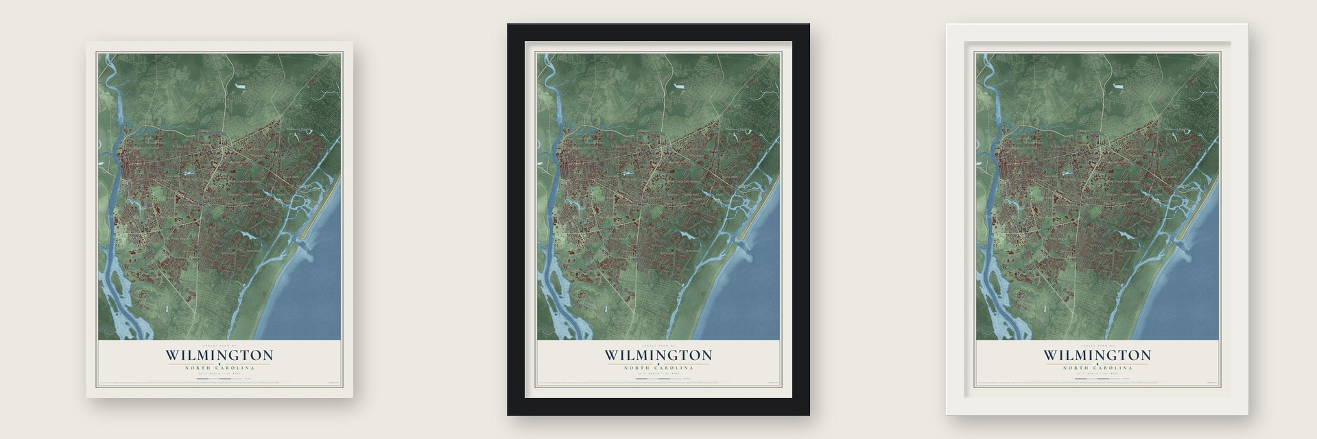
Unframed archival matte, a black wood frame or a white wood frame.
Up close
Geography Worth Displaying
This map was created using accurate cartographic data and authoritative geographic sources, including the U.S. Geological Survey and the Census Bureau. The map brings together terrain, waterways, roads, and building detail. The majority of the streets are labeled, houses are accurately depicted, and the topography is derived from government sources. Combining local data with carefully composed color and shading leads to this beautifully detailed Wilmington artwork for your wall.
Rather than simply showing street outlines, we’ve included as many of the street names as we could reasonably fit on the map while keeping their names legible. Zoom in on the high resolution preview to see exactly what’s on the map. We truly set out to create a statement piece for anyone who loves Wilmington. So whether it’s for you, or a gift for someone you love, we hope this map of Wilmington brings back fond memories.
Read the story behind this map of Wilmington, North Carolina from 2026.
About Wilmington, North Carolina
Wilmington is a port city of 115,451 people and the seat of New Hanover County, on the Cape Fear River. In September 1732 George Burrington, the colony's first royal governor, founded a settlement on John Watson's land, where the river's two branches meet. People called it New Carthage, then New Liverpool, and over time it became known as Newton. In 1739 Col. William Bartram brought a bill to make it a town. It was named Wilmington for his patron, Spencer Compton, Earl of Wilmington.
In the 1830s the town wanted a railroad from Raleigh. Raleigh residents did not buy enough stock, so the builders moved the far end of the line to Weldon. The line was finished in 1840 and was then the longest single stretch of railroad track in the world. Late in the century Wilmington was the largest city in the state, with a Black majority. In 1898 white supremacists overthrew the elected Fusionist government in a coup now called the Wilmington massacre. They drove out opposition leaders and destroyed Black-owned property. Estimates of the dead range from 60 to more than 300. Charlotte had grown larger than Wilmington by 1910.
“The Inhabitants immediately assembled about me & demanded a Categorical Answer whether I intended to put the Act relating [to] the Stamps in force. The Town Bell was rung[,] Drums [were] beating, Colours [were] flying and [a] great concourse of People [were] gathered together.”
- Liberty still had a pulseOn October 19, 1765, several hundred residents protested the Stamp Act and burned an effigy of a neighbor who supported it. On October 31 a crowd staged a funeral for Liberty, but Liberty turned out to be alive, and the mourners celebrated. When the stamps arrived on November 28, Governor William Tryon kept them on HMS Diligence, and shipping and the courts shut down. Parliament repealed the act in March 1766.
- Sons of Liberty at BrunswickOn February 18, 1766, a British cruiser seized two merchant ships that had come in without stamped papers. Residents of the southern counties met in Wilmington and formed the Sons of Liberty. The next day Cornelius Harnett led as many as a thousand men, among them the mayor and aldermen, to face Tryon at Brunswick. A crowd took the ships back and made the royal officials swear never to issue stamped paper.
- Oakdale CemeteryBy the middle of the century the town's churchyards were full. On November 16, 1853, a group of citizens formed the Proprietors of the Wilmington Cemetery and chose sixty-five acres along Burnt Mill Creek. It was North Carolina's first rural cemetery. Its first burial, on February 6, 1855, was Annie deRosset, a girl of six.
- Thalian HallBuilders laid the first cornerstone of a new city hall on December 27, 1855. The Thalian Association paid for the opera house attached to it, Thalian Hall. City Hall and Thalian Hall joined the National Register in 1970.
- A battleship and a film townThe World War II battleship USS North Carolina is now a memorial moored across from downtown. In 2020 Wilmington was named the nation's first World War II Heritage City. A film studio complex opened in 1984, and Blue Velvet, The Crow, Dawson's Creek and One Tree Hill were all made in or near the city.
Find your street
Names on the Wilmington map
Every name below is printed on this map. Look for your street, your school, the park where you played, or the pond down the road.
Places and landmarks33
- Wilmington City Hall
- Airlie
- Alandale
- Barclay Hills
- Bradley Creek East Estates
- Bradley Creek Point
- Bradley Park
- College Acres
- Delgado
- Devon Park
- Echo Farms
- Fairlawn
Show all 33 places
- Forest Hills
- Glen Meade
- Lake Forest
- Lincoln Forest
- Lions Gate
- Long Leaf Acres
- Love Grove
- Masonboro
- Millbrook
- Oakcrest
- Ogden
- Pine Valley Estates
- Piney Woods
- Princess Place
- Seagate
- South Oleander
- Sunset Park
- Westwood Heights
- Windemere
- Winter Park
- Wrightsville
Streets and roads366
- South College Road
- Market Street
- Oleander Drive
- Carolina Beach Road
- Eastwood Road
- Military Cutoff Road
- South Third Street
- Dawson Street
- Martin Luther King Junior Parkway
- Shipyard Boulevard
- Wrightsville Avenue
- North Third Street
- South Front Street
- South 16th Street
- Pine Grove Drive
- Burnett Boulevard
- South Fourth Street
- Queen Street
- North Front Street
- Rankin Street
- South 15th Street
- Midland Drive
- Independence Boulevard
- Park Avenue
- Masonboro Loop Road
- Greenville Loop Road
- South Kerr Avenue
- Eagles Nest Drive
- South 17th Street
- River Road
Show all 366 streets
- Arboretum Drive
- State Road 1100
- Randall Parkway
- South Fifth Street
- Pembroke Jones Drive
- Masonboro Sound Road
- Chestnut Street
- Princess Place Drive
- North Fifth Street
- New Centre Drive
- North 23rd Street
- South Moorings Drive
- South 13th Street
- Pine Valley Drive
- Castle Street
- Peachtree Avenue
- Forest Hills Drive
- Princess Street
- Ann Street
- Airlie Road
- Beasley Road
- Holly Tree Road
- George Anderson Drive
- Tanbridge Road
- Saint Andrews Drive
- Allens Lane
- McRae Street
- Edgerton Drive
- Kelly Road
- Navaho Trail
- Mears Street
- Town Center Drive
- Echo Farms Boulevard
- Racine Drive
- South Second Street
- Wilshire Boulevard
- Dock Street
- Rose Avenue
- Central Boulevard
- Adams Street
- Kirby Smith Drive
- Gillette Drive
- Martin Street
- Riegel Road
- Jeb Stuart Drive
- Medical Center Drive
- Deer Island Lane
- Pine Street
- Kidder Street
- Mercer Avenue
- Aster Court
- Wellington Avenue
- Lullwater Drive
- College Acres Drive
- Semmes Drive
- Worth Drive
- Landfall Drive
- Monroe Street
- Towles Road
- Clear Run Drive
- Old Military Road
- Colony Circle North
- Raleigh Street
- Elisha Drive
- Long Leaf Hills Drive
- Barksdale Road
- Green Meadows Drive
- Spartan Road
- Cedar Avenue
- Waltmoor Road
- Mimosa Place
- Brookshire Lane
- Moss Tree Drive
- Shandy Lane
- Oak Bluff Lane
- Kenwood Avenue
- Lake Avenue
- Chester Street
- Steeplechase Road
- Delaney Avenue
- Melton Road
- Davie Drive
- Old Towne Street
- Spirea Drive
- Partridge Road
- Station Road
- Bryan Road
- Dogwood Lane
- Bagley Avenue
- Vance Street
- Ringo Drive
- Ashley Circle
- Metts Avenue
- Lancaster Road
- Mallard Street
- Edgewater Lane
- Brenda Drive
- Head Road
- Floral Parkway
- Nixon Street
- Teal Street
- Elm Street
- Bell Street
- Gordon Road
- State Road 1411
- East Lake Shore Drive
- Robert East Lee Drive
- Appleton Way
- State Road 1492
- South 41st Street
- Sunnyvale Drive
- West Lake Shore Drive
- Grace Street
- North Sixth Street
- South Sixth Street
- Old Maccumber Station Road
- Nun Street
- South Live Oak Parkway
- Washington Street
- North Seventh Street
- Northern Boulevard
- Shinnwood Road
- Cavalier Drive
- Amber Drive
- State Road 1419
- Wayne Drive
- North 30th Street
- Halifax Road
- Country Club Road
- Audubon Boulevard
- Leader Circle
- Fairview Drive
- Finian Drive
- Greenhowe Drive
- Covil Avenue
- Orchard Trce
- Andover Road
- Walton Drive
- South Churchill Drive
- Newkirk Avenue
- Eastwind Road
- North 26th Street
- John South Mosby Drive
- Barclay Hills Drive
- Broomsedge Terrace
- King Street
- Nutt Street
- Sweetbriar Road
- Dapple Court
- Hinton Avenue
- Trisail Terrace
- Evans Street
- Price Drive
- Charter Drive
- Upper Reach Drive
- Woodland Trce
- Manly Avenue
- Wood Dale Drive
- Hugh Macrae Road
- Old Eastwood Road
- Yaupon Drive
- Rabbit Run Road
- Hearthside Drive
- Cinema Drive
- White Oak Drive
- Passerine Avenue
- Tiburon Drive
- Dogwood Drive
- Hampshire Drive
- Spanish Wells Drive
- Antelope Trail Drive
- Bess Street
- Quail Run Road
- Parker Farm Drive
- Peiffer Avenue
- Varsity Drive
- Rogers Avenue
- South 21st Street
- Quail Ridge Road
- Beretta Way
- Fairlawn Drive
- Burnt Mill Drive
- Sea Spray Drive
- Beech Street
- Timber Lane
- Edinboro Lane
- Diligence Road
- Prior Drive
- Sylvan Lane
- Hollins Road
- Troy Drive
- Sigmon Road
- Dixie Avenue
- Regatta Drive
- Dover Road
- Belfairs Drive
- Burney Street
- North 29th Street
- Cahill Drive
- Bob King Drive
- Great Oaks Drive
- Essex Drive
- Kilarny Road
- Crete Drive
- Talley Lane
- Sikes Drive
- Lancelot Lane
- Stokley Drive
- Carl Street
- Arbor Way
- South 29th Street
- Fall Drive
- Ivey Circle
- Inlet View Drive
- Hurst Drive
- Vorils Lane
- Pickett Drive
- Pecan Avenue
- Lee Drive
- Alpine Drive
- Dare Street
- Bryan Avenue
- Quiet Lane
- Lunar Lane
- 41st Street
- Joy Place
- Rice Road
- Penn Street
- Greenfield Street
- North Kerr Avenue
- Wright Street
- Bragg Drive
- Colonial Drive
- Shirley Road
- Mockingbird Lane
- Hanover Street
- Glen Meade Road
- Lansdowne Road
- North 21st Street
- Braxlo Lane
- Crews Drive
- Buccaneer Road
- Sun Runner Place
- Helmsdale Drive
- Marlboro Street
- Azalea Drive
- Efird Road
- Bexley Drive
- Ocean Point Drive
- Holbrook Avenue
- Camellia Lane
- Kornegay Avenue
- Smith Creek Boulevard
- Oakland Drive
- Willoughby Park Court
- Oak Leaf Drive
- Perry Avenue
- Dundee Drive
- Wagner Road
- North 18th Street
- Montrose Lane
- Carleton Drive
- Ocean Ridge Drive
- Wayfarer Trail
- Graywalsh Drive
- Harborway Drive
- Warlick Drive
- Freedom Road
- Village Green Drive
- Marion Drive
- Softwind Way
- Bristol Road
- Gate Post Lane
- Benton Avenue
- Lion's Den Drive
- Cliff Road
- Jones Road
- Zoom Court
- South Eleventh Street
- Church Street
- Verrazzano Drive
- Chippenham Drive
- Hawthorne Road
- Oriole Drive
- Hawksbill Drive
- McClelland Drive
- Harnett Street
- Cornelius Harnette Drive
- Still Meadow Drive
- Maple Avenue
- Bay Colony Lane
- French Road
- Dunmore Road
- Lynnwood Drive
- North 25th Street
- Hunters Trail
- North 15th Street
- Clearbrook Drive
- Robin Hood Road
- Lennon Drive
- Greenway Avenue
- Museum Drive
- Gull Point Road
- Cabbage Inlet Lane
- Cape Fear Road
- Surrey Street
- Inspiration Drive
- Gallery Park Boulevard
- Floating Bridge Trail
- Albert Circle
- Kellerton Place
- Shelby Drive
- Bentley Drive
- Seven Oaks Drive
- Gibson Avenue
- Acacia Drive
- Willow Woods Drive
- Wagon Court
- Fisherville Road
- Cayman Court
- Anson Drive
- Tabor Lane
- Dobbon Avenue
- Hospital Plaza Drive
- Chilcot Lane
- Forest Park Road
- Iron Gate Drive
- Cove Point Drive
- Clipper Lane
- Mayfair Drive
- Grouse Court
- Brevard Drive
- Guinea Lane
- Foxhall Court
- Canal Street
- Bull Street
Names are listed as they appear on the printed map. Zoom into the product photos to find them.
The art of mapping a place
How This Map Was Made
Real places. Remarkable detail. Discover the layers that turn geographic data into a map of home.

The view from above
Aerial imagery reveals the character of the land: woodland, open fields, and the patterns of a place.

The shape of the land
Elevation data brings hills, valleys, and subtle changes in the landscape into view.

The details of home
Roads, waterways, and building footprints come together to make the map feel unmistakably local.

Geography becomes art
Considered color, shading, and typography bring the layers together in a map made for your wall.


Process illustrated with Mendon, Massachusetts. Aerial imagery: USDA NAIP. Terrain: USGS 3D Elevation Program. Map details and finished artwork: KNOWOL.
The Details
About This Print
Choose an archival matte print, or a black or white Ayous wood frame. The archival matte print is unframed.
Select your size and finish above to see the matching product image and price.
Materials & Craftsmanship
A contemporary map with the character of a classic atlas, printed on archival matte paper. Optional frames are made from Ayous wood.
Your printed map does not include the watermark shown in the full-map preview.
Shipping & Delivery
Free shipping within the United States. Every print is made to order in the USA.
Buying a gift? Add a note in your cart and we'll include it. We never put prices in the package.
Prints ship within 2 to 3 business days. Allow 7 to 10 days total from ordering for delivery. Timing may vary during holidays or periods of high order volume.
Read our shipping policy.
Returns and damaged prints
Each print is made to order. Change-of-mind refunds are not available after production.
If your print arrives damaged, misprinted or incorrect, contact support@knowol.com within 30 days of receiving it. Include your order number, photos and a description of the issue.
Read our full refund and replacement policy. For questions about your order, email support@knowol.com.
Find your town
Looking for another city?
Find a map of home in our North Carolina collection, or any town in the country.
Nearby
Maps of towns near Wilmington
Know someone from one of these towns? Their map makes a great gift.
 Kings Grant
, North Carolina
From $39.99See the map
 Silver Lake
, North Carolina
From $39.99See the map
 Wrightsville Beach
, North Carolina
From $39.99See the map
More maps nearby: Hightsville, Myrtle Grove, Wrightsboro, Blue Clay Farms and Murraysville.