
Search for another town





Free U.S. delivery 7 to 10 days after you order
Woodland, Washington Map Art
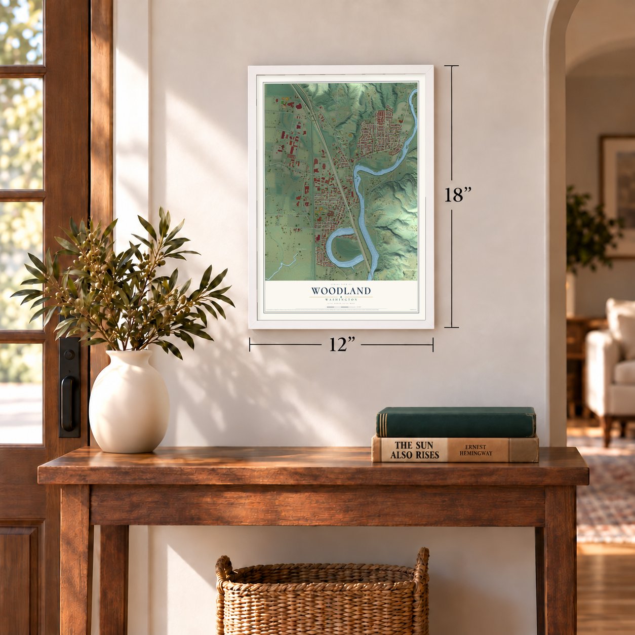
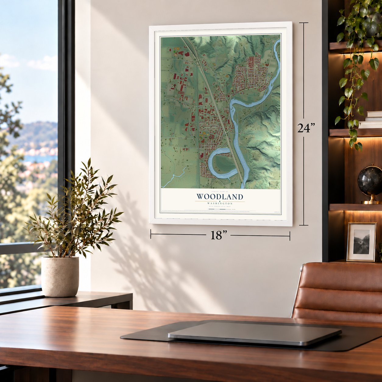
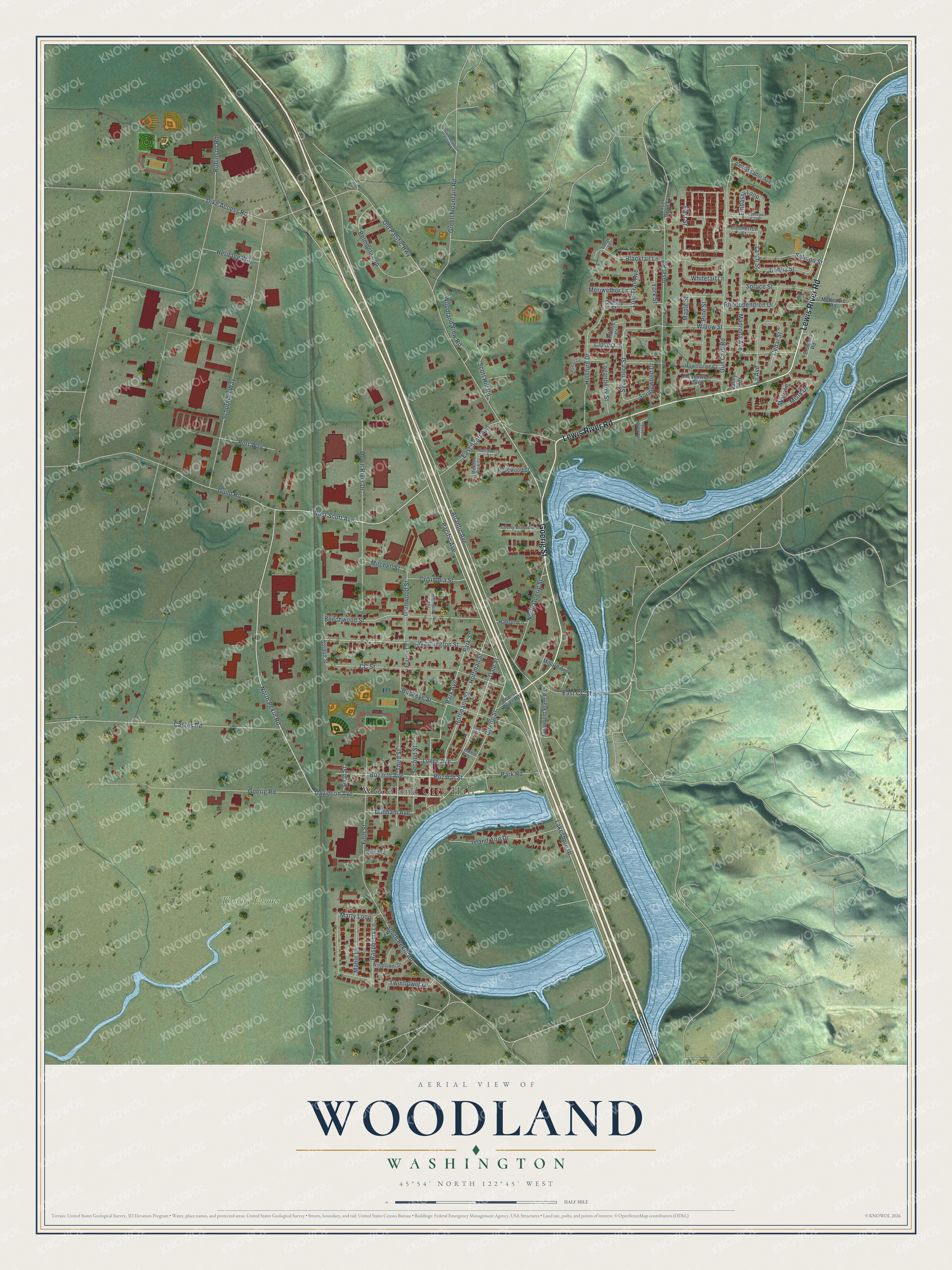
A new map of Woodland, Washington, made in 2026 and printed to order on thick archival matte paper.
12" x 18" Archival Matte Print
A Map of Home. A Work of Art.
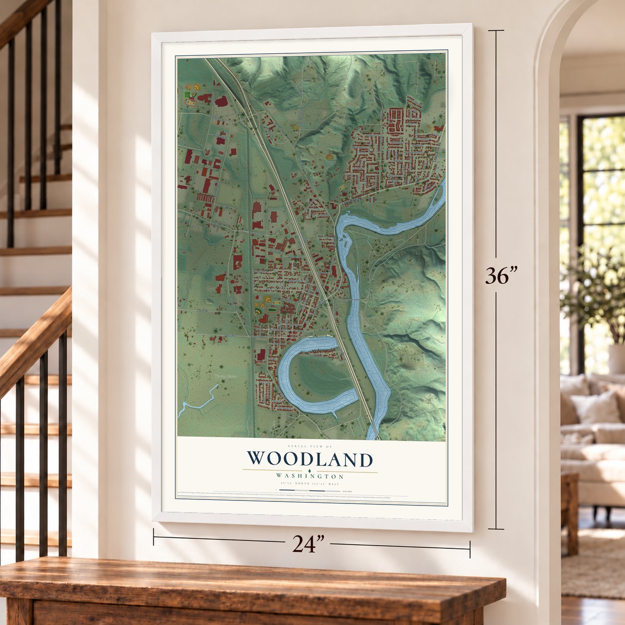
Explore Woodland, Washington from a whole new perspective. Created using aerial imagery and detailed geographic data, this map captures Woodland building by building, with labeled streets, familiar landmarks, and shaded topographical relief that highlights the natural contours of the landscape.
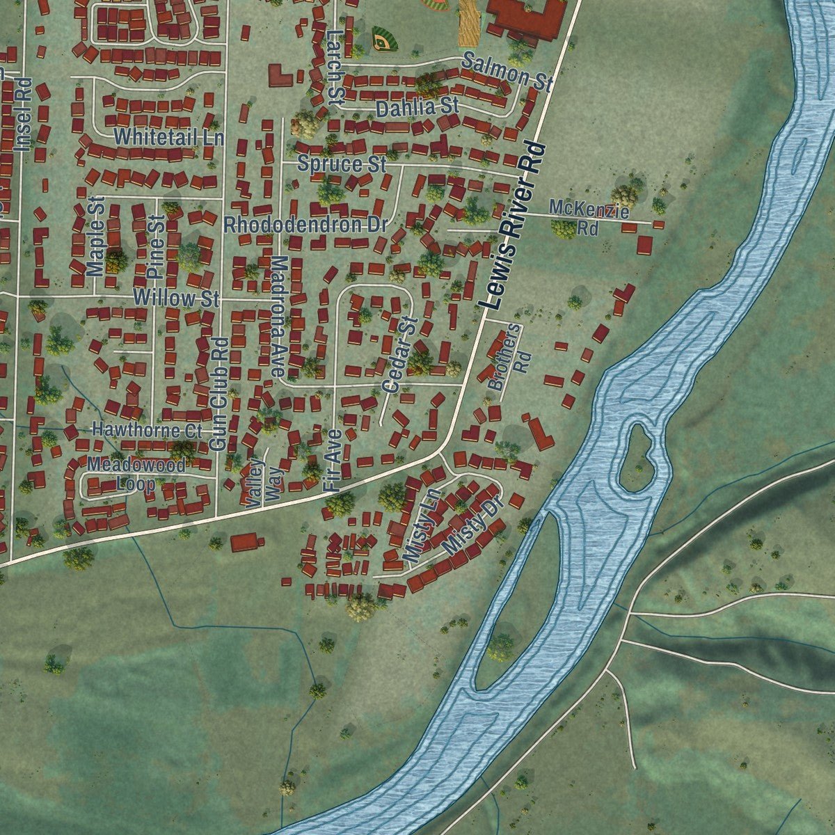
Combining modern data with the timeless character of a vintage atlas, this map is just as interesting up close as it is beautiful on the wall. Whether you grew up in Woodland, spent memorable years there, or call it home today, this unique map is a great way to celebrate a place that means something to you. Zoom in on the preview to look for your street, and then order a print to put your memories on the wall.
Three ways to hang it
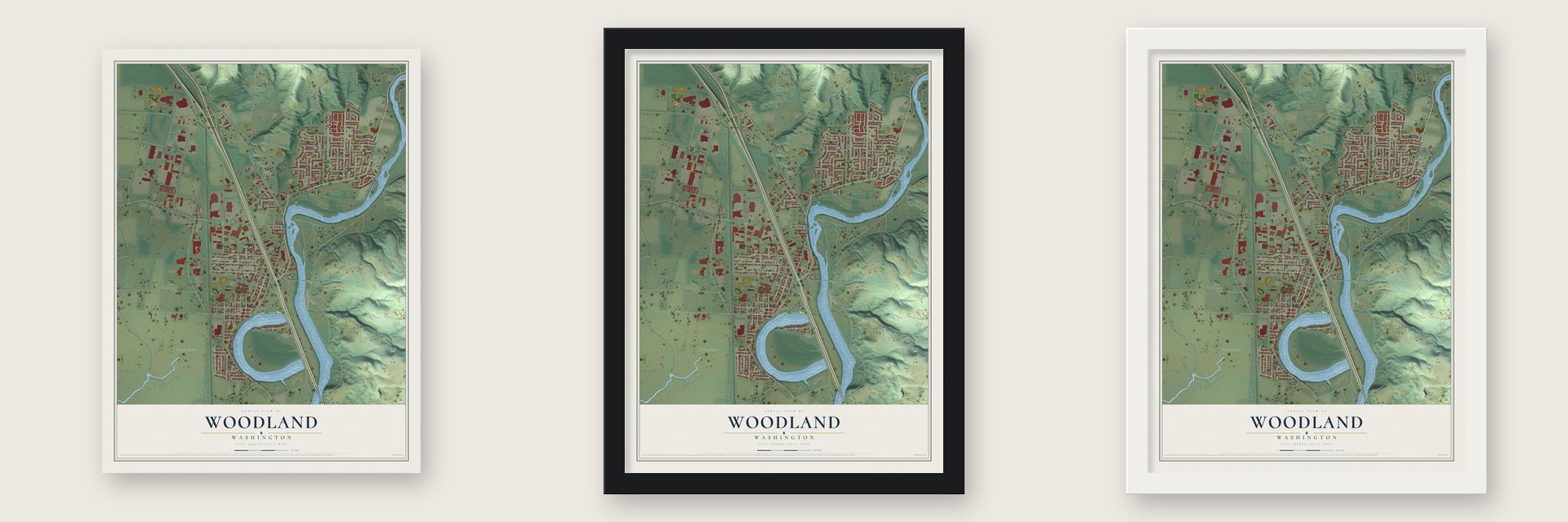
Unframed archival matte, a black wood frame or a white wood frame.
Up close
Geography Worth Displaying
This map was created using accurate cartographic data and authoritative geographic sources, including the U.S. Geological Survey and the Census Bureau. The map brings together terrain, waterways, roads, and building detail. The majority of the streets are labeled, houses are accurately depicted, and the topography is derived from government sources. Combining local data with carefully composed color and shading leads to this beautifully detailed Woodland artwork for your wall.
Rather than simply showing street outlines, we’ve included as many of the street names as we could reasonably fit on the map while keeping their names legible. Zoom in on the high resolution preview to see exactly what’s on the map. We truly set out to create a statement piece for anyone who loves Woodland. So whether it’s for you, or a gift for someone you love, we hope this map of Woodland brings back fond memories.
Read the story behind this map of Woodland, Washington from 2026.

About Woodland, Washington
Woodland is a city of 6,531 people near the mouth of the Lewis River. Most of the city lies in Cowlitz County, and a small part reaches into Clark County. In 1849 Adolphous Le Lewes, a retired Hudson's Bay Company man, took up a homestead at the river's mouth, and the Lewis River is named for him, not for Meriwether Lewis. Next came two Iowa families joined by marriage. The Solomon Strongs claimed their land in September 1850, and the Squire Bozarths claimed theirs that December.
Squire Bozarth built the first frame house in what is now Woodland and called it Woodland Farm House. A few years later his son, Christopher Columbus Bozarth, opened a store named Woodland after the farm and became the first postmaster, and the town grew up around his store. A.W. Scott platted Woodland on October 14, 1889, the year Washington became a state. It incorporated as a city on March 27, 1906, with L. Hopf as its first mayor.
- Pekin, the town on stiltsBefore Woodland, trade on the Lewis River bottoms centered on Pekin, where James Woods and F.H. Marsh opened a store and post office in 1867 or 1868. Pekin stood on stilts and flooded nearly every June. Woodland sat higher and closer to the center of the bottoms, and its streets rarely went under. Once Woodland had its own store and post office, the trade moved there, and Pekin is now part of the Woodland Bottoms.
- A warning from Indian ZackOn March 26, 1856, a party of Yakimas came down to burn out the settlers, in the only Indian attack on record here. Indian Zack, one of the few Cowlitz still living, had warned the settlers ahead of time. They took refuge in the Block House at St. Helens and stayed there until the Yakimas went back east of the Cascade Mountains. A monument to Indian Zack once stood at a water fountain in Horseshoe Lake Park.
- The Lilac LadyHulda Klager, a German immigrant, came to Woodland when her family bought a farm. A friend's gift of a book on Luther Burbank led her to breed lilacs, and by 1920 she opened her garden each spring for Lilac Week. The 1948 flood killed every plant, but people across the Northwest sent starts, and she reopened in 1950 at 87. The Woodland Federated Garden Club bought the garden after her 1960 death, which joined the National Register in 1975.
- Planter's Days since 1922Woodland first held Planter's Days in 1922, and no community festival in Washington has run longer without a break. The four days celebrate the finished dikes along the Columbia and Lewis rivers, which stopped the yearly flooding. The festival brings a parade through Old Town, the Firefighters' BBQ, the Frog Jump, rides in Horseshoe Lake Park and, on the last day, a car show.
- A president lands at the fieldThe river still broke through at times. The 1948 flood was one of the worst in the town's history, and Old Town Woodland was among the hardest hit. Another great flood in 1996 struck mostly the northeast residential part of the city. President Bill Clinton came to see the damage and landed his helicopter on the Woodland High School football field.
Find your street
Names on the Woodland map
Every name below is printed on this map. Look for your street, your school, the park where you played, or the pond down the road.
Places and landmarks2
- Woodland City Hall
- Thoeny Farms
Streets and roads108
- Goerig Street
- Lewis River Road
- North Pekin Road
- West Scott Avenue
- Davidson Avenue
- Pacific Avenue
- Washington Street
- Dale Street
- Lakeshore Drive
- Atlantic Avenue
- Bozarth Avenue
- Bozarth Street
- Sycamore Street
- Larch Street
- Cedar Street
- Robinson Road
- Old Pacific Highway
- Dike Access Road
- Schurman Way
- Gun Club Road
- Goerig Road
- Guild Road
- North Goerig Street
- Down River Drive
- Park Avenue
- Park Street
- Caples Road
- CC Street
- Insel Road
- South Pekin Road
Show all 108 streets
- Beechwood Street
- Hillshire Drive
- Green Mountain Road
- Marty Loop
- Hoffman Street
- Blacktail Lane
- Belmont Loop
- Willow Street
- Island Aire Drive
- Rhododendron Drive
- Fifth Street
- Buckeye Street
- Madrona Avenue
- Third Street
- Hoffmann Street
- Fir Avenue
- Dunham Avenue
- East Scott Avenue
- Lolo Trail Avenue
- Park Road
- Second Street
- Woodland View Road
- Glenwood Street
- Spruce Street
- Loganberry Street
- Pine Street
- Raspberry Lane
- Salmon Street
- Scott Hill Road
- East CC Street
- Dahlia Street
- Loves Avenue
- Misty Drive
- Embassy Loop
- Mable Lane
- Columbia Street
- Heritage Way
- York Street
- Springwood Drive
- Port Way
- Whitetail Lane
- Twinflower Drive
- East Street
- Mitchell Street
- Meriwether Lane
- Misty Lane
- Clover Lane
- Maple Street
- Sixth Street
- Gordon Street
- Treatment Plant Road
- Meadowood Loop
- McKenzie Road
- Frazier Lane
- Ambassador Avenue
- Hawthorne Court
- Insel Road Extension
- Hansen Lane
- Rosewood Street
- Cimmerron Street
- Thistle Court
- Clatsop Street
- Millard Avenue
- Lake Avenue
- Brothers Road
- Valley Way
- Cherry-Blossom Lane
- Windflower Drive
- Hollyberry Street
- River Rock Lane
- Woodside Terrace
- Meadow Park Court
- Gorge Court
- Statesman Drive
- Green Mountain Loop Road
- Foxtail Circle
- Truth Street
- Robbins Street
Names are listed as they appear on the printed map. Zoom into the product photos to find them.
The art of mapping a place
How This Map Was Made
Real places. Remarkable detail. Discover the layers that turn geographic data into a map of home.

The view from above
Aerial imagery reveals the character of the land: woodland, open fields, and the patterns of a place.

The shape of the land
Elevation data brings hills, valleys, and subtle changes in the landscape into view.

The details of home
Roads, waterways, and building footprints come together to make the map feel unmistakably local.

Geography becomes art
Considered color, shading, and typography bring the layers together in a map made for your wall.


Process illustrated with Mendon, Massachusetts. Aerial imagery: USDA NAIP. Terrain: USGS 3D Elevation Program. Map details and finished artwork: KNOWOL.
The Details
About This Print
Choose an archival matte print, or a black or white Ayous wood frame. The archival matte print is unframed.
Select your size and finish above to see the matching product image and price.
Materials & Craftsmanship
A contemporary map with the character of a classic atlas, printed on archival matte paper. Optional frames are made from Ayous wood.
Your printed map does not include the watermark shown in the full-map preview.
Shipping & Delivery
Free shipping within the United States. Every print is made to order in the USA.
Buying a gift? Add a note in your cart and we'll include it. We never put prices in the package.
Prints ship within 2 to 3 business days. Allow 7 to 10 days total from ordering for delivery. Timing may vary during holidays or periods of high order volume.
Read our shipping policy.
Returns and damaged prints
Each print is made to order. Change-of-mind refunds are not available after production.
If your print arrives damaged, misprinted or incorrect, contact support@knowol.com within 30 days of receiving it. Include your order number, photos and a description of the issue.
Read our full refund and replacement policy. For questions about your order, email support@knowol.com.
Find your town
Looking for another city?
Find a map of home in our Washington collection, or any town in the country.
Nearby
Maps of towns near Woodland
Know someone from one of these towns? Their map makes a great gift.
 La Center
, Washington
From $39.99See the map
 Ridgefield
, Washington
From $39.99See the map
 Kalama
, Washington
From $39.99See the map
More maps nearby: Duluth, Cherry Grove, Dollars Corner, Amboy and Lewisville.