
Search for another town





Free U.S. delivery 7 to 10 days after you order
Woodlands, New York Map Art
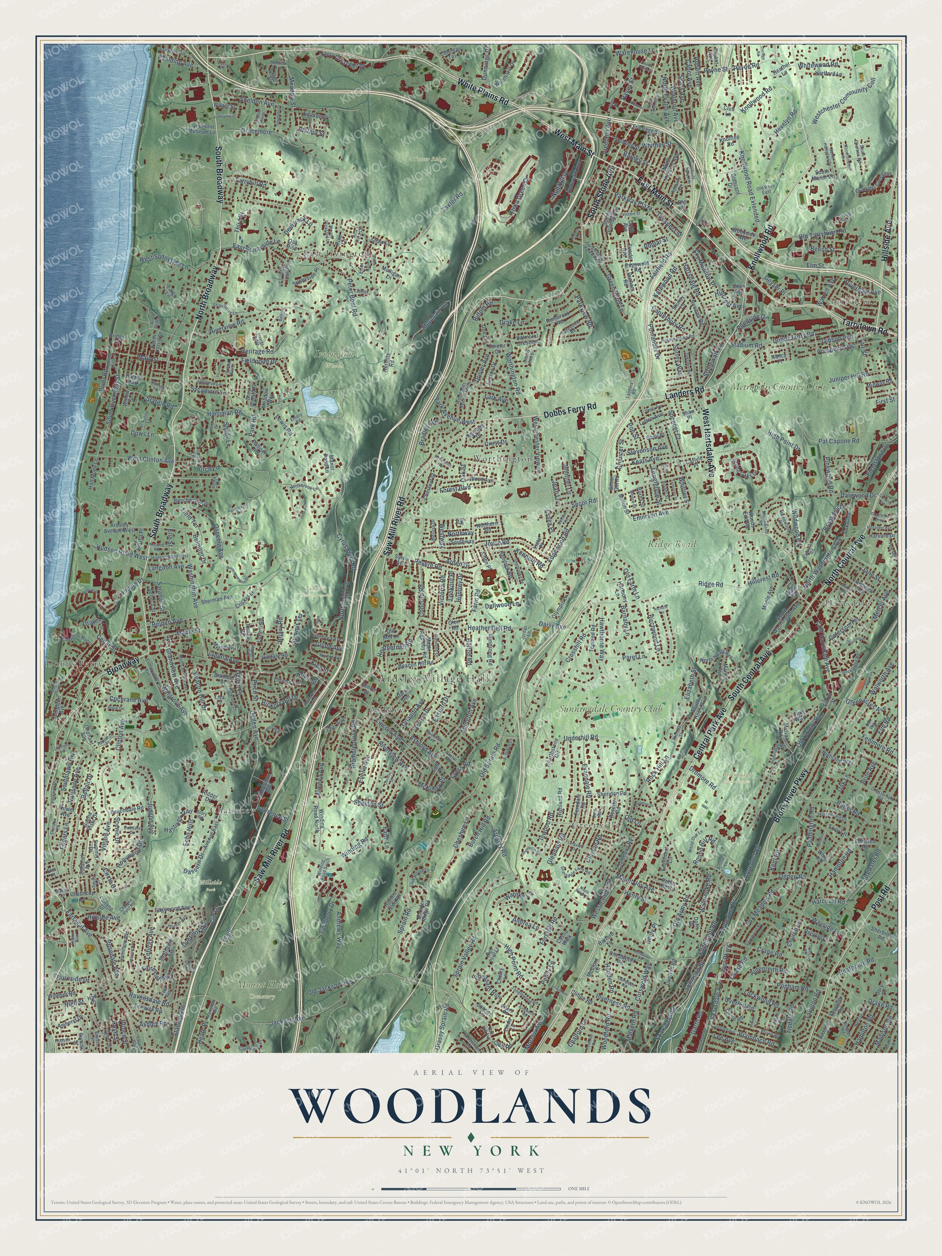
A new map of Woodlands, New York, made in 2026 and printed to order on thick archival matte paper.
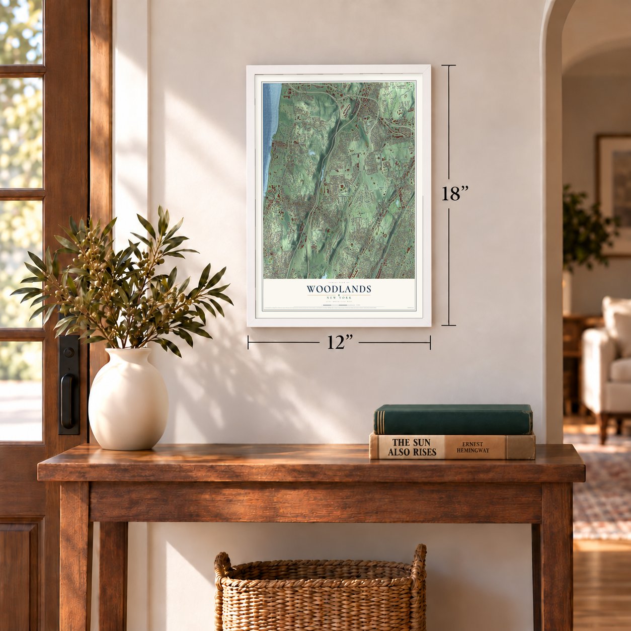
12" x 18" Archival Matte Print
A Map of Home. A Work of Art.
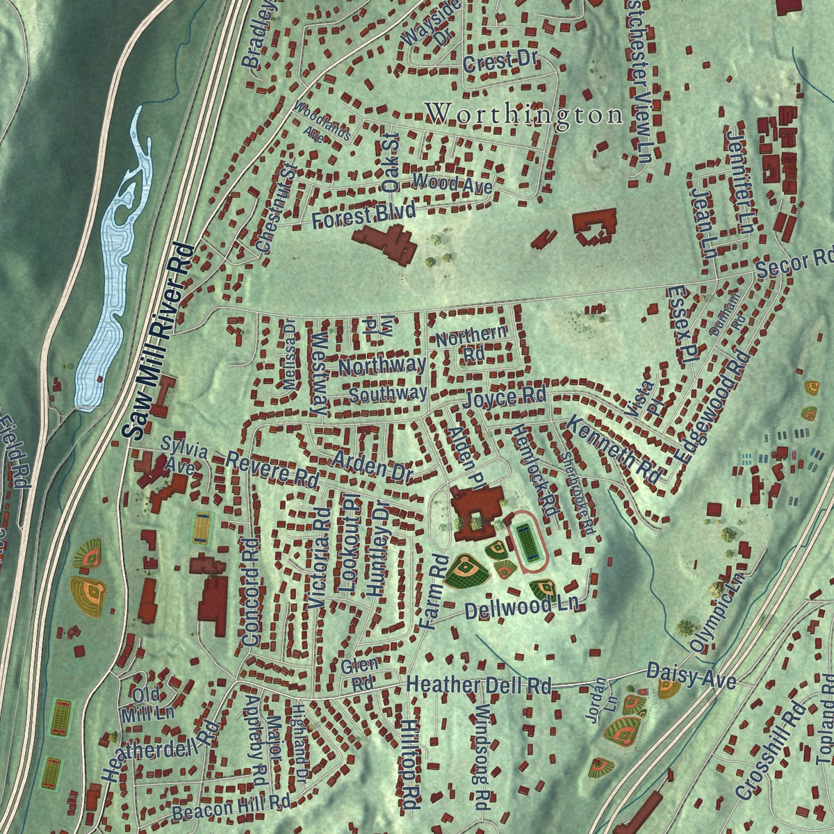
Explore Woodlands, New York from a whole new perspective. Created using aerial imagery and detailed geographic data, this map captures Woodlands building by building, with labeled streets, familiar landmarks, and shaded topographical relief that highlights the natural contours of the landscape.
Combining modern data with the timeless character of a vintage atlas, this map is just as interesting up close as it is beautiful on the wall. Whether you grew up in Woodlands, spent memorable years there, or call it home today, this unique map is a great way to celebrate a place that means something to you. Zoom in on the preview to look for your street, and then order a print to put your memories on the wall.
Three ways to hang it
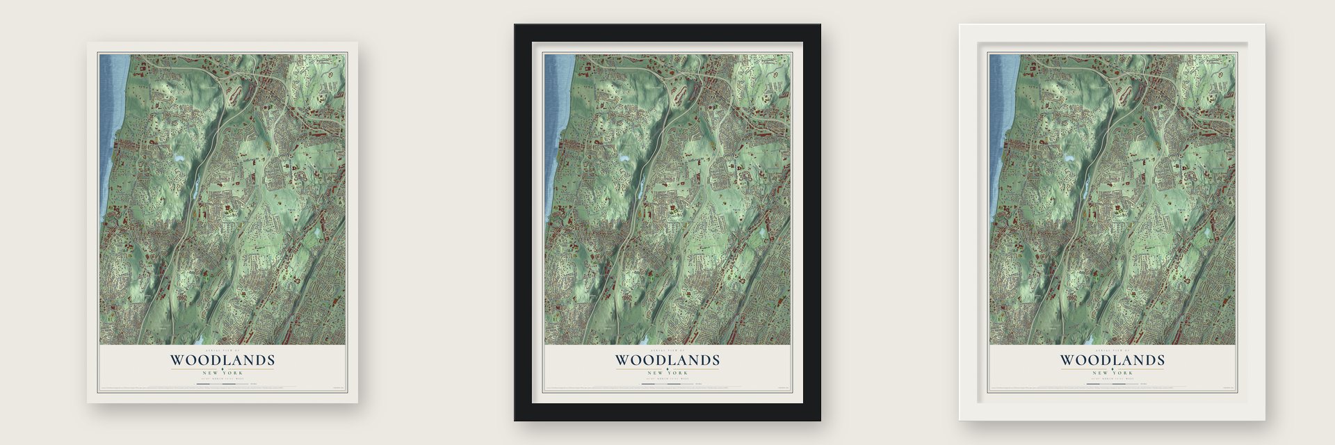
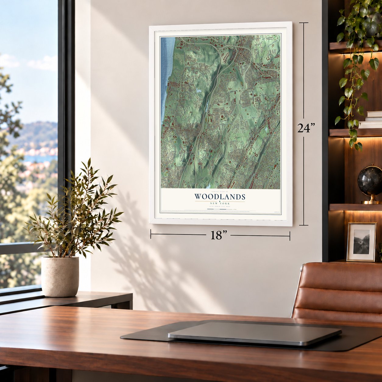
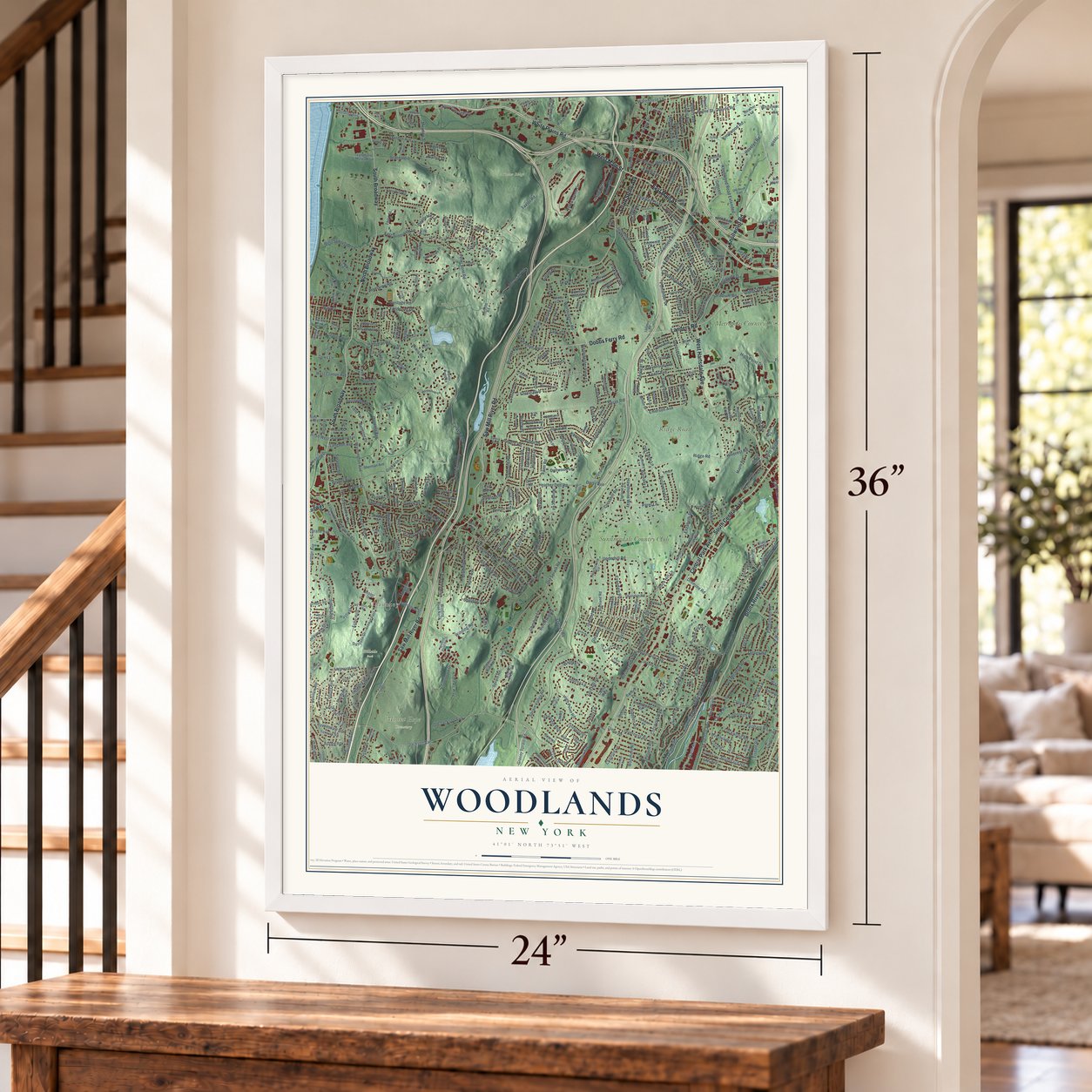
Unframed archival matte, a black wood frame or a white wood frame.
Up close
Geography Worth Displaying
This map was created using accurate cartographic data and authoritative geographic sources, including the U.S. Geological Survey and the Census Bureau. The map brings together terrain, waterways, roads, and building detail. The majority of the streets are labeled, houses are accurately depicted, and the topography is derived from government sources. Combining local data with carefully composed color and shading leads to this beautifully detailed Woodlands artwork for your wall.
Rather than simply showing street outlines, we’ve included as many of the street names as we could reasonably fit on the map while keeping their names legible. Zoom in on the high resolution preview to see exactly what’s on the map. We truly set out to create a statement piece for anyone who loves Woodlands. So whether it’s for you, or a gift for someone you love, we hope this map of Woodlands brings back fond memories.
Read the story behind this map: Detailed Map of Woodlands, New York.
Find your street
Names on the Woodlands map
Every name below is printed on this map. Look for your street, your school, the park where you played, or the pond down the road.
Places and landmarks19
- Ardsley Village Hall
- Fairview
- Greenburgh Nature Center
- Hillside Park
- Irvington Woods
- Juhring Nature Preserve
- Mount Hope Cemetery
- Ridge Road Park
- Taxter Ridge
- Dobbs Ferry
- Greenville
- Chauncey
Show all 19 places
- East Irvington
- Worthington
- Hartsdale
- Ardsley
- Metropolis Country Club
- Sunningdale Country Club
- Barney Park
Streets and roads614
- South Broadway
- Tarrytown Road
- North Central Avenue
- North Broadway
- East Main Street
- West Main Street
- South Stone Avenue
- White Plains Road
- Central Park Avenue
- Saw Mill River Road
- Bronx River Parkway
- Dobbs Ferry Road
- Knollwood Road
- Broadway
- West Hartsdale Avenue
- Landers Road
- Post Road
- Hillside Avenue
- South Central Avenue
- Dassern Drive
- Farragut Avenue
- Knollwood Road Extended
- Hayes Street
- East Sunnyside Lane
- Hamilton Road
- Fieldpoint Drive
- High Street
- Gracemere
- South Buckhout Street
- Nob Hill Drive
Show all 614 streets
- Meadow Street
- Kathwood Road
- Walnut Street
- Burnside Drive
- Jackson Avenue
- Cyrus Field Road
- Hartsdale Road
- Main Street
- Lewis Road
- Sprain Road
- Ridge Road
- Fort Hill Road
- Taxter Road
- Heather Dell Road
- North Washington Avenue
- Draper Lane
- Daisy Avenue
- Prospect Avenue
- Bramblebrook Road
- Grandview Avenue
- Payne Road
- Cotswold Way
- Warnke Lane
- Ashford Avenue
- Town Green Drive
- Ardsley Road
- Secor Road
- Old Army Road
- Fox Meadow Road
- Underhill Road
- Echo Hills
- Edgemont Road
- Mountain Road
- Lincoln Avenue
- Aqueduct Road
- Andrews Way
- Overlook Road
- Heatherdell Road
- Riverview Road
- Peter Bont Road
- Washington Avenue
- Maple Street
- Clinton Avenue
- Euclid Avenue
- Brite Avenue
- Old Colony Road
- Pat Capone Road
- Old Tarrytown Road
- Ogden Avenue
- Harriman Road
- Sprain Valley Road
- Winthrop Avenue
- Judson Avenue
- Sheldon Avenue
- Oak Street
- Joyce Road
- Lefurgy Avenue
- Hampton Road
- Osceola Avenue
- Brewster Road
- Clayton Road
- Westchester Community Coll
- Stanley Avenue
- Northfield Avenue
- Birchwood Lane
- Cochrane Avenue
- Heritage Road
- Palisade Avenue
- Evandale Road
- Garth Road
- Worthington Road
- Popham Road
- Old Jackson Avenue
- Old Sprain Road
- Beacon Hill Drive
- Glendale Road
- Edgewood Road
- Hawthorne Way
- Crane Road
- Paddington Road
- Pinewood Road
- Butler Road
- Church Lane
- Parkview Road
- East Parkway
- North Evarts Avenue
- Round Hill Road
- Villard Avenue
- Landing Drive
- Wayside Lane
- Stonewall Circle
- Fairmont Avenue
- Gibson Avenue
- Hudson Road West
- Sears Avenue
- Farm Road
- Ogden Road
- West Sunnyside Lane
- Fieldstone Drive
- Dromore Road
- Walgrove Avenue
- Mount Joy Avenue
- Ravensdale Road
- Overhill Road
- King Street
- Canterbury Road
- Forest Boulevard
- Longfellow Street
- Keats Avenue
- Belden Avenue
- Circle Drive
- Pondside Drive
- Abington Avenue
- Huntley Drive
- Walworth Avenue
- Hevelyn Road
- High Point Drive
- Greenwood Lane
- West Clinton Avenue
- Fenimore Road
- Hillcrest Avenue
- Caterson Terrace
- Crosshill Road
- East Hartsdale Avenue
- Walbrooke Road
- Payne Street
- Cabot Avenue
- Sheldon Street
- Crest Drive
- Parkway Plaza
- Rosedale Avenue
- Lynwood Road
- Eastern Drive
- Juniper Hill Road
- Scarsdale Avenue
- Cheshire Lane
- Cedar Street
- Drisler Avenue
- Inverness Road
- Mercer Avenue
- Hadden Road
- Chalford Lane
- Drake Road
- Pheasant Run
- Elm Street
- Bellair Drive
- Birch Lane
- Scarsdale Road
- Penny Lane
- Heathcote Road
- Langdon Avenue
- Station Road
- Oak Lane
- Concord Road
- Shady Lane
- Warren Avenue
- Aqueduct Drive
- Brambach Road
- Sycamore Lane
- Fairfield Road
- Southlawn Avenue
- Abbott Avenue
- Westchester View Lane
- Dalewood Drive
- Grassy Sprain Road
- Edgars Lane
- Revere Road
- Victoria Road
- Greenacres Avenue
- Turnberry Drive
- Andrea Lane
- Tarry Crescent Drive
- Spencer Court
- High Point Road
- Kent Road
- Hollywood Drive
- Tisdale Road
- Hillcrest Road
- Henry Street
- Kenneth Road
- Lockwood Road
- Almena Avenue
- Hickory Hill Drive
- Lark Avenue
- Orlando Avenue
- Malvern Road
- Faith Lane
- Dellwood Lane
- Burch Hill Road
- Briary Road
- Scenic Drive
- Poe Street
- Paulding Avenue
- Emerson Avenue
- Stadium Road
- Woodford Road
- Jane Street
- Third Street
- Westminster Road
- Chase Road
- Whitewood Road
- Park Avenue West
- Taunton Road
- Inwood Road
- Pomander Drive
- Brookdell Drive
- Bradley Avenue
- Price Street
- Sky Meadow Place
- Surrey Way
- Madison Road
- Stevenson Avenue
- Fair Street
- River Road
- Lee Avenue
- Virginia Avenue
- Elizabeth Street
- Winding Road
- Barney Street
- Riverview Avenue
- Deertrack Lane
- Autenreith Road
- Wildwood Road
- Geyser Place
- Dows Lane
- Arden Drive
- Chaucer Street
- Drake Lane
- McKinley Place
- Harcourt Road
- Tarryhill Road
- Field Terrace
- Seely Place
- Paret Lane
- Rose Street
- Old Farm Lane
- Rock Hill Lane
- Saranac Street
- Vreeland Avenue
- Warehouse Lane
- Jean Lane
- Heath Place
- Hilltop Road
- Poplar Street
- Riverdale Avenue
- Cross Road
- Prospect Street
- Morrow Avenue
- Hastings Trail
- Erie Street
- Whitney Street
- Lawrence Street
- Dunnings Drive
- First Street
- Allen Street
- Beech Street
- Biltom Road
- Whittier Street
- Summit Terrace
- Barnaby Lane
- Prince Street
- Belmont Drive
- Gould Avenue
- Ashley Road
- Elm Road
- Lookout Place
- Jennifer Lane
- Westway
- Northway
- Ogden Place
- Park Road
- Essex Place
- Gail Road
- Tory Lane
- Old Lane
- Palliser Road
- Ardsley Avenue West
- Sunnyside Place
- Hudson Avenue
- Midvale Road
- Bridge Street
- Ridder Drive
- Summit Street
- Lyndhurst Museum Lane
- Boulder Ridge Road
- Highland Road
- Olmsted Road
- Sherman Avenue
- Topland Road
- Watch Hill Drive
- Manor Pond Lane
- Granada Crescent
- Beechwood Road
- North Healy Avenue
- Beacon Hill Road
- South Healy Avenue
- Park Avenue
- Chestnut Street
- South Washington Avenue
- Sheridan Road
- Balmoral Crescent
- Stone Oaks Drive
- Club Way
- Lakeview Avenue
- Fargo Lane
- Bowbell Road
- South Hillside Avenue
- Hamilton Avenue
- Ferndale Road
- Southgate Avenue
- Wood Avenue
- Shirley Lane
- Western Drive
- Amherst Drive
- Doris Drive
- Whig Road
- Olympic Lane
- Locust Lane
- Buena Vista Drive
- Robin Hill Road
- Hidden Glen Road
- Circle Road
- Crescent Drive
- Ferncliff Road
- North Perkins Avenue
- Shaw Lane
- Oliphant Avenue
- Fisher Street
- Wayside Drive
- Myrtle Avenue
- Cliff Street
- Undercliff Avenue
- Hartford Lane
- Marion Avenue
- South Manor Drive
- Rectory Lane
- Shaw Place
- Beechdale Road
- Livingstone Avenue
- Lytton Avenue
- Knolltop Road
- Windsong Road
- Chedworth Road
- Sylvia Avenue
- Hearthstone Circle
- Lenroc Drive
- Clarendon Road
- Chauncey Lane
- Flower Avenue
- Farlane Drive
- Evarts Avenue
- Castle Walk
- Beverly Road
- Rumbrook Road
- Eiler Lane
- Sherbrook Road
- Center Street
- Maple Avenue
- Fenwick Road
- Summit Drive
- Seneca Street
- Livingston Avenue
- Old Road
- Edgewold Road
- Edgemont Circle
- Major Appleby Road
- Avenue East
- Edgewood Avenue
- Harvard Drive
- Carlyle Place
- Hilldale Road
- Paulding Street
- Highland Way
- Winding Road North
- Half Moon Lane
- Medford Lane
- Woodside Avenue
- Hemlock Road
- Calumet Avenue
- Fox Glen
- Southway
- Meadow Way
- Coleman Terrace
- North Ferris Street
- Harmony Lane
- Bertha Place
- Durham Road
- Luzern Road
- Obry Drive
- Bradley Street
- Overton Road
- Frontage Street
- Embree Street
- Windsor Road
- Finmor Drive
- Taft Lane
- Northern Road
- Midway Road
- Alden Place
- Milton Street
- Fuller Avenue
- Pine Lane
- Club Lane
- Cricket Lane
- Hermits Road
- Linda Lane
- Mulligan Lane
- Grey Rock Terrace
- Heather Lane
- Clifton Road
- Cherry Lane
- Elm Place
- Bryant Avenue
- Woods End Road
- Barford Lane
- Walter Street
- Temple Road
- Secor Gln Road
- Burns Street
- Glen Road
- Old Mill Lane
- Lisa Court
- Scott Place
- Sunrise Lane
- Joan Avenue
- Cobb Avenue
- Don Lane
- Nancy Place
- Fourth Street
- Willow Street
- Vista Place
- Clark Street
- Oak Rise
- Hall Place
- Ivy Place
- Highridge Road
- Ilinka Lane
- Fort Hill Avenue
- River Street
- Thomas Street
- Sprain Brook Parkway Drive
- Rockledge Road
- North Lawn Avenue
- Florence Avenue
- Chesterfield Road
- Maplewood Road
- Strawberry Lane
- Livingston Manor
- White Oak Lane
- Rockingchair Road
- Dogwood Lane
- Northbrook Lane
- Nelson Road
- Estherwood Avenue
- Valleyview Road
- Delhi Road
- El Retiro Lane
- Kent Avenue
- Winding Road South
- Rodney Road
- Club House Lane
- Mendham Avenue
- Mohican Park Avenue
- Axtell Drive
- Van Wart Avenue
- Clarewood Drive
- Hudson Road East
- Brown Road
- Woodlands Avenue North
- North Hampton Drive
- Elmwood Road
- Scarsdale Farm Road
- Roland Road
- Chemka Pool Road
- Tanglewood Road
- Horseguard Lane
- Hudson Street
- Yale Road
- Mount Pleasant Lane
- Forkland Lane
- Campden Road
- James Street
- Appleton Place
- Sandrock Avenue
- South Astor Street
- Melissa Drive
- Sheldon Place
- Homewood Road
- Robbins Avenue
- Artillery Lane
- Highland Drive
- Parkway Drive
- Alta Vista Circle
- Glory Road
- South Chelsea Road
- Fraydun Lane
- Roosevelt Place
- Oakdale Drive
- Old Road East
- Horner Avenue
- Hillside Street
- Bryant Street
- Barney Lane
- High Point Lane
- Skytop Road
- Exeter Place
- Emory Road
- Plainview Avenue
- South Drive
- Oak Way
- Moore Street
- Haynes Avenue
- Baker Lane
- Tarry Place
- Hopke Avenue
- Brandt Street
- Jordan Lane
- North Payne Street
- Woodlands Avenue
- Longview Drive
- North Mountain Drive
- Stonehouse Road
- Vincent Street
- Havermeyer Road
- Dunham Road
- Hunters Run
- Stephens Drive
- Gray Rock Road
- School Lane
- Sherbrooke Road
- Tarryhill Way
- Paradise Drive
- Colonial Avenue
- Kempster Road
- Chester Avenue
- Jefferson Avenue
- Brook Lane
- Country Club Drive
- Lawton Avenue
- Fountain Lane
- Hudson Drive
- Southfield Avenue
- Alexander Avenue
- Charlotte Place
- Kingwood Road
- Greenville Road
- Farragut Parkway
- Woods Lane
- Chatterton Parkway
- Woodhampton Drive
- Barbara Lane
- Brambach Avenue
- Brace Terrace
- South Sears Avenue
- Babbitt Court
- Shelly Avenue
- Berwick Road
- Hearthstone Road
- Frost Lane
- Tennyson Street
- Brace Bridge Lane
- Emerald Woods
- Concord Avenue
- Maple Ridge Court
- Moulton Avenue
- Stearns Ridge
- Station Plaza
- Oakridge Road
- Old Orchard Lane
- Lakeview Drive
- Havens Street
- Green Way Drive
- Falmouth Road
- Millbrook Avenue
- Oxridge Road
- Garland Drive
- Richard Terrace
- Victor Drive
- Willow Lane
- Divney Lane
- Daisy Lane
- Chester Street
- Storm Street
- Glen Avenue
Names are listed as they appear on the printed map. Zoom into the product photos to find them.
The art of mapping a place
How This Map Was Made
Real places. Remarkable detail. Discover the layers that turn geographic data into a map of home.

The view from above
Aerial imagery reveals the character of the land: woodland, open fields, and the patterns of a place.

The shape of the land
Elevation data brings hills, valleys, and subtle changes in the landscape into view.

The details of home
Roads, waterways, and building footprints come together to make the map feel unmistakably local.

Geography becomes art
Considered color, shading, and typography bring the layers together in a map made for your wall.


Process illustrated with Mendon, Massachusetts. Aerial imagery: USDA NAIP. Terrain: USGS 3D Elevation Program. Map details and finished artwork: KNOWOL.
The Details
About This Print
Choose an archival matte print, or a black or white Ayous wood frame. The archival matte print is unframed.
Select your size and finish above to see the matching product image and price.
Materials & Craftsmanship
A contemporary map with the character of a classic atlas, printed on archival matte paper. Optional frames are made from Ayous wood.
Your printed map does not include the watermark shown in the full-map preview.
Shipping & Delivery
Free shipping within the United States. Every print is made to order in the USA.
Buying a gift? Add a note in your cart and we'll include it. We never put prices in the package.
Prints ship within 2 to 3 business days. Allow 7 to 10 days total from ordering for delivery. Timing may vary during holidays or periods of high order volume.
Read our shipping policy.
Returns and damaged prints
Each print is made to order. Change-of-mind refunds are not available after production.
If your print arrives damaged, misprinted or incorrect, contact support@knowol.com within 30 days of receiving it. Include your order number, photos and a description of the issue.
Read our full refund and replacement policy. For questions about your order, email support@knowol.com.
Find your town
Looking for another city?
Find a map of home in our New York collection, or any town in the country.
Nearby
Maps of towns near Woodlands
Know someone from one of these towns? Their map makes a great gift.
 Greenburgh
, New York
From $39.99See the map
 Ardsley
, New York
From $39.99See the map
 Hartsdale
, New York
From $39.99See the map
More maps nearby: Irvington, Greenville, Dobbs Ferry, Elmsford and Tarrytown.