
Search for another town




Free U.S. delivery 7 to 10 days after you order
Woodstock, Virginia Map Art
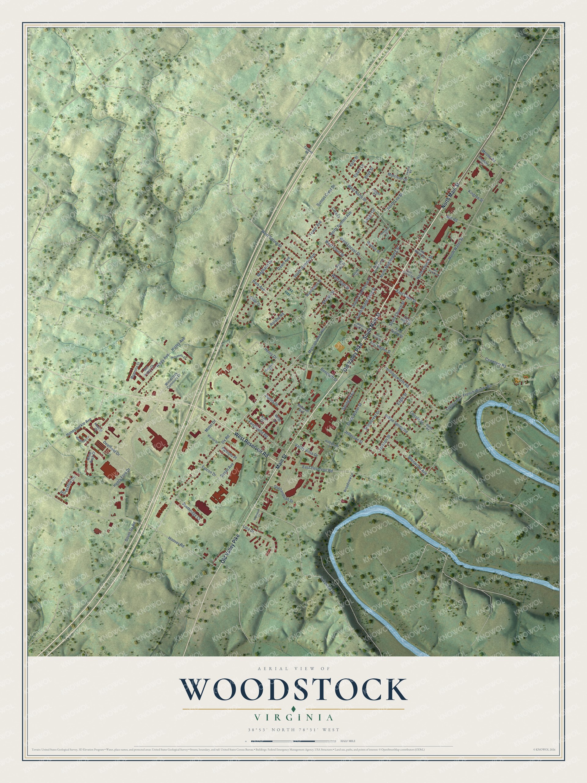
A new map of Woodstock, Virginia, made in 2026 and printed to order on thick archival matte paper.
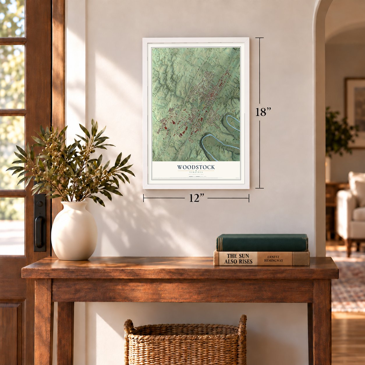
12" x 18" Archival Matte Print
A Map of Home. A Work of Art.
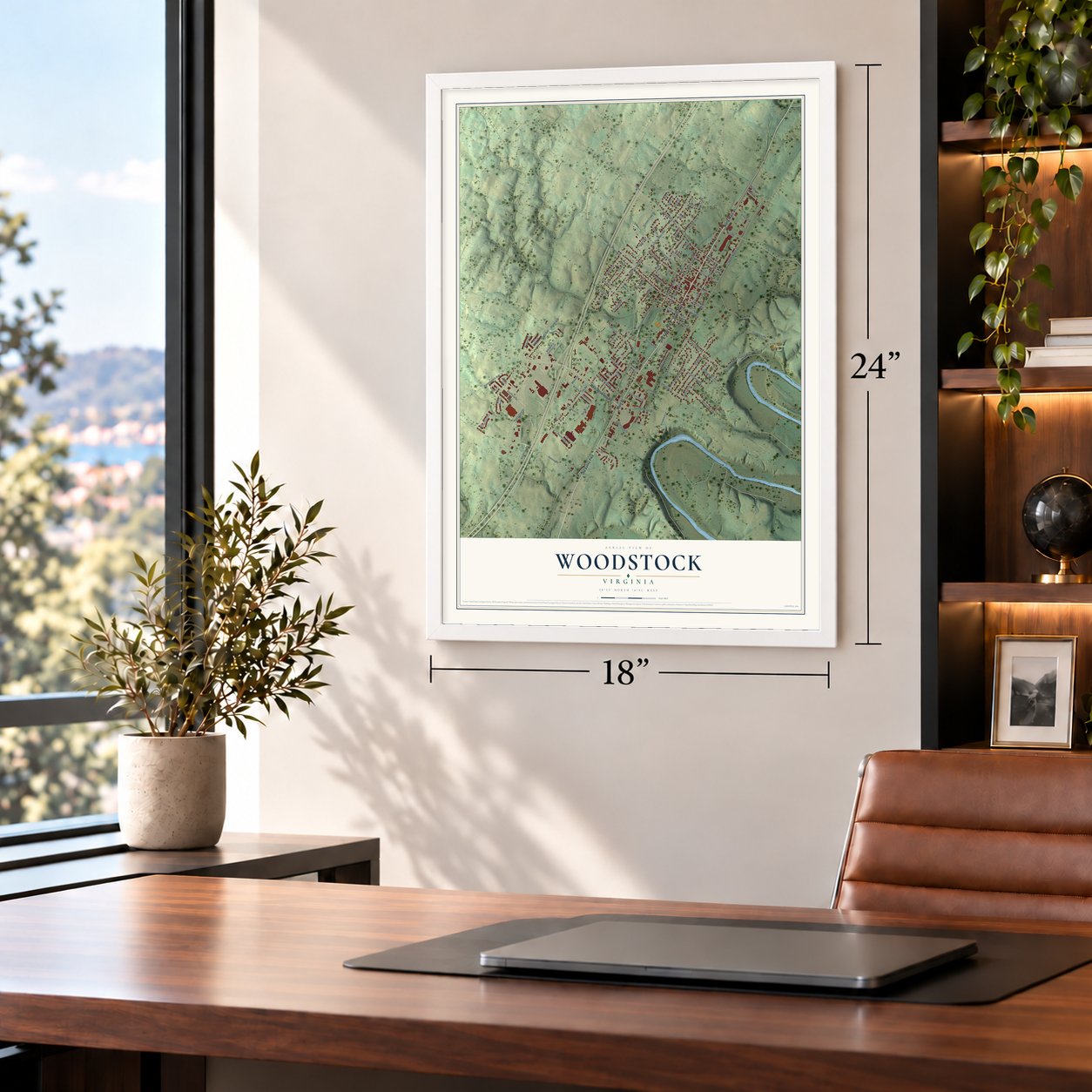
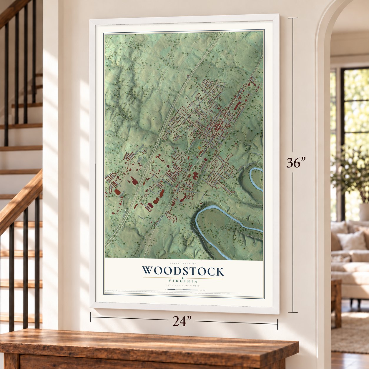
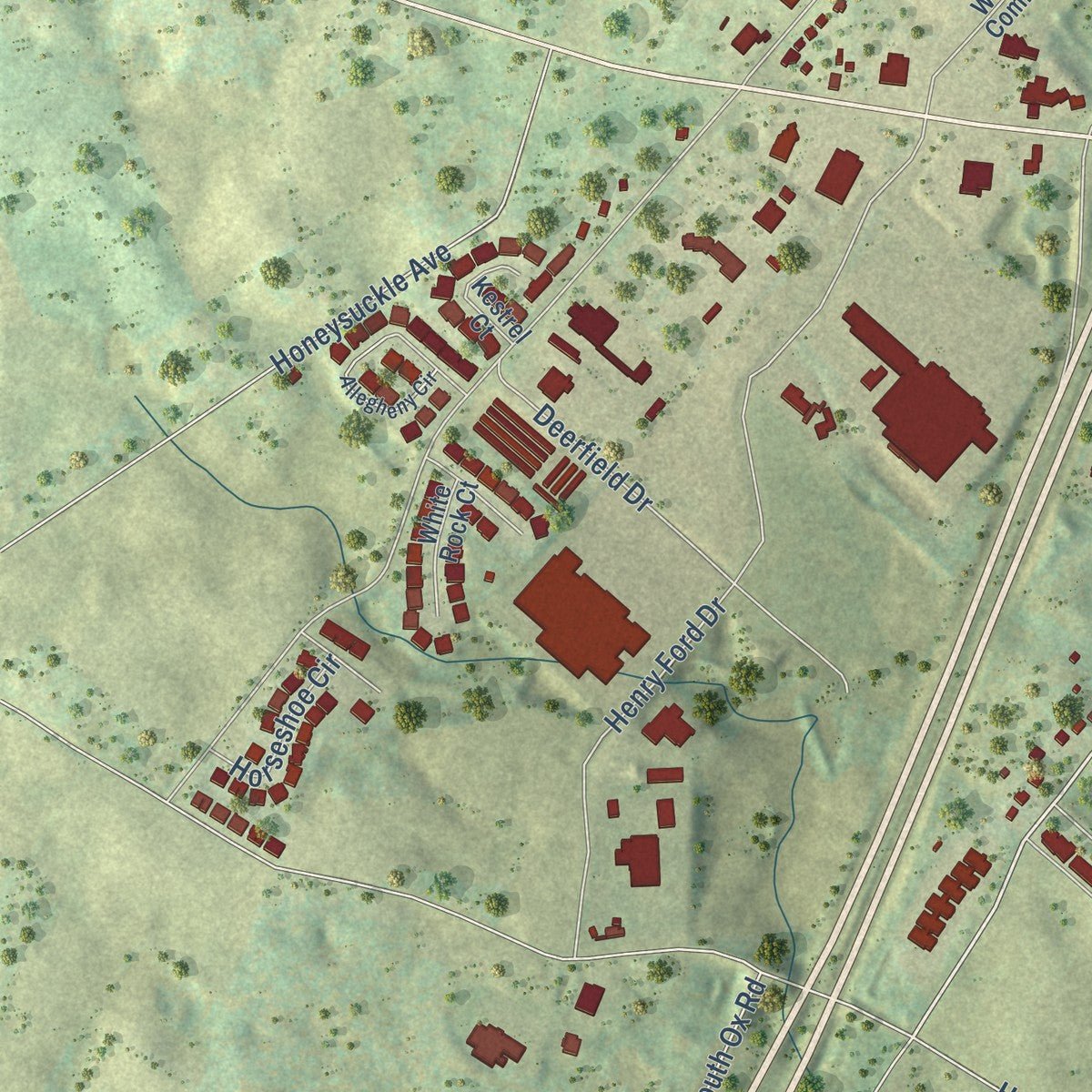
Explore Woodstock, Virginia from a whole new perspective. Created using aerial imagery and detailed geographic data, this map captures Woodstock building by building, with labeled streets, familiar landmarks, and shaded topographical relief that highlights the natural contours of the landscape.
Combining modern data with the timeless character of a vintage atlas, this map is just as interesting up close as it is beautiful on the wall. Whether you grew up in Woodstock, spent memorable years there, or call it home today, this unique map is a great way to celebrate a place that means something to you. Zoom in on the preview to look for your street, and then order a print to put your memories on the wall.
Three ways to hang it
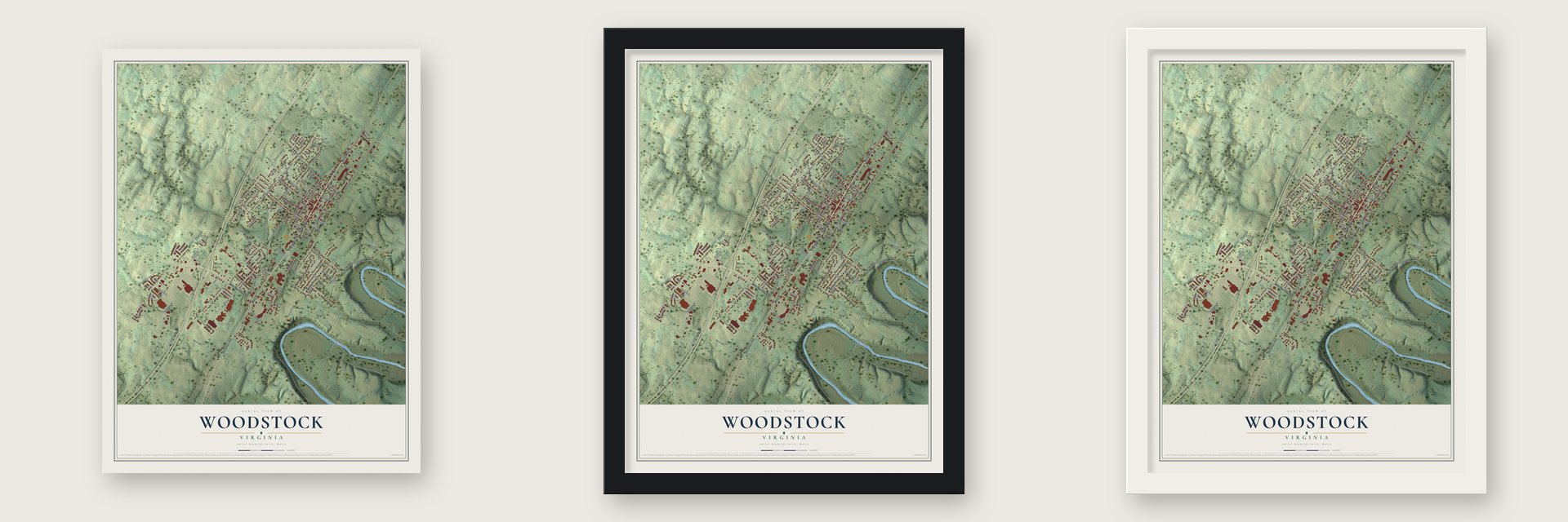
Unframed archival matte, a black wood frame or a white wood frame.
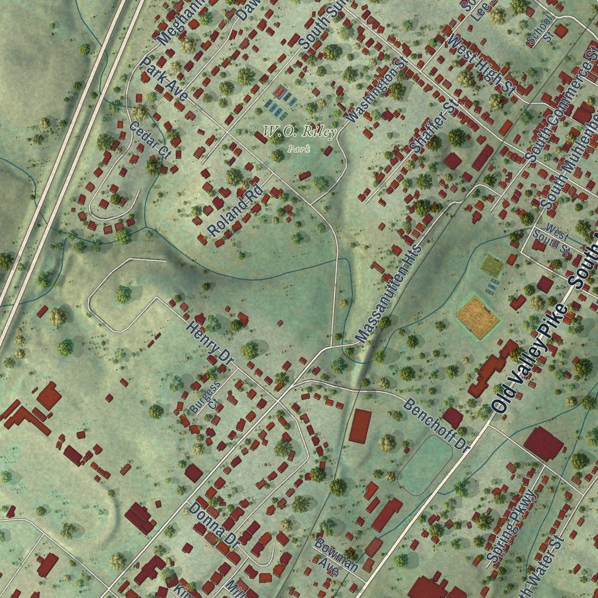
Up close
Geography Worth Displaying
This map was created using accurate cartographic data and authoritative geographic sources, including the U.S. Geological Survey and the Census Bureau. The map brings together terrain, waterways, roads, and building detail. The majority of the streets are labeled, houses are accurately depicted, and the topography is derived from government sources. Combining local data with carefully composed color and shading leads to this beautifully detailed Woodstock artwork for your wall.
Rather than simply showing street outlines, we’ve included as many of the street names as we could reasonably fit on the map while keeping their names legible. Zoom in on the high resolution preview to see exactly what’s on the map. We truly set out to create a statement piece for anyone who loves Woodstock. So whether it’s for you, or a gift for someone you love, we hope this map of Woodstock brings back fond memories.
Read the story behind this map of Woodstock, Virginia from 2026.

About Woodstock, Virginia
Woodstock is a town of 5,807 people and the county seat of Shenandoah County, beside the Shenandoah River's North Fork at its Seven Bends. Jacob Muller left Germany in 1749 and lived first in Pennsylvania. By 1752 he had bought 400 acres from Lord Fairfax in the Shenandoah Valley, and there he planned a town called Muellerstadt, following an old Indian trail for its main street.
In March 1761 the House of Burgesses chartered the town in an act sponsored by George Washington, and it became Woodstock, though no record explains the new name. Muller sold 40 lots at a large land sale but died in 1766. His son-in-law Andrew Brewbaker took over the grant, and trustees appointed by the General Assembly ran the town until 1795, when it won the right to hold elections.
“in the language of Holy Writ there is a time for all things, a time to preach and a time to pray, but those times have passed away. There is a time to fight, and that time has now come.”
- The sermon of 1776Peter Muhlenberg came to Woodstock in 1771 to preach to its Lutherans and Episcopalians, and he went on to sit in the House of Burgesses in 1774. On January 21, 1776, he ended his farewell sermon by throwing off his robes to show an officer's uniform. He raised and led the 8th Virginia Regiment, called the German Regiment, with Lt. Colonel Abraham Bowman of Woodstock, and two of its ten companies came from around the town.
- Jefferson's courthouseWoodstock became the seat of Dunmore County in 1772, and the county was renamed Shenandoah County in 1777. A permanent courthouse stood by 1774. In 1795 the county replaced it with a building of native limestone designed by Thomas Jefferson. Additions followed in 1871 and 1886, and that building, now the Shenandoah County Courthouse on Main Street, still holds court. No older working courthouse stands west of the Blue Ridge.
- From Indian Road to Route 11The road through Woodstock began as a trail between the Catawba in the south and their rivals in the north. Settlers called it the Indian Road and used it to move into the valley. Later travelers knew it as the Great Wagon Road, and after that as the Valley Pike, and Route 11 still follows much of its path. The area's last Indian raid came in 1766, about two miles south of town.
- A limestone depot in 1888The Manassas Gap Railroad reached south to Mount Jackson on March 2, 1859, passing through Woodstock. After the Civil War the B&O rebuilt the damaged line, and in 1888 it built a passenger station in Woodstock of native limestone, one of the finer depots in the region. The railroad made Woodstock a busier place for trade.
- A school won in 1882Black residents of Woodstock pressed for a school building of their own. In 1882 the town's first public school for African American children was built on the lot of their church.
Find your street
Names on the Woodstock map
Every name below is printed on this map. Look for your street, your school, the park where you played, or the pond down the road.
Places and landmarks2
- Riverview Park
- W.O. Riley Park
Streets and roads108
- South Main Street
- North Main Street
- West Reservoir Road
- Old Valley Pike
- Main Street
- West Court Street
- East Court Street
- Ox Road
- West Locust Street
- South Muhlenberg Street
- North Lee Street
- West North Street
- North Muhlenberg Street
- West Spring Street
- South Water Street
- Hisey Avenue
- Hoover Road
- North Water Street
- Susan Avenue
- Henry Drive
- Henry Ford Drive
- Meghann Drive
- Eagle Street
- North Summit Avenue
- Fairground Road
- Park Avenue
- Cemetery Road
- East Reservoir Road
- South Summit Avenue
- Hollingsworth Road
Show all 108 streets
- West High Street
- Sunset Crest Drive
- Lakeview Drive
- Deerfield Drive
- Indian Spring Road
- Jackson Street
- Massanutten Heights
- French Woods Road
- Stonecrest Drive
- Motel Drive
- South Church Street
- North Church Street
- Lora Drive
- Shenwood Avenue
- South Commerce Street
- Benchoff Drive
- Jefferson Street
- Dawn Avenue
- Mill Road
- Honeysuckle Avenue
- Moose Road
- Shaffer Street
- Southridge Court
- Walnut Street
- Shenandoah Street
- Lupton Road
- Kern Street
- Donna Drive
- Kingree Street
- Spring Parkway
- Epard Lane
- Valley Vista Drive
- Horseshoe Circle
- Boyd Street
- South Ox Road
- Logan Circle
- Morrison Drive
- Hisley Avenue
- Roland Road
- Falcon Drive
- Lincoln Street
- Patriots Place
- Tower Avenue
- Washington Street
- Woodstock Commons Drive
- East North Street
- South Lee Street
- East High Street
- East Hughes Street
- East Spring Street
- Cobb Court
- Broadview Lane
- Magnolia Court
- Sun Poppy Court
- White Rock Court
- Kestrel Court
- Miller Court
- Bowman Avenue
- Holtzman Lane
- Cedar Court
- Jasper Court
- Kim Court
- North Commerce Street
- East Locust Street
- Allegheny Circle
- Hotchkiss Drive
- Warren Drive
- Swartz Road
- Burgess Court
- West South Street
- Pheasant Lane
- Fairview Road
- School Street
- Hottel Road
- East Foundry Street
- East South Street
- Wadewood Court
- Stonewall Circle
Names are listed as they appear on the printed map. Zoom into the product photos to find them.
The art of mapping a place
How This Map Was Made
Real places. Remarkable detail. Discover the layers that turn geographic data into a map of home.

The view from above
Aerial imagery reveals the character of the land: woodland, open fields, and the patterns of a place.

The shape of the land
Elevation data brings hills, valleys, and subtle changes in the landscape into view.

The details of home
Roads, waterways, and building footprints come together to make the map feel unmistakably local.

Geography becomes art
Considered color, shading, and typography bring the layers together in a map made for your wall.


Process illustrated with Mendon, Massachusetts. Aerial imagery: USDA NAIP. Terrain: USGS 3D Elevation Program. Map details and finished artwork: KNOWOL.
The Details
About This Print
Choose an archival matte print, or a black or white Ayous wood frame. The archival matte print is unframed.
Select your size and finish above to see the matching product image and price.
Materials & Craftsmanship
A contemporary map with the character of a classic atlas, printed on archival matte paper. Optional frames are made from Ayous wood.
Your printed map does not include the watermark shown in the full-map preview.
Shipping & Delivery
Free shipping within the United States. Every print is made to order in the USA.
Buying a gift? Add a note in your cart and we'll include it. We never put prices in the package.
Prints ship within 2 to 3 business days. Allow 7 to 10 days total from ordering for delivery. Timing may vary during holidays or periods of high order volume.
Read our shipping policy.
Returns and damaged prints
Each print is made to order. Change-of-mind refunds are not available after production.
If your print arrives damaged, misprinted or incorrect, contact support@knowol.com within 30 days of receiving it. Include your order number, photos and a description of the issue.
Read our full refund and replacement policy. For questions about your order, email support@knowol.com.
Find your town
Looking for another city?
Find a map of home in our Virginia collection, or any town in the country.
Nearby
Maps of towns near Woodstock
Know someone from one of these towns? Their map makes a great gift.
 Edinburg
, Virginia
From $39.99See the map
 Saumsville
, Virginia
From $39.99See the map
 Alonzaville
, Virginia
From $39.99See the map
More maps nearby: Maurertown, Columbia Furnace, Bowmans Crossing, Toms Brook and Mount Olive.