
Search for another town





Free U.S. delivery 7 to 10 days after you order
Yoakum, Texas Map Art
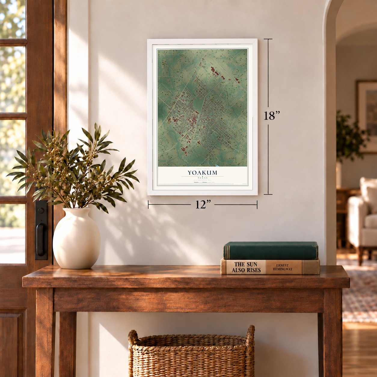
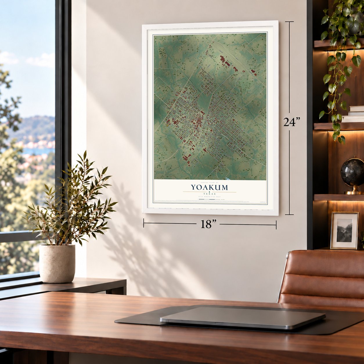
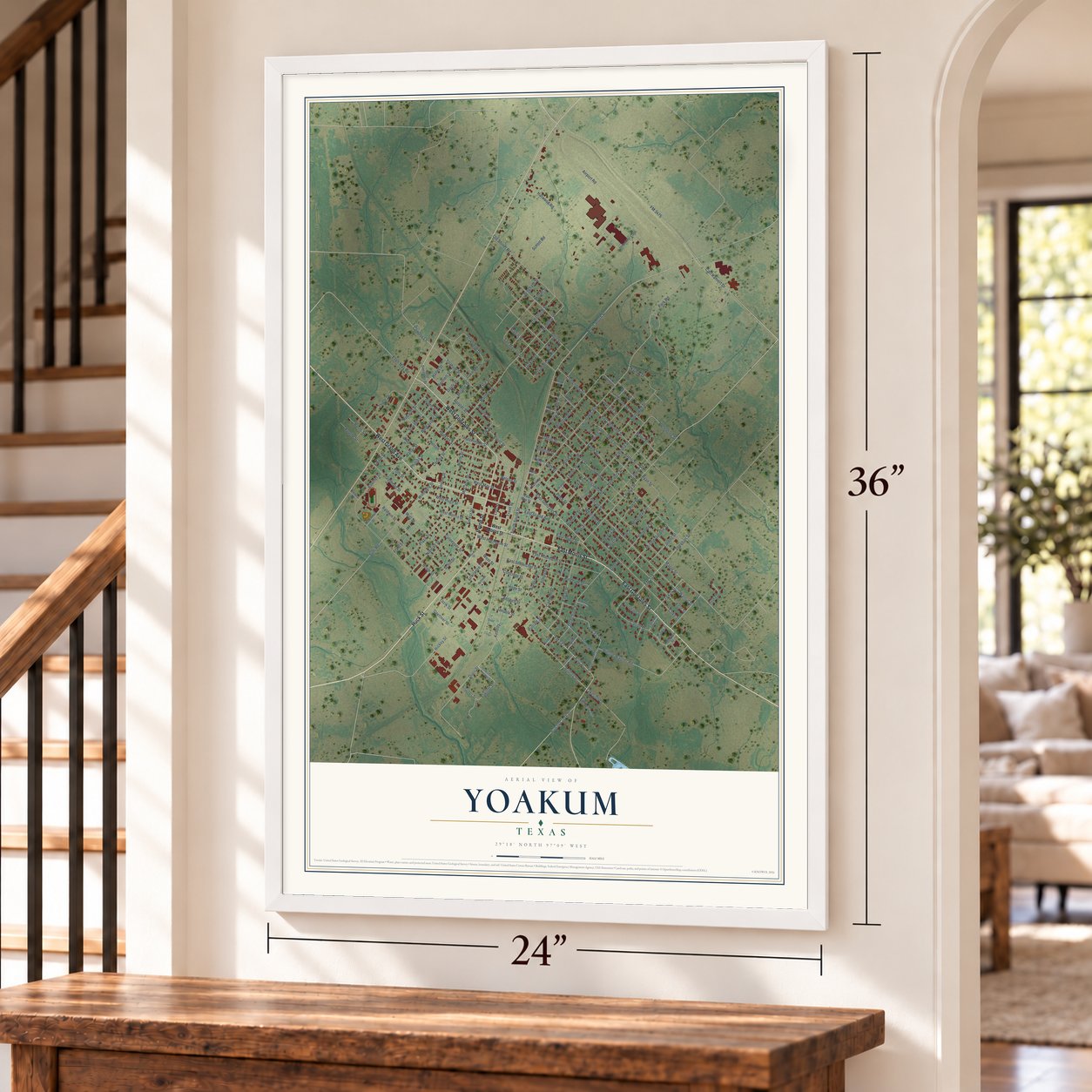
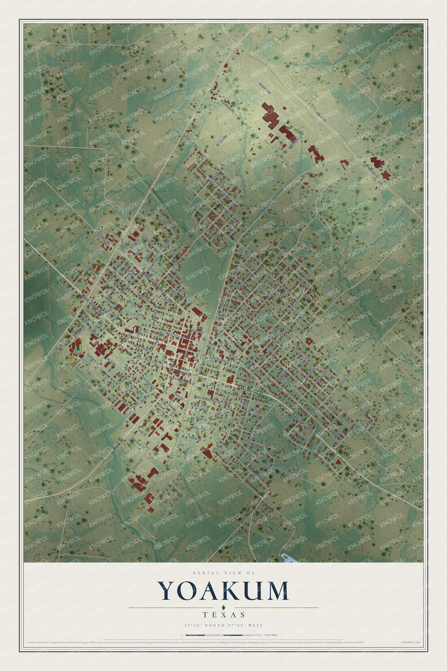
A new map of Yoakum, Texas, made in 2026 and printed to order on thick archival matte paper.
12" x 18" Archival Matte Print
A Map of Home. A Work of Art.
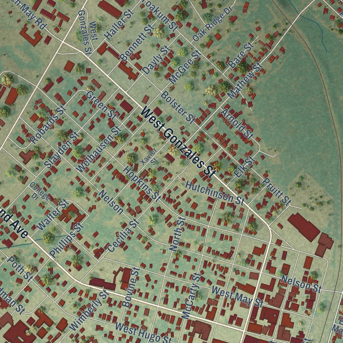
This beautifully detailed map of Yoakum, Texas was created in 2026 using aerial imagery combined with modern topographical, census, street and landmark data. It's a modern aerial view of Yoakum in Lavaca County, Texas, that combines modern data with a vintage aesthetic. Zoom in on the preview and look for your block.
Three ways to hang it
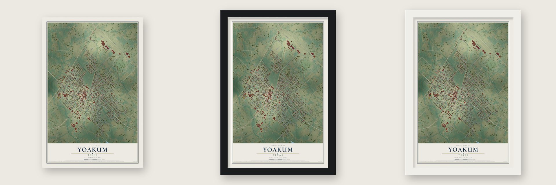
Unframed archival matte, a black wood frame or a white wood frame.
Up close
Real geography. Art worth displaying.
This map was created using accurate cartographic data and authoritative geographic sources, including the U.S. Geological Survey and the Census Bureau. The map brings together terrain, waterways, roads, and building detail. The majority of the streets are labeled, houses are accurately depicted, and the topography is derived from government sources. Combining local data with carefully composed color and shading leads to this beautifully detailed Yoakum artwork for your wall.
Rather than simply showing street outlines, we’ve included as many of the street names as we could reasonably fit on the map while keeping their names legible. Zoom in on the high resolution preview to see exactly what’s on the map. We truly set out to create a statement piece for anyone who loves Yoakum. So whether it’s for you, or a gift for someone you love, we hope this map of Yoakum brings back fond memories.

About Yoakum, Texas
Yoakum stands on the Lavaca-DeWitt county line, where a railway townsite was established in 1887 and named for railroad executive Benjamin F. Yoakum. Roundhouse and maintenance work soon employed hundreds, and the community incorporated in 1889. Leather manufacturing, commercial tomato growing, and annual festivals later shaped local life.
- 2020 PopulationThe 2020 census recorded 5,908 residents in Yoakum.
- Railroad BeginningsConstruction of the San Antonio and Aransas Pass Railway spurred Yoakum's growth in 1887.
- Leather IndustryCarl Welhausen assumed control of a small tannery in 1919, beginning an industry later associated with Tex-Tan.
- Tomato TradeCommercial tomato growing began locally in 1926, and fifteen Yoakum packing sheds shipped tomatoes north by the 1940s.
- Community TraditionsYoakum has sponsored a spring wildflower trail since 1960, while its Tom-Tom festival traces its beginnings to 1928.
Find your street
Names on the Yoakum map
Every name below is printed on this map. Look for your street, your school, the park where you played, or the pond down the road.
Streets and roads198
- East Morris Street
- West Grand Avenue
- Irvine Street
- Huck Street
- East Gonzales Street
- West Gonzales Street
- South South Street
- North South Street
- Lavaca Street
- Carl Ramert Drive
- Josephine Street
- Kenedy
- Nelson Street
- West Street
- Vollentine Street
- East Hugo Street
- FM 3475
- FM 682
- Burt Street
- Aurora Street
- Koether Drive
- Davis Avenue
- Oakridge Drive
- Forest Street
- Schott Road
- Robards Street
- Cowboy Lane
- Perry Street
- Phillips Street
- Dunn Street
Show all 198 streets
- Hopkins Street
- Old Shiner Road
- Wilson-Wagner Road
- Suhr Road
- Pincham Street
- Park Road
- Airport Road
- Clark Street
- Tozik Street
- Mathew Street
- Matthew Street
- Coke Street
- Hickey Street
- Nelson
- Maple Street
- Walnut Street
- West May Street
- Migl Street
- Culpepper Street
- Carroll Drive
- Boyle Street
- Baldwin Street
- East Hochheim Street
- Front Street
- Edgar Street
- Simpson Street
- West Hugo Street
- Montgomery Street
- Oconnor Street
- Lott Street
- Aubrey Street
- McCarty Street
- Cecilia Street
- Yoakum Street
- Kent Street
- Julia Street
- Pat Cleburne Street
- FM 318
- Sheehan Street
- Elenora Street
- Wimberly Street
- Martin Street
- Fink Street
- Slayden Street
- Ryan Street
- Crisswell Street
- Henrietta Street
- Trimmel Street
- Bingham Street
- Moffitt Street
- Armstrong Street
- North Street
- Poth Street
- Brushy Creek Drive
- Plaza Street
- Nieman Street
- Minnie Gordon Street
- East Schleicher Street
- Thiele Drive
- Orth Street
- Southwell Street
- Crittenden Street
- Pruitt Street
- Harwood Road
- Bolster Street
- Hill Street
- Elwood Street
- West Hochheim Street
- Flato Street
- Schill Street
- Svoboda Street
- Ducey Street
- Ross Street
- Hubbard Street
- Turner Street
- Goldman Street
- Mann Street
- Davidson Street
- Willis Street
- East Grand Avenue
- West Morris Street
- Texas Street
- Tucker Street
- Ellen May Road
- Rose Street
- Hefferman Street
- Price Street
- Laredo Street
- Ranney Street
- Kvinta Drive
- Welhausen Street
- San Marcos Street
- Hope Street
- Bovine Street
- Concrete Street
- Cadwell Street
- Theresa Street
- Gaettner Street
- Bennett Street
- Dayly Street
- McGee Street
- Walter Street
- Arnold Street
- Antioch Street
- Lowrance Street
- Hutchinson Street
- Pulliam Street
- Haller Street
- Green Street
- Boothe Street
- Lester Street
- Dallas Street
- Burns Street
- Jakubik Street
- Post Street
- Ewald Street
- Whitfield Street
- Pecan Street
- Kimberly Lane
- Lakeside Drive
- Houston Street
- Bare Street
- Garrett Street
- Elk Street
- Christiana
- Fischer Street
- Duke Street
- Industrial Loop
- McKinnon Street
- Charles Street
- Cross Street
- Baxter Street
- Raska Drive
- East May Street
- Oak Ridge Drive
- Steinmann Street
- James Street
- Hamil Street
- McVean Street
- Galloway Street
- Aldergate Street
- Porter Street
- Trinity Street
- Kenedy Street
- Lander Street
- Steen Street
- First Street
- Ehlers Street
- Third Street
- Waco Street
- Ruppert Street
- Xavier Street
- Park Street
- Andrew Street
- East Hickey Street
- Austin Street
- Tom Marshall Street
- College Drive
- Orange Street
- Schwab Street
- Ruhman Street
- Dodd
- John Street
- Cooper
- Luryan Street
- Herder Street
- Schench Street
- Victoria Street
Names are listed as they appear on the printed map. Zoom into the product photos to find them.
The art of mapping a place
How This Map Was Made
Real places. Remarkable detail. Discover the layers that turn geographic data into a map of home.

The view from above
Aerial imagery reveals the character of the land: woodland, open fields, and the patterns of a place.

The shape of the land
Elevation data brings hills, valleys, and subtle changes in the landscape into view.

The details of home
Roads, waterways, and building footprints come together to make the map feel unmistakably local.

Geography becomes art
Considered color, shading, and typography bring the layers together in a map made for your wall.


Process illustrated with Mendon, Massachusetts. Aerial imagery: USDA NAIP. Terrain: USGS 3D Elevation Program. Map details and finished artwork: KNOWOL.
The Details
About This Print
Choose an archival matte print, or a black or white Ayous wood frame. The archival matte print is unframed.
Select your size and finish above to see the matching product image and price.
Materials & Craftsmanship
A contemporary map with the character of a classic atlas, printed on archival matte paper. Optional frames are made from Ayous wood.
Your printed map does not include the watermark shown in the full-map preview.
Shipping & Delivery
Free shipping within the United States. Every print is made to order in the USA.
Buying a gift? Add a note in your cart and we'll include it. We never put prices in the package.
Prints ship within 2 to 3 business days. Allow 7 to 10 days total from ordering for delivery. Timing may vary during holidays or periods of high order volume.
Read our shipping policy.
Returns and damaged prints
Each print is made to order. Change-of-mind refunds are not available after production.
If your print arrives damaged, misprinted or incorrect, contact support@knowol.com within 30 days of receiving it. Include your order number, photos and a description of the issue.
Read our full refund and replacement policy. For questions about your order, email support@knowol.com.
Find your town
Looking for another city?
Find a map of home in our Texas collection.
Nearby
Maps of towns near Yoakum
Know someone from one of these towns? Their map makes a great gift.
 Shiner
, Texas
From $39.99See the map
 Cuero
Cuero, Texas
From $39.99See the map
 Hallettsville
, Texas
From $39.99See the map
More maps nearby: Moulton, Gonzales, Flatonia, Waelder and Smiley.