
Search for another town





Free U.S. delivery 7 to 10 days after you order
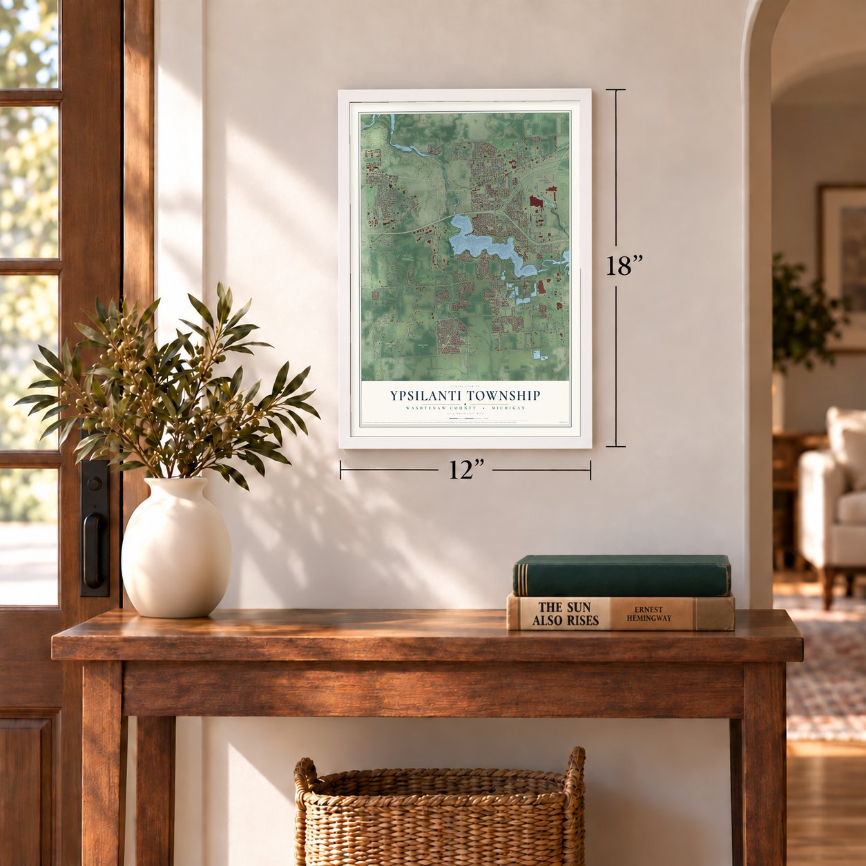
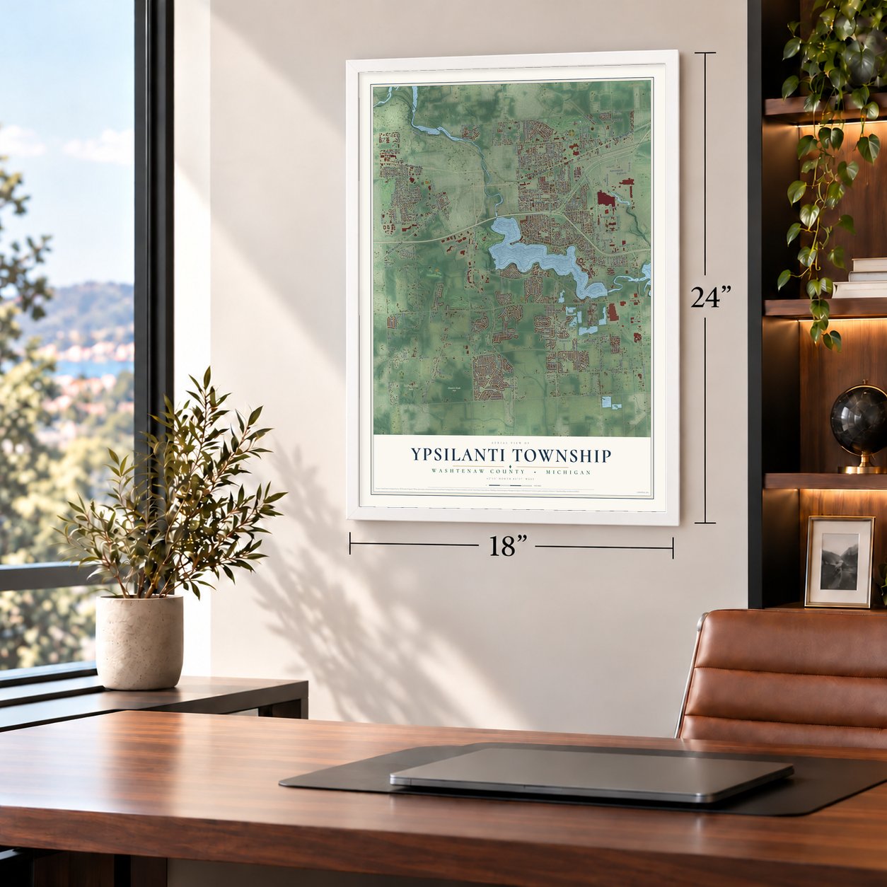
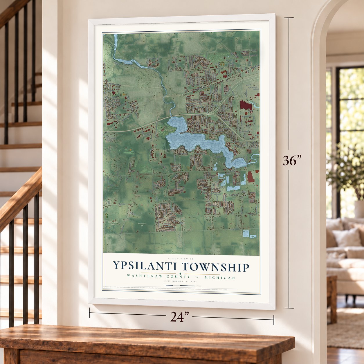
Ypsilanti Township, Michigan Map Art
Building by building, with labeled streets and shaded relief.
12" x 18" Archival Matte Print
A Map of Home. A Work of Art.
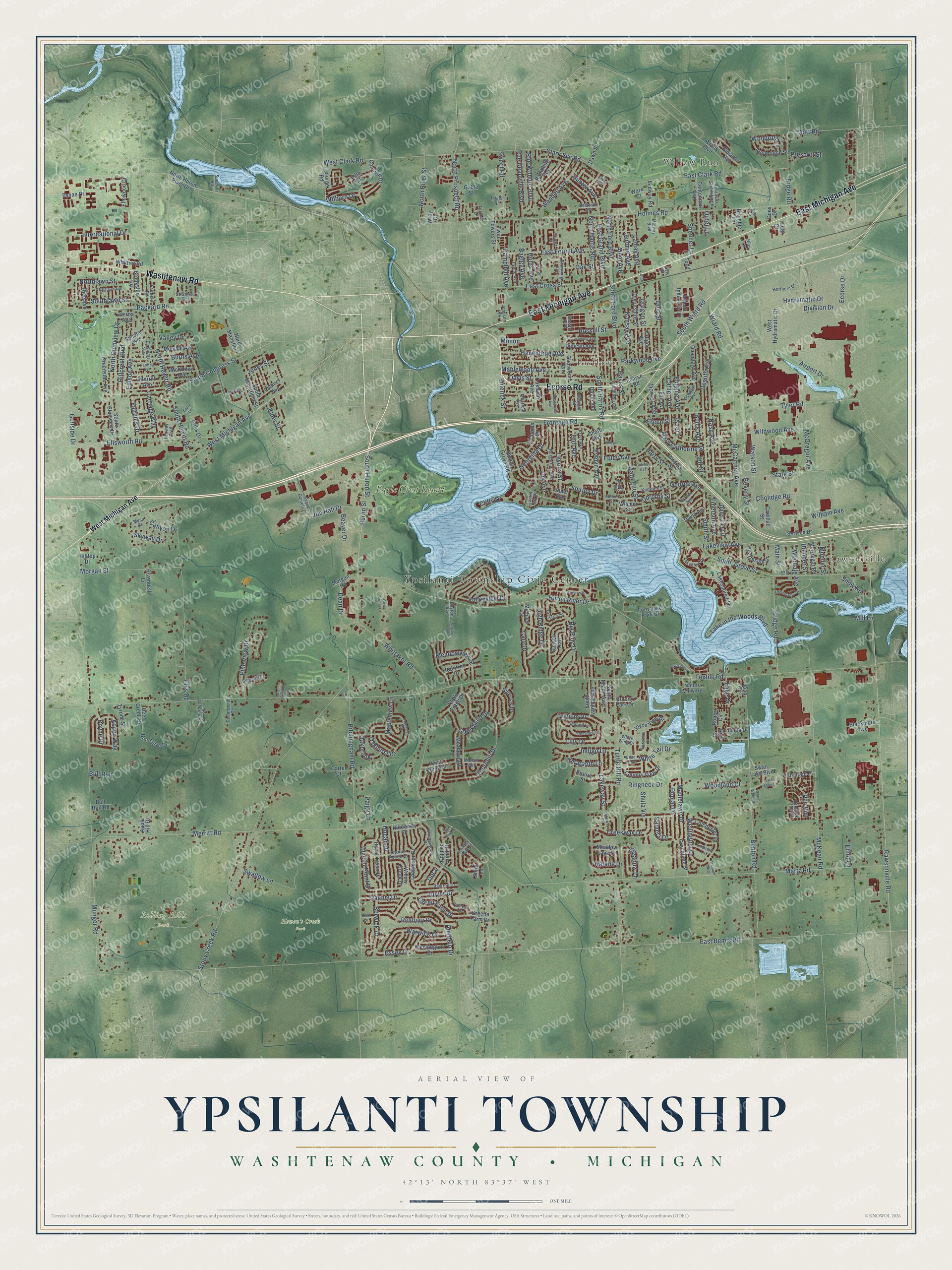
Explore Ypsilanti Township, Michigan from a whole new perspective. Created using aerial imagery and detailed geographic data, this map captures Ypsilanti Township building by building, with labeled streets, familiar landmarks, and shaded topographical relief that highlights the natural contours of the landscape.
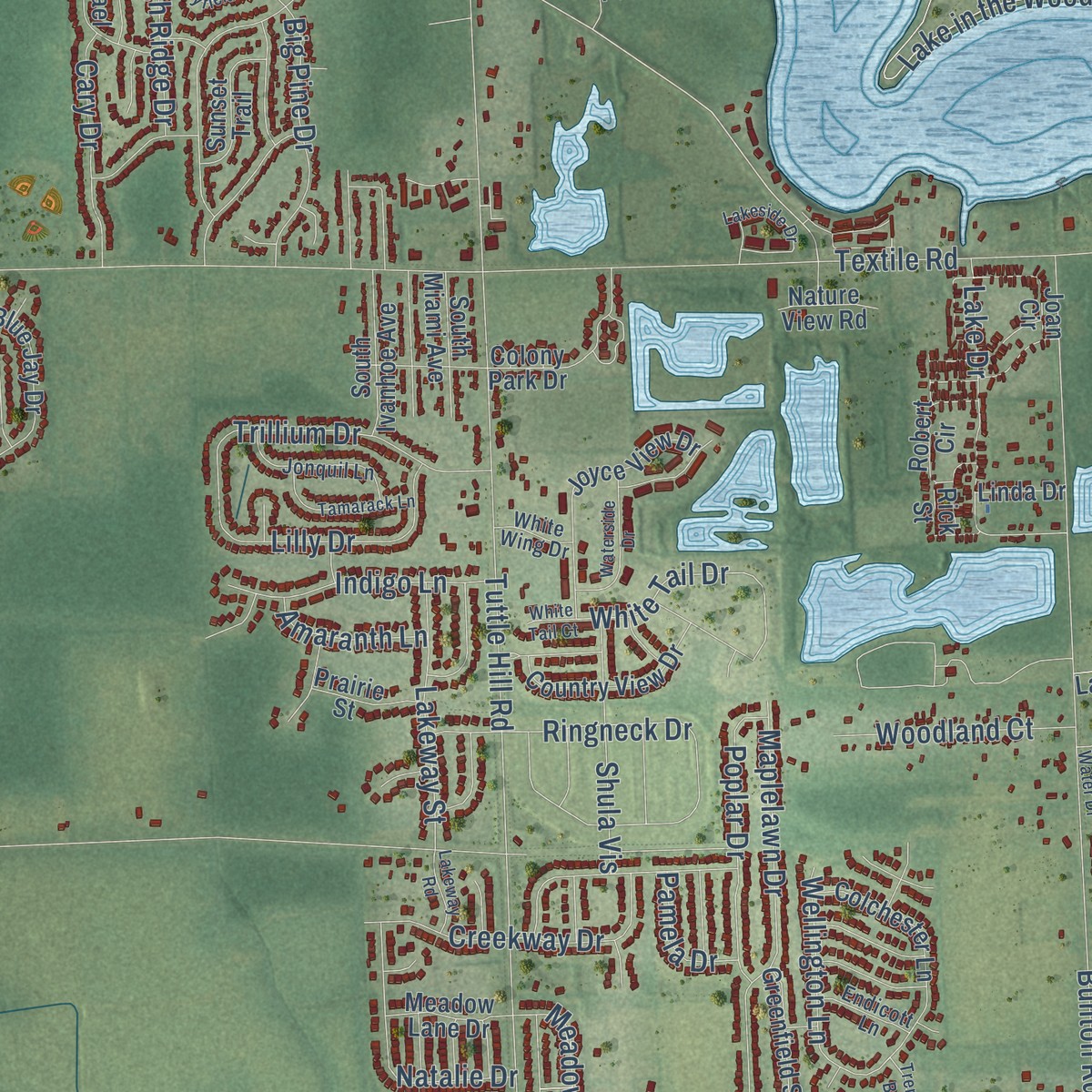
Combining modern data with the timeless character of a vintage atlas, this map is just as interesting up close as it is beautiful on the wall. Whether you grew up in Ypsilanti Township, spent memorable years there, or call it home today, this unique map is a great way to celebrate a place that means something to you. Zoom in on the preview to look for your street, and then order a print to put your memories on the wall.
Three ways to hang it
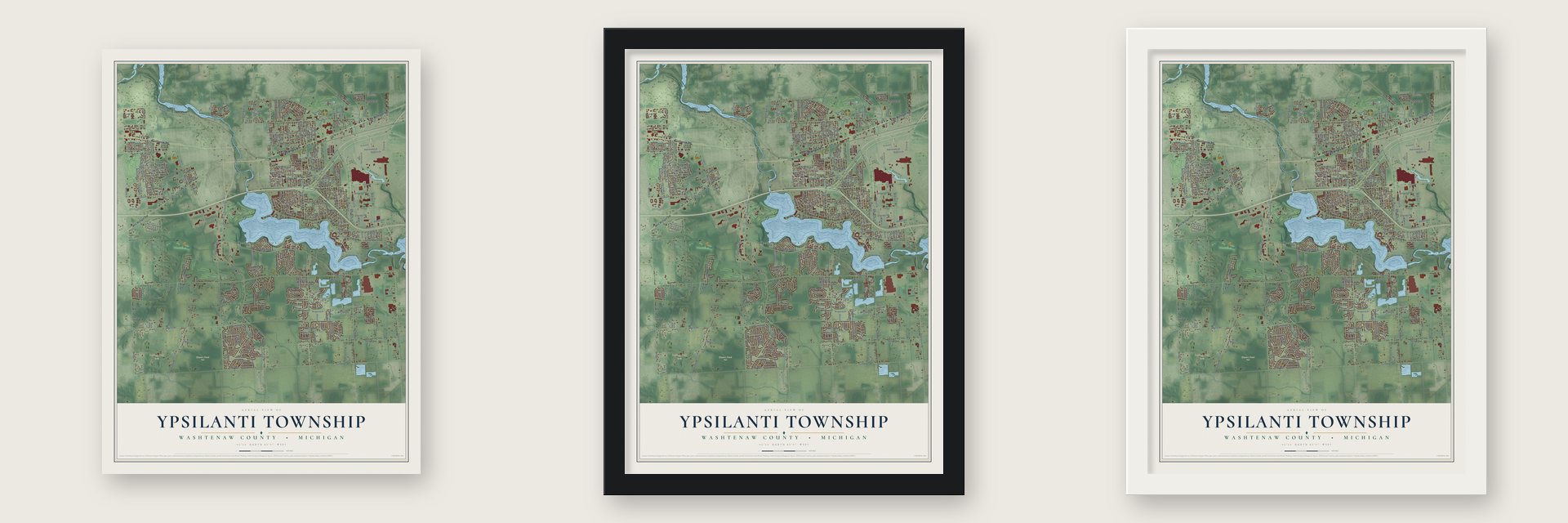
Unframed archival matte, a black wood frame or a white wood frame.
Up close
Geography Worth Displaying
This map was created using accurate cartographic data and authoritative geographic sources, including the U.S. Geological Survey and the Census Bureau. The map brings together terrain, waterways, roads, and building detail. The majority of the streets are labeled, houses are accurately depicted, and the topography is derived from government sources. Combining local data with carefully composed color and shading leads to this beautifully detailed Ypsilanti artwork for your wall.
Rather than simply showing street outlines, we’ve included as many of the street names as we could reasonably fit on the map while keeping their names legible. Zoom in on the high resolution preview to see exactly what’s on the map. We truly set out to create a statement piece for anyone who loves Ypsilanti. So whether it’s for you, or a gift for someone you love, we hope this map of Ypsilanti brings back fond memories.
Read the story behind this map of Ypsilanti Township, Michigan from 2026.

Find your street
Names on the Ypsilanti map
Every name below is printed on this map. Look for your street, your school, the park where you played, or the pond down the road.
Places and landmarks7
- Ypsilanti Township Civic Center
- Willow Run
- Rawsonville
- Eastlawn
- Hewen's Creek Park
- Rolling Hills Park
- Eagle Crest Resort
Streets and roads359
- East Michigan Avenue
- Ecorse Road
- Washtenaw Road
- West Michigan Avenue
- North Hewitt Road
- Huron Street
- South Hewitt Road
- South Huron Street
- South Congress Street
- West Clark Road
- South Ford Boulevard
- Huron River Drive
- South Harris Road
- Rawsonville Road
- Desoto Avenue
- White Tail Drive
- South Grove Street
- North Prospect Road
- George Avenue
- East Bemis Road
- Textile Road
- Merritt Road
- Whittaker Road
- Munger Road
- Wiard Road
- Martz Road
- Holmes Road
- Stony Creek Road
- East Clark Road
- Tyler Road
Show all 359 streets
- Tuttle Hill Road
- Ellis Road
- Hitchingham Road
- Golfside Drive
- Bunton Road
- McKean Road
- McCartney Avenue
- Lake in the Woods Boulevard
- East Forest Avenue
- Parkwood Avenue
- State Street
- Ellsworth Road
- South Wiard Road
- Nash Avenue
- Airport Drive
- Lakeview Avenue
- Packard Road
- Maplelawn Drive
- McGregor Avenue
- Valley Drive
- Thornhill Drive
- North Ford Boulevard
- Russell Street
- Morgan Street
- Ringneck Drive
- East Cross Street
- Frontage Road
- Davis Street
- Bridge Road
- Glacier Point Drive
- Hawthorne Avenue
- Watson Street
- Big Pine Drive
- Coolidge Road
- Edison Avenue
- North Clubview Drive
- Burns Avenue
- Warwick Drive
- Creekbend Drive
- Lake Drive
- Ridge Road
- Pine View Drive
- Clark Svc Road
- International Drive
- Swallow Lane
- Woodale Avenue
- Emerick Street
- Hillcrest Boulevard
- Creekway Drive
- Roxbury Drive
- Dover Drive
- Mary Catherine Street
- North Harris Road
- Ohio Street
- Joe Hall Drive
- Emerson Avenue
- Jay Avenue
- Wendell Avenue
- Evelyn Avenue
- Kansas Avenue
- Natalie Drive
- East Grand Boulevard
- Levona Street
- Berwick Drive
- Harry Street
- Rue Deauville Boulevard
- Sweet Road
- Lilly Drive
- William Avenue
- North River Street
- Mott Road
- Poplar Drive
- Bagley Avenue
- Main Street
- Hull Avenue
- Allen Avenue
- Southlawn Street
- Fairhills Drive
- Rue Willette Boulevard
- Campbell Avenue
- Maplewood Avenue
- Georgina Drive
- Jerome Avenue
- Hogan Drive
- Lamay Avenue
- Indigo Lane
- Lakeway Street
- Wellington Lane
- Trillium Drive
- Meadowview Street
- Oakhurst Drive
- Ecorse Drive
- Shula Vis
- Carriage Way
- Green Farm Drive
- Mapleview Lane
- Woodland Court
- Northlawn Street
- Cary Drive
- Wildwood Avenue
- Foley Avenue
- Valleyview Drive
- Woodruff Lane
- Eugene Avenue
- Hunter Avenue
- Dorset Avenue
- High Ridge Drive
- Bomber Street
- Essex Drive
- Smith Street
- Cliffs Drive
- Aspen Way
- Dean Drive
- Hydramatic Drive
- Rachel Drive
- Hayes Street
- Calder Avenue
- Spencer Lane
- Gattegno Street
- Skyway Drive
- Canyon Drive
- Oak Street
- Snow Road
- Oregon Street
- Dorothy Street
- Paige Lane
- Oakbrook
- Boyne Drive
- Elder Street
- Shirley Drive
- Amaranth Lane
- Division Drive
- Beaver Drive
- Pen Run
- Woburn Drive
- Meadow Lane
- Moeller Street
- Beverly Street
- Pamela Drive
- Prescott Street
- Lori Street
- Hollis Avenue
- Jones Street
- Amrhein Drive
- Eileen Street
- Buick Avenue
- Jeff Street
- Outer Lane
- Bull Run
- Elliot Lane
- Doral
- Mill Lane
- Minion
- North Huron River Drive
- Elmwood Drive
- Service Drive
- Lakeshore Boulevard
- Villa Drive
- Glenwood Avenue
- Bynan Drive
- Greenside Avenue
- Merrill Avenue
- Midvale Avenue
- Oaklawn Avenue
- Joyce View Drive
- Leforge Road
- Airport Industrial Drive
- South Ivanhoe Avenue
- Colchester Lane
- Ford Lake Park Drive
- Onandago Avenue
- Hilltop Drive
- Greene Farm Drive
- Lochmoor Drive
- South Mansfield Street
- Swan Lake Boulevard
- West Hydramatic Drive
- Joan Circle
- Andrea Street
- Hearthside Drive
- Country View Drive
- Concord Drive
- Blue Jay Drive
- South Clubview Drive
- Rambling Road
- Midway Road
- Appleridge Street
- Colony Park Drive
- Copper Creek Drive
- Wiard Boulevard
- Meadowlark Lane
- Outer Lane Drive
- North Mansfield
- Share Avenue
- Brookside Road
- Royal Troon Drive
- Michael Drive
- Wismer Street
- Greenfield Street
- Raintree Drive
- Kensington Drive
- Willow Creek Drive
- Devonshire Street
- Blossom Avenue
- Centennial Avenue
- Duncan Avenue
- Sunset Trail
- Paint Creek Drive
- Bon Terre Drive
- Meadow Lane Drive
- Oregon Avenue
- Tyrone Street
- Fox Avenue
- Twin Towers Street
- South Miami Avenue
- McKinley Avenue
- McGregor Road
- Robert Circle
- Ardis Drive
- Rivendell Lane
- Coleman Street
- Lathers Avenue
- Blackmore Avenue
- Plantain Place
- Eagle Trace Drive
- Whittier Road
- Hideaway Drive
- Senate Avenue
- Cadillac Street
- Deer Creek Drive
- Rice Avenue
- South Grove Road
- Janet Avenue
- Prairie Street
- Morgan Road
- Carter Court
- David Avenue
- Dubie Avenue
- Bull Run Road
- Nature View Road
- Bramble Lane
- Gable Street
- Shire Lane
- Linda Drive
- Apple Hill Drive
- Dawn Street
- Ware Court
- Verna Avenue
- Dons Drive
- Taddi Drive
- Todd
- Wray Court
- Rick Street
- Streamwood Drive
- Woodlawn Avenue
- Lakeview Drive
- Borgstrom Avenue
- Lester Avenue
- Baytree Drive
- Pasadena Street North
- Northern Drive
- Midway Boulevard
- Trotters Park Street
- Jonquil Lane
- Terrace Lane
- White Wing Drive
- Knowles Street
- Frank Daniels Drive
- Pioneer Drive
- Lynne Avenue
- Fairfield Road
- Browning Avenue
- Stratford Road
- Oswego Avenue
- Ide Street
- Riley Court
- Hemlock Hollow
- Cedarbend Street
- Laurel Bay Drive
- Cedarbend Drive
- Fairway Trail
- Wharton Street
- Elmhurst Avenue
- Cyprus Pointe Drive
- Sequoia Drive
- Endicott Lane
- Mallard Way
- Delaware Avenue
- Forest Court
- Superior Road
- Daytona Avenue
- Montreal Avenue
- Johnson Street
- Russell Boulevard
- Melvin Street
- Mesa Drive
- Haven Street
- Avis Street
- Stevens Drive
- Wingate Boulevard
- Harding Avenue
- Rosewood Avenue
- Swan Lake Cr
- Civic Center Drive
- Village Lane
- Creekside Circle
- Eastlawn Avenue
- Ambassador Drive
- Lagoon Drive
- Grayfield Circle
- Tamarack Lane
- Waterside Drive
- Hunt Place
- Lakeside Drive
- Sweet Water Drive
- Conway Avenue
- Crestwood Avenue
- Harmon Avenue
- Laurel Avenue
- East Circle
- Lakeway Road
- Daytona Street
- Glory Lane
- Tremont Boulevard
- Crest Drive
- Par View Drive
- Sea Mist Drive
- White Tail Court
- Utah
Names are listed as they appear on the printed map. Zoom into the product photos to find them.
About Ypsilanti Township, Michigan
Ypsilanti Township is a charter township of 55,670 people in Washtenaw County. It wraps around most of the city of Ypsilanti, but the two have always governed themselves separately. Its first settler was Benjamin Woodruff, a native of Ohio, who arrived in 1823 and settled at a grove about a mile below where the city stands now. The settlement took the name Woodruff's Grove, and it had a post office from May 9, 1825, to January 28, 1828.
In 1827, when Ypsilanti Township was formed, its land still lay inside Wayne County. Two years later, in 1829, the Michigan Territory created Washtenaw County. When the village of Ypsilanti incorporated in 1832, Woodruff's Grove was taken into it, and the first settlement in the township became part of the city.
- Bombers at Willow RunIn 1943 the federal government built a bomber plant at Willow Run, a community named for a small stream that feeds the Huron River, and Henry Ford ran the plant during World War II. Willow Village went up nearby to house the workers and their families, and it kept its own post office until the plant shut down on June 30, 1945.
- Kalitta Air's home fieldWillow Run Airport stands in the township, and the cargo airline Kalitta Air has its headquarters there. The Michigan Flight Museum, known for years as the Yankee Air Museum, is in the township too.
- Rawsonville on the HuronRawsonville grew up on the township's eastern edge along the Huron River and Belleville Lake, and it reaches across the line into Van Buren Township in Wayne County. Upstream, Ford Lake Dam holds back Ford Lake on the Huron, and the Border-to-Border Trail follows the river through the township.
Keep exploring Michigan
Ypsilanti Township is one of 2,030 Michigan towns we've mapped. Every dot on the map is a print of its own.
The search covers every state, Michigan first.
Near Ypsilanti Township
Order 2 or more town maps and save 10%. Shown in the size and finish you picked above, so they hang as a set.
- City of Ypsilanti 12" x 18" / Archival Matte Print $39.99
- Rawsonville 12" x 18" / Archival Matte Print $39.99
- Lincoln 12" x 18" / Archival Matte Print $39.99


More maps nearby: Augusta Township, Van Buren, Pittsfield, Belleville and Superior.
The art of mapping a place
How This Map Was Made
Real places. Remarkable detail. Discover the layers that turn geographic data into a map of home.

The view from above
Aerial imagery reveals the character of the land: woodland, open fields, and the patterns of a place.

The shape of the land
Elevation data brings hills, valleys, and subtle changes in the landscape into view.

The details of home
Roads, waterways, and building footprints come together to make the map feel unmistakably local.

Geography becomes art
Considered color, shading, and typography bring the layers together in a map made for your wall.


Process illustrated with Mendon, Massachusetts. Aerial imagery: USDA NAIP. Terrain: USGS 3D Elevation Program. Map details and finished artwork: KNOWOL.
The Details
About This Print
Choose an archival matte print, or a black or white Ayous wood frame. The archival matte print is unframed.
Select your size and finish above to see the matching product image and price.
Materials & Craftsmanship
A contemporary map with the character of a classic atlas, printed on archival matte paper. Optional frames are made from Ayous wood.
Your printed map does not include the watermark shown in the full-map preview.
Shipping & Delivery
Free shipping within the United States. Every print is made to order in the USA.
Buying a gift? Add a note in your cart and we'll include it. We never put prices in the package.
Prints ship within 2 to 3 business days. Allow 7 to 10 days total from ordering for delivery. Timing may vary during holidays or periods of high order volume.
Read our shipping policy.
Returns and damaged prints
Each print is made to order. Change-of-mind refunds are not available after production.
If your print arrives damaged, misprinted or incorrect, contact support@knowol.com within 30 days of receiving it. Include your order number, photos and a description of the issue.
Read our full refund and replacement policy. For questions about your order, email support@knowol.com.