


Search for another town





Free U.S. delivery 7 to 10 days after you order
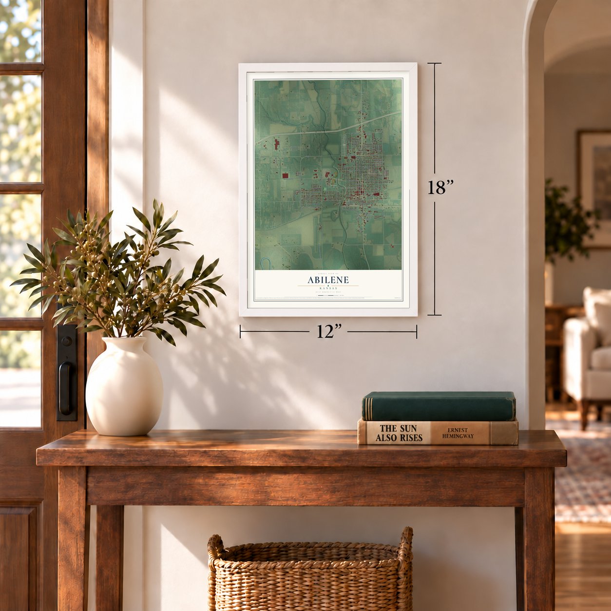
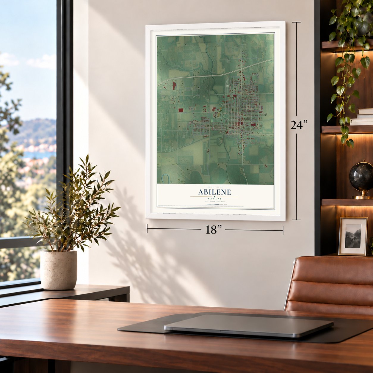
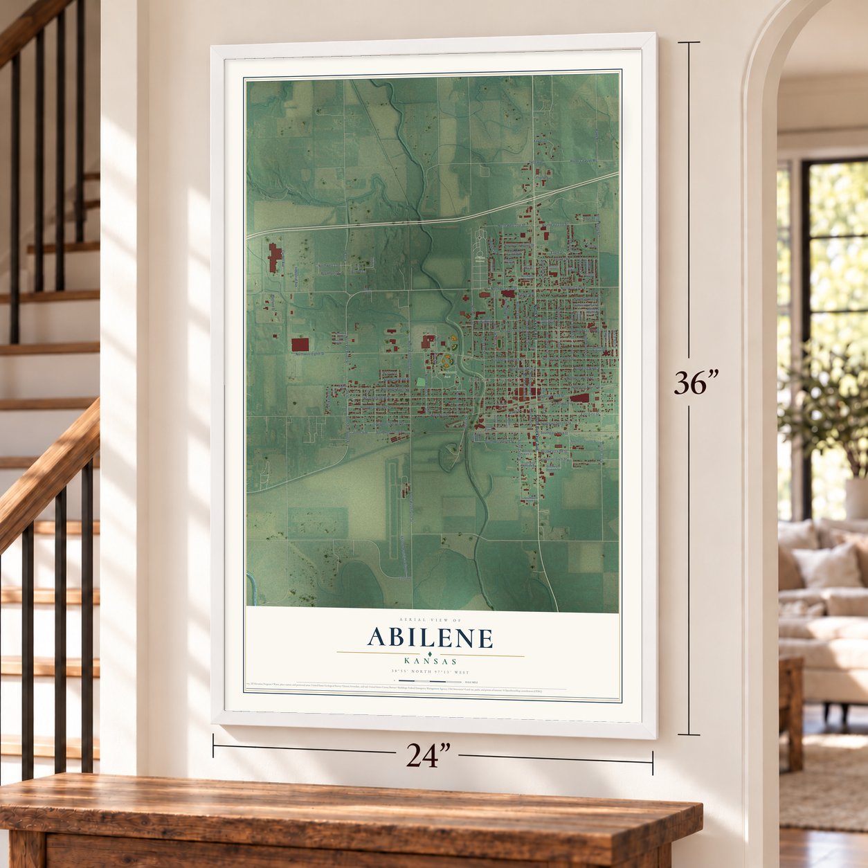
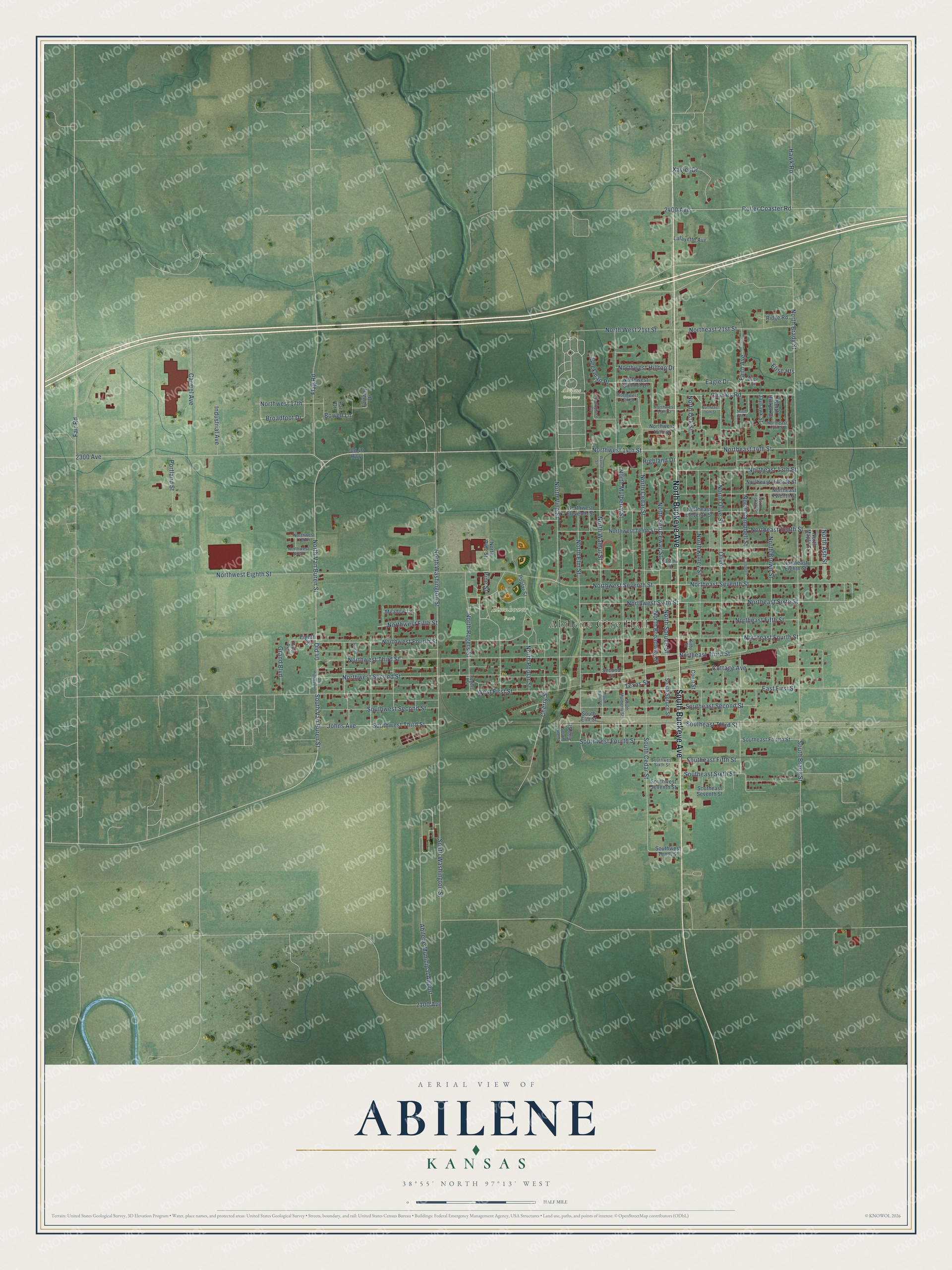
Abilene, Kansas Map Art
Building by building, with labeled streets and shaded relief.
12" x 18" Archival Matte Print
A Map of Home. A Work of Art.
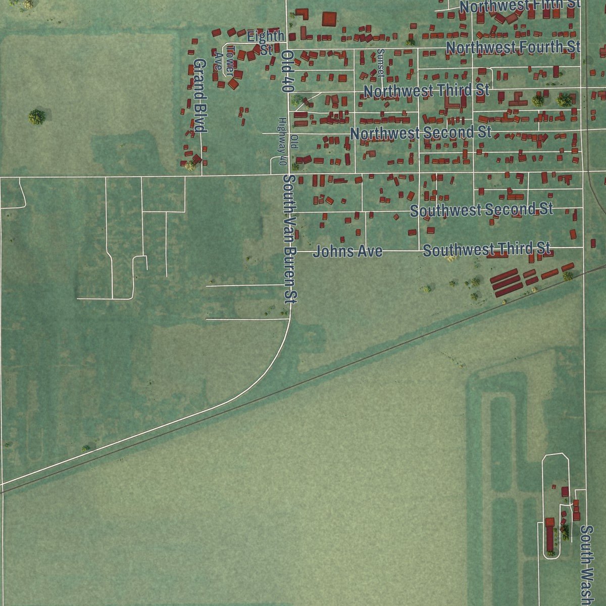
Explore Abilene, Kansas from a whole new perspective. Created using aerial imagery and detailed geographic data, this map captures Abilene building by building, with labeled streets, familiar landmarks, and shaded topographical relief that highlights the natural contours of the landscape.
Combining modern data with the timeless character of a vintage atlas, this map is just as interesting up close as it is beautiful on the wall. Whether you grew up in Abilene, spent memorable years there, or call it home today, this unique map is a great way to celebrate a place that means something to you. Zoom in on the preview to look for your street, and then order a print to put your memories on the wall.
Three ways to hang it
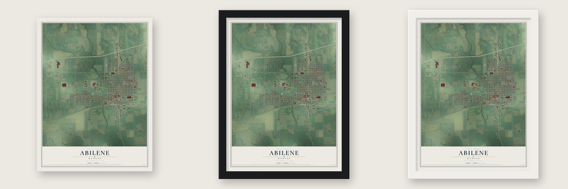
Unframed archival matte, a black wood frame or a white wood frame.
Up close
Geography Worth Displaying
This map was created using accurate cartographic data and authoritative geographic sources, including the U.S. Geological Survey and the Census Bureau. The map brings together terrain, waterways, roads, and building detail. The majority of the streets are labeled, houses are accurately depicted, and the topography is derived from government sources. Combining local data with carefully composed color and shading leads to this beautifully detailed Abilene artwork for your wall.
Rather than simply showing street outlines, we’ve included as many of the street names as we could reasonably fit on the map while keeping their names legible. Zoom in on the high resolution preview to see exactly what’s on the map. We truly set out to create a statement piece for anyone who loves Abilene. So whether it’s for you, or a gift for someone you love, we hope this map of Abilene brings back fond memories.
Read the story behind this map of Abilene, Kansas from 2026.

Find your street
Names on the Abilene map
Every name below is printed on this map. Look for your street, your school, the park where you played, or the pond down the road.
Places and landmarks4
- Abilene City Hall
- Abilene Cemetery
- Eisenhower Park
- Abilene Municipal Airport
Streets and roads132
- North Buckeye Avenue
- South Buckeye Avenue
- Northwest 14th Street
- North Van Buren Street
- South Van Buren Street
- Northeast 14th Street
- Northeast Seventh Street
- Northeast Sixth Street
- West First Street
- North Walnut Street
- Southwest Third Street
- North Cedar Street
- South Cedar Street
- Cherry Street
- North Campbell Street
- Northwest Seventh Street
- Northeast Fourth Street
- Southeast Second Street
- East First Street
- Bowell Lane
- North Brady Street
- Northwest Eighth Street
- Northwest Third Street
- Northwest Second Street
- North Mulberry Street
- North Vine Street
- Northwest Fourth Street
- North Olive Street
- South Washington Street
- North Brown Street
Show all 132 streets
- North Kuney Street
- Southwest Second Street
- Carmel Avenue
- 2100 Avenue
- North Elm Street
- North Washington Street
- 2300 Avenue
- Northwest Fifth Street
- 2400 Avenue
- Northeast Tenth Street
- North Spruceway Street
- Old 40
- Cottage Avenue
- Pine Street
- Johns Avenue
- Northeast 13th Street
- Northeast Fifth Street
- Flag Road
- Southwest Fourth Street
- Charles Road
- Northeast 21st Street
- North Poplar Street
- Southeast Sixth Street
- Roller Coaster Road
- North West 21st Street
- Northeast Third Street
- North Rogers Street
- Northwest Sixth Street
- North Spruce Street
- North Broadway Street
- South Brady Street
- Fair Road
- Faith Avenue
- North Ash Street
- Northwest 17th
- Northwest Hilltop Drive
- Eagle Drive
- Southeast Fifth Street
- Hawk Road
- Texas Street
- Southeast Third Street
- North Oak Street
- Portland Street
- Industrial Avenue
- Grand Boulevard
- Beekman Place
- Broadfoot Drive
- Xavier Drive
- Olive
- Highland Drive
- Elise Heights
- Second Street
- South Elm Street
- Northeast Eighth Street
- Northwest Tenth Street
- Northeast Twelfth Street
- Northwest Eleventh Street
- Northeast Eleventh Street
- North Maple Street
- Southeast Fourth Street
- Southeast Seventh Street
- North Pine Street
- Northeast Hillside Street
- Northwest 15th Street
- Northwest Summit Drive
- Poplar Street
- South Spruce Street
- Lafayette Avenue
- Southwest Seventh Street
- Southwest Tenth Street
- Fairway Drive
- Jayhawk Street
- Meadow Lane
- North Hickok Drive
- Ridge Road
- Eighth Street
- Court Street
- Elm Street
- Old 40 Highway
- Par Drive
- South Vine Street
- Northeast 15th Street
- South Mulberry Street
- Southwest Sixth Street
- Northwest Ninth
- Northwest Tenth
- Parkplace Court
- Northwest 17th Street
- Northwest 16th Street
- North Hickok Street
- Rogers Street
- Kirby Street
- Brice Court
- Naroma Street
- Tower Avenue
- Old Highway 40
- Northeast 16th Street
- South Walnut Street
- Campbell
- Walnut Street
- Sunset
- North 16th Street
Names are listed as they appear on the printed map. Zoom into the product photos to find them.
About Abilene, Kansas
Abilene is the county seat of Dickinson County, a city of 6,460 people just north of the Smoky Hill River. It began in 1857 as a stagecoach stop called Mud Creek, set up by Timothy Hersey. In 1860 C. H. Thompson laid out a town of forty acres on his own land, and it took the name Abilene from Luke 3:1, a Bible name meaning "grassy plains." The next spring, in 1861, voters made it the county seat.
The first store was a log house opened by a settler remembered as "Old Man Jones," who sold whisky along with other goods. Dr. Moon soon put up a larger one, known for years as the Frontier Store. Growth stayed slow until the Kansas Pacific Railway arrived. After that, frame buildings replaced the log houses, and new additions were platted almost every year from 1868 to 1870.
- The first cow townIn 1867 Joseph G. McCoy bought 250 acres north and east of town and built stockyards for 2,000 head of cattle, a stable and a hotel, the Drovers' Cottage. He sent circulars and agents across Texas urging drovers to bring their herds here. The first twenty carloads left for Chicago on September 5, 1867, and the yards shipped 35,000 head that year. Until 1871 Abilene was the end of the Chisholm Trail.
- Two marshals in two yearsMarshal Tom "Bear River" Smith kept order mostly with his bare hands and lived through two attempts on his life. He was killed on November 2, 1870, and both of his attackers got life in prison. Wild Bill Hickok took the job in April 1871. During a street fight that year he killed the gambler Phil Coe, then accidentally shot his own deputy, Mike Williams. Hickok was out of the job by December.
- Eisenhower's hometownDwight D. Eisenhower's family moved here from Denison, Texas, in 1892. He went through school in Abilene and finished high school in 1909. The Eisenhower Home joined the National Register in 1971. He is buried at the Dwight D. Eisenhower Presidential Library and Museum, beside Mamie and their first son, Doud Dwight.
- A patent medicine mansionIn 1890 Dr. A. B. Seelye started a patent medicine business, the A.B. Seelye Medical Company, and developed more than 100 products, among them "Wasa-Tusa." In 1905 he built a 25-room Georgian mansion for $55,000, which still holds its original furniture and Edison light fixtures. Now a museum, the A. B. Seelye House joined the National Register in 1986.
Keep exploring Kansas
Abilene is one of 764 Kansas towns we've mapped. Every dot on the map is a print of its own.
The search covers every state, Kansas first.
Near Abilene
Order 2 or more town maps and save 10%. Shown in the size and finish you picked above, so they hang as a set.
- Detroit 12" x 18" / Archival Matte Print $39.99
- Enterprise 12" x 18" / Archival Matte Print $39.99
- Talmage 12" x 18" / Archival Matte Print $39.99


More maps nearby: Solomon, Navarre, Chapman, Manchester and Niles.
The art of mapping a place
How This Map Was Made
Real places. Remarkable detail. Discover the layers that turn geographic data into a map of home.

The view from above
Aerial imagery reveals the character of the land: woodland, open fields, and the patterns of a place.

The shape of the land
Elevation data brings hills, valleys, and subtle changes in the landscape into view.

The details of home
Roads, waterways, and building footprints come together to make the map feel unmistakably local.

Geography becomes art
Considered color, shading, and typography bring the layers together in a map made for your wall.


Process illustrated with Mendon, Massachusetts. Aerial imagery: USDA NAIP. Terrain: USGS 3D Elevation Program. Map details and finished artwork: KNOWOL.
The Details
About This Print
Choose an archival matte print, or a black or white Ayous wood frame. The archival matte print is unframed.
Select your size and finish above to see the matching product image and price.
Materials & Craftsmanship
A contemporary map with the character of a classic atlas, printed on archival matte paper. Optional frames are made from Ayous wood.
Your printed map does not include the watermark shown in the full-map preview.
Shipping & Delivery
Free shipping within the United States. Every print is made to order in the USA.
Buying a gift? Add a note in your cart and we'll include it. We never put prices in the package.
Prints ship within 2 to 3 business days. Allow 7 to 10 days total from ordering for delivery. Timing may vary during holidays or periods of high order volume.
Read our shipping policy.
Returns and damaged prints
Each print is made to order. Change-of-mind refunds are not available after production.
If your print arrives damaged, misprinted or incorrect, contact support@knowol.com within 30 days of receiving it. Include your order number, photos and a description of the issue.
Read our full refund and replacement policy. For questions about your order, email support@knowol.com.