
Search for another town




Free U.S. delivery 7 to 10 days after you order
Alton, Illinois Map Art
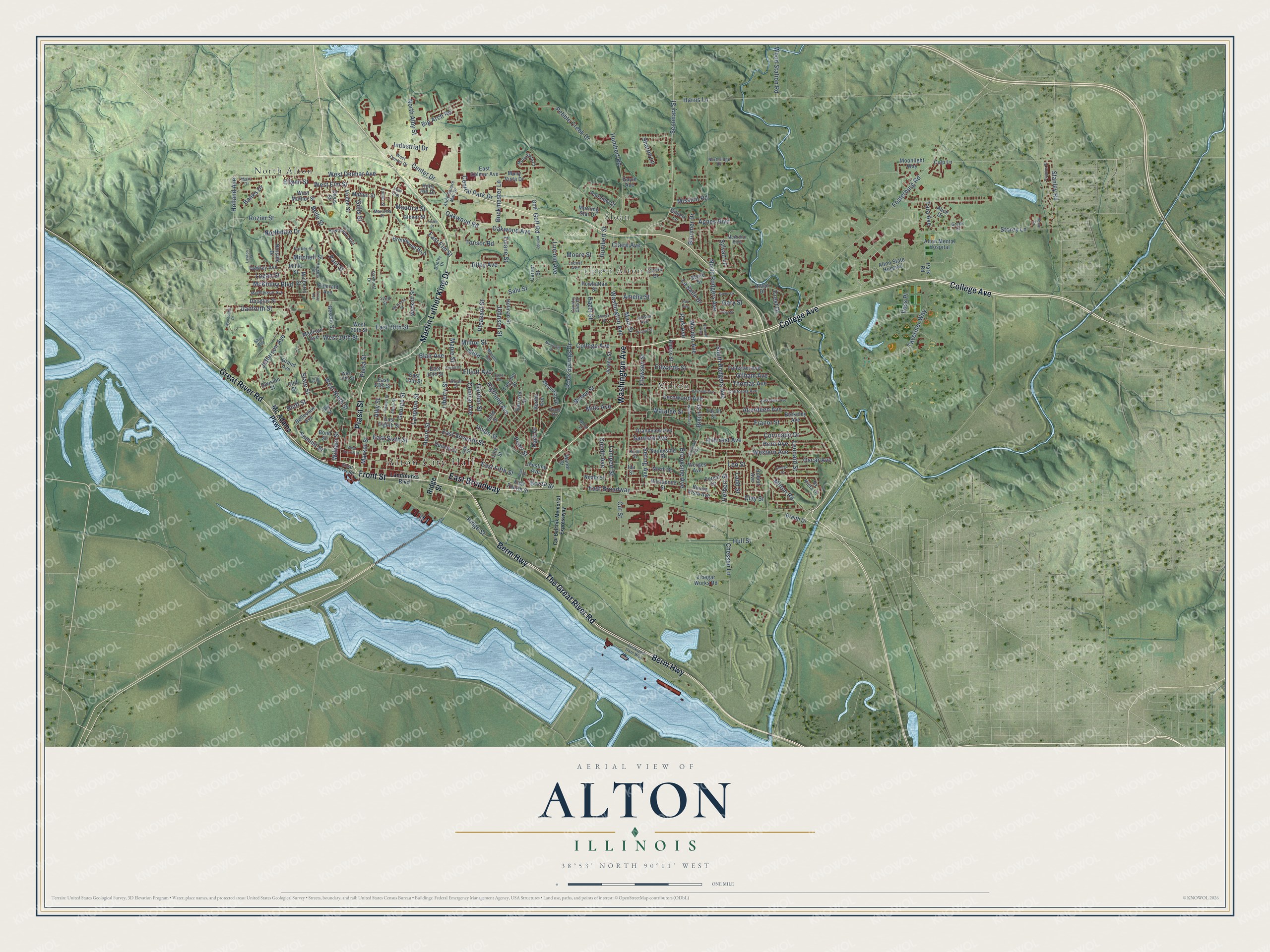
A new map of Alton, Illinois, made in 2026 and printed to order on thick archival matte paper.
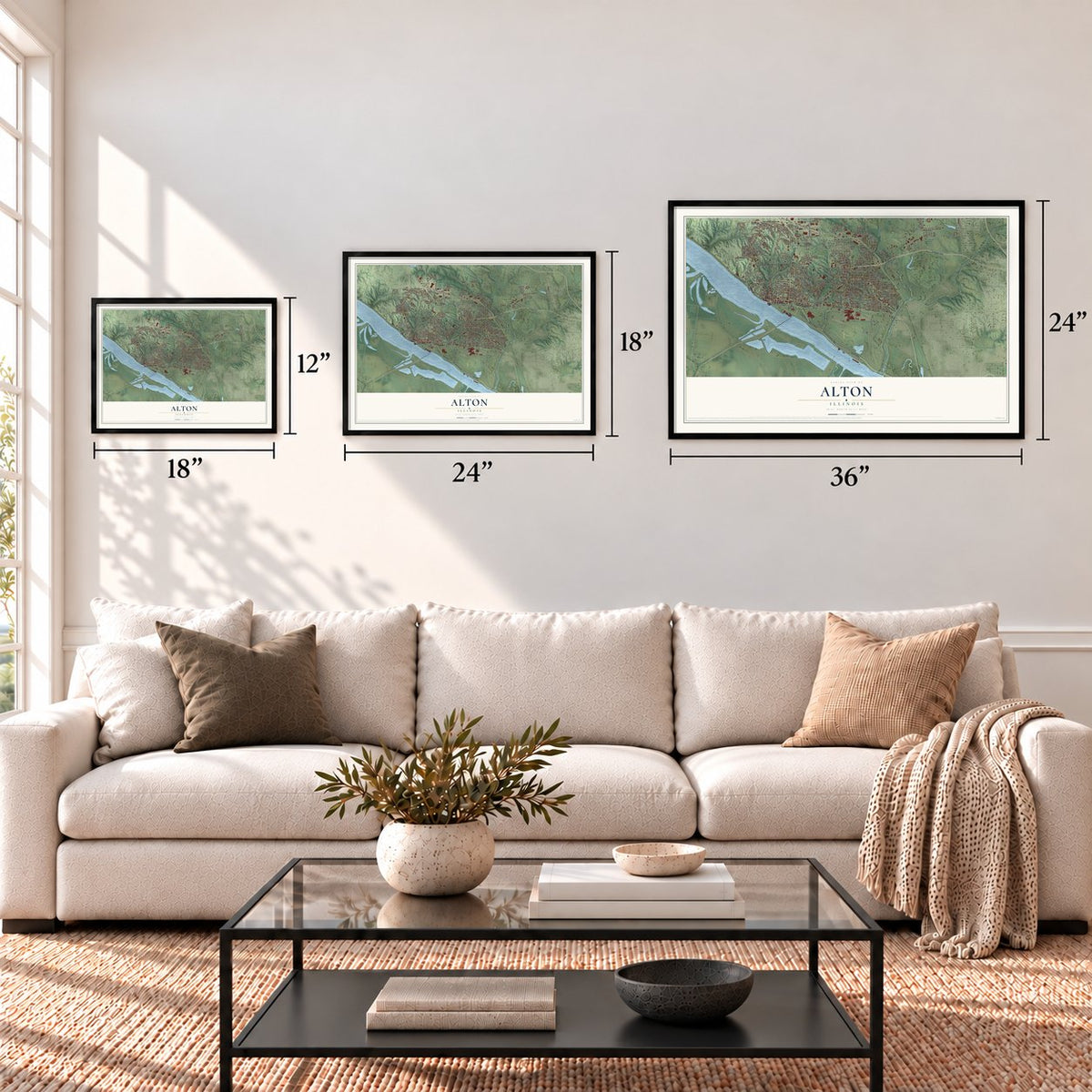
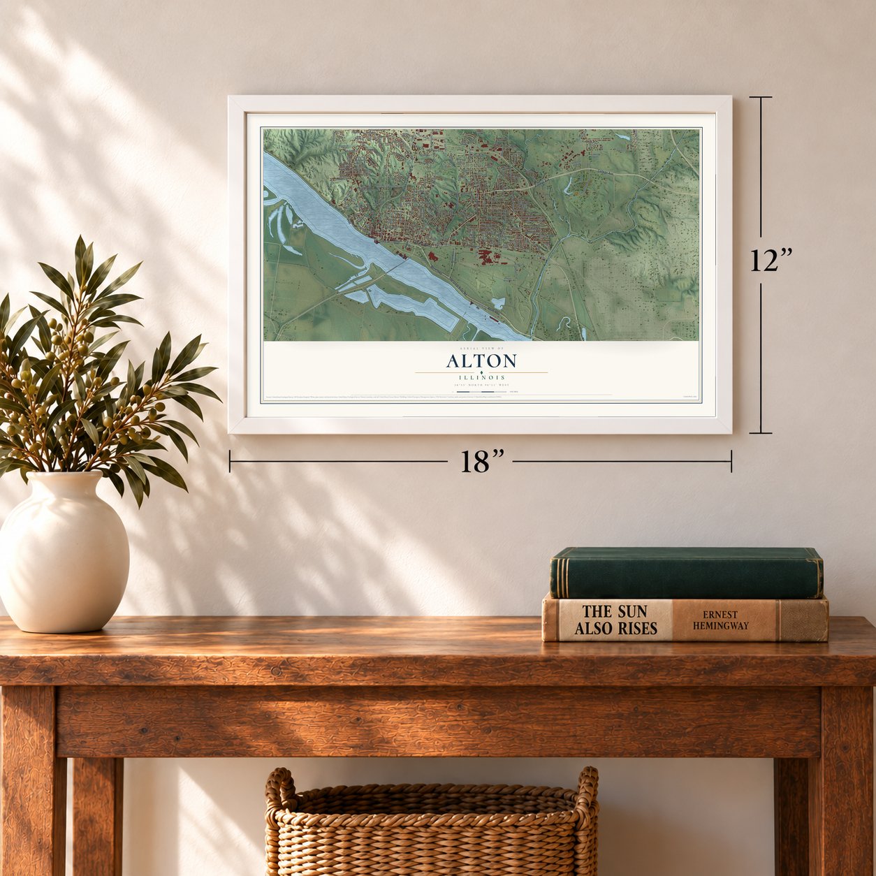
12" x 18" Archival Matte Print
A Map of Home. A Work of Art.
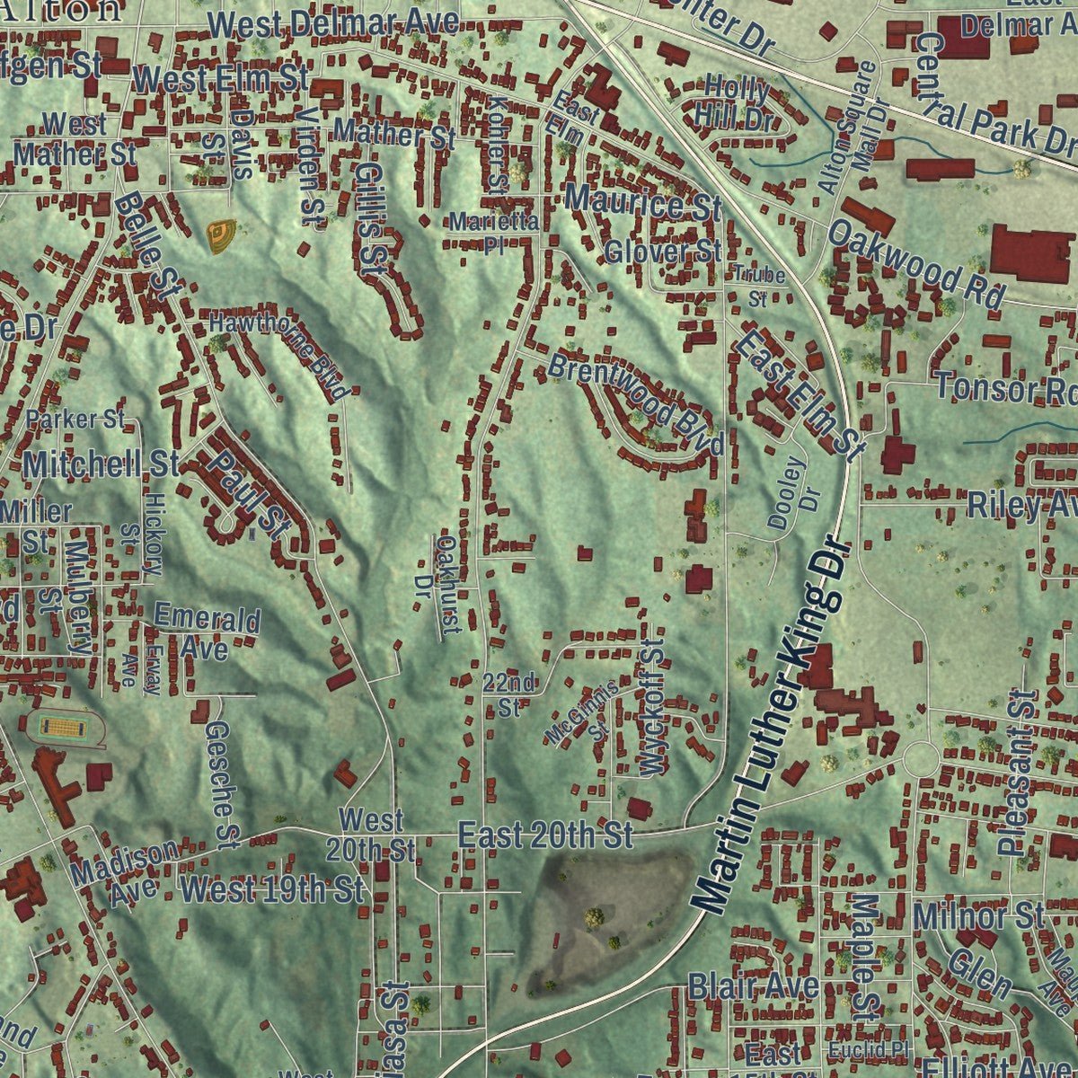
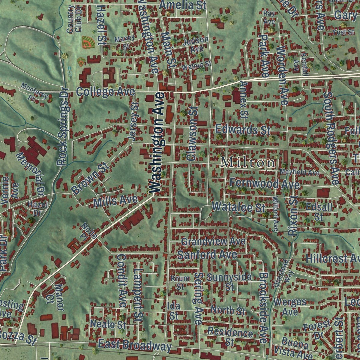
Explore Alton, Illinois from a whole new perspective. Created using aerial imagery and detailed geographic data, this map captures Alton building by building, with labeled streets, familiar landmarks, and shaded topographical relief that highlights the natural contours of the landscape.
Combining modern data with the timeless character of a vintage atlas, this map is just as interesting up close as it is beautiful on the wall. Whether you grew up in Alton, spent memorable years there, or call it home today, this unique map is a great way to celebrate a place that means something to you. Zoom in on the preview to look for your street, and then order a print to put your memories on the wall.
Three ways to hang it
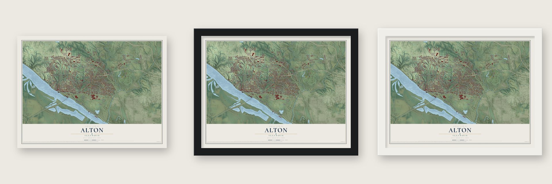
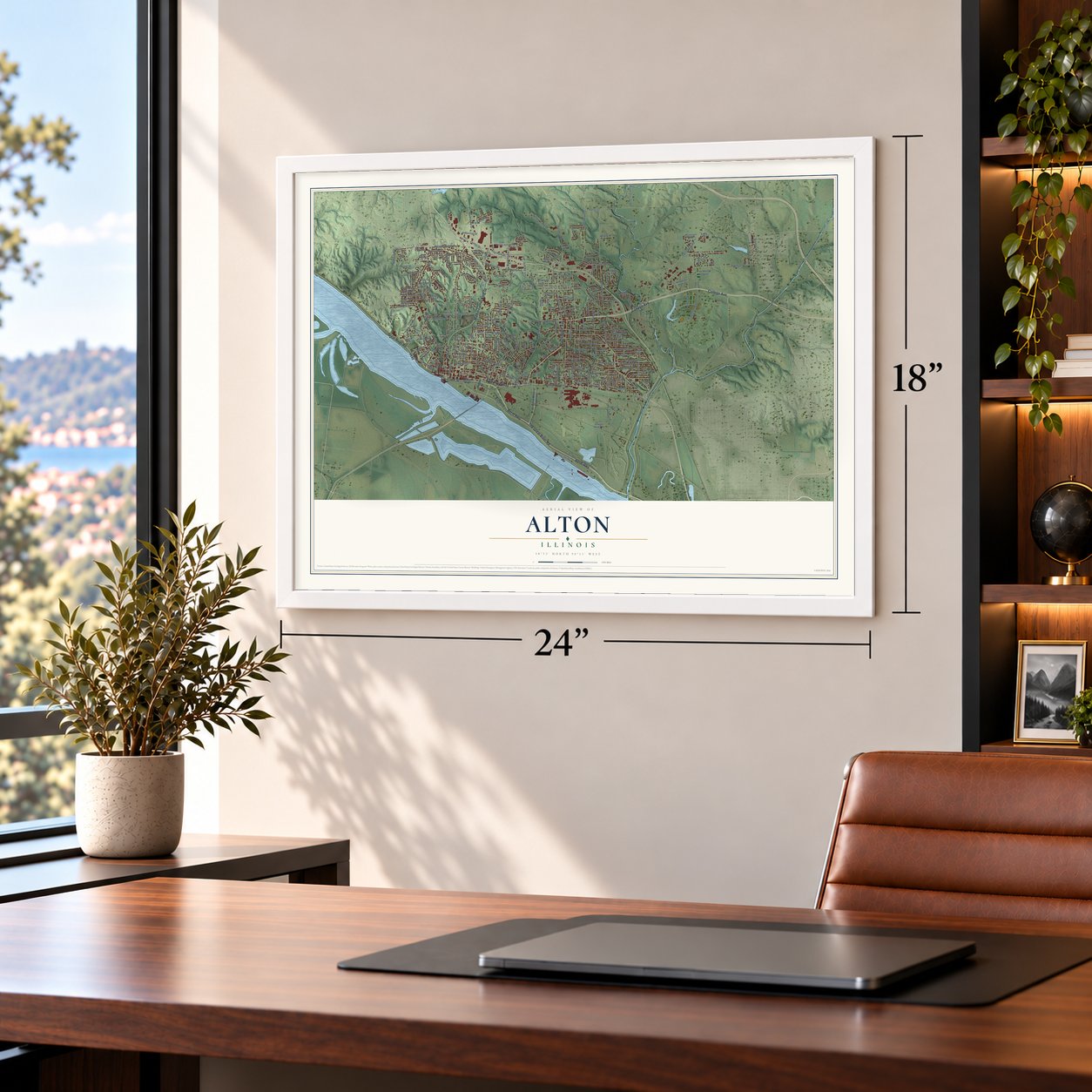
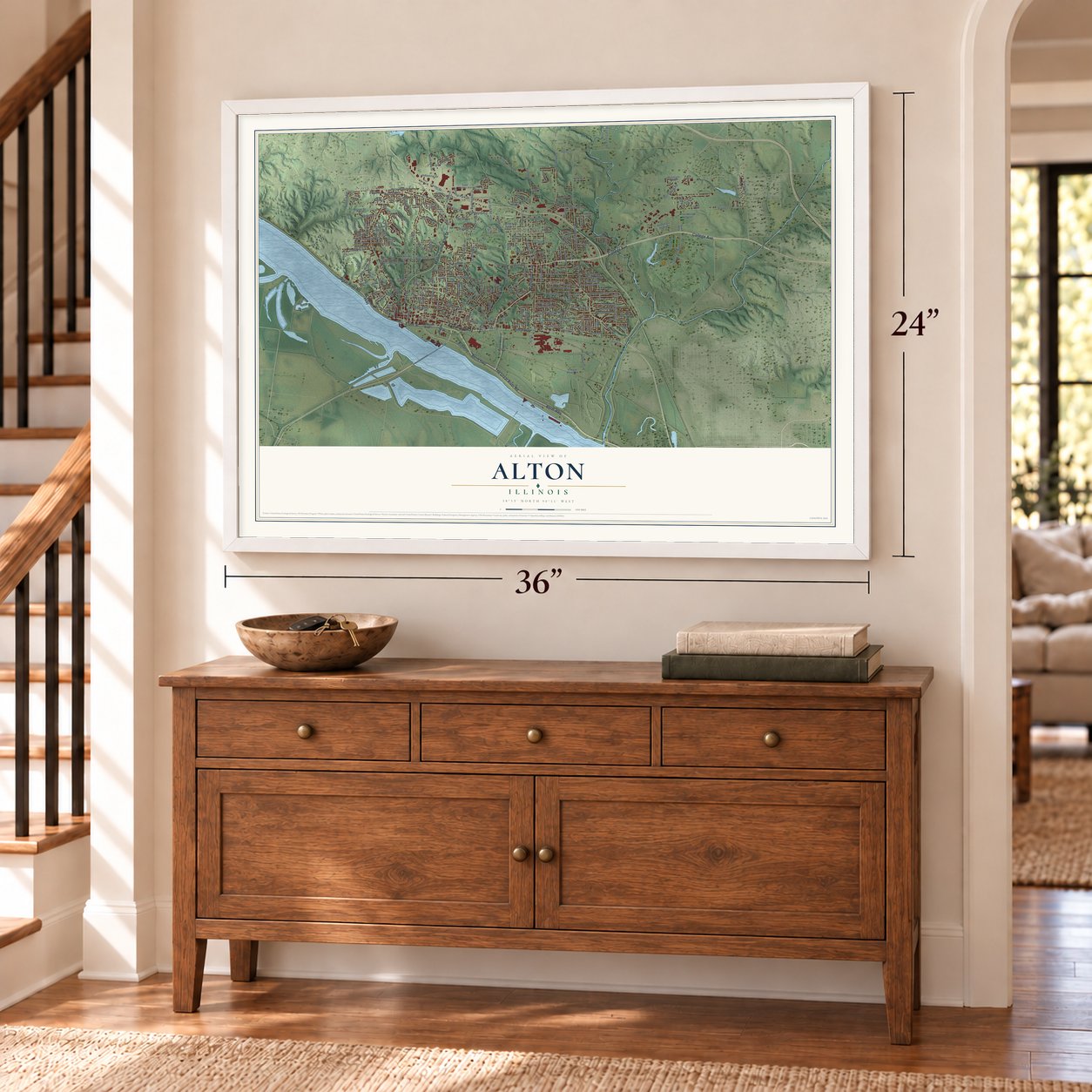
Unframed archival matte, a black wood frame or a white wood frame.
Up close
Geography Worth Displaying
This map was created using accurate cartographic data and authoritative geographic sources, including the U.S. Geological Survey and the Census Bureau. The map brings together terrain, waterways, roads, and building detail. The majority of the streets are labeled, houses are accurately depicted, and the topography is derived from government sources. Combining local data with carefully composed color and shading leads to this beautifully detailed Alton artwork for your wall.
Rather than simply showing street outlines, we’ve included as many of the street names as we could reasonably fit on the map while keeping their names legible. Zoom in on the high resolution preview to see exactly what’s on the map. We truly set out to create a statement piece for anyone who loves Alton. So whether it’s for you, or a gift for someone you love, we hope this map of Alton brings back fond memories.
Read the story behind this map of Alton, Illinois from 2026.

About Alton, Illinois
Alton is a Madison County city on the Mississippi River, with bluffs overlooking the river valley. Founded as a river town in 1818, it developed through trade, manufacturing, and shipping. Its history includes abolitionist activity, the Civil War, and a Lincoln-Douglas debate.
- Population in 2020The 2020 census counted 25,676 people in Alton.
- Three River SettingAlton developed near the confluence of the Illinois, Mississippi, and Missouri rivers.
- Final Lincoln-Douglas DebateAbraham Lincoln and Stephen Douglas held their seventh and final debate in Alton on October 15, 1858.
- Abolitionist PressA proslavery mob killed abolitionist printer Elijah P. Lovejoy in Alton on November 7, 1837.
- Early Electric StationThe Alton Gas & Electric Power House served as the area's primary electrical distribution station from 1915 through 1928.
Find your street
Names on the Alton map
Every name below is printed on this map. Look for your street, your school, the park where you played, or the pond down the road.
Places and landmarks6
- Alton City Hall
- Oakwood Cemetery
- Milton
- North Alton
- Sloan
- Upper Alton
Streets and roads265
- College Avenue
- Washington Avenue
- East Broadway
- Front Street
- Berm Highway
- Piasa Street
- Martin Luther King Drive
- The Great River Road
- Great River Road
- State Street
- West 19th Street
- West Delmar Avenue
- Belle Street
- Market Street
- East 20th Street
- Pleasant Street
- Summit Street
- West Elm Street
- Park Avenue
- Elliott Avenue
- Seminary Street
- Alby Street
- Rock Springs Drive
- Brown Street
- Henry Street
- North Rodgers Avenue
- Central Avenue
- Main Street
- Oakwood Avenue
- Fosterburg Road
Show all 265 streets
- Storey Lane
- Milton Road
- East Fifth Street
- Ridge Street
- Clawson Street
- Salu Street
- Edwards Street
- Aberdeen Avenue
- Stanley Road
- Pearl Street
- Oakwood Road
- Highland Avenue
- East Sixth Street
- East Seventh Street
- Tavernier Way
- Hillcrest Avenue
- Humbert Street
- Liberty Street
- Union Street
- Center Drive
- East Elm Street
- Rozier Street
- Bloomer Drive
- Langdon Street
- Franor Street
- Sanford Avenue
- George Street
- Pebble Creek Drive
- West Ninth Street
- Industrial Drive
- North Alby Street
- Western Avenue
- Blair Avenue
- Agnes Boulevard
- Amelia Street
- Leonard Street
- Worden Avenue
- Danforth Street
- Cut Street
- Chessen Lane
- Coronado Drive
- Sering Avenue
- Johnson Street
- Fernwood Avenue
- McKinley Boulevard
- Golf Road
- Jefferson Avenue
- Oscar Avenue
- Horn Avenue
- Harris Lane
- Moore Street
- Big Arch Road
- Humbert Road
- Lincoln Avenue
- Hull Street
- Maurice Street
- Watalee Street
- Hazel Street
- Tara Avenue
- Park Drive
- South Rodgers Avenue
- Bluff Street
- Tonsor Road
- Buckmaster Lane
- Herbert Street
- Riley Avenue
- Brookside Avenue
- Wood Station Road
- Central Park Drive
- Rixon Street
- Gilham Avenue
- Northdale Drive
- La Salle Drive
- Lampert Street
- Thomas Avenue
- Clay Street
- Mitchell Street
- Claire Avenue
- Milnor Street
- Holland Avenue
- Mills Avenue
- Garden Street
- Gillis Street
- Logan Street
- Sharon Lane
- Crest Drive
- Banks Drive
- Mission Road
- Tulane Street
- Leo Street
- Elfgen Street
- Paul Street
- Condit Avenue
- Sylvan Lane
- William Street
- Gary Street
- Ladd Street
- Maple Street
- Bozza Street
- Glen
- Voss Place
- Mc Adams Parkway
- Alton Mental Hospital
- West 20th Street
- Mather Street
- East Fourth Street
- Memorial Drive
- East Delmar Avenue
- East Eighth Street
- Fairview Drive
- Powhattan Street
- Berkeley Avenue
- Quincy Court
- West Mather Street
- Vine Street
- Jersey Street
- Brentwood Boulevard
- Harrison Street
- Madison Avenue
- Holly Hill Drive
- Grandview Avenue
- Culp Lane
- East 13th Street
- Fullerton Avenue
- Douglas Street
- Muny Vista Drive
- Alton State Hospital
- Mulberry Street
- East 14th Street
- Residence Street
- Sunnyside Street
- Hawley Avenue
- Vinegar Works Road
- Hy Vista Drive
- Grand Avenue
- Ridge Drive
- Norside Drive
- North Street
- Robert Avenue
- Moonlight Way
- Holman Street
- Ida Street
- Fletcher Street
- Circle Drive
- Gold Street
- Buena Vista Avenue
- Emerald Avenue
- Davis Street
- Forest Drive
- Gesche Street
- Myrle Street
- Morning Star Drive
- Wyckoff Street
- Virden Street
- Belleview Avenue
- Dreith Drive
- Annex Street
- Neale Street
- Werges Avenue
- East 15th Street
- Edsall Street
- Division Street
- Joesting Avenue
- Bond Street
- Dry Street
- Miller Street
- Glover Street
- Alice Drive
- Manor Court
- Cliff Street
- Gilbert Lane
- Vernie Avenue
- Park Road
- Carver Street
- Golf
- Gayle Avenue
- Landmarks Boulevard
- Lock and Dam Way
- Alton Street
- Judson Avenue
- Locust Avenue
- Alton Square Mall Drive
- Muny Vista Court
- Dooley Drive
- Oak Street
- Hawthorne Boulevard
- McArthur Boulevard
- McPherson Avenue
- California Avenue
- Krum Street
- Maupin Avenue
- Hickory Street
- Marc Drive
- Royal Street
- West Center Drive
- Northridge Drive
- Parker Street
- Oakhurst Drive
- West 13th Street
- Kohler Street
- Shaw Avenue
- Marietta Place
- Country Club Drive
- Hazel Drive
- Gretel Court
- 22nd Street
- Nolte Place
- East Elm
- Cpl Belchik Memorial Expressway
- Easton Street
- Mayfield Avenue
- Maxey Street
- Omega Street
- West Fourth Street
- Kendall Avenue
- Woodcliffe Drive
- Willard Avenue
- Poppins Place
- Olmstead Way
- East Doerr Avenue
- Lawton Street
- Taylor Avenue
- McGinnis Street
- Walnut Street
- Glenn Drive
- Pear Street
- Yost Street
- Monterey Place
- Euclid Place
- Phillips
- Ervay Avenue
- Trube Street
- Manor Drive
- Hill Road
- Ray Avenue
Names are listed as they appear on the printed map. Zoom into the product photos to find them.
The art of mapping a place
How This Map Was Made
Real places. Remarkable detail. Discover the layers that turn geographic data into a map of home.

The view from above
Aerial imagery reveals the character of the land: woodland, open fields, and the patterns of a place.

The shape of the land
Elevation data brings hills, valleys, and subtle changes in the landscape into view.

The details of home
Roads, waterways, and building footprints come together to make the map feel unmistakably local.

Geography becomes art
Considered color, shading, and typography bring the layers together in a map made for your wall.


Process illustrated with Mendon, Massachusetts. Aerial imagery: USDA NAIP. Terrain: USGS 3D Elevation Program. Map details and finished artwork: KNOWOL.
The Details
About This Print
Choose an archival matte print, or a black or white Ayous wood frame. The archival matte print is unframed.
Select your size and finish above to see the matching product image and price.
Materials & Craftsmanship
A contemporary map with the character of a classic atlas, printed on archival matte paper. Optional frames are made from Ayous wood.
Your printed map does not include the watermark shown in the full-map preview.
Shipping & Delivery
Free shipping within the United States. Every print is made to order in the USA.
Buying a gift? Add a note in your cart and we'll include it. We never put prices in the package.
Prints ship within 2 to 3 business days. Allow 7 to 10 days total from ordering for delivery. Timing may vary during holidays or periods of high order volume.
Read our shipping policy.
Returns and damaged prints
Each print is made to order. Change-of-mind refunds are not available after production.
If your print arrives damaged, misprinted or incorrect, contact support@knowol.com within 30 days of receiving it. Include your order number, photos and a description of the issue.
Read our full refund and replacement policy. For questions about your order, email support@knowol.com.
Find your town
Looking for another city?
Find a map of home in our Illinois collection, or any town in the country.
Nearby
Maps of towns near Alton
Know someone from one of these towns? Their map makes a great gift.
 East Alton
, Illinois
From $39.99See the map
 Rosewood Heights
, Illinois
From $39.99See the map
 Wood River
, Illinois
From $39.99See the map
More maps nearby: Godfrey, Bethalto, Moro, Hartford and Roxana.