
Search for another town


Free U.S. delivery 7 to 10 days after you order
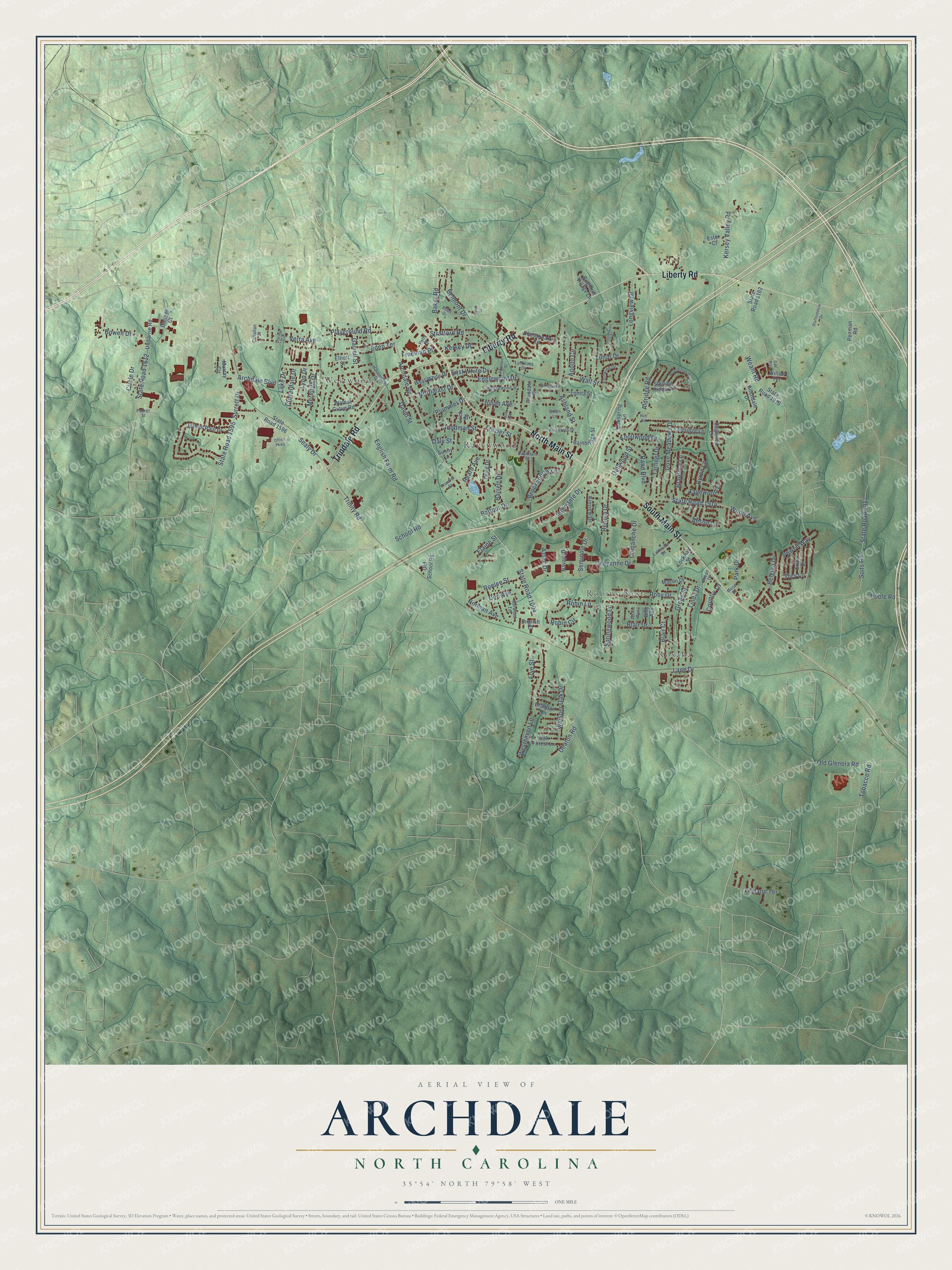
Archdale, North Carolina Map Art
Building by building, with labeled streets and shaded relief.
12" x 18" Archival Matte Print
A Map of Home. A Work of Art.
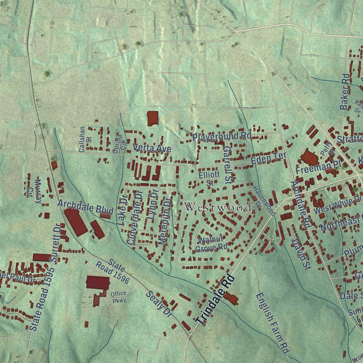
Explore Archdale, North Carolina from a whole new perspective. Created using aerial imagery and detailed geographic data, this map captures Archdale building by building, with labeled streets, familiar landmarks, and shaded topographical relief that highlights the natural contours of the landscape.
Combining modern data with the timeless character of a vintage atlas, this map is just as interesting up close as it is beautiful on the wall. Whether you grew up in Archdale, spent memorable years there, or call it home today, this unique map is a great way to celebrate a place that means something to you. Zoom in on the preview to look for your street, and then order a print to put your memories on the wall.
Three ways to hang it
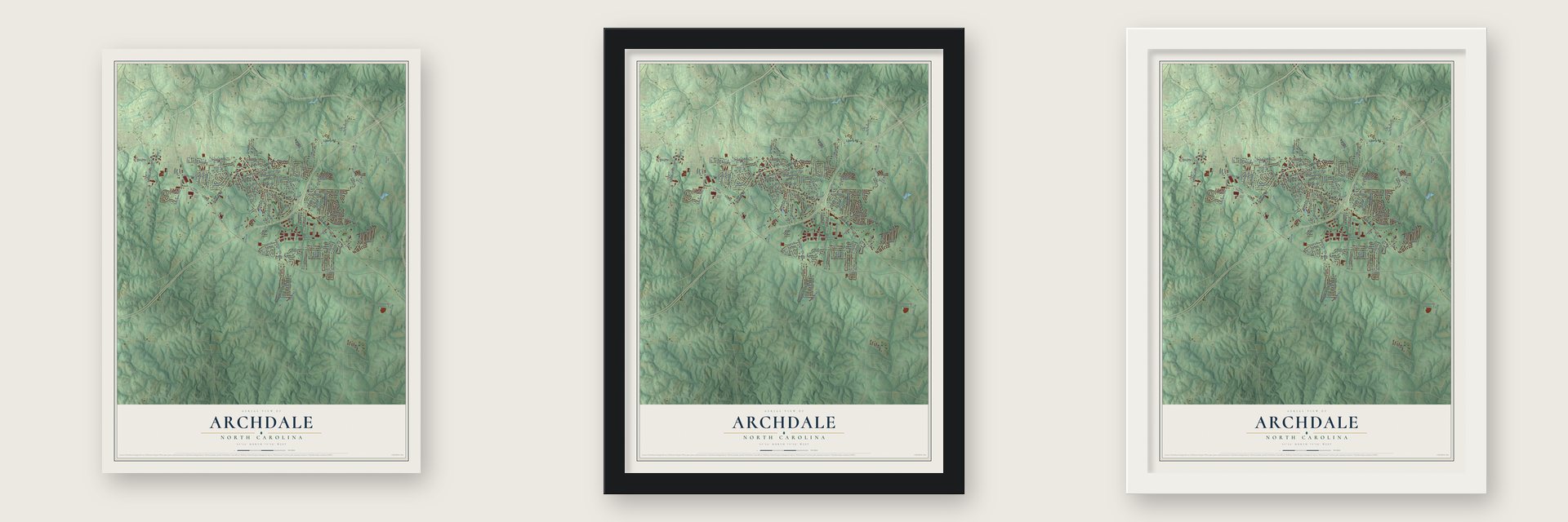
Unframed archival matte, a black wood frame or a white wood frame.
Up close
Geography Worth Displaying
This map was created using accurate cartographic data and authoritative geographic sources, including the U.S. Geological Survey and the Census Bureau. The map brings together terrain, waterways, roads, and building detail. The majority of the streets are labeled, houses are accurately depicted, and the topography is derived from government sources. Combining local data with carefully composed color and shading leads to this beautifully detailed Archdale artwork for your wall.
Rather than simply showing street outlines, we’ve included as many of the street names as we could reasonably fit on the map while keeping their names legible. Zoom in on the high resolution preview to see exactly what’s on the map. We truly set out to create a statement piece for anyone who loves Archdale. So whether it’s for you, or a gift for someone you love, we hope this map of Archdale brings back fond memories.
Read the story behind this map of Archdale, North Carolina from 2026.

Find your street
Names on the Archdale map
Every name below is printed on this map. Look for your street, your school, the park where you played, or the pond down the road.
Places and landmarks4
- Ravenwood
- Robins Nest
- Roxana
- Westwood
Streets and roads159
- North Main Street
- Liberty Road
- South Main Street
- Trindale Road
- Aldridge Road
- State Road 1595
- State Road 1004
- Archdale Road
- Ashland Street
- Baker Road
- Eden Terrace
- Weant Road
- Lake Drive
- Surrett Drive
- English Farm Road
- Westhaven Lane
- Robin Lane
- State Road 1914
- Wood Avenue
- Balfour Drive
- Trinity Road
- Cheyenne Drive
- Knollwood Drive
- Longview Drive
- School Road
- State Road 1917
- Suits Road
- Sealy Drive
- Apollo Circle
- Bradford Lane
Show all 159 streets
- State Road 1612
- Julian Avenue
- Gregg Street
- Playground Road
- Archdale Boulevard
- Linda Drive
- Kersey Valley Road
- Interstate Drive
- Dove Meadows Drive
- Rand Boulevard
- Englewood Drive
- Roby Drive
- Renola Drive
- Sagewood Lane
- Tarheel Drive
- Powell Way
- Barrett Drive
- Stratford Road
- Comanche Drive
- Old Glenola Road
- Belgian Drive
- Garrell Street
- Circle Drive
- Blair Drive
- Springwood Lane
- Whisper Oak Drive
- Robin Circle
- Brookhollow Lane
- Leyland Terrace
- Beard Avenue
- Wall Street
- Elaine Street
- Meredith Drive
- Belmont Drive
- Goodman Street
- Frazier Street
- Park Drive
- Deaton Road
- Plummer Drive
- Northeast Drive
- Blair Court
- Alison Lane
- Lunar Drive
- Don Avenue
- Roelee Street
- Cloverdale Drive
- Frye Street
- Kersey Drive
- Freeman Place
- Dellwood Street
- East White Drive
- Tobacco Road
- Verta Avenue
- Norman Avenue
- Byron Lane
- Seminole Drive
- Lane Drive
- Poole Road
- David Street
- Country Lane
- Lynn Drive
- Bowen Drive
- Trey Lane
- Aztec Drive
- Dale Street
- State Road 1916
- Daniel Paul Drive
- State Road 1596
- Uwharrie Road
- Allendale Drive
- Walnut Grove Road
- Aldridge Lane
- Murray Circle
- Kinview Drive
- Old School Road
- West White Drive
- Macon Drive
- Oak Forest Lane
- Chesapeake Lane
- Dogwood Lane
- Sterling Ridge Drive
- Bainbridge Street
- Lonita Street
- Erica Drive
- Oakspring Lane
- State Road 1162
- Luck Drive
- Brandon Lane
- Lockhart Street
- Brighton Village Lane
- Navajo Drive
- Ester Court
- Elliott Street
- Glendale Drive
- Craig Drive
- Penman Road
- Gaither Court
- Willow Terrace
- English Court
- Billy Avenue
- Sunny Lane
- Havenwood Drive
- Barwood Terrace
- Pinecrest Drive
- Wedgewood Street
- Lakeside Drive
- Corina Circle
- Eastwind Drive
- Mose Drive
- Lynbrook Drive
- Davidson Street
- Smith Lane
- Frontier Street
- Petty Street
- Jackie Avenue
- Callahan Street
- Shean Drive
- Parker Street
- Greenhaven Drive
- Hope Valley Drive
- Ralph Drive
- Forestwood Drive
- Staffordshire Drive
- Office Parkway
- Fountain Street
- Huff Road
- Laura Avenue
- Oak Way
- Gene Street
Names are listed as they appear on the printed map. Zoom into the product photos to find them.
About Archdale, North Carolina
Archdale is a city of 11,907 people in Randolph County, and it reaches north into Guilford County. Muddy Creek, a branch of the Deep River, has its source inside the city. The place began as a mostly Quaker settlement known as Bush Hill. It later took the name Archdale to honor John Archdale, a lord proprietor who served as one of the early Quaker governors.
- Johnston's army goes homeGeneral Johnston's Confederate army surrendered near Durham on April 26, 1865. A few days later, on May 1 and 2, his men were paid off and mustered out near Archdale, and a state historical marker records the event.
- A city since July 1969The area's heavy clay soil meant homes and businesses needed water and sewer lines. Voters settled the question in a referendum, and Archdale was incorporated as a city in July 1969. Residents of neighboring Trinity voted not to join, and Trinity is now Archdale's neighbor to the southwest.
- The Bush Hill FestivalArchdale's first name has never been forgotten. The Bush Hill Festival carries it on, and it is one of the city's attractions along with Creekside Park and Kersey Valley Spookywoods.
Keep exploring North Carolina
Archdale is one of 952 North Carolina towns we've mapped. Every dot on the map is a print of its own.
The search covers every state, North Carolina first.
Near Archdale
Order 2 or more town maps and save 10%. Shown in the size and finish you picked above, so they hang as a set.
- Trinity 12" x 18" / Archival Matte Print $39.99
- High Point 12" x 18" / Archival Matte Print $39.99
- Jamestown 12" x 18" / Archival Matte Print $39.99


More maps nearby: Thomasville, New Market, Level Cross, Randleman and Pleasant Garden.
The art of mapping a place
How This Map Was Made
Real places. Remarkable detail. Discover the layers that turn geographic data into a map of home.

The view from above
Aerial imagery reveals the character of the land: woodland, open fields, and the patterns of a place.

The shape of the land
Elevation data brings hills, valleys, and subtle changes in the landscape into view.

The details of home
Roads, waterways, and building footprints come together to make the map feel unmistakably local.

Geography becomes art
Considered color, shading, and typography bring the layers together in a map made for your wall.


Process illustrated with Mendon, Massachusetts. Aerial imagery: USDA NAIP. Terrain: USGS 3D Elevation Program. Map details and finished artwork: KNOWOL.
The Details
About This Print
Choose an archival matte print, or a black or white Ayous wood frame. The archival matte print is unframed.
Select your size and finish above to see the matching product image and price.
Materials & Craftsmanship
A contemporary map with the character of a classic atlas, printed on archival matte paper. Optional frames are made from Ayous wood.
Your printed map does not include the watermark shown in the full-map preview.
Shipping & Delivery
Free shipping within the United States. Every print is made to order in the USA.
Buying a gift? Add a note in your cart and we'll include it. We never put prices in the package.
Prints ship within 2 to 3 business days. Allow 7 to 10 days total from ordering for delivery. Timing may vary during holidays or periods of high order volume.
Read our shipping policy.
Returns and damaged prints
Each print is made to order. Change-of-mind refunds are not available after production.
If your print arrives damaged, misprinted or incorrect, contact support@knowol.com within 30 days of receiving it. Include your order number, photos and a description of the issue.
Read our full refund and replacement policy. For questions about your order, email support@knowol.com.