


Search for another town





Free U.S. delivery 7 to 10 days after you order
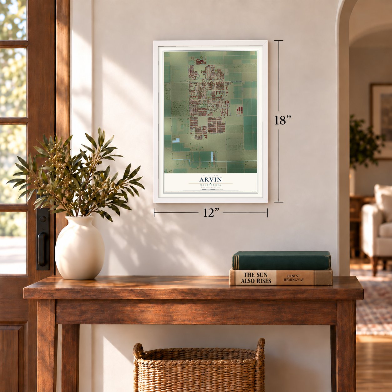
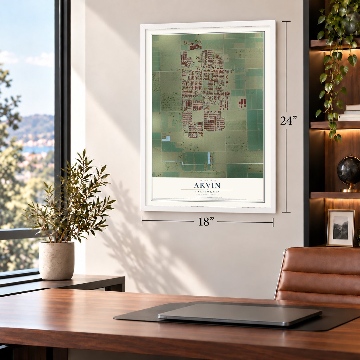
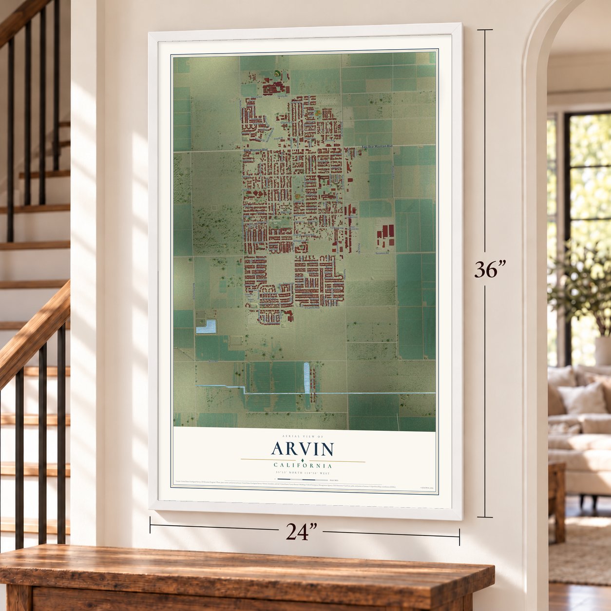
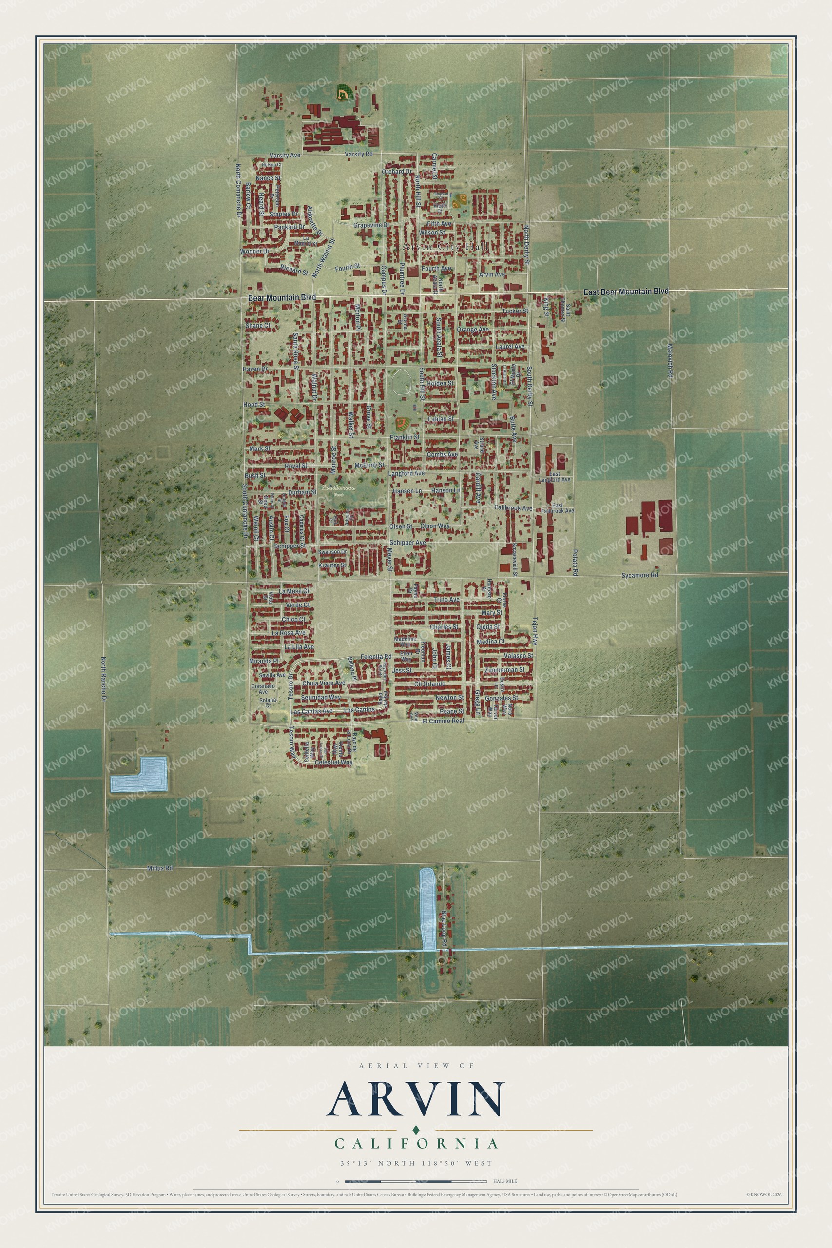
Arvin, California Map Art
Building by building, with labeled streets and shaded relief.
12" x 18" Archival Matte Print
A Map of Home. A Work of Art.
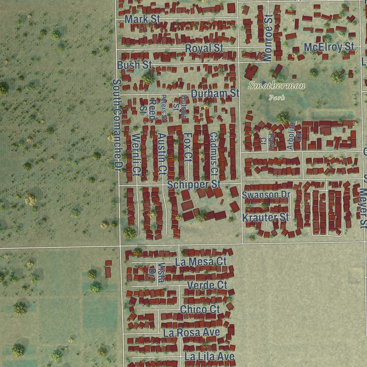
Explore Arvin, California from a whole new perspective. Created using aerial imagery and detailed geographic data, this map captures Arvin building by building, with labeled streets, familiar landmarks, and shaded topographical relief that highlights the natural contours of the landscape.
Combining modern data with the timeless character of a vintage atlas, this map is just as interesting up close as it is beautiful on the wall. Whether you grew up in Arvin, spent memorable years there, or call it home today, this unique map is a great way to celebrate a place that means something to you. Zoom in on the preview to look for your street, and then order a print to put your memories on the wall.
Three ways to hang it
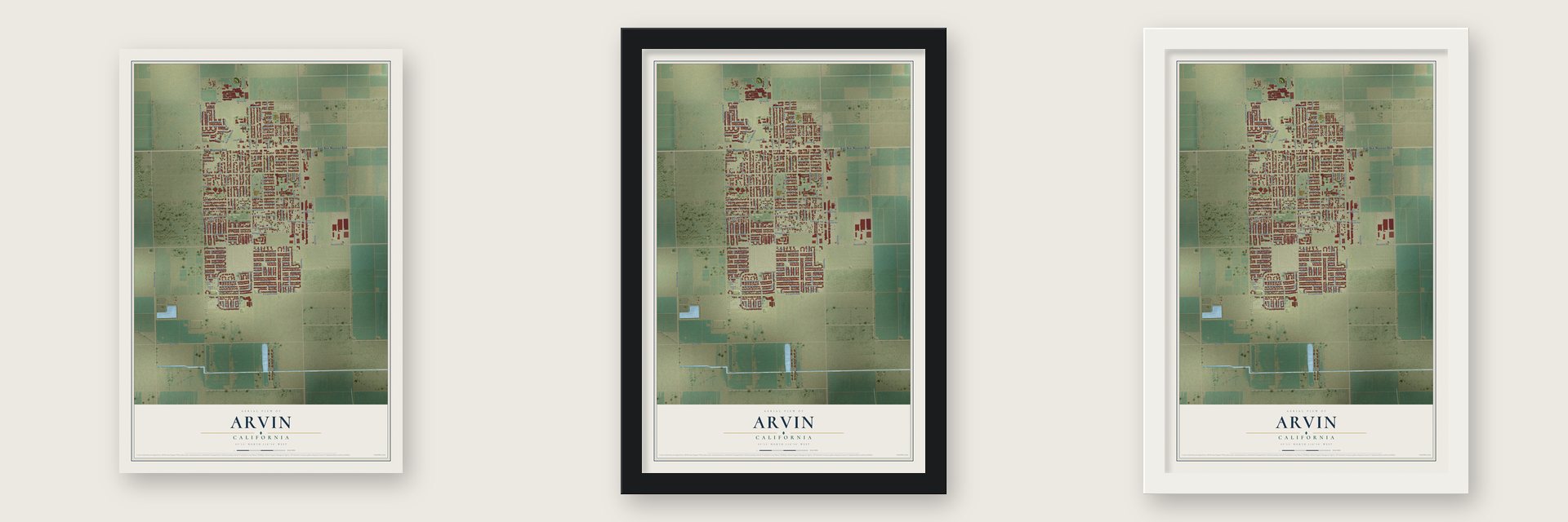
Unframed archival matte, a black wood frame or a white wood frame.
Up close
Geography Worth Displaying
This map was created using accurate cartographic data and authoritative geographic sources, including the U.S. Geological Survey and the Census Bureau. The map brings together terrain, waterways, roads, and building detail. The majority of the streets are labeled, houses are accurately depicted, and the topography is derived from government sources. Combining local data with carefully composed color and shading leads to this beautifully detailed Arvin artwork for your wall.
Rather than simply showing street outlines, we’ve included as many of the street names as we could reasonably fit on the map while keeping their names legible. Zoom in on the high resolution preview to see exactly what’s on the map. We truly set out to create a statement piece for anyone who loves Arvin. So whether it’s for you, or a gift for someone you love, we hope this map of Arvin brings back fond memories.
Read the story behind this map of Arvin, California from 2026.

Find your street
Names on the Arvin map
Every name below is printed on this map. Look for your street, your school, the park where you played, or the pond down the road.
Places and landmarks2
- Arvin City Hall
- Smothermon Park
Streets and roads147
- Bear Mountain Boulevard
- East Bear Mountain Boulevard
- Las Cantas Avenue
- Los Cantos
- Tesoro Drive
- Tesoro Way
- Felecita Road
- Celestial Way
- North Derby Street
- El Camino Real
- North Hill Street
- Varsity Road
- South Comanche Drive
- Hood Street
- Orange Avenue
- North Walnut Street
- Sycamore Road
- Malovich Road
- Tejon Highway
- Millux Road
- Meyer Street
- Haven Drive
- North Rancho Drive
- South Derby Street
- Walnut Drive
- Franklin Street
- North Comanche Drive
- Stockton Avenue
- Monroe Street
- Potato Road
Show all 147 streets
- South Hill Street
- Tucker Street
- Campus Drive
- Schipper Avenue
- Olson Way
- Langford Avenue
- Cll Orlando
- Schipper Street
- Plumtree Drive
- Walker Street
- Blue Loop Road
- Grove Street
- Trino Avenue
- Mary Street
- Laurel Avenue
- Fifth Avenue
- Fourth Avenue
- Chula Vista Avenue
- Gregg Lane
- Serinidad Way
- Royal Street
- Grapevine Drive
- Packard Drive
- Fallbrook Avenue
- Olsen Street
- Durham Street
- Hansen Lane
- Hanson Lane
- Bush Street
- Mark Street
- Newton Street
- Jess Street
- Charles Street
- Santa Rosa Street
- Combs Avenue
- Wooner Drive
- Fourth Street
- Varsity Avenue
- La Lila Avenue
- Austin Court
- Wernli Court
- La Rosa Avenue
- Valasco Street
- Verde Court
- La Mesa Court
- Barlow Court
- Butte Avenue
- South Acala Street
- Peace Street
- Richard Street
- Arvin Avenue
- Zimmerman Street
- Gonzales Street
- Medina Court
- Chico Court
- Alderette Drive
- Staples Drive
- Fabian Street
- Wilson Street
- Orchard Drive
- Morton Place
- King Street
- Cardiff Avenue
- Heard Street
- Holden Street
- McElroy Street
- Fox Court
- Miranda Place
- Shane Court
- Carmel Street
- John Court
- James Court
- Krauter Street
- Ojeda Street
- Nance Street
- Rayo del Sol
- Rayo de la Luna Drive
- North Acala Street
- Madeline Way
- Freeman Drive
- Flores Court
- Dustin Lane
- East Fallbrook Avenue
- East Langford Avenue
- La Madrid Street
- Peterson Drive
- Saint Thomas Street
- Kovacevich Street
- El Monte Drive
- Sevilla Avenue
- Cadmus Court
- Ellen Way
- Swanson Drive
- Coranado Avenue
- Belleza Place
- Viento Way
- Centella Way
- Tarver Way
- Nora Way
- Payne Drive
- Honesto Street
- Strand Avenue
- Arvina Street
- Solana Court
- Reed Street
- Vietti Court
- Vista Drive
- Rayo del Sol Drive
- Nelson Court
- Arbolito Court
- Hutson Street
- Park Court
- Vibe Avenue
- Las Luces Court
- La Vista Drive
- Peters Street
- Simpson Street
Names are listed as they appear on the printed map. Zoom into the product photos to find them.
About Arvin, California
Arvin is a city of 19,495 people in Kern County, 15 miles southeast of Bakersfield. Lots in the present town first went on sale in 1906. In 1914 Birdie Heard asked for a post office and offered three names: Bear Mountain, Walnut and Arvin. Officials in Washington picked Arvin because no other place in California used it. The name honors Arvin Richardson, a son of one of the first families, who came from San Bernardino.
Heard became the first postmaster and ran the post office from her living room, then moved it into the Staples family's general store. That counter also served as the town's first library until the Kern County Library opened a branch here in 1927. Arvin grew as a farm town, and it became a city in 1960.
“Padre Garcés, first recorded non-Indian to visit this locality, came in April of 1776, seeking a new route from Mexico to California.”
- A model camp in 1937The Farm Security Administration opened the Arvin Migratory Labor Camp in 1937. It was the first farm labor camp the federal government ran. The Resettlement Administration built it as part of Franklin D. Roosevelt's New Deal response to the Great Depression, and other camps looked to it as a model.
- Oil wells under the streetsThe Mountain View Oil Field was found beneath Arvin and the land around it in 1933, and crews drilled it heavily through the 1930s. Wells still ring the town today, and some are drilled at a slant to reach the oil lying under homes.
- Gliders over Tejon RanchIn the 1930s and 1940s, pilots came to the hills east of Arvin to fly gliders. The Western Soaring Championship was held each spring on the slopes of the Tejon Ranch. In 2000 the National Soaring Museum named the site a National Landmark of Soaring.
- The 1952 earthquakeBy mid-century Arvin had its own paper, the Arvin Tiller, started in 1939, and Arvin High School, built in 1949. On July 21, 1952, the magnitude 7.3 Kern County earthquake broke along the White Wolf Fault and nearly destroyed the city. A dust storm struck it again on December 20, 1977.
Keep exploring California
Arvin is one of 1,990 California towns we've mapped. Every dot on the map is a print of its own.
The search covers every state, California first.
Near Arvin
Order 2 or more town maps and save 10%. Shown in the size and finish you picked above, so they hang as a set.
- Edmundson Acres 12" x 18" / Archival Matte Print $39.99
- Di Giorgio 12" x 18" / Archival Matte Print $39.99
- Weedpatch 12" x 18" / Archival Matte Print $39.99

More maps nearby: Lamont, El Adobe, Fuller Acres, Bear Valley Springs and Edison.
The art of mapping a place
How This Map Was Made
Real places. Remarkable detail. Discover the layers that turn geographic data into a map of home.

The view from above
Aerial imagery reveals the character of the land: woodland, open fields, and the patterns of a place.

The shape of the land
Elevation data brings hills, valleys, and subtle changes in the landscape into view.

The details of home
Roads, waterways, and building footprints come together to make the map feel unmistakably local.

Geography becomes art
Considered color, shading, and typography bring the layers together in a map made for your wall.


Process illustrated with Mendon, Massachusetts. Aerial imagery: USDA NAIP. Terrain: USGS 3D Elevation Program. Map details and finished artwork: KNOWOL.
The Details
About This Print
Choose an archival matte print, or a black or white Ayous wood frame. The archival matte print is unframed.
Select your size and finish above to see the matching product image and price.
Materials & Craftsmanship
A contemporary map with the character of a classic atlas, printed on archival matte paper. Optional frames are made from Ayous wood.
Your printed map does not include the watermark shown in the full-map preview.
Shipping & Delivery
Free shipping within the United States. Every print is made to order in the USA.
Buying a gift? Add a note in your cart and we'll include it. We never put prices in the package.
Prints ship within 2 to 3 business days. Allow 7 to 10 days total from ordering for delivery. Timing may vary during holidays or periods of high order volume.
Read our shipping policy.
Returns and damaged prints
Each print is made to order. Change-of-mind refunds are not available after production.
If your print arrives damaged, misprinted or incorrect, contact support@knowol.com within 30 days of receiving it. Include your order number, photos and a description of the issue.
Read our full refund and replacement policy. For questions about your order, email support@knowol.com.