
Search for another town

Free U.S. delivery 7 to 10 days after you order
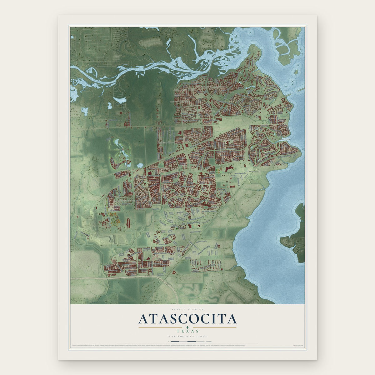
Atascocita, Texas Map Art
Building by building, with labeled streets and shaded relief.
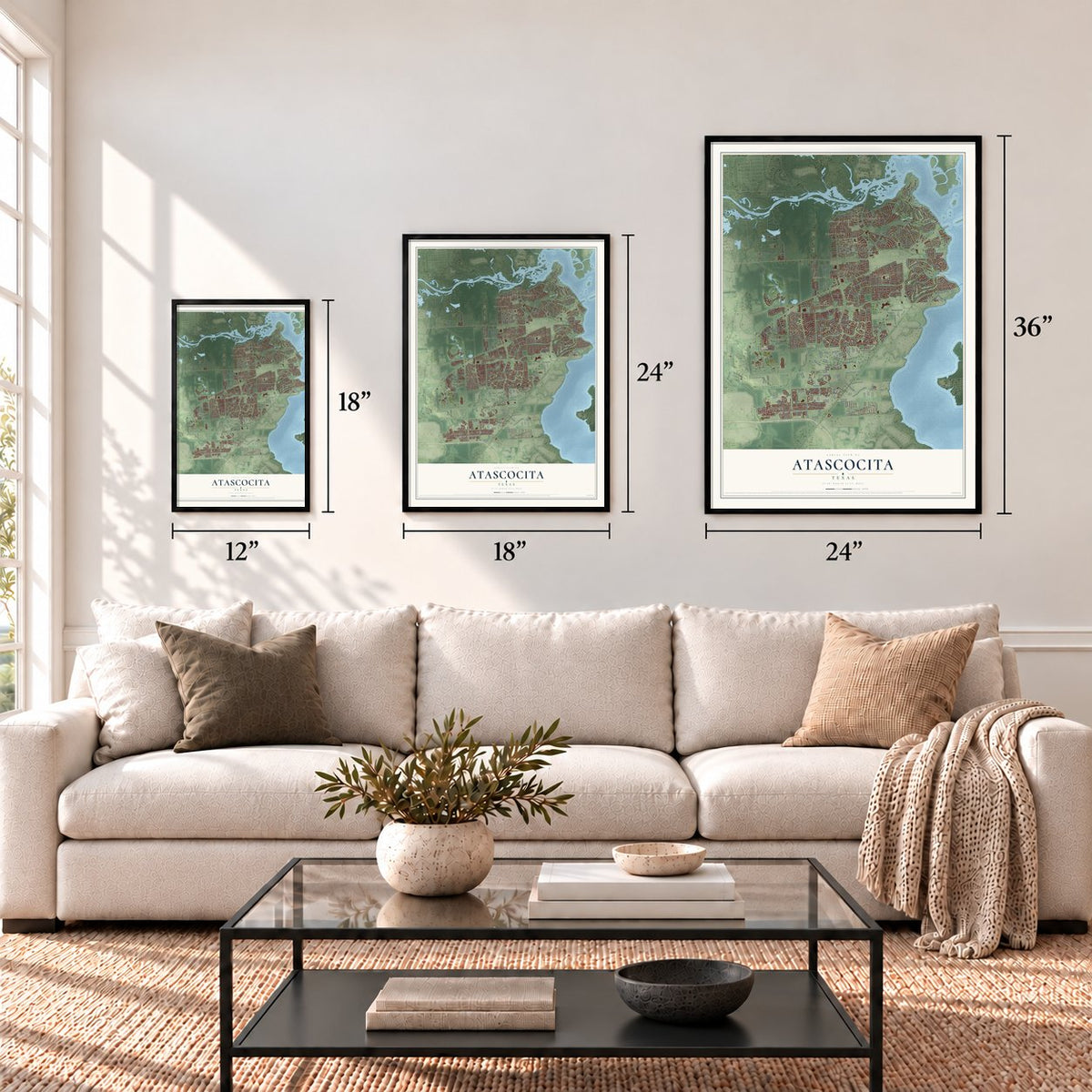
12" x 18" Archival Matte Print
A Map of Home. A Work of Art.
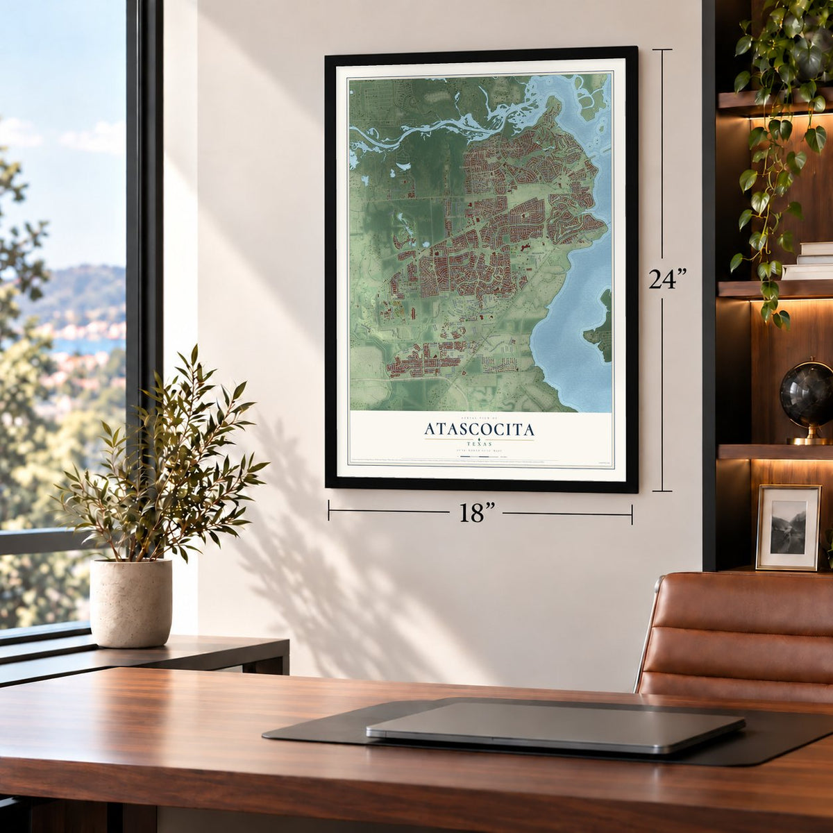
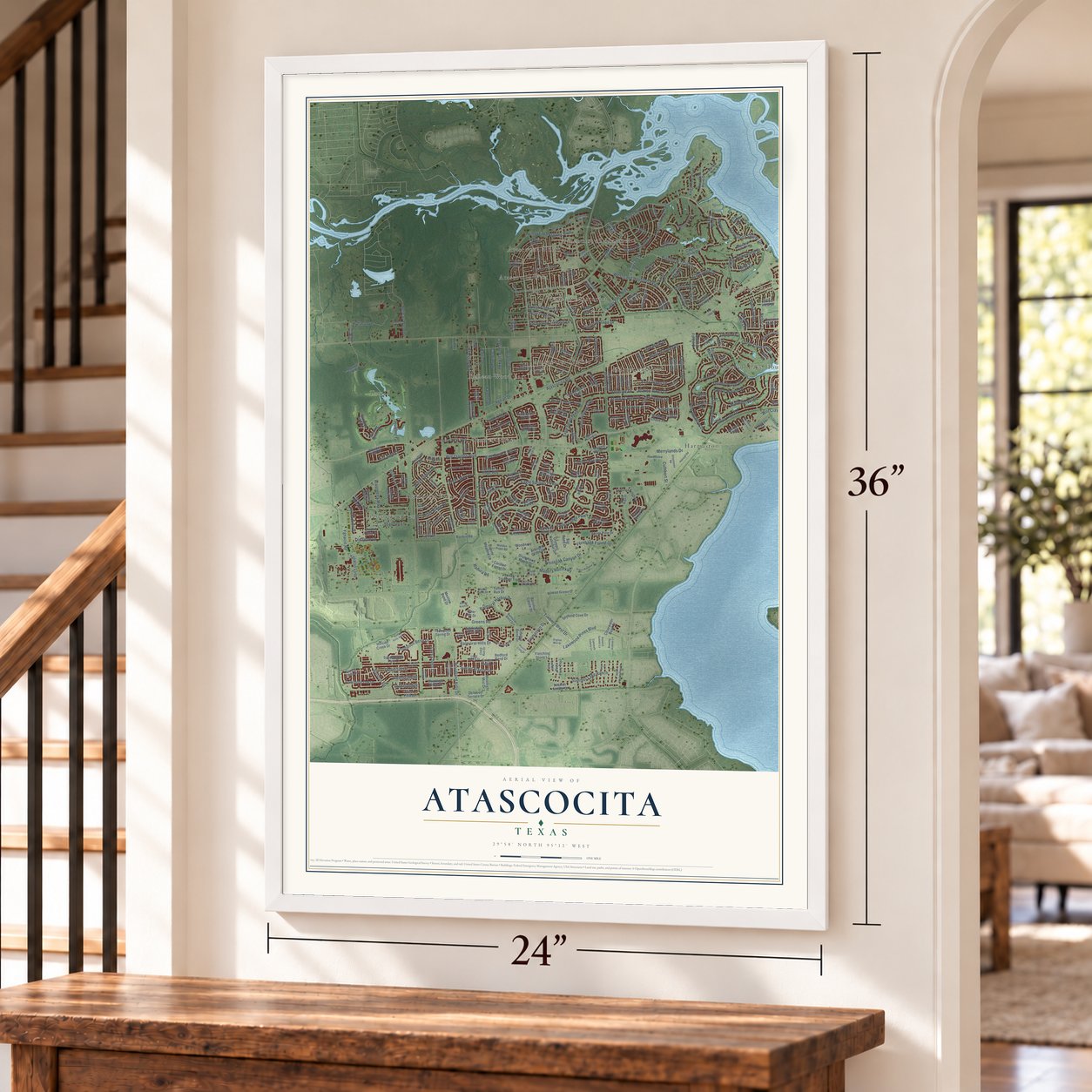
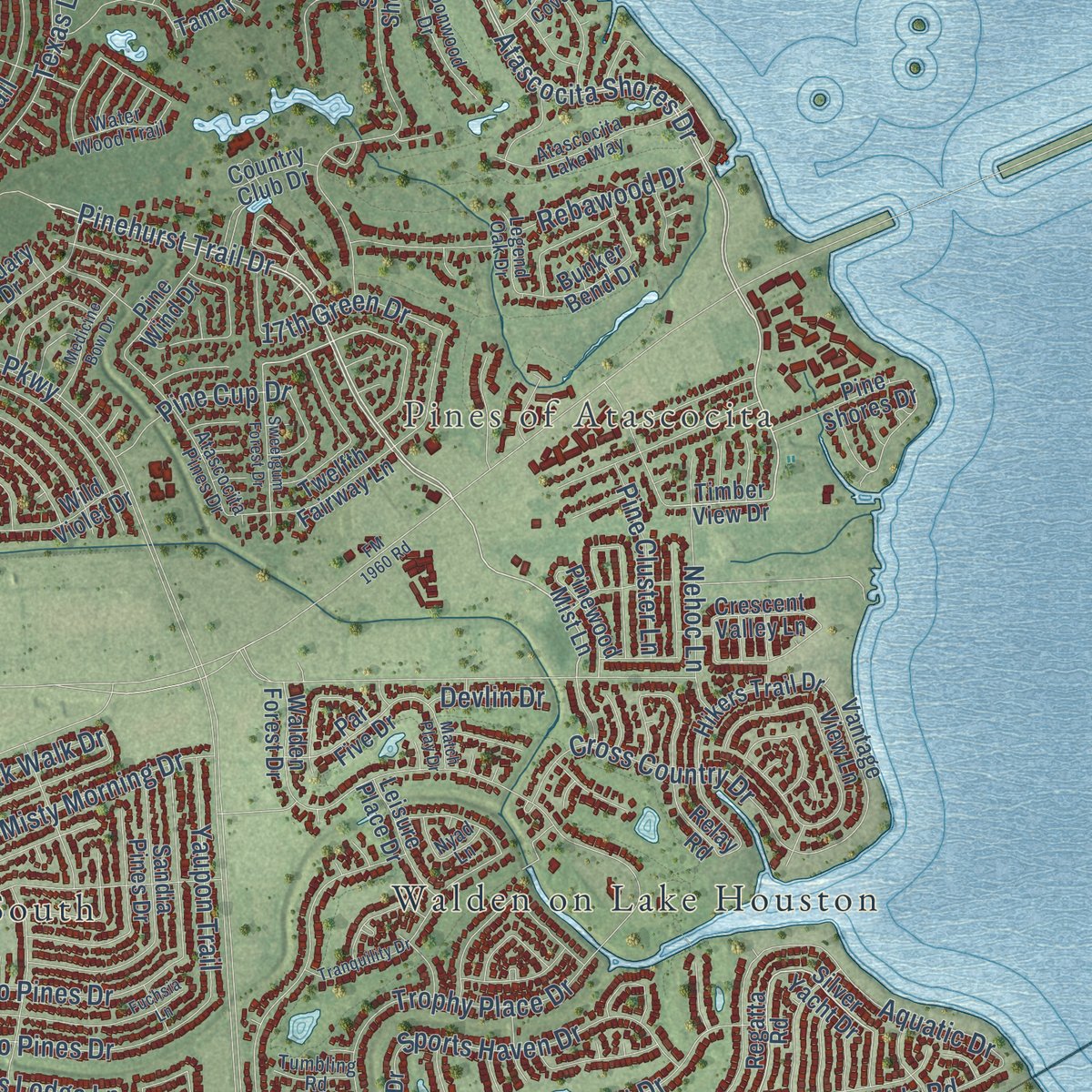
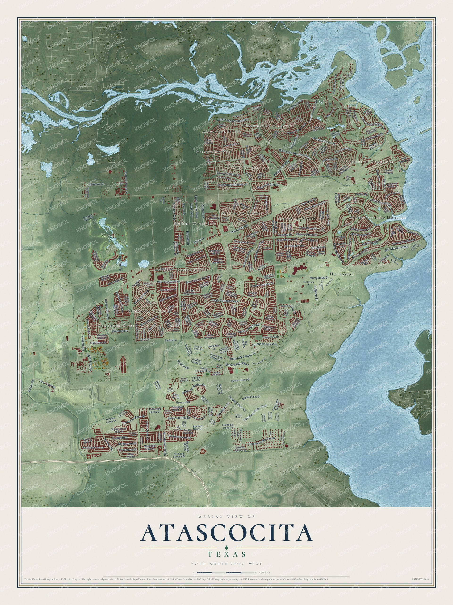
Explore Atascocita, Texas from a whole new perspective. Created using aerial imagery and detailed geographic data, this map captures Atascocita building by building, with labeled streets, familiar landmarks, and shaded topographical relief that highlights the natural contours of the landscape.
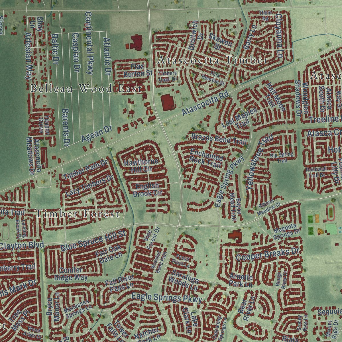
Combining modern data with the timeless character of a vintage atlas, this map is just as interesting up close as it is beautiful on the wall. Whether you grew up in Atascocita, spent memorable years there, or call it home today, this unique map is a great way to celebrate a place that means something to you. Zoom in on the preview to look for your street, and then order a print to put your memories on the wall.
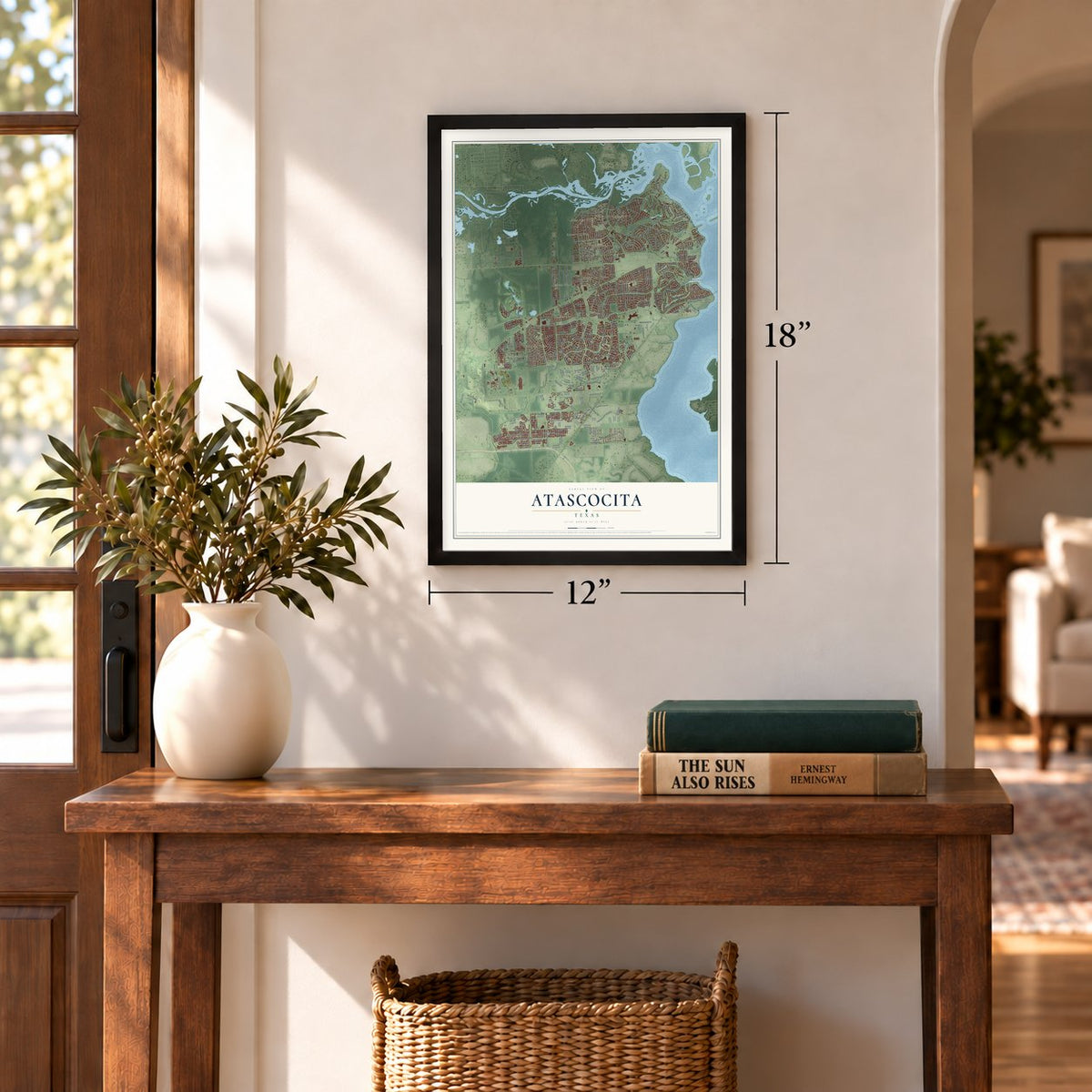
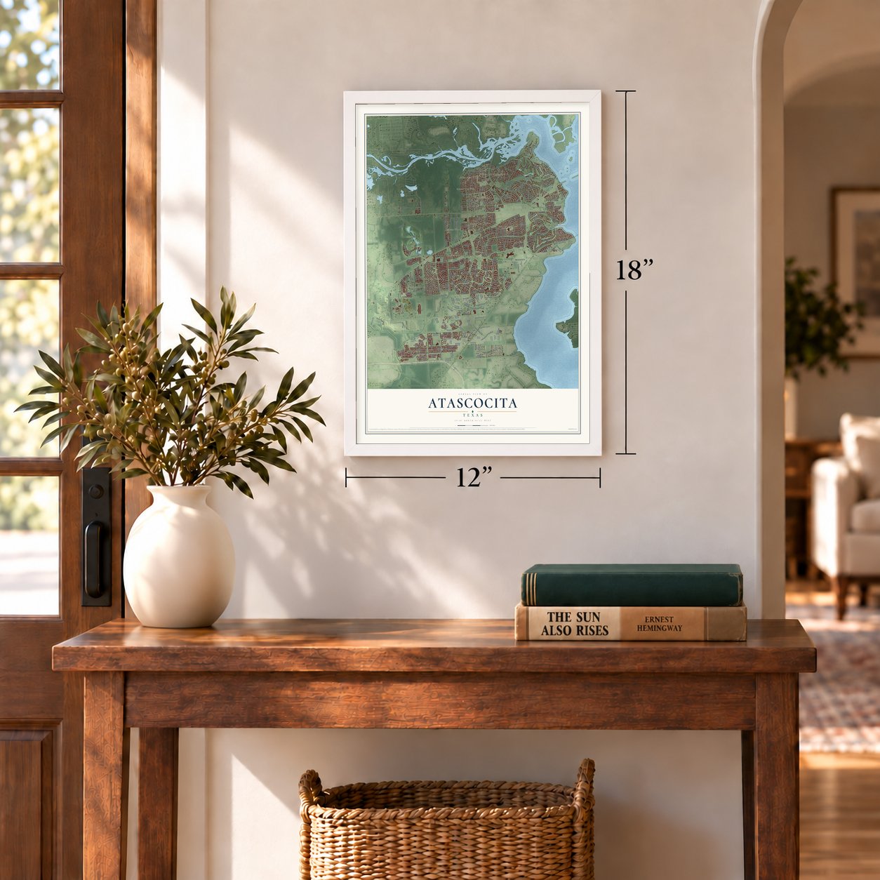
Three ways to hang it
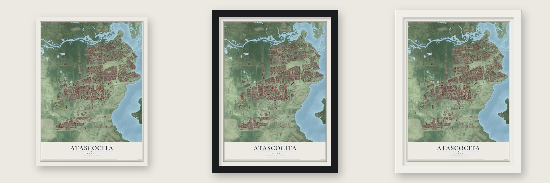
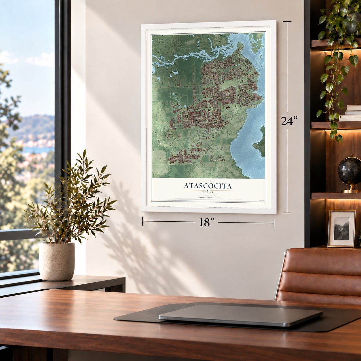
Unframed archival matte, a black wood frame or a white wood frame.
Up close
Geography Worth Displaying
This map was created using accurate cartographic data and authoritative geographic sources, including the U.S. Geological Survey and the Census Bureau. The map brings together terrain, waterways, roads, and building detail. The majority of the streets are labeled, houses are accurately depicted, and the topography is derived from government sources. Combining local data with carefully composed color and shading leads to this beautifully detailed Atascocita artwork for your wall.
Rather than simply showing street outlines, we’ve included as many of the street names as we could reasonably fit on the map while keeping their names legible. Zoom in on the high resolution preview to see exactly what’s on the map. We truly set out to create a statement piece for anyone who loves Atascocita. So whether it’s for you, or a gift for someone you love, we hope this map of Atascocita brings back fond memories.
Read the story behind this map of Atascocita, Texas from 2026.
Find your street
Names on the Atascocita map
Every name below is printed on this map. Look for your street, your school, the park where you played, or the pond down the road.
Places and landmarks14
- Pines of Atascocita
- Atascocita Acres
- Atascocita Timber
- Timber Forest
- Pinehurst of Atascocita
- Walden on Lake Houston
- Harmaston
- Atascocita West
- Belleau Wood East
- Atascocita South
- Atascocita Forest
- Atascocita North
Show all 14 places
- Oaks of Atascocita
- Tour 18
Streets and roads307
- Timber Forest Drive
- Atascocita Shores Drive
- Pinehurst Trail Drive
- Kings River Drive
- Will Clayton Parkway
- Kings Parkway
- Yellowstone Trail
- West Lake Houston Parkway
- Woodland Hills Drive
- Atascocita Road
- Madera Run Parkway
- Will Clayton Boulevard
- Valley Lodge Parkway
- Eagle Springs Parkway
- Greens Road
- Water Point Trail
- Polo Meadow Drive
- Kings Lake Estates Boulevard
- Trophy Place Drive
- Shannon Lane
- Ygnacio Loop
- Silver Lure Drive
- Summer Lake Ranch
- Lakewood Pines Boulevard
- Ralston Road
- Continental Parkway
- Kings Park Way
- Forest Timbers Drive
- Balmoral Hills Drive
- Barents Drive
Show all 307 streets
- Malardcrest Drive
- Thompson Bend Drive
- Cross Country Drive
- Wells Mark Drive
- Baltic Drive
- Sunset Breeze Drive
- Wilson Road
- Enchanted Timbers Drive
- Artesian Way
- Rebawood Drive
- Aquatic Drive
- Texas Laurel Trail
- Thorncliff Drive
- Firesign Drive
- Ygnacio Road
- Caspian Drive
- Fernbank Forest Drive
- Atlantic Drive
- Blanco Pines Drive
- Whiteoak Canyon Drive
- Sports Haven Drive
- Oak Walk Drive
- Rolling Rapids Road
- Echo Pines Drive
- Huffman Lane
- 17th Green Drive
- Balmoral Harbor Drive
- Kingwood Glen Drive
- Misty Morning Drive
- Deer Trail Drive
- Nehoc Lane
- Liles Lane
- Blue Spruce Hill Street
- Merrylands Drive
- Yaupon Trail
- Belleau Wood Drive
- Leens Lodge Lane
- Wintergreen Drive
- Fire Sage Drive
- Ambergate Drive
- Cyril Drive
- Hot Creek Trce
- Atasca Creek Drive
- Misty Ridge Drive
- Cooper Breaks Drive
- Aerobic Drive
- Pine Cluster Lane
- Loys Coves Court
- Cuthbert Street
- Pine Cup Drive
- Atascocita Way
- Hunters Terrace
- Cloyanna Lane
- Formaston Drive
- Drakeland Drive
- Agean Drive
- Radura Road
- Treeline Drive
- Old Draw Drive
- Devlin Drive
- Atasca Oaks Drive
- Atascocita Point Drive
- Delwood Terrace Drive
- Bedford Bend Drive
- Silver Yacht Drive
- Talmadge Reach Drive
- Crathie Bend Drive
- Whisper Bluff Drive
- Regatta Road
- Timber View Drive
- Sylvan Dale Drive
- Eagle Spring Parkway
- Walden Forest Drive
- Kentington Oak Drive
- Sunny Shores Drive
- Crestline Road
- Wild Violet Drive
- Shrub Oak Drive
- Upper Lake Drive
- Twelfth Fairway Lane
- Atascocita Bend Drive
- Hikers Trail Drive
- Droitwich Drive
- Sequoia Kings Drive
- Kings River Point
- Cherry Oaks Lane
- Atasca South Drive
- Hillside Creek Drive
- Possum Park Road
- Shay Lane
- Pine Shores Drive
- Bluewater Cove Drive
- Tamarron Drive
- Moonlight Mist Drive
- Winding Green Drive
- Olympic National Drive
- Relay Road
- Blackstone Trail Drive
- Barry Lane
- Hampton Hills Drive
- Flax Burton Street
- Oak Briar Drive
- Kelly Mill Lane
- Enchanted Rock Trail
- Fawn Trail Lane
- Davenport Hills Lane
- Seybold Cove Drive
- Teakwood Spring Drive
- Brazos Bend Trail
- Tree Moss Place
- Rowan Green Drive
- Bear River Lane
- Fall River Pass Lane
- Sandia Pines Drive
- Fountain Lilly Drive
- Blanton Forest Drive
- Albright Grove Drive
- Texas Trumpet Trail
- Lazy Timbers Drive
- Pine Wind Drive
- Chaplin Place Drive
- Dunberry Trail
- Fair Oak Dale Lane
- Beretta Bend Drive
- Atascocita Trail
- Drummond Maple Drive
- Conifer Ridge Way
- Badlands Bend Lane
- Itasca Pine Drive
- January Drive
- Quail Tree Lane
- Pinto Pony Trail
- Timber Path Drive
- Woodglen Shadows Drive
- Spring Brook Pass Drive
- Pine Trail Lane
- Clearwater Bend Drive
- Vantage View Lane
- Baronial Castle Drive
- Lupine Meadow Lane
- Aerobic Avenue
- Leisure Place Drive
- Lost Maples Trail
- Golden Oasis Lane
- Clear Fork Drive
- Half Moon Trail
- Atascocita Meadows Drive
- Pinewood Mist Lane
- Bunker Bend Drive
- Saratoga Woods Lane
- Woodnote Lane
- Crockett Bend Lane
- Hawthorne Hill Circle
- Leather Saddle Court
- Par Five Drive
- Sunlight Peak Lane
- Moonlight Ridge Drive
- Bryce Manor Lane
- Grand Arches Lane
- Carillon Forest Drive
- Rankin Road
- Langkawi Lane
- Fletching Stone Lane
- Crescent Valley Lane
- Mossy Grove
- Wigeon Way Drive
- English Brook Circle
- Natchez Park Lane
- Arnette Park Lane
- Tower Falls Lane
- Tullich Run Drive
- Redbud Trail
- Scenic Vista Drive
- Lake Clark Lane
- Ross Lake Court
- Wisteria Chase Place
- Hannah Oaks Lane
- Skewen Street
- Country Club Drive
- Menlow Bend Drive
- Big Reed Drive
- Maillart Way
- River Dee Drive
- Riata River Lane
- Moon Trail Drive
- Solly Oak Place
- Sierra Lane
- Magenta Springs Drive
- Skene Bend Drive
- Dawn Mist Drive
- Balmoral Bend Drive
- Atascocita Lake Way
- Timber Way Drive
- Spoonwood Drive
- Atascocita Pines Drive
- Sabine Point Drive
- Moonshine Hill Loop
- Mossy Timbers Drive
- Vine Forest Drive
- Mount Riga Drive
- Tahoe Shores Court
- Oak Station Drive
- Bayou Mead Trail
- Iron Horseshoe Lane
- Loch Muick Drive
- Walden Pines Road
- Water Wood Trail
- Timber Trace Drive
- Hawksview Street
- Ganter River Trail
- Peach Orchard Drive
- Amber Cove Drive
- Manasses Springs Lane
- Legend Oak Drive
- Summer Sunset Drive
- Castano Creek Drive
- Tumbling Road
- Oaktrace Drive
- Yaupon Grove
- Ordie Run Drive
- Caroling Oaks Court
- Turtle Cove Court
- Brindle Trail
- Dain Place
- Pecos Park Lane
- Nyad Lane
- Provost Craig Drive
- Sierra National Drive
- Sunset Creek Drive
- Sun River Falls Drive
- Tranquility Drive
- Fuchsia Lane
- Auburn Oak Trail
- Sweetgum Forest Drive
- Running Arabian Lane
- Swiftbrook Drive
- Atascocita Place Drive
- Flax Bourton Street
- Cascading Springs Lane
- Rosebud Bend Drive
- River Brook Drive
- Glenhew Road
- Village Grove Drive
- Bridle Court
- Rivergrove Bend Drive
- Medicine Bow Drive
- Big Spring Trail
- Greystanes Road
- Great Forest Court
- Thom Road
- Capewood Drive
- Match Play Drive
- Wind Cove Place Court
- Holroyd Road
- Ribbon Meadow Court
- San Juanico Street
- Rockwall Trail Drive
- Oakheath Colony Lane
- English Mist Drive
- Humble Gully Run Drive
- Landing Brook Drive
- Water Point Court
- Rosehill Summit Lane
- Wooded Bend Path
- Bazley Knoll Drive
- Waterbury Edge Lane
- Wood Arbor Court
- Meadow Rose Court
- Svensson Slade Lane
- Timbers Quail Drive
- Fossil Point Lane
- FM 1960 Road
- Royce Holly Drive
- Pinyon Bend Drive
- Rough River Court
- Alsey Rose Drive
- Stoney Rise Lane
Names are listed as they appear on the printed map. Zoom into the product photos to find them.
About Atascocita, Texas
Atascocita is a census-designated place of 88,174 people in Harris County, with Lake Houston along its eastern edge, about 18 miles northeast of downtown Houston. Its name comes from Atascocito, a military outpost the Spanish built in 1756, and from the road they laid out from it. That road ran from Spanish Louisiana west to San Antonio, linking eastern Texas with the rest of New Spain, and American settlers used it to reach Texas in the 1820s and 1830s. No one knows when the final o changed to an a.
Houston annexed parts of the area in the 1960s but gave them up again in the late 1970s, the same decade that building began here. By the 1990s the community held fifteen neighborhoods, and few developments around Houston were growing faster. The Census Bureau first drew its boundaries for the 2000 census, which counted 35,757 people, and the count climbed to 65,844 by 2010.
- A library neighbors fought forIn 1986 the Atascocita Hi Neighbor group started pushing for a library of its own. With help from Janette Dennis, a local resident and philanthropist, the 12,000-square-foot Harris County Public Library branch went up between 1994 and 1996 and opened on May 5, 1996. The Friends of the Atascocita Library, a group Dennis helped lead, gives it around $20,000 each year.
- A high school like MonticelloAtascocita teenagers once went to Humble High School, but the community grew so fast that it needed its own. Atascocita High School opened in 2006 on a wooded 100-acre tract in the middle of the community. Its outside was modeled on Thomas Jefferson's Monticello, and the 435,000-square-foot building cost $46.9 million. In 2010 the state named it a Recognized campus.
- Atascocita Park, 2020Harris County opened Atascocita Park on Lake Houston Parkway on June 24, 2020, at a cost of $11,500,000. The 20-acre park has a dog park of 1 acre, a boardwalk beside a 2-acre pond and a playground with skywalks.
- Golf by Lake HoustonThe community has several country clubs and golf courses, among them Atascocita Country Club and Walden on Lake Houston Golf and Country Club. Tour 18 recreates some of the most famous golf holes in the United States.
Keep exploring Texas
Atascocita is one of 2,049 Texas towns we've mapped. Every dot on the map is a print of its own.
The search covers every state, Texas first.
Near Atascocita
Order 2 or more town maps and save 10%. Shown in the size and finish you picked above, so they hang as a set.
- Humble 12" x 18" / Archival Matte Print $39.99
- Kingwood 12" x 18" / Archival Matte Print $39.99
- Huffman 12" x 18" / Archival Matte Print $39.99
More maps nearby: Porter, Sheldon, Crosby, Royalwood and Orange Grove.
The art of mapping a place
How This Map Was Made
Real places. Remarkable detail. Discover the layers that turn geographic data into a map of home.

The view from above
Aerial imagery reveals the character of the land: woodland, open fields, and the patterns of a place.

The shape of the land
Elevation data brings hills, valleys, and subtle changes in the landscape into view.

The details of home
Roads, waterways, and building footprints come together to make the map feel unmistakably local.

Geography becomes art
Considered color, shading, and typography bring the layers together in a map made for your wall.


Process illustrated with Mendon, Massachusetts. Aerial imagery: USDA NAIP. Terrain: USGS 3D Elevation Program. Map details and finished artwork: KNOWOL.
The Details
About This Print
Choose an archival matte print, or a black or white Ayous wood frame. The archival matte print is unframed.
Select your size and finish above to see the matching product image and price.
Materials & Craftsmanship
A contemporary map with the character of a classic atlas, printed on archival matte paper. Optional frames are made from Ayous wood.
Your printed map does not include the watermark shown in the full-map preview.
Shipping & Delivery
Free shipping within the United States. Every print is made to order in the USA.
Buying a gift? Add a note in your cart and we'll include it. We never put prices in the package.
Prints ship within 2 to 3 business days. Allow 7 to 10 days total from ordering for delivery. Timing may vary during holidays or periods of high order volume.
Read our shipping policy.
Returns and damaged prints
Each print is made to order. Change-of-mind refunds are not available after production.
If your print arrives damaged, misprinted or incorrect, contact support@knowol.com within 30 days of receiving it. Include your order number, photos and a description of the issue.
Read our full refund and replacement policy. For questions about your order, email support@knowol.com.