
Search for another town

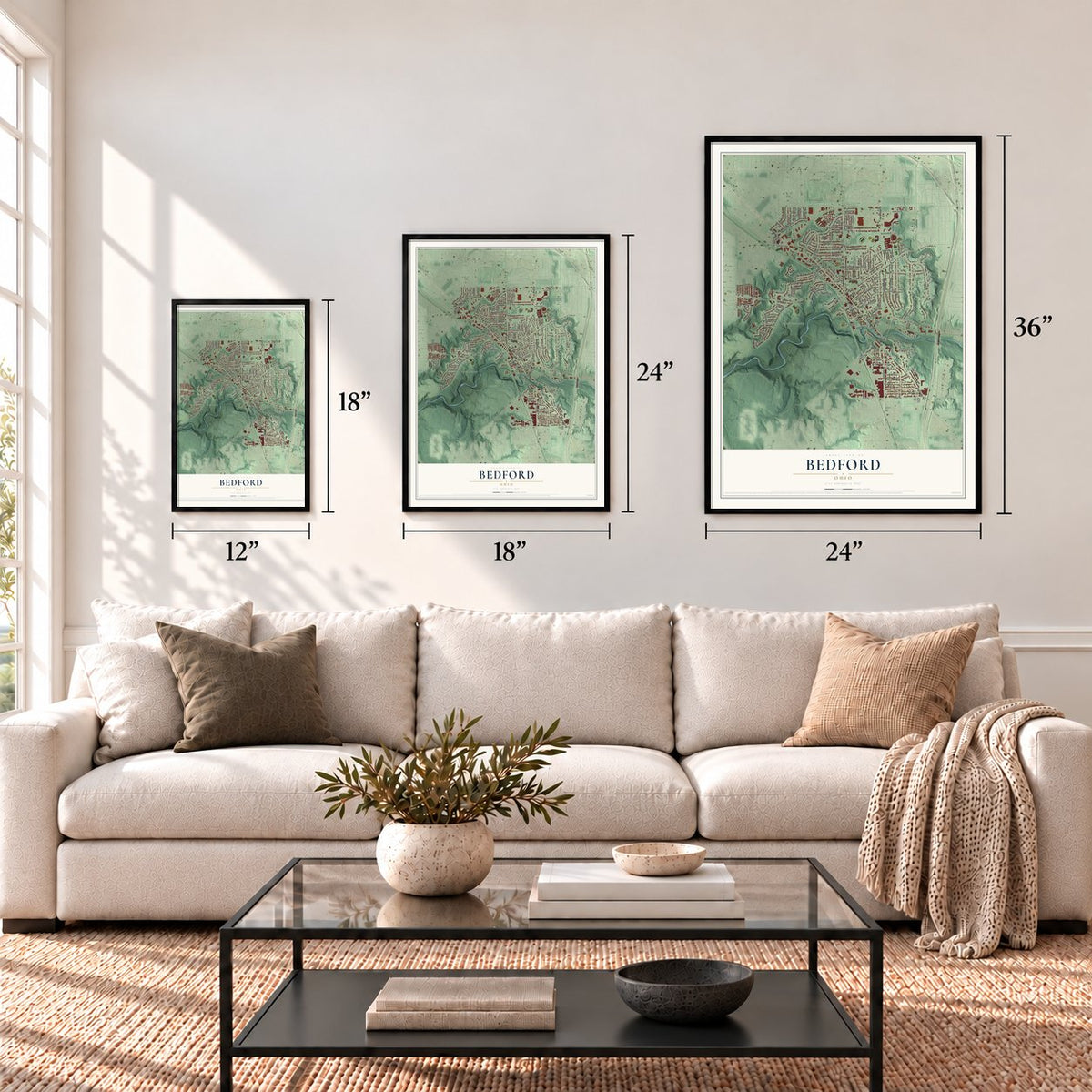
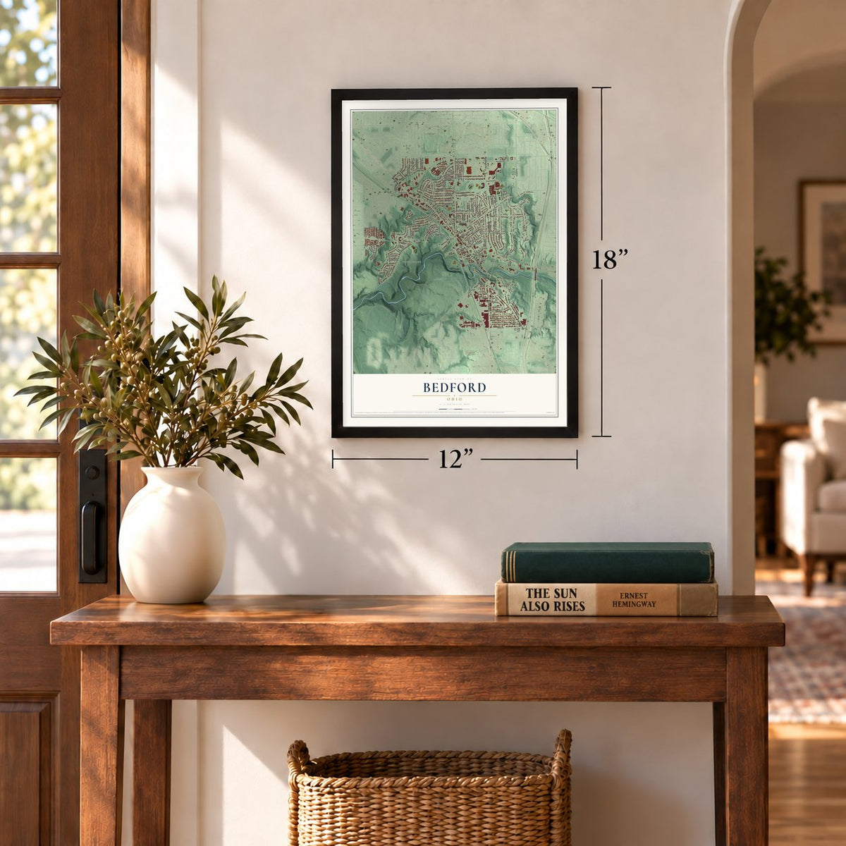
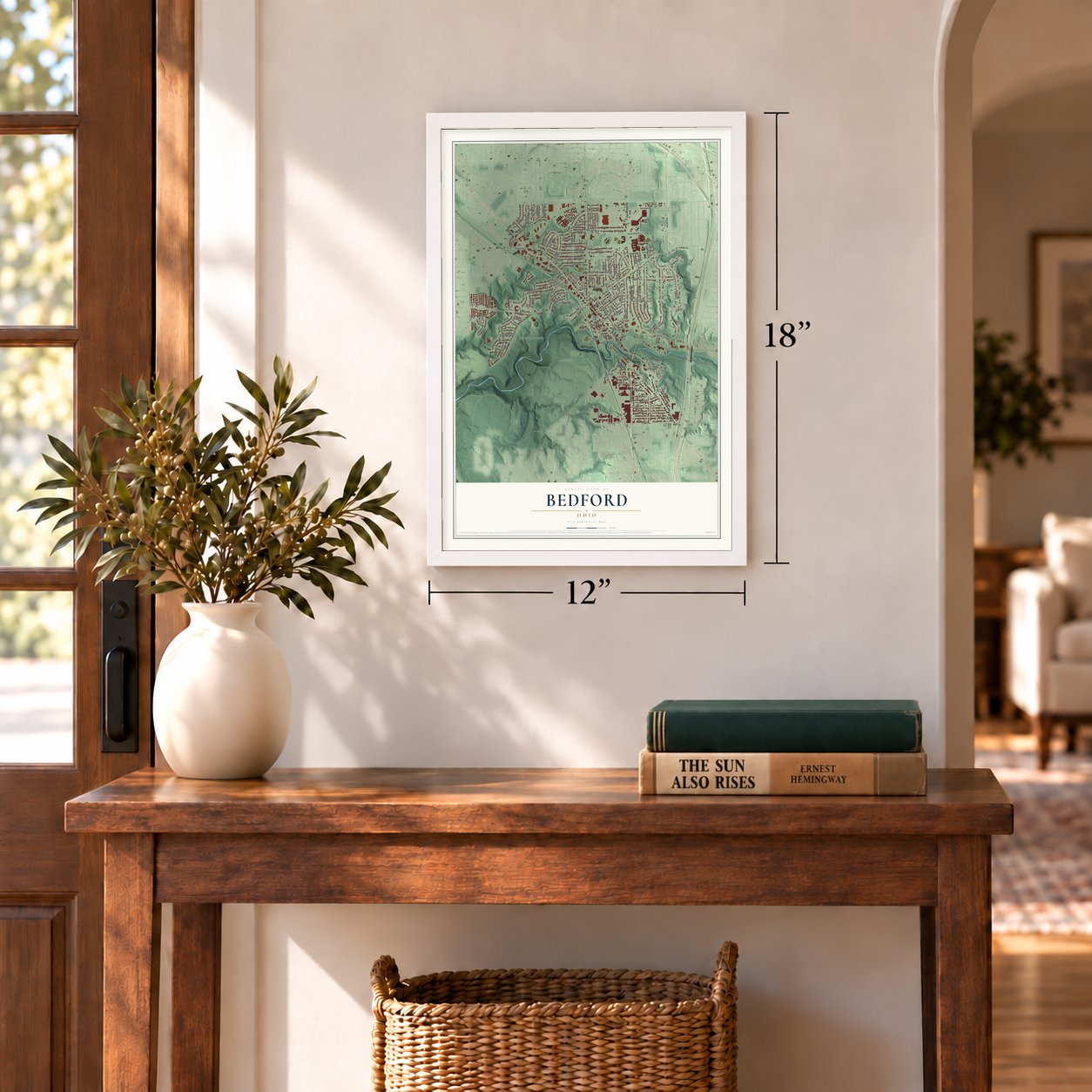
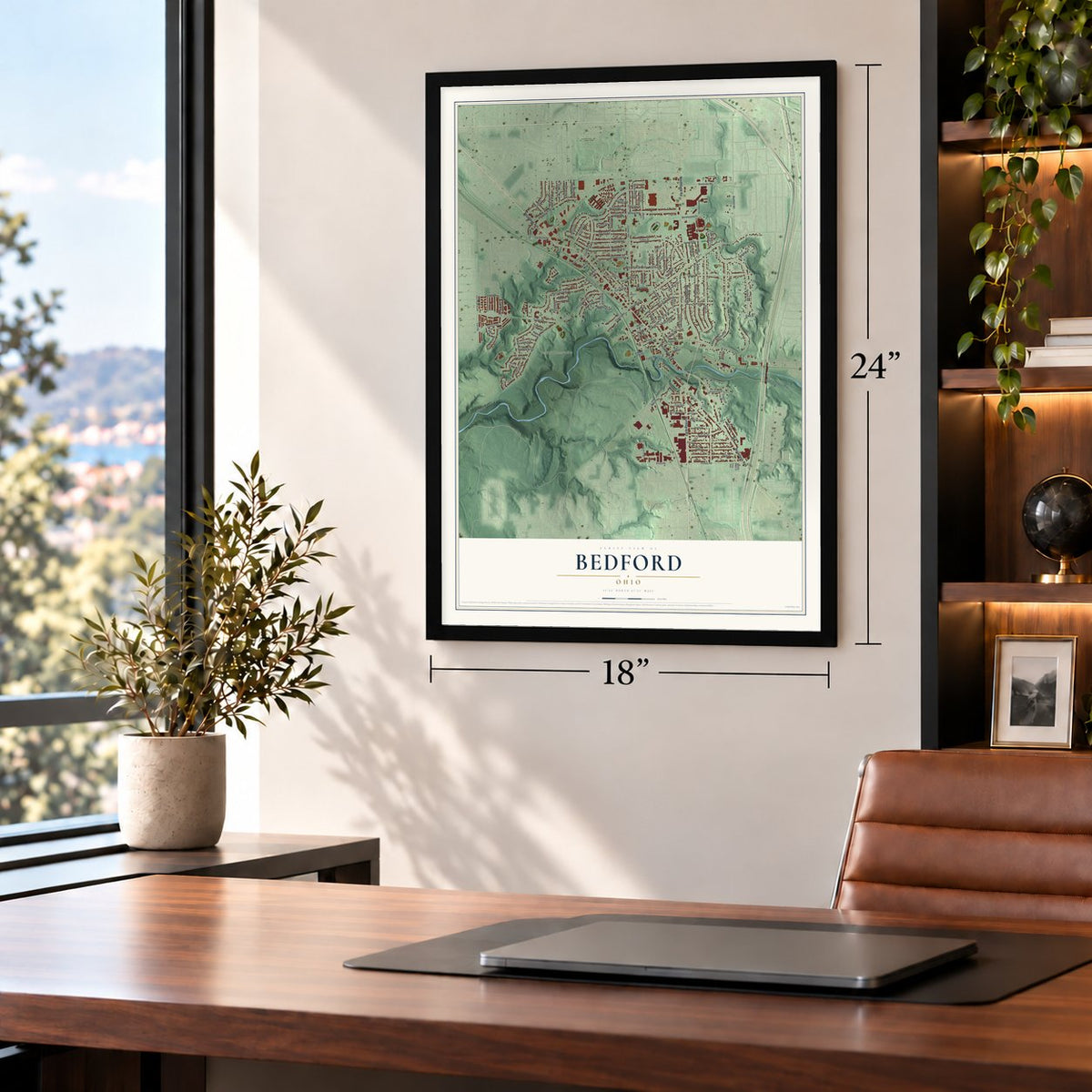

Free U.S. delivery 7 to 10 days after you order
Bedford, Ohio Map Art
Building by building, with labeled streets and shaded relief.
12" x 18" Archival Matte Print
A Map of Home. A Work of Art.
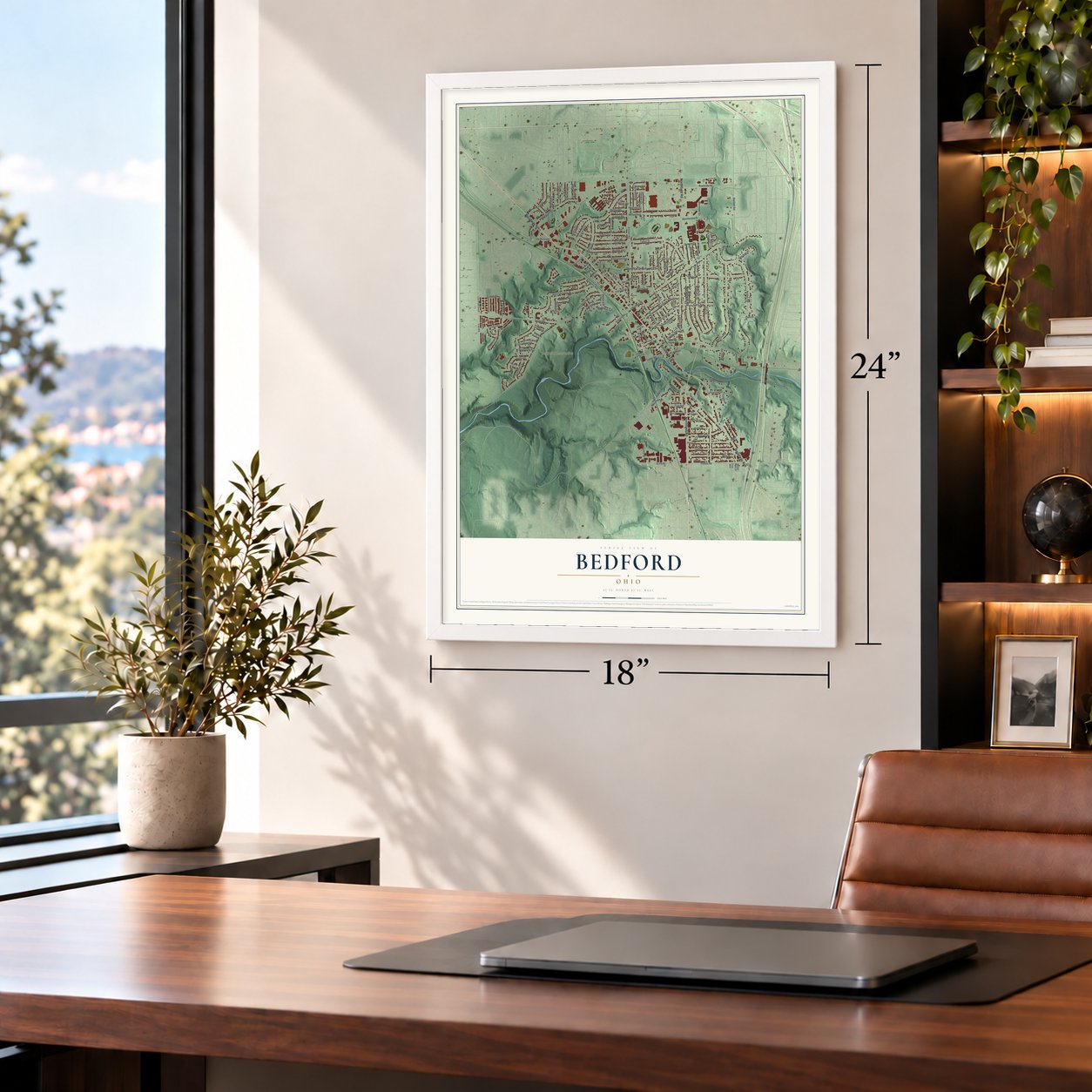
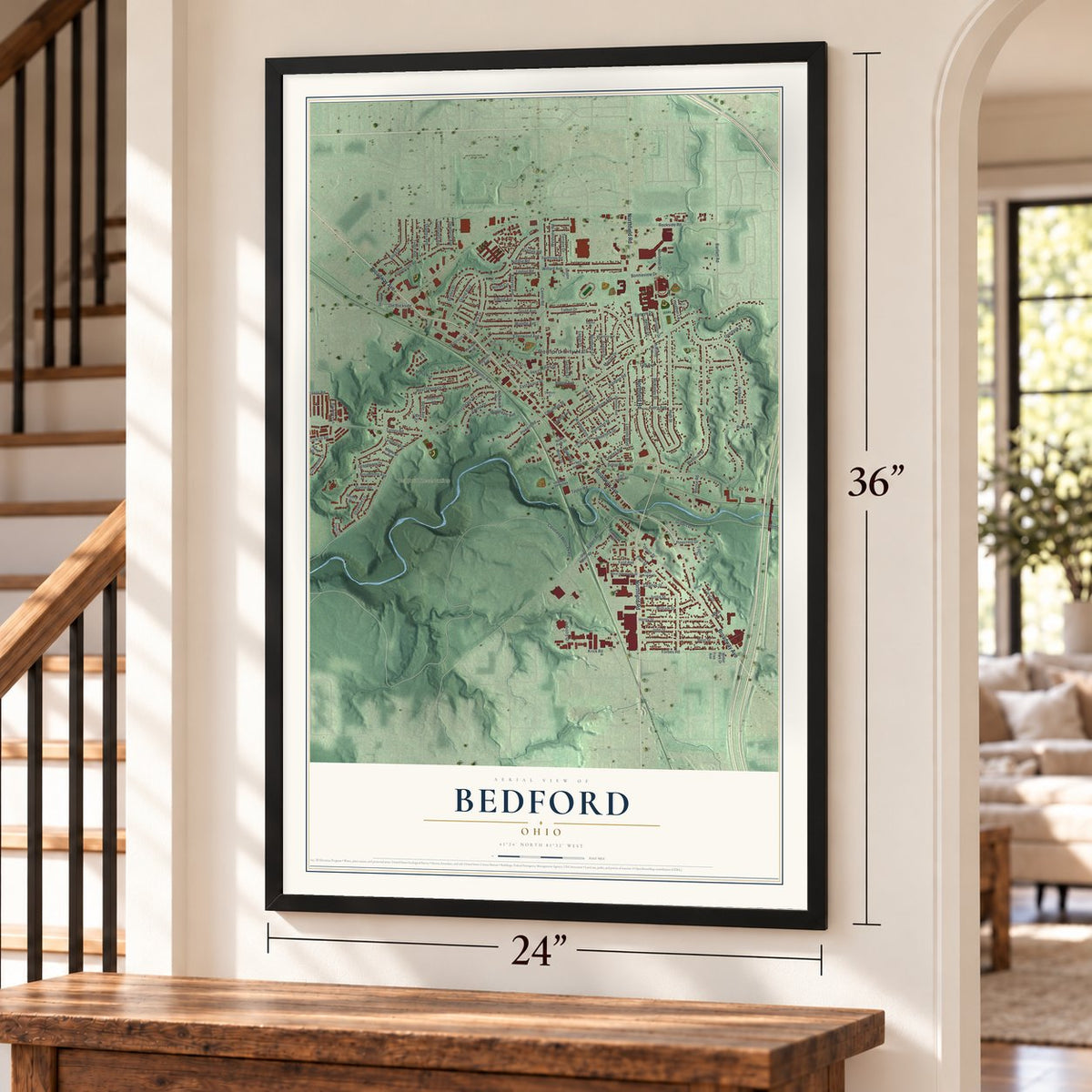
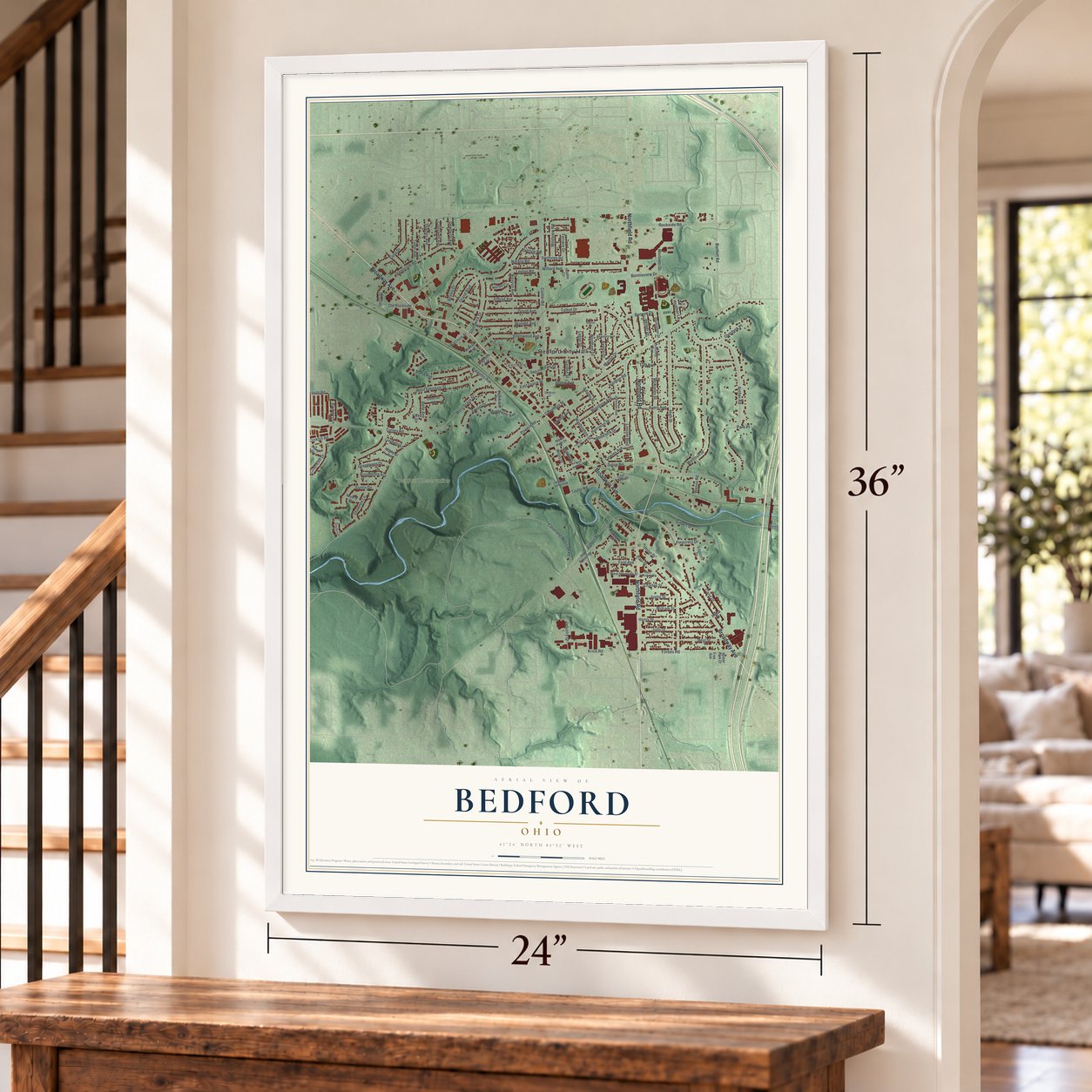
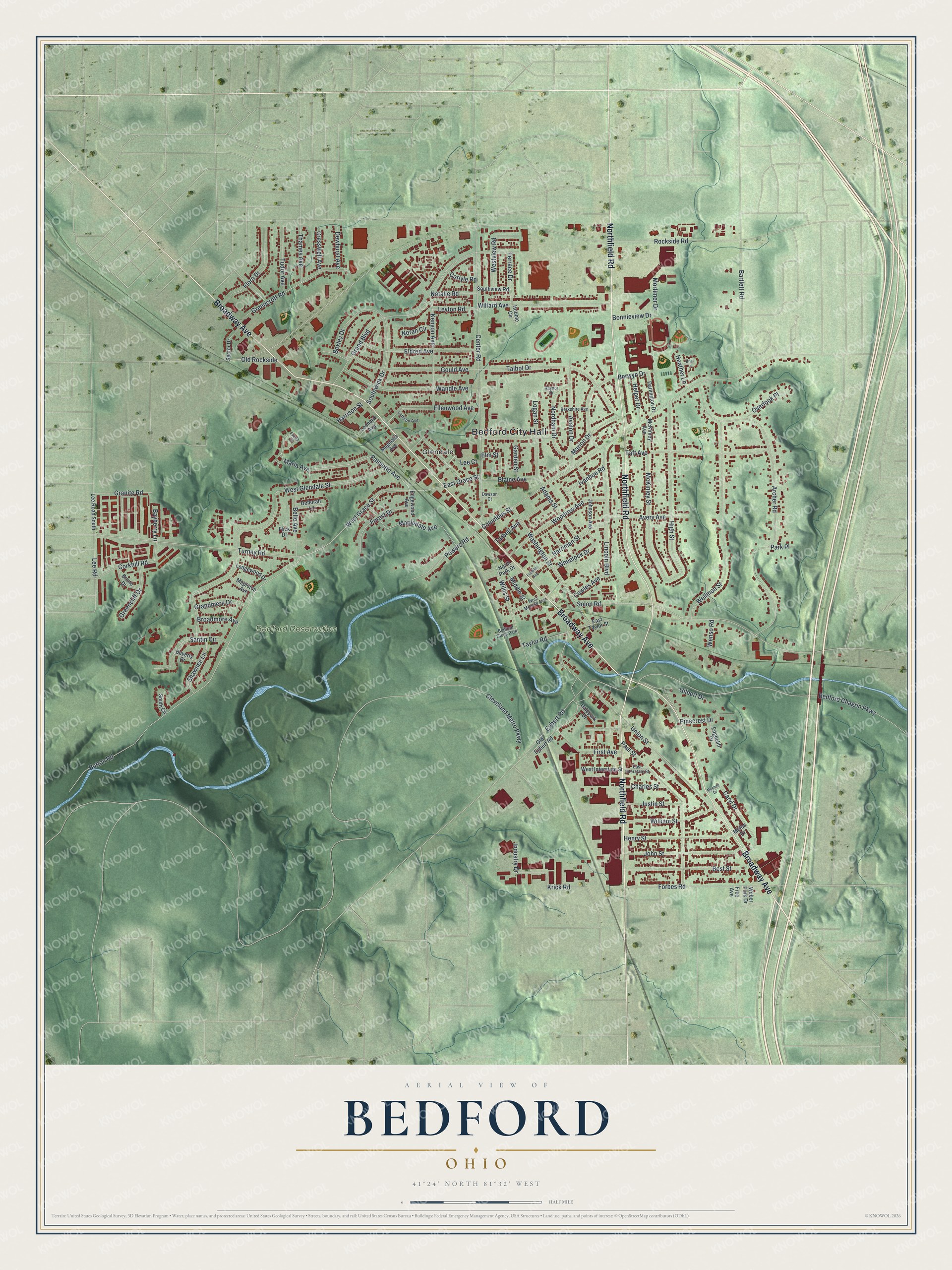
Explore Bedford, Ohio from a whole new perspective. Created using aerial imagery and detailed geographic data, this map captures Bedford building by building, with labeled streets, familiar landmarks, and shaded topographical relief that highlights the natural contours of the landscape.
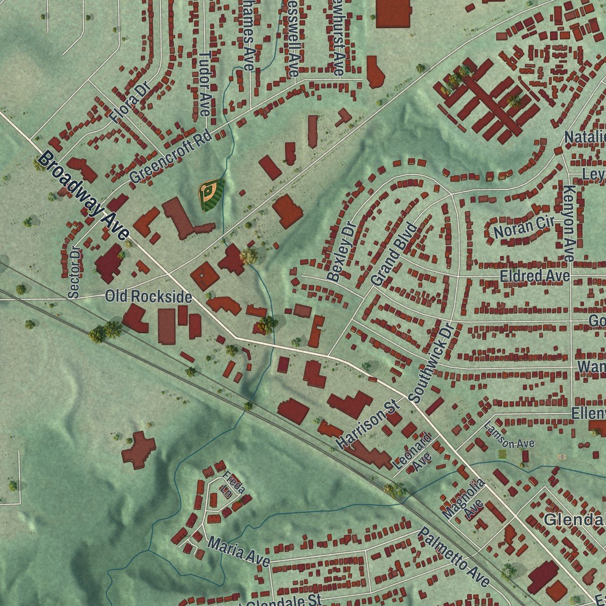
Combining modern data with the timeless character of a vintage atlas, this map is just as interesting up close as it is beautiful on the wall. Whether you grew up in Bedford, spent memorable years there, or call it home today, this unique map is a great way to celebrate a place that means something to you. Zoom in on the preview to look for your street, and then order a print to put your memories on the wall.
Three ways to hang it
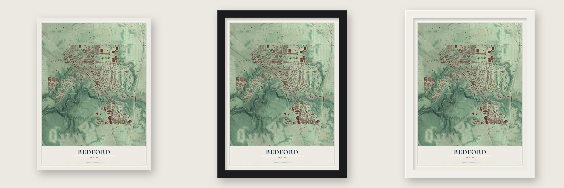
Unframed archival matte, a black wood frame or a white wood frame.
Up close
Geography Worth Displaying
This map was created using accurate cartographic data and authoritative geographic sources, including the U.S. Geological Survey and the Census Bureau. The map brings together terrain, waterways, roads, and building detail. The majority of the streets are labeled, houses are accurately depicted, and the topography is derived from government sources. Combining local data with carefully composed color and shading leads to this beautifully detailed Bedford artwork for your wall.
Rather than simply showing street outlines, we’ve included as many of the street names as we could reasonably fit on the map while keeping their names legible. Zoom in on the high resolution preview to see exactly what’s on the map. We truly set out to create a statement piece for anyone who loves Bedford. So whether it’s for you, or a gift for someone you love, we hope this map of Bedford brings back fond memories.
Find your street
Names on the Bedford map
Every name below is printed on this map. Look for your street, your school, the park where you played, or the pond down the road.
Places and landmarks5
- Bedford City Hall
- Glendale
- Bedford Reservation
- Taft Park
- Bedford Glens Park
Streets and roads139
- Broadway Avenue
- Northfield Road
- Maria Avenue
- Palmetto Avenue
- West Grace Street
- Center Road
- Rockside Road
- Columbus Street
- West Glendale Street
- Archer Road
- Solon Road
- Bedford Chagrin Parkway
- Union Street
- Wellmon Street
- Turney Road
- Grand Boulevard
- Forbes Road
- High Street
- Paul Street
- Talbot Drive
- Willis Street
- Bartlett Road
- Taft Avenue
- Washington Street
- Wandle Avenue
- Egbert Road
- Willard Avenue
- McKinley Street
- Gould Avenue
- Lincoln Boulevard
Show all 139 streets
- Best Street
- Berwyn Drive
- Greencroft Road
- John Street
- Eldred Avenue
- Woodrow Avenue
- Henry Street
- Kenyon Avenue
- Avalon Drive
- Button Road
- Gilbert Drive
- Ellenwood Avenue
- Flora Drive
- William Street
- Santin Circle
- Nordham Drive
- Southwick Drive
- Powers Road
- Mapledale Avenue
- Corkhill Road
- Caryl Drive
- Avery Avenue
- Forest Drive
- Cleveland Metro Parkway
- Logan Street
- Bexley Drive
- Lee Road
- Westview Road
- First Avenue
- Industry Drive
- Adams Street
- Harriman Street
- Tarbell Avenue
- Marion Drive
- Tudor Avenue
- Wheelock Drive
- Belle Avenue
- Shawnee Lane
- Greencliff Drive
- Justin Street
- Granite Road
- Taylor Road
- Pinecrest Drive
- Blaine Avenue
- Thames Avenue
- Grandmere Drive
- Terrace Drive
- Cowles Avenue
- Overlook Place
- Helper Drive
- Natalie Road
- Cresswell Avenue
- Leyton Road
- Ivanhoe Road
- Charles Street
- Bonnieview Drive
- Elm Street
- Dewhurst Avenue
- Broadmore Avenue
- Mortimer Drive
- Lee Court
- Garden Street
- Krick Road
- East Grace Street
- Old Rockside
- Heather Lane
- Harrison Street
- Bayberry Lane
- Noran Circle
- Carlyle Road
- Middle Street
- Wenso Road
- Park Place
- Old Egbert Road
- Johnson Avenue
- West Interstate Street
- Dalepark Drive
- Lee Road South
- Sector Drive
- Darlington Drive
- Magnolia Avenue
- Ledgewood Drive
- Flick Drive
- McKinley Avenue
- Brune Drive
- East Taylor Street
- Southview Road
- Edgewood Avenue
- Mapleton Avenue
- Deborah Lane
- Beverly Drive
- Edgecliff Drive
- Leonard Avenue
- South Circle
- Hubble Circle
- North Park Drive
- Weber Park Drive
- Free Avenue
- Melba Drive
- Lamson Avenue
- West Monroe Avenue
- Berkshire Avenue
- East Interstate Street
- Dawson Court
- Raynor Drive
- Freda Lane
- Franklin Avenue
- Mitchell Drive
- Briar Lane
Names are listed as they appear on the printed map. Zoom into the product photos to find them.
About Bedford, Ohio
Bedford is a city of 13,149 people in Cuyahoga County, southeast of Cleveland. Surveyors for the Connecticut Land Company marked this ground as township 6, range 11 of the Western Reserve. Settlers began arriving in 1813, drawn by the hardwood forests and by the waterfalls on Tinkers Creek, which could turn mills. Adams and Starr built the township's first mill at the mouth of the creek in 1815, and in 1823 Daniel Benedict, who had come from Bedford, New York, gave the township its name.
By 1837 the township had 475 people, and residents asked to form a village at its center. Bedford was incorporated on March 15, 1837, and Hezekiah Dunham, a wealthy businessman, gave three acres with his wife Clarissa for a public square and for churches and public buildings. Stagecoaches between Cleveland and Pittsburgh already stopped here, and the Cleveland & Pittsburgh Railroad began in 1852. The village adopted a city manager charter and became the City of Bedford in 1932.
“used as a public square forever.”
- The Dunham house, 1832In 1832 Hezekiah and Clarissa Dunham built one of the earliest houses around Bedford. Marked with the letters H & D above its door, the house survives today at 729 Broadway, and it was added to the National Register in 1975.
- A church begun in a parlorThe First Baptist Church was organized in 1834 with 14 members, meeting in Hezekiah Dunham's home. In 1893 the congregation moved into a building of its own, a Late Gothic Revival stone church on the Bedford Commons designed by Jacob Snyder. The church moved to Turney Road and West Glendale Avenue in 1968, and the Bedford Historical Society now owns the old stone building, listed on the National Register in 2002 as Bedford Baptist Church.
- Over 60 miles an hourBroadway began as part of the Mahoning Indian Trail and later carried the name Turnpike Road. By 1895 it was Main Street, and electric cars of the Akron, Bedford and Cleveland Railway ran down its center at more than 60 miles per hour. A state marker credits the railway as the country's first long-distance, high-speed electric interurban. Main Street was later renamed Broadway.
- The world's largest craneThe McMyler-Interstate Company set up in Bedford in 1910 and grew into the city's largest manufacturer. In 1919 its workers built the largest crane in the world.
- The Automile since 1956Car dealers started setting up on Broadway in the early 1950s, and in 1956 they founded the Bedford Automile Dealers Association to cooperate with the city. Today the Automile, along Rockside Road and Broadway, holds 24 dealerships, the largest collection of new and used car lots in Ohio, and it has raised money for causes that include Bedford High School scholarships.
Keep exploring Ohio
Bedford is one of 1,389 Ohio towns we've mapped. Every dot on the map is a print of its own.
The search covers every state, Ohio first.
Near Bedford
Order 2 or more town maps and save 10%. Shown in the size and finish you picked above, so they hang as a set.
- Bedford Heights 12" x 18" / Archival Matte Print $39.99
- Maple Heights 12" x 18" / Archival Matte Print $39.99
- Walton Hills 12" x 18" / Archival Matte Print $39.99

More maps nearby: Oakwood, North Randall, Warrensville Heights, Northfield and Valley View.
The art of mapping a place
How This Map Was Made
Real places. Remarkable detail. Discover the layers that turn geographic data into a map of home.

The view from above
Aerial imagery reveals the character of the land: woodland, open fields, and the patterns of a place.

The shape of the land
Elevation data brings hills, valleys, and subtle changes in the landscape into view.

The details of home
Roads, waterways, and building footprints come together to make the map feel unmistakably local.

Geography becomes art
Considered color, shading, and typography bring the layers together in a map made for your wall.


Process illustrated with Mendon, Massachusetts. Aerial imagery: USDA NAIP. Terrain: USGS 3D Elevation Program. Map details and finished artwork: KNOWOL.
The Details
About This Print
Choose an archival matte print, or a black or white Ayous wood frame. The archival matte print is unframed.
Select your size and finish above to see the matching product image and price.
Materials & Craftsmanship
A contemporary map with the character of a classic atlas, printed on archival matte paper. Optional frames are made from Ayous wood.
Your printed map does not include the watermark shown in the full-map preview.
Shipping & Delivery
Free shipping within the United States. Every print is made to order in the USA.
Buying a gift? Add a note in your cart and we'll include it. We never put prices in the package.
Prints ship within 2 to 3 business days. Allow 7 to 10 days total from ordering for delivery. Timing may vary during holidays or periods of high order volume.
Read our shipping policy.
Returns and damaged prints
Each print is made to order. Change-of-mind refunds are not available after production.
If your print arrives damaged, misprinted or incorrect, contact support@knowol.com within 30 days of receiving it. Include your order number, photos and a description of the issue.
Read our full refund and replacement policy. For questions about your order, email support@knowol.com.