
Search for another town





Free U.S. delivery 7 to 10 days after you order
Beekman, New York Map Art
Building by building, with labeled streets and shaded relief.
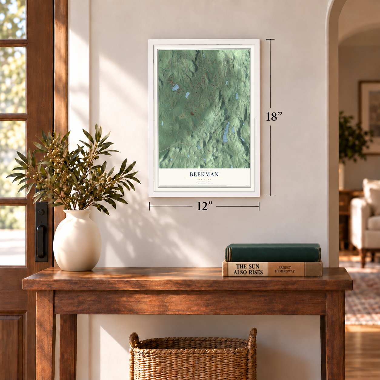
12" x 18" Archival Matte Print
A Map of Home. A Work of Art.
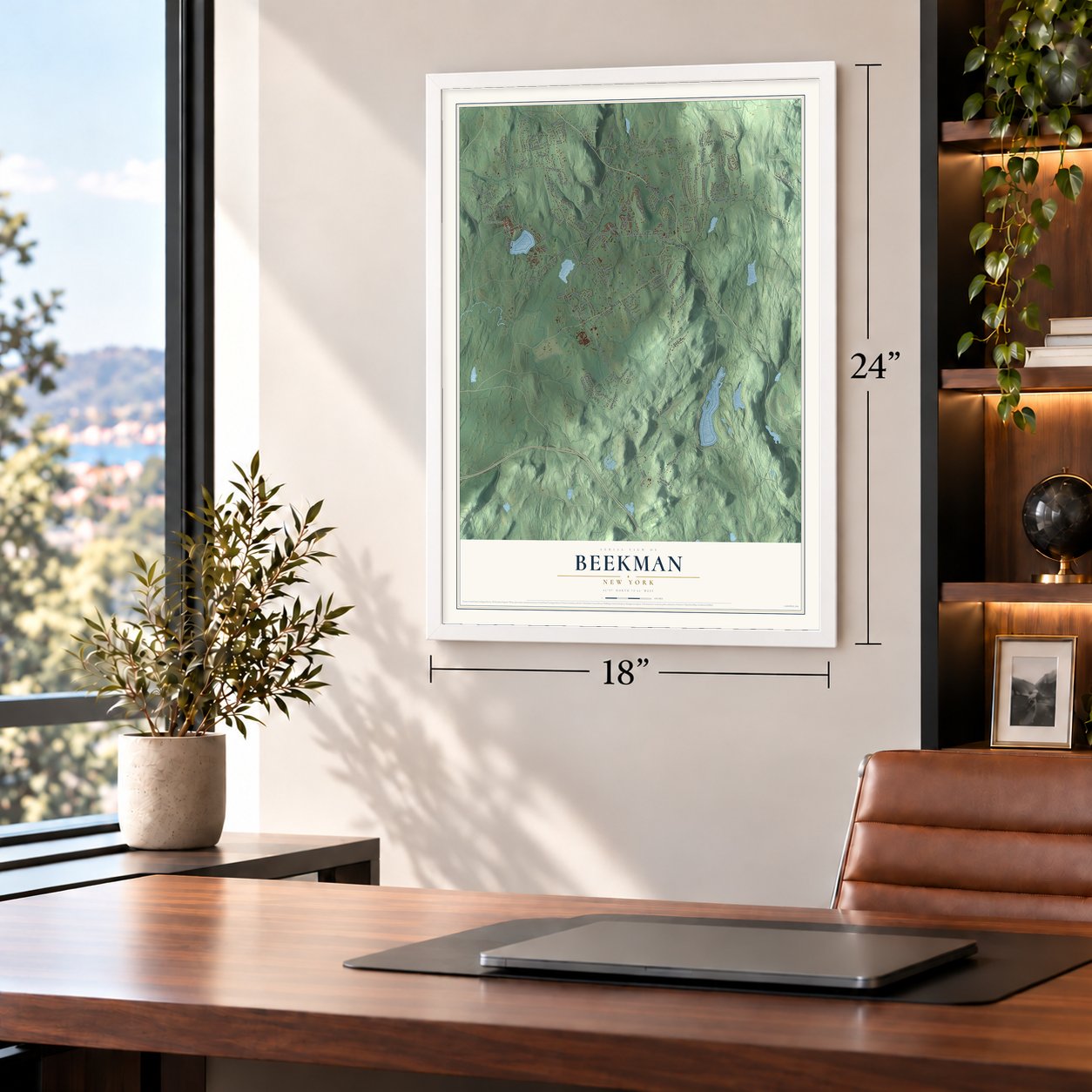
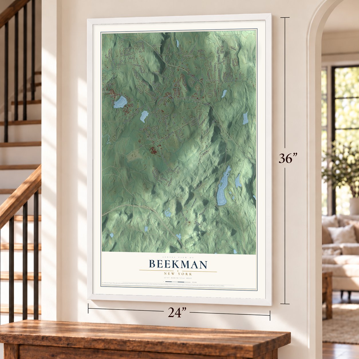
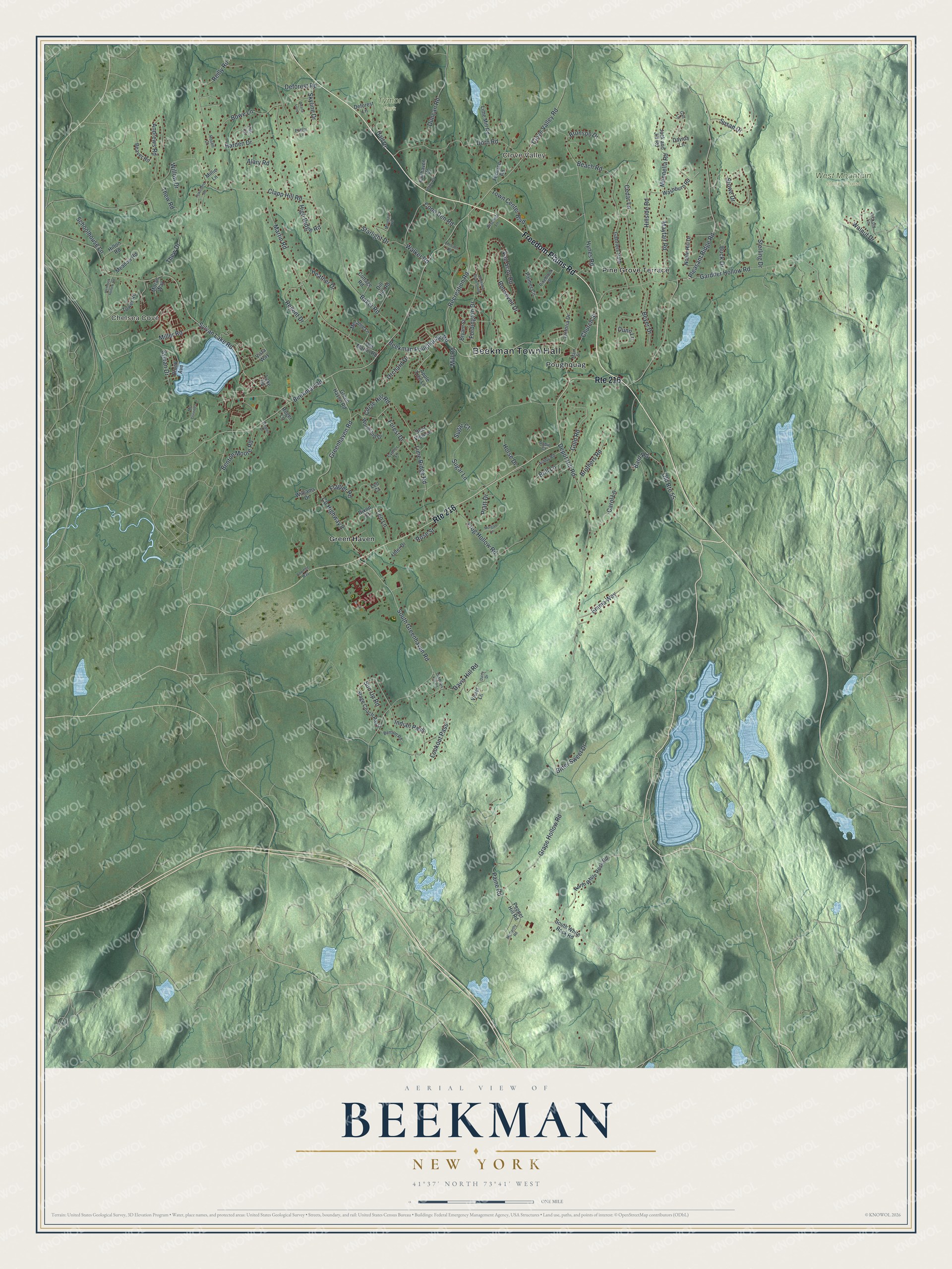
Explore Beekman, New York from a whole new perspective. Created using aerial imagery and detailed geographic data, this map captures Beekman building by building, with labeled streets, familiar landmarks, and shaded topographical relief that highlights the natural contours of the landscape.
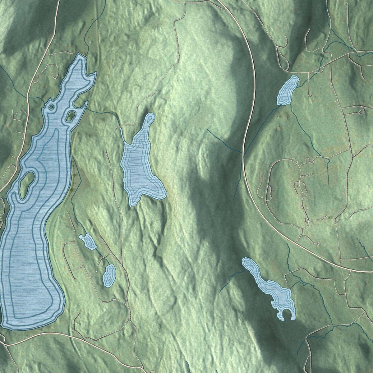
Combining modern data with the timeless character of a vintage atlas, this map is just as interesting up close as it is beautiful on the wall. Whether you grew up in Beekman, spent memorable years there, or call it home today, this unique map is a great way to celebrate a place that means something to you. Zoom in on the preview to look for your street, and then order a print to put your memories on the wall.
Three ways to hang it
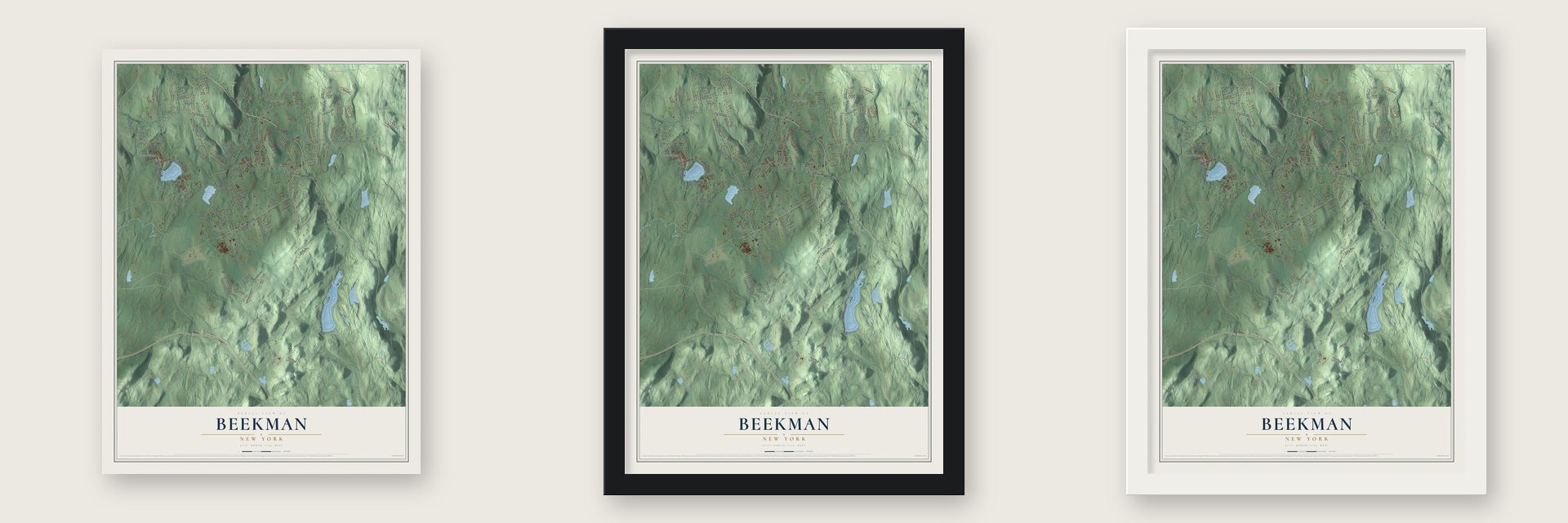
Unframed archival matte, a black wood frame or a white wood frame.
Up close
Geography Worth Displaying
This map was created using accurate cartographic data and authoritative geographic sources, including the U.S. Geological Survey (USGS) and FEMA. The map brings together terrain, waterways, roads, and building detail. The majority of the streets are labeled, houses are accurately depicted, and the topography is derived from government sources. Combining local data with carefully composed color and shading leads to this beautifully detailed Beekman artwork for your wall.
Rather than simply showing street outlines, we’ve included as many of the street names as we could reasonably fit on the map while keeping their names legible. Zoom in on the high resolution preview to see exactly what’s on the map. We truly set out to create a statement piece for anyone who loves Beekman. So whether it’s for you, or a gift for someone you love, we hope this map of Beekman brings back fond memories.
Explore the full map of Beekman, New York and read about the local places it shows.

Find your street
Names on the Beekman map
Every name below is printed on this map. Look for your street, your school, the park where you played, or the pond down the road.
Places and landmarks8
- Beekman Town Hall
- Clove Valley
- Chelsea Cove
- Tymor Park
- West Mountain State Forest
- Green Haven
- Pine Grove Terrace
- Poughquag
Streets and roads150
- Freedom Plains Road
- Route 216
- Pleasant Ridge Road
- Sylvan Lake Road
- Clapp Hill Road
- Depot Hill Road
- Beekman Road
- Gardner Hollow Road
- County Highway 8
- Roosevelt Drive
- South Greenhaven Road
- Martin Road
- Beekman Poughquag Road
- Hynes Road
- Grape Hollow Road
- Sugar Lane
- Lime Ridge Road
- Greenhaven Road
- Baker Road
- Beach Road
- Dorn Road
- Old Route 55
- Recreation Road
- Clove Valley Road
- Stowe Drive
- Paine Road
- Hillside Road
- Andrews Road
- Harden Drive
- Frog Hollow Road
Show all 150 streets
- Mennella Road
- Reilly Road
- Leo Lane
- Bowe Lane
- Walker Road
- Mayfair Road
- Heather Drive
- Davis Hill Road
- Gold Road
- Indian Pass
- Regent Drive
- Van Scoy Road
- Fordington Drive
- Schoolhouse Lane
- Alary Road
- Brothers Road
- Miller Road
- Beyer Drive
- Benton Moore Road
- Susan Drive
- Forest Drive
- Starlight Drive
- Emma Way
- Carol Lane
- Duncan Road
- High Ridge Road
- Thew Drive
- Sylvan Drive
- Town Center Boulevard
- Walnut Drive
- Cedar Lane
- Orchard Drive
- Deforest Road
- Buck Drive
- Church Street
- Bitter Sweet Drive
- Brill Lane
- Sterling Drive
- Lookout Pass
- Coon Den Road
- Rose Street
- Circle Hill Road
- Skyline Drive
- Thew Road
- Sun Up Road
- Dunn Lane
- Flagler Road
- Willow Drive
- Horse Drive
- Bronson Drive
- Pratt Drive
- Bard Road
- Sugar Court
- Mill Road
- Hall Drive
- Washburn Road
- Palmer Circle
- Stage Coach Pass
- North White Rock Road
- Victoria Drive
- Gabriels Path
- Woodland Drive
- Apple Tree Lane
- Melanie Lane
- Jack and Jill Road
- Brook Avenue
- South White Rock Road
- Tower Road
- Noble Hill Drive
- Bryant Street
- Furnace Road
- Vista Way
- Lime Mill Road
- Violet Lane
- Green Haven Road
- Meadow Road
- Beaver Road
- Pepper Hill Road
- Hilton Road
- Cottage Road
- Dill Hill Road
- Fairhaven Court
- Lee Lane
- Old Martin Road
- Deforest Lane
- Lake Road
- Utter Drive
- Roger Lane
- Williams Drive
- Deer View Lane
- Dixon Court
- Moran Way
- Davida Lane
- Millie Lane
- Leo Court
- Hickory Lane
- Ashby Road
- Robin Court
- Main Street
- Cypher Lane
- Benson Road
- Pinebrook Drive
- Bischoff Lane
- Potter Lane
- Rosell Court
- Gail Lane
- Mountain Vw
- Deana Loop
- Townsend Road
- Daisy Drive
- Underhill Road South
- Morgan Lane
- Rocky Road
- McCarthy Road
- Mc Donnells Lane
- Whalen Drive
- Hemlock Hollow Road
- Old Davis Hill Road
- Limbach Road
- Coombe Way
Names are listed as they appear on the printed map. Zoom into the product photos to find them.
About Beekman, New York
Beekman is a town of 14,172 people in southeastern Dutchess County. It takes its name from Henry Beekman, a judge from Kingston and the son of New York City deputy mayor Wilhemus Beekman. In 1697 he received a grant from the British crown, and his Beekman Patent became the second largest landholding in the county, covering today's Beekman, Pawling, Dover and Union Vale and a piece of LaGrange.
The Wappinger people lived here before European settlers came around 1710. The patent stayed a manor until after the Revolution, so families could only lease their farms, paying their rent in wheat and fat fowls and by working on the roads. Beekman became a precinct with its own local government in 1737, and it later gave up land to form LaGrange in 1821 and Union Vale in 1827.
- A Lutheran church by 1749The town's first house of worship was probably a Lutheran church off Beach Road, which appears in records from 1749. It was built for German families who arrived in the Palatine migration. In 1771 Quakers raised their own meeting house in Gardner Hollow, known as the Apoquague Preparative Meeting.
- Iron at Hidden LakeMining brought a boom to Sylvan Lake, Beekmanville and Clove Valley in the late 19th and early 20th centuries. Many Irish men fleeing the Great Famine came to work and sent for their families. Daniel Delany got rich on iron ore he found at Hidden Lake, then bought the entire Sylvan Lake shore and rebuilt the St. Denis church. The mines left few traces, but the Beekman Furnace still stands on Furnace Road, off Clove Valley Road.
- The round body of waterSylvan Lake, on the western town line, formed during the ice age, and its first Native name was Poughquag, meaning round body of water. Miners dug for iron along its shores in the early 1930s. When the mine flooded, they left their machines and tools on the bottom, where they still lie, and the old retaining wall pilings can be seen from a boat.
- A fire district since 1937Formed in 1937, the Beekman Fire District was southern Dutchess County's first fire district. Its single station is in the hamlet of Poughquag, and in 1977 it became one of the area's first volunteer departments to get the Hurst Tool for freeing people from wrecks.
Keep exploring New York
Beekman is one of 2,165 New York towns we've mapped. Every dot on the map is a print of its own.
The search covers every state, New York first.
Near Beekman
Order 2 or more town maps and save 10%. Shown in the size and finish you picked above, so they hang as a set.
- Chelsea Cove 12" x 18" / Archival Matte Print $39.99
- Shorehaven 12" x 18" / Archival Matte Print $39.99
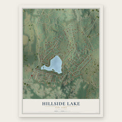
- Hillside Lake 12" x 18" / Archival Matte Print $39.99
More maps nearby: East Fishkill, Pawling, Hopewell Junction, Union Vale and Noxon.
The art of mapping a place
How This Map Was Made
Real places. Remarkable detail. Discover the layers that turn geographic data into a map of home.

The view from above
Aerial imagery reveals the character of the land: woodland, open fields, and the patterns of a place.

The shape of the land
Elevation data brings hills, valleys, and subtle changes in the landscape into view.

The details of home
Roads, waterways, and building footprints come together to make the map feel unmistakably local.

Geography becomes art
Considered color, shading, and typography bring the layers together in a map made for your wall.


Process illustrated with Mendon, Massachusetts. Aerial imagery: USDA NAIP. Terrain: USGS 3D Elevation Program. Map details and finished artwork: KNOWOL.
The Details
About This Print
Choose an archival matte print, or a black or white Ayous wood frame. The archival matte print is unframed.
Select your size and finish above to see the matching product image and price.
Materials & Craftsmanship
A contemporary map with the character of a classic atlas, printed on archival matte paper. Optional frames are made from Ayous wood.
Your printed map does not include the watermark shown in the full-map preview.
Shipping & Delivery
Free shipping within the United States. Every print is made to order in the USA.
Buying a gift? Add a note in your cart and we'll include it. We never put prices in the package.
Prints ship within 2 to 3 business days. Allow 7 to 10 days total from ordering for delivery. Timing may vary during holidays or periods of high order volume.
Read our shipping policy.
Returns and damaged prints
Each print is made to order. Change-of-mind refunds are not available after production.
If your print arrives damaged, misprinted or incorrect, contact support@knowol.com within 30 days of receiving it. Include your order number, photos and a description of the issue.
Read our full refund and replacement policy. For questions about your order, email support@knowol.com.