
Search for another town





Free U.S. delivery 7 to 10 days after you order
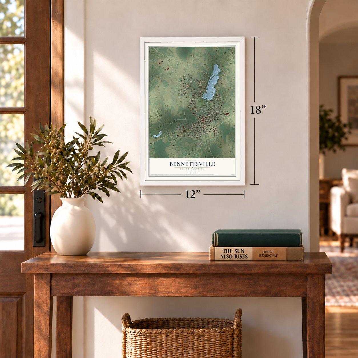
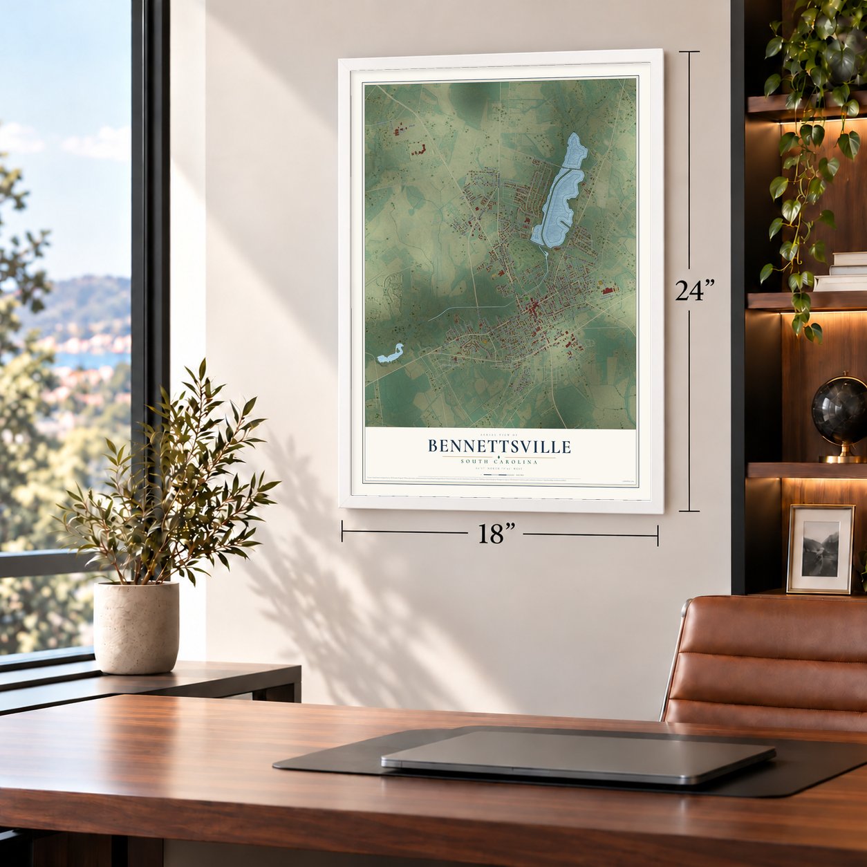
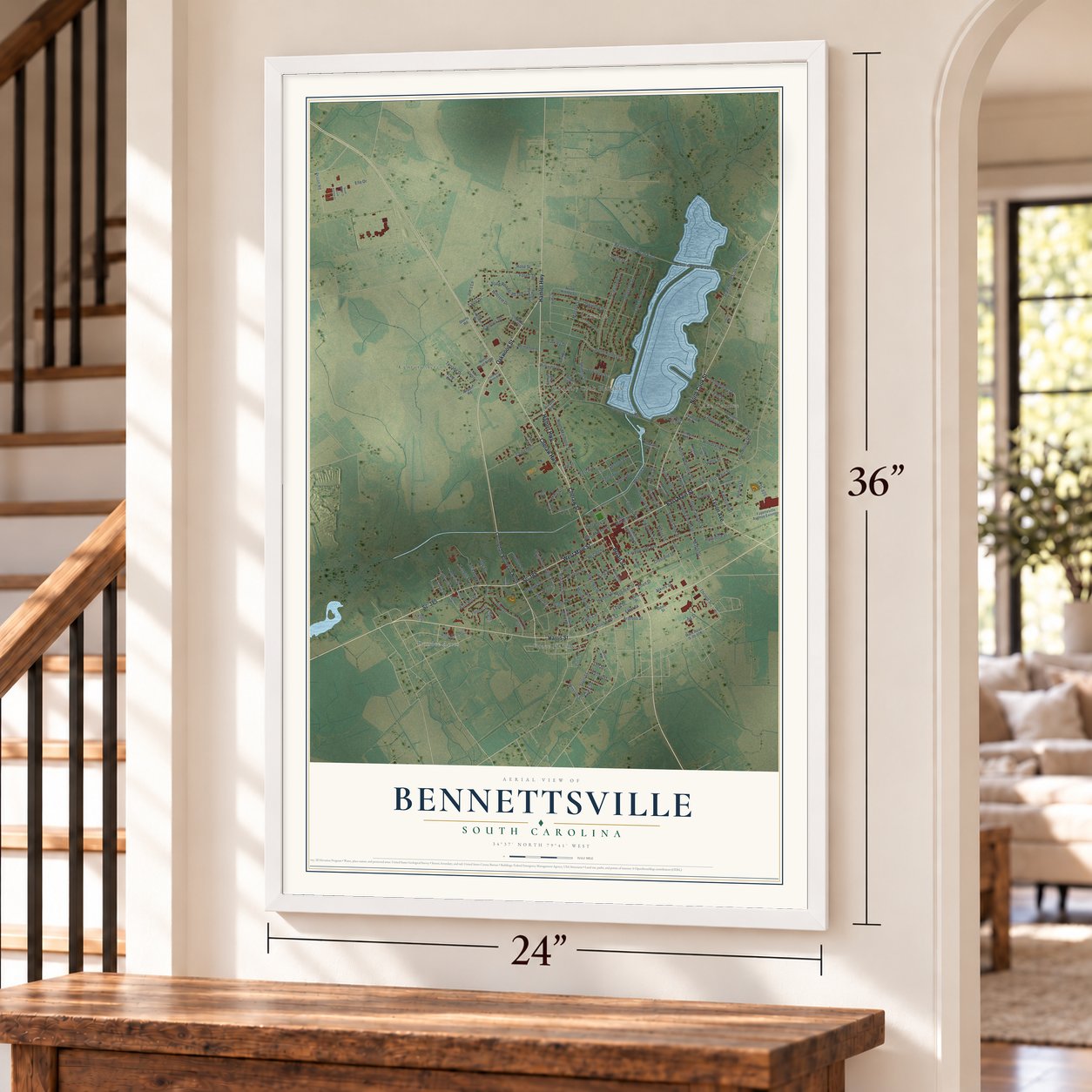
Bennettsville, South Carolina Map Art
A new map of Bennettsville, South Carolina, made in 2026 and printed to order on thick archival matte paper.
12" x 18" Archival Matte Print
A Map of Home. A Work of Art.
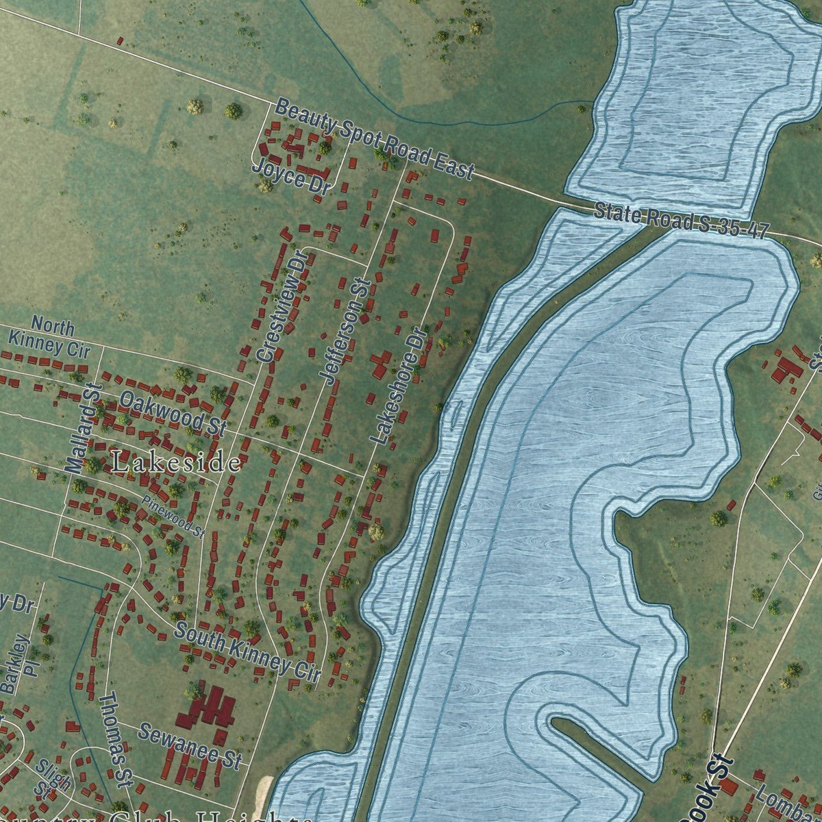
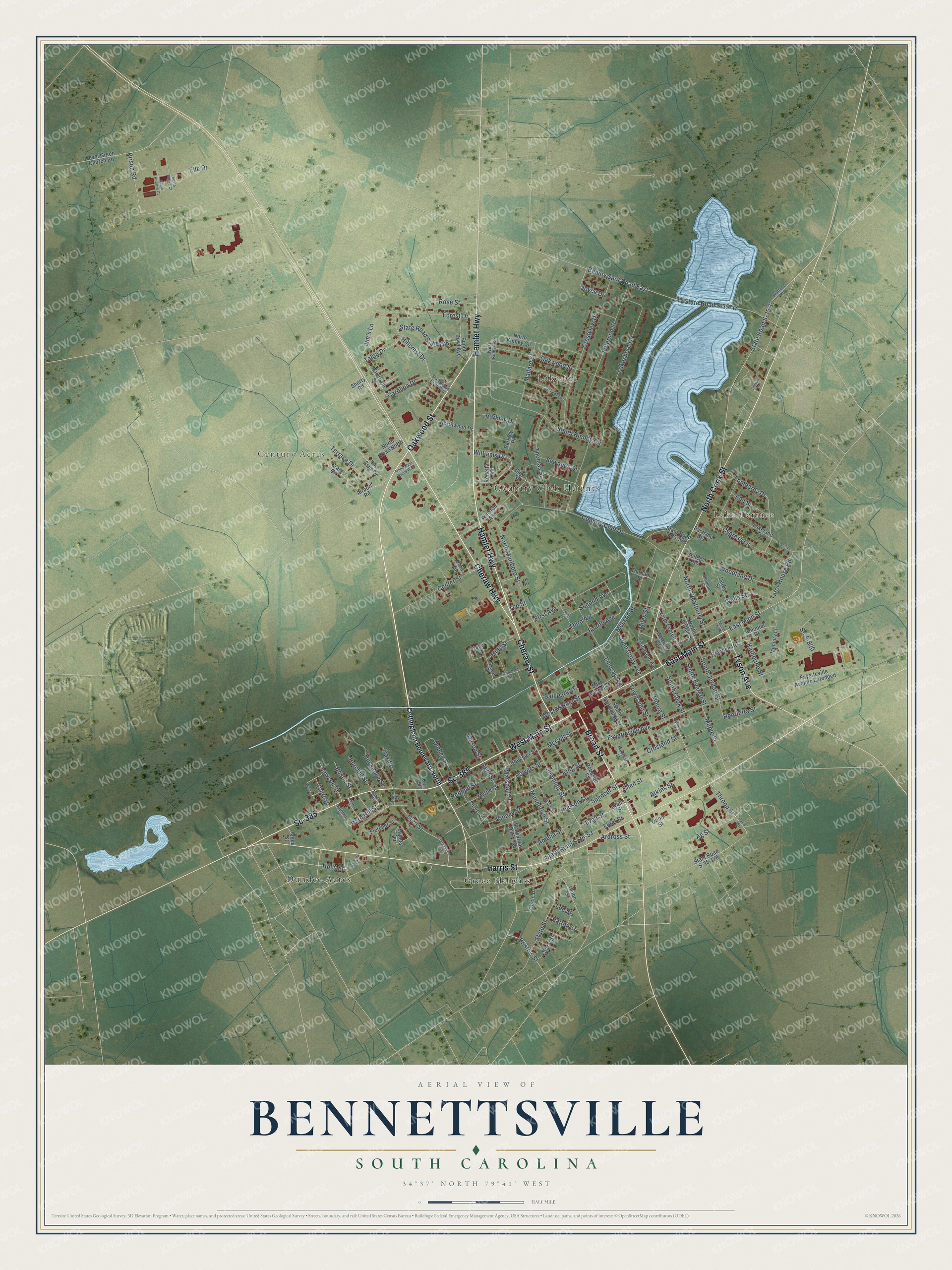
Explore Bennettsville, South Carolina from a whole new perspective. Created using aerial imagery and detailed geographic data, this map captures Bennettsville building by building, with labeled streets, familiar landmarks, and shaded topographical relief that highlights the natural contours of the landscape.
Combining modern data with the timeless character of a vintage atlas, this map is just as interesting up close as it is beautiful on the wall. Whether you grew up in Bennettsville, spent memorable years there, or call it home today, this unique map is a great way to celebrate a place that means something to you. Zoom in on the preview to look for your street, and then order a print to put your memories on the wall.
Three ways to hang it
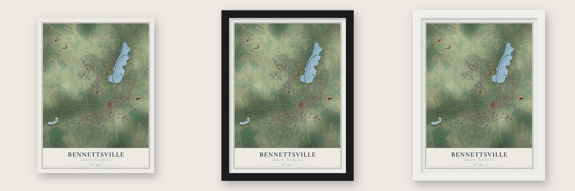
Unframed archival matte, a black wood frame or a white wood frame.
Up close
Geography Worth Displaying
This map was created using accurate cartographic data and authoritative geographic sources, including the U.S. Geological Survey and the Census Bureau. The map brings together terrain, waterways, roads, and building detail. The majority of the streets are labeled, houses are accurately depicted, and the topography is derived from government sources. Combining local data with carefully composed color and shading leads to this beautifully detailed Bennettsville artwork for your wall.
Rather than simply showing street outlines, we’ve included as many of the street names as we could reasonably fit on the map while keeping their names legible. Zoom in on the high resolution preview to see exactly what’s on the map. We truly set out to create a statement piece for anyone who loves Bennettsville. So whether it’s for you, or a gift for someone you love, we hope this map of Bennettsville brings back fond memories.
Read the story behind this map of Bennettsville, South Carolina from 2026.

About Bennettsville, South Carolina
Bennettsville is a city of 7,020 people and the county seat of Marlboro County, near the Great Pee Dee River. On December 14, 1819, the South Carolina General Assembly voted to move the Marlboro District courthouse from the east bank of the Pee Dee to a site closer to the middle of the district. The chosen ground was a 3-acre apple orchard on a bluff over Crooked Creek, and the new town was named for Thomas Bennett Jr., the governor at the time.
Planters around the town grew short-staple cotton, which the cotton gin had made profitable, and the crop depended on the work of enslaved African Americans. Some were brought up from the Lowcountry and carried Gullah culture with them, while slave traders brought others from the Upper South. In 1885 Duncan Donald McColl paid for the town's first railroad, its first bank and its first textile mills, which linked Bennettsville to outside markets. In the king cotton boom that followed, the city grew into the hub of one of South Carolina's richest farming regions.
- Three courthouses on one squareArchitect Robert Mills designed the first courthouse, finished in 1824, and the town's streets were laid out to radiate from its square, one of the largest in the state. A second courthouse replaced it in 1852, and a third, in the Second Empire style, went up on the same spot in 1884. Between 1952 and 1954 local architect Henry D. Harrall added two-story red brick wings and the clock steeple, and the 1884 building still forms the center.
- Sherman's troops in 1865Union troops occupied Bennettsville in 1865, the final year of the Civil War, and General William T. Sherman set up headquarters in town. The courthouse was not burned, so Marlboro County's records survive back to 1785, which makes it one of the few county seats with papers that old. Genealogists still come to search them.
- A library for Marian Wright EdelmanMarian Wright Edelman, who founded the Children's Defense Fund, was born and raised in Bennettsville. The county library named for her opened on February 22, 2010, beside the Murchison School building of 1902, with its front tower lined up on the Murchison's tower. It holds 60,000 volumes.
Find your street
Names on the Bennettsville map
Every name below is printed on this map. Look for your street, your school, the park where you played, or the pond down the road.
Places and landmarks6
- Century Acres
- Country Club Heights
- Dundee Acres
- Grace Heights
- Lake Terrace
- Lakeside
Streets and roads175
- Sc-385
- West Main Street
- Broad Street
- Oakwood Street
- Cheraw Highway
- Hamlet Highway
- East Main Street
- North Cook Street
- Cheraw Street
- Tyson Avenue
- Harris Street
- Barn Hill Street
- Beauty Spot Road East
- State Road S-35-17
- State Street
- Munnerlyn Street
- South Jordan Street
- Light Street
- Olive Street
- Dudley Street
- Cypress Lane
- State Road S-35-47
- Jefferson Street
- North Marlboro Street
- Country Club Drive
- Fayetteville Avenue
- Prison Road
- Lakeshore Drive
- McLeod Street
- Crestview Drive
Show all 175 streets
- King Street
- Thomas Street
- First Avenue
- Jennings Street
- Marshall Street
- State Road S-35-708
- Wells Street
- Lombardy Drive
- Forest Drive
- Spencer Street
- Third Avenue
- Lindsay Avenue
- Hillcrest Drive
- Elle Drive
- State Road S-35-53
- Hudson Street
- Second Avenue
- Williams Drive
- North Weatherly Street
- South Kinney Circle
- Throop Street
- Glen Street
- Crosland Street
- Woodland Drive
- Center Street
- Huckabee Street
- Katherine Street
- Moore Street
- Atkins Street
- Jim's Lane
- Redbud Street
- Joyce Drive
- Amelia Street
- Fleet Street
- Miles Street
- Tator House Road
- Clark Street
- Mallard Street
- Ag Street
- Terrace Drive
- South Everett Street
- Fourth Avenue
- McColl Street
- Kinney Street
- John Corry Avenue
- South Cook Street
- Lyall Street
- Talon Drive
- Rose Street
- West Market Street
- Townsend Street
- Carolina Drive
- Ellen Street
- Lawson Street
- Sewanee Street
- Henrietta Street
- Elm Street
- Holly Street
- Maple Street
- Burchill Street
- Barkley Drive
- Powers Street
- Mills Street
- Bostic Street
- Patton Street
- Ball Park Street
- S-35-820
- Lee Street
- Bristow Street
- Wilson Street
- Court Street
- Ardross Street
- Oak Street
- Tee Street
- Cottingham Boulevard North
- North Everett Street
- Grace Street
- College Heights
- Airport Road
- South Parsonage Street
- Winston Avenue
- State Road S-35-178
- State Road S-35-136
- Lakeland Drive
- Fletcher Street
- Craig Circle
- Fayetteville Avenue Extended
- Sligh Street
- Robeson Street
- East Market Street
- State Road S-35-538
- Myrtle Street
- Level Green Church Road
- Lyalls Street
- Breeden Heights
- North Kinney Circle
- Punch Bowl Avenue
- Grace Court
- Northwood Drive
- Emerson Street
- North Jordan Street
- Livingston Avenue
- Bouchier Street
- Millers Terrace
- Barkley Place
- Union Street
- Renetta Avenue
- North Road North
- Memory Lane
- Darby Street
- Colonial Drive
- Durham Street
- Circle Drive
- Wearing Street
- Eastside Heights
- Odom Street
- Apple Street
- Fara Street
- Shorty Road
- Kerr Street
- Burch Street
- West Kinney Circle
- Wallace Road
- State Road S-35-706
- Ayers Street
- East Craig Circle
- Barnhill Street
- S-35-535
- Simmons Street
- Stokes Street
- West Street
- State Road S-35-518
- Pinewood Street
- Davis Street
- Richardson Avenue
- Lewis Street
- Breeden Street
- Matheson Street
- Adams Street
- S-35-364
- Frank West Evans Way
- Gibson Circle
- South Bernie Court
- South Andrew Court
- Steed Avenue
Names are listed as they appear on the printed map. Zoom into the product photos to find them.
The art of mapping a place
How This Map Was Made
Real places. Remarkable detail. Discover the layers that turn geographic data into a map of home.

The view from above
Aerial imagery reveals the character of the land: woodland, open fields, and the patterns of a place.

The shape of the land
Elevation data brings hills, valleys, and subtle changes in the landscape into view.

The details of home
Roads, waterways, and building footprints come together to make the map feel unmistakably local.

Geography becomes art
Considered color, shading, and typography bring the layers together in a map made for your wall.


Process illustrated with Mendon, Massachusetts. Aerial imagery: USDA NAIP. Terrain: USGS 3D Elevation Program. Map details and finished artwork: KNOWOL.
The Details
About This Print
Choose an archival matte print, or a black or white Ayous wood frame. The archival matte print is unframed.
Select your size and finish above to see the matching product image and price.
Materials & Craftsmanship
A contemporary map with the character of a classic atlas, printed on archival matte paper. Optional frames are made from Ayous wood.
Your printed map does not include the watermark shown in the full-map preview.
Shipping & Delivery
Free shipping within the United States. Every print is made to order in the USA.
Buying a gift? Add a note in your cart and we'll include it. We never put prices in the package.
Prints ship within 2 to 3 business days. Allow 7 to 10 days total from ordering for delivery. Timing may vary during holidays or periods of high order volume.
Read our shipping policy.
Returns and damaged prints
Each print is made to order. Change-of-mind refunds are not available after production.
If your print arrives damaged, misprinted or incorrect, contact support@knowol.com within 30 days of receiving it. Include your order number, photos and a description of the issue.
Read our full refund and replacement policy. For questions about your order, email support@knowol.com.
Find your town
Looking for another city?
Find a map of home in our South Carolina collection, or any town in the country.
Nearby
Maps of towns near Bennettsville
Know someone from one of these towns? Their map makes a great gift.
 Tatum
Tatum, South Carolina
From $39.99See the map
 Blenheim
, South Carolina
From $39.99See the map
 McColl
, South Carolina
From $39.99See the map
More maps nearby: Clio, Wallace, Cash, Society Hill and Cheraw.