
Search for another town





Free U.S. delivery 7 to 10 days after you order
Cheraw, South Carolina Map Art
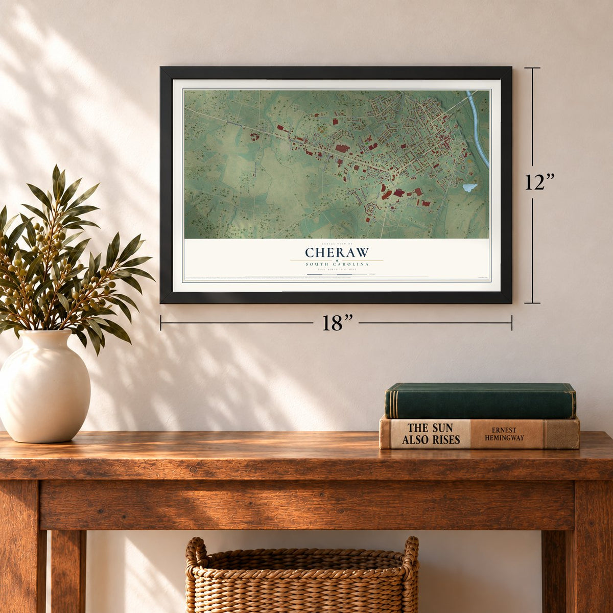
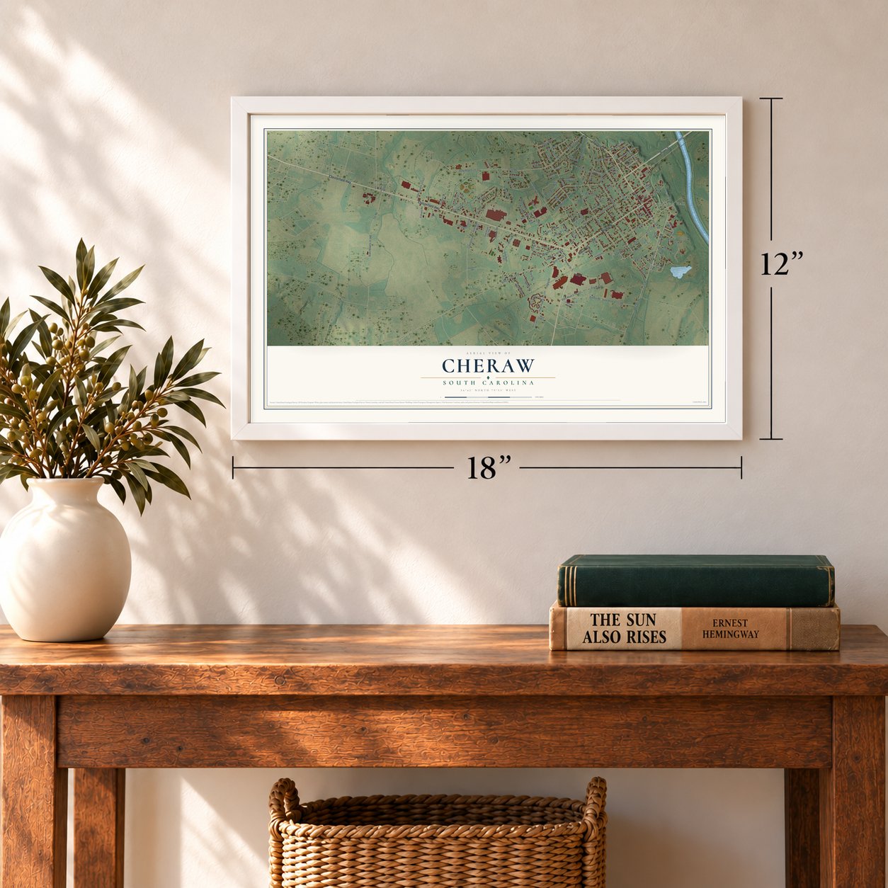
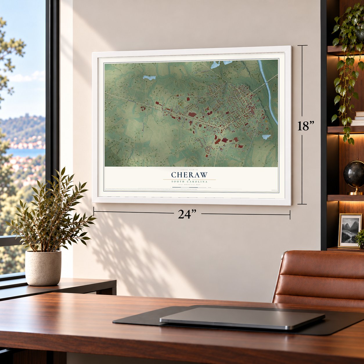
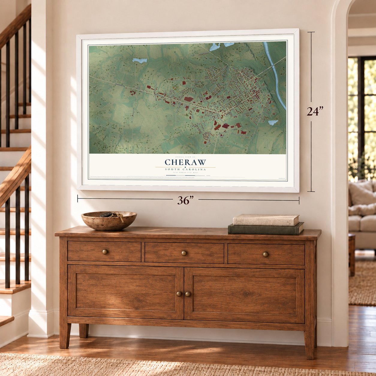
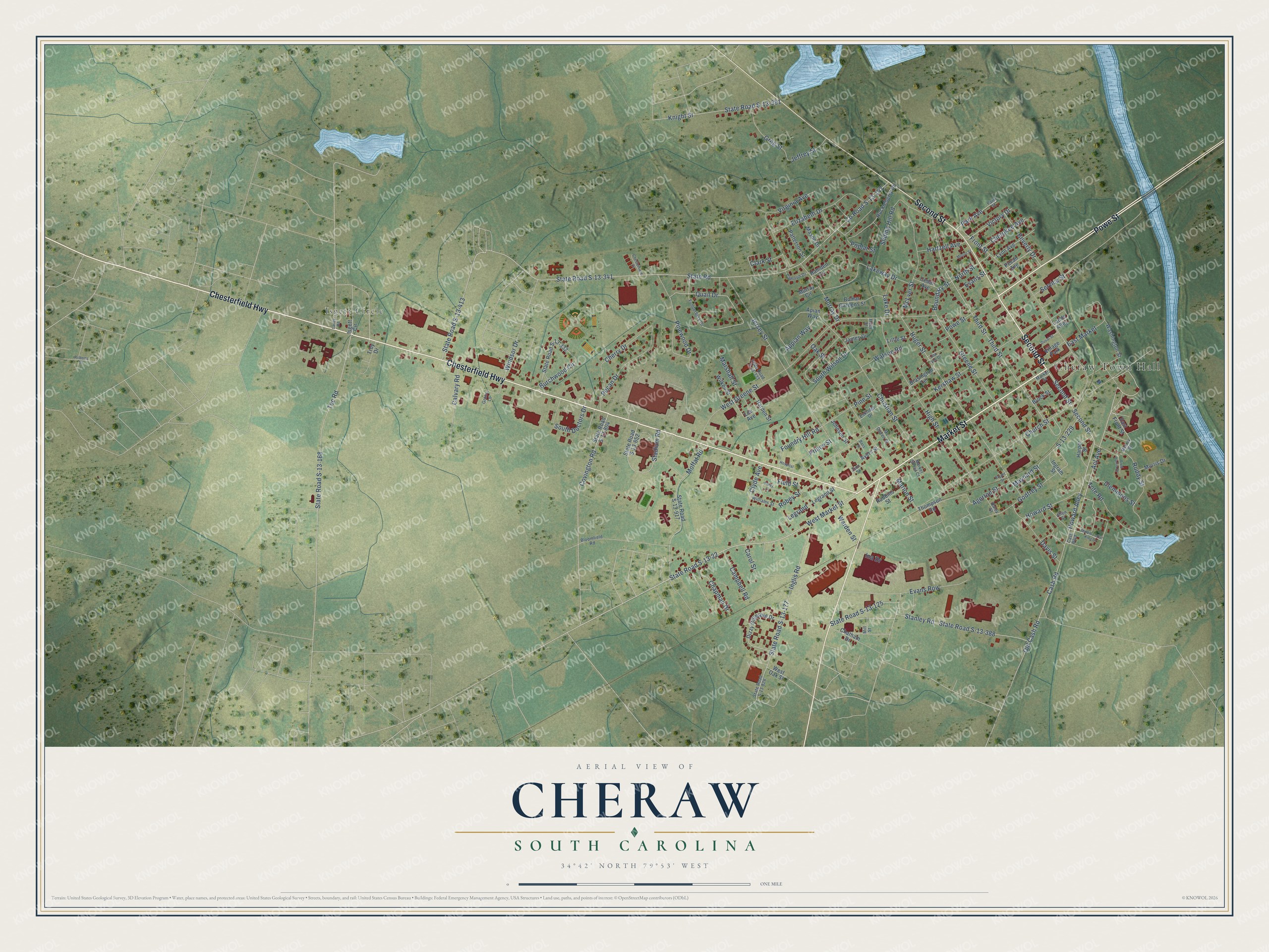
A new map of Cheraw, South Carolina, made in 2026 and printed to order on thick archival matte paper.
12" x 18" Archival Matte Print
A Map of Home. A Work of Art.
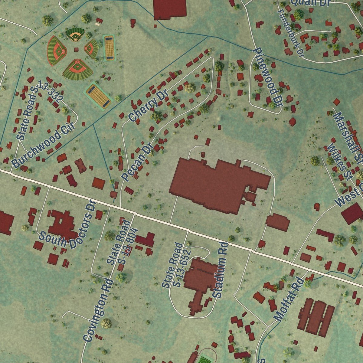
Explore Cheraw, South Carolina from a whole new perspective. Created using aerial imagery and detailed geographic data, this map captures Cheraw building by building, with labeled streets, familiar landmarks, and shaded topographical relief that highlights the natural contours of the landscape.
Combining modern data with the timeless character of a vintage atlas, this map is just as interesting up close as it is beautiful on the wall. Whether you grew up in Cheraw, spent memorable years there, or call it home today, this unique map is a great way to celebrate a place that means something to you. Zoom in on the preview to look for your street, and then order a print to put your memories on the wall.
Three ways to hang it
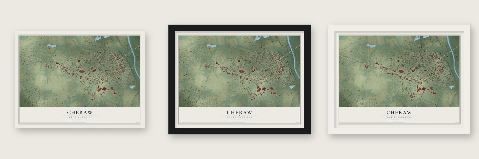
Unframed archival matte, a black wood frame or a white wood frame.
Up close
Geography Worth Displaying
This map was created using accurate cartographic data and authoritative geographic sources, including the U.S. Geological Survey and the Census Bureau. The map brings together terrain, waterways, roads, and building detail. The majority of the streets are labeled, houses are accurately depicted, and the topography is derived from government sources. Combining local data with carefully composed color and shading leads to this beautifully detailed Cheraw artwork for your wall.
Rather than simply showing street outlines, we’ve included as many of the street names as we could reasonably fit on the map while keeping their names legible. Zoom in on the high resolution preview to see exactly what’s on the map. We truly set out to create a statement piece for anyone who loves Cheraw. So whether it’s for you, or a gift for someone you love, we hope this map of Cheraw brings back fond memories.
Read the story behind this map of Cheraw, South Carolina from 2026.

About Cheraw, South Carolina
Cheraw is a town of 5,040 people in Chesterfield County, where the Pee Dee River crosses its fall line. It carries the name of the Cheraw people, who lived near the waterfall hill until diseases brought by European traders devastated them by the 1730s, and the survivors joined the Catawba. By 1750 a trading village stood on the river here, one of only six South Carolina places shown on English maps of that time. In the 1760s Joseph and Eli Kershaw received the land that is now downtown, laid out its streets and named the town Chatham, but people kept calling it Cheraw.
In 1819 the first steamboat, The Great Pee Dee, came up the river under Moses Rogers, and the new trade made the town rich. Cheraw was incorporated in 1820, and by 1830 elm trees shaded its streets. Its cotton market became the largest between Georgetown and Wilmington, North Carolina, and before the Civil War it had the biggest bank in the state outside Charleston. A bad fire struck in 1835, yet by 1850 Cheraw was again a thriving trade center.
“a pleasant town and an old one with the Southern aristocratic bearing.”
- St. David's, founded 1768St. David's Parish was the last Anglican church South Carolina built under King George III. During the Revolution it was a hospital for Lord Cornwallis's British troops and quarters for the state militia. In the Civil War both armies used it as a hospital and buried soldiers there. A Confederate monument went up in its cemetery in 1867, first without the soldiers' names because Federal troops still held the area. It joined the National Register in 1971.
- Sherman's days in 1865Union troops under General William T. Sherman spent several days in Cheraw in March 1865. Retreating Confederates had burned the Pee Dee bridge to slow them down. Sherman's men destroyed no homes or public buildings, but captured gunpowder blew up by accident at the river hill, and the fire burned the business district. With the bridge and the stores both gone, the town struggled until prosperity returned in the early 1900s.
- The secession resolutionOn November 19, 1860, a public meeting at the Chesterfield County Courthouse made the first call for South Carolina to leave the Union. John A. Inglis of Cheraw was there. He went on to introduce the state's secession resolution and chaired the committee that drafted the document.
- A park built by the CCCDuring the Great Depression, Cheraw became the first town in South Carolina to put the Civilian Conservation Corps to work on a state park. Its citizens paid for the plan themselves, hoping to make Cheraw the "Gateway City" of the state. Cheraw State Park opened in the 1930s and remains the largest of South Carolina's CCC parks.
- Patton's tanks downtownIn November 1941 the Carolina Maneuvers staged a mock Battle of Pee Dee River in Cheraw's streets. General George Patton's 2nd Armored Division attacked, and its tanks broke through and rolled into the town center, where anti-tank guns met them. The umpires ruled for Patton, and the defending I Corps had to pull out of town.
Find your street
Names on the Cheraw map
Every name below is printed on this map. Look for your street, your school, the park where you played, or the pond down the road.
Places and landmarks3
- Cheraw Town Hall
- Isgett Circle
- Village Park
Streets and roads159
- Chesterfield Highway
- Market Street
- Second Street
- Powe Street
- West Market Street
- Howard Alley
- Acl Avenue
- Church Street
- Covington Road
- Pinewood Drive
- Quail Drive
- Huger Street
- State Road
- Cash Road
- County Road S-13-147
- State Road S-13-413
- West Greene Street
- Tec Road
- S-13-229
- Oak Street
- State Road S-13-168
- Greene Street
- State Road S-13-177
- Kershaw Street
- Jersey Street
- Third Street
- State Road S-13-341
- Front Street
- State Road S-13-22
- Christian Street
Show all 159 streets
- High Street
- Inglis Road
- Marion Street
- Moffat Road
- Evans Row
- Burchwood Circle
- Stanley Road
- State Road S-13-388
- Elizabeth Drive
- Virginia Avenue
- Knight Street
- State Road S-13-391
- McLver Street
- Stadium Road
- Lakeway Drive
- Pecan Drive
- Old Cash Road
- Maynard Street
- Godfrey Street
- Cherry Drive
- Sliding Hill Road
- Legrand
- Appian Way
- Roddy Street
- East Market
- South Doctors Drive
- Agerton Street
- Davis Street
- Tote Road
- Watson Road
- Poplar Street
- Carol Street
- Windsor Drive
- Greg Street
- Murray Drive
- Marshall Street
- Foundry Hill Road
- State Road S-13-125
- Beverly Drive
- Howard Street
- North Street
- Chapman Drive
- Clyde Avenue
- Campbell Road
- Field Street
- Clemmons Street
- Pine Street
- Cherokee Avenue
- Victory Drive
- Hartzell Avenue
- Park Avenue
- South Wilson Drive
- Robey Street
- Jeffrey Street
- Ina Drive
- Warden Street
- Boundary Street
- Lake Drive
- Calvary Road
- Service Street
- Prince Street
- Clark Street
- Evans Street
- Washington Street
- East Front Street
- West Oak Street
- State Road S-13-917
- State Road S-13-332
- State Road S-13-652
- State Road S-13-804
- Dizzy Gillespie Drive
- Huckleberry Drive
- Hamden Circle
- Mason Drive
- Bomar Gardens Street
- Wilkes Street
- Lynn Avenue
- Harper Street
- Patterson Street
- Ayers Street
- Robbins Street
- Harden Street
- Chatham Drive
- Legrand Street
- Johnson Street
- Brasington Terrace
- Brock Street
- Thompson Road
- Morris Drive
- Pecan Avenue
- Cedar Avenue
- Little Street
- Ingram Street
- James Drive
- Ladds Alley
- Murray Circle
- Lee Avenue
- Apian Way
- Troy Drive
- Cash Boulevard
- McKay Street
- State Road S-13-828
- Funderburk Drive
- State Road S-13-333
- Park Street
- Williams Street
- Eskridge Drive
- Calhoun Drive
- Mill Street
- Bloomfield Road
- Mc Queen Street
- Raley Street
- Market Street Court
- Allen Street
- Zion Street
- Grace Lane
- Huey Street
- Martin Luther King Drive
- Patsy Lane
- Duval Street
- Chesterfield Court
- Fred Harris Drive
- Moore Street
- Roberts Street
- Hospital
- Bass Street
- Jay Vee Drive
- Laney Road
- Bryant Street
Names are listed as they appear on the printed map. Zoom into the product photos to find them.
The art of mapping a place
How This Map Was Made
Real places. Remarkable detail. Discover the layers that turn geographic data into a map of home.

The view from above
Aerial imagery reveals the character of the land: woodland, open fields, and the patterns of a place.

The shape of the land
Elevation data brings hills, valleys, and subtle changes in the landscape into view.

The details of home
Roads, waterways, and building footprints come together to make the map feel unmistakably local.

Geography becomes art
Considered color, shading, and typography bring the layers together in a map made for your wall.


Process illustrated with Mendon, Massachusetts. Aerial imagery: USDA NAIP. Terrain: USGS 3D Elevation Program. Map details and finished artwork: KNOWOL.
The Details
About This Print
Choose an archival matte print, or a black or white Ayous wood frame. The archival matte print is unframed.
Select your size and finish above to see the matching product image and price.
Materials & Craftsmanship
A contemporary map with the character of a classic atlas, printed on archival matte paper. Optional frames are made from Ayous wood.
Your printed map does not include the watermark shown in the full-map preview.
Shipping & Delivery
Free shipping within the United States. Every print is made to order in the USA.
Buying a gift? Add a note in your cart and we'll include it. We never put prices in the package.
Prints ship within 2 to 3 business days. Allow 7 to 10 days total from ordering for delivery. Timing may vary during holidays or periods of high order volume.
Read our shipping policy.
Returns and damaged prints
Each print is made to order. Change-of-mind refunds are not available after production.
If your print arrives damaged, misprinted or incorrect, contact support@knowol.com within 30 days of receiving it. Include your order number, photos and a description of the issue.
Read our full refund and replacement policy. For questions about your order, email support@knowol.com.
Find your town
Looking for another city?
Find a map of home in our South Carolina collection, or any town in the country.
Nearby
Maps of towns near Cheraw
Know someone from one of these towns? Their map makes a great gift.
 Wallace
, South Carolina
From $39.99See the map
 Cash
Cash, South Carolina
From $39.99See the map
 Chesterfield
, South Carolina
From $39.99See the map
More maps nearby: Patrick, Society Hill, Bennettsville, Ruby and Mount Croghan.