
Search for another town




Free U.S. delivery 7 to 10 days after you order
Berryville, Virginia Map Art
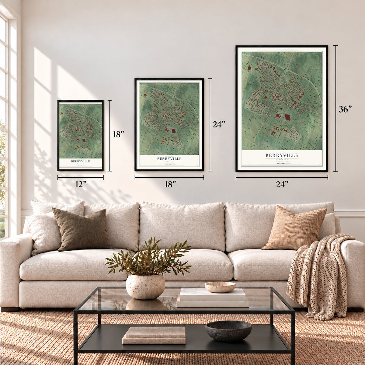
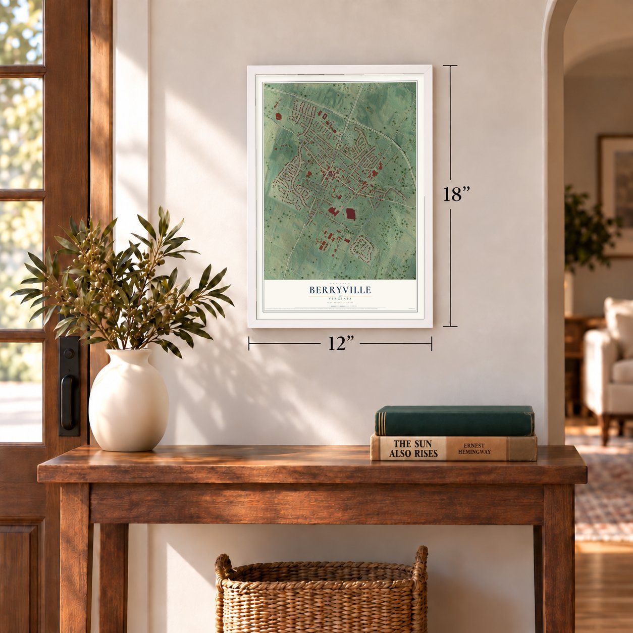
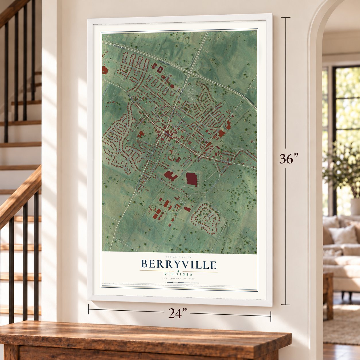
A new map of Berryville, Virginia, made in 2026 and printed to order on thick archival matte paper.
12" x 18" Archival Matte Print
A Map of Home. A Work of Art.
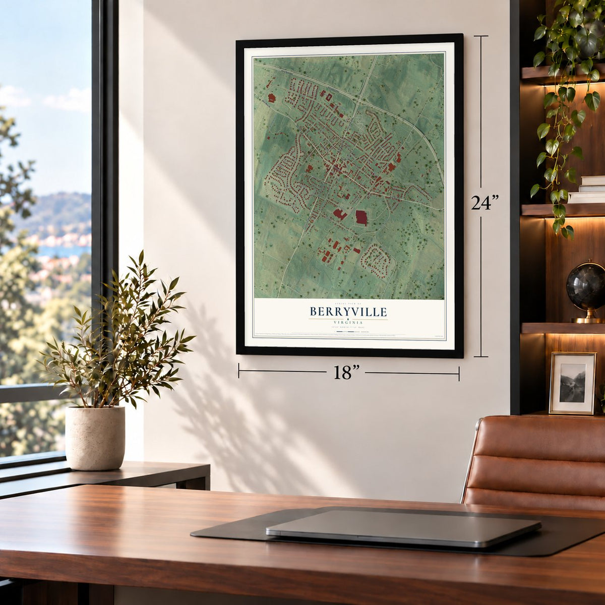
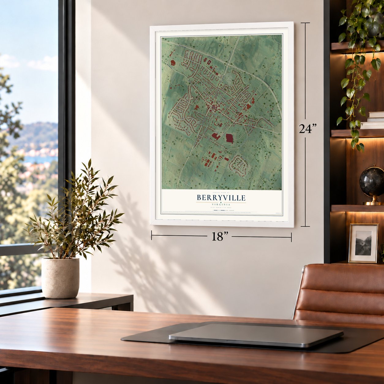
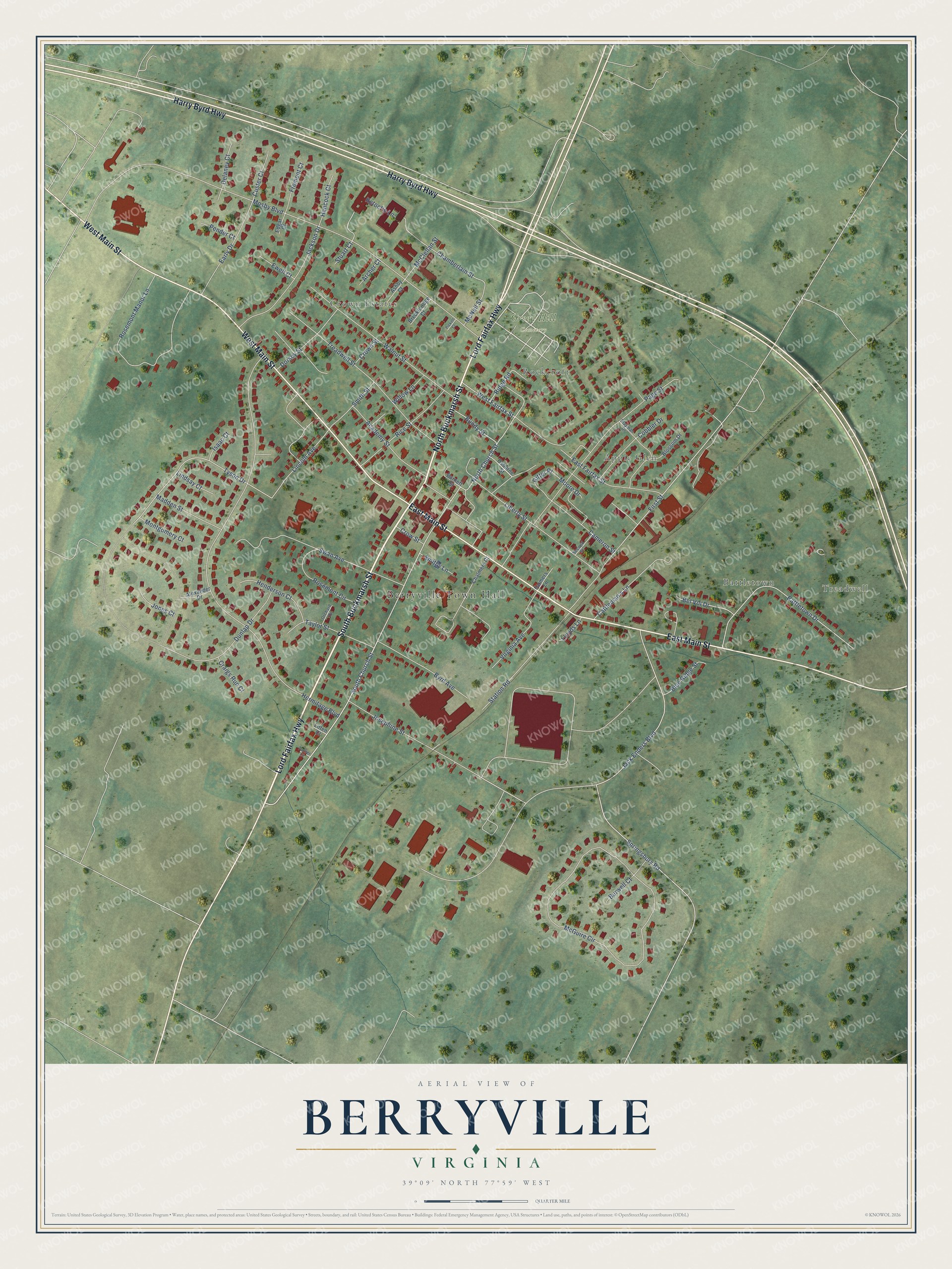
Explore Berryville, Virginia from a whole new perspective. Created using aerial imagery and detailed geographic data, this map captures Berryville building by building, with labeled streets, familiar landmarks, and shaded topographical relief that highlights the natural contours of the landscape.
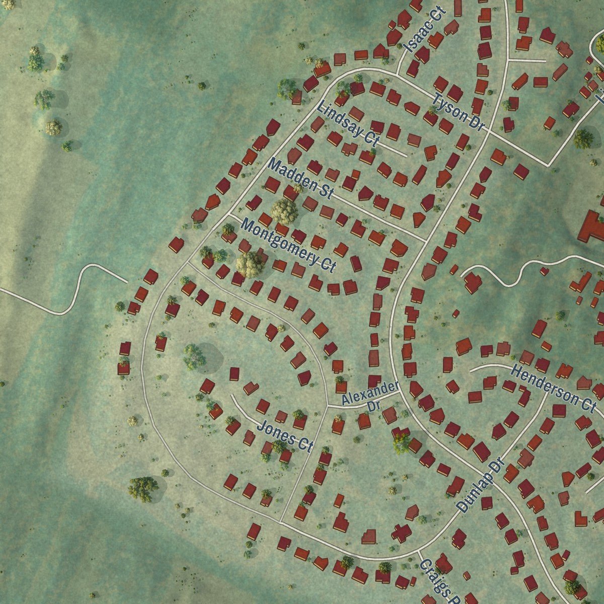
Combining modern data with the timeless character of a vintage atlas, this map is just as interesting up close as it is beautiful on the wall. Whether you grew up in Berryville, spent memorable years there, or call it home today, this unique map is a great way to celebrate a place that means something to you. Zoom in on the preview to look for your street, and then order a print to put your memories on the wall.
Three ways to hang it
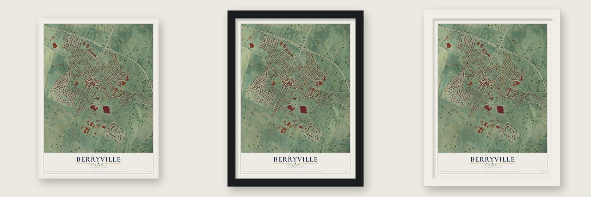
Unframed archival matte, a black wood frame or a white wood frame.
Up close
Geography Worth Displaying
This map was created using accurate cartographic data and authoritative geographic sources, including the U.S. Geological Survey and the Census Bureau. The map brings together terrain, waterways, roads, and building detail. The majority of the streets are labeled, houses are accurately depicted, and the topography is derived from government sources. Combining local data with carefully composed color and shading leads to this beautifully detailed Berryville artwork for your wall.
Rather than simply showing street outlines, we’ve included as many of the street names as we could reasonably fit on the map while keeping their names legible. Zoom in on the high resolution preview to see exactly what’s on the map. We truly set out to create a statement piece for anyone who loves Berryville. So whether it’s for you, or a gift for someone you love, we hope this map of Berryville brings back fond memories.
Read the story behind this map of Berryville, Virginia from 2026.

About Berryville, Virginia
Berryville is a town of 4,574 people and the county seat of Clarke County, in the northern Shenandoah Valley. It grew up where the Winchester Turnpike crossed the road to Charlestown. The Crown granted this land to Captain Isaac Pennington in 1734, George Washington surveyed it on October 23, 1750, and Pennington sold it to Colonel John Hite in 1754.
In 1765 Hite handed the land to Major Charles Smith, who had married his daughter. In 1797 John Smith, the major's son, sold Benjamin Berry and Sarah (Berry) Stribling 20 acres he had inherited, and the pair split the ground into town lots. The town of Berryville was established on January 15, 1798, and by 1810 it counted at least 25 homes along with three stores, two taverns, an apothecary and an academy.
- Why it was Battle TownLegend says Daniel Morgan piled up large stones at the crossroads to throw in case of need, then fought the local toughs there. That story and a rowdy tavern nearby earned the place the nickname Battle Town. Major Charles Smith gave his estate the same name and built a clapboard homestead where the tavern had stood. It still stands on Main Street, known today as The Nook.
- Morgan comes homeAfter making his name in the Revolution, Daniel Morgan came back to the area to live. He became one of the regular customers of the new tavern in town, and by reputation one of its most quarrelsome. The Battletown Inn now stands where that tavern was.
- County seat in 1836Berryville was not much bigger than it had been in 1810 when it was picked as the seat of the newly formed Clarke County. On March 28, 1836, the justices of the peace appointed by the Governor gathered in Berryville, in the Academy, to begin the county's business. An 1855 gazetteer still called it "a small town" with some trade.
- The Battle of BerryvilleWhen the Second Battle of Winchester was fought during the Gettysburg Campaign, the town served as an outpost backing up Winchester. General Jubal A. Early briefly made his headquarters here in 1864, and not long afterward fighting broke out in and around the town in what became known as the Battle of Berryville. The railroad arrived in the 1870s, and the line is now part of Norfolk Southern's H-Line.
- Governor Byrd's orchard homeHarry F. Byrd, later governor of Virginia and a U.S. senator, was a state senator in 1916 when he built Westwood, a cabin of chestnut logs cut before the chestnut blight, at a family orchard in Berryville. In 1926 he bought Rosemont, an estate beside his family's apple orchards, and he moved his family there in 1929 when his term as governor ended.
Find your street
Names on the Berryville map
Every name below is printed on this map. Look for your street, your school, the park where you played, or the pond down the road.
Places and landmarks7
- Berryville Town Hall
- Treadwell
- Crown Estates
- Battletown
- Rockcroft
- Apple Glen
- Green Hill Cemetery
Streets and roads87
- South Buckmarsh Street
- North Buckmarsh Street
- Lord Fairfax Highway
- East Main Street
- West Main Street
- Harry Byrd Highway
- South Church Street
- North Church Street
- Tyson Drive
- Mosby Boulevard
- Ketoctin Lane
- Chamberlain Street
- Lincoln Avenue
- Ritter Place
- Hermitage Boulevard
- Jack Enders Boulevard
- McGuire Circle
- First Street
- Springsbury Road
- Page Street
- Rosemont Manor Lane
- Treadwell Street
- Swan Avenue
- Battletown Drive
- Walnut Street
- Josephine Street
- Liberty Street
- Dunlap Drive
- Academy Street
- Jackson Drive
Show all 87 streets
- Station Road
- East Fairfax Street
- Rice Street
- Byrd Avenue
- Cattleman's Lane
- Virginia Avenue
- Cameron Street
- Early Drive
- Taylor Street
- Rosemont Circle
- Cobbler Drive
- Dorsey Street
- Henderson Court
- Madden Street
- Smith Street
- West Fairfax Street
- Bel Voi Drive
- Burwell Court
- Bundy Street
- Blue Ridge Street
- Fremont Court
- Hancock Court
- Custer Court
- McClellan Street
- Montgomery Court
- McNeil Street
- Delaney Court
- Ridge Road
- Craigs Run Court
- Lindsay Court
- Ewell Court
- Willow Lane
- Jones Court
- Smithy Lane
- Moore Drive
- Pender Court
- Crown Street
- Isaac Court
- Lloyds Lane
- Crow Street
- Archer Court
- Stuart Court
- Blossom Drive
- Chalmers Court
- Breckinridge Court
- Ashby Court
- Alexander Drive
- Osborne Street
- Barnett Street
- Farmers Lane
- Edgar Court
- Litten Court
- Stayman Drive
- Second Street
- Orchard Drive
- Turner Court
- Pickett Court
Names are listed as they appear on the printed map. Zoom into the product photos to find them.
The art of mapping a place
How This Map Was Made
Real places. Remarkable detail. Discover the layers that turn geographic data into a map of home.

The view from above
Aerial imagery reveals the character of the land: woodland, open fields, and the patterns of a place.

The shape of the land
Elevation data brings hills, valleys, and subtle changes in the landscape into view.

The details of home
Roads, waterways, and building footprints come together to make the map feel unmistakably local.

Geography becomes art
Considered color, shading, and typography bring the layers together in a map made for your wall.


Process illustrated with Mendon, Massachusetts. Aerial imagery: USDA NAIP. Terrain: USGS 3D Elevation Program. Map details and finished artwork: KNOWOL.
The Details
About This Print
Choose an archival matte print, or a black or white Ayous wood frame. The archival matte print is unframed.
Select your size and finish above to see the matching product image and price.
Materials & Craftsmanship
A contemporary map with the character of a classic atlas, printed on archival matte paper. Optional frames are made from Ayous wood.
Your printed map does not include the watermark shown in the full-map preview.
Shipping & Delivery
Free shipping within the United States. Every print is made to order in the USA.
Buying a gift? Add a note in your cart and we'll include it. We never put prices in the package.
Prints ship within 2 to 3 business days. Allow 7 to 10 days total from ordering for delivery. Timing may vary during holidays or periods of high order volume.
Read our shipping policy.
Returns and damaged prints
Each print is made to order. Change-of-mind refunds are not available after production.
If your print arrives damaged, misprinted or incorrect, contact support@knowol.com within 30 days of receiving it. Include your order number, photos and a description of the issue.
Read our full refund and replacement policy. For questions about your order, email support@knowol.com.
Find your town
Looking for another city?
Find a map of home in our Virginia collection, or any town in the country.
Nearby
Maps of towns near Berryville
Know someone from one of these towns? Their map makes a great gift.
 Boyce
Boyce, Virginia
From $39.99See the map
 Shenandoah Retreat
, Virginia
From $39.99See the map
 Brucetown
, Virginia
From $39.99See the map
More maps nearby: Paris, Winchester, Round Hill, Upperville and Shenandoah Farms.