
Search for another town



Free U.S. delivery 7 to 10 days after you order
Big Bear City, California Map Art
Building by building, with labeled streets and shaded relief.
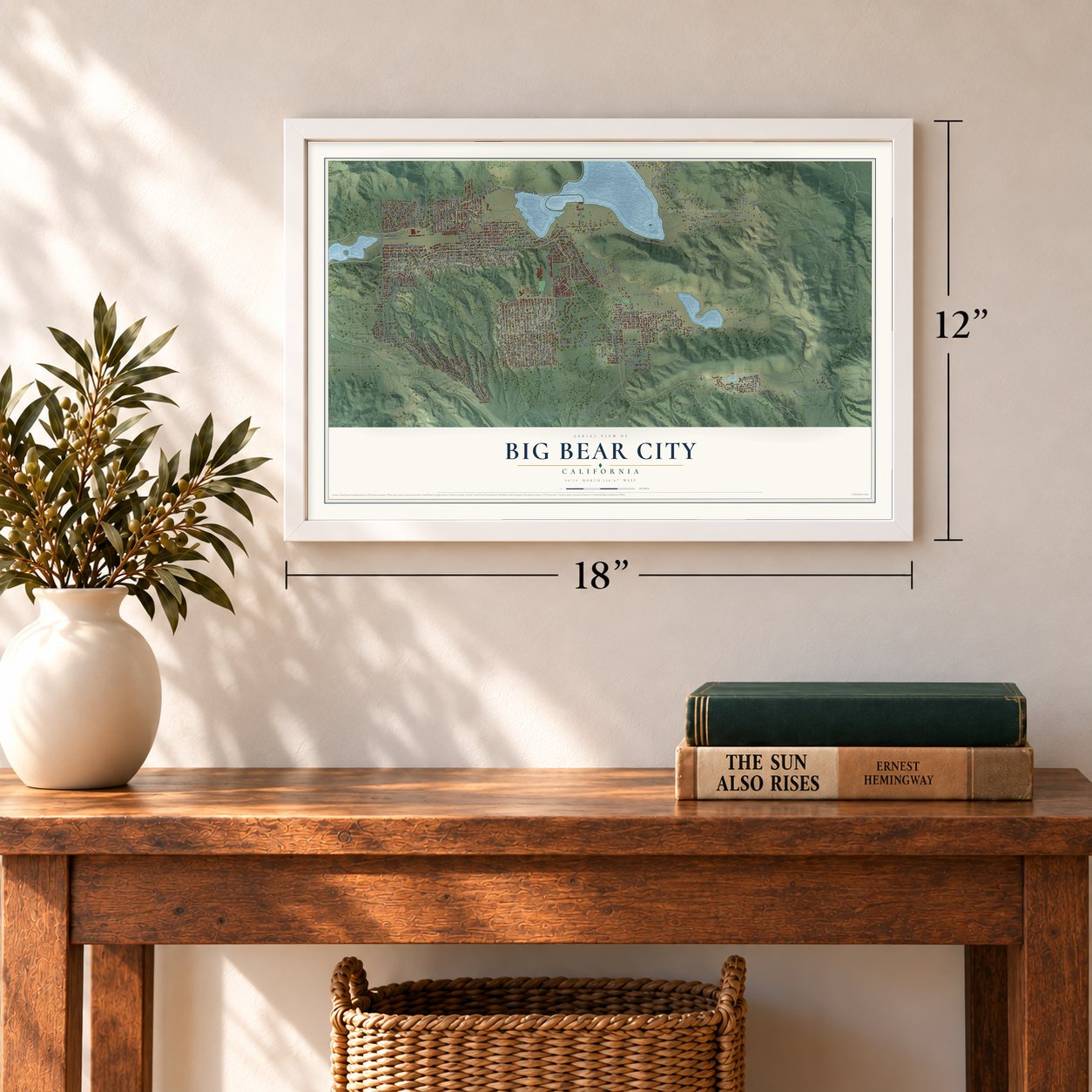
12" x 18" Archival Matte Print
A Map of Home. A Work of Art.
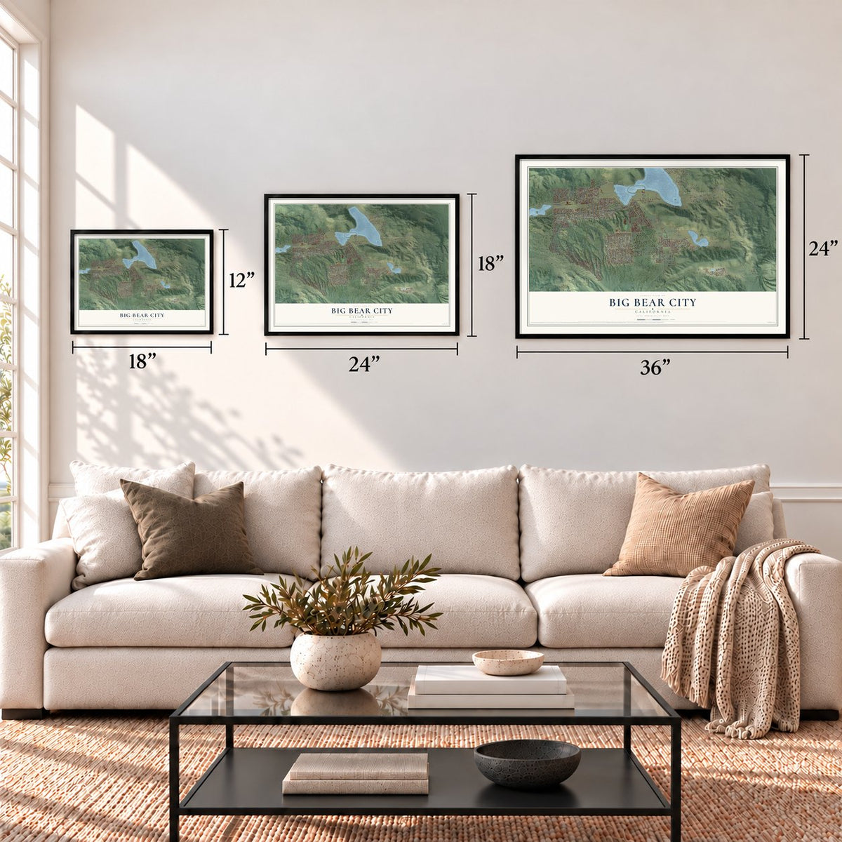
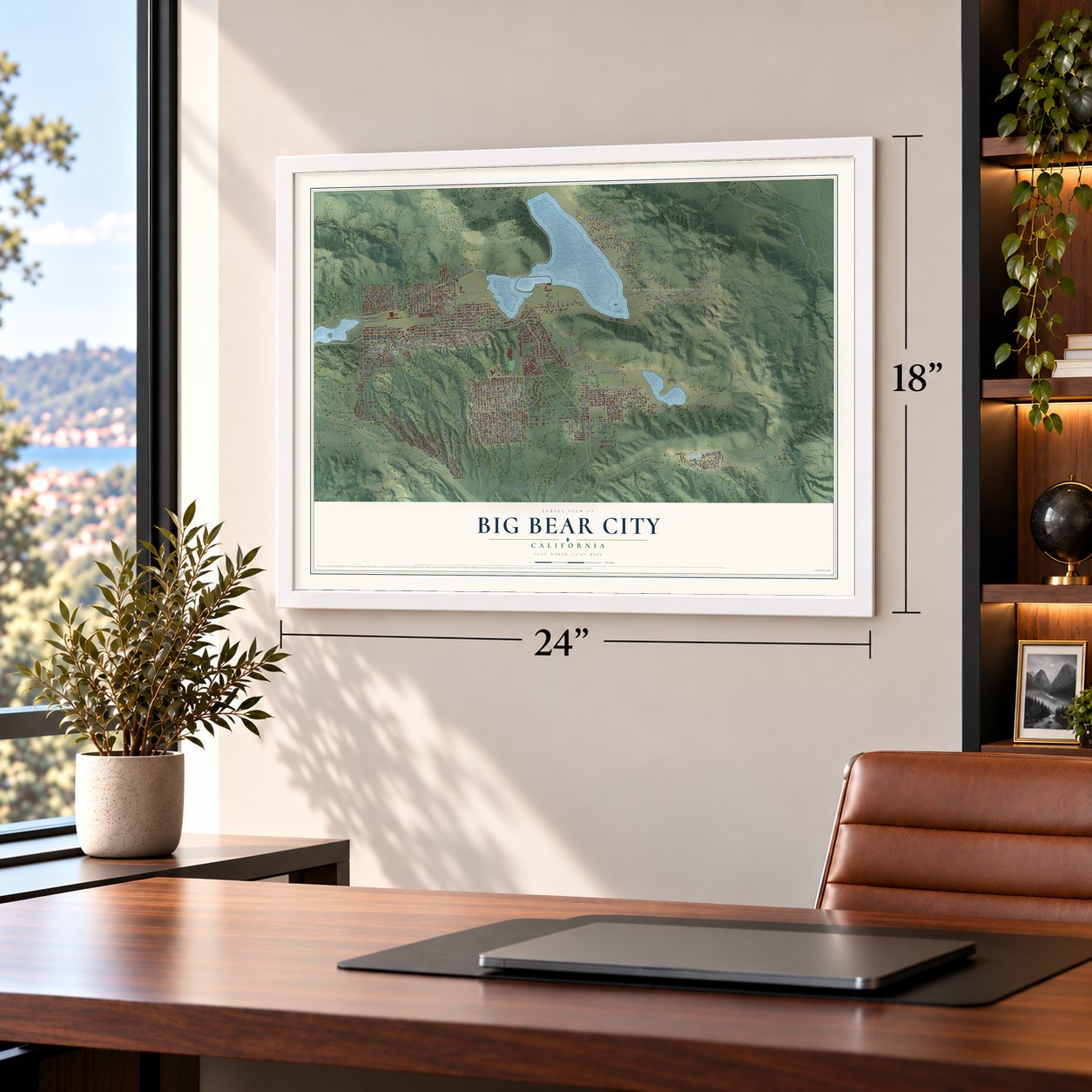
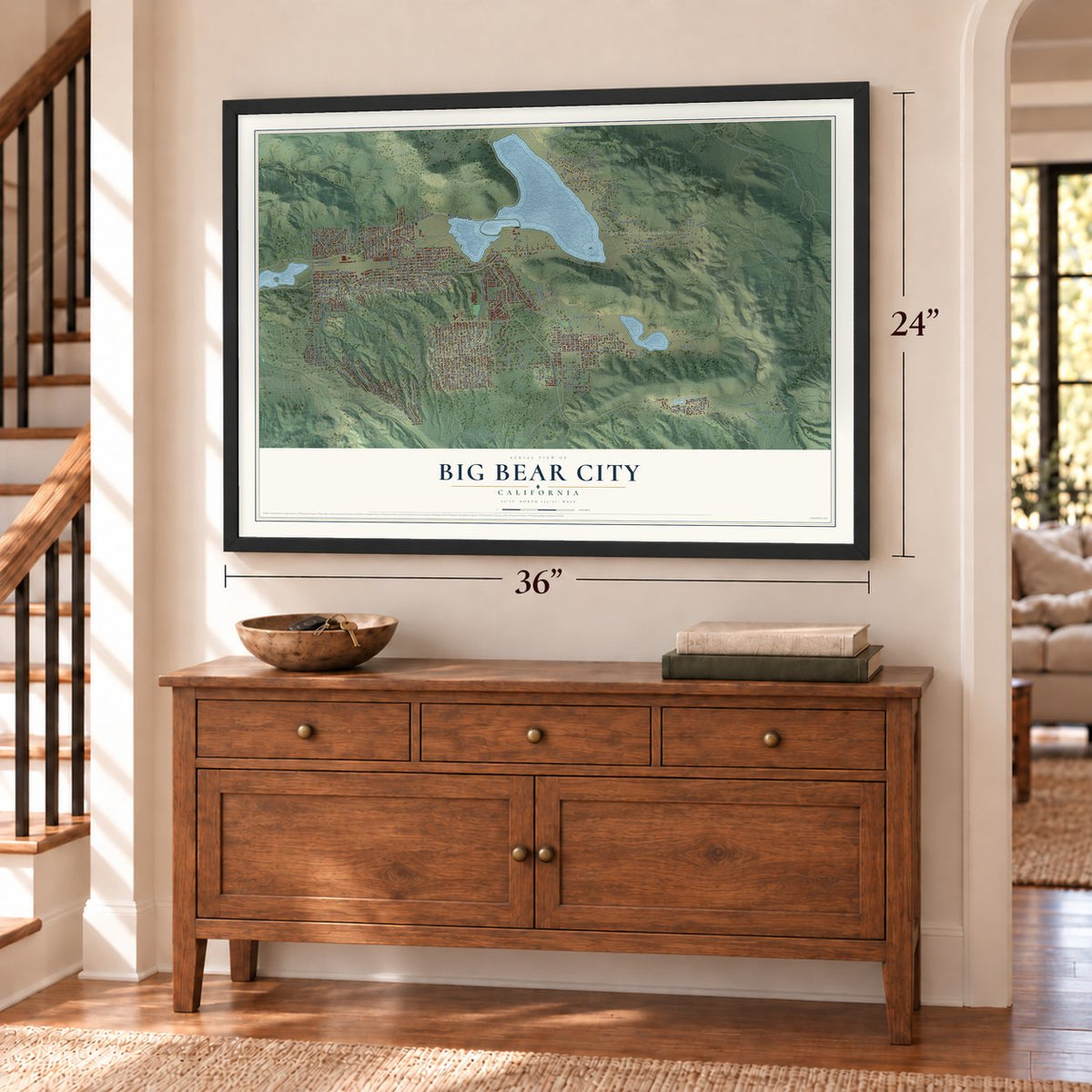
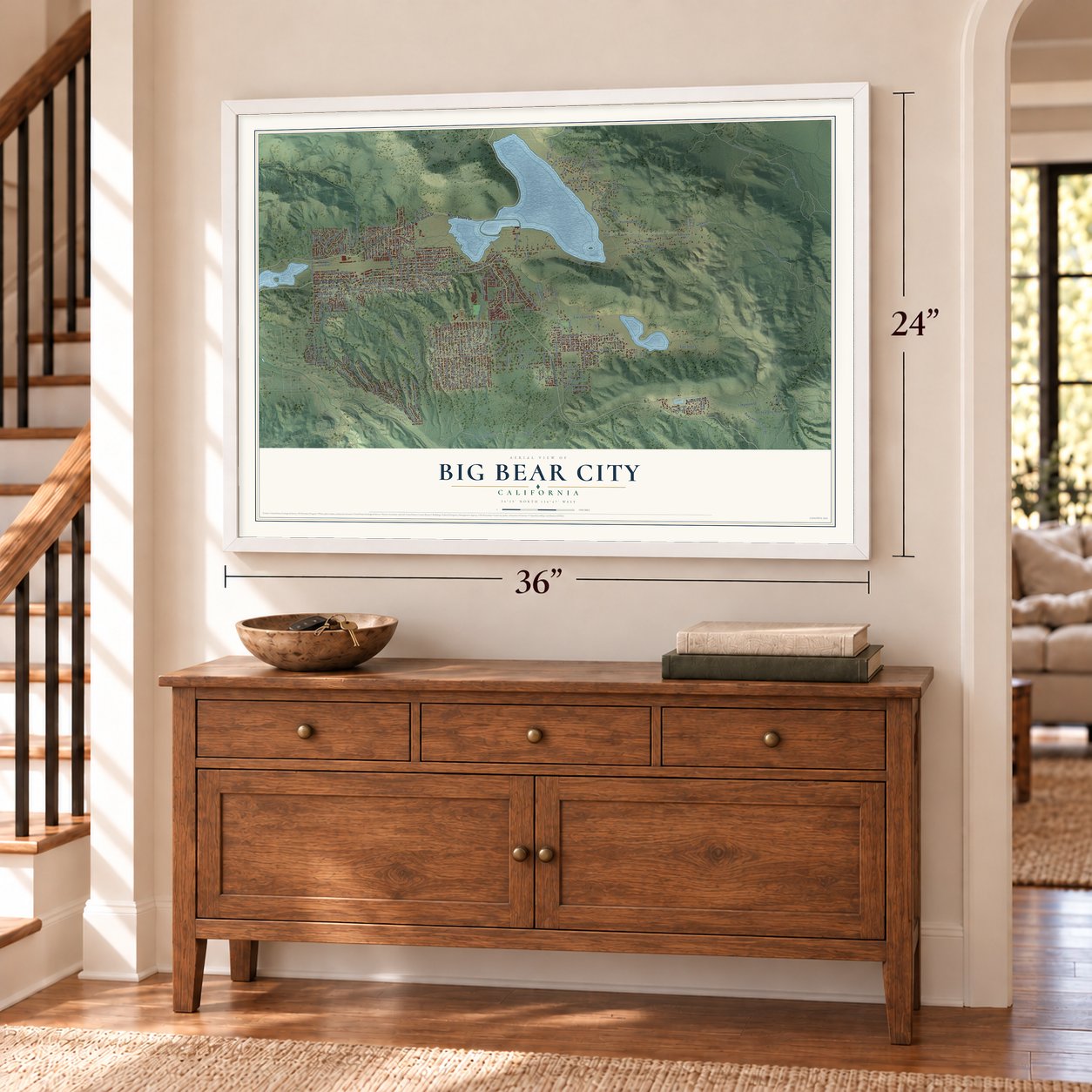
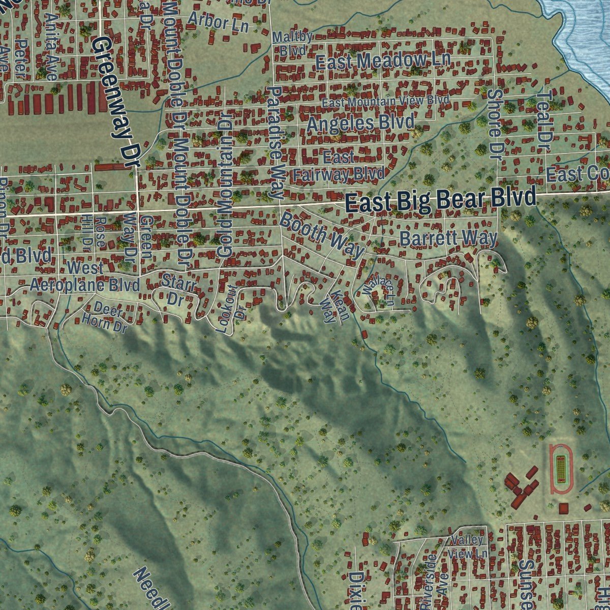
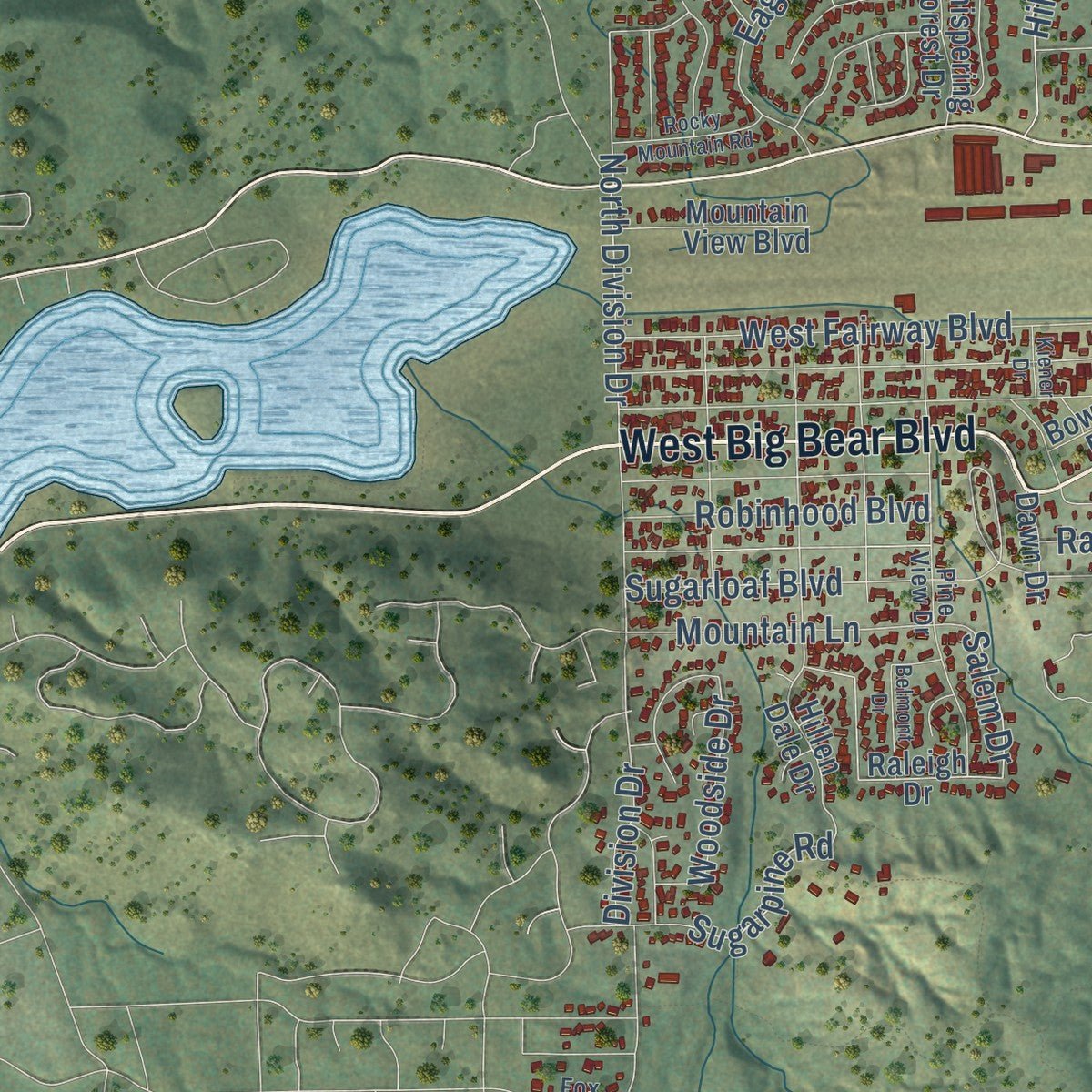
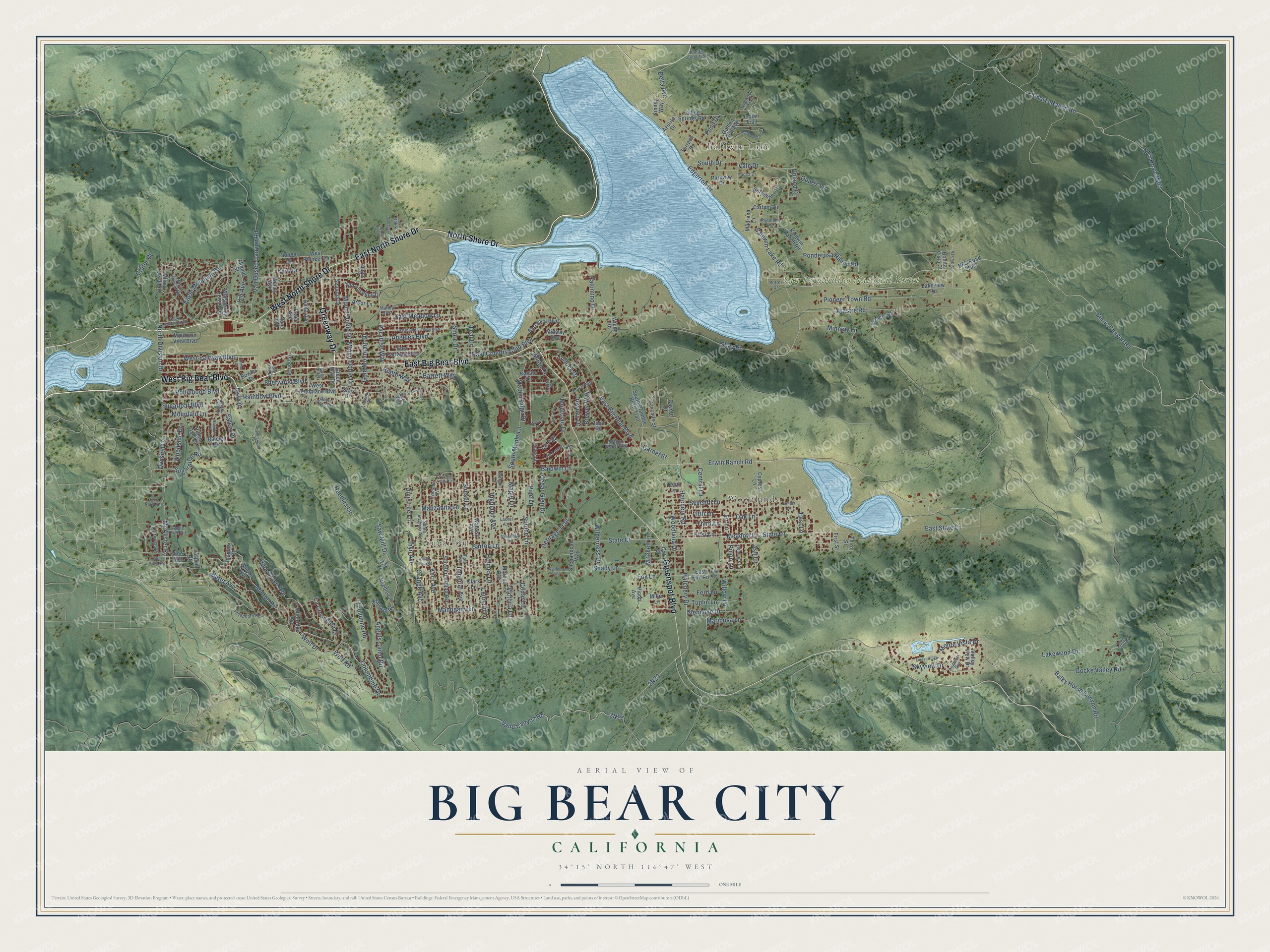
Explore Big Bear City, California from a whole new perspective. Created using aerial imagery and detailed geographic data, this map captures Big Bear City building by building, with labeled streets, familiar landmarks, and shaded topographical relief that highlights the natural contours of the landscape.
Combining modern data with the timeless character of a vintage atlas, this map is just as interesting up close as it is beautiful on the wall. Whether you grew up in Big Bear City, spent memorable years there, or call it home today, this unique map is a great way to celebrate a place that means something to you. Zoom in on the preview to look for your street, and then order a print to put your memories on the wall.
Three ways to hang it
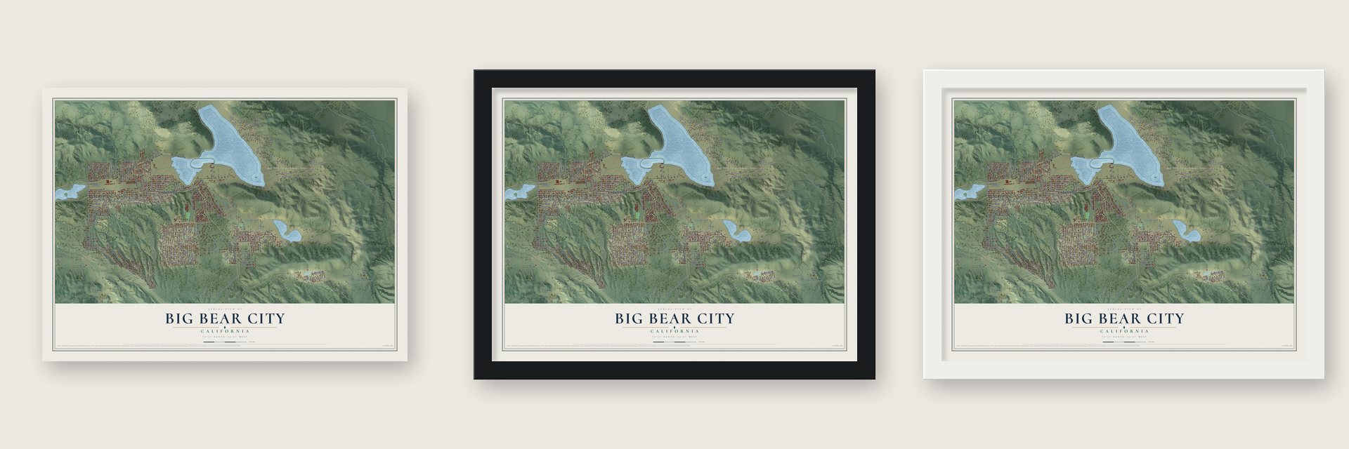
Unframed archival matte, a black wood frame or a white wood frame.
Up close
Geography Worth Displaying
This map was created using accurate cartographic data and authoritative geographic sources, including the U.S. Geological Survey and the Census Bureau. The map brings together terrain, waterways, roads, and building detail. The majority of the streets are labeled, houses are accurately depicted, and the topography is derived from government sources. Combining local data with carefully composed color and shading leads to this beautifully detailed Big Bear City artwork for your wall.
Rather than simply showing street outlines, we’ve included as many of the street names as we could reasonably fit on the map while keeping their names legible. Zoom in on the high resolution preview to see exactly what’s on the map. We truly set out to create a statement piece for anyone who loves Big Bear City. So whether it’s for you, or a gift for someone you love, we hope this map of Big Bear City brings back fond memories.
Read the story behind this map of Big Bear City, California from 2026.
Find your street
Names on the Big Bear City map
Every name below is printed on this map. Look for your street, your school, the park where you played, or the pond down the road.
Places and landmarks4
- Sugarloaf
- Baldwin Lake
- Woodlands
- San Bernardino National Forest
Streets and roads242
- West Big Bear Boulevard
- North Shore Drive
- East North Shore Drive
- East Big Bear Boulevard
- Greenway Drive
- West North Shore Drive
- Greenspot Boulevard
- Erwin Ranch Road
- Lakewood Drive
- State Lane
- Meadow Lane
- Hatchery Drive
- East State Lane
- East Lane
- Saw Mill Drive
- Paradise Way
- Sand Canyon Road
- Baldwin Lake Road
- Pioneer Town Road
- Villa Grove Avenue
- West Fairway Boulevard
- North Division Drive
- Salem Drive
- Victoria Lane
- State Court
- Needles Lane
- Hatchery Road
- Pond Drive
- Shay Road
- Arastre Road
Show all 242 streets
- Division Drive
- Edgerton Drive
- Monte Vista Drive
- Pine Lane
- Gold Mountain Drive
- Barton Lane
- Wolf Drive
- Sugarpine Road
- Burns Canyon Road
- East Country Club Boulevard
- Baldwin Lane
- Mount Doble Drive
- Oak Lane
- Montclair Drive
- Smarts Ranch Road
- Spruce Lane
- Maple Lane
- Cedar Lane
- Minnow Lane
- Manzanita Lane
- Mahogany Lane
- Imperial Avenue
- Holmes Lane
- Leonard Lane
- Highland Avenue
- Sunset Lane
- Kern Avenue
- Sugarloaf Boulevard
- Willow Lane
- Sherwood Boulevard
- Angeles Boulevard
- Rainbow Boulevard
- Heritage Trail
- Shady Lane
- Vale Drive
- Gocke Valley Road
- Tuolumne Road
- Balky Horse Canyon Road
- Skyview Drive
- Angels Camp Road
- Van Dusen Canyon Road
- Butte Avenue
- Wolf Road
- McAlister Road
- East Meadow Lane
- Orange Avenue
- Ponderosa Ranch Road
- La Crescenta Drive
- Mitchell Lane
- Minton Drive
- Eagle Mountain Drive
- Booth Way
- Central Lane
- Inyo Avenue
- Hill Avenue
- Ash Lane
- Barrett Way
- Cedar Glen Drive
- Shore Drive
- Mountain Lane
- Pinon Lane
- Woodland Drive
- Mann Drive
- Fir Lane
- Fifth Lane
- Maple Ridge Drive
- Robinhood Boulevard
- Seventh Lane
- First Lane
- Third Lane
- Garnet Street
- Glencove Drive
- South Drive
- Dixie Lee Lane
- Delta Avenue
- Fox Lane
- Brewer Way
- Wilderness Drive
- Columbine Drive
- South Maple Lane
- Fern Lane
- Quartz Lane
- Palomino Drive
- Mariposa Lane
- Woodside Drive
- Tuplin Lane
- Crater Court
- Downey Drive
- Teal Drive
- La Paz
- Turlock Drive
- Upland Drive
- Green Way Drive
- Cascade Street
- Raleigh Drive
- West Pioneer Lane
- Bowles Drive
- Hillen Dale Drive
- Oak Drive
- Third Street
- Madrona Lane
- Pioneer Lane
- Klamath Road
- Nana Avenue
- East Fox Road
- West Aeroplane Boulevard
- East Fairway Boulevard
- San Bernardino Avenue
- Wabash Avenue
- Moreno Avenue
- Clark Lane
- Lakeview Road
- Minton Avenue
- Cypress Lane
- Mound Street
- Wendy Avenue
- Sequoia Drive
- Anita Avenue
- Falling Springs Road
- Whispering Forest Drive
- Golden Rod Avenue
- Barranca Boulevard
- Pinon Drive
- Shenandoah Way
- Estacia Road
- Baldwin Ranch Road
- Zaca Road
- Serpentine Drive
- Peter Avenue
- Arbor Lane
- Plumas Court
- South Bramble Bush Trail
- San Anselmo Drive
- Mountain View Boulevard
- Mount Verdi Road
- Parkway Drive
- Valley View Drive
- Midway Boulevard
- Needle Lane
- Pinon Avenue
- Carbon Lane
- Kayah Drive
- Indian Trail
- Kinney Way
- Flintridge Avenue
- Starr Drive
- Dawson
- Terrace Drive
- Hugo Lane
- Dawn Drive
- Cavern Drive
- Azurite Drive
- Vine Avenue
- Curly Drive
- Tenth Lane
- Bonita Vista Court
- Jasper Drive
- First Street
- Wiebe Road
- Miller Lane
- Lookout Drive
- Vista Avenue
- Riverside Avenue
- Santa Barbara Avenue
- Pine View Drive
- Maltby Boulevard
- Sheephorn Road
- Hemlock Lane
- Pacific Crest Trail
- Wildwood Trail
- Big Tree Drive
- Magnolia Lane
- Laurel Lane
- Rose Hill Drive
- Mount Shasta Road
- Kiowa Drive
- Kean Way
- Angelus Avenue
- De Lamar
- Wagon Wheel Way
- Dutch Way
- Alpenweg Drive
- Deer Horn Drive
- Live Oak Place
- Nettle Road
- Apple Tree Road
- Selenium Lane
- Yucca Drive
- Petrel Drive
- Moreno Lane
- Fox Farm Road
- Fox Road
- Lofty Vw
- East Mountain View Boulevard
- Tanglewood Drive
- Juniper Lane
- Rock Point Road
- Oakes Camp Road
- Sites Way
- Alta Vista Avenue
- Forest Hill Drive
- Rocky Mountain Road
- Wallace Lane
- Mohagany
- North Log Lane
- Belmont Drive
- Appaloosa Trail
- Silver Pine Road
- Silverton
- Valley View Lane
- Kiener Drive
- Mason Lane
Names are listed as they appear on the printed map. Zoom into the product photos to find them.
About Big Bear City, California
From the Historical Marker Database: "Builder Guy Maltby was known for his legendary half log homes that developed Big Bear City."
Keep exploring California
Big Bear City is one of 1,914 California towns we've mapped. Every dot on the map is a print of its own.
The search covers every state, California first.
Near Big Bear City
Order 2 or more town maps and save 10%. Shown in the size and finish you picked above, so they hang as a set.
- Big Bear Lake 12" x 18" / Archival Matte Print $39.99
- Lucerne Valley 12" x 18" / Archival Matte Print $39.99
- Oak Glen 12" x 18" / Archival Matte Print $39.99


More maps nearby: Running Springs, Morongo Valley, Yucaipa, Cherry Valley and Lake Arrowhead.
The art of mapping a place
How This Map Was Made
Real places. Remarkable detail. Discover the layers that turn geographic data into a map of home.

The view from above
Aerial imagery reveals the character of the land: woodland, open fields, and the patterns of a place.

The shape of the land
Elevation data brings hills, valleys, and subtle changes in the landscape into view.

The details of home
Roads, waterways, and building footprints come together to make the map feel unmistakably local.

Geography becomes art
Considered color, shading, and typography bring the layers together in a map made for your wall.


Process illustrated with Mendon, Massachusetts. Aerial imagery: USDA NAIP. Terrain: USGS 3D Elevation Program. Map details and finished artwork: KNOWOL.
The Details
About This Print
Choose an archival matte print, or a black or white Ayous wood frame. The archival matte print is unframed.
Select your size and finish above to see the matching product image and price.
Materials & Craftsmanship
A contemporary map with the character of a classic atlas, printed on archival matte paper. Optional frames are made from Ayous wood.
Your printed map does not include the watermark shown in the full-map preview.
Shipping & Delivery
Free shipping within the United States. Every print is made to order in the USA.
Buying a gift? Add a note in your cart and we'll include it. We never put prices in the package.
Prints ship within 2 to 3 business days. Allow 7 to 10 days total from ordering for delivery. Timing may vary during holidays or periods of high order volume.
Read our shipping policy.
Returns and damaged prints
Each print is made to order. Change-of-mind refunds are not available after production.
If your print arrives damaged, misprinted or incorrect, contact support@knowol.com within 30 days of receiving it. Include your order number, photos and a description of the issue.
Read our full refund and replacement policy. For questions about your order, email support@knowol.com.