
Search for another town





Free U.S. delivery 7 to 10 days after you order
Bloomington, Indiana Map Art
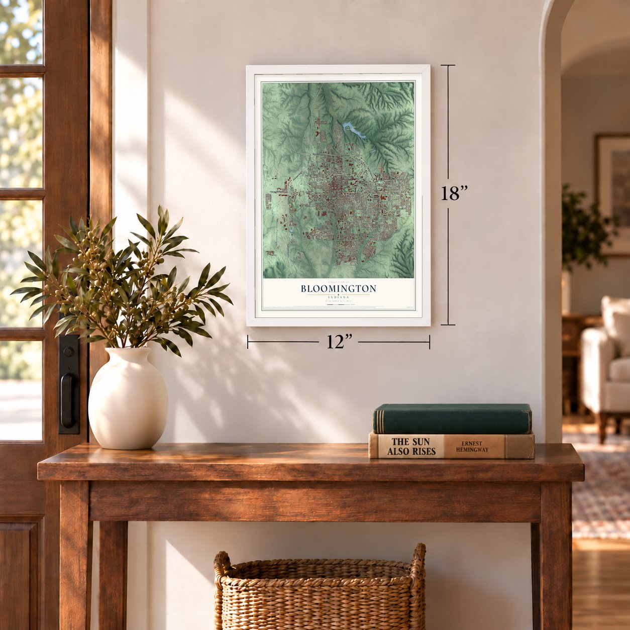
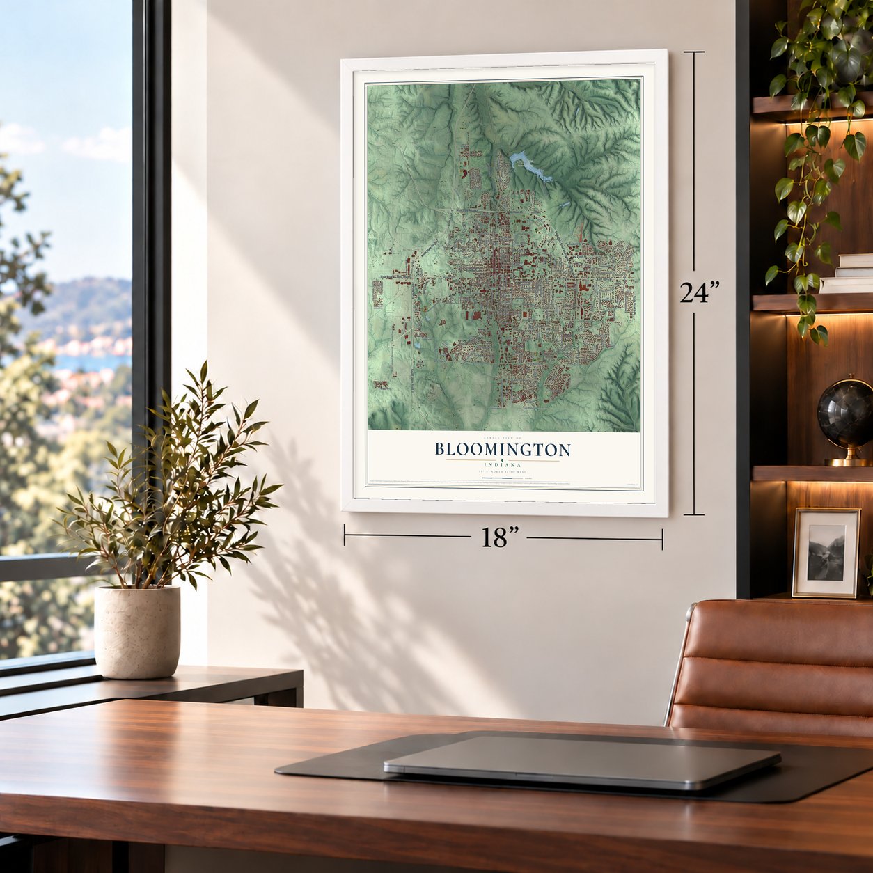
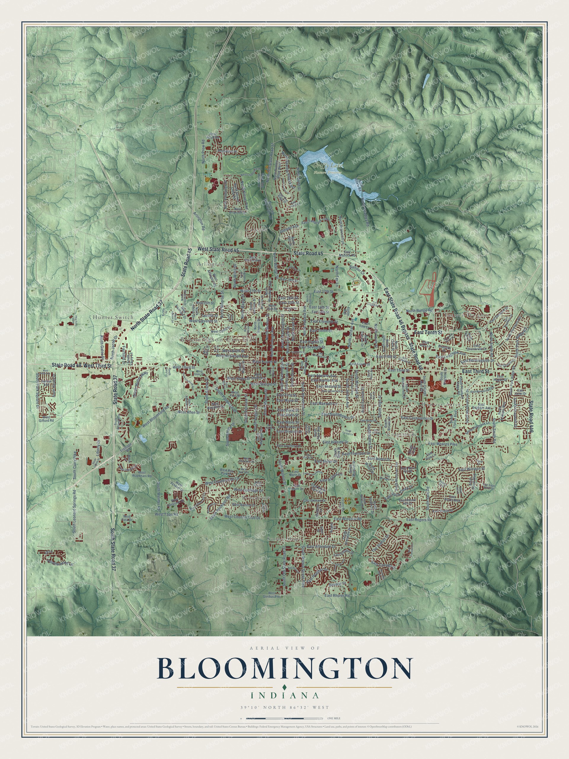
A new map of Bloomington, Indiana, made in 2026 and printed to order on thick archival matte paper.
12" x 18" Archival Matte Print
A Map of Home. A Work of Art.
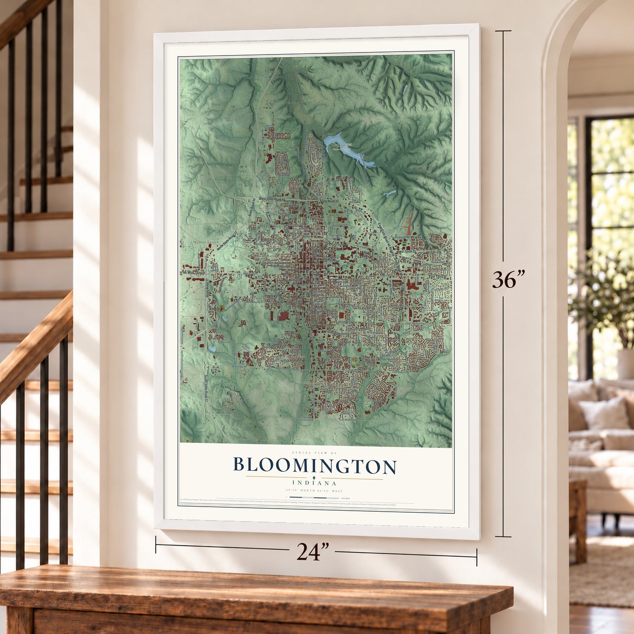
This beautifully detailed map of Bloomington, Indiana was created in 2026 using aerial imagery combined with modern topographical, census, street and landmark data. It's a modern aerial view of Bloomington in Monroe County, Indiana, that combines modern data with a vintage aesthetic. Zoom in on the preview and look for your block.
Three ways to hang it
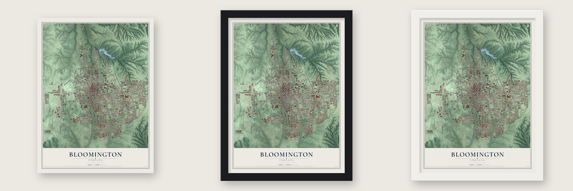
Unframed archival matte, a black wood frame or a white wood frame.
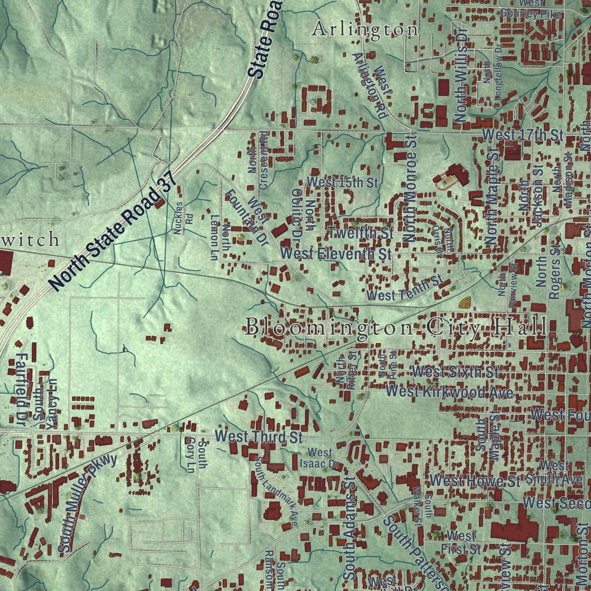
Up close
Real geography. Art worth displaying.
This map was created using accurate cartographic data and authoritative geographic sources, including the U.S. Geological Survey and the Census Bureau. The map brings together terrain, waterways, roads, and building detail. The majority of the streets are labeled, houses are accurately depicted, and the topography is derived from government sources. Combining local data with carefully composed color and shading leads to this beautifully detailed Bloomington artwork for your wall.
Rather than simply showing street outlines, we’ve included as many of the street names as we could reasonably fit on the map while keeping their names legible. Zoom in on the high resolution preview to see exactly what’s on the map. We truly set out to create a statement piece for anyone who loves Bloomington. So whether it’s for you, or a gift for someone you love, we hope this map of Bloomington brings back fond memories.
Read the story behind this map of Bloomington, Indiana from 2026.

Find your street
Names on the Bloomington map
Every name below is printed on this map. Look for your street, your school, the park where you played, or the pond down the road.
Places and landmarks12
- Bloomington City Hall
- Bryan Park
- Griffy Lake Nature Preserve
- Olcott Park
- Arlington
- Broadview
- Cascade
- Eastern Heights
- Hoosier Acres
- Hunter Switch
- Ridgemede
- Sunny Slopes
Streets and roads278
- State Road 45
- State Road 46
- West State Road 45
- East State Road 46 Bypass
- East Tenth Street
- East Third Street
- State Road 48
- West Third Street
- State Road 37
- North State Road 37
- South State Road 37
- State Road 446
- South Walnut Street
- West Bloomfield Road
- South Walnut Street Pike
- East Rhorer Road
- North College Avenue
- North Headley Road
- North Jordan Avenue
- South Jordan Avenue
- South Curry Pike
- East Davis Street
- East Azalea Lane
- South Leonard Springs Road
- Arlington Road
- Heatherwood Lane
- East Driscoll Drive
- Fairfield Drive
- South Smith Road
- East Canada Drive
Show all 278 streets
- North Kinser Pike
- North Walnut Street
- North Dunn Street
- South Sare Road
- North Old State Road 37
- South Rogers Street
- South Henderson Street
- East Seventh Street
- East Moores Pike
- South High Street
- East Second Street
- West Allen Street
- East 17th Street
- West 17th Street
- East Hillside Drive
- East First Street
- East Winslow Road
- East Maxwell Lane
- West Tapp Road
- East Covenanter Drive
- West Eleventh Street
- South Adams Street
- South Old State Road 37
- South Lincoln Street
- South Washington Street
- South Grant Street
- East Atwater Avenue
- North Lincoln Street
- West Kirkwood Avenue
- East Morningside Drive
- North Washington Street
- West Sixth Street
- North Fee Lane
- West Countryside Lane
- East Hunter Avenue
- South Patterson Drive
- West Country Club Drive
- East Miller Drive
- East Eighth Street
- West Second Street
- East Rogers Road
- South Rockport Road
- East Winston Street
- East Allendale Drive
- North Monroe Street
- North Prow Road
- North Indiana Avenue
- South Weimer Road
- North Grant Street
- East Rock Creek Drive
- East Southdowns Drive
- East Eleventh Street
- North Range Road
- East Thornton Drive
- South Mitchell Street
- North Union Street
- South Morton Street
- North Maple Street
- South Fairview Street
- East 14th Street
- The Stands Drive
- North Gates Drive
- West Fourth Street
- East Wylie Street
- South Park Square Drive
- East Longview Avenue
- North Park Ridge Road
- West Howe Street
- North Morton Street
- North Ramble Road East
- East Fifth Street
- South Strong Drive
- East Arden Drive
- East Heather Drive
- North Smith Road
- South Muller Parkway
- North Jacob Drive
- Liberty Drive
- East 15th Street
- Benson Court
- South Graywell Drive
- South Nancy Street
- West Coolidge Drive
- North Willis Drive
- East Allen Street
- East Dixie Street
- Twelfth Street
- East 16th Street
- Glendora Drive
- Balfour Court
- East Matlock Road
- South College Mall Road
- South Clarizz Boulevard
- West 15th Street
- North Old Martinsville Road
- South Madison Street
- West Arlington Road
- West Fountain Drive
- South Meadowbrook Drive
- East Fourth Street
- South Olcott Boulevard
- South Park Avenue
- South Woodscrest Drive
- South Pleasant Ridge Road
- North Rogers Street
- North Jackson Street
- West First Street
- West Club House Drive
- West Tenth Street
- East Grimes Lane
- South Eastside Drive
- North Ramble Road West
- West 14th Street
- Rosewood Drive
- South Fenbrook Lane
- West Smith Avenue
- East Law Lane
- East Daniel Street
- South Park Ridge Road
- East 13th Street
- North Browncliff Lane
- North Woodburn Avenue
- South Montclair Avenue
- South Maxwell Street
- North Fritz Drive
- East Tamarack Trail
- West Ralston Drive
- North Hinkle Road
- North Valleyview Drive
- South Romans Way
- East Deckard Drive
- South Kingston Drive
- South Allendale Drive
- South Olive Street
- North Stoney Crest Road
- North Plymouth Road
- South Maple Street
- East Brighton Avenue
- Acadia Court
- East Southern Drive
- East Grandview Drive
- West Gordon Pike
- South Harvey Drive
- East Wylie Farm Road
- East Graham Drive
- North Jefferson Street
- West Briarcliff Drive
- West Rca Park Drive
- Foster Hall
- East 19th Street
- East Elliston Drive
- West Wapehani Road
- South Wilton Drive
- South Stratford Drive
- North Clark Street
- South Brooks Drive
- South Indiana Avenue
- West Acuff Road
- East North Drive
- Burberry Lane
- West Sunstone Drive
- East Amy Lane
- East Hagan Street
- West Gifford Road
- North Oolitic Drive
- East Olcott Boulevard
- East Janet Drive
- West Woodhill Drive
- East South Drive
- Braeside Drive
- East Round Hill Lane
- West Ezekiel Drive
- Sunset Avenue
- North Sunrise Drive
- Frontage Road
- East Nora Hill Drive
- South Yancy Lane
- West Cota Drive
- Birch Lane
- Iris Lane
- East Pine Lane
- South Ira Street
- Eden Drive
- West Gourley Pike
- East University Street
- South Basswood Drive
- North Fess Avenue
- South Oakdale Drive
- South Fess Avenue
- West Clubhouse Drive
- South Rose Avenue
- West Adams Hill Circle
- East Blue Ridge Drive
- East Brownridge Road
- North Madison Street
- East Saratoga Drive
- South Swain Avenue
- Pinehurst Drive
- North Crescent Road
- North Lemon Lane
- East Stephens Drive
- Robins Bow
- East Ruby Lane
- South Ransom Lane
- North Kerry Drive
- East Clover Lane
- West Cherokee Drive
- South Wexley Road
- South Cory Lane
- East Saint Remy Drive
- West Isaac Drive
- North Ritter Street
- West Guy Avenue
- West Joy Street
- Reed Court
- East Kirkwood Avenue
- East Varsity Lane
- South Highland Avenue
- South College Avenue
- South Liberty Drive
- North Fairview Street
- South Landmark Avenue
- East Kirkwood Street
- East Lingenbach Lane
- South Walker Street
- South Oaklawn Circle
- East Summit View Place
- East Sixth Street
- East John Hinkle Place
- South Bryan Street
- West Belle Avenue
- East Burks Drive
- South Tarzian Lane
- North Bankers Drive
- North Orris Drive
- South Laura Way
- Brownstone Drive
- North Longfellow Drive
- East Wimbleton Lane
- West Grimes Lane
- Nuckles Road
- South Anita Street
- South Dale Court
- South Mill Stone Court
- North Curry Pike
- East Viva Drive
- East Moody Drive
- North Pine Street
Names are listed as they appear on the printed map. Zoom into the product photos to find them.
The art of mapping a place
How This Map Was Made
Real places. Remarkable detail. Discover the layers that turn geographic data into a map of home.

The view from above
Aerial imagery reveals the character of the land: woodland, open fields, and the patterns of a place.

The shape of the land
Elevation data brings hills, valleys, and subtle changes in the landscape into view.

The details of home
Roads, waterways, and building footprints come together to make the map feel unmistakably local.

Geography becomes art
Considered color, shading, and typography bring the layers together in a map made for your wall.


Process illustrated with Mendon, Massachusetts. Aerial imagery: USDA NAIP. Terrain: USGS 3D Elevation Program. Map details and finished artwork: KNOWOL.
The Details
About This Print
Choose an archival matte print, or a black or white Ayous wood frame. The archival matte print is unframed.
Select your size and finish above to see the matching product image and price.
Materials & Craftsmanship
A contemporary map with the character of a classic atlas, printed on archival matte paper. Optional frames are made from Ayous wood.
Your printed map does not include the watermark shown in the full-map preview.
Shipping & Delivery
Free shipping within the United States. Every print is made to order in the USA.
Buying a gift? Add a note in your cart and we'll include it. We never put prices in the package.
Prints ship within 2 to 3 business days. Allow 7 to 10 days total from ordering for delivery. Timing may vary during holidays or periods of high order volume.
Read our shipping policy.
Returns and damaged prints
Each print is made to order. Change-of-mind refunds are not available after production.
If your print arrives damaged, misprinted or incorrect, contact support@knowol.com within 30 days of receiving it. Include your order number, photos and a description of the issue.
Read our full refund and replacement policy. For questions about your order, email support@knowol.com.
Find your town
Looking for another city?
Find a map of home in our Indiana collection.
Nearby
Maps of towns near Bloomington
Know someone from one of these towns? Their map makes a great gift.
 Ellettsville
, Indiana
From $39.99See the map
 Smithville-Sanders
, Indiana
From $39.99See the map
 Stanford
, Indiana
From $39.99See the map
More maps nearby: Harrodsburg, Stinesville, Solsberry, Judah and Helmsburg.