
Search for another town





Free U.S. delivery 7 to 10 days after you order
Bossier City, Louisiana Map Art
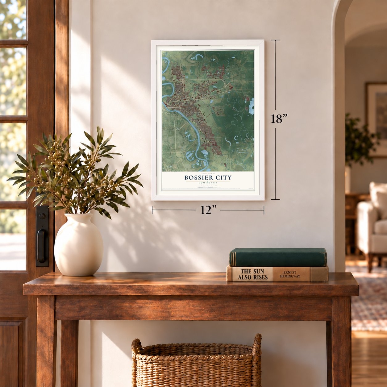
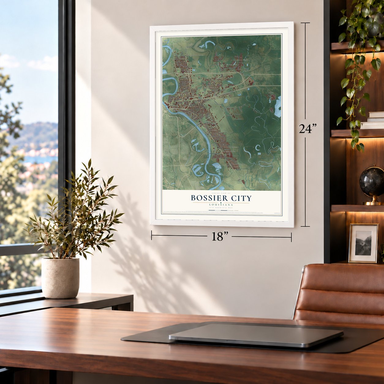
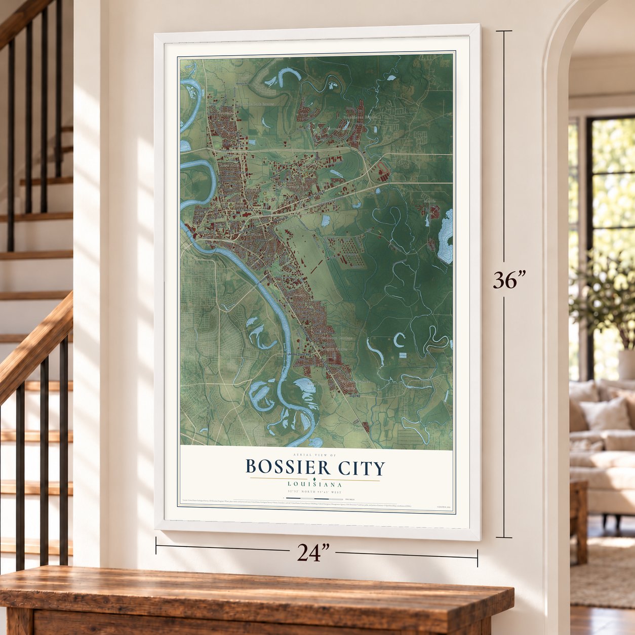
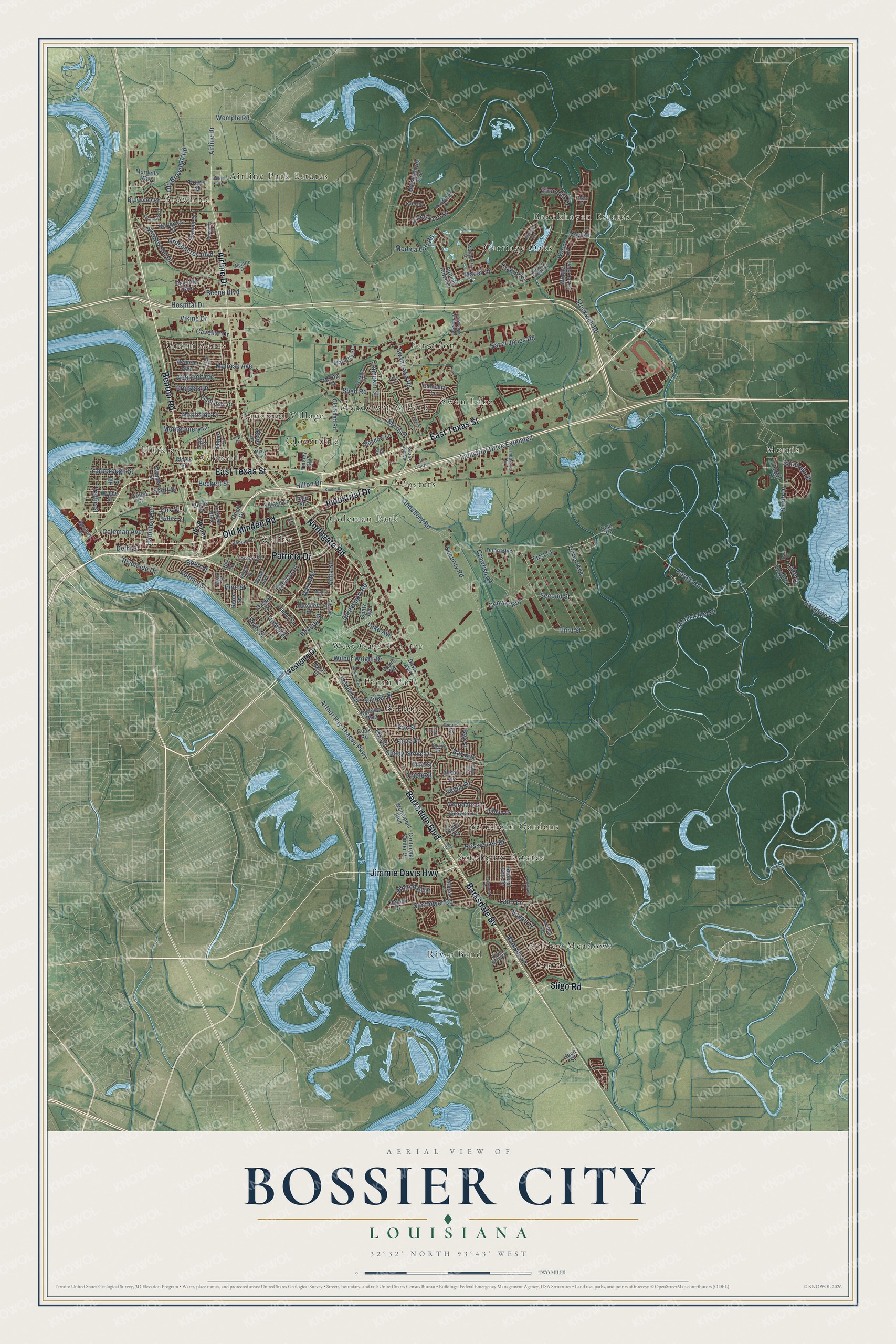
A new map of Bossier City, Louisiana, made in 2026 and printed to order on thick archival matte paper.
12" x 18" Archival Matte Print
A Map of Home. A Work of Art.
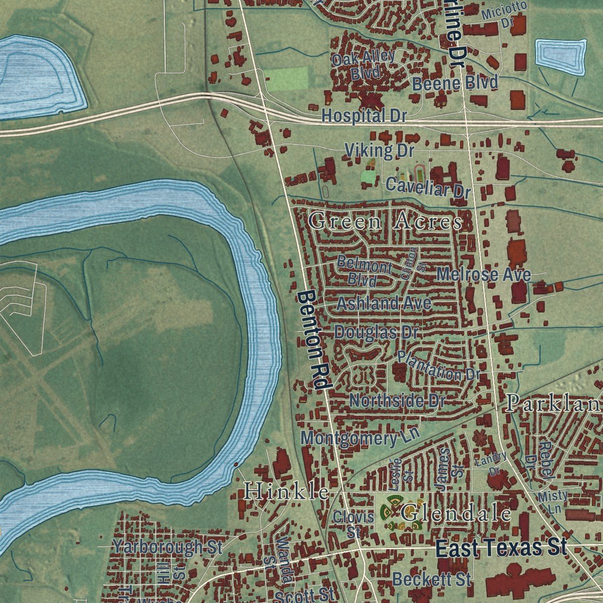
Explore Bossier City, Louisiana from a whole new perspective. Created using aerial imagery and detailed geographic data, this map captures Bossier City building by building, with labeled streets, familiar landmarks, and shaded topographical relief that highlights the natural contours of the landscape.
Combining modern data with the timeless character of a vintage atlas, this map is just as interesting up close as it is beautiful on the wall. Whether you grew up in Bossier City, spent memorable years there, or call it home today, this unique map is a great way to celebrate a place that means something to you. Zoom in on the preview to look for your street, and then order a print to put your memories on the wall.
Three ways to hang it
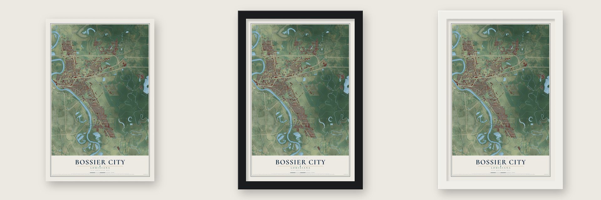
Unframed archival matte, a black wood frame or a white wood frame.
Up close
Geography Worth Displaying
This map was created using accurate cartographic data and authoritative geographic sources, including the U.S. Geological Survey and the Census Bureau. The map brings together terrain, waterways, roads, and building detail. The majority of the streets are labeled, houses are accurately depicted, and the topography is derived from government sources. Combining local data with carefully composed color and shading leads to this beautifully detailed Bossier City artwork for your wall.
Rather than simply showing street outlines, we’ve included as many of the street names as we could reasonably fit on the map while keeping their names legible. Zoom in on the high resolution preview to see exactly what’s on the map. We truly set out to create a statement piece for anyone who loves Bossier City. So whether it’s for you, or a gift for someone you love, we hope this map of Bossier City brings back fond memories.
Read the story behind this map of Bossier City, Louisiana from 2026.

About Bossier City, Louisiana
Bossier City is a city of 62,701 people in Bossier Parish, on the east bank of the Red River across from Shreveport. In the 1830s James Cane and his wife Mary bought a plantation here called Elysian Grove. Its dock on the river, near where the Texas Trail crossed, became known as Cane's Landing.
The Canes' granddaughter, Anna B., was sure a city on the riverfront would do well, so she and J. J. Stockwell began selling lots in 1883. People often called the settlement Cane City, and it had about 600 residents in the 1890s. Around 1907 Governor Newton C. Blanchard incorporated it as a village named Bossier City and chose Ewald Max Hoyer, a Shreveport businessman, as its first mayor. Governor John M. Parker later made it a town, and Governor Earl Kemp Long declared it a city.
- Forts on the Cane plantationDuring the Civil War, Confederate companies left Cane's Landing by steamboat, and Mrs. Cane welcomed hundreds of officers and soldiers on their way to war. Three batteries were built on her land to guard Shreveport from the east, with Fort Kirby Smith at the center. The war ended in Shreveport when the Trans-Mississippi Department surrendered. Bossier High School later went up near the fort's old site, and it joined the National Register in 2004.
- A covered road to the riverShed Road ran for 9 miles from Red Chute to the Red River, raised up and covered with a roof. Open from 1874 to 1886, it was the South's first turnpike that wagons could use in any weather, and it made hauling goods to the river easier in the years before the railroads came.
- A golden spike in 1884On July 12, 1884, Julia "Pansy" Rule drove a golden spike at Bossier City to mark the completion of the Vicksburg, Shreveport and Pacific Railroad, a line running east to west. No woman had driven such a spike before. The Shreveport and Arkansas Railroad followed on April 6, 1888, and the Louisiana-Arkansas Railroad on November 2, 1909, making the town a hub.
- Half of downtown burnedOn June 23, 1925, a fire destroyed half of downtown Bossier City, and residents had no way to stop it. The loss pushed the city to build a modern water system strong enough for such fires, a new city hall, a fire alarm system, new sidewalks and its first city park. The Bossier City Municipal Building joined the National Register in 2002.
- Barksdale comes to townOn December 4, 1928, after years of effort by civic leaders, the Shreveport-Bossier City area won the Third Attack Group. Shreveport annexed land south of Bossier City in 1929 and gave it to the federal government, and Barksdale Airfield went up in the 1930s. It trained World War II pilots, navigators and bombardiers and now headquarters the 8th Air Force. Its Bachelor Officers' Garage, Bakery, Base Storage Facility and Ordnance Warehouse joined the National Register in 1992.
Find your street
Names on the Bossier City map
Every name below is printed on this map. Look for your street, your school, the park where you played, or the pond down the road.
Places and landmarks24
- Brownlee
- Airline Park Estates
- Bellaire
- Brookhaven Estates
- Carriage Oaks
- Cloverdale
- Coleman Park
- Curtis
- Ferguson
- Fosters
- Glendale
- Golden Meadows
Show all 24 places
- Green Acres
- Hinkle
- Meadowview Park
- Morris
- Parkland Village
- Pecan Park
- River Bend
- Southern Gardens
- Southgate Estates
- Swan Lake
- Waller
- West Gate Terrace
Streets and roads192
- Barksdale Boulevard
- East Texas Street
- Benton Road
- Barksdale Bv
- Old Minden Road
- Northgate Road
- Jimmie Davis Highway
- Airline Drive
- Industrial Drive
- Patricia Drive
- Sligo Road
- Range Road
- Lake Drive
- Security Road
- Convoy Route
- Fox Street
- Traffic Street
- Second Street
- Arthur Ray Teague Parkway
- Shed Road
- Lindeberg Road
- Viking Drive
- Swan Lake Road
- Stockwell Road
- Industrial Drive Extended
- Hazel Jones Road
- Hamilton Road
- Old Brownlee Road
- Shady Grove Drive
- Smith Drive
Show all 192 streets
- Bayou Drive
- Douglas Drive
- Wilbur Wright Drive
- Melrose Avenue
- Southwood Drive
- Greenacres Boulevard
- Moon Lake Road
- Holiday Place
- Hospital Drive
- Avondale Lane
- Pampus Lane
- Anita Street
- Ray Avenue
- Venus Drive
- Long Acre Drive
- Delhi Street
- Northside Drive
- Shreveport Road
- Sunflower Road
- Wemple Road
- Rossie Lee Drive
- Beene Boulevard
- Turner Avenue
- Rodney Street
- Beckett Street
- Ashland Avenue
- Eastgate Road
- Norris Drive
- Modica Lott Road
- Lampkin Street
- Whitehall Drive
- Saratoga Street
- Montgomery Lane
- Schuler Drive
- Crawfish Road
- Yarborough Street
- Caveliar Drive
- Coleman Avenue
- Hilton Drive
- River Street
- Beverly Street
- Riverside Drive
- Mark Avenue
- Scott Street
- Coy Road
- Luke Avenue
- Trichel Street
- Churchill Drive
- Pine Street
- Third Street
- Cove Street
- Bonn Street
- Lauri Lane
- Coach Road
- Macey Lane
- Ella Street
- First Street
- Cox Street
- Oriole Street
- Bey Street
- Westgate Drive
- Davis Avenue
- Dunn Boulevard
- Old Shed Road
- Brownlee Road
- Centurytel Center Drive
- Woodmont Boulevard
- Waller Avenue
- Alison Avenue
- Middle Creek Boulevard
- Summit Drive
- Bellaire Boulevard
- Horseguards Avenue
- Belmont Boulevard
- Plantation Drive
- Curtis Road
- Wyche Street
- James Street
- Northpark Drive
- Village Lane
- Green Street
- General Polk Drive
- Garden Street
- Brown Street
- Gould Drive
- Rebel Drive
- Violet Avenue
- Gaston Lane
- Erwin Drive
- Benton Street
- Oak Alley Boulevard
- Mordello Way
- Marlena Street
- Rome Street
- Preston Boulevard
- Jordan Drive
- Spatz Avenue
- Burchett Street
- Meadow Lane
- Camellia Lane
- Chopin Drive
- Autumn Ridge Drive
- Griffin Lane
- Wanda Street
- Loreco Street
- Winsor Court
- Lamar Street
- Burns Drive
- Hill Street
- Tinsley Boulevard
- Cline Street
- Cook Road
- Hope Street
- McCoy Drive
- Rose Place
- Clovis Street
- Tulip Street
- Spur Road
- Roy Street
- Benton Spr
- Bobbie Street
- Hickory Ridge Drive
- Surrey Lane
- Kristen Avenue
- Swan Lake Spr
- Waterbury Drive
- Industrial Circle
- Melissa Lane
- Leslie Street
- Peremiter Road
- Teekell Street
- Dennis Street
- Downing Court
- Arrowhead Drive
- Le Rivage of Bossier
- Miciotto Drive
- Bayou Circle
- Gilbert Drive
- River Bend Drive
- Carnaby
- Lily Street
- Gibson Drive
- Many Street
- Misty Lane
- Joey Lane
- Ann Street
- Longstreet Place
- Twining Drive
- Antietam Drive
- Knolin Road
- Lancashire Drive
- Clinton Street
- Murphy Street
- Shirley Lane
- Rue Lebossier
- Valkyrie Drive
- Landry Drive
- Evelyn Street
- Diana Street
- Jason Street
- Kirk Lane
- Lens Court
Names are listed as they appear on the printed map. Zoom into the product photos to find them.
The art of mapping a place
How This Map Was Made
Real places. Remarkable detail. Discover the layers that turn geographic data into a map of home.

The view from above
Aerial imagery reveals the character of the land: woodland, open fields, and the patterns of a place.

The shape of the land
Elevation data brings hills, valleys, and subtle changes in the landscape into view.

The details of home
Roads, waterways, and building footprints come together to make the map feel unmistakably local.

Geography becomes art
Considered color, shading, and typography bring the layers together in a map made for your wall.


Process illustrated with Mendon, Massachusetts. Aerial imagery: USDA NAIP. Terrain: USGS 3D Elevation Program. Map details and finished artwork: KNOWOL.
The Details
About This Print
Choose an archival matte print, or a black or white Ayous wood frame. The archival matte print is unframed.
Select your size and finish above to see the matching product image and price.
Materials & Craftsmanship
A contemporary map with the character of a classic atlas, printed on archival matte paper. Optional frames are made from Ayous wood.
Your printed map does not include the watermark shown in the full-map preview.
Shipping & Delivery
Free shipping within the United States. Every print is made to order in the USA.
Buying a gift? Add a note in your cart and we'll include it. We never put prices in the package.
Prints ship within 2 to 3 business days. Allow 7 to 10 days total from ordering for delivery. Timing may vary during holidays or periods of high order volume.
Read our shipping policy.
Returns and damaged prints
Each print is made to order. Change-of-mind refunds are not available after production.
If your print arrives damaged, misprinted or incorrect, contact support@knowol.com within 30 days of receiving it. Include your order number, photos and a description of the issue.
Read our full refund and replacement policy. For questions about your order, email support@knowol.com.
Find your town
Looking for another city?
Find a map of home in our Louisiana collection, or any town in the country.
Nearby
Maps of towns near Bossier City
Know someone from one of these towns? Their map makes a great gift.
 Red Chute
, Louisiana
From $39.99See the map
 Eastwood
, Louisiana
From $39.99See the map
 Haughton
, Louisiana
From $39.99See the map
More maps nearby: Shreveport, Benton, Doyline, Blanchard and Greenwood.