
Search for another town





Free U.S. delivery 7 to 10 days after you order
Shreveport, Louisiana Map Art
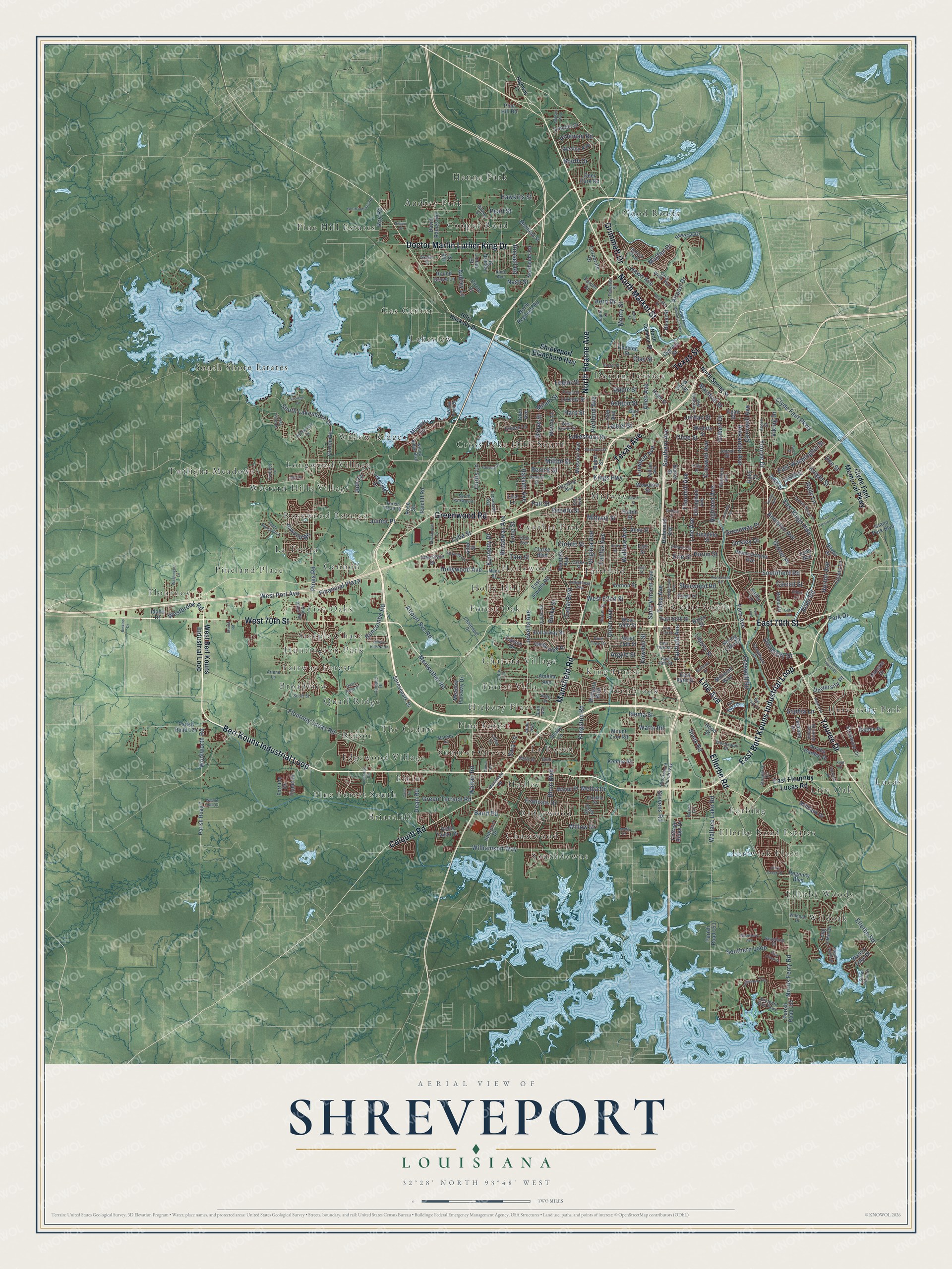
A new map of Shreveport, Louisiana, made in 2026 and printed to order on thick archival matte paper.
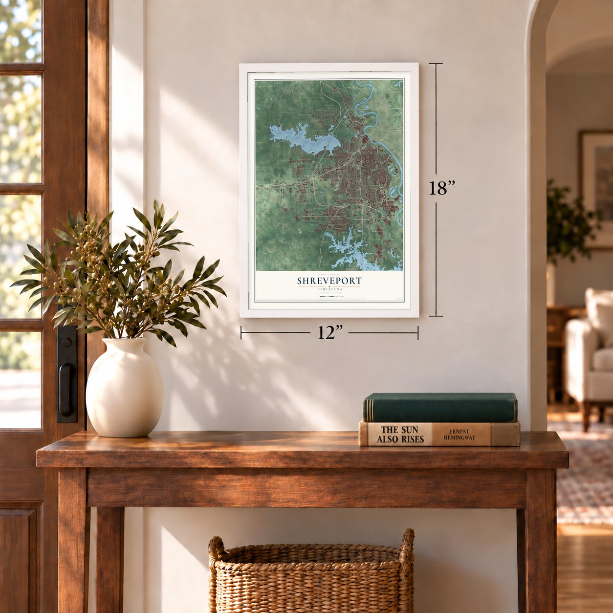
12" x 18" Archival Matte Print
A Map of Home. A Work of Art.
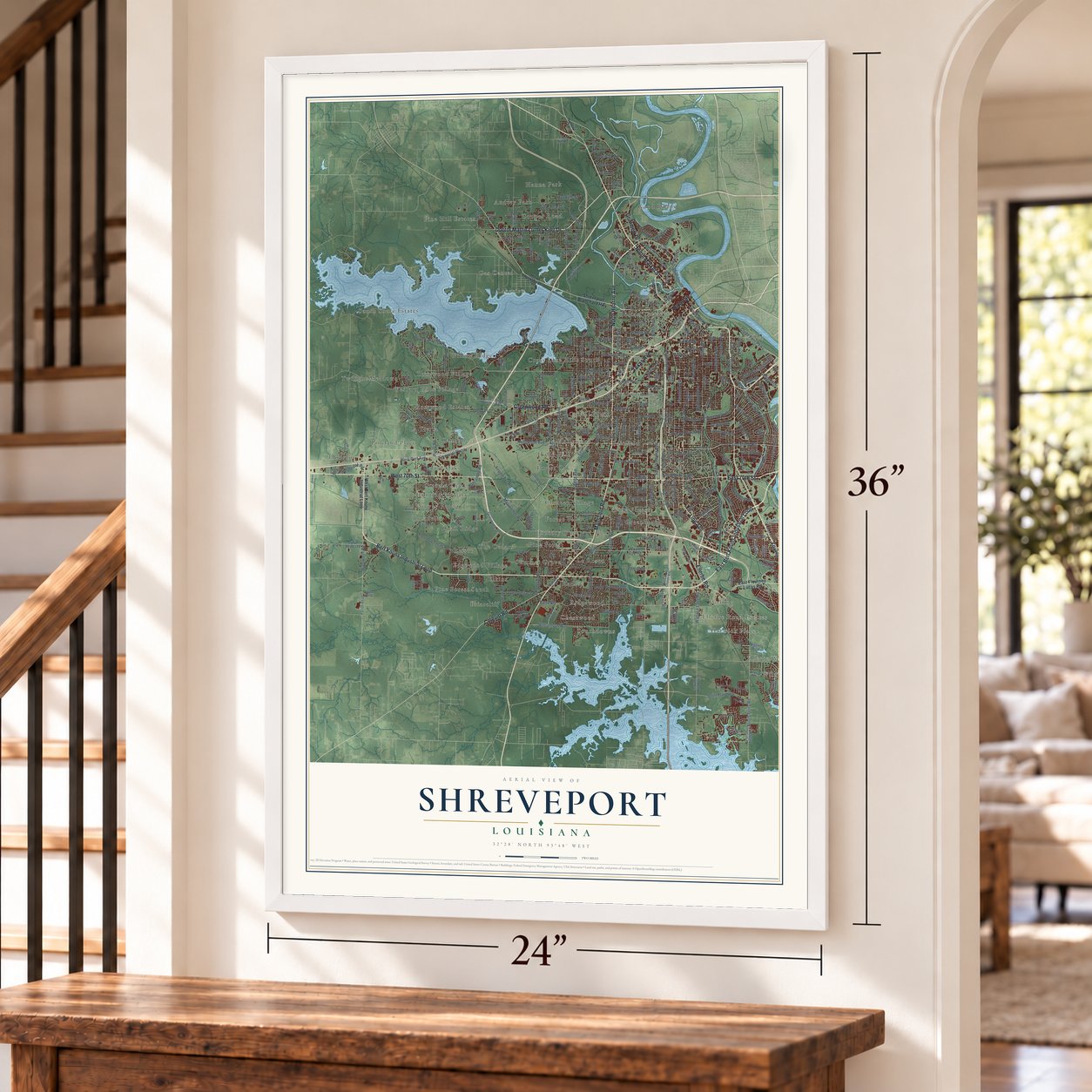
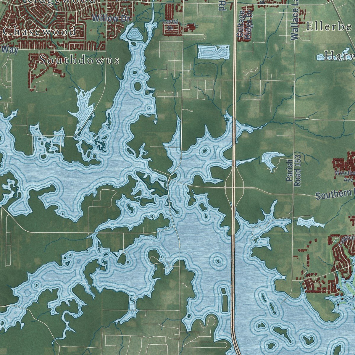
Explore Shreveport, Louisiana from a whole new perspective. Created using aerial imagery and detailed geographic data, this map captures Shreveport building by building, with labeled streets, familiar landmarks, and shaded topographical relief that highlights the natural contours of the landscape.
Combining modern data with the timeless character of a vintage atlas, this map is just as interesting up close as it is beautiful on the wall. Whether you grew up in Shreveport, spent memorable years there, or call it home today, this unique map is a great way to celebrate a place that means something to you. Zoom in on the preview to look for your street, and then order a print to put your memories on the wall.
Three ways to hang it
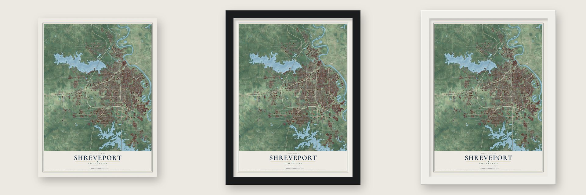
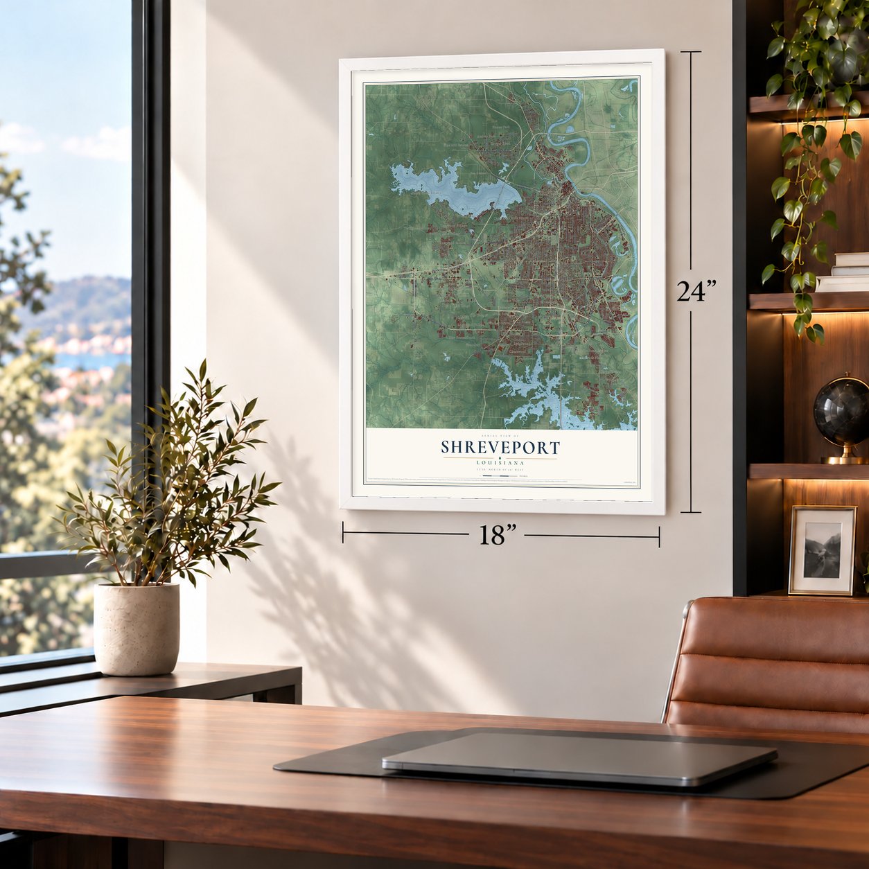
Unframed archival matte, a black wood frame or a white wood frame.
Up close
Geography Worth Displaying
This map was created using accurate cartographic data and authoritative geographic sources, including the U.S. Geological Survey and the Census Bureau. The map brings together terrain, waterways, roads, and building detail. The majority of the streets are labeled, houses are accurately depicted, and the topography is derived from government sources. Combining local data with carefully composed color and shading leads to this beautifully detailed Shreveport artwork for your wall.
Rather than simply showing street outlines, we’ve included as many of the street names as we could reasonably fit on the map while keeping their names legible. Zoom in on the high resolution preview to see exactly what’s on the map. We truly set out to create a statement piece for anyone who loves Shreveport. So whether it’s for you, or a gift for someone you love, we hope this map of Shreveport brings back fond memories.
Read the story behind this map of Shreveport, Louisiana from 2026.

About Shreveport, Louisiana
Shreveport is a city of 187,593 people on the west bank of the Red River. Most of it lies in Caddo Parish, where it is the parish seat, and part of it reaches into Bossier Parish. For years a log jam called the Great Raft, 180 miles long, kept boats off this stretch of the river. Captain Henry Miller Shreve led the Army Corps of Engineers in clearing it with a modified riverboat, the Heliopolis. In 1836 the Shreve Town Company, named in his honor, founded a town where the open river met the Texas Trail, the road into the new Republic of Texas.
The Caddo Indians had sold the company its land in 1835. When Caddo Parish was carved out of Natchitoches Parish in 1838, Shreve Town became its seat, and on March 20, 1839, it was incorporated as Shreveport. The first town covered 64 blocks. Eight streets ran west from the river, crossed by eight more heading south from Cross Bayou. Steamboats soon carried cotton from the parish's plantations, and by 1860 the city's population included 2,200 free residents and 1,300 people held in slavery.
- Confederate capital, 1863 to 1865After Baton Rouge and then Opelousas fell to Union forces, Shreveport served as Louisiana's Confederate capital from 1863 to 1865. It also held the headquarters of the army's Trans-Mississippi Department. That command kept fighting for weeks after Lee gave up, and no Confederate command held out longer: it finally surrendered on May 26, 1865.
- The yellow fever of 1873An epidemic in 1873 killed 759 residents in 80 days, and by the end of November the toll had reached about 1,200, roughly a quarter of the city. About 800 victims were buried in a mass grave at Oakland Cemetery. Five Catholic priests and two religious sisters died while nursing the sick.
- Elvis on the Hayride, 1954From 1948 to 1960 the Louisiana Hayride went out over KWKH each week from the Shreveport Municipal Memorial Auditorium. The country show helped build the careers of Hank Williams and many others. Elvis Presley made his broadcast debut on its stage in 1954, introduced by Horace Logan, who created the program, and Frank Page.
- Lead Belly on Fannin StreetBy the 1910s Huddie Ledbetter, known as Lead Belly, was playing for crowds in St. Paul's Bottoms. The saloons and dance halls of Fannin Street shaped his style, and the blues singer and guitarist went on to international fame.
- Sam Cooke's arrest, 1963In 1963 Shreveport police arrested Sam Cooke when his band, in town for a show, tried to get rooms at a whites-only Holiday Inn. In the months after, he recorded "A Change Is Gonna Come," and the next year Congress passed the Civil Rights Act, ending segregation in public facilities.
Find your street
Names on the Shreveport map
Every name below is printed on this map. Look for your street, your school, the park where you played, or the pond down the road.
Places and landmarks58
- Audrey Park
- Briarcliff
- Broadview
- Cannon
- Cedar Grove
- Chasewood
- Chateau Village
- Cooper Road
- Cross Lake Hills South
- Cynthia Park
- Dorian Terrace
- Edgewood Village
Show all 58 places
- Elkins
- Ellerbe Road Estates
- Ellerbe Woods
- Fairfield
- Fairway Forest
- Five Oaks
- Flournoy
- Forbing
- Forest Oak
- Forest Villa
- Gas Center
- Good Roads
- Greenbrook
- Hadley
- Hanna Park
- Harwick Place
- Hickory Place
- Holly Hill
- Hollywood
- Huntington Park
- King Forest
- La Rosen
- La Tierra
- Lakeview
- Live Oak
- Longwood Village
- Lucas
- Midway
- Pine Forest
- Pine Forest South
- Pine Hill Estates
- Pineland Place
- Quail Ridge
- Reisor
- Ridgewood
- Rosewood Estates
- South Shore Estates
- Southdowns
- Steeple Chase
- Summer Grove
- The Cedars
- Twilight Meadows
- University Park
- Western Hills Village
- Wildoak
- Willow Ridge
Streets and roads353
- North Hearne Avenue
- East 70th Street
- Line Avenue
- Texas Avenue
- West 70th Street
- Ellerbe Road
- Bert Kouns Industrial Loop
- Greenwood Road
- Texas Street
- Youree Drive
- North Market Street
- Mansfield Road
- East Bert Kouns Industrial Loop
- Doctor Martin Luther King Drive
- Colquitt Road
- Grimmett Drive
- Linwood Avenue
- East Kings Highway
- Hollywood Avenue
- Kennedy Drive
- Fern Avenue
- Flournoy Lucas Road
- Allen Avenue
- Midway Street
- Milton Street
- Jewella Avenue
- Pines Road
- Clyde Fant Parkway
- Saint Vincent Avenue
- South Lakeshore Drive
Show all 353 streets
- Fairfield Avenue
- Southern Avenue
- Kingston Road
- Buncombe Road
- Gilbert Drive
- Walker Road
- Lakeshore Drive
- Milam Street
- Creswell Avenue
- Thornhill Avenue
- Meriwether Road
- Kings Highway
- Southfield Road
- Norris Ferry Road
- Ockley Drive
- University Place
- Wallace Avenue
- Portland Avenue
- Highland Avenue
- Dowdell Street
- Wallace Lake Road
- Williamson Way
- Virginia Avenue
- Grover Place
- Union Avenue
- Woolworth Road
- Russell Road
- Baird Road
- Broadway Avenue
- Audrey Lane
- Airport Drive
- West Port Avenue
- Alexander Avenue
- Creswell Road
- Blom Boulevard
- Francais Drive
- Curtis Lane
- Cornwell Avenue
- Hassett Avenue
- East Washington Street
- Desoto Street
- Dean Road
- Grove Street
- Anniston Avenue
- River Road
- Financial Plaza
- Jordan Street
- Southern Loop
- Marshall Street
- Corbitt Street
- Ashton Street
- Logan Street
- Airport Svc Road
- Olive Street
- Knight Street
- Aero Drive
- Roy Road
- Abbie Street
- Penick Street
- Horton Avenue
- Green Terrace Road
- Greenway Place
- Park Drive
- Canal Boulevard
- Carroll Street
- Hawkins Street
- Hawn Avenue
- Reily Lane
- Inwood Road
- University Drive
- Laurel Street
- Tulsa Avenue
- Harp Street
- West 62nd Street
- Liberty Street
- Junior Place
- Sherwood Road
- Fairfax Avenue
- Slack Road
- Watts Road
- Dee Street
- Clay Street
- Lyba Street
- Erie Street
- Westbrook Road
- Poleman Road
- Idema Street
- Willow Drive
- Stevens Road
- Mayfair Drive
- Sophia Lane
- Booth Drive
- Judy Lane
- Fair Street
- Monty Street
- Huron Street
- Viking Drive
- Tate Street
- Argyle Street
- Sara Lane
- Melba Drive
- Burke Street
- Pearl Street
- Nash Street
- Long Street
- West Bert Kouns Industrial Loop
- Shreveport Blanchard Highway
- East Flournoy Lucas Road
- Clyde Fant Memorial Parkway
- Mount Zion Road
- Lynn Avenue
- Millicent Way
- Parish Road 155
- Shrevepark Drive
- Parish Road 7
- Valley View Drive
- David Raines Road
- Dillingham Avenue
- Missouri Avenue
- Pennsylvania Avenue
- Wyngate Boulevard
- Legardy Street
- Fulton Street
- Interport Drive
- Looney Street
- Interstate Drive
- Richmond Avenue
- Amelia Avenue
- Prentiss Avenue
- Gorton Road
- Woodrow Street
- Long Lake Drive
- Montana Street
- Shady Lane
- Parish Road 124
- Spring Lake Drive
- Lakeside Drive
- Pine Hill Road
- Roma Drive
- Holly Street
- Millbank Drive
- East 84th Street
- Unadilla Street
- Stratmore Circle
- East Jewella Road
- Corporate Drive
- Ardis Taylor Drive
- Hill Street
- Egan Street
- West 69th Street
- West 74th Street
- Lovers Lane
- Alma Street
- Dollarway Street
- Azalea Garden Drive
- North Regional Road
- Wichita Street
- Island Park Boulevard
- Linear Street
- Northside Road
- Parish Road 153
- Cottage Ridge Drive
- Lincoln Drive
- Meadow Parkway Drive
- East 68th Street
- Manor Place
- Reverse Drive
- Mabel Street
- Snow Street
- Bayou Drive
- Chester Street
- Waters Edge Drive
- Deer Park Road
- Wesley Avenue
- Mirador Circle
- Round Grove Lane
- Kennie Road
- Circle Drive
- Ricou Street
- Vernon Street
- Bagley Road
- Catawba Drive
- Zeke Drive
- Clarke Boulevard
- Ratcliff Road
- Hallette Drive
- Earl Street
- Murray Lane
- Cypress Street
- Hope Street
- Eileen Lane
- Barret Street
- Flame Drive
- Fortune Drive
- Liaison Drive
- Regency Boulevard
- Yale Avenue
- Kathy Lane
- Bates Street
- Lisa Lane
- Glen Avenue
- Forum Drive
- Hood Street
- Idaho Drive
- Alton Street
- Rose Street
- North Spring Street
- Hilry Huckaby Drive
- Brookwood Church Way
- Orla Avenue
- Parish Road 18
- Southern Trail Parkway
- Mackey Lane
- Dalzell Street
- Louisiana Avenue
- Hoyte Drive
- Willow Ridge Boulevard
- Campus Drive
- Esplanade Avenue
- Fullerton Street
- Ontario Street
- Lotus Lane
- Pershing Boulevard
- Huston Street
- Wheeless Avenue
- Klug Pines Road
- Wildoak Drive
- Camelback Drive
- Gary Street
- Lakehurst Avenue
- Drexel Drive
- East 79th Street
- Aline Avenue
- East 75th Street
- Miles Street
- Village Green Drive
- Jack Wells Boulevard
- Scott Street
- Challenger Drive
- Stonebriar Circle
- Seneca Trail
- Sippel Street
- Essex Street
- Acorn Street
- Flora Avenue
- Keysburg Court
- Chinquapin Drive
- Betty Street
- South Fairway Drive
- Gilliam Street
- William Avenue
- Willow Point Drive
- Camilla Drive
- Quilen Road
- Silver Point Drive
- Jupiter Lane
- Pine Tree Drive
- West Laurel Street
- Twilight Lane
- Arlene Lane
- Elmdale Street
- Joy Drive
- Skelly Street
- Aspen Circle
- Letha Lane
- Ranch Lane
- Vidor Lane
- Anne Avenue
- Ruth Avenue
- Beth Lane
- North Common Street
- Highway 71
- Pierremont Road
- East Harts Island Road
- Captain Shreve Drive
- Henderson Avenue
- Stonewall Street
- Monkhouse Drive
- Santa Monica Boulevard
- Industrial Road
- East Preston Avenue
- Poland Street
- Dudley Drive
- Longfellow Trce
- Doris Street
- Pugh Avenue
- East 71st Street
- Dinkins Drive
- Risinger Drive
- Bus Park Drive
- Washington Lane
- Kirby Place
- McDaniel Drive
- North Industry Road
- Fern Loop
- Bolch Street
- Sidney Street
- Addison Avenue
- Rainbow Drive
- North Pointe Drive
- Plum Creek Drive
- Gator Avenue
- Quail Ridge Drive
- Loch Ridge Drive
- Fairway Drive
- Walnut Hill Drive
- Wonderland Drive
- Woodberry Avenue
- Shreve Hills North
- Long Pines Drive
- Archer Avenue
- Parkway Drive
- Ferry Creek Drive
- Parkside Drive
- Grover Street
- Lash Street
- Bester Street
- Brooks Road
- Edwin Street
- Laurie Lane
- Lavita Drive
- Cana Drive
- King Place
Names are listed as they appear on the printed map. Zoom into the product photos to find them.
The art of mapping a place
How This Map Was Made
Real places. Remarkable detail. Discover the layers that turn geographic data into a map of home.

The view from above
Aerial imagery reveals the character of the land: woodland, open fields, and the patterns of a place.

The shape of the land
Elevation data brings hills, valleys, and subtle changes in the landscape into view.

The details of home
Roads, waterways, and building footprints come together to make the map feel unmistakably local.

Geography becomes art
Considered color, shading, and typography bring the layers together in a map made for your wall.


Process illustrated with Mendon, Massachusetts. Aerial imagery: USDA NAIP. Terrain: USGS 3D Elevation Program. Map details and finished artwork: KNOWOL.
The Details
About This Print
Choose an archival matte print, or a black or white Ayous wood frame. The archival matte print is unframed.
Select your size and finish above to see the matching product image and price.
Materials & Craftsmanship
A contemporary map with the character of a classic atlas, printed on archival matte paper. Optional frames are made from Ayous wood.
Your printed map does not include the watermark shown in the full-map preview.
Shipping & Delivery
Free shipping within the United States. Every print is made to order in the USA.
Buying a gift? Add a note in your cart and we'll include it. We never put prices in the package.
Prints ship within 2 to 3 business days. Allow 7 to 10 days total from ordering for delivery. Timing may vary during holidays or periods of high order volume.
Read our shipping policy.
Returns and damaged prints
Each print is made to order. Change-of-mind refunds are not available after production.
If your print arrives damaged, misprinted or incorrect, contact support@knowol.com within 30 days of receiving it. Include your order number, photos and a description of the issue.
Read our full refund and replacement policy. For questions about your order, email support@knowol.com.
Find your town
Looking for another city?
Find a map of home in our Louisiana collection, or any town in the country.
Nearby
Maps of towns near Shreveport
Know someone from one of these towns? Their map makes a great gift.
 Bossier City
, Louisiana
From $39.99See the map
 Greenwood
, Louisiana
From $39.99See the map
 Blanchard
, Louisiana
From $39.99See the map
More maps nearby: Red Chute, Stonewall, Eastwood, Benton and Frierson.