
Search for another town





Free U.S. delivery 7 to 10 days after you order
Brandywine, Delaware Map Art
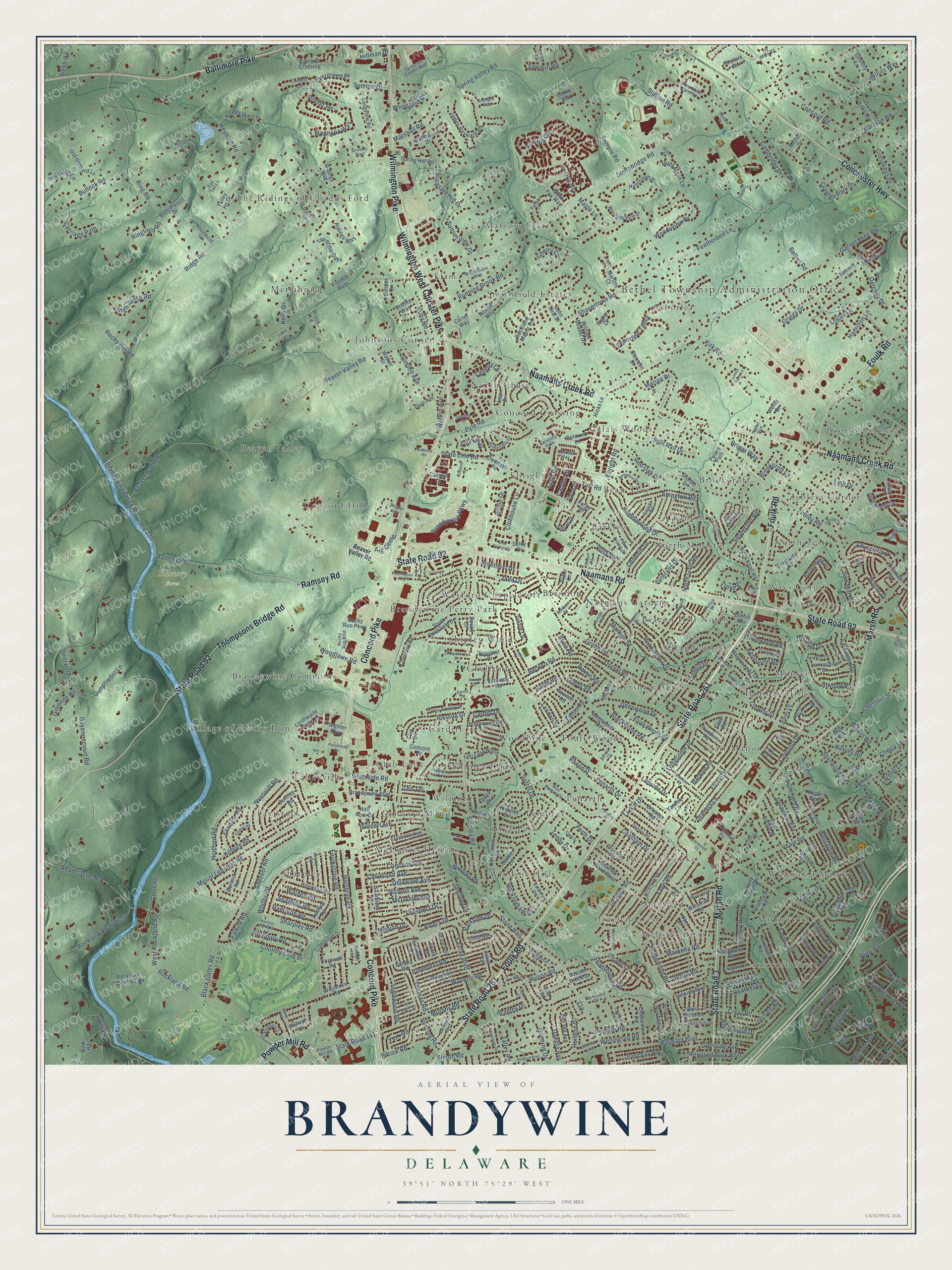
A new map of Brandywine, Delaware, made in 2026 and printed to order on thick archival matte paper.
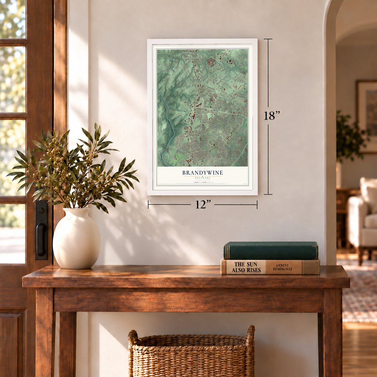
12" x 18" Archival Matte Print
A Map of Home. A Work of Art.
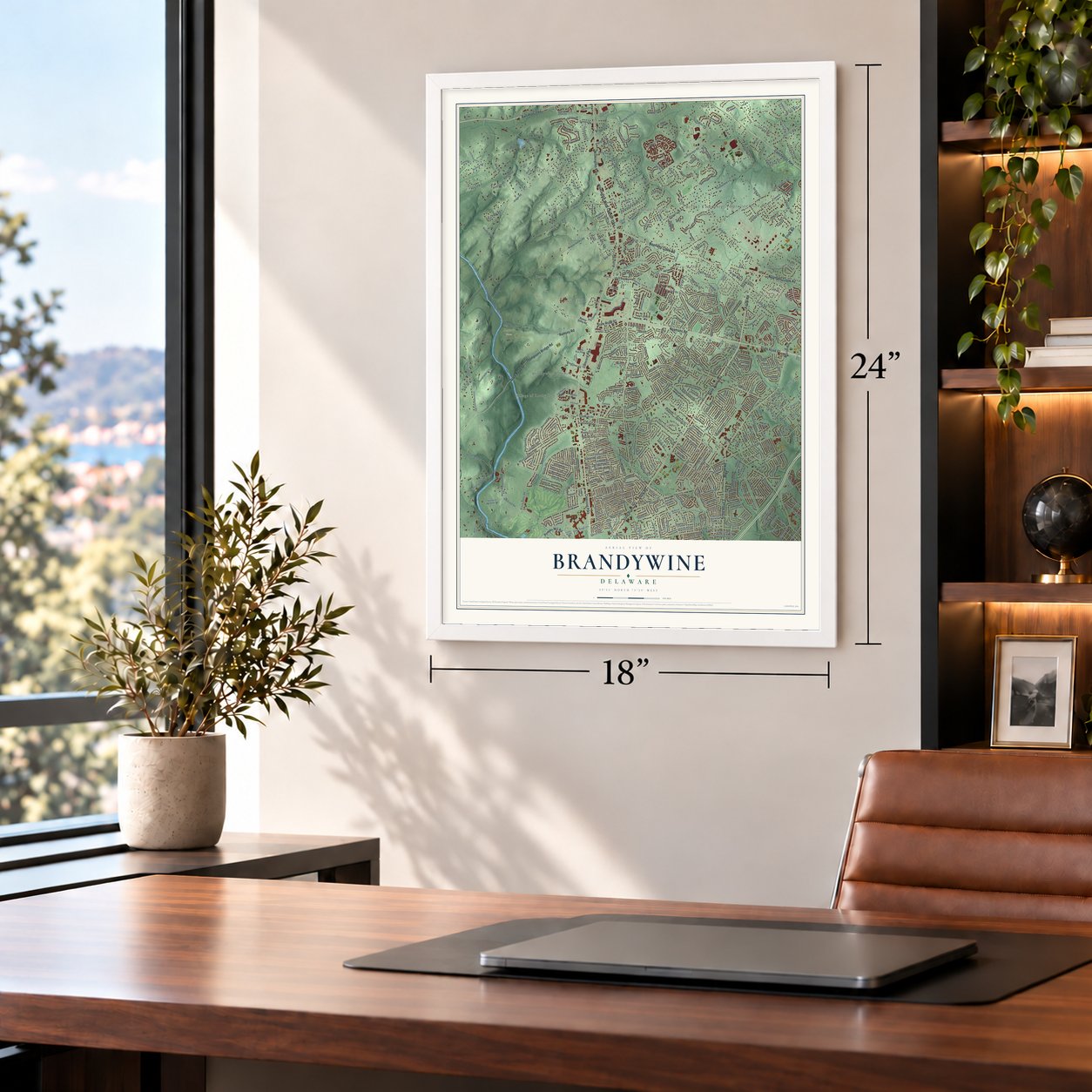
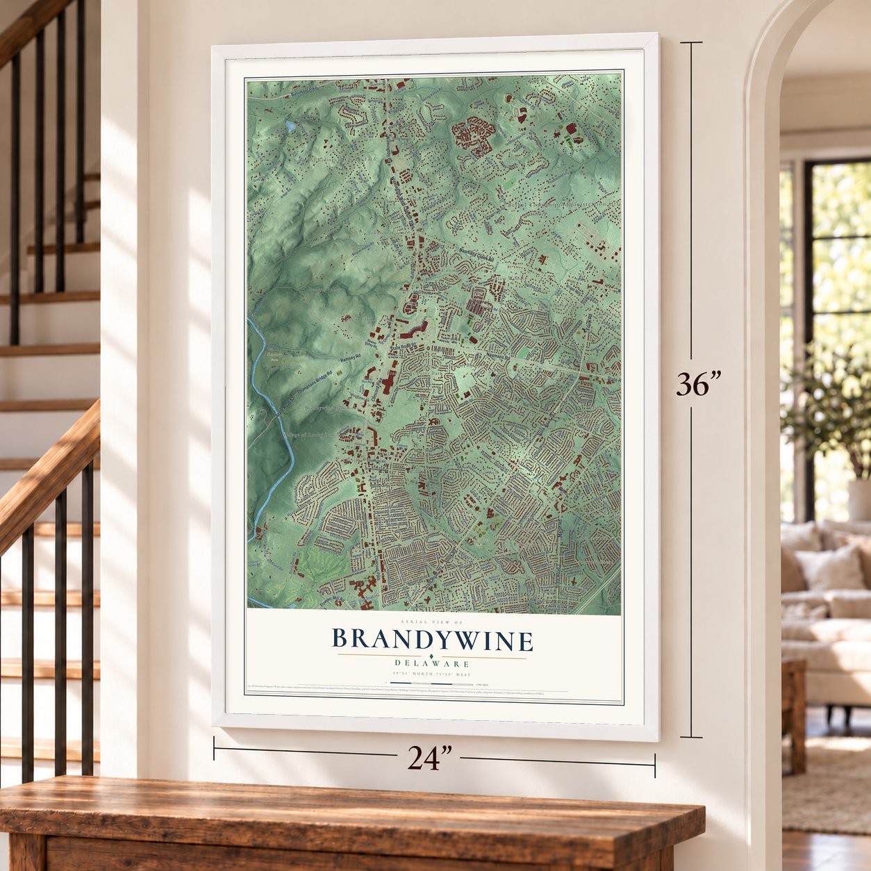
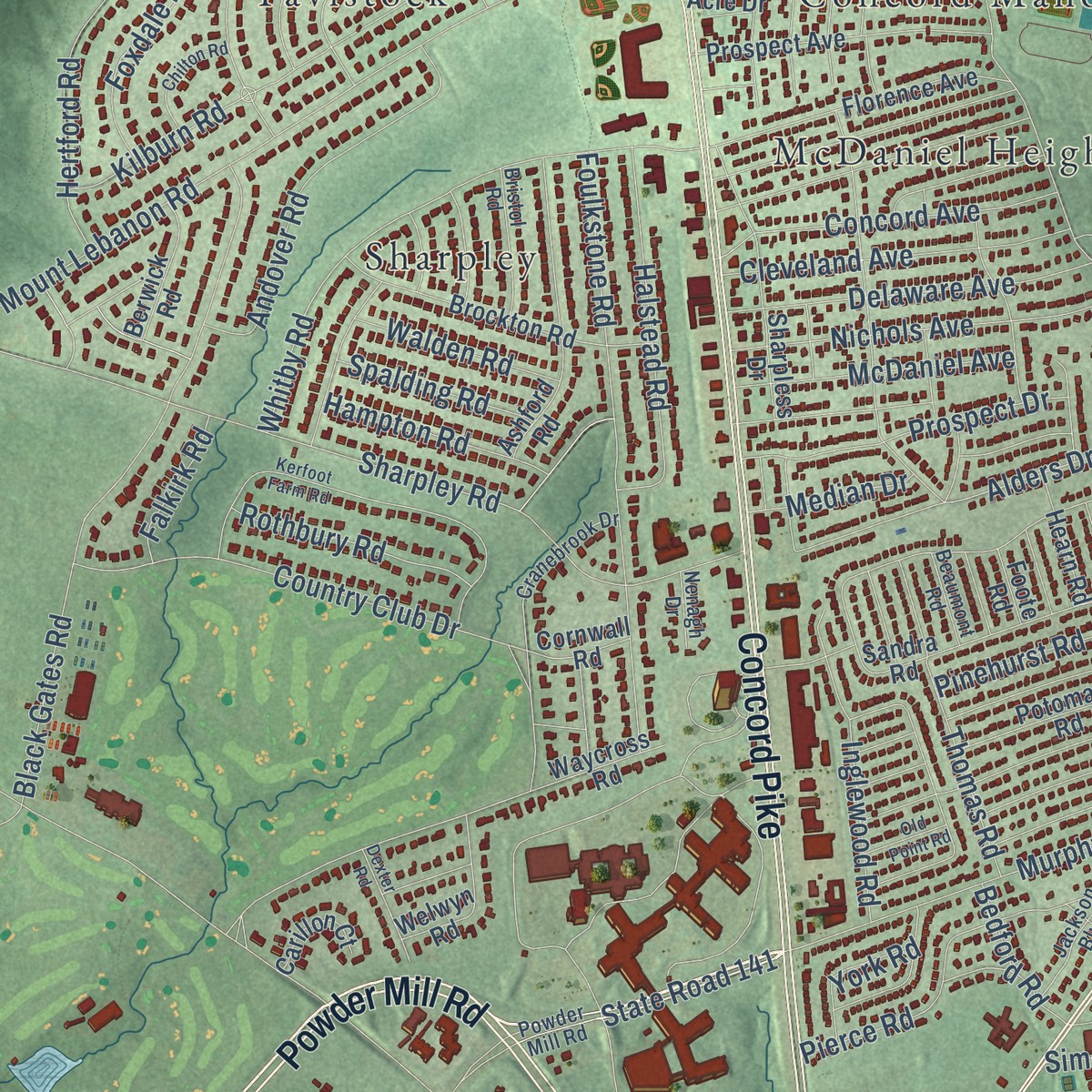
Explore Brandywine, Delaware from a whole new perspective. Created using aerial imagery and detailed geographic data, this map captures Brandywine building by building, with labeled streets, familiar landmarks, and shaded topographical relief that highlights the natural contours of the landscape.
Combining modern data with the timeless character of a vintage atlas, this map is just as interesting up close as it is beautiful on the wall. Whether you grew up in Brandywine, spent memorable years there, or call it home today, this unique map is a great way to celebrate a place that means something to you. Zoom in on the preview to look for your street, and then order a print to put your memories on the wall.
Three ways to hang it
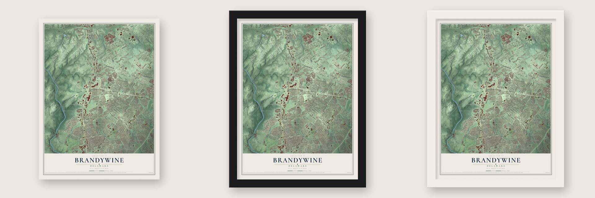
Unframed archival matte, a black wood frame or a white wood frame.
Up close
Geography Worth Displaying
This map was created using accurate cartographic data and authoritative geographic sources, including the U.S. Geological Survey and the Census Bureau. The map brings together terrain, waterways, roads, and building detail. The majority of the streets are labeled, houses are accurately depicted, and the topography is derived from government sources. Combining local data with carefully composed color and shading leads to this beautifully detailed Brandywine artwork for your wall.
Rather than simply showing street outlines, we’ve included as many of the street names as we could reasonably fit on the map while keeping their names legible. Zoom in on the high resolution preview to see exactly what’s on the map. We truly set out to create a statement piece for anyone who loves Brandywine. So whether it’s for you, or a gift for someone you love, we hope this map of Brandywine brings back fond memories.
Read the story behind this map: Detailed Map of Brandywine, Delaware.

Find your street
Names on the Brandywine map
Every name below is printed on this map. Look for your street, your school, the park where you played, or the pond down the road.
Places and landmarks63
- Bethel Township Administration Office
- Ramsey Farm
- Talley Day Park
- Meriahnna
- Wexford Chapelcroft
- Marrow Tract
- Westwood Manor
- Sharpley
- Beau Tree
- Cardiff
- Beaver Valley
- Holiday Hills
Show all 63 places
- Booths Corner
- Village of Rocky Run
- Foulk Woods
- Elam
- Carrcroft Crest
- Northcrest
- Arborlea
- Concord Crossing
- Brandywine Perry Park
- Heatherbrooke
- Ways Corner
- Calais Woods
- Concord Manor
- Concord Hills
- Naamans Gardens
- The Ridings of Chadds Ford
- Ebright
- McDaniel Heights
- Chalfonte
- Surrey Park
- Kershaw Acres
- Brandywine Commons
- Munsee
- Woodbine
- Graylyn Crest
- Smithfield Estates
- North Chase
- Northwood
- Penarth
- Tavistock
- North Minister
- Cedartree
- Barkley
- Beacon Hill North
- Brandon
- Clair Manor
- Johnsons Corner
- Club Lane
- Brookcroft
- Windsor Hills
- Pembrey
- Talleyville
- Devon
- Channin
- Brandywood
- Wilmont
- Zebleys Corner
- Shipley Woods
- Shipley Chase
- Webster Farm
- Mayfield
Streets and roads480
- Foulk Road
- State Road 261
- Powder Mill Road
- Ramsey Road
- State Road 92
- Naamans Road
- Concord Pike
- Wilmington Pike
- Wilmington West Chester Pike
- Marsh Road
- State Road 3
- Baltimore Pike
- Naamans Creek Road
- Thompsons Bridge Road
- Conchester Highway
- Brandywine Parkway
- Brandywine Creek Road
- Route 230
- West Rockland Road
- State Road 141
- Westcliff Road
- Channin Drive
- West Dale Road
- State Line Road
- Smithbridge Road
- Silverside Road
- Shipley Road
- Stone Hall
- Ridge Road
- Beaver Valley Road
Show all 480 streets
- Garnet Mine Road
- Grubb Road
- Kirk Road
- Bethel Road
- Heyburn Road
- Zebley Road
- Wilson Road
- Black Gates Road
- Country Club Drive
- Mount Lebanon Road
- Ring Road
- Featherbed Lane
- Concord Road
- Veale Road
- Shavertown Road
- Sharpley Road
- Pennington Drive
- Ebright Road
- Fairfax Boulevard
- Rockland Road
- Fox Hill Circle
- Harvey Road
- Baynard Boulevard
- Evergreen Place
- Temple Road
- Cambridge Drive
- Gunpowder Lane
- Pyle Road
- Foulkstone Road
- Deepwood Drive
- Sunset View Drive
- Floral Drive
- Carr Road
- Whitby Road
- Graylyn Road
- Berwyn Road
- Faun Road
- Guyennecourt Road
- Landon Drive
- Rocky Hill Road
- Beaver Dam Road
- Kilburn Road
- Murphy Road
- Simon Road
- Ramblewood Drive
- Glenside Avenue
- Shellpot Drive
- Rowland Park Boulevard
- Millers Road
- Ringfield Road
- Station Road
- Spring Valley Road
- Delaware Avenue
- Rockland Road West
- Longcome Drive
- Woodsview Drive
- Woodlawn Road
- Stonecrop Road
- Adams Dam Road
- Maple Lane
- Magnolia Way
- Bullock Road
- Waverly Road
- Hertford Road
- Homewood Road
- Andover Road
- Willits Way
- Chinchilla Drive
- Mattson Road
- Alders Drive
- Gravers Lane
- Marcella Road
- Nichols Avenue
- Sorrel Drive
- Inwood Road
- Halstead Road
- Dorval Road
- Wellington Road
- Raven Road
- Pierce Road
- Pennrose Talley
- Harwyn Road
- Pinehurst Road
- Marian Drive
- Concord Avenue
- Parkside Drive
- Gunning Drive
- Cleveland Avenue
- Dakota Avenue
- Cherry Circle
- Red Oak Drive
- Pierson Drive
- Prospect Drive
- Eaton Road
- Thomas Road
- Shadybrook Road
- Hunt Meet Lane
- Griggs Drive
- North Cliffe Drive
- Abington Road
- Inglewood Road
- Coventry Drive
- Link Drive
- Old Orchard Road
- Stoney Run Drive
- Woodland Drive
- Century Lane
- Emory Road
- Blackwood Road
- Prior Road
- Crosskeys Drive
- Athens Road
- Deorwold Drive
- Dogwood Drive
- McDaniel Avenue
- Running Brook Road
- Chestnut Street
- Ivydale Road
- Ross Road
- Delaview Avenue
- South Cliffe Drive
- Bradley Drive
- Perth Drive
- Marshall Road
- Ardmoor Lane
- Carriage Path
- Hoiland Drive
- Summit Avenue
- Rothbury Road
- Darczuk Drive
- Crest Road
- Clayton Park Drive
- Rockingham Drive
- High Ridge Road
- Brentwood Drive
- Sherwood Road
- Pleasant Hill Drive
- Hampton Road
- Larkwood Drive
- Lloyd Place
- Foxdale Road
- Kennwynn Road
- Jade Drive
- Echo Road
- Sulky Way
- Saw Mill Drive
- Clubhouse Lane
- Bette Road
- Ruby Road
- Walter Drive
- Chatham Drive
- Amethyst Drive
- Hamilton Lane
- Keepsake Lane
- Justin Lane
- Watkin Avenue
- Walden Road
- North Gate Road
- Paschall Road
- Penarth Drive
- Tenby Drive
- Heather Lane
- Spalding Road
- Norbee Drive
- Split Rail Drive
- Turf Road
- Pelham Road
- Kelly Drive
- Logan Lane
- Bridle Drive
- Larkal Drive
- Briggs Way
- Wynnwood Road
- Brookcroft Lane
- Decatur Drive
- Guyenne Road
- Median Drive
- Windley Road
- Hillman Drive
- Bedford Road
- Aig Center
- Talley Road
- Cardiff Drive
- Hillside Avenue
- Falkirk Road
- Lorelei Lane
- Summit Drive
- Veterans Drive
- York Road
- Webb Road
- Cherry Lane
- Marklyn Drive
- Poplar Road
- Dunhill Drive
- Hilltop Avenue
- Bona Road
- Lanside Drive
- Sawmill Road
- Garth Road
- Canter Road
- Crowns Street
- Paxon Drive
- Sunset Lane
- Lee Terrace
- Concord Pz
- Rocky Run Parkway
- Lori Lane North
- South Rockfield Drive
- Coachman Road
- Ridings Way
- Hagley Creek Road
- James Hayward Road
- Grinnell Road
- Hillside Boulevard
- John Beal Drive
- Bridlewood Drive
- Painters Crossing
- Ballymeade Drive
- Birch Knoll Road
- Longwood Drive
- Carter Way
- Sharon Drive
- Lynthwaite Farm Lane
- Old Orchard Lane
- Clemson Drive
- Raven Drive
- Fresno Road
- Brockton Road
- Sandra Road
- Belmont Lane
- Potomac Road
- Ashford Road
- Florence Avenue
- Stony Run Drive
- Prospect Avenue
- Talley Ho Drive
- Brandywine Boulevard
- Woodsedge Drive
- Wrexham Road
- Rockland Meadows Road
- Kennedy Road
- Hillock Lane
- Sharpless Drive
- Crestfield Road
- Huntsman Drive
- Weilers Bend
- Rockland Manor Road
- Granby Road
- Evergreen Road
- Oak Lane Road
- White Fox Way
- Burnley Road
- Branmar Pz
- Chadwick Road
- Boulder Brook Drive
- Lancashire Drive
- West Holly Oak Road
- Delview Drive
- Nevada Avenue
- Top of the Oaks
- Lea Drive
- Cloister Road
- Wynnwood Drive
- Foulk Woods Road
- Jan Drive
- Hackney Circle
- Hicks Lane
- Harrison Avenue
- Graydon Road
- Longview Road
- Jones Lane
- Buttonwood Drive
- Newlin Way
- Fox Hill Boulevard
- Spring Hill Road
- Half Acre Drive
- Welwyn Road
- Fairfield Drive
- Heather Road West
- Willow Way
- Heathwood Road
- Greenway Road
- Maplewood Lane
- Briar Road
- Cassell Court
- Martins Court
- Carson Road
- Julian Road
- Winstead Road
- West Crest Road
- Berwick Road
- Rambler Road
- Cheshire Road
- Laurel Avenue
- Hearn Road
- Robins Way
- Northwood Road
- Brickton Road
- Churchill Drive
- Mill Road
- Stable Lane
- William Beaser Drive
- Country Lane
- Forge Drive
- Cleaver Lane
- East Sutton Place
- Carillon Court
- Bulk Road
- Locust Avenue
- Waycross Road
- Owensby Road
- Dain Avenue
- Paper Lane
- Swan Lake Drive
- Righter Parkway
- Cornwall Road
- Yardley Lane
- Creek Road
- Poplar Street
- Newton Road
- Meadow Lane
- Merion Drive
- Walters Road
- Walker Street
- Brooklet Drive
- Sulky Ci
- Ridings Boulevard
- Feldspar Drive
- Alpha Drive
- Lido Lane
- Locust Lane
- Avery Lane
- Giana Way
- Foothill Path
- Tanya Drive
- Summit Lane
- Foote Road
- Devon Court
- Weller Drive
- Brook Lane
- Eden Road
- Rigby Court
- Peters Path
- Mount Aire Farm Road
- Rotherfield Lane
- Jamaica Drive
- Crestover Road
- Woodside Farm Drive
- Bellows Drive
- Copley Drive
- Point Breeze Drive
- Woodchuck Way
- Tulane Road
- Village Avenue
- Cross Country Drive
- Corporate Center Way
- Garland Road
- Cranebrook Drive
- Donlon Road
- Banbury Drive
- Jackson Boulevard
- Marker Drive
- Anson Road
- Palmer Drive
- Bristol Road
- Nassau Drive
- Fox Tail Lane
- Brook Drive
- Wyckwood Court
- Pan Road
- The Highway
- Rocky Run Boulevard
- Cayuga Road
- Zeigler Lane
- Chapelcrest Lane
- Gumwood Drive
- Benton Court
- Beechwood Circle
- Darley Road
- Ivy Mills Road
- Morris Drive
- Grouse Trail
- Dogwood Lane
- Hazel Ridge Drive
- Beaumont Road
- Sarasota Path
- Georges Way
- Harness Way
- Forwood Street
- Taylor Run
- Nenagh Drive
- Allen Drive
- Fawn Lane
- Sonia Court
- West Trotter Drive
- Stateline Road
- Kerfoot Farm Road
- Bodine Drive
- West Pembrey Drive
- Windybush Road
- Broadbent Road
- Washington Avenue
- Knowles Road
- Mousley Place
- Magnolia Drive
- Baldwin Drive
- Woodbrook Circle
- Buckingham Road
- Graywood Drive
- Englewood Road
- Bedford Boulevard
- Passmore Road
- Woodside Avenue
- Belvedere Drive
- Dacia Drive
- Forestdale Road
- Pembrey Place
- Paulwynn Road
- Hilton Road
- Mayfield Road
- Chilton Road
- Colorado Avenue
- Dexter Road
- Clyth Drive
- Green Lane
- Woodstream Lane
- Sharpley Drive
- Overlook Drive
- Rosewood Drive
- Partridge Lane
- Bruce Road
- Sharpley Lane
- Husband Drive
- Hoyer Court
- Donald Drive
- Cobbler Lane
- Delwynn Drive
- Old Point Road
- Arosa Lane
- Sayers Court
- Cinder Road
- Annwood Drive
- Linton Farm Lane
- Culver Drive
- Tudor Place
- Emma Drive
- Ivy Lane
- Broom Court
- Drexel Drive
- Beech Lane
Names are listed as they appear on the printed map. Zoom into the product photos to find them.
The art of mapping a place
How This Map Was Made
Real places. Remarkable detail. Discover the layers that turn geographic data into a map of home.

The view from above
Aerial imagery reveals the character of the land: woodland, open fields, and the patterns of a place.

The shape of the land
Elevation data brings hills, valleys, and subtle changes in the landscape into view.

The details of home
Roads, waterways, and building footprints come together to make the map feel unmistakably local.

Geography becomes art
Considered color, shading, and typography bring the layers together in a map made for your wall.


Process illustrated with Mendon, Massachusetts. Aerial imagery: USDA NAIP. Terrain: USGS 3D Elevation Program. Map details and finished artwork: KNOWOL.
The Details
About This Print
Choose an archival matte print, or a black or white Ayous wood frame. The archival matte print is unframed.
Select your size and finish above to see the matching product image and price.
Materials & Craftsmanship
A contemporary map with the character of a classic atlas, printed on archival matte paper. Optional frames are made from Ayous wood.
Your printed map does not include the watermark shown in the full-map preview.
Shipping & Delivery
Free shipping within the United States. Every print is made to order in the USA.
Buying a gift? Add a note in your cart and we'll include it. We never put prices in the package.
Prints ship within 2 to 3 business days. Allow 7 to 10 days total from ordering for delivery. Timing may vary during holidays or periods of high order volume.
Read our shipping policy.
Returns and damaged prints
Each print is made to order. Change-of-mind refunds are not available after production.
If your print arrives damaged, misprinted or incorrect, contact support@knowol.com within 30 days of receiving it. Include your order number, photos and a description of the issue.
Read our full refund and replacement policy. For questions about your order, email support@knowol.com.
Find your town
Looking for another city?
Find a map of home in our Delaware collection, or any town in the country.
Nearby
Maps of towns near Brandywine
Know someone from one of these towns? Their map makes a great gift.
 Lancashire
, Delaware
From $39.99See the map
 Arden
Arden, Delaware
From $39.99See the map
 Forwood
, Delaware
From $39.99See the map
More maps nearby: Ardencroft, Ardentown, Carrcroft, Claymont and Bellefonte.