
Search for another town





Free U.S. delivery 7 to 10 days after you order
Bridgeport, West Virginia Map Art
A new map of Bridgeport, West Virginia, made in 2026 and printed to order on thick archival matte paper.
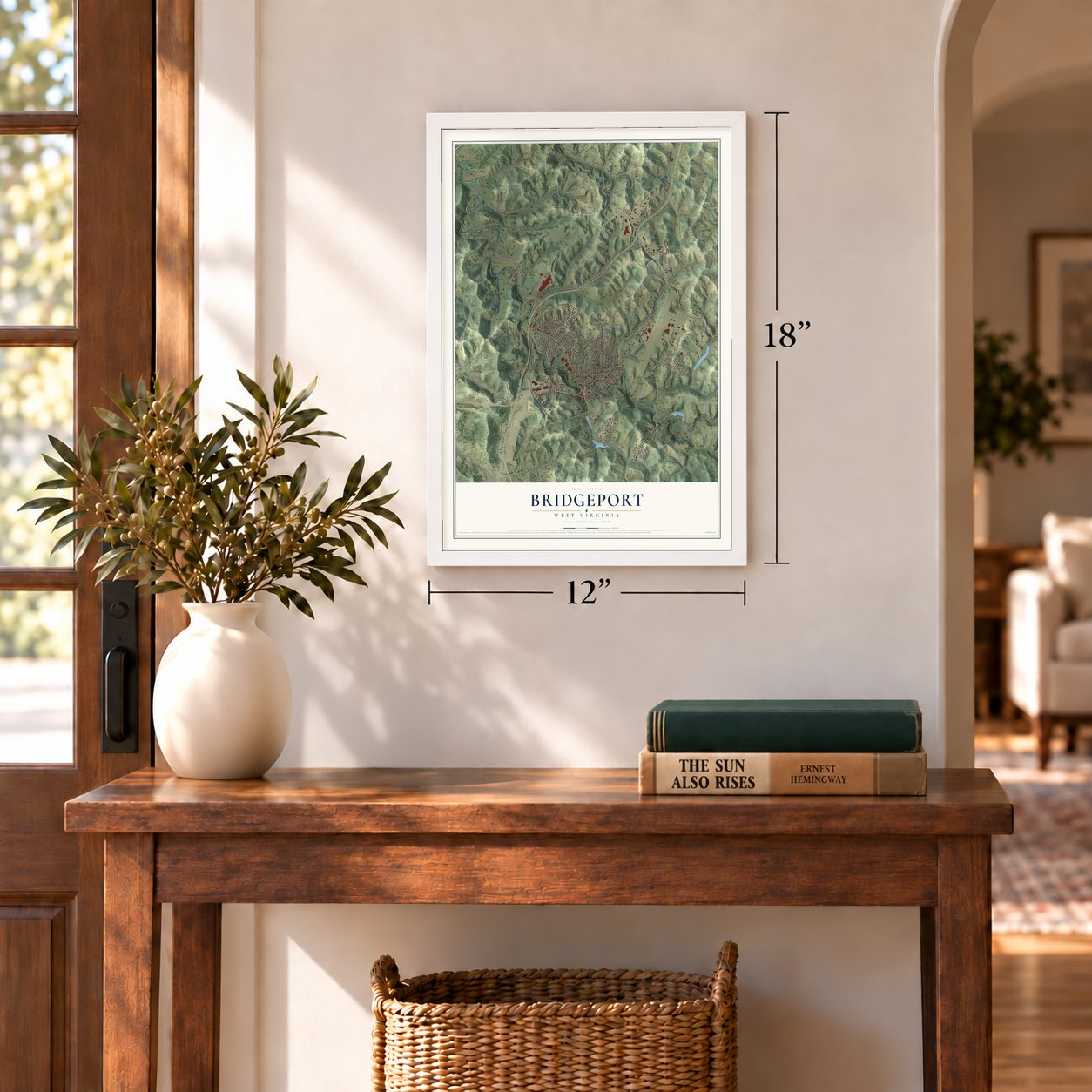
12" x 18" Archival Matte Print
A Map of Home. A Work of Art.
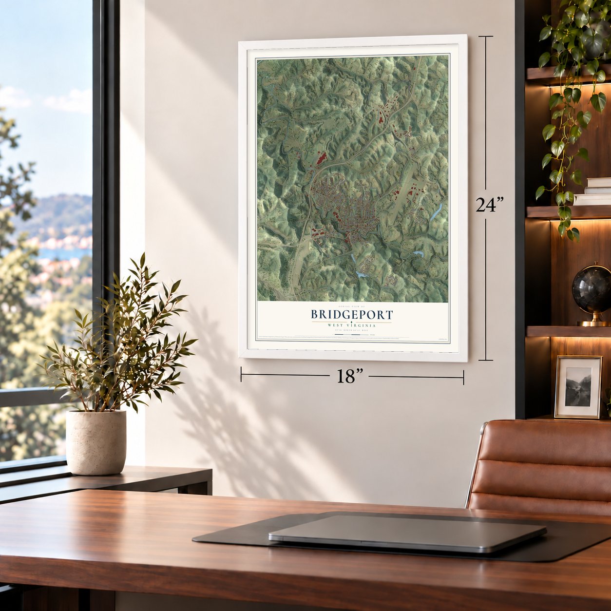
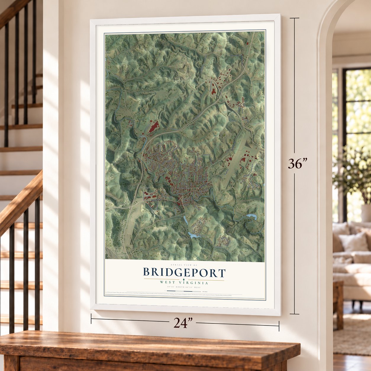
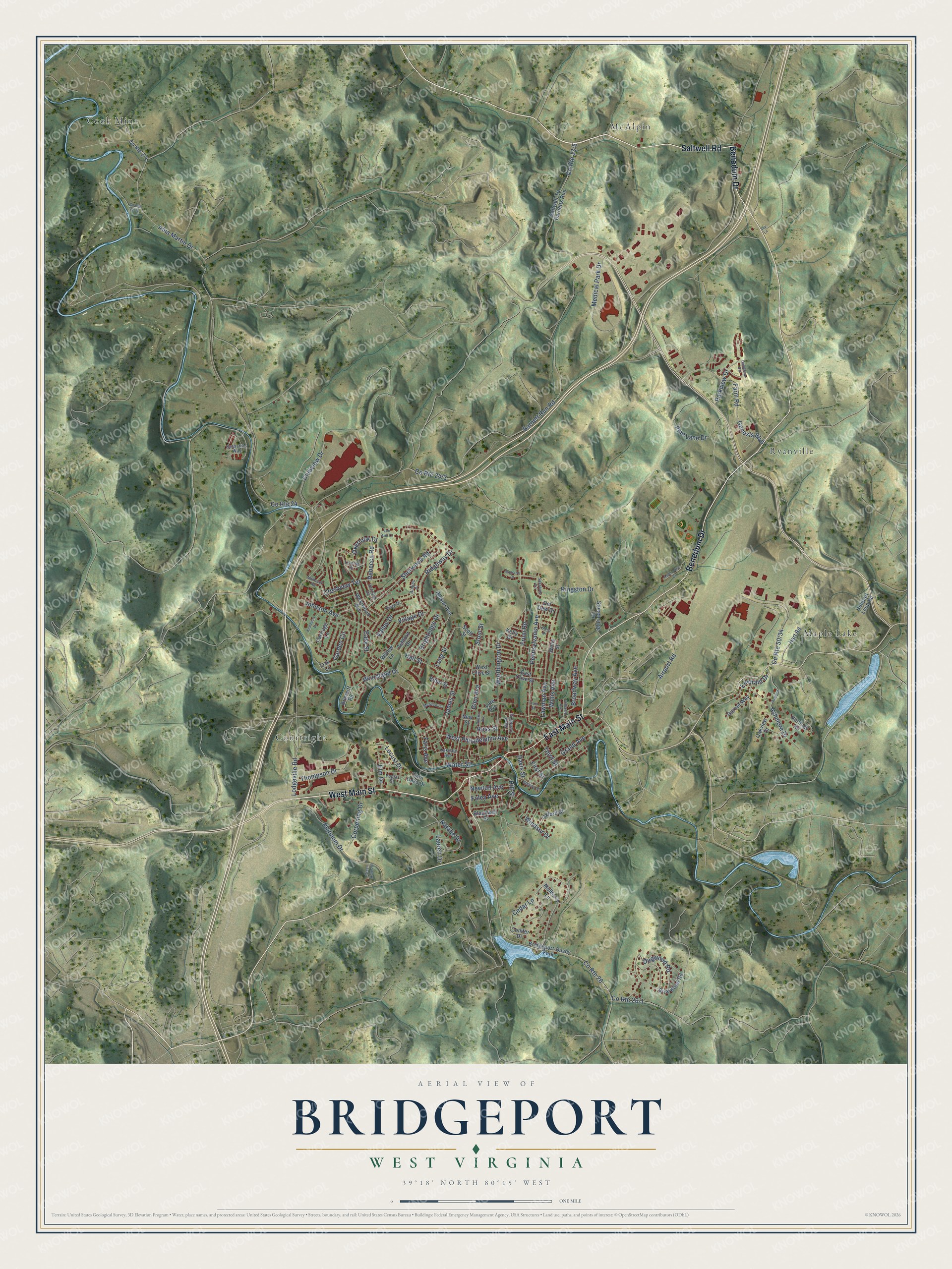
Explore Bridgeport, West Virginia from a whole new perspective. Created using aerial imagery and detailed geographic data, this map captures Bridgeport building by building, with labeled streets, familiar landmarks, and shaded topographical relief that highlights the natural contours of the landscape.
Combining modern data with the timeless character of a vintage atlas, this map is just as interesting up close as it is beautiful on the wall. Whether you grew up in Bridgeport, spent memorable years there, or call it home today, this unique map is a great way to celebrate a place that means something to you. Zoom in on the preview to look for your street, and then order a print to put your memories on the wall.
Three ways to hang it
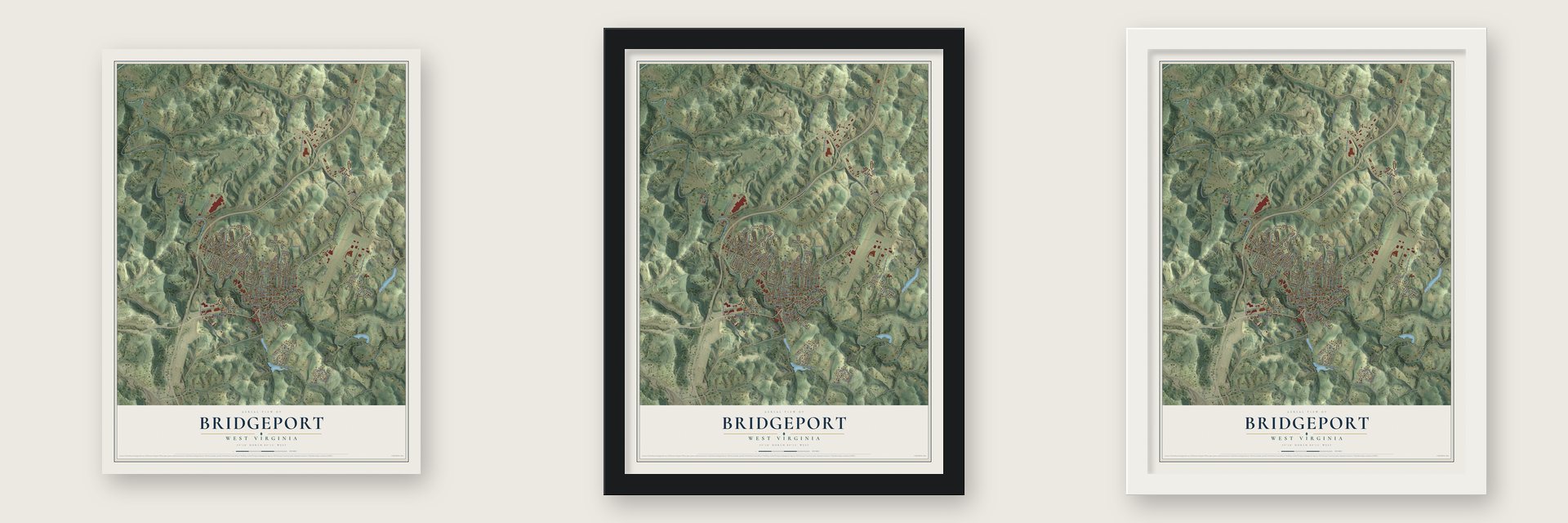
Unframed archival matte, a black wood frame or a white wood frame.
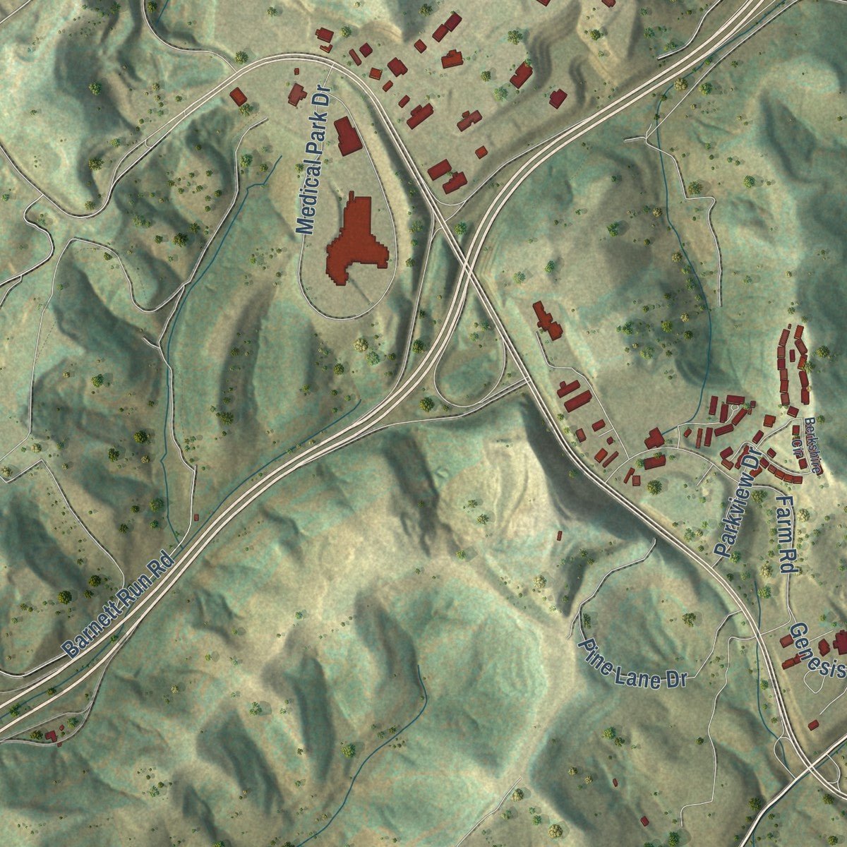
Up close
Geography Worth Displaying
This map was created using accurate cartographic data and authoritative geographic sources, including the U.S. Geological Survey and the Census Bureau. The map brings together terrain, waterways, roads, and building detail. The majority of the streets are labeled, houses are accurately depicted, and the topography is derived from government sources. Combining local data with carefully composed color and shading leads to this beautifully detailed Bridgeport artwork for your wall.
Rather than simply showing street outlines, we’ve included as many of the street names as we could reasonably fit on the map while keeping their names legible. Zoom in on the high resolution preview to see exactly what’s on the map. We truly set out to create a statement piece for anyone who loves Bridgeport. So whether it’s for you, or a gift for someone you love, we hope this map of Bridgeport brings back fond memories.
Read the story behind this map of Bridgeport, West Virginia from 2026.

About Bridgeport, West Virginia
Bridgeport is a city of 9,336 people in Harrison County. The trapper and fur trader John Simpson came into this country in 1764, and the creek that runs through town still carries his name. Settlers put up a fort here between 1771 and 1774, and somewhere along Simpson Creek they built the first recorded gristmill, sometime before 1787. Bridgeport received its town charter in 1816 and was incorporated in 1887.
Stockyards appeared early in the 19th century, and in 1838 the local stretch of the Northwestern Virginia Turnpike opened, giving Bridgeport its first direct road to Clarksburg. Stagecoaches started running on it in 1852, and the old turnpike route later became U.S. Route 50. When the Baltimore and Ohio Railroad came through in the 1850s, the town turned into a busy shipping point for the region's cattle.
- A name from Simpson CreekEarly settlers crossed Simpson Creek on a floating bridge of logs tied with hickory branches, and a covered wooden bridge followed in the early 19th century. Local tradition says Joseph Johnson saw the bridge as a kind of port and picked the name Bridgeport when he asked for a town charter on 15 acres he owned. Another story says the place was Bridge Fort, for two early forts, until a mapmaker wrote it wrong.
- Governor Johnson's OakdaleJoseph Johnson moved to Bridgeport in 1801 and went on to serve as a U.S. representative and as governor of Virginia. His house, Oakdale, was built for him in 1818, and around 1840 it was remodeled in the Italianate style. Johnson died in Bridgeport in 1877 and is buried in Bridgeport Cemetery. The Governor Joseph Johnson House joined the National Register in 1987.
- 24,000 lamp chimneys a dayFounded in 1904, the Bridgeport Lamp Chimney Company was making about 24,000 lamp chimneys every day at its glass plant by 1923. In 1924 the Concrete Steel Bridge Company and Frank Duff McEnteer completed a bowstring concrete arch bridge so workers could push handcarts over Simpson Creek between the plant and a warehouse. That bridge joined the National Register in 1997. The Master Glass Company later made marbles on the property until 1973.
- Raided on April 30, 1863Bridgeport's people were split between the Union and the Confederacy during the Civil War. On April 30, 1863, during the Jones-Imboden Raid, Confederate general William E. Jones took a company of Union soldiers prisoner near town. His men also seized railroad workers, burned bridges and looted stores before moving on.
- A church from about 1770John Sutton founded Simpson Creek Baptist Church around 1770, making it one of the first two Baptist churches west of the mountains that are still active. Its old brick church graveyard, dating to 1770, became the oldest part of Bridgeport Cemetery when the city combined three burial grounds in 1939. The graves of 17 known Revolutionary War veterans lie there.
Find your street
Names on the Bridgeport map
Every name below is printed on this map. Look for your street, your school, the park where you played, or the pond down the road.
Places and landmarks5
- Cook Mine
- Courtright
- Maple Lake
- McAlpin
- Ryanville
Streets and roads117
- West Main Street
- East Main Street
- Saltwell Road
- Benedum Drive
- Frum Road
- Hill Street
- Ridgeway Drive
- Worthington Drive
- Cedar Lane
- Locust Drive
- Easy Street
- Johnson Avenue
- Barnett Run Road
- County Route 26
- Abia Martin Drive
- Medical Park Drive
- Pennsylvania Avenue
- Platinum Drive
- Lodgeville Road
- County Route 24
- Lawman Avenue
- Stout Street
- Airport Road
- Clubview Drive
- Sherwood Road
- Pine Lane Drive
- Crestview Terrace
- James Street
- Farm Road
- Ashmore Drive
Show all 117 streets
- Overlook Drive
- Garden Circle
- Grand Avenue
- Kingston Drive
- Willis Avenue
- Dogwood Road
- Valley Drive
- West Philadelphia Avenue
- Natalie Drive
- Corpening Drive
- Emerald Drive
- Thompson Drive
- Lauren Drive
- Hall Street
- Windsor Drive
- Broadway Avenue
- Parkview Drive
- Village Drive
- Brightridge Drive
- Woodland Drive
- Long Street
- Water Street
- Genesis Boulevard
- Newton Avenue
- Rebecca Road
- Glen Avenue
- Faris Avenue
- First Street
- Foley Avenue
- Davis Street
- Third Street
- Ross Street
- Elm Drive
- Blackwell Street
- Brierciff Road
- Briarwood Road
- Saltwell To Barnetts Run
- Bridgeport-Bushy Fork
- Carriage Lane
- Heritage Road
- Allison Avenue
- East Olive Street
- Hart Road
- Conifer Drive
- Stonebridge Drive
- Westwood Avenue
- Garnet Way
- Mulberry Lane
- West Olive Street
- Willow Lane
- Oxford Court
- Ashford Drive
- Twin Oaks Drive
- Heliport Loop Road
- Ritter Street
- Oakview Drive
- Scott Street
- Del Dew Drive
- Willis Street
- Kelly Drive
- Late Avenue
- Oak Lane
- New Street
- North Center Street
- Sassafras Way
- Vista Drive
- Ventura Drive
- Lindale Street
- Oakdale Avenue
- Poplar Street
- Blakes Place
- Berkshire Circle
- Millbrook Road
- Dunkin Avenue
- Ashmor
- Ashbrooke Court
- Front Street
- Kemberry Drive
- Williams Avenue
- Meadow Lane
- Salisbury Circle
- Lee Ann Lane
- Geneva Street
- Mesa Drive
- Green Acres Drive
- Bancroft Court
- Joy Lane
Names are listed as they appear on the printed map. Zoom into the product photos to find them.
The art of mapping a place
How This Map Was Made
Real places. Remarkable detail. Discover the layers that turn geographic data into a map of home.

The view from above
Aerial imagery reveals the character of the land: woodland, open fields, and the patterns of a place.

The shape of the land
Elevation data brings hills, valleys, and subtle changes in the landscape into view.

The details of home
Roads, waterways, and building footprints come together to make the map feel unmistakably local.

Geography becomes art
Considered color, shading, and typography bring the layers together in a map made for your wall.


Process illustrated with Mendon, Massachusetts. Aerial imagery: USDA NAIP. Terrain: USGS 3D Elevation Program. Map details and finished artwork: KNOWOL.
The Details
About This Print
Choose an archival matte print, or a black or white Ayous wood frame. The archival matte print is unframed.
Select your size and finish above to see the matching product image and price.
Materials & Craftsmanship
A contemporary map with the character of a classic atlas, printed on archival matte paper. Optional frames are made from Ayous wood.
Your printed map does not include the watermark shown in the full-map preview.
Shipping & Delivery
Free shipping within the United States. Every print is made to order in the USA.
Buying a gift? Add a note in your cart and we'll include it. We never put prices in the package.
Prints ship within 2 to 3 business days. Allow 7 to 10 days total from ordering for delivery. Timing may vary during holidays or periods of high order volume.
Read our shipping policy.
Returns and damaged prints
Each print is made to order. Change-of-mind refunds are not available after production.
If your print arrives damaged, misprinted or incorrect, contact support@knowol.com within 30 days of receiving it. Include your order number, photos and a description of the issue.
Read our full refund and replacement policy. For questions about your order, email support@knowol.com.
Find your town
Looking for another city?
Find a map of home in our West Virginia collection, or any town in the country.
Nearby
Maps of towns near Bridgeport
Know someone from one of these towns? Their map makes a great gift.
 Anmoore
, West Virginia
From $39.99See the map
 Despard
, West Virginia
From $39.99See the map
 East View
, West Virginia
From $39.99See the map
More maps nearby: Spelter, Stonewood, Hepzibah, Nutter Fort and Gypsy.