
Search for another town




Free U.S. delivery 7 to 10 days after you order
Bridgeton, Missouri Map Art
A new map of Bridgeton, Missouri, made in 2026 and printed to order on thick archival matte paper.
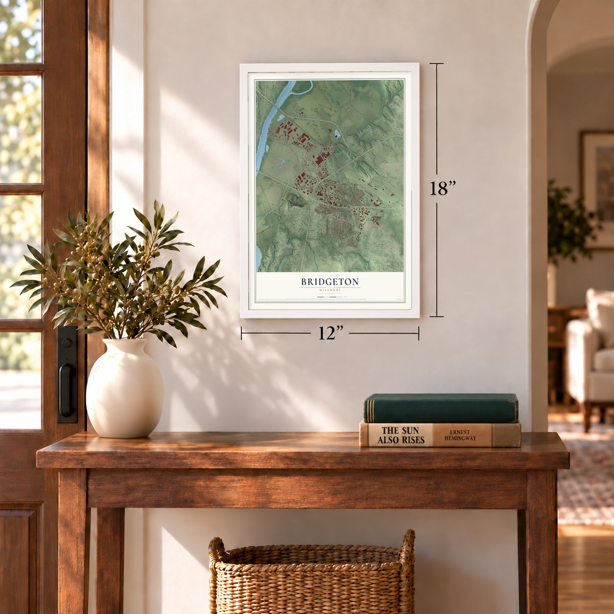
12" x 18" Archival Matte Print
A Map of Home. A Work of Art.
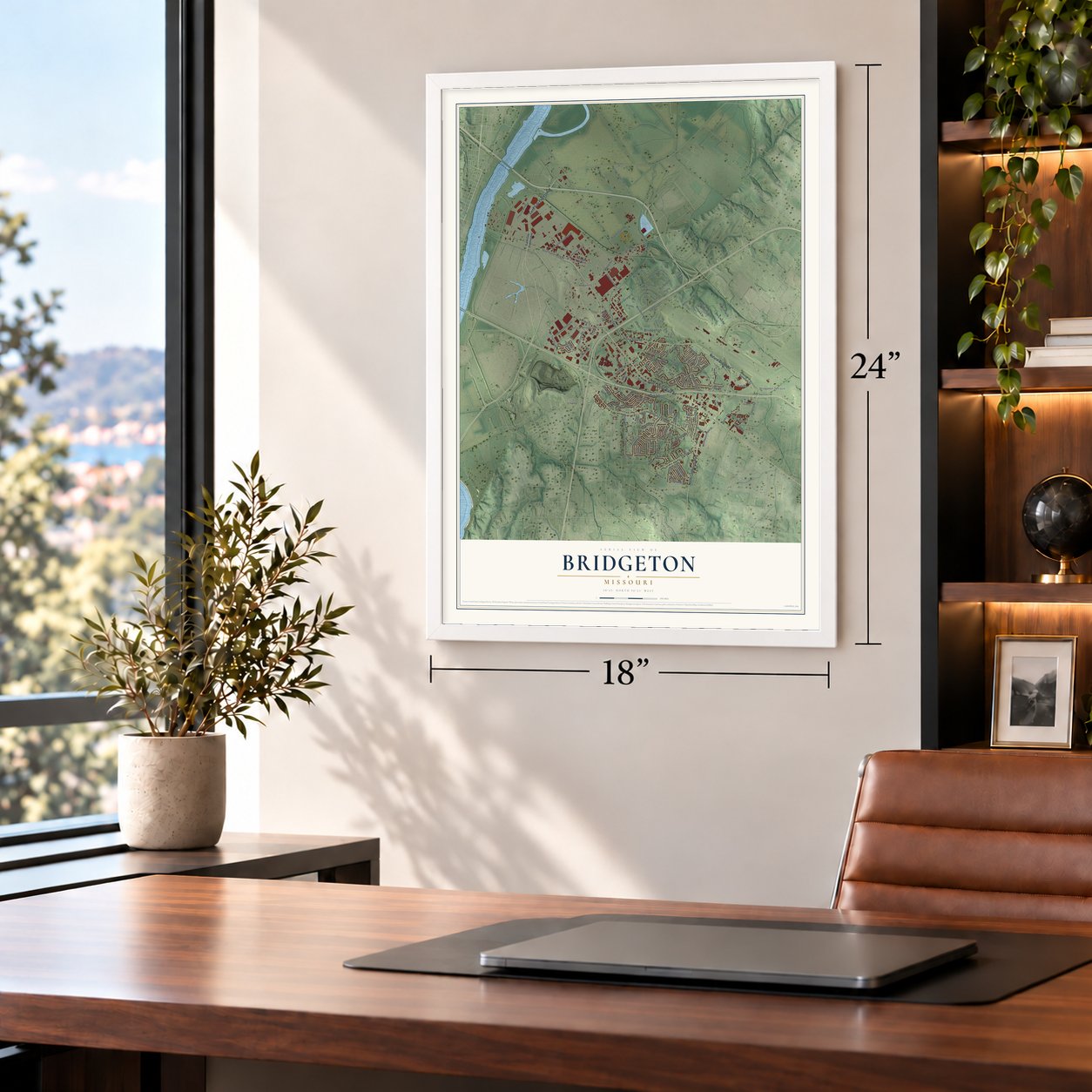
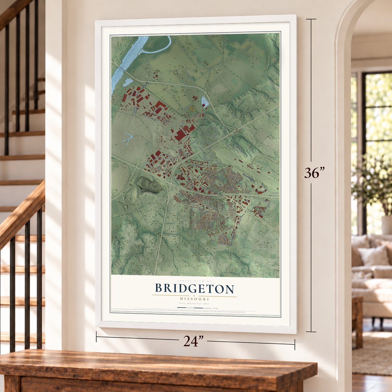
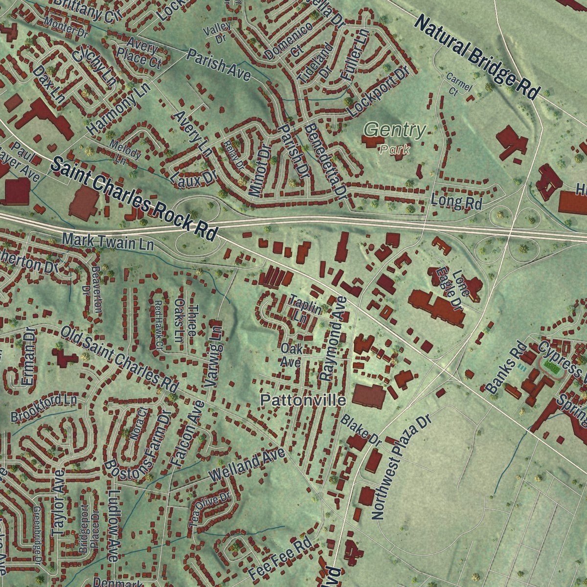
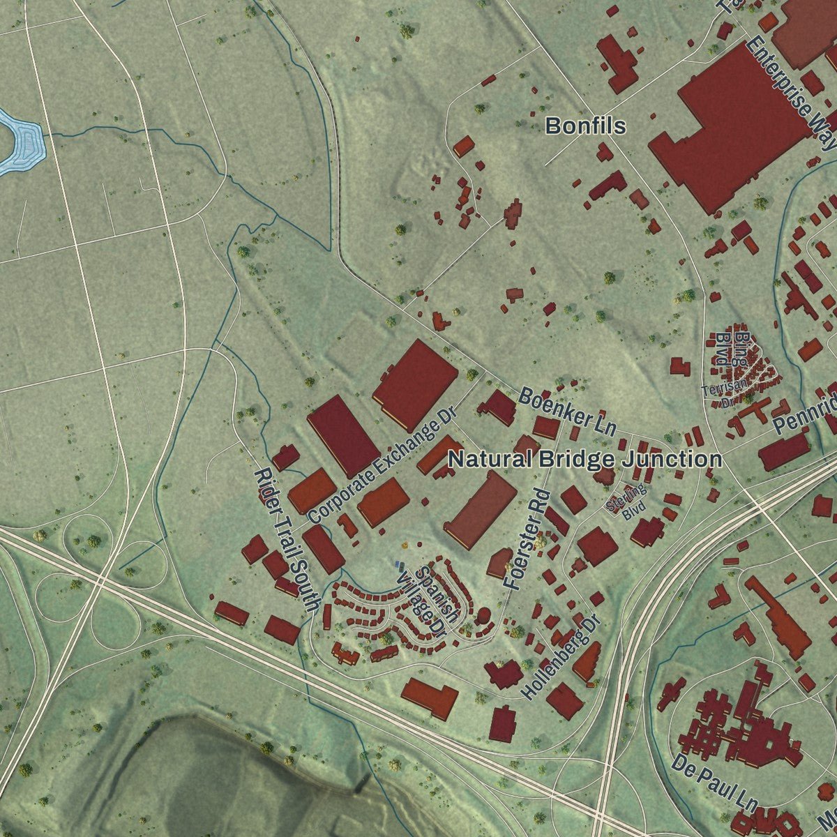
Explore Bridgeton, Missouri from a whole new perspective. Created using aerial imagery and detailed geographic data, this map captures Bridgeton building by building, with labeled streets, familiar landmarks, and shaded topographical relief that highlights the natural contours of the landscape.
Combining modern data with the timeless character of a vintage atlas, this map is just as interesting up close as it is beautiful on the wall. Whether you grew up in Bridgeton, spent memorable years there, or call it home today, this unique map is a great way to celebrate a place that means something to you. Zoom in on the preview to look for your street, and then order a print to put your memories on the wall.

Three ways to hang it
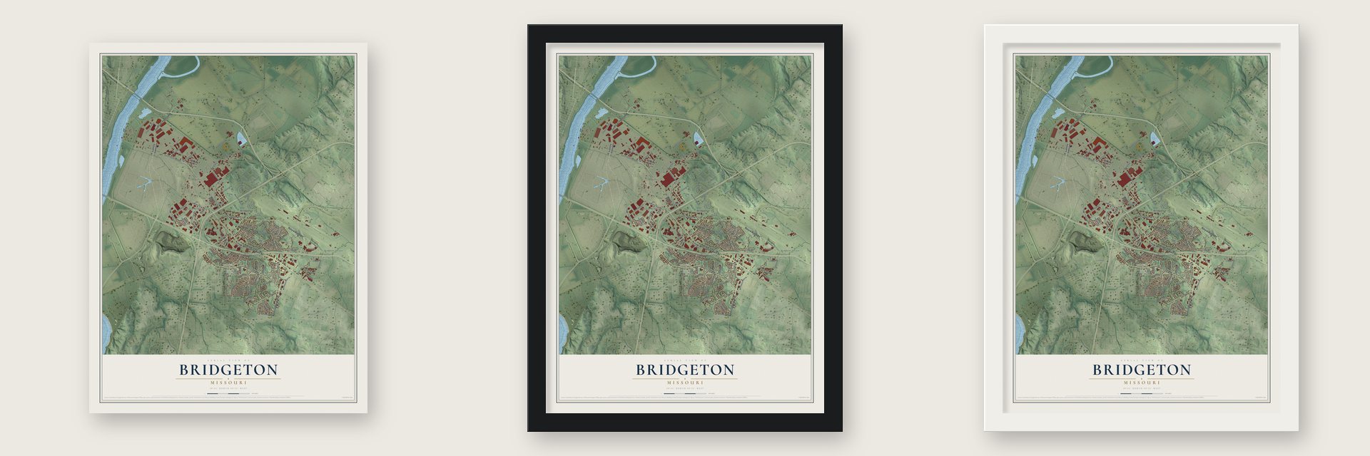
Unframed archival matte, a black wood frame or a white wood frame.
Up close
Geography Worth Displaying
This map was created using accurate cartographic data and authoritative geographic sources, including the U.S. Geological Survey and the Census Bureau. The map brings together terrain, waterways, roads, and building detail. The majority of the streets are labeled, houses are accurately depicted, and the topography is derived from government sources. Combining local data with carefully composed color and shading leads to this beautifully detailed Bridgeton artwork for your wall.
Rather than simply showing street outlines, we’ve included as many of the street names as we could reasonably fit on the map while keeping their names legible. Zoom in on the high resolution preview to see exactly what’s on the map. We truly set out to create a statement piece for anyone who loves Bridgeton. So whether it’s for you, or a gift for someone you love, we hope this map of Bridgeton brings back fond memories.
Read the story behind this map of Bridgeton, Missouri from 2026.

About Bridgeton, Missouri
Bridgeton is a city in northwestern St. Louis County, situated between St. Louis Lambert International Airport and St. Charles, with the Missouri River along its northwestern boundary. Its population was 11,445 in 2020. Historic roads and modern air, rail, and interstate links have long influenced the community.
- Early Village NamesFirst platted in 1794 as Marais des Liards, the settlement was also called Village a Robert and later Owen's Station.
- Historic Travel RoutesTrails established by the Osage Nation helped form early roads, including Natural Bridge Road and St. Charles Rock Road.
- Payne-Gentry HouseBridgeton acquired its oldest home in 1968, established Gentry Park around it, and later saw the property listed on the National Register of Historic Places.
- Airport ExpansionA runway expansion plan begun in 1995 ultimately removed 2,000 Bridgeton homes, particularly in the Carrollton subdivision.
- 2011 TornadoAn EF4 tornado struck Bridgeton on April 22, 2011, injuring five people but causing no deaths.
Find your street
Names on the Bridgeton map
Every name below is printed on this map. Look for your street, your school, the park where you played, or the pond down the road.
Places and landmarks7
- Bridgeton
- Bridgeton Terrace
- Pattonville
- Gentry Park
- Bonfils
- Champ
- Natural Bridge Junction
Streets and roads138
- Saint Charles Rock Road
- North Lindbergh Boulevard
- Natural Bridge Road
- Earth Side Expressway
- Fee Fee Road
- Rider Trail South
- Long Road
- Missouri Bottom Road
- Old Saint Charles Road
- Ferguson Lane
- Gist Road
- Taussig Avenue
- Taussig Road
- McKelvey Road
- Woodford Way Drive
- Gallatin Lane
- Avery Lane
- Taylor Avenue
- Pennridge Drive
- Mark Twain Lane
- Celburne Lane
- Benedetta Drive
- De Paul Lane
- Lockport Drive
- Prouhet Farm Road
- Cypress Road
- Smiley Road
- Bostons Farm Drive
- Chartley Drive
- Rock Industrial Park Drive
Show all 138 streets
- Foerster Road
- Brittany Circle
- Hunter Drive
- Falcon Avenue
- Raymond Avenue
- Majella Drive
- Enterprise Way
- Weskan Lane
- Pont Drive
- Boenker Lane
- Archerton Drive
- Terry Avenue
- Haas Avenue
- Brookington Drive
- Northwest Plaza Drive
- Banks Road
- Manteca Drive
- Margatehall Drive
- Brampton Drive
- Varwig Lane
- Cypress Village Drive
- Bristol Hall Drive
- Locke Avenue
- Mandeville Drive
- Berry Hill Road
- Harmony Lane
- Parish Drive
- Welland Avenue
- Bondurante Drive
- Phelps Drive
- Ludlow Avenue
- Cordin Lane
- Dax Lane
- Fuller Lane
- Duncombe Drive
- Clichy Lane
- Laux Drive
- Gistpark Drive
- Erman Drive
- Hammack Drive
- Lake Avenue
- Parish Avenue
- Spring Avenue
- Minot Drive
- Earth City Expressway
- Hollenberg Drive
- Corporate Woods Drive
- Corporate Exchange Drive
- Whitehall Manor Drive
- Northwest Industrial Court
- Paul Mayer Avenue
- Domenico Court
- Bonfils Drive
- Northwest Industrial Drive
- Brumley Drive
- Avery Place Court
- Bridgeton Square
- Latham Lane
- Spanish Village Drive
- Asherton Drive
- Lone Eagle Drive
- Brookford Lane
- Tideland Drive
- Patty Lane
- Chaparral Drive
- Oak Avenue
- Blake Drive
- Three Oaks Lane
- Apple Tree Lane
- Willow Lane
- Ayrshire Drive
- Denmark Drive
- Taplin Lane
- Bing Boulevard
- Garrett Road
- De Paul Drive
- Beaverton Drive
- Grundy Drive
- Carrollton Drive
- Chartley Lane
- Bridgeport Place Drive
- Admiralton Drive
- Ralls Drive
- Monter Drive
- Tea Olive Drive
- Primghar Drive
- Cypress Garden Court
- Melody Lane
- Taylor Pines Drive
- Cameo Drive
- Nora Court
- Orchid Lane
- Valley Drive
- Lonsdale Drive
- Greenbridge Drive
- Hemet Lane
- Terrisan Drive
- Bridgeton Trails Drive
- Boulder Industrial Drive
- Relay Drive
- Red Hawk Court
- Aubuchon Road
- Tuscany Hills Court
- Sterling Boulevard
- Dunsinane Lane
- Bridgeton Greens Drive
- Carmel Court
- Larchburr Drive
Names are listed as they appear on the printed map. Zoom into the product photos to find them.
The art of mapping a place
How This Map Was Made
Real places. Remarkable detail. Discover the layers that turn geographic data into a map of home.

The view from above
Aerial imagery reveals the character of the land: woodland, open fields, and the patterns of a place.

The shape of the land
Elevation data brings hills, valleys, and subtle changes in the landscape into view.

The details of home
Roads, waterways, and building footprints come together to make the map feel unmistakably local.

Geography becomes art
Considered color, shading, and typography bring the layers together in a map made for your wall.


Process illustrated with Mendon, Massachusetts. Aerial imagery: USDA NAIP. Terrain: USGS 3D Elevation Program. Map details and finished artwork: KNOWOL.
The Details
About This Print
Choose an archival matte print, or a black or white Ayous wood frame. The archival matte print is unframed.
Select your size and finish above to see the matching product image and price.
Materials & Craftsmanship
A contemporary map with the character of a classic atlas, printed on archival matte paper. Optional frames are made from Ayous wood.
Your printed map does not include the watermark shown in the full-map preview.
Shipping & Delivery
Free shipping within the United States. Every print is made to order in the USA.
Buying a gift? Add a note in your cart and we'll include it. We never put prices in the package.
Prints ship within 2 to 3 business days. Allow 7 to 10 days total from ordering for delivery. Timing may vary during holidays or periods of high order volume.
Read our shipping policy.
Returns and damaged prints
Each print is made to order. Change-of-mind refunds are not available after production.
If your print arrives damaged, misprinted or incorrect, contact support@knowol.com within 30 days of receiving it. Include your order number, photos and a description of the issue.
Read our full refund and replacement policy. For questions about your order, email support@knowol.com.
Find your town
Looking for another city?
Find a map of home in our Missouri collection, or any town in the country.
Nearby
Maps of towns near Bridgeton
Know someone from one of these towns? Their map makes a great gift.
 Hazelwood
, Missouri
From $39.99See the map
 Champ
Champ, Missouri
From $39.99See the map
 St. Ann
, Missouri
From $39.99See the map
More maps nearby: Edmundson, Woodson Terrace, Berkeley, Breckenridge Hills and Maryland Heights.