
Search for another town





Free U.S. delivery 7 to 10 days after you order
Brooklyn, New York Map Art
Building by building, with labeled streets and shaded relief.
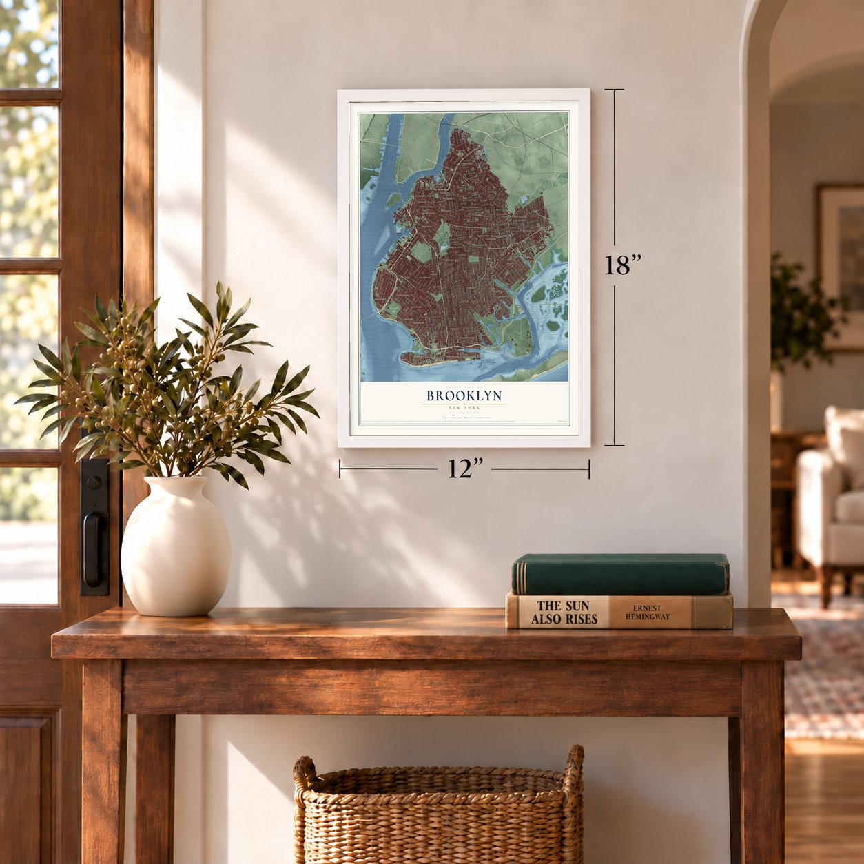
12" x 18" Archival Matte Print
A Map of Home. A Work of Art.
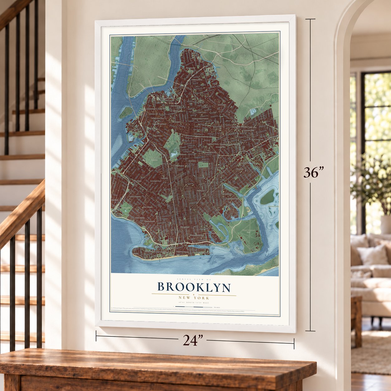
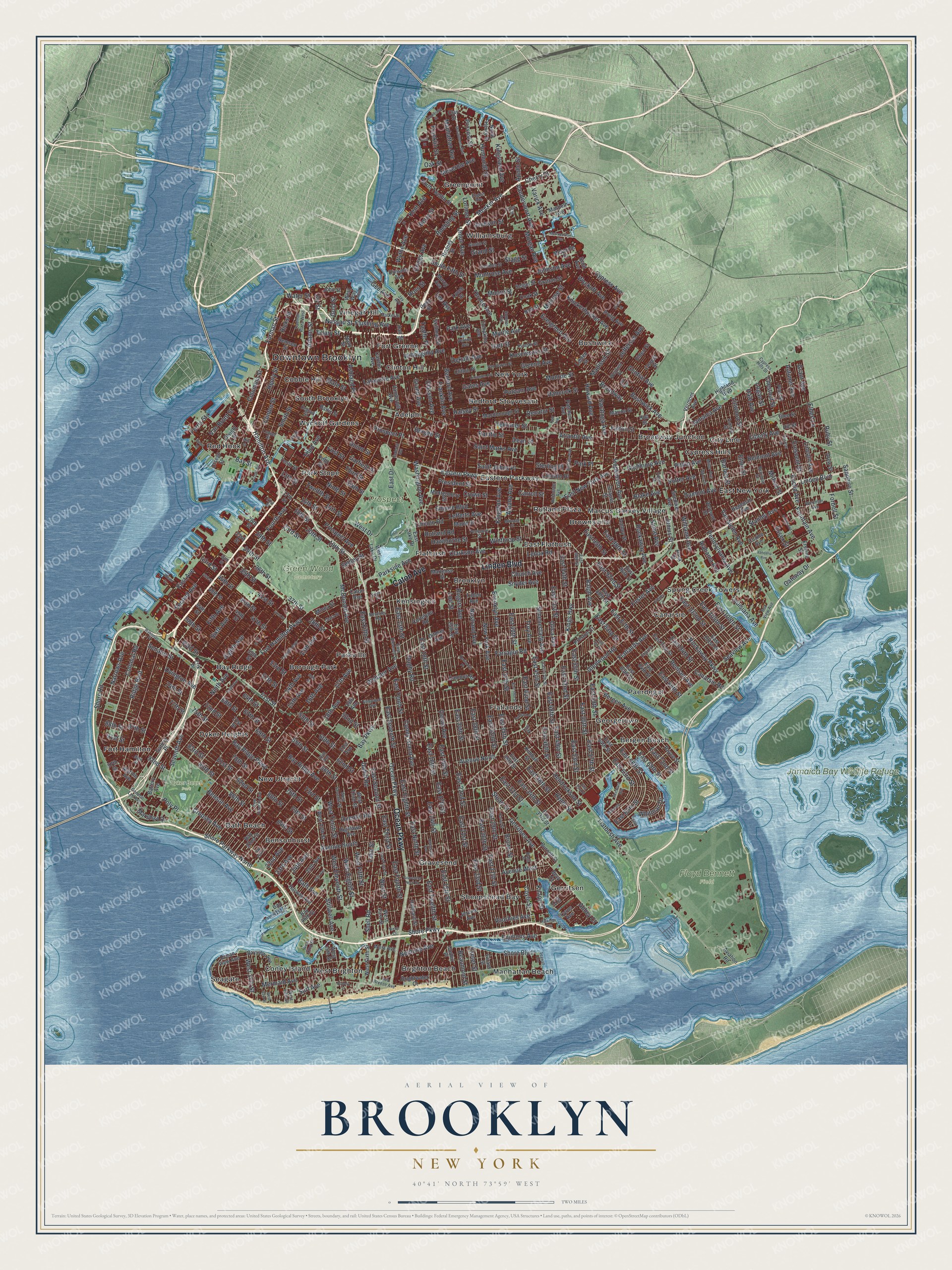
Explore Brooklyn, New York from a whole new perspective. Created using aerial imagery and detailed geographic data, this map captures Brooklyn building by building, with labeled streets, familiar landmarks, and shaded topographical relief that highlights the natural contours of the landscape.
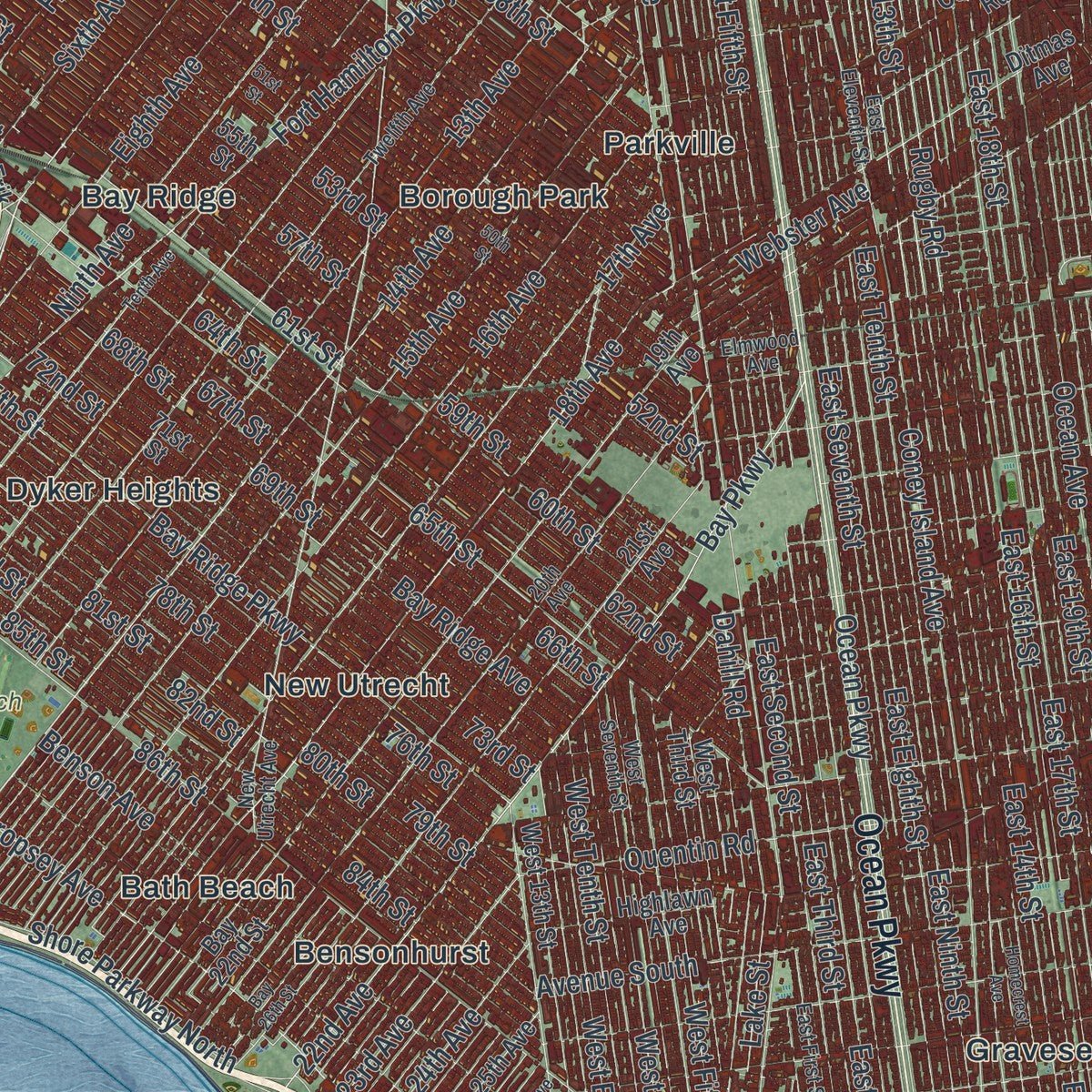
Combining modern data with the timeless character of a vintage atlas, this map is just as interesting up close as it is beautiful on the wall. Whether you grew up in Brooklyn, spent memorable years there, or call it home today, this unique map is a great way to celebrate a place that means something to you. Zoom in on the preview to look for your street, and then order a print to put your memories on the wall.
Three ways to hang it
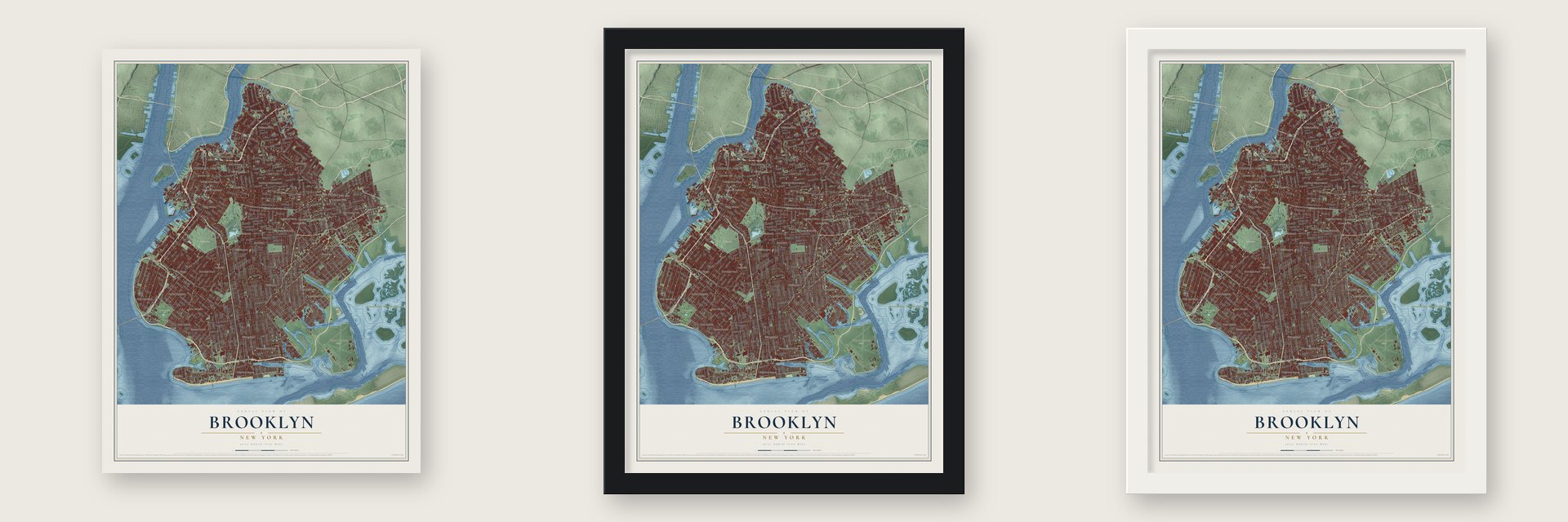
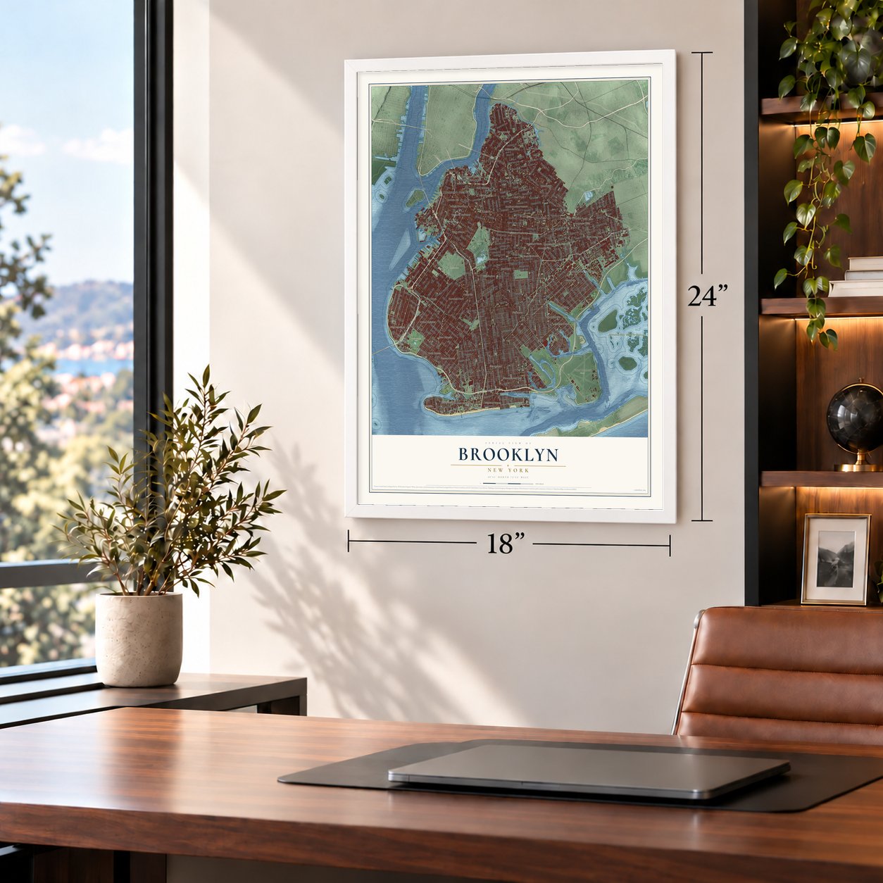
Unframed archival matte, a black wood frame or a white wood frame.
Up close
Geography Worth Displaying
This map was created using accurate cartographic data and authoritative geographic sources, including the U.S. Geological Survey (USGS) and FEMA. The map brings together terrain, waterways, roads, and building detail. The majority of the streets are labeled, houses are accurately depicted, and the topography is derived from government sources. Combining local data with carefully composed color and shading leads to this beautifully detailed Brooklyn artwork for your wall.
Rather than simply showing street outlines, we’ve included as many of the street names as we could reasonably fit on the map while keeping their names legible. Zoom in on the high resolution preview to see exactly what’s on the map. We truly set out to create a statement piece for anyone who loves Brooklyn. So whether it’s for you, or a gift for someone you love, we hope this map of Brooklyn brings back fond memories.
Explore the full map of Brooklyn, New York and read about the local places it shows.

Find your street
Names on the Brooklyn Borough map
Every name below is printed on this map. Look for your street, your school, the park where you played, or the pond down the road.
Places and landmarks54
- Downtown Brooklyn
- Dyker Beach Park
- Floyd Bennett Field
- Green-Wood Cemetery
- Jamaica Bay Wildlife Refuge
- Prospect Park
- Adelphi
- Bath Beach
- Bay Ridge
- Bedford-Stuyvesant
- Bensonhurst
- Bergen Beach
Show all 54 places
- Borough Park
- Brighton Beach
- Broadway Junction
- Brooklyn
- Brownsville
- Bushwick
- Canarsie
- City Line
- Clinton Hill
- Cobble Hill
- Coney Island
- Cypress Hills
- Dyker Heights
- East Flatbush
- East New York
- Eastern Parkway
- Flatbush
- Flatlands
- Fort Greene
- Fort Hamilton
- Georgetown
- Gerritsen
- Gravesend
- Greenpoint
- Kensington
- Manhattan Beach
- Marcus Garvey Village
- New Utrecht
- New York
- Paerdegat
- Park Slope
- Parkville
- Red Hook
- Rutland Plaza
- Seagate
- Sheepshead Bay
- South Brooklyn
- Spring Creek Towers
- Vinegar Hill
- West Brighton
- Williamsburg
- Wyckoff Gardens
Streets and roads570
- Linden Boulevard
- Ocean Parkway
- Caton Avenue
- Seventh Avenue
- Shore Parkway
- Fort Hamilton Parkway
- Adams Street
- Lee Avenue
- Poly Place
- 78th Street
- Roebling Street
- 14th Avenue
- Cropsey Avenue
- Park Avenue
- Ridge Boulevard
- 24th Avenue
- South Fifth Street
- Second Avenue
- Colonial Road
- Montrose Avenue
- Shell Road
- Atlantic Avenue
- Flatbush Avenue
- Bedford Avenue
- Third Avenue
- Nostrand Avenue
- Fulton Street
- Kings Highway
- Ocean Avenue
- Fourth Avenue
Show all 570 streets
- Fifth Avenue
- Flatlands Avenue
- Coney Island Avenue
- Foster Avenue
- Pacific Street
- East Twelfth Street
- East 21st Street
- Bergen Street
- East 14th Street
- Utica Avenue
- East 18th Street
- East 19th Street
- McDonald Avenue
- East 13th Street
- Avenue North
- Ralph Avenue
- Dean Street
- East Seventh Street
- Broadway
- Glenwood Road
- 86th Street
- New York Avenue
- Schenectady Avenue
- Union Street
- East Fourth Street
- East 17th Street
- Sixth Avenue
- East 29th Street
- East 23rd Street
- East 15th Street
- East 22nd Street
- East 28th Street
- East Second Street
- Myrtle Avenue
- Church Avenue
- Troy Avenue
- Dekalb Avenue
- East 26th Street
- East Eighth Street
- East Third Street
- East Fifth Street
- East 16th Street
- Carroll Street
- 75th Street
- President Street
- Bushwick Avenue
- Greene Avenue
- Bay Ridge Avenue
- Park Place
- Brooklyn Avenue
- Farragut Road
- Albany Avenue
- Gates Avenue
- East 52nd Street
- Sterling Place
- East 34th Street
- Saint Marks Avenue
- East 53rd Street
- 65th Street
- 85th Street
- East 35th Street
- East 24th Street
- Rockaway Parkway
- Avenue South
- 80th Street
- Sutter Avenue
- 69th Street
- 68th Street
- East 51st Street
- East 27th Street
- Prospect Place
- 79th Street
- Eighth Avenue
- 18th Avenue
- Saint Johns Place
- East 37th Street
- 81st Street
- 83rd Street
- Pitkin Avenue
- East 38th Street
- 60th Street
- 72nd Street
- Putnam Avenue
- Flushing Avenue
- 61st Street
- 82nd Street
- 64th Street
- 84th Street
- 15th Avenue
- Bay Ridge Parkway
- East 56th Street
- Willoughby Avenue
- 62nd Street
- East Ninth Street
- 59th Street
- 73rd Street
- 52nd Street
- 77th Street
- East 92nd Street
- Lincoln Place
- 67th Street
- Washington Avenue
- Dumont Avenue
- Jefferson Avenue
- 74th Street
- Neptune Avenue
- East 54th Street
- 16th Avenue
- East 49th Street
- 76th Street
- Hancock Street
- 63rd Street
- 53rd Street
- Quentin Road
- Remsen Avenue
- 58th Street
- East 95th Street
- East 94th Street
- Blake Avenue
- East 55th Street
- Halsey Street
- Manhattan Avenue
- Avenue West
- Lafayette Avenue
- East New York Avenue
- East 32nd Street
- Pennsylvania Avenue
- Rogers Avenue
- East 48th Street
- Madison Street
- East 31st Street
- 22nd Avenue
- Bay Parkway
- 57th Street
- 47th Street
- 17th Avenue
- Kent Avenue
- East 98th Street
- Hicks Street
- Glenmore Avenue
- Shore Parkway North
- Surf Avenue
- Franklin Avenue
- Herkimer Street
- Hamilton Avenue
- 39th Street
- East 57th Street
- Van Siclen Avenue
- 66th Street
- Meeker Avenue
- Shore Road
- Rockaway Avenue
- Belmont Avenue
- 13th Avenue
- 44th Street
- East 46th Street
- East 45th Street
- Grand Street
- Liberty Avenue
- Decatur Street
- Stillwell Avenue
- Stanley Avenue
- 45th Street
- Lenox Road
- 41st Street
- Dahill Road
- Hopkinson Avenue
- East 59th Street
- Clarkson Avenue
- 43rd Street
- Winthrop Street
- Lorimer Street
- Hart Street
- Classon Avenue
- Humboldt Street
- Bath Avenue
- Wythe Avenue
- Rutland Road
- Saratoga Avenue
- Gerritsen Avenue
- West Eighth Street
- Essex Street
- East 40th Street
- Clinton Street
- Monroe Street
- Eldert Lane
- Elton Street
- Crescent Street
- Linwood Street
- Snyder Avenue
- Williams Avenue
- Fountain Avenue
- Evergreen Avenue
- Knickerbocker Avenue
- Henry Street
- Jamaica Avenue
- Howard Avenue
- East Tenth Street
- West Fifth Street
- Ovington Avenue
- Benson Avenue
- West Street
- Logan Street
- Central Avenue
- Alabama Avenue
- Throop Avenue
- Autumn Avenue
- Driggs Avenue
- Columbia Street
- East 42nd Street
- Crown Street
- Morgan Avenue
- Euclid Avenue
- Stone Avenue
- Barbey Street
- Seaview Avenue
- Smith Street
- East 86th Street
- East 66th Street
- 37th Street
- Lincoln Avenue
- East 87th Street
- West Drive
- Empire Boulevard
- Prospect Avenue
- Lefferts Avenue
- Ninth Avenue
- Third Street
- Kingston Avenue
- Kosciuszko Street
- 19th Street
- Kingsland Avenue
- East 65th Street
- Louisiana Avenue
- West Eleventh Street
- 18th Street
- East 105th Street
- Bergen Avenue
- East 83rd Street
- Grant Avenue
- Union Avenue
- East 102nd Street
- Rugby Road
- 20th Street
- 16th Street
- Grand Avenue
- Parkside Avenue
- West Tenth Street
- Milford Street
- Wyckoff Avenue
- Ryder Street
- East 108th Street
- 36th Street
- Emmons Avenue
- Hendrickson Street
- Voorhies Avenue
- Johnson Avenue
- Junius Street
- Varick Avenue
- Mermaid Avenue
- Berry Street
- Ninth Street
- First Street
- Forbell Street
- Stuart Street
- East 72nd Street
- Tillary Street
- Shore Boulevard
- State Street
- Twelfth Street
- Knapp Street
- Sixth Street
- East 63rd Street
- 23rd Avenue
- 14th Street
- First Avenue
- 38th Street
- East 69th Street
- Brown Street
- 13th Street
- Van Brunt Street
- Narrows Avenue
- Stagg Street
- 88th Street
- Coyle Street
- 92nd Street
- Cypress Avenue
- Jay Street
- Hawthorne Street
- Chestnut Street
- Gateway Drive
- Whitman Drive
- Franklin Street
- Gold Street
- Furman Street
- Lincoln Road
- 87th Street
- Melrose Street
- Jackson Street
- Lake Street
- Senator Street
- Meserole Avenue
- Vandervoort Avenue
- Garfield Place
- Webster Avenue
- East Drive
- Moore Street
- Ruby Street
- Water Street
- 91st Street
- Bay Street
- Canarsie Road
- West 37th Street
- 23rd Street
- Ashland Place
- Taaffe Place
- Sapphire Street
- Cherry Street
- Beaumont Street
- Exeter Street
- Nassau Street
- Seeley Street
- Ross Street
- Hale Avenue
- Marshall Drive
- 29th Street
- 34th Street
- Abbey Court
- Provost Street
- Gee Avenue
- Apollo Street
- Lott Street
- Oak Street
- Ferris Street
- Gatling Place
- Scott Avenue
- Otsego Street
- 54th Street
- East 96th Street
- 71st Street
- 48th Street
- 55th Street
- 49th Street
- Cortelyou Road
- Marcy Avenue
- 19th Avenue
- Ditmas Avenue
- East 91st Street
- Vermont Street
- 21st Avenue
- Hegeman Avenue
- West Sixth Street
- Macdonough Street
- Montgomery Street
- East 88th Street
- Cozine Avenue
- Vanderbilt Avenue
- Irving Avenue
- East 36th Street
- Snediker Avenue
- Maple Street
- Vermont Avenue
- East 84th Street
- Carlton Avenue
- Tilden Avenue
- Pine Street
- East 80th Street
- West Third Street
- Tompkins Avenue
- Highland Boulevard
- East 64th Street
- Baltic Street
- Meserole Street
- West 13th Street
- Kimball Street
- 17th Street
- East 101st Street
- Fifth Street
- Tenth Street
- East 33rd Street
- West First Street
- Amboy Street
- North Henry Street
- Ocean View Avenue
- Drew Street
- Linden Street
- Maspeth Avenue
- Patchen Avenue
- Strauss Street
- Clifton Place
- Marion Street
- 25th Avenue
- Rodney Street
- Royce Street
- Bay 41st Street
- Burnett Street
- Campus Road
- Eldert Street
- Division Avenue
- West 15th Street
- Cooper Street
- Harway Avenue
- East Lake Drive
- Penn Street
- Battery Avenue
- Marine Avenue
- Skillman Street
- Hull Street
- Martense Street
- Erskine Street
- Navy Street
- Aviation Road
- North Twelfth Street
- Bayview Avenue
- Corbin Place
- Preston Court
- Seigel Street
- Lynch Street
- Highlawn Avenue
- Hall Street
- Bay 46th Street
- Jerome Avenue
- Dwight Street
- Bay 22nd Street
- Noll Street
- 97th Street
- Hubbard Street
- Bevy Court
- Remsen Street
- West Lake Drive
- 28th Street
- 33rd Street
- East 25th Street
- Clay Street
- John Street
- Cook Street
- Brightwater Court
- Minna Street
- Grattan Street
- West Avenue
- Cyrus Avenue
- Girard Street
- Glen Street
- Hill Street
- Bank Street
- Ira Court
- West Way
- Erik Place
- Twelfth Avenue
- New Utrecht Avenue
- Beverley Road
- 20th Avenue
- East 58th Street
- 40th Street
- Wortman Avenue
- Court Street
- Ashford Street
- East Eleventh Street
- Miller Avenue
- Berriman Street
- West Seventh Street
- Sumner Avenue
- East 47th Street
- Degraw Street
- Scholes Street
- Powell Street
- Bond Street
- Pulaski Street
- East First Street
- Mill Avenue
- Rochester Avenue
- Vernon Avenue
- Van Buren Street
- Fenimore Street
- Weirfield Street
- Buffalo Avenue
- Frost Street
- Cadman Plaza West
- 21st Street
- West 22nd Street
- Ainslie Street
- 94th Street
- General Lee Avenue
- Cypress Hills Street
- West 28th Street
- Luquer Street
- Market Street
- Engert Avenue
- Sea View Avenue
- Church Lane
- Sea Breeze Avenue
- Elmwood Avenue
- Clara Street
- Jay Avenue
- Friel Place
- Lott Place
- Metropolitan Avenue
- McGuinness Boulevard
- 51st Street
- 50th Street
- Tenth Avenue
- 46th Street
- 42nd Street
- Lexington Avenue
- Gravesend Neck Road
- East 39th Street
- Atkins Avenue
- Wyona Street
- Midwood Street
- Haring Street
- Vandalia Avenue
- Bragg Street
- Homecrest Avenue
- Grove Street
- Strickland Avenue
- West 33rd Street
- 26th Avenue
- India Street
- Underhill Avenue
- East 79th Street
- Bay 26th Street
- 56th Drive
- Reid Avenue
- Beard Street
- Hill Drive
- Seawall Avenue
- Doscher Street
- Kenilworth Place
- Commercial Street
- Wakeman Place
- Hubbard Place
- Joy Way
- Whale Square
- Harkness Avenue
- River Street
- Bowery Street
- Smiths Lane
- Mill Street
- East 53rd Place
- Nixon Court
Names are listed as they appear on the printed map. Zoom into the product photos to find them.
About Brooklyn, New York
Brooklyn is a borough of 2,736,074 people at the western tip of Long Island, and it covers the same ground as Kings County. The Dutch chartered a settlement here called Breuckelen in 1646. They named it for Breukelen in the province of Utrecht, a name built from Dutch words for marshland and a small dug stream. The English took the colony in 1664, and on November 1, 1683, they made Kings County, named for King Charles II, one of the province's first twelve counties.
Reliable steam ferries to Fulton Landing turned Brooklyn Heights into a home for people who worked on Wall Street. The Village of Brooklyn, incorporated in 1816, joined its surrounding town in 1834 to form the City of Brooklyn, and in 1855 that city took in Williamsburgh and Bushwick, after which Williamsburg lost the h at the end of its name. On January 1, 1898, over the objections of many residents, Brooklyn became one of the five boroughs of Greater New York. Its motto, Een Draght Mackt Maght, is early modern Dutch for "In unity there is strength."
“What brave men I must this day lose!”
- The Battle of Brooklyn, 1776On August 27, 1776, British troops pushed George Washington's Continental Army off the heights that now hold Grand Army Plaza, Prospect Park and Green-Wood Cemetery. No major battle had come before it in the newly independent country, and no battle in the whole war was bigger. The hardest fighting came at Gowanus Creek and the Old Stone House.
- Washington's retreat by nightDays after the battle, Washington moved every soldier and all his supplies back across the East River in a single night, a retreat historians now rank among his finest moves. The British held the area until the 1783 Treaty of Paris.
- Six Dutch townsThe Dutch West India Company chartered six towns on this land. English followers of the Anabaptist Deborah Moody settled Gravesend in 1645, Breuckelen followed in 1646, Nieuw Amersfoort (now Flatlands) in 1647, Midwout (Flatbush) and Nieuw Utrecht in 1652, and Boswijck (Bushwick) in 1661. The Dutch also built North America's first tide mill in what is now Marine Park, and its foundation can still be seen.
- Prison ships in Wallabout BayDuring the British occupation, captured Americans were held on ships anchored in Wallabout Bay, and more of them died aboard than were killed in action in every battle of the war put together. After independence the same bay, between Fort Greene and Williamsburg, became home to the New York Navy Yard, which operated there for the full 19th century and for two-thirds of the 20th.
- The Brooklyn Eagle since 1841Alfred G. Stevens began publishing The Brooklyn Eagle, and Kings County Democrat in 1841, giving the growing city a major newspaper of its own. L. Van Anden took over on April 19, 1842, and the name was trimmed to The Brooklyn Daily Eagle on May 14, 1849, and to Brooklyn Eagle in 1938. It grew into the most widely read afternoon paper in America and helped Brooklynites see themselves as a people apart.
Keep exploring New York
Brooklyn is one of 2,165 New York towns we've mapped. Every dot on the map is a print of its own.
The search covers every state, New York first.
Near Brooklyn
Order 2 or more town maps and save 10%. Shown in the size and finish you picked above, so they hang as a set.
- Flatbush 12" x 18" / Archival Matte Print $39.99
- Midwood 12" x 18" / Archival Matte Print $39.99
- Flatlands 12" x 18" / Archival Matte Print $39.99


More maps nearby: Kensington, New York, Borough Park, Bensonhurst and Canarsie.
The art of mapping a place
How This Map Was Made
Real places. Remarkable detail. Discover the layers that turn geographic data into a map of home.

The view from above
Aerial imagery reveals the character of the land: woodland, open fields, and the patterns of a place.

The shape of the land
Elevation data brings hills, valleys, and subtle changes in the landscape into view.

The details of home
Roads, waterways, and building footprints come together to make the map feel unmistakably local.

Geography becomes art
Considered color, shading, and typography bring the layers together in a map made for your wall.


Process illustrated with Mendon, Massachusetts. Aerial imagery: USDA NAIP. Terrain: USGS 3D Elevation Program. Map details and finished artwork: KNOWOL.
The Details
About This Print
Choose an archival matte print, or a black or white Ayous wood frame. The archival matte print is unframed.
Select your size and finish above to see the matching product image and price.
Materials & Craftsmanship
A contemporary map with the character of a classic atlas, printed on archival matte paper. Optional frames are made from Ayous wood.
Your printed map does not include the watermark shown in the full-map preview.
Shipping & Delivery
Free shipping within the United States. Every print is made to order in the USA.
Buying a gift? Add a note in your cart and we'll include it. We never put prices in the package.
Prints ship within 2 to 3 business days. Allow 7 to 10 days total from ordering for delivery. Timing may vary during holidays or periods of high order volume.
Read our shipping policy.
Returns and damaged prints
Each print is made to order. Change-of-mind refunds are not available after production.
If your print arrives damaged, misprinted or incorrect, contact support@knowol.com within 30 days of receiving it. Include your order number, photos and a description of the issue.
Read our full refund and replacement policy. For questions about your order, email support@knowol.com.