
Search for another town



Free U.S. delivery 7 to 10 days after you order
Brownsville, Tennessee Map Art
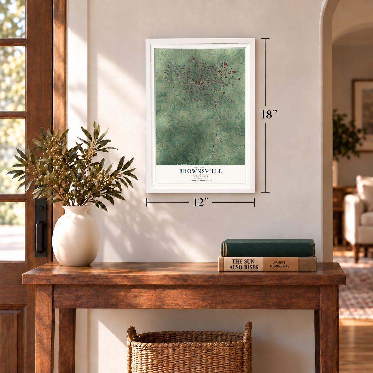
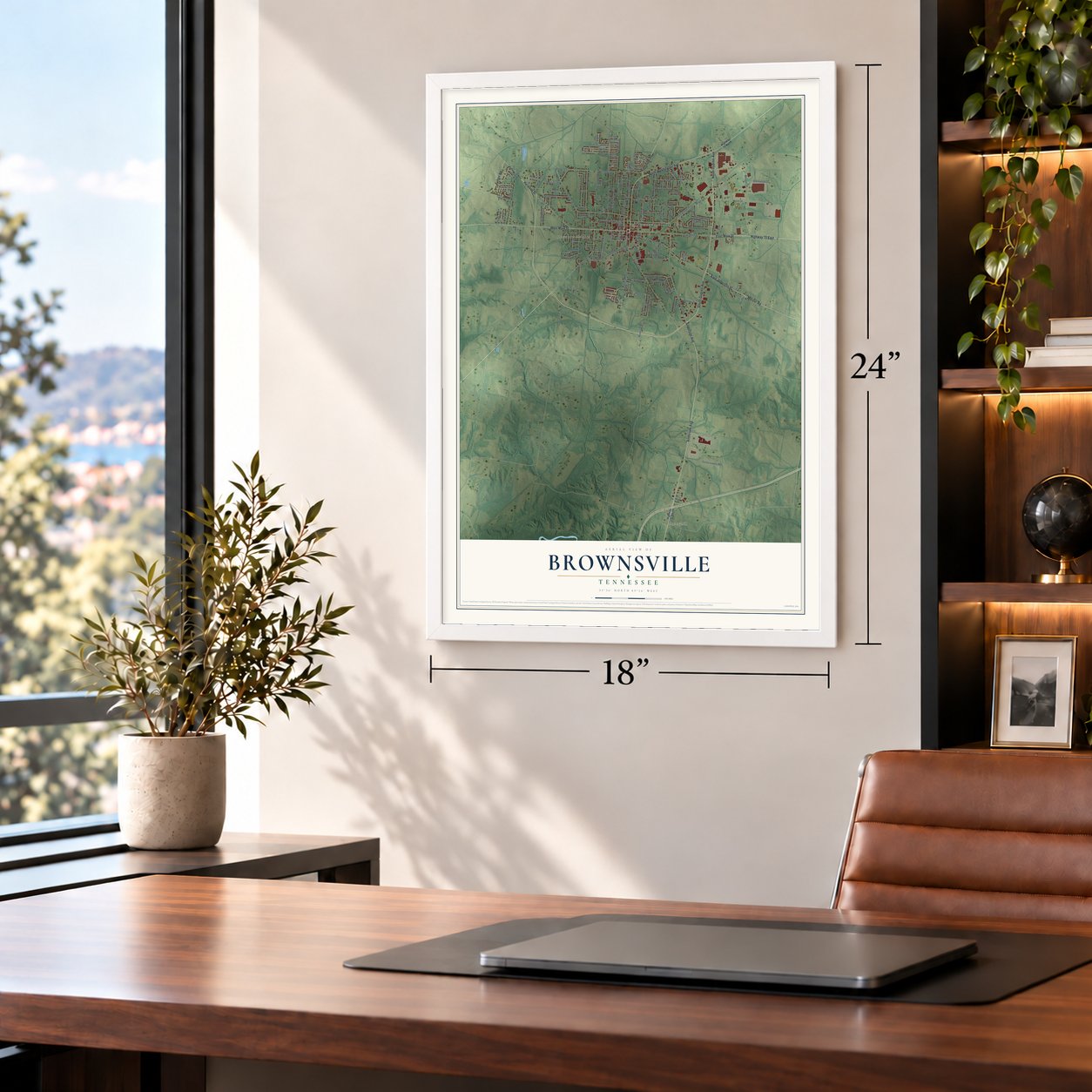
A new map of Brownsville, Tennessee, made in 2026 and printed to order on thick archival matte paper.
12" x 18" Archival Matte Print
A Map of Home. A Work of Art.
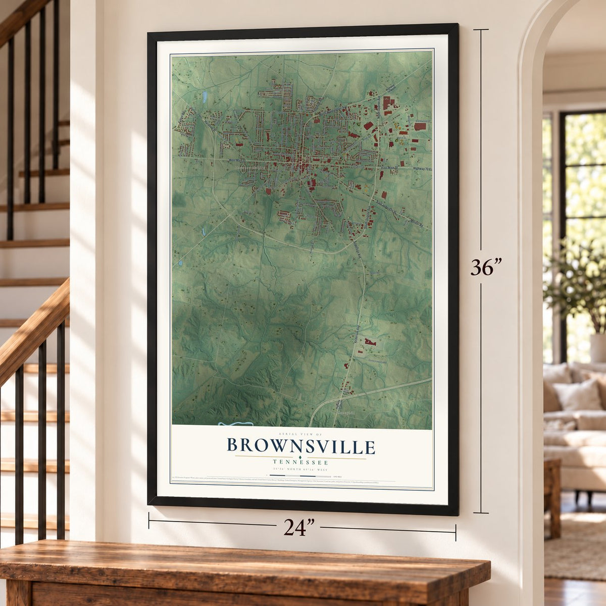
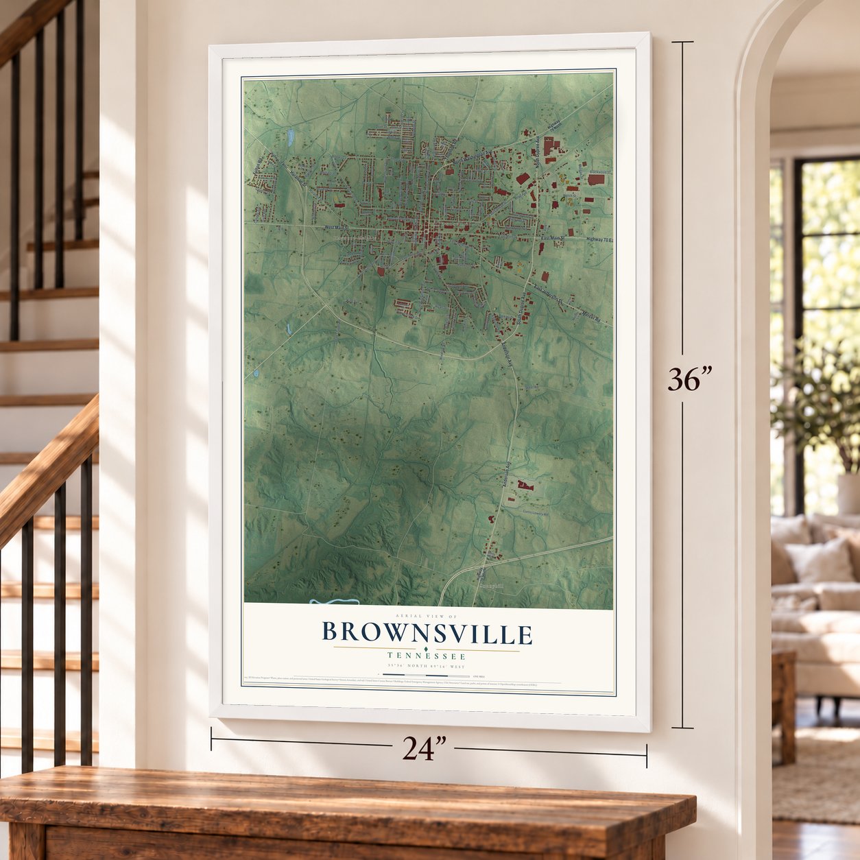
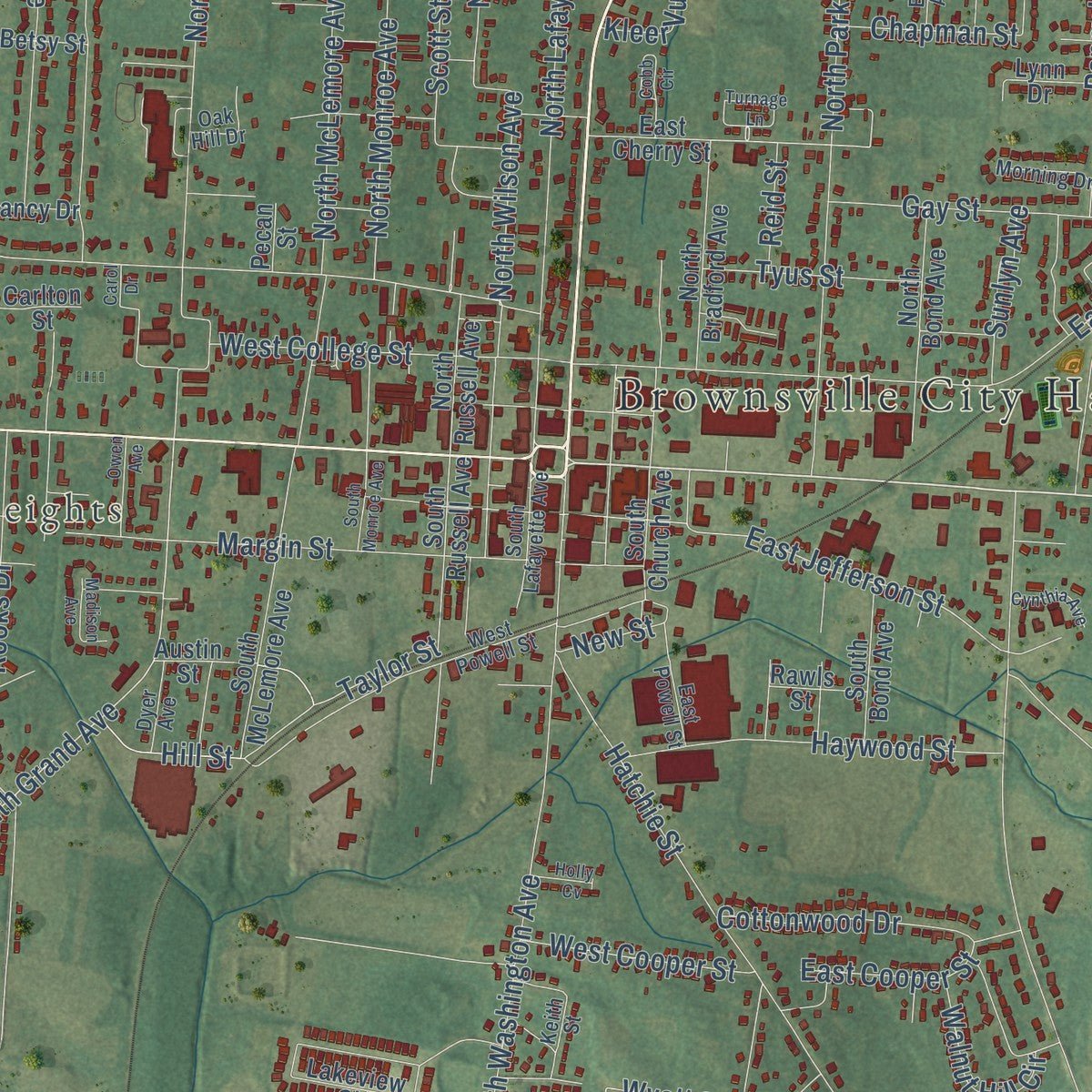
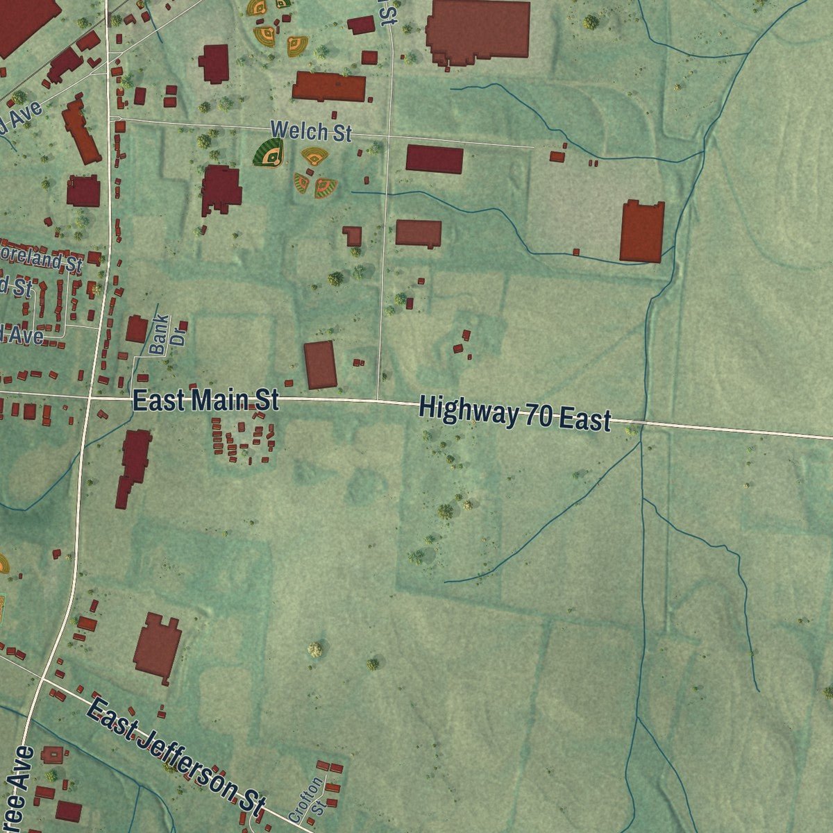
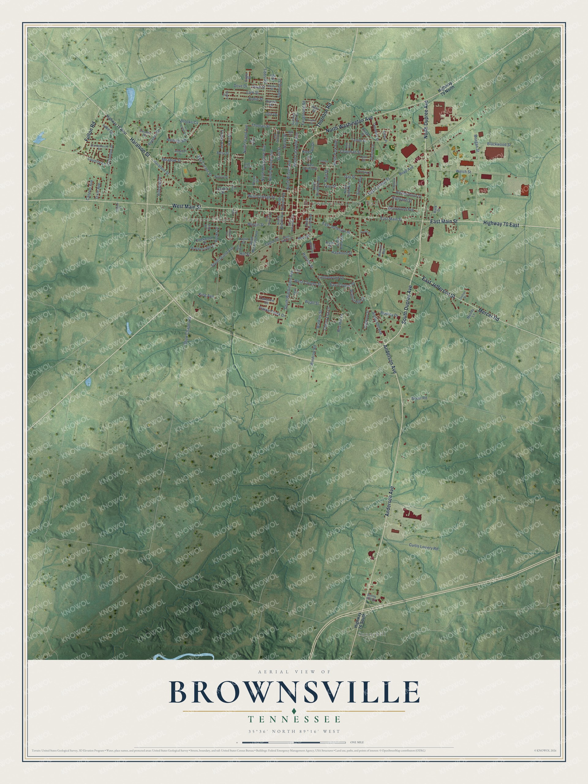
Explore Brownsville, Tennessee from a whole new perspective. Created using aerial imagery and detailed geographic data, this map captures Brownsville building by building, with labeled streets, familiar landmarks, and shaded topographical relief that highlights the natural contours of the landscape.
Combining modern data with the timeless character of a vintage atlas, this map is just as interesting up close as it is beautiful on the wall. Whether you grew up in Brownsville, spent memorable years there, or call it home today, this unique map is a great way to celebrate a place that means something to you. Zoom in on the preview to look for your street, and then order a print to put your memories on the wall.
Three ways to hang it
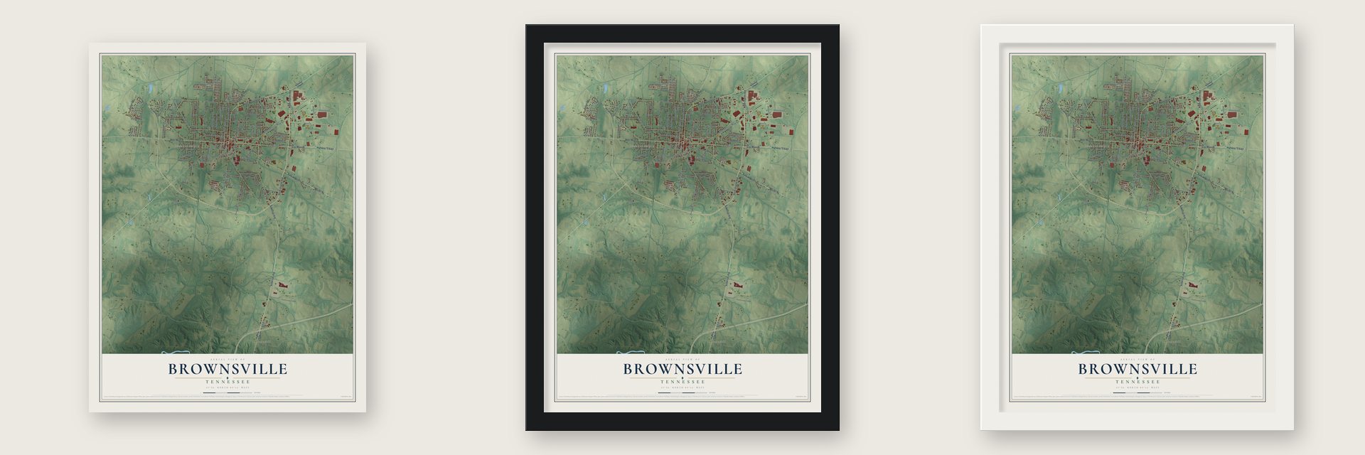
Unframed archival matte, a black wood frame or a white wood frame.
Up close
Geography Worth Displaying
This map was created using accurate cartographic data and authoritative geographic sources, including the U.S. Geological Survey and the Census Bureau. The map brings together terrain, waterways, roads, and building detail. The majority of the streets are labeled, houses are accurately depicted, and the topography is derived from government sources. Combining local data with carefully composed color and shading leads to this beautifully detailed Brownsville artwork for your wall.
Rather than simply showing street outlines, we’ve included as many of the street names as we could reasonably fit on the map while keeping their names legible. Zoom in on the high resolution preview to see exactly what’s on the map. We truly set out to create a statement piece for anyone who loves Brownsville. So whether it’s for you, or a gift for someone you love, we hope this map of Brownsville brings back fond memories.
Read the story behind this map of Brownsville, Tennessee from 2026.

About Brownsville, Tennessee
Brownsville is a city of 9,788 people and the seat of Haywood County, just north of the Hatchie River. The state legislature chose it as the county seat on October 16, 1824. On December 14, 1825, fifty acres were deeded for the town for one dollar and a choice of lots, and Brownsville was incorporated in 1826. It honors General Jacob Jennings Brown, a War of 1812 officer, because local legend says he kept a trading post near the present square before the Chickasaw treaty opened West Tennessee to settlers.
Cotton built the town. Planters turned the surrounding land into plantations worked by enslaved people of African descent, who made up most of the town and county, and the Hatchie carried the crop toward market. Brownsville had 400 people by 1832 and kept growing until the depression of 1837, which left only two of its ten stores open. Floods and several earthquakes struck the area during the same hard years.
- The first cotton gin, 1825Brothers Hiram and Miles Bradford founded Bradford's Landing in 1824, and the next year Hiram opened Brownsville's first cotton gin and store. Emil Tamm, one of the town's early Jewish settlers, later bought the storefront, and for 96 years his family ran it as Emil Tamm & Sons Department Store.
- Temple Adas Israel, 1882German Jewish immigrants settled in Brownsville and formed a congregation during the 1860s. In 1882 they finished Temple Adas Israel, which is thought to be Tennessee's oldest synagogue and is a rare synagogue in the Gothic Revival style. It joined the National Register in 1979.
- Yellow fever in 1878The yellow fever epidemic of 1878 brought 844 reported cases to Brownsville and killed more than 200 people. The Howard Association sent help. With too few workers to bury every victim alone, several were laid in an unmarked mass grave in Oakwood Cemetery.
- A rest room for farmwivesIn 1909 the town opened a public Ladies Rest Room, so farm women had somewhere to rest while they did their shopping in town. It is the first known facility of its kind in Tennessee. Brownsville already had a gas works from 1872, and natural gas arrived in 1934.
- Elbert Williams, 1940In 1939 Black residents founded a local NAACP chapter to win the right to vote in the 1940 election. That June a white mob kidnapped member Elisha Davis, who fled town. On June 20, 1940, police questioned chapter secretary Elbert Williams, and days later his body turned up in the Hatchie River. Thurgood Marshall investigated, but no one was prosecuted, and the case closed in 1942. A marker honoring Williams went up in 2015.
Find your street
Names on the Brownsville map
Every name below is printed on this map. Look for your street, your school, the park where you played, or the pond down the road.
Places and landmarks3
- Brownsville City Hall
- Haywood Heights
- Sunnyhill
Streets and roads147
- West Main Street
- East Main Street
- South Dupree Avenue
- Highway 70 East
- Anderson Avenue
- North Dupree Avenue
- North Washington Avenue
- Thornton Road
- Mercer Road
- East Jefferson Street
- Haralson Street
- Fulton Road
- South Grand Avenue
- Taylor Street
- Cherry Lea Lane
- Wyatt Street
- Welch Street
- North Wilson Avenue
- Robin Street
- Shaw Chapel Road
- Key Corner Street
- Lark Street
- West College Street
- East College Street
- Hatchie Street
- Boyd Avenue
- Windrow Road
- Thomas Street
- South Washington Avenue
- Morgan Street
Show all 147 streets
- North Grand Avenue
- Tamm Street
- North Park Avenue
- North Lafayette Avenue
- North McLemore Avenue
- Margin Street
- King Avenue
- Country Lane
- North Monroe Avenue
- Tibbs Road
- Hart Drive
- Foster Avenue
- Curtis Lowery Road
- Berrywood Avenue
- Haywood Street
- Watkins Street
- Highland Street
- Meadow Street
- Scott Street
- Cottonwood Drive
- Gay Street
- Rooks Drive
- Blackwood Street
- East Cooper Street
- Preston Drive
- West Cooper Street
- Wellingrath
- Dove Drive
- Dove Street
- Berkley Drive
- Tyus Street
- Hillcrest Drive
- Walnut Hill Circle
- Prairie Creek Drive
- Fairground Road
- Rev Hill Lane
- Skeet Road
- Chapman Street
- Sunlyn Avenue
- Kleer Vu Drive
- Fleming Street
- Norris Street
- Hill Street
- Penny Lane
- Cannon Avenue
- Brooks Cv
- Dixie Avenue
- Reid Street
- Lake Drive
- New Street
- Otis Drive
- Highway 79 North
- Highway 76 South
- East Cherry Street
- South Russell Avenue
- Lakeview Circle
- Cottondale Drive
- South McLemore Avenue
- North Bond Avenue
- Breckenridge Drive
- North Bradford Avenue
- Westmoreland Street
- Austin Street
- Creekwood Drive
- Tammbell Street
- Summer Oaks Cv
- South Bond Avenue
- North Russell Avenue
- Dogwood Street
- Hess Street
- Sunny Hill Cv
- South Church Avenue
- Carmen Drive
- Iola Street
- Nancy Drive
- Melody Lane
- Cedar Street
- Lynn Drive
- Lee Avenue
- Eagle Street
- Kirby Place
- Morrich Avenue
- Rawls Street
- Carlton Street
- Bank Drive
- Betsy Street
- Dianne Drive
- Pecan Street
- Highway 19 West
- Sandy Street
- West Powell Street
- East Powell Street
- Altawood Drive
- Bramblewood Street
- Cummings Avenue
- South Lafayette Avenue
- Morning Drive
- Bell Street
- Oak Hill Drive
- Dyer Avenue
- Bain Avenue
- Crofton Street
- Ingram Street
- Clinton Drive
- Keith Street
- Turnage Lane
- Tisdale Street
- Cobb Circle
- Key Corner Road
- Edgewood Avenue
- South Monroe Avenue
- Houston Street
- Owen Avenue
- Cynthia Avenue
- Madison Avenue
- Holly Cv
- Carol Drive
Names are listed as they appear on the printed map. Zoom into the product photos to find them.
The art of mapping a place
How This Map Was Made
Real places. Remarkable detail. Discover the layers that turn geographic data into a map of home.

The view from above
Aerial imagery reveals the character of the land: woodland, open fields, and the patterns of a place.

The shape of the land
Elevation data brings hills, valleys, and subtle changes in the landscape into view.

The details of home
Roads, waterways, and building footprints come together to make the map feel unmistakably local.

Geography becomes art
Considered color, shading, and typography bring the layers together in a map made for your wall.


Process illustrated with Mendon, Massachusetts. Aerial imagery: USDA NAIP. Terrain: USGS 3D Elevation Program. Map details and finished artwork: KNOWOL.
The Details
About This Print
Choose an archival matte print, or a black or white Ayous wood frame. The archival matte print is unframed.
Select your size and finish above to see the matching product image and price.
Materials & Craftsmanship
A contemporary map with the character of a classic atlas, printed on archival matte paper. Optional frames are made from Ayous wood.
Your printed map does not include the watermark shown in the full-map preview.
Shipping & Delivery
Free shipping within the United States. Every print is made to order in the USA.
Buying a gift? Add a note in your cart and we'll include it. We never put prices in the package.
Prints ship within 2 to 3 business days. Allow 7 to 10 days total from ordering for delivery. Timing may vary during holidays or periods of high order volume.
Read our shipping policy.
Returns and damaged prints
Each print is made to order. Change-of-mind refunds are not available after production.
If your print arrives damaged, misprinted or incorrect, contact support@knowol.com within 30 days of receiving it. Include your order number, photos and a description of the issue.
Read our full refund and replacement policy. For questions about your order, email support@knowol.com.
Find your town
Looking for another city?
Find a map of home in our Tennessee collection, or any town in the country.
Nearby
Maps of towns near Brownsville
Know someone from one of these towns? Their map makes a great gift.
 Stanton
, Tennessee
From $39.99See the map
 Dancyville
, Tennessee
From $39.99See the map
 Bells
Bells, Tennessee
From $39.99See the map
More maps nearby: Mercer, Alamo, Maury City, Ripley and Henning.