
Search for another town




Free U.S. delivery 7 to 10 days after you order
Bullhead City, Arizona Map Art
Building by building, with labeled streets and shaded relief.
12" x 18" Archival Matte Print
A Map of Home. A Work of Art.
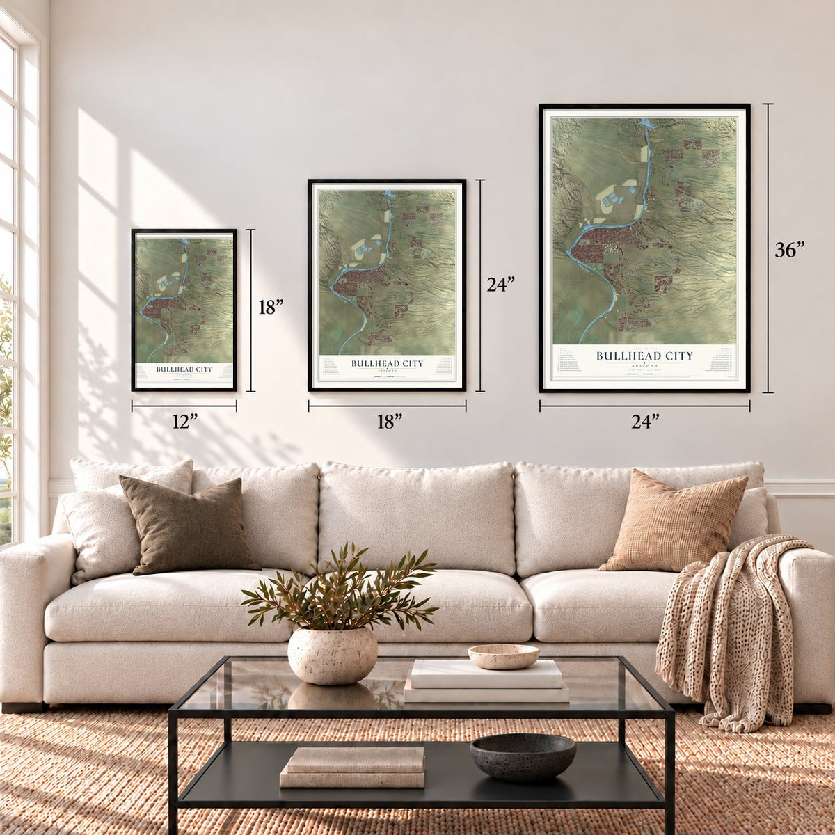
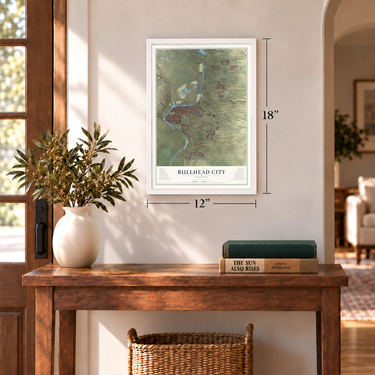
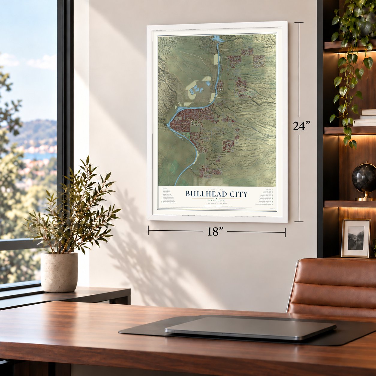
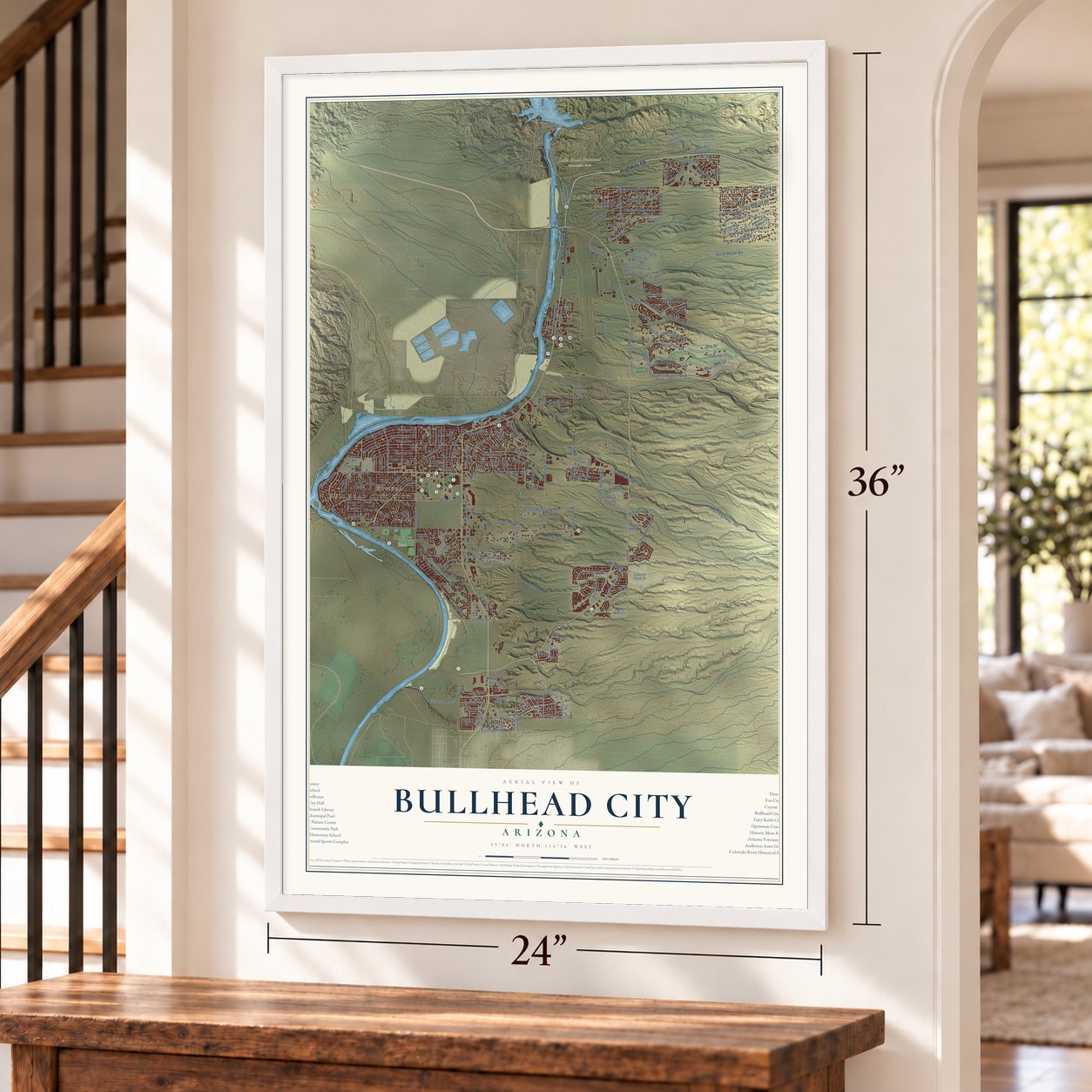
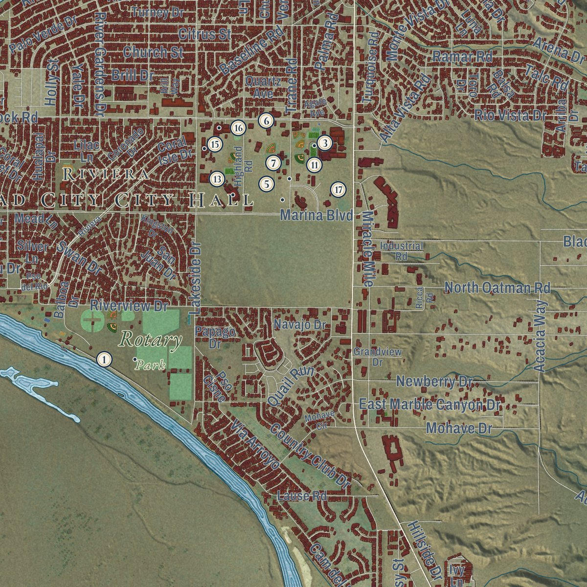
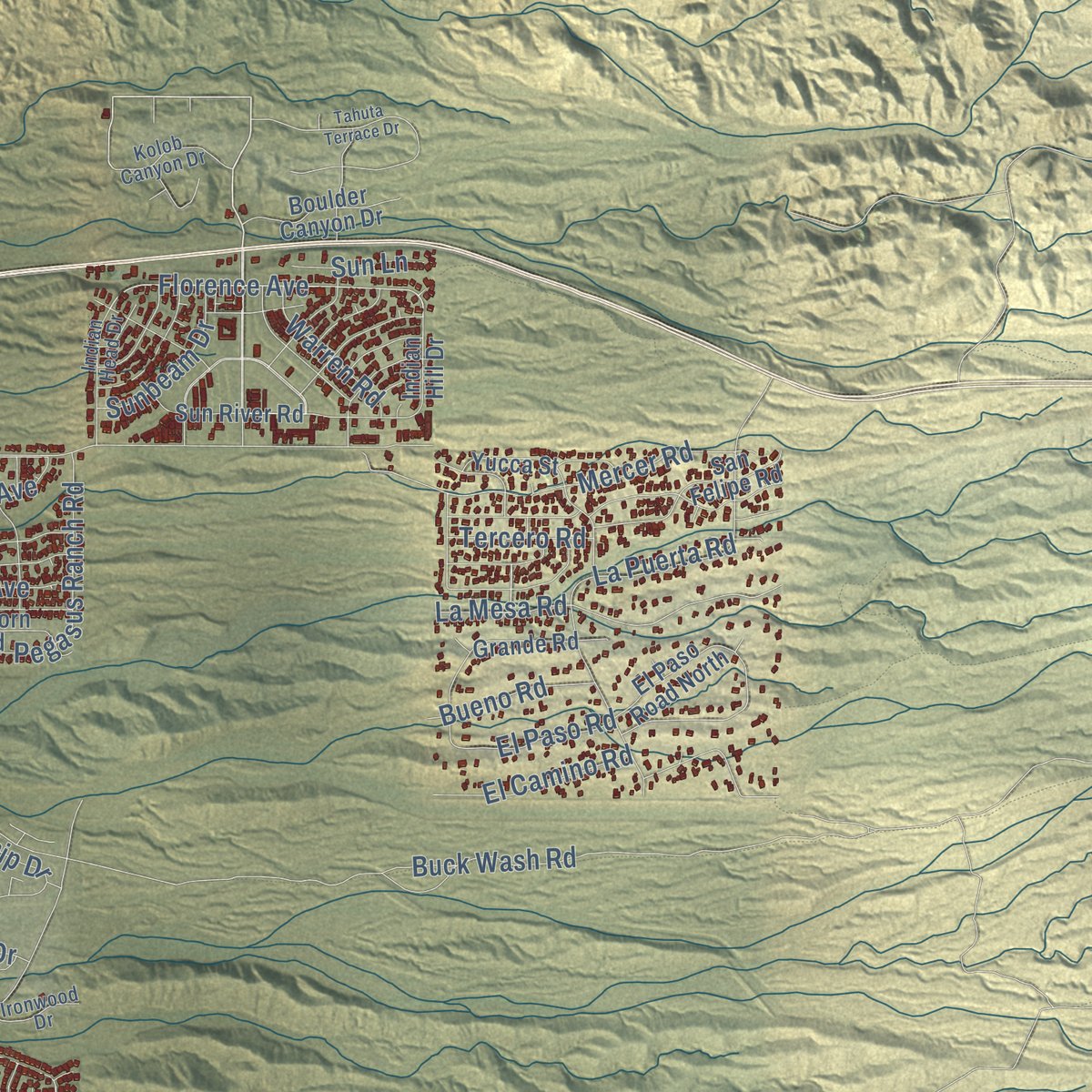
Explore Bullhead City, Arizona from a whole new perspective. Created using aerial imagery and detailed geographic data, this map captures Bullhead City building by building, with labeled streets, familiar landmarks, and shaded topographical relief that highlights the natural contours of the landscape.
Combining modern data with the timeless character of a vintage atlas, this map is just as interesting up close as it is beautiful on the wall. Whether you grew up in Bullhead City, spent memorable years there, or call it home today, this unique map is a great way to celebrate a place that means something to you. Zoom in on the preview to look for your street, and then order a print to put your memories on the wall.

Three ways to hang it
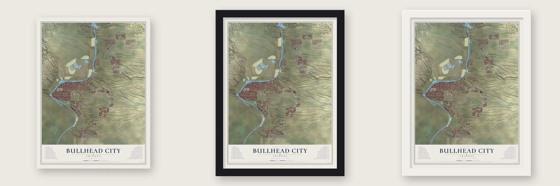
Unframed archival matte, a black wood frame or a white wood frame.
Up close
Geography Worth Displaying
This map was created using accurate cartographic data and authoritative geographic sources, including the U.S. Geological Survey (USGS) and FEMA. The map brings together terrain, waterways, roads, and building detail. The majority of the streets are labeled, houses are accurately depicted, and the topography is derived from government sources. Combining local data with carefully composed color and shading leads to this beautifully detailed Bullhead City artwork for your wall.
Rather than simply showing street outlines, we’ve included as many of the street names as we could reasonably fit on the map while keeping their names legible. Zoom in on the high resolution preview to see exactly what’s on the map. We truly set out to create a statement piece for anyone who loves Bullhead City. So whether it’s for you, or a gift for someone you love, we hope this map of Bullhead City brings back fond memories.
Explore the full map of Bullhead City, Arizona and read about the local places it shows.

Find your street
Names on the Bullhead City map
Every name below is printed on this map. Look for your street, your school, the park where you played, or the pond down the road.
Places and landmarks5
- Bullhead City City Hall
- Riviera
- Davis Dam
- Lake Mead National Recreation Area
- Rotary Park
Streets and roads216
- Topock-Davis Dam Road
- Highway 68
- Bullhead Parkway
- Landon Drive
- Sidewheel Drive
- Fort Mojave Drive
- Pso Grande
- Esmerelda Drive
- Ash Avenue
- Florence Avenue
- Kobe Drive
- Silver Creek Road
- Hancock Road
- Ramar Road
- Marina Boulevard
- Buck Wash Road
- Riverview Drive
- North Oatman Road
- McCormick Boulevard
- Riverfront Drive
- C0 Highway 155
- Lakeside Drive
- Black Mountain Road
- Havasupai Drive
- Adobe Road
- Richardo Avenue
- Arizona Street
- River Gardens Drive
- Terrace Drive
- Cam del Rio
Show all 216 streets
- Baseline Road
- Church Street
- Davis Dam Road
- Mohave Drive
- La Puerta Road
- Rolling Hills Road
- Laughlin Ranch Boulevard
- Park Ridge Avenue
- Rio Vista Drive
- Canyon Road
- Citrus Street
- Arroyo Vista Drive
- Trane Road
- Country Club Drive
- Miracle Mile
- Swan Drive
- Arena Drive
- Newberry Drive
- Roadrunner Drive
- Desert Vista Drive
- Arcadia Boulevard
- Mercer Road
- Booster Drive
- Holly Street
- Joann Avenue
- Talc Road
- East Corwin Road
- El Camino Road
- Pegasus Ranch Road
- La Mesa Road
- Goldrush Road
- Long Avenue
- Acacia Way
- East Sterling Road
- Ridge View Avenue
- East Marble Canyon Drive
- Colina Drive
- Riverside Drive
- Louis Lamour Drive
- Avenida Ventura Drive
- Merrill Avenue
- Lee Avenue
- Desert Sky Boulevard
- Alta Vista Road
- Dorado Drive
- Yale Drive
- La Paloma Drive
- Monte Vista Drive
- Pass Canyon Road
- Palma Road
- Via Arroyo
- Malibu Drive
- Locust Boulevard
- County Highway 155
- Rainbow Drive
- Kingman Drive
- Schooner Cv
- El Paso Road
- Tesota Way
- Central Avenue
- Sunbeam Drive
- Quail Run
- Park River Drive
- Third Street
- Steamship Drive
- Ocotillo Avenue
- Woods
- Hillview Drive
- Warren Road
- Bueno Road
- Main Street
- Wolf Road
- Kyle Avenue
- Easy Street
- Tercero Road
- Hillside Drive
- Sun Lane
- Gila Drive
- Ladera Drive
- Brill Drive
- Park Lane
- Hi Jolly Drive
- Martin Place
- Felipe Drive
- Verde Drive
- Fox Drive
- Trade Wind Drive
- Ilona Drive
- Cll de Mercado
- Palo Verde Drive
- Desert Trail Drive
- Coral Reef Drive
- Shadow Canyon Drive
- Rio Grande Road
- Balboa Drive
- Laughlin View Drive
- Tangier Circle
- Hualapai Drive
- Yucca Street
- San Felipe Road
- Coral Isle Drive
- Avenue Grande
- Ramsey Road
- Country Hills Road
- Desert Stars Lane
- Lariat Drive
- Unicorn Road
- Lause Road
- Balsa Road
- Grande Road
- Navajo Drive
- Rising Sun Road
- Mountain Pass Road
- Turquoise Road
- Boulder Canyon Drive
- Sun River Road
- El Paso Road North
- Gloria Avenue
- Quartz Avenue
- Riverport Drive
- Turney Drive
- Wendell Avenue
- Toro Drive
- Luna Lane
- Sixth Street
- North Avenue
- San Juan Drive
- Dani Circle
- Oatman Road
- Indian Hill Drive
- Downey Drive
- Church Drive
- Mead Lane
- Canyon Park Drive
- Arriba Drive
- Oak Avenue
- Georgia Lane
- Plata Caleta
- Outpost Drive
- Papago Drive
- Rio Drive
- Santa Fe Drive
- Pso Cisne
- Lilac Lane
- Ranch Road
- Silver Lane
- Ivy Lane
- Coronado Drive
- Highland Road
- Mountain View Road
- Sanctuary Drive
- Moss Mine Drive
- Desert Nights Lane
- Whitewater Drive
- Lincoln Lane
- Indian Head Drive
- Kolob Canyon Drive
- Industrial Road
- Mohave Ridge Avenue
- Majestic Way
- Cll Gaviota
- Ridge Vw
- Ironwood Drive
- Grandview Drive
- Emery Drive
- Terra Loma
- Montana Drive
- Corwin Road
- Highland Trail
- Tahuta Terrace Drive
- Verano Drive
- Montano Place Drive
- Agate Avenue
- Kingston Drive
- Pso del Rio
- Copper Drive
- Mohave Circle
- Camino Real Boulevard
- Bryan Drive
- Pioneer Trail
- Palo Verde Avenue
- First Street
- Desierto Verde
- Oasis Lane
- Ricca Road
- Brill Way
Names are listed as they appear on the printed map. Zoom into the product photos to find them.
About Bullhead City, Arizona
Bullhead City is a city of 41,348 people in Mohave County, on the Arizona side of the Colorado River across from Laughlin, Nevada. In March 1864 this ground held Hardyville, a settlement named for William Harrison Hardy, an entrepreneur from New York. Backed by George Alonzo Johnson's steamboat company, Hardy started a ferry and a steamboat landing at the spot where the Mojave Road met the river.
Steamboats called there from 1864 to 1883, bringing supplies for nearby mines and hauling their ore away. Hardyville became the Mohave County seat in 1867 and had 20 people in 1870, but the seat went to Cerbat in 1873. Railroads then pulled the mining trade elsewhere, the post office closed on February 19, 1883, and by the early 1890s the mill sat idle and the last residents had gone. The building of Davis Dam, from 1942 to 1953, brought the town back to life under a new name.
“Hardyville itself was then more of a name than place, consisting chiefly of a warehouse and quartz-mill, with a few adobe shanties.”
- Named for a rockThe dam was first called Bullhead Dam, for Bull's Head Rock, a formation that steamboat pilots used to find their way on the river. The camp that grew up around the work took the nickname Bullhead and served as headquarters for the project. The dam was later renamed for Arthur Powell Davis, and the lake rising behind it now hides nearly all of the rock.
- Hardy's toll road and mail sackHardy built and owned a toll road from Hardyville to Prescott, the new territorial capital, and raised Angora goats. On January 17, 1865, he took the job of the town's first postmaster, and he gets the credit for coming up with the riveted mail sack. In 1864 he was worth over $40,000, which made him the second-richest man in Arizona.
- Graves under cobblestonesHardyville Cemetery, on State Route 95, is the most important trace of the old river town left today. Its 17 graves still lie under heaps of cobblestones, just as they were first made, and the cemetery joined the National Register in 2001.
- Three towns, one name in 1984In 1970 Bullhead City was just six blocks on Highway 95, home to roughly a thousand people, and nearby Riviera had about 3,000. In 1984 voters in Bullhead City, Riviera and Holiday Shores chose to become one city, and they picked the name Bullhead City for its history.
- A regatta of 30,158The Bullhead City River Regatta has become the city's best-known event. Its 10th annual run, in August 2016, had a Pirates of the Colorado theme and drew 30,158 registered participants to the river.
Keep exploring Arizona
Bullhead City is one of 525 Arizona towns we've mapped. Every dot on the map is a print of its own.
The search covers every state, Arizona first.
Near Bullhead City
Order 2 or more town maps and save 10%. Shown in the size and finish you picked above, so they hang as a set.
- Katherine 12" x 18" / Archival Matte Print $39.99
- Fort Mohave 12" x 18" / Archival Matte Print $39.99
- Mesquite Creek 12" x 18" / Archival Matte Print $39.99


More maps nearby: Oatman, Mojave Ranch Estates, Willow Valley, Mohave Valley and Fort Mojave Indian Tribe.
The art of mapping a place
How This Map Was Made
Real places. Remarkable detail. Discover the layers that turn geographic data into a map of home.

The view from above
Aerial imagery reveals the character of the land: woodland, open fields, and the patterns of a place.

The shape of the land
Elevation data brings hills, valleys, and subtle changes in the landscape into view.

The details of home
Roads, waterways, and building footprints come together to make the map feel unmistakably local.

Geography becomes art
Considered color, shading, and typography bring the layers together in a map made for your wall.


Process illustrated with Mendon, Massachusetts. Aerial imagery: USDA NAIP. Terrain: USGS 3D Elevation Program. Map details and finished artwork: KNOWOL.
The Details
About This Print
Choose an archival matte print, or a black or white Ayous wood frame. The archival matte print is unframed.
Select your size and finish above to see the matching product image and price.
Materials & Craftsmanship
A contemporary map with the character of a classic atlas, printed on archival matte paper. Optional frames are made from Ayous wood.
Your printed map does not include the watermark shown in the full-map preview.
Shipping & Delivery
Free shipping within the United States. Every print is made to order in the USA.
Buying a gift? Add a note in your cart and we'll include it. We never put prices in the package.
Prints ship within 2 to 3 business days. Allow 7 to 10 days total from ordering for delivery. Timing may vary during holidays or periods of high order volume.
Read our shipping policy.
Returns and damaged prints
Each print is made to order. Change-of-mind refunds are not available after production.
If your print arrives damaged, misprinted or incorrect, contact support@knowol.com within 30 days of receiving it. Include your order number, photos and a description of the issue.
Read our full refund and replacement policy. For questions about your order, email support@knowol.com.