


Search for another town





Free U.S. delivery 7 to 10 days after you order
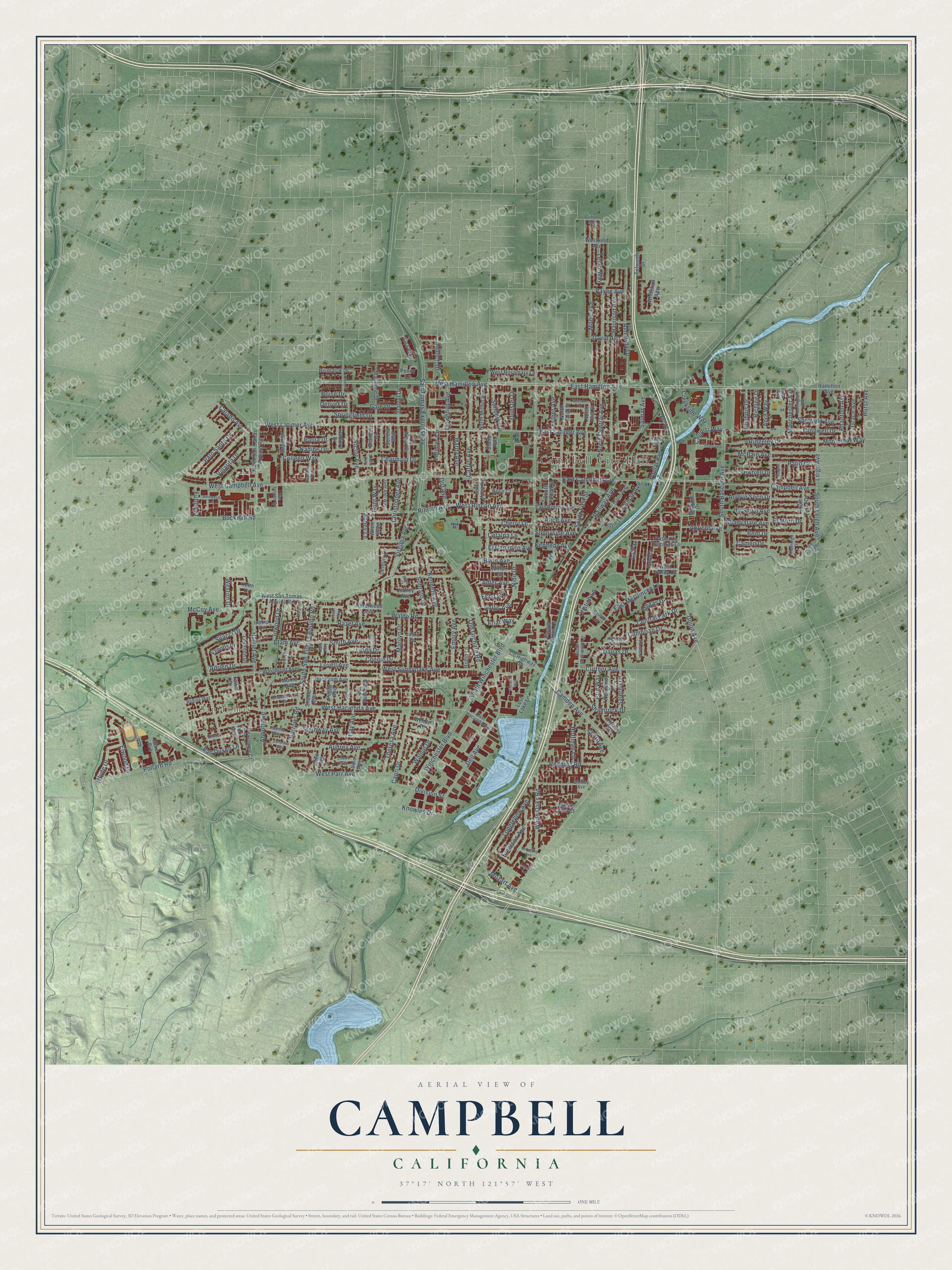
Campbell, California Map Art
Building by building, with labeled streets and shaded relief.
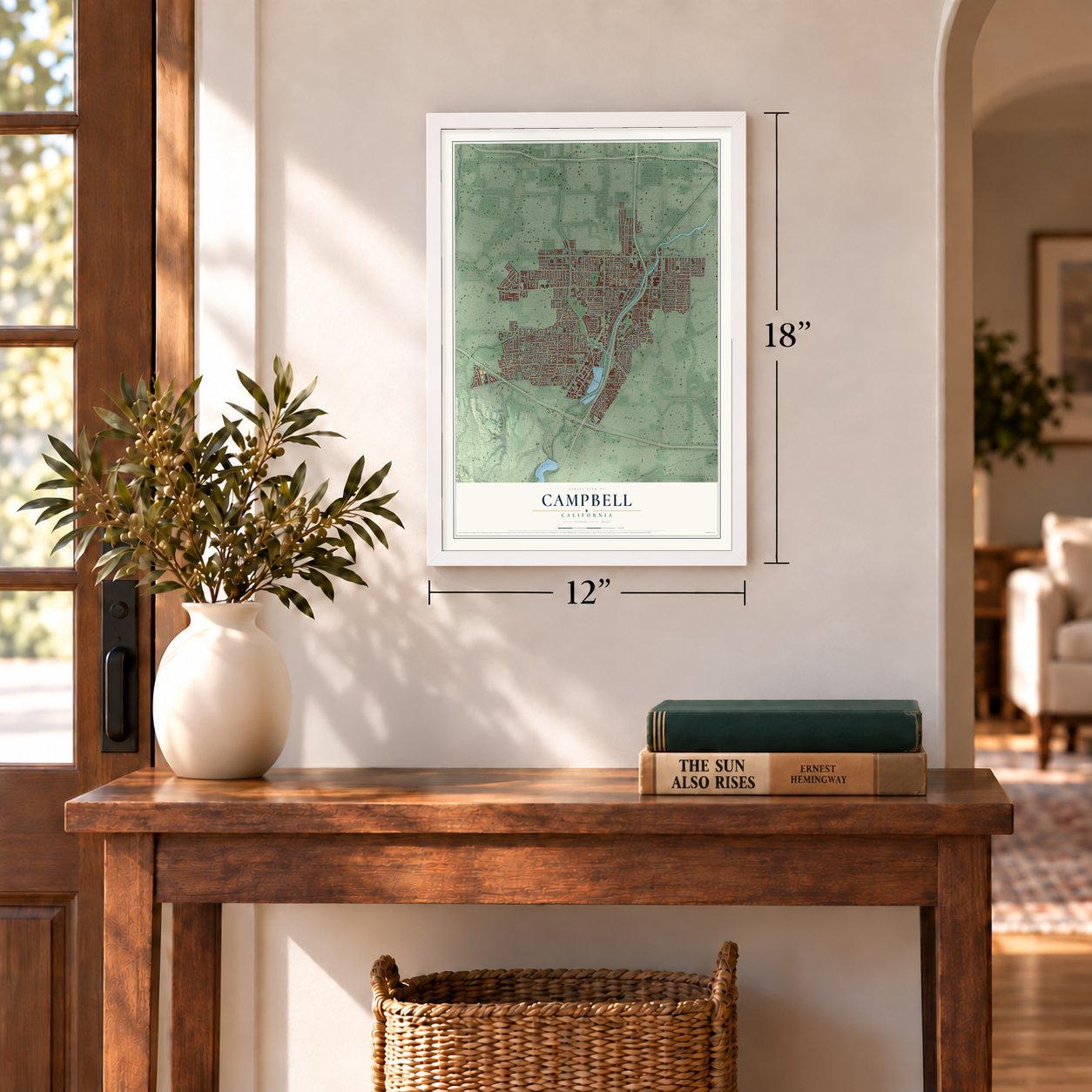
12" x 18" Archival Matte Print
A Map of Home. A Work of Art.
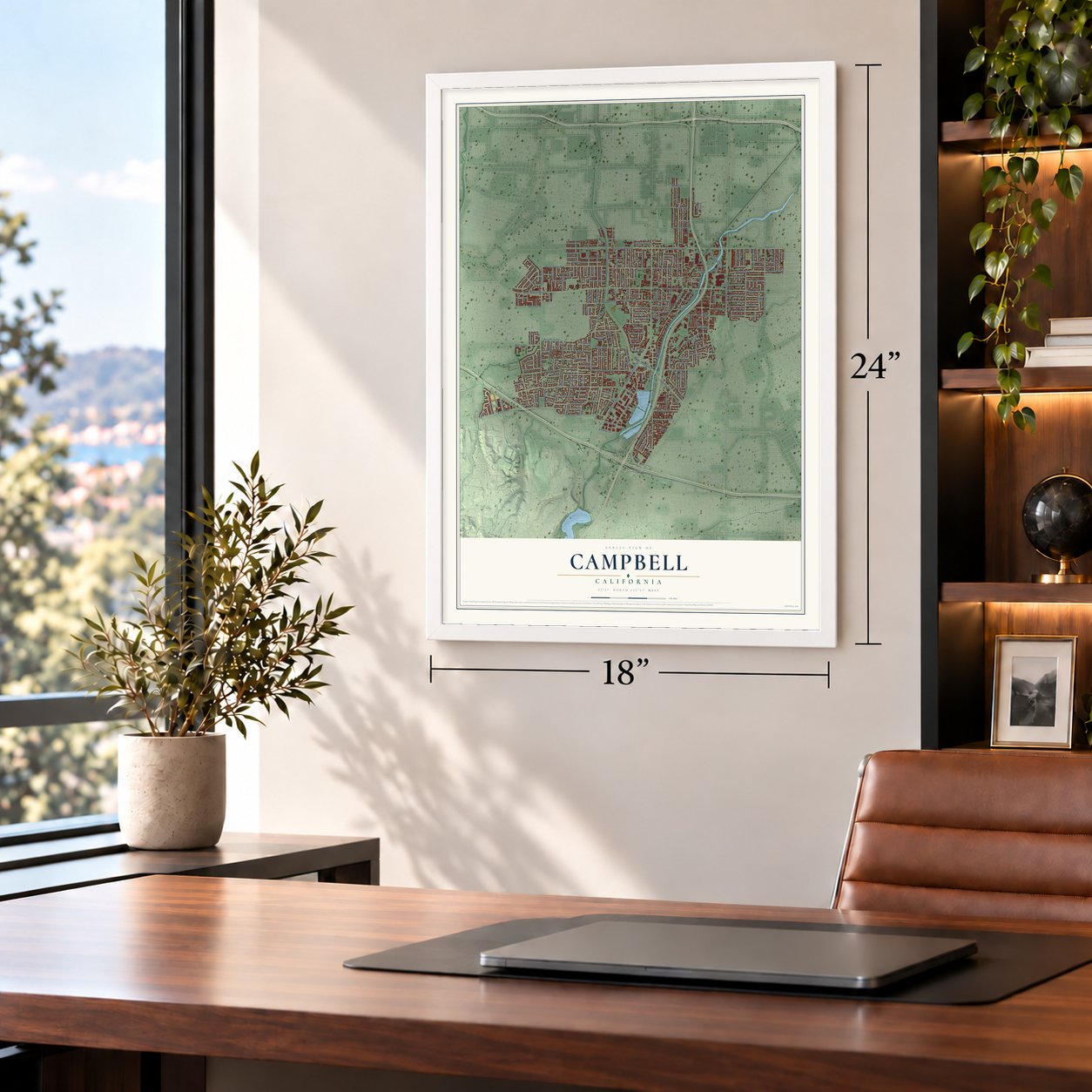
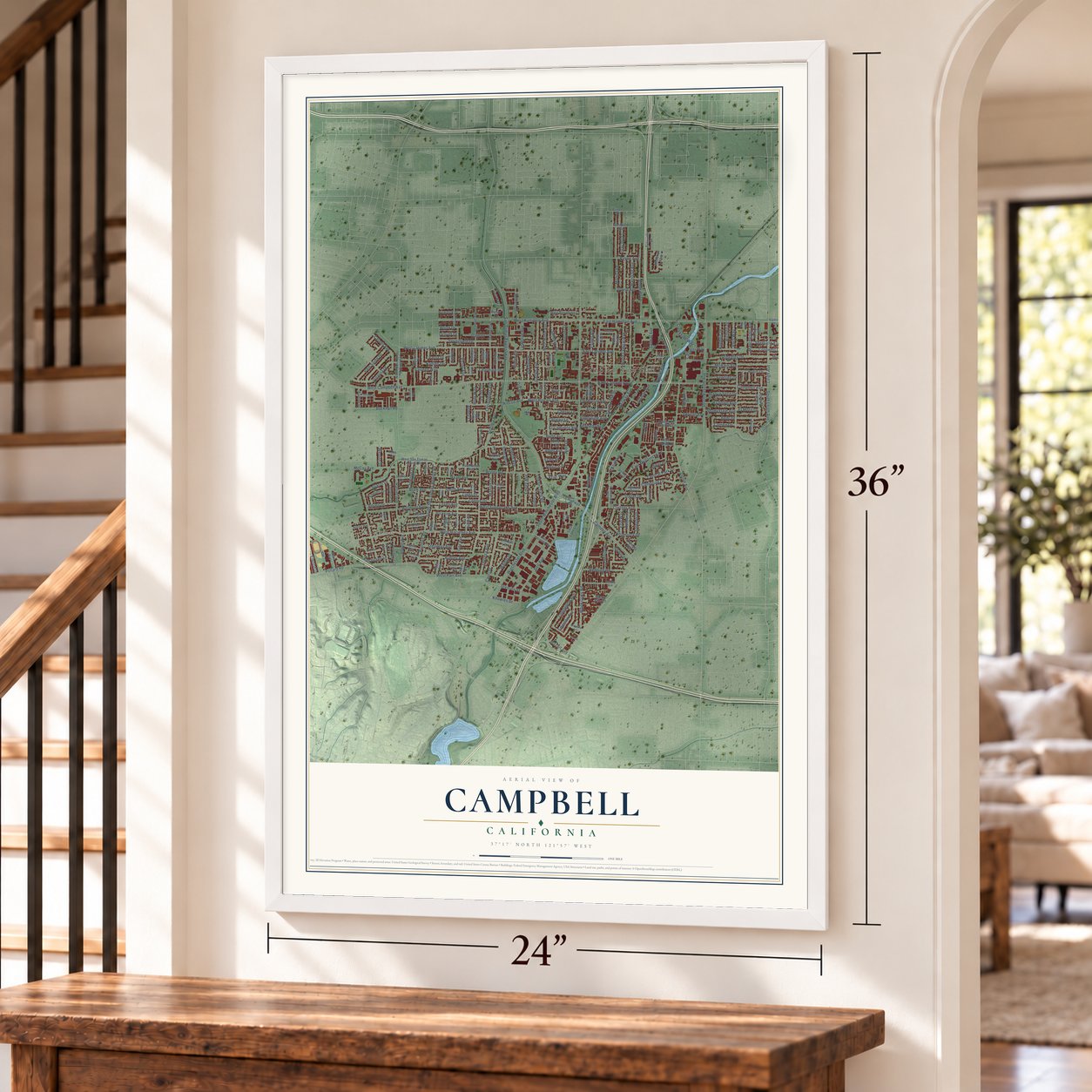
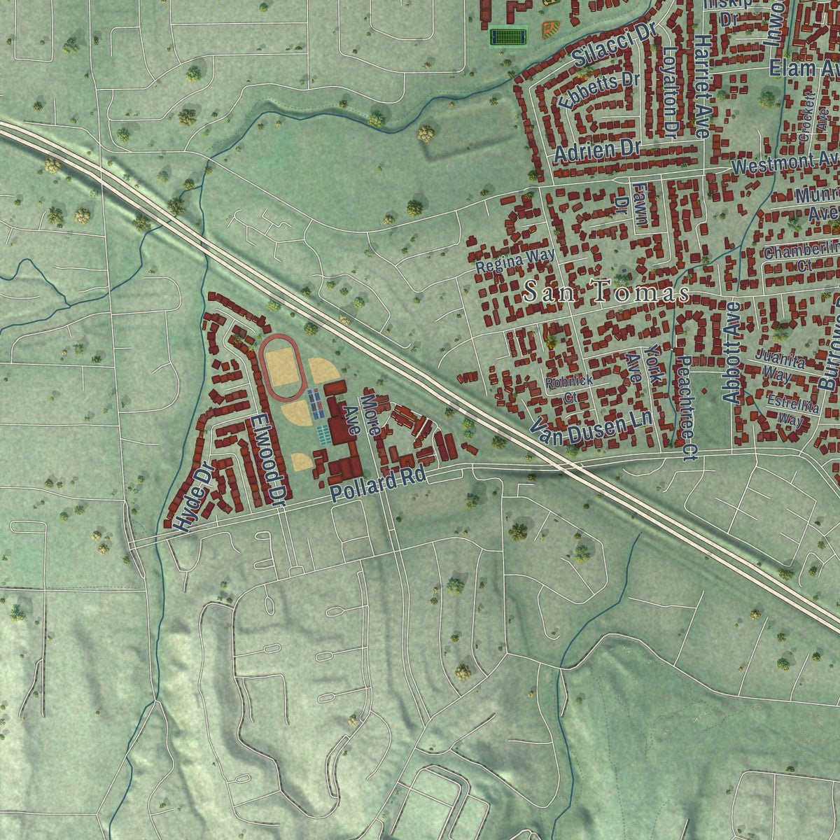
Explore Campbell, California from a whole new perspective. Created using aerial imagery and detailed geographic data, this map captures Campbell building by building, with labeled streets, familiar landmarks, and shaded topographical relief that highlights the natural contours of the landscape.
Combining modern data with the timeless character of a vintage atlas, this map is just as interesting up close as it is beautiful on the wall. Whether you grew up in Campbell, spent memorable years there, or call it home today, this unique map is a great way to celebrate a place that means something to you. Zoom in on the preview to look for your street, and then order a print to put your memories on the wall.
Three ways to hang it
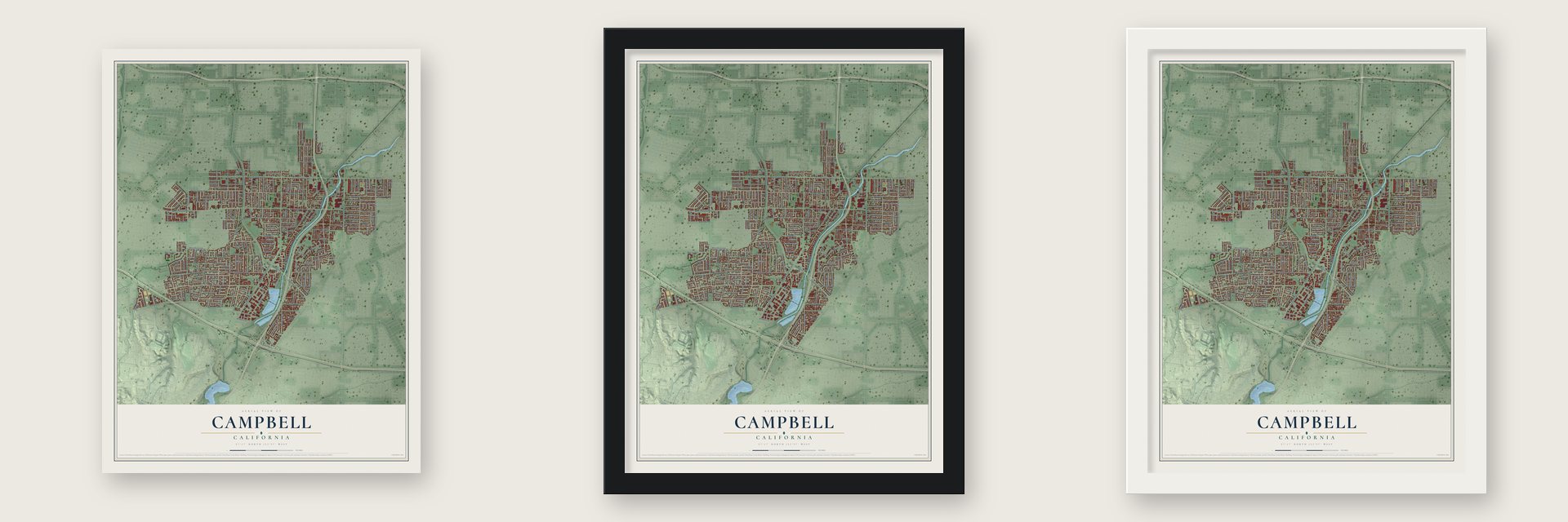
Unframed archival matte, a black wood frame or a white wood frame.
Up close
Geography Worth Displaying
This map was created using accurate cartographic data and authoritative geographic sources, including the U.S. Geological Survey and the Census Bureau. The map brings together terrain, waterways, roads, and building detail. The majority of the streets are labeled, houses are accurately depicted, and the topography is derived from government sources. Combining local data with carefully composed color and shading leads to this beautifully detailed Campbell artwork for your wall.
Rather than simply showing street outlines, we’ve included as many of the street names as we could reasonably fit on the map while keeping their names legible. Zoom in on the high resolution preview to see exactly what’s on the map. We truly set out to create a statement piece for anyone who loves Campbell. So whether it’s for you, or a gift for someone you love, we hope this map of Campbell brings back fond memories.
Read the story behind this map of Campbell, California from 2026.

Find your street
Names on the Campbell map
Every name below is printed on this map. Look for your street, your school, the park where you played, or the pond down the road.
Places and landmarks2
- Campbell City Hall
- San Tomas
Streets and roads246
- South Bascom Avenue
- West Latimer Avenue
- Union Avenue
- East Latimer Avenue
- Mozart Avenue
- Camden Avenue
- West Hamilton Avenue
- East Hamilton Avenue
- South San Tomas Aquino Road
- Campisi Way
- East Campbell Avenue
- Montemar Way
- Nadine Drive
- San Tomas Expressway
- West Campbell Avenue
- Winchester Boulevard
- Pollard Road
- West Hacienda Avenue
- Virginia Avenue
- Dell Avenue
- North Central Avenue
- South Winchester Boulevard
- White Oaks Road
- Harrison Avenue
- West Rincon Avenue
- Harriet Avenue
- Budd Avenue
- Rincon Avenue
- Almarida Drive
- Sobrato Drive
Show all 246 streets
- Monica Lane
- Kenneth Avenue
- West Parr Avenue
- East McGlincey Lane
- Bucknall Road
- Capri Drive
- Darryl Drive
- West Sunnyoaks Avenue
- Leigh Avenue
- Arroyo Seco Drive
- Emory Avenue
- Carlyn Avenue
- Ridgeley Drive
- McBain Avenue
- Central Park Drive
- Silacci Drive
- Springfield Drive
- Waldo Road
- Steinway Avenue
- Curtner Avenue
- Llewellyn Avenue
- Villarita Drive
- Elwood Drive
- Bent Drive
- El Solyo Avenue
- Railway Avenue
- Audrey Avenue
- Shamrock Drive
- Salmar Avenue
- Theresa Avenue
- Walnut Drive
- Hazel Avenue
- Calado Avenue
- Lovell Avenue
- Palo Santo Drive
- Latimer Circle
- Cambrian Drive
- Abbott Avenue
- McCoy Avenue
- Cameo Drive
- Smith Avenue
- Christopher Avenue
- Colleen Way
- Redding Road
- Gale Drive
- Longfellow Avenue
- Hurst Avenue
- Dallas Drive
- South First Street
- Salerno Drive
- Victor Avenue
- Phantom Avenue
- Linda Drive
- Elam Avenue
- Burrows Road
- South Leigh Avenue
- Manchester Avenue
- Cherry Lane
- Grace Avenue
- Charmain Drive
- Sheffield Avenue
- Creekside Way
- Erin Way
- Cronwell Drive
- Old Orchard Road
- Poplar Avenue
- Shady Dale Avenue
- Cristich Lane
- Connie Drive
- Millich Drive
- Hyde Drive
- Adrien Drive
- Hoffman Lane
- Fewtrell Drive
- Hardy Avenue
- Catalpa Lane
- Lenor Way
- Campbell Avenue
- Patio Drive
- Dunster Drive
- Van Dusen Lane
- El Caminito Avenue
- Esther Avenue
- Marilyn Drive
- Inwood Drive
- Sharp Avenue
- Sunnyside Avenue
- Alice Avenue
- April Way
- Sunberry Drive
- Knowles Drive
- Apricot Avenue
- Richlee Drive
- Payne Avenue
- Kuehnis Drive
- Nido Drive
- Emerson Avenue
- Kennedy Avenue
- Friar Way
- Regas Drive
- Adler Avenue
- David Avenue
- El Moro Drive
- Paula Drive
- Boise Drive
- Gilman Avenue
- Echo Avenue
- Division Street
- Hunt Way
- Weston Drive
- Hollis Avenue
- Fulton Street
- Dot Avenue
- La Paz
- Abbey Lane
- Denver Drive
- Gay Avenue
- Timber Cove Drive
- North First Street
- North San Tomas Aquino Road
- Branbury Drive
- Fawn Drive
- Westmont Avenue
- North Milton Avenue
- North Third Street
- Bucknam Avenue
- Superior Drive
- Michael Drive
- Marathon Drive
- West San Tomas Aquino Road
- County Highway G4
- Hazelwood Avenue
- Del Prado Drive
- Peggy Avenue
- Hamilton Avenue
- East Rincon Avenue
- West Rosemary Lane
- South Peter Drive
- Paseo de Palomas Lane
- Jeffrey Avenue
- Century Drive
- Lost Lake Lane
- Normandy Drive
- Lottie Lane
- Olympia Avenue
- Peachtree Court
- Ebbetts Drive
- Robin Lane
- Loyalton Drive
- Bismarck Drive
- Whitehall Avenue
- York Avenue
- Radford Drive
- La Paloma
- Via Ranchero
- West Valley Drive
- Munro Avenue
- South Fourth Street
- More Avenue
- Shadle Avenue
- Vale Avenue
- Wendell Drive
- Sondra Way
- Hack Avenue
- Monte Villa Court
- Lisa Way
- Laura Drive
- Tolworth Drive
- Bland Avenue
- Westfield Avenue
- Wilton Drive
- Inskip Drive
- Wren Way
- Rose Court
- Arc Road
- Penny Lane
- Keith Drive
- Shelley Avenue
- Dillon Avenue
- South McGlincey Lane
- Lavonne Drive
- Chamberlin Court
- Jane Ann Way
- East Hacienda Avenue
- South Milton Avenue
- Griffith Lane
- Regina Way
- Juanita Way
- Highland Park Lane
- Kim Louise Drive
- Flamingo Drive
- Lucot Way
- Clifton Avenue
- Kara Way
- Whitwood Lane
- Sonuca Avenue
- Crockett Avenue
- Nottingham Way
- Dry Creek Road
- Phoenix Drive
- El Patio Drive
- Pruneyard
- Stonehurst Drive
- Watson Drive
- Robnick Court
- Margaret Lane
- Browning Avenue
- Loretta Lane
- Florence Way
- Estrellita Way
- Jones Way
- Pecan Way
- Herbert Lane
- Amato Avenue
- Dover Way
- Budd Court
Names are listed as they appear on the printed map. Zoom into the product photos to find them.
About Campbell, California
Campbell is a city of 43,959 people in Santa Clara County, in the southern Santa Clara Valley. Ohlone people lived on this land first, and about a third of today's city later fell inside Rancho Rinconada de Los Gatos, a land grant made in 1839. Benjamin Campbell came to California with his father, William, in 1846, and in 1851 he bought 160 acres here and planted hay and grain.
In 1878 Campbell sold land to a railroad company for $5 an acre, and by 1887 the first subdivision had been recorded west of the tracks. Benjamin and his wife, Mary, started the settlement as Campbell's Place, and it later became the town of Campbell. Fruit from the orchards around it soon made the town a busy rail shipping point, with drying grounds and canneries. Campbell was incorporated as a city in 1952, and housing tracts then replaced the orchards one by one.
- Fruit growers united by 1892By 1892 the Campbell Fruit Growers' Union was a well-known cooperative, drying fruit on a yard of 17 acres. Hyde Cannery, Payne Cannery and the J.C. Ainsley Packing Company did most of the packing in town. In 1895 the Bank of Campbell opened, and the Campbell Weekly Visitor, the town's first newspaper, started printing.
- The Ainsley HouseJohn Colpitts Ainsley, a canning pioneer in the county, had an English Tudor house built in 1925 at Hamilton and Bascom Avenues, styled after English country cottages. In the early 1990s the house was moved downtown and filled with many of the family's own furnishings. It is now the center of the Ainsley House and Campbell Historical Museum, which also uses the old firehouse nearby.
- Roosevelt's redwood, 1903President Theodore Roosevelt planted a redwood on May 11, 1903, where Winchester Boulevard meets Campbell Avenue. That corner held Campbell High School. Five years after the school closed, on August 1, 1985, the city bought the site and turned it into the Campbell Community Center. The old school auditorium reopened as the Heritage Theater in 2004.
- From bank to GaslighterCampbell's oldest commercial building went up in 1920 for the Grower's Bank and became a movie theater in 1938. The Gaslighter Theater company bought it in 1968, added a small stage and bar, and staged melodramas and Vaudeville-style shows until it closed in 2006. After a sale in 2013, the building was remade as a wine bar, tasting room and restaurant.
Keep exploring California
Campbell is one of 1,990 California towns we've mapped. Every dot on the map is a print of its own.
The search covers every state, California first.
Near Campbell
Order 2 or more town maps and save 10%. Shown in the size and finish you picked above, so they hang as a set.
- Cambrian Park 12" x 18" / Archival Matte Print $39.99
- Fruitdale 12" x 18" / Archival Matte Print $39.99
- Willow Glen 12" x 18" / Archival Matte Print $39.99


More maps nearby: Buena Vista, Monte Sereno, Los Gatos, Rancho Rinconada and Saratoga.
The art of mapping a place
How This Map Was Made
Real places. Remarkable detail. Discover the layers that turn geographic data into a map of home.

The view from above
Aerial imagery reveals the character of the land: woodland, open fields, and the patterns of a place.

The shape of the land
Elevation data brings hills, valleys, and subtle changes in the landscape into view.

The details of home
Roads, waterways, and building footprints come together to make the map feel unmistakably local.

Geography becomes art
Considered color, shading, and typography bring the layers together in a map made for your wall.


Process illustrated with Mendon, Massachusetts. Aerial imagery: USDA NAIP. Terrain: USGS 3D Elevation Program. Map details and finished artwork: KNOWOL.
The Details
About This Print
Choose an archival matte print, or a black or white Ayous wood frame. The archival matte print is unframed.
Select your size and finish above to see the matching product image and price.
Materials & Craftsmanship
A contemporary map with the character of a classic atlas, printed on archival matte paper. Optional frames are made from Ayous wood.
Your printed map does not include the watermark shown in the full-map preview.
Shipping & Delivery
Free shipping within the United States. Every print is made to order in the USA.
Buying a gift? Add a note in your cart and we'll include it. We never put prices in the package.
Prints ship within 2 to 3 business days. Allow 7 to 10 days total from ordering for delivery. Timing may vary during holidays or periods of high order volume.
Read our shipping policy.
Returns and damaged prints
Each print is made to order. Change-of-mind refunds are not available after production.
If your print arrives damaged, misprinted or incorrect, contact support@knowol.com within 30 days of receiving it. Include your order number, photos and a description of the issue.
Read our full refund and replacement policy. For questions about your order, email support@knowol.com.