
Search for another town



Free U.S. delivery 7 to 10 days after you order
Los Gatos, California Map Art
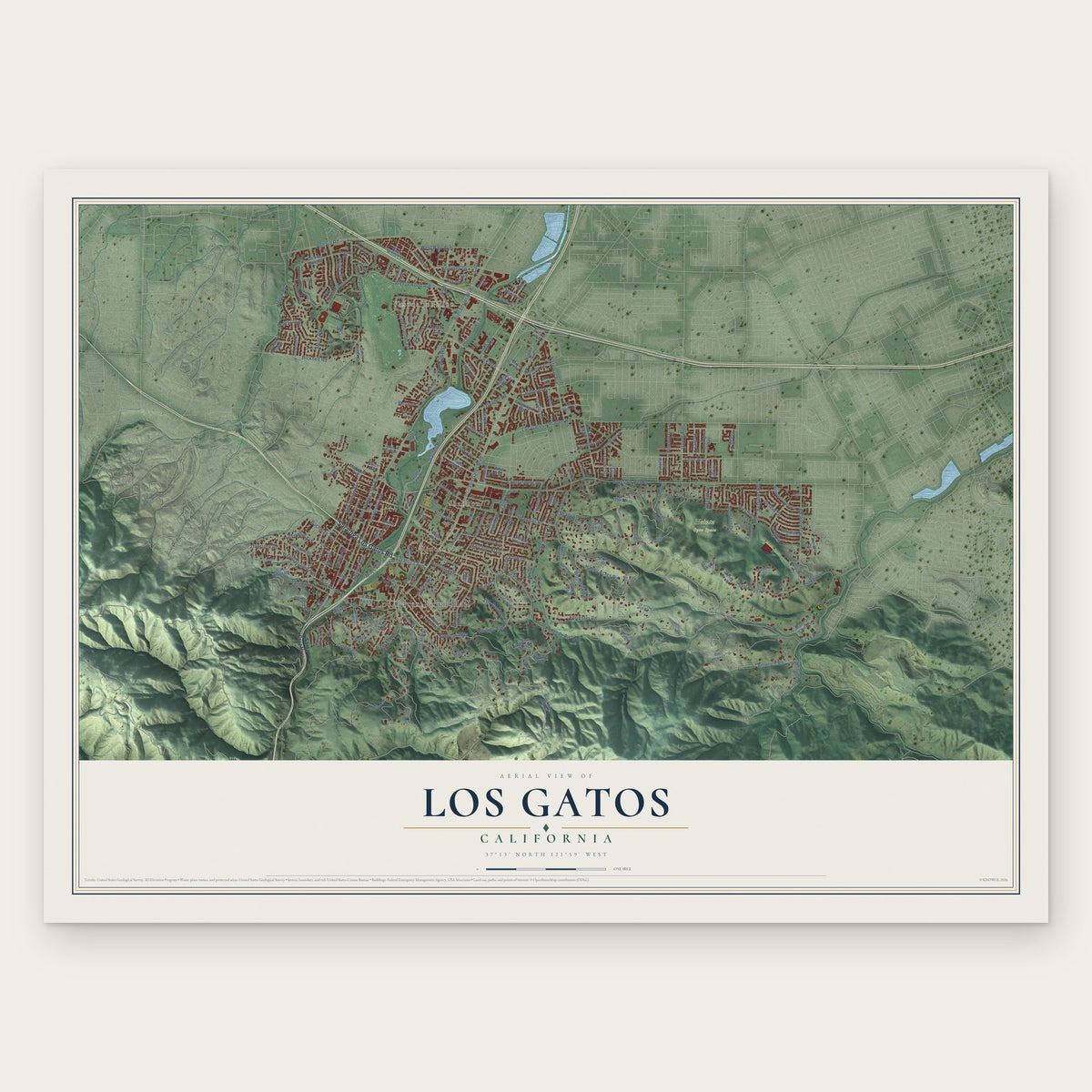
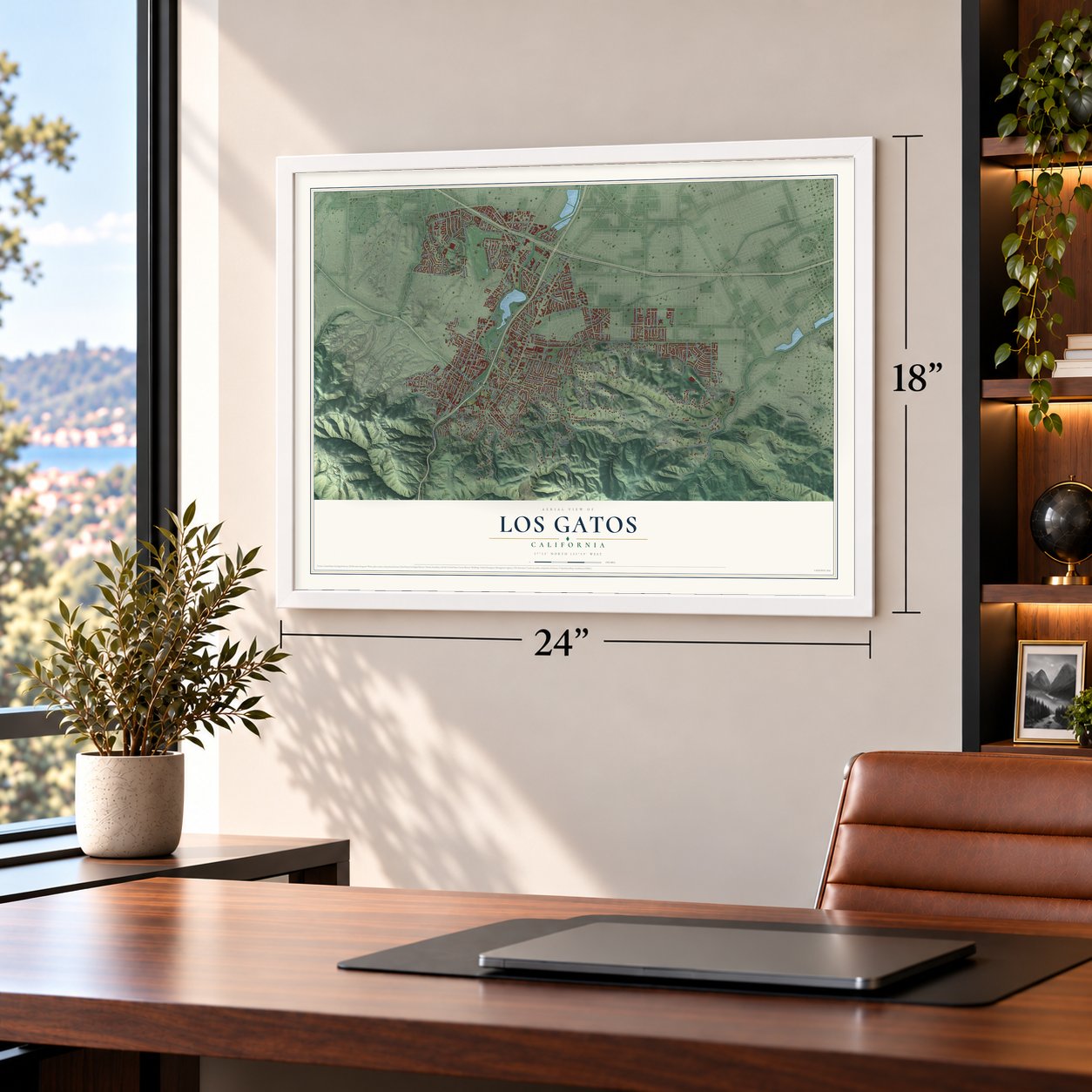
A new map of Los Gatos, California, made in 2026 and printed to order on thick archival matte paper.
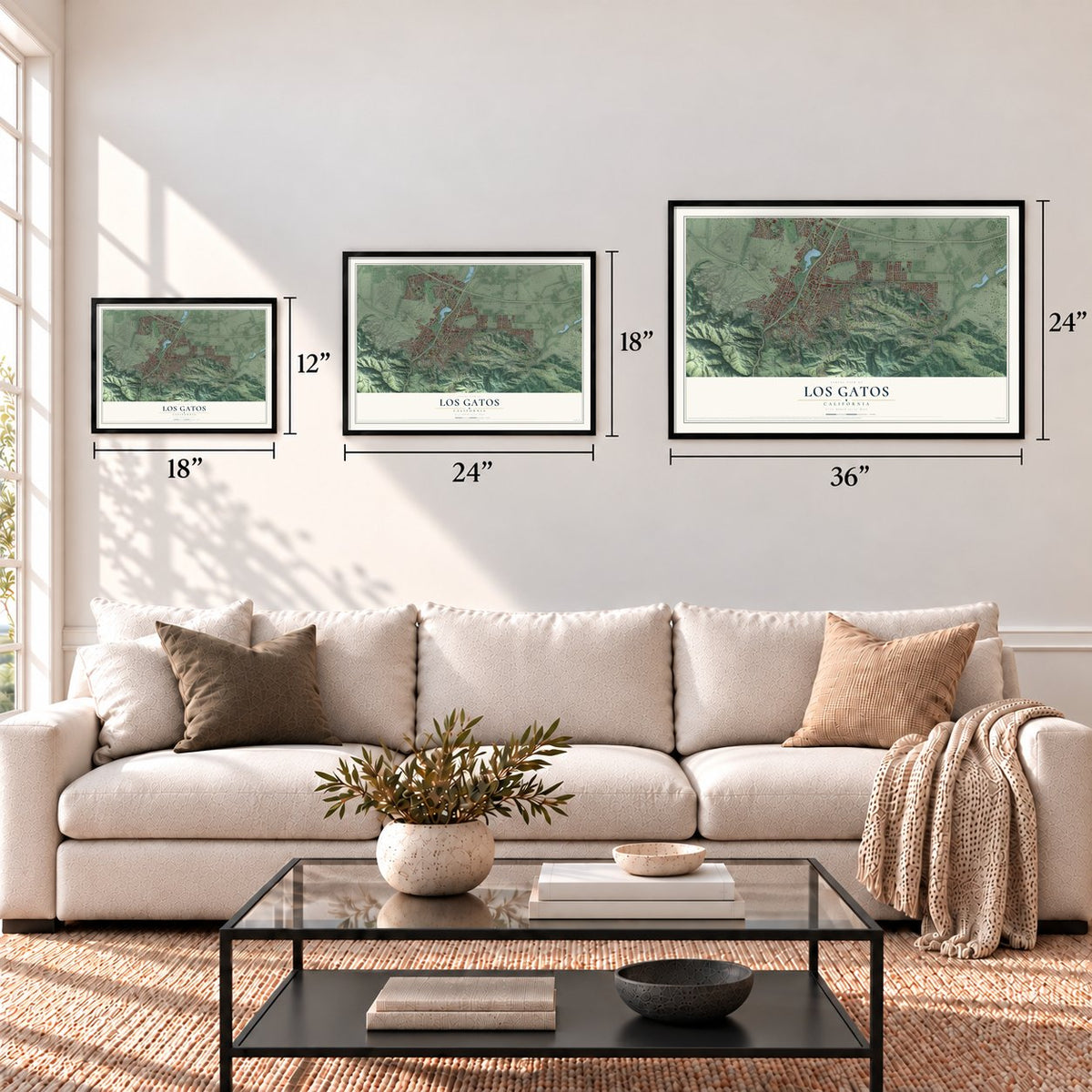
12" x 18" Archival Matte Print
A Map of Home. A Work of Art.
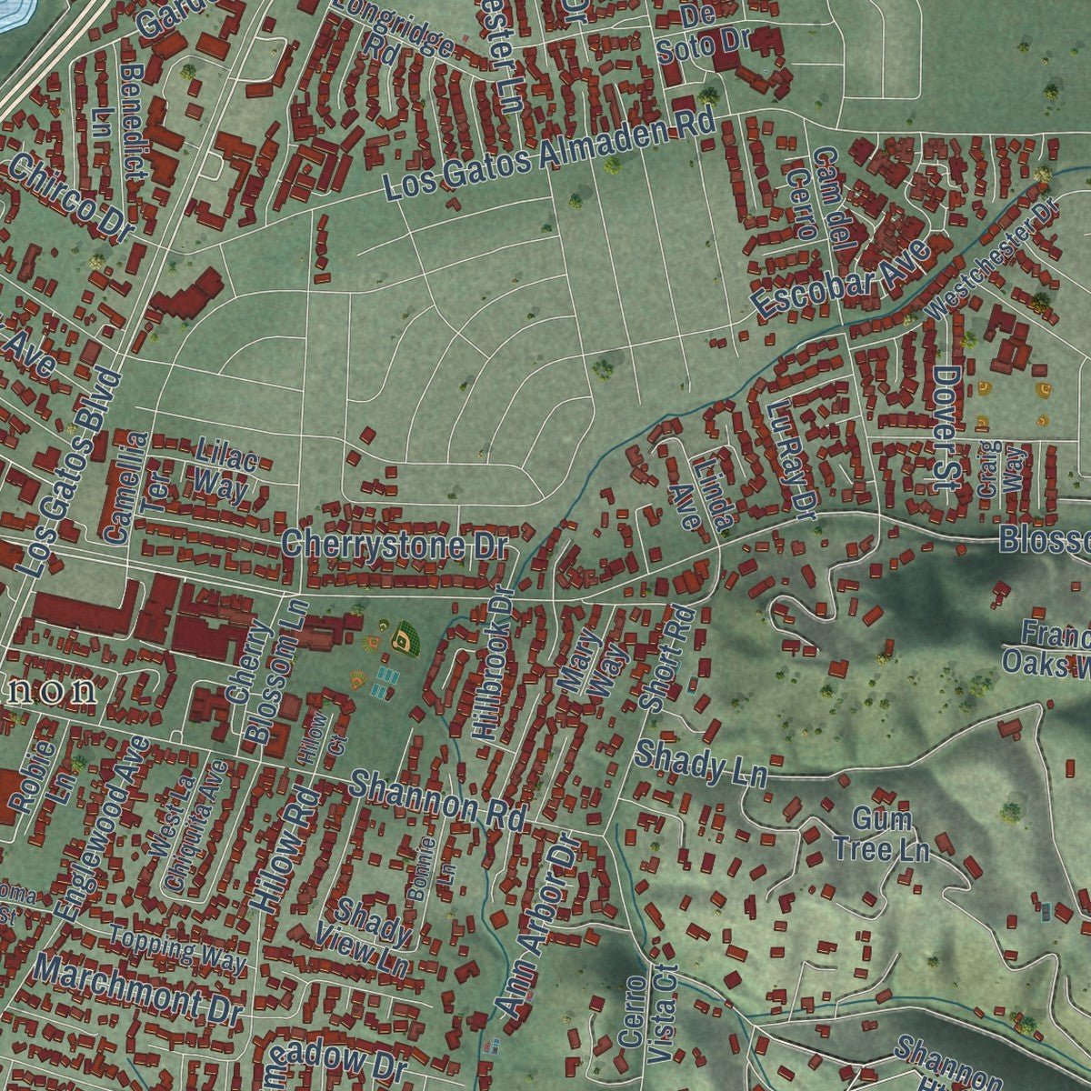
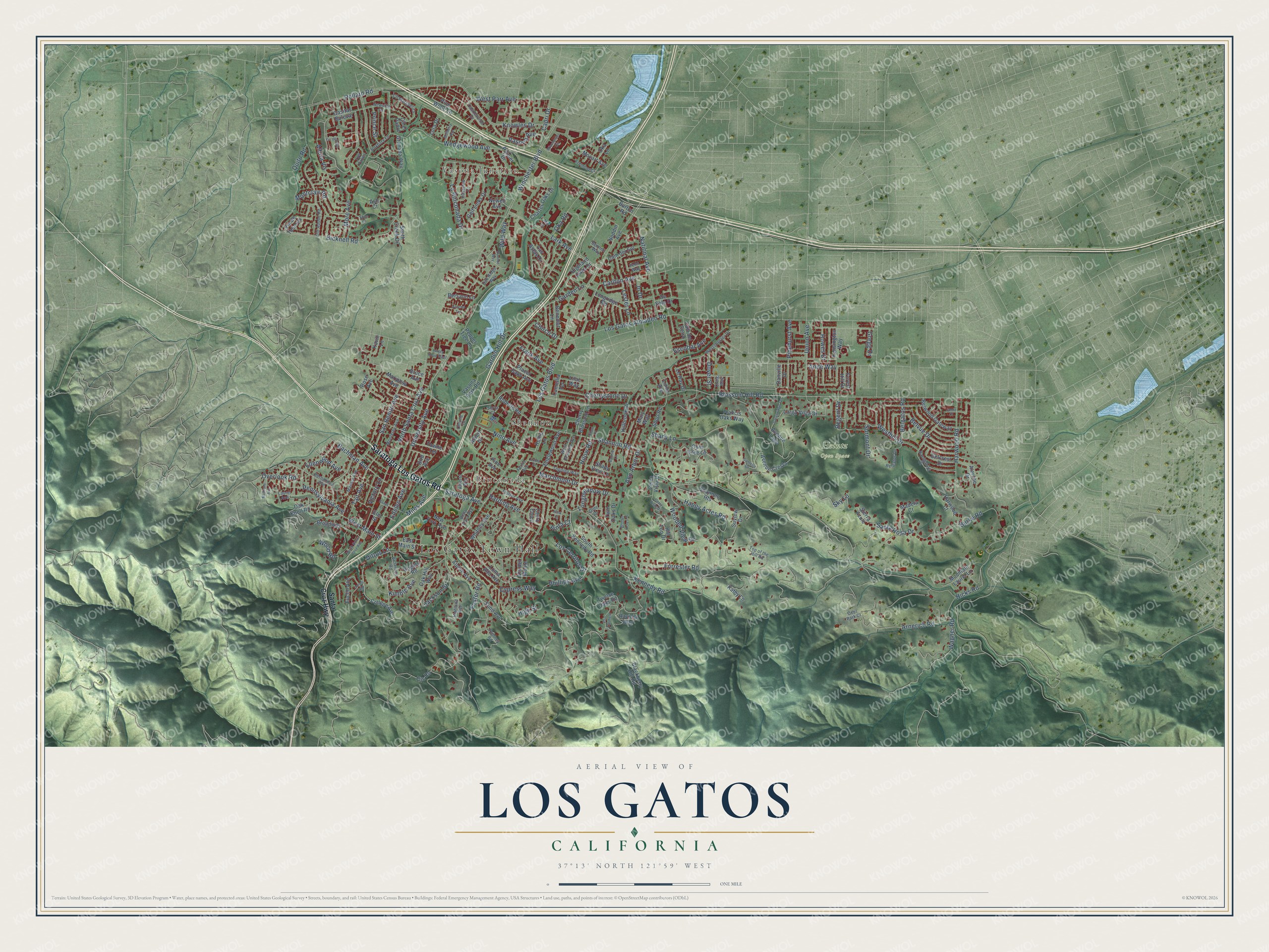
Explore Los Gatos, California from a whole new perspective. Created using aerial imagery and detailed geographic data, this map captures Los Gatos building by building, with labeled streets, familiar landmarks, and shaded topographical relief that highlights the natural contours of the landscape.
Combining modern data with the timeless character of a vintage atlas, this map is just as interesting up close as it is beautiful on the wall. Whether you grew up in Los Gatos, spent memorable years there, or call it home today, this unique map is a great way to celebrate a place that means something to you. Zoom in on the preview to look for your street, and then order a print to put your memories on the wall.
Three ways to hang it
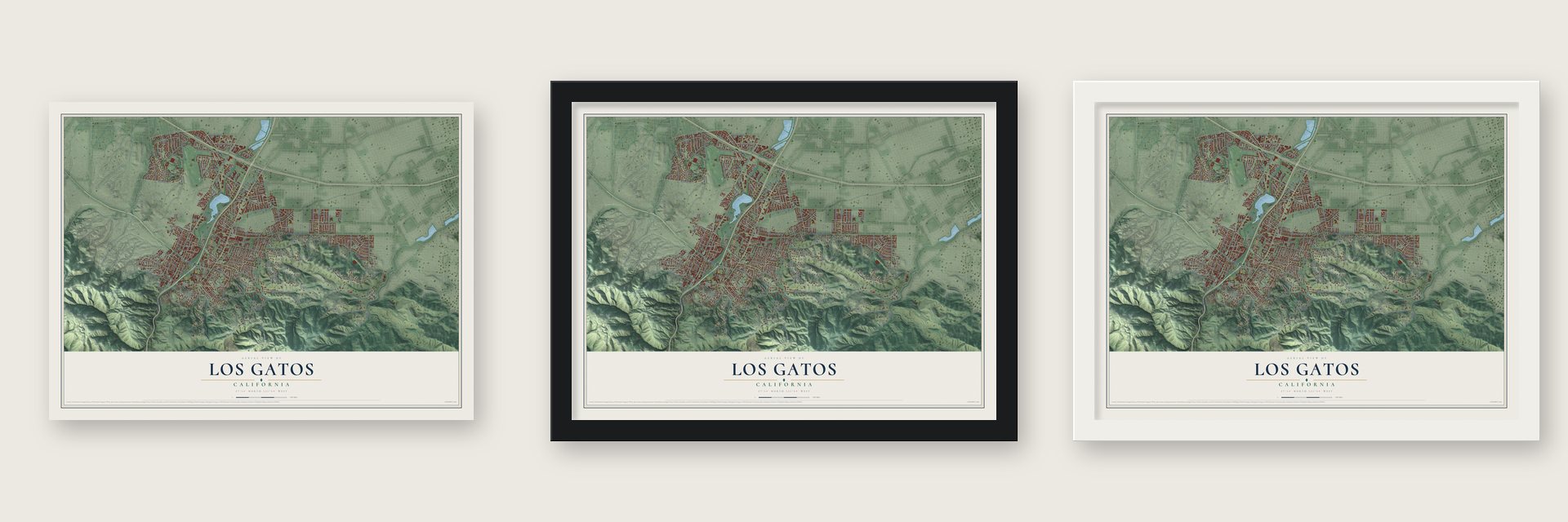
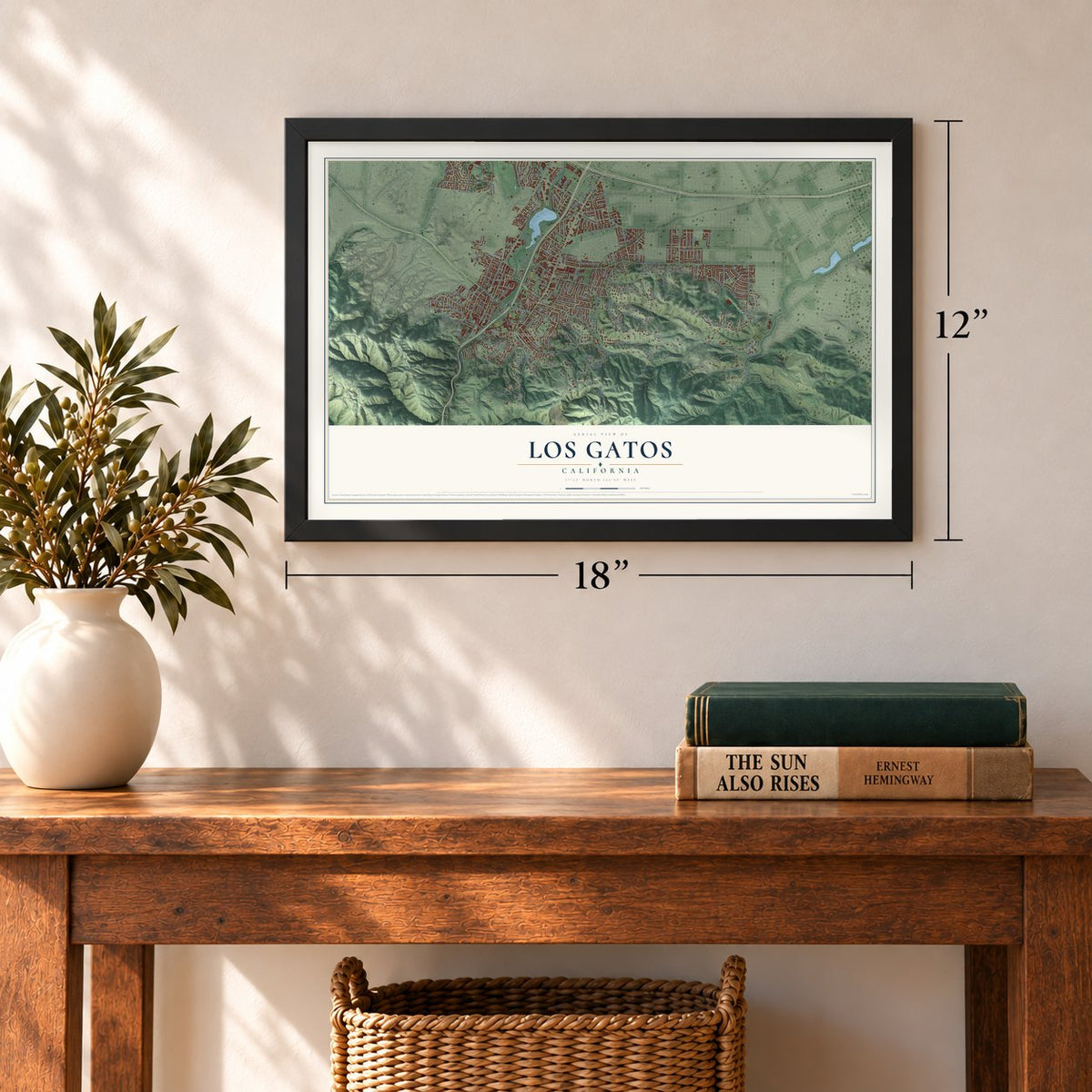
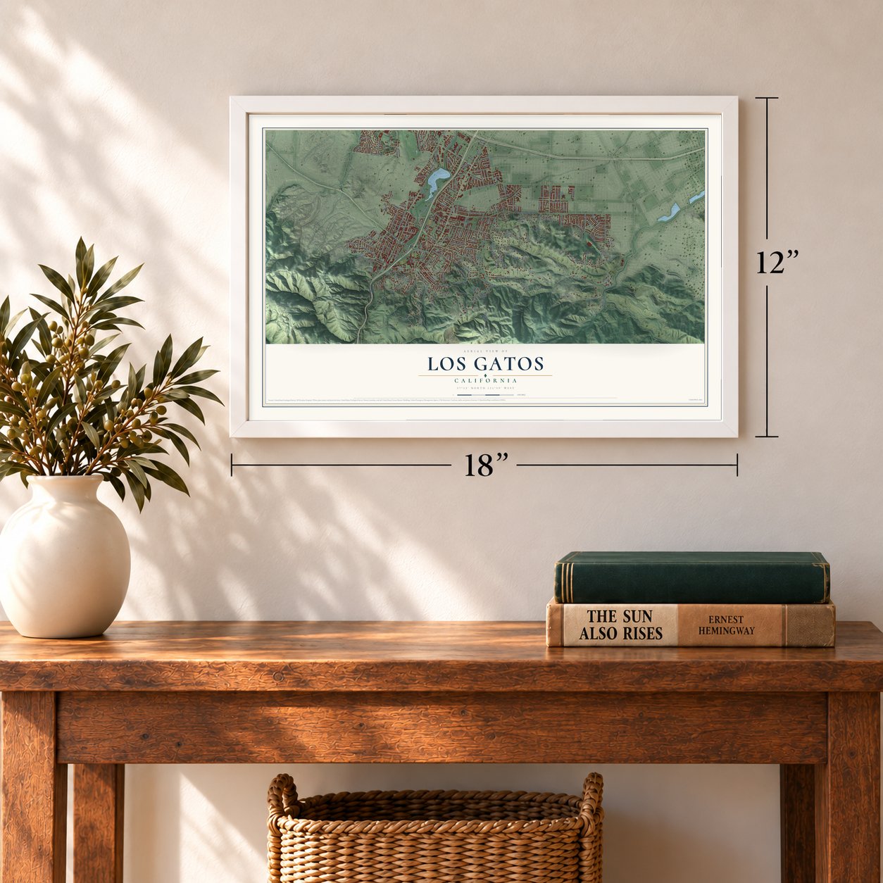
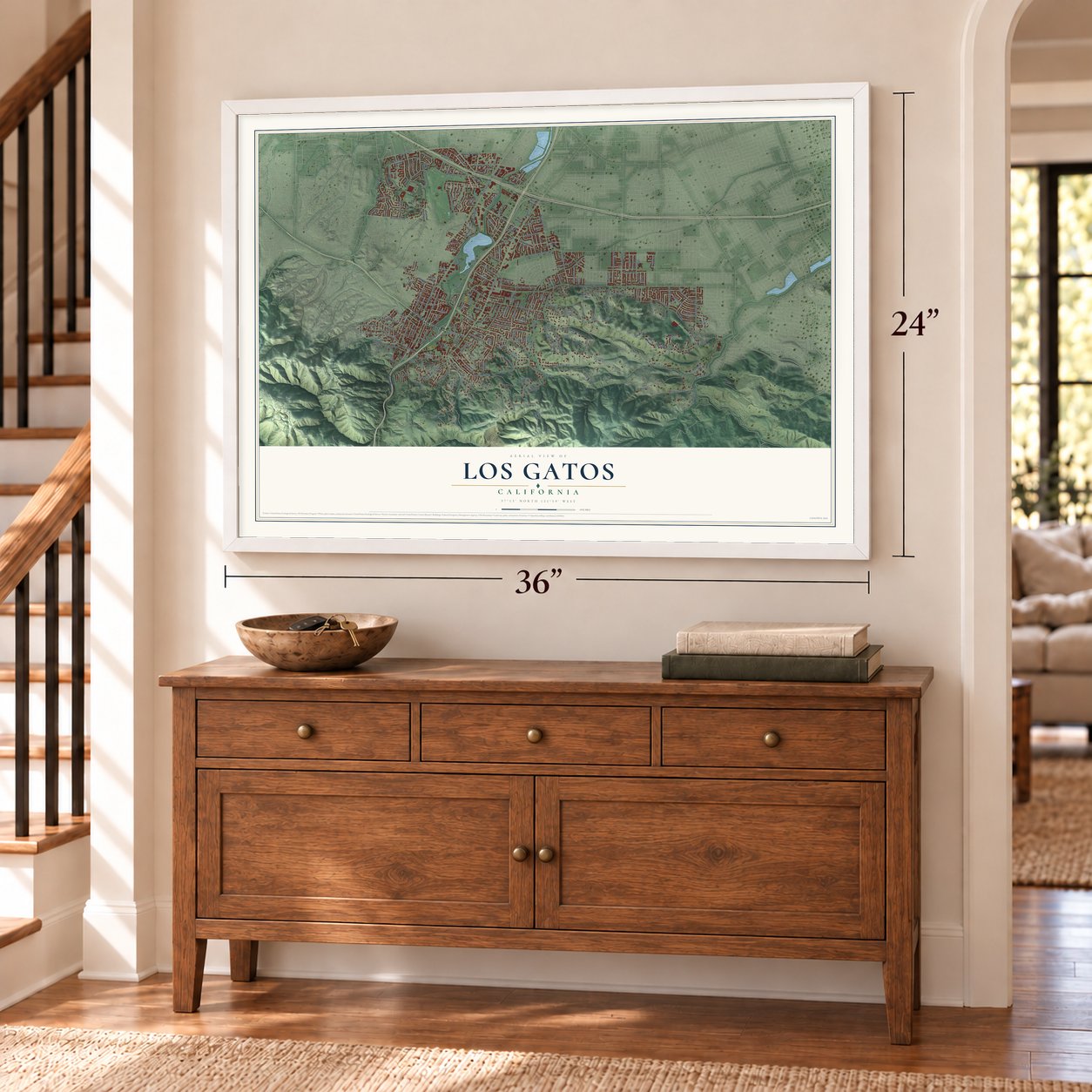
Unframed archival matte, a black wood frame or a white wood frame.
Up close
Geography Worth Displaying
This map was created using accurate cartographic data and authoritative geographic sources, including the U.S. Geological Survey and the Census Bureau. The map brings together terrain, waterways, roads, and building detail. The majority of the streets are labeled, houses are accurately depicted, and the topography is derived from government sources. Combining local data with carefully composed color and shading leads to this beautifully detailed Los Gatos artwork for your wall.
Rather than simply showing street outlines, we’ve included as many of the street names as we could reasonably fit on the map while keeping their names legible. Zoom in on the high resolution preview to see exactly what’s on the map. We truly set out to create a statement piece for anyone who loves Los Gatos. So whether it’s for you, or a gift for someone you love, we hope this map of Los Gatos brings back fond memories.
Read the story behind this map of Los Gatos, California from 2026.

About Los Gatos, California
Los Gatos is a town of 33,529 people in Santa Clara County, at the foot of the Santa Cruz Mountains. Its name is Spanish for "the cats." It comes from La Rinconada de Los Gatos, an 1839 land grant named for the mountain lions and bobcats of the hills. In the mid-1850s James Alexander Forbes built a flour mill on Los Gatos Creek, then known as Jones's Creek. The settlement that grew up in the 1860s first carried the mill's name, then took the name of the old grant.
The Los Gatos Turnpike put the town on the road between San Jose and Santa Cruz, and people began to settle here. In 1852 the area had one adobe home. By 1868 it had the mill, a post office, a hotel, a stage depot, a blacksmith shop, a lumber yard and a temporary schoolhouse. Los Gatos was incorporated in 1887 and served loggers on their way into the mountains. When the timber trade faded and nearby Lexington declined, the town kept growing, and by the early 20th century its farms grew apricots, grapes and prunes.
- Forbes Mill's stone annexThe two-story stone storage annex of Forbes Mill dates to 1880 and still stands beside the creek, where it once housed a history museum. It joined the National Register in 1978, and the Los Gatos Creek Trail runs past it.
- Last train south in 1940The narrow-gauge South Pacific Coast Railroad ran from Alameda to Santa Cruz and stopped in Los Gatos. Southern Pacific took over the line in 1887. Its last passenger train to Santa Cruz left town on February 26, 1940, and commuter trains to San Francisco served downtown until 1959. Town Plaza and the post office now sit where the station stood.
- An arts colony by the 1920sPainters, musicians, writers and actors made Los Gatos their home. The violinist Yehudi Menuhin lived here as a boy, the actress sisters Joan Fontaine and Olivia de Havilland graduated from Los Gatos High School, and the Beat figure Neal Cassady lived here in the 1950s.
- Oil on San Jose RoadIn 1891 R.C. McPherson, a driller from the Moody Gulch field, hit oil while drilling beside San Jose Road, the street now called Los Gatos Boulevard. About 20 wells were drilled in and around town between 1891 and 1929. None ever produced oil for sale, but residents used the small amounts as fuel, lubricant and road tar.
- Rebuilt after 1989The 1989 Loma Prieta earthquake wrecked or badly damaged several brick buildings downtown, and the district was soon rebuilt. The Los Gatos Historic Commercial District joined the National Register in 1991.
Find your street
Names on the Los Gatos map
Every name below is printed on this map. Look for your street, your school, the park where you played, or the pond down the road.
Places and landmarks5
- Los Gatos Town Hall
- Vasona Junction
- Rinconada
- Heintz Open Space
- Shannon
Streets and roads228
- Saratoga Los Gatos Road
- Garden Lane
- Nino Avenue
- Ellenwood Avenue
- Blossom Hill Road
- Shannon Road
- Kennedy Road
- Los Gatos Boulevard
- Winchester Boulevard
- University Avenue
- Pollard Road
- Los Gatos Almaden Road
- More Avenue
- Cypress Way
- Foster Road
- Garden Hill Drive
- Wedgewood Avenue
- North Santa Cruz Avenue
- Hicks Road
- Santa Rosa Drive
- Bicknell Road
- Shady Lane
- Knowles Drive
- Montclair Road
- La Rinconada Drive
- Carlton Avenue
- Lark Avenue
- National Avenue
- Quito Road
- Happy Acres Road
Show all 228 streets
- Belvue Drive
- Harwood Road
- Jackson Street
- Westhill Drive
- Oka Road
- High Street
- Cherrystone Drive
- Marchmont Drive
- Bachman Avenue
- West Parr Avenue
- Regent Drive
- Union Avenue
- Phillips Avenue
- Wooded View Drive
- Tait Avenue
- Forrester Road
- Kimble Avenue
- Altura Vis
- Pinehurst Avenue
- Lester Lane
- San Benito Avenue
- Sky Lane
- Arnerich Road
- Wild Way
- Pennsylvania Avenue
- Harding Avenue
- Frank Avenue
- West Main Street
- Escobar Avenue
- Longmeadow Drive
- Burke Road
- Wood Road
- Hilow Road
- Howes Drive
- Victory Lane
- Anne Way
- Wagner Road
- Miles Avenue
- Vasona Avenue
- Capri Drive
- Belgatos Road
- Los Cerritos Drive
- Surmont Drive
- Saratoga Avenue
- Overlook Road
- Ann Arbor Drive
- Prince Street
- Dover Street
- Chirco Drive
- Edelen Avenue
- Gregg Drive
- Jo Drive
- Dittos Lane
- Pinta Court
- Santa Cruz Highway
- Gum Tree Lane
- Blackberry Hill Road
- Casitas Bulevar
- College Avenue
- Cam del Cerro
- Suview Drive
- Roberts Road
- Oak Knoll Road
- Vis del Monte
- Shannon Heights
- Francis Oaks Way
- Loma Alta Avenue
- Vasona Park Road
- Avenue Cresta
- Pine Wood Lane
- South Kennedy Road
- Twelve Oaks Road
- Golf Links Drive
- Englewood Avenue
- Larga Vista Drive
- Granada Way
- East Main Street
- Cherry Blossom Lane
- Avenue Lago
- Kensington Way
- Newell Avenue
- Kathy Lane
- Hill Top Drive
- Alerche Drive
- Broadway
- Alpine Avenue
- Belwood Gateway
- Oak Hill Way
- Short Road
- Placer Oaks Avenue
- Shady View Lane
- Charter Oaks Drive
- Euclid Avenue
- Cerro Vista Court
- Highland Oaks Drive
- Pepper Tree Lane
- Cam del Sol
- Las Astas Drive
- Madera Court
- Bersano Lane
- Ravinia Way
- Belcrest Drive
- Mountain Laurel Lane
- Lu Ray Drive
- Mariposa Avenue
- New York Avenue
- Harwood Court
- Camellia Terrace
- Longridge Road
- Rose Avenue
- Whitney Avenue
- Benedict Lane
- Via de Tesoros
- Sund Avenue
- Mozart Avenue
- Twin Oaks Drive
- Towne Terrace
- Smith Creek Drive
- Hillbrook Drive
- Forest Hill Drive
- Sierra Azule
- Cerro Chico
- Fire Road
- Bruce Avenue
- De Soto Drive
- Lilac Way
- Danville Drive
- Robie Lane
- Noddin Avenue
- Kavin Lane
- Pine Avenue
- Palmer Drive
- Lora Drive
- Oka Lane
- Albert Drive
- Mary Way
- Rogers Road
- Burton Road
- Linda Avenue
- Cll el Padre
- Bird Avenue
- Elm Street
- Ash Court
- Old Adobe Road
- Bacigalupi Drive
- Hernandez Avenue
- Tourney Road
- Cll Marguerita
- Bella Vista Avenue
- Massol Avenue
- Highland Avenue
- Westchester Drive
- Penn Way
- Eastview Drive
- Reservoir Road
- Monterey Avenue
- Top of the Hill Road
- Alberto Way
- Topping Way
- Newville Drive
- Belgatos Lane
- Deer Park Court
- Fillmer Avenue
- Ohlone Court
- West La Chiquita Avenue
- Ferris Avenue
- Castlewood Drive
- Roxbury Lane
- Oak Ridge Way
- Serra Court
- Fremont Court
- Laurel Avenue
- Los Patios
- Bennett Way
- Olde Drive
- Craig Way
- Vasona Terrace
- Winchester Circle
- Greenridge Terrace
- Brooke Acres Drive
- Pso Carmelo
- Cerro Vista Drive
- South Santa Cruz Avenue
- Bonnie Lane
- Jones Road
- Summit Way
- Vis del Lago
- Madrone Avenue
- Farley Road West
- Mulberry Avenue
- Loma Street
- Santella Drive
- Grays Lane
- Hilow Court
- Shire Court
- Jamie Court
- Mill Street
- Nina Court
Names are listed as they appear on the printed map. Zoom into the product photos to find them.
The art of mapping a place
How This Map Was Made
Real places. Remarkable detail. Discover the layers that turn geographic data into a map of home.

The view from above
Aerial imagery reveals the character of the land: woodland, open fields, and the patterns of a place.

The shape of the land
Elevation data brings hills, valleys, and subtle changes in the landscape into view.

The details of home
Roads, waterways, and building footprints come together to make the map feel unmistakably local.

Geography becomes art
Considered color, shading, and typography bring the layers together in a map made for your wall.


Process illustrated with Mendon, Massachusetts. Aerial imagery: USDA NAIP. Terrain: USGS 3D Elevation Program. Map details and finished artwork: KNOWOL.
The Details
About This Print
Choose an archival matte print, or a black or white Ayous wood frame. The archival matte print is unframed.
Select your size and finish above to see the matching product image and price.
Materials & Craftsmanship
A contemporary map with the character of a classic atlas, printed on archival matte paper. Optional frames are made from Ayous wood.
Your printed map does not include the watermark shown in the full-map preview.
Shipping & Delivery
Free shipping within the United States. Every print is made to order in the USA.
Buying a gift? Add a note in your cart and we'll include it. We never put prices in the package.
Prints ship within 2 to 3 business days. Allow 7 to 10 days total from ordering for delivery. Timing may vary during holidays or periods of high order volume.
Read our shipping policy.
Returns and damaged prints
Each print is made to order. Change-of-mind refunds are not available after production.
If your print arrives damaged, misprinted or incorrect, contact support@knowol.com within 30 days of receiving it. Include your order number, photos and a description of the issue.
Read our full refund and replacement policy. For questions about your order, email support@knowol.com.
Find your town
Looking for another city?
Find a map of home in our California collection, or any town in the country.
Nearby
Maps of towns near Los Gatos
Know someone from one of these towns? Their map makes a great gift.
 Monte Sereno
, California
From $39.99See the map
 Cambrian Park
, California
From $39.99See the map
 Campbell
, California
From $39.99See the map
More maps nearby: Saratoga, Lexington Hills, Fruitdale, Cupertino and San Jose.