
Search for another town


Free U.S. delivery 7 to 10 days after you order
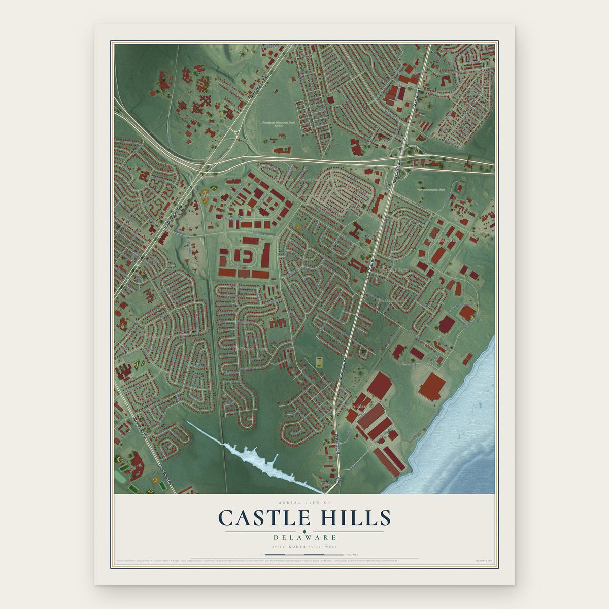
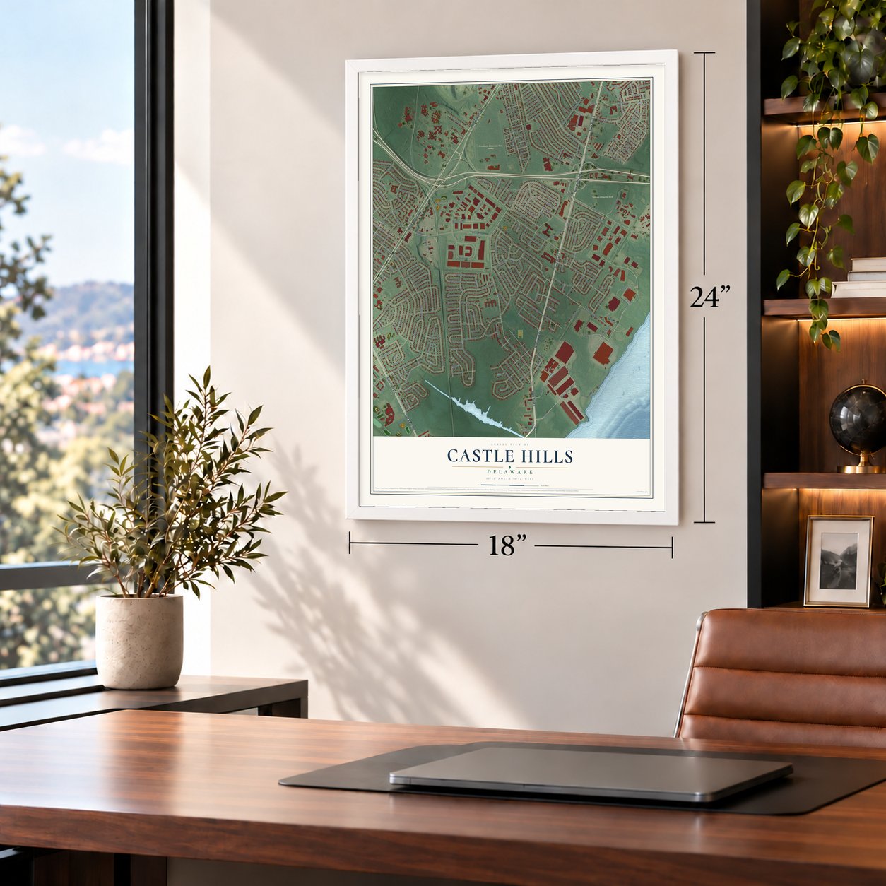
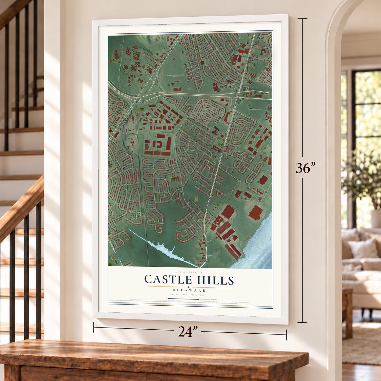
Castle Hills, Delaware Map Art
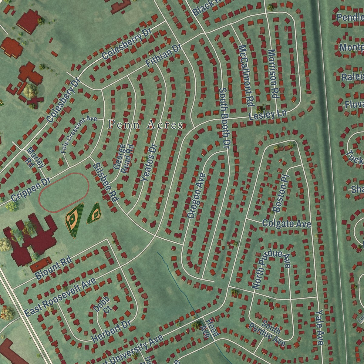
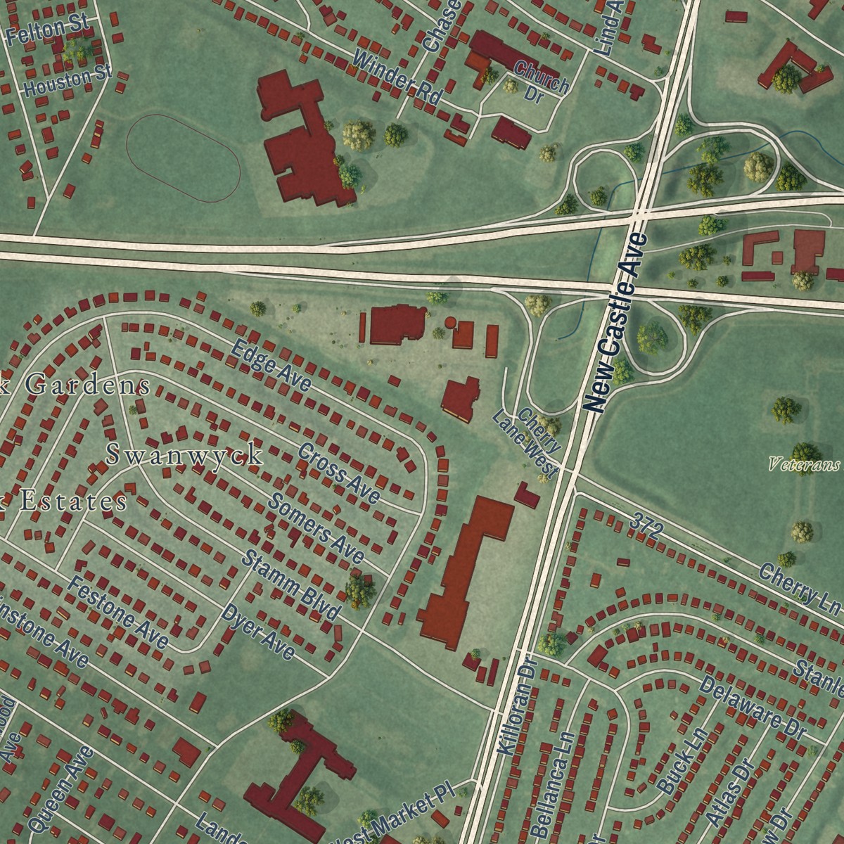
Building by building, with labeled streets and shaded relief.
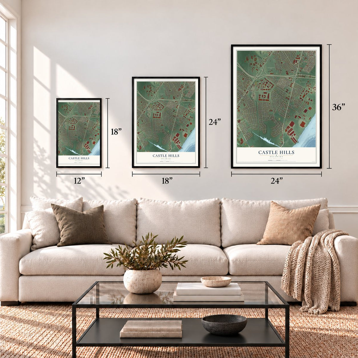
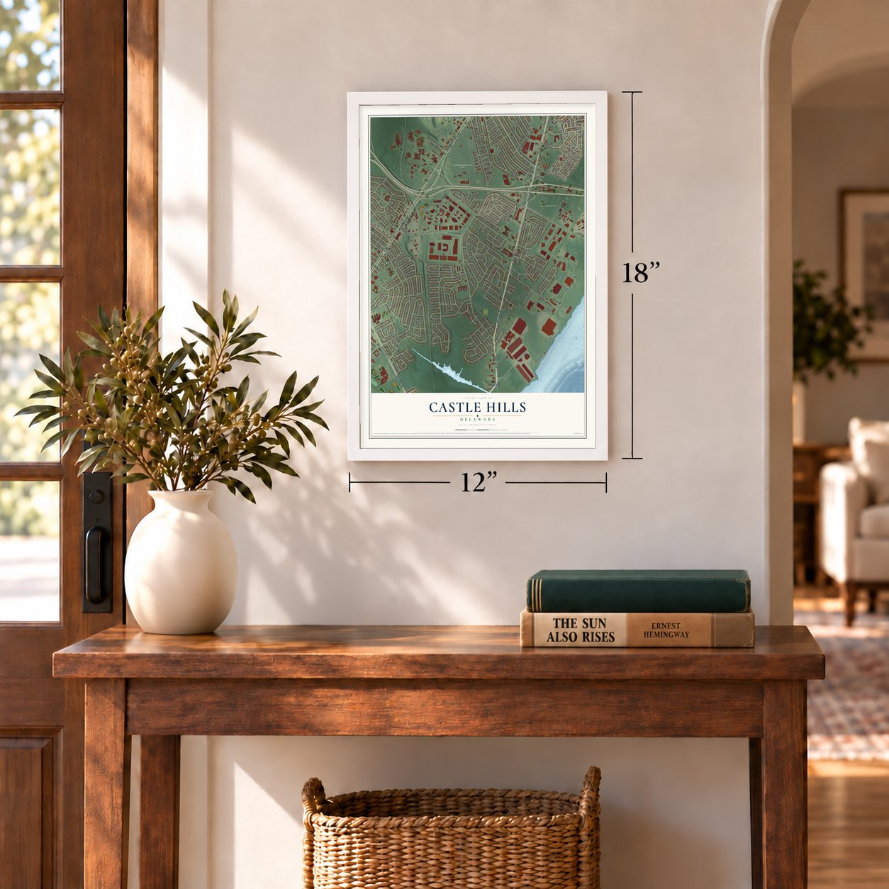
12" x 18" Archival Matte Print
A Map of Home. A Work of Art.
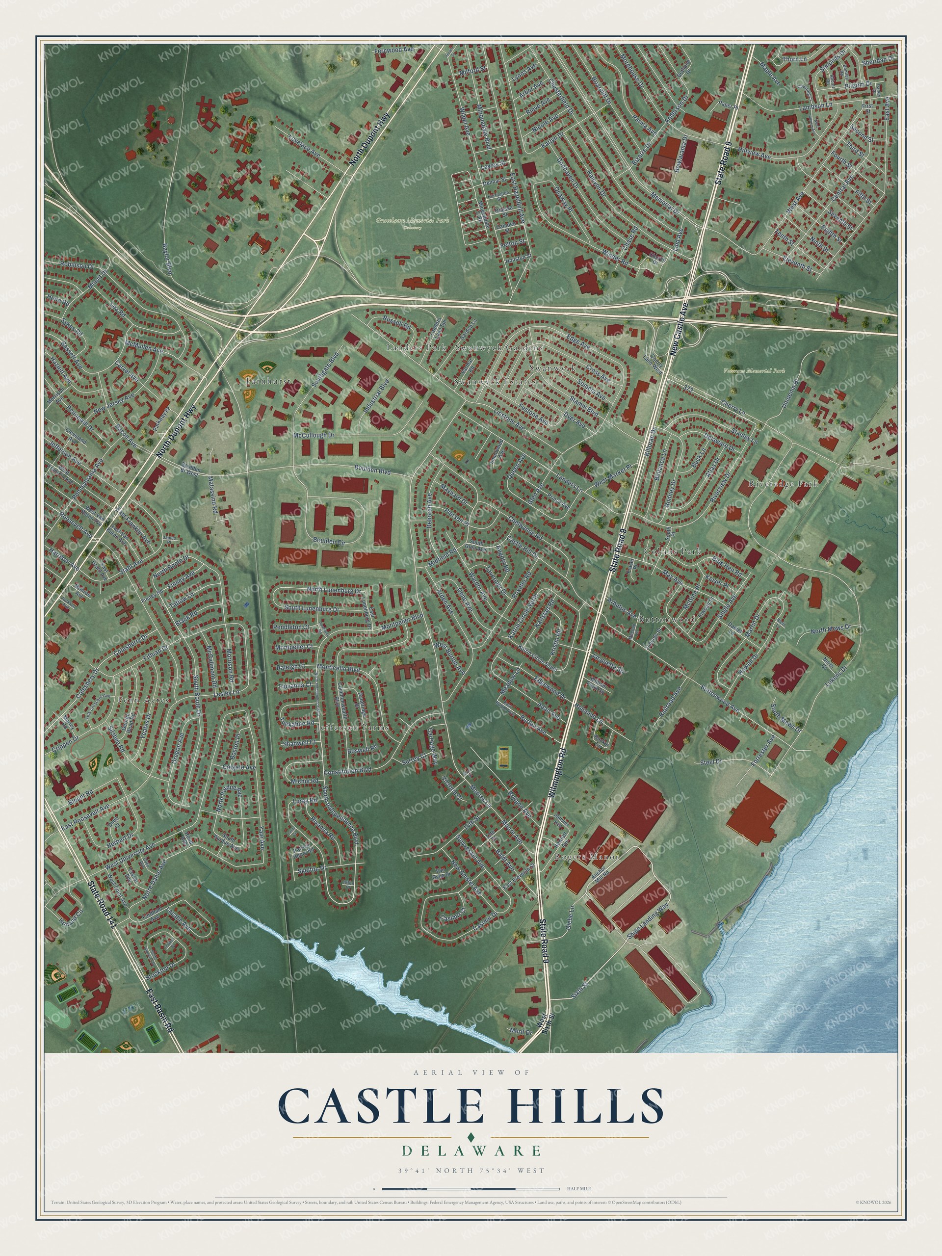
Explore Castle Hills, Delaware from a whole new perspective. Created using aerial imagery and detailed geographic data, this map captures Castle Hills building by building, with labeled streets, familiar landmarks, and shaded topographical relief that highlights the natural contours of the landscape.
Combining modern data with the timeless character of a vintage atlas, this map is just as interesting up close as it is beautiful on the wall. Whether you grew up in Castle Hills, spent memorable years there, or call it home today, this unique map is a great way to celebrate a place that means something to you. Zoom in on the preview to look for your street, and then order a print to put your memories on the wall.
Three ways to hang it
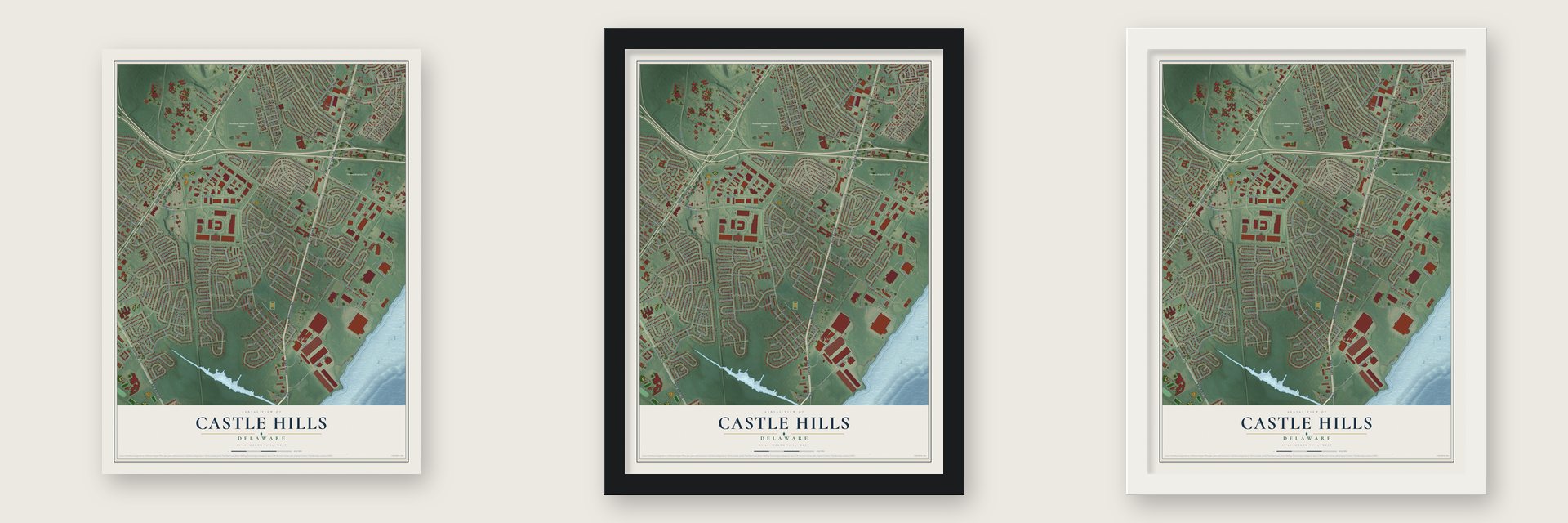
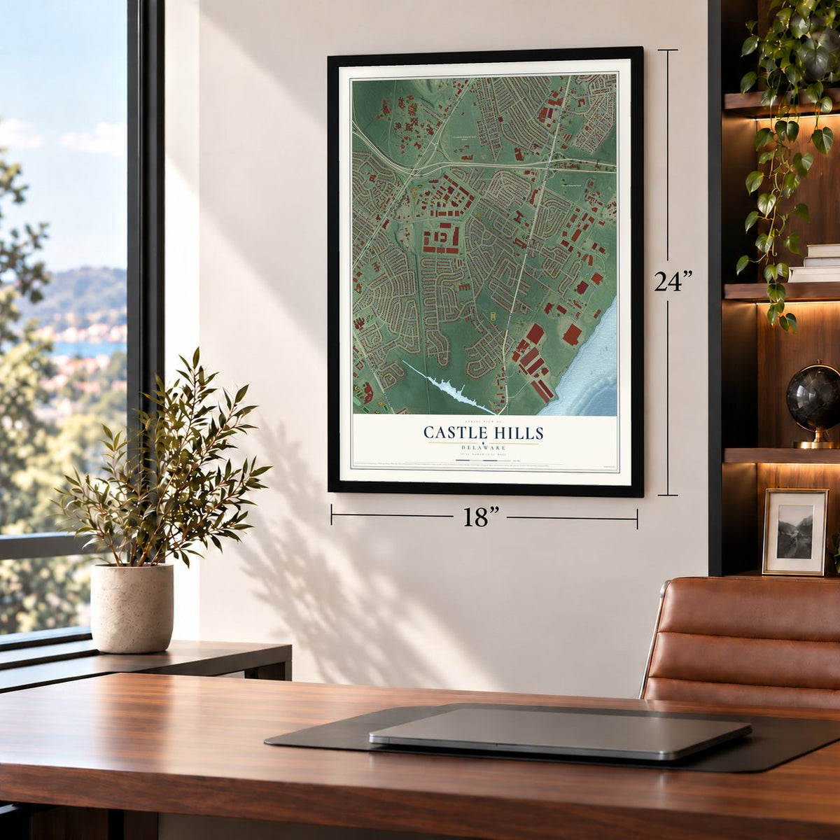
Unframed archival matte, a black wood frame or a white wood frame.
Up close
Geography Worth Displaying
This map was created using accurate cartographic data and authoritative geographic sources, including the U.S. Geological Survey and the Census Bureau. The map brings together terrain, waterways, roads, and building detail. The majority of the streets are labeled, houses are accurately depicted, and the topography is derived from government sources. Combining local data with carefully composed color and shading leads to this beautifully detailed Castle Hills artwork for your wall.
Rather than simply showing street outlines, we’ve included as many of the street names as we could reasonably fit on the map while keeping their names legible. Zoom in on the high resolution preview to see exactly what’s on the map. We truly set out to create a statement piece for anyone who loves Castle Hills. So whether it’s for you, or a gift for someone you love, we hope this map of Castle Hills brings back fond memories.
Read the story behind this map: Detailed Map of Castle Hills, Delaware.

Find your street
Names on the Castle Hills map
Every name below is printed on this map. Look for your street, your school, the park where you played, or the pond down the road.
Places and landmarks13
- Gracelawn Memorial Park Cemetery
- Veterans Memorial Park
- Buttonwood
- Penn Acres
- Farnhurst
- Jefferson Farms
- Swanwyck Estates
- Rogers Manor
- Riveredge Park
- Collins Park
- Swanwyck
- Landers Park
Show all 13 places
- Swanwyck Gardens
Streets and roads271
- State Road 9
- New Castle Avenue
- Wilmington Road
- North Dupont Highway
- East Basin Road
- State Road 141
- Sixth Street
- Ships Landing Way
- South Independence Boulevard
- Moores Lane
- Glebe Lane
- North Booth Drive
- Memorial Drive
- Holcomb Lane
- Meadow Lane
- Baylor Boulevard
- Glen Avenue
- Yale Avenue
- North Lunenburg Drive
- East Roosevelt Avenue
- Cherry Lane
- Landers Lane
- West University Avenue
- Lukens Drive
- Robinson Drive
- East Hazeldell Avenue
- Wildel Avenue
- Boulden Boulevard
- Buttonwood Avenue
- West Avenue
Show all 271 streets
- Central Avenue
- Chesterfield Drive
- East Avenue
- South Booth Drive
- Boulden Circle
- Karlyn Drive
- Killoran Drive
- Notre Dame Avenue
- Riverview Drive
- Halcyon Drive
- Edge Avenue
- Casimir Drive
- Oregon Avenue
- Stamm Boulevard
- Winder Road
- Midfield Road
- Stahl Avenue
- New Jersey Avenue
- Single Avenue
- Lambson Lane
- Cross Avenue
- Arden Avenue
- Morehouse Drive
- Colesberry Drive
- Colesbery Drive
- Lesley Lane
- Fithian Drive
- Parma Avenue
- Lea Road
- McCullough Drive
- Constitution Boulevard
- Hillview Avenue
- Katrin Circle North
- Queen Avenue
- Morrison Road
- Southgate Boulevard
- Bassett Avenue
- Herbert Drive
- Monticello Boulevard
- Montpelier Boulevard
- Pennsylvania Avenue
- Howell Drive
- Donhaven Drive
- Briarcliff Drive
- Chelwynne Road
- Somers Avenue
- Burton Avenue
- Martin Drive
- Rodney Drive
- May Avenue
- Castle Hill Drive
- Crippen Drive
- Adair Avenue
- Luray Road
- Roxeter Road
- Festone Avenue
- Yeates Drive
- Linstone Avenue
- Wardor Avenue
- Anderson Drive
- Bacon Avenue
- Minquadale Boulevard
- Brylgon Avenue
- Stuyvesant Avenue
- Pierson Place
- Stanley Lane
- South Lunenburg Drive
- Deborah Avenue
- Baldt Avenue
- Lasalle Avenue
- Jefferson Avenue
- Pennewill Drive
- Uniqema Bl
- Blue Hen Road
- 14th Street
- Lovelace Avenue
- Atlas Drive
- Edgewood Drive
- Silsbee Road
- Onaway Place
- Bellanca Lane
- Michie Road
- McMullen Avenue
- Tuckahoe Road
- Matassino Road
- Dyer Avenue
- Stockton Drive
- Minuit Drive
- New Amstel Avenue
- Gene Avenue
- Steel Drive
- Holland Circle
- Russell Road
- Simonds Drive
- Rivanna Road
- Hazlett Avenue
- Blount Road
- Finney Avenue
- North Purdue Avenue
- Skelton Drive
- Sykes Road
- North Mews Drive
- Delaware Drive
- East Franklin Avenue
- Pilgrim Drive
- Fourth Street
- Roosevelt Avenue
- Industrial Boulevard
- Fifth Street
- Moore Avenue
- West Market Place
- McCallmont Road
- Seventh Street
- Kristin Road
- Eighth Street
- Forrester Avenue
- Karlstad Road
- Eleventh Street
- Ninth Street
- Tenth Street
- Tavernier Drive
- Bizarre Drive
- Bowlarama Drive
- Railroad Avenue
- Tatlow Lane
- Carvel Avenue
- Third Street
- McGinn Place
- Nieole Avenue
- Carriage Way
- Thorn Lane
- Fernwood Avenue
- Buck Lane
- Black Road
- Keiser Place
- Boston Place
- Rieve Avenue
- Chase Road
- Sheridan Drive
- Maynard Drive
- South Mews Drive
- West Burton Avenue
- Casimir Court
- Angola Road
- Pendleton Court
- Surrey Court
- Colgate Avenue
- Montpelier Court
- Harrison Avenue
- Arbor Avenue
- Maple Avenue
- Raleigh Court
- Second Street
- Shadwell Court
- Arbutus Avenue
- Jacquette Square
- Fluvanna Court
- Lind Avenue
- Lyons Avenue
- Victoria Court
- Milford Street
- Lewes Street
- Boswell Road
- Merit Drive
- Felton Street
- Hunn Road
- West Sixth Street
- Anchor Mill Road
- Minquadale Tr Pk
- Commonwealth Boulevard
- West Franklin Avenue
- Katrin Circle South
- George Read Road
- Dandridge Drive
- South Purdue Avenue
- Finney Road
- West Van Buren Avenue
- Garden Lane
- Prince Avenue
- Parkway Pz
- South Glen Avenue
- Fordham Avenue
- 13th Street
- Church Drive
- Booker Circle
- Landers Lane Spr
- Boulden Bl West
- Hewlett Avenue
- South Place
- Daniel Lane
- Patrick Henry Road
- Monroe Avenue
- West Point Avenue
- East Van Buren Avenue
- Elwood Place
- Vassar Avenue
- East Eleventh Street
- Bethune Drive
- Cleveland Avenue
- East Lunenburg Drive
- Varmar Road
- Morrison Avenue
- Cherry Lane West
- Paper Place
- William Penn Square
- Delmar Street
- East Grant Avenue
- Lincoln Street
- Odessa Street
- Smallwood Avenue
- Camden Street
- Janvier Avenue
- Dobb Court
- Houston Street
- Marley Road
- Van Dyke Drive
- Frazer Place
- North Court
- Hood Avenue
- First Street
- East Burton Avenue
- Fols Crescent Avenue
- Bentley Road
- Harrington Street
- Duke Avenue
- Jackson Avenue
- Downing Court
- Meehan Lane
- Abbott Road
- James Place
- Parker Place
- Afton Court
- Klein Lane
- North Independence Boulevard
- Powhatan Road
- West Hillview Avenue
- South Stockton Drive
- Dover Street
- Stabler Court
- Grove Street
- Luray Circle
Names are listed as they appear on the printed map. Zoom into the product photos to find them.
Keep exploring Delaware
Castle Hills is one of 94 Delaware towns we've mapped. Every dot on the map is a print of its own.
The search covers every state, Delaware first.
Near Castle Hills
Order 2 or more town maps and save 10%. Shown in the size and finish you picked above, so they hang as a set.
- Wilmington Manor 12" x 18" / Archival Matte Print $39.99
- New Castle 12" x 18" / Archival Matte Print $39.99
- Newport 12" x 18" / Archival Matte Print $39.99

More maps nearby: Christiana, Richardson Park, Pleasantville, Wilmington and Elsmere.
The art of mapping a place
How This Map Was Made
Real places. Remarkable detail. Discover the layers that turn geographic data into a map of home.

The view from above
Aerial imagery reveals the character of the land: woodland, open fields, and the patterns of a place.

The shape of the land
Elevation data brings hills, valleys, and subtle changes in the landscape into view.

The details of home
Roads, waterways, and building footprints come together to make the map feel unmistakably local.

Geography becomes art
Considered color, shading, and typography bring the layers together in a map made for your wall.


Process illustrated with Mendon, Massachusetts. Aerial imagery: USDA NAIP. Terrain: USGS 3D Elevation Program. Map details and finished artwork: KNOWOL.
The Details
About This Print
Choose an archival matte print, or a black or white Ayous wood frame. The archival matte print is unframed.
Select your size and finish above to see the matching product image and price.
Materials & Craftsmanship
A contemporary map with the character of a classic atlas, printed on archival matte paper. Optional frames are made from Ayous wood.
Your printed map does not include the watermark shown in the full-map preview.
Shipping & Delivery
Free shipping within the United States. Every print is made to order in the USA.
Buying a gift? Add a note in your cart and we'll include it. We never put prices in the package.
Prints ship within 2 to 3 business days. Allow 7 to 10 days total from ordering for delivery. Timing may vary during holidays or periods of high order volume.
Read our shipping policy.
Returns and damaged prints
Each print is made to order. Change-of-mind refunds are not available after production.
If your print arrives damaged, misprinted or incorrect, contact support@knowol.com within 30 days of receiving it. Include your order number, photos and a description of the issue.
Read our full refund and replacement policy. For questions about your order, email support@knowol.com.