
Search for another town





Free U.S. delivery 7 to 10 days after you order
Castle Rock, Colorado Map Art
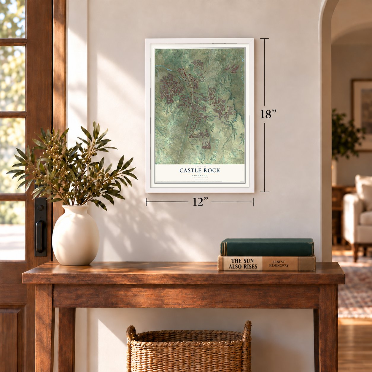
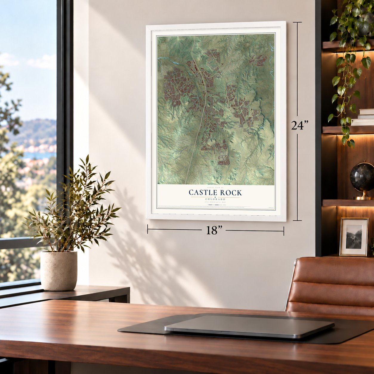
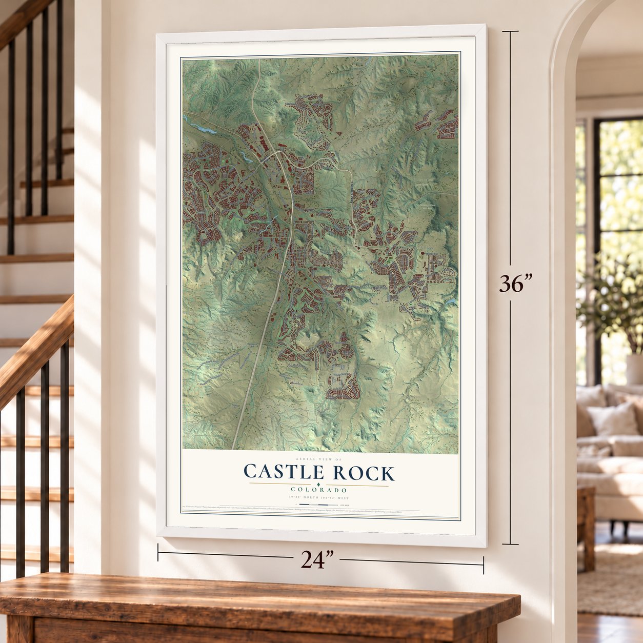
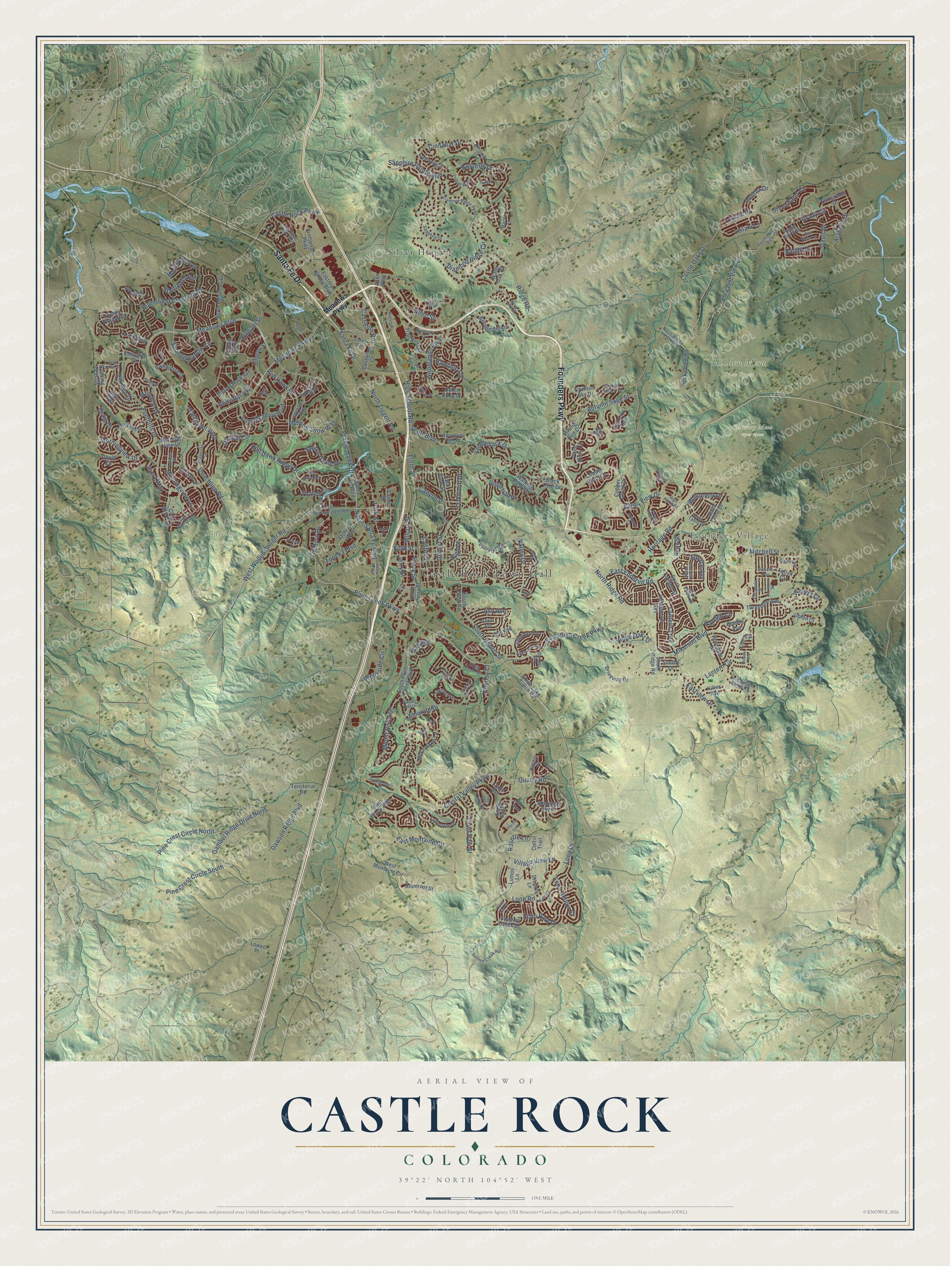
A new map of Castle Rock, Colorado, made in 2026 and printed to order on thick archival matte paper.
12" x 18" Archival Matte Print
A Map of Home. A Work of Art.
Explore Castle Rock, Colorado from a whole new perspective. Created using aerial imagery and detailed geographic data, this map captures Castle Rock building by building, with labeled streets, familiar landmarks, and shaded topographical relief that highlights the natural contours of the landscape.
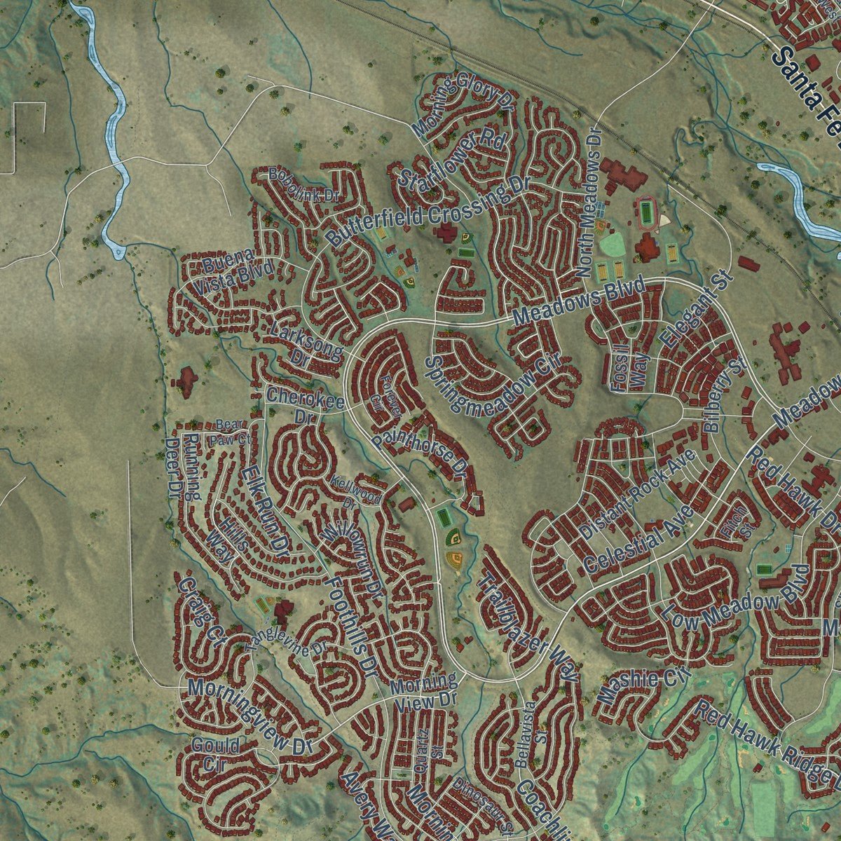
Combining modern data with the timeless character of a vintage atlas, this map is just as interesting up close as it is beautiful on the wall. Whether you grew up in Castle Rock, spent memorable years there, or call it home today, this unique map is a great way to celebrate a place that means something to you. Zoom in on the preview to look for your street, and then order a print to put your memories on the wall.
Three ways to hang it
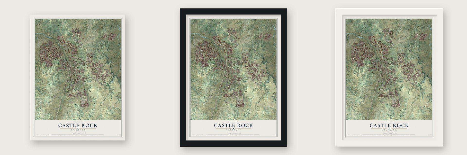
Unframed archival matte, a black wood frame or a white wood frame.
Up close
Geography Worth Displaying
This map was created using accurate cartographic data and authoritative geographic sources, including the U.S. Geological Survey and the Census Bureau. The map brings together terrain, waterways, roads, and building detail. The majority of the streets are labeled, houses are accurately depicted, and the topography is derived from government sources. Combining local data with carefully composed color and shading leads to this beautifully detailed Castle Rock artwork for your wall.
Rather than simply showing street outlines, we’ve included as many of the street names as we could reasonably fit on the map while keeping their names legible. Zoom in on the high resolution preview to see exactly what’s on the map. We truly set out to create a statement piece for anyone who loves Castle Rock. So whether it’s for you, or a gift for someone you love, we hope this map of Castle Rock brings back fond memories.
Read the story behind this map of Castle Rock, Colorado from 2026.

About Castle Rock, Colorado
Castle Rock is a town of 73,158 people and the seat of Douglas County. It takes its name from the castle-shaped butte that rises just north of downtown. White settlers first came for rumors of gold and for land opened by the Homestead Act of 1862, but rhyolite stone, not gold, is what finally built the town. In 1874 the county's eastern border was moved, and Castle Rock's central spot made it the new county seat.
That same year homesteader Jeremiah Gould, who owned about 160 acres south of the butte, gave 120 of them to the new town. Surveyors drew six streets around a courthouse square, named Front, Castle, Perry, Wilcox, Jerry and Elbert, and about 77 lots of 50 by 112 feet sold at auction for $3,400. A new depot then put Castle Rock on the Denver and Rio Grande Railway.
- A star on the butteIn 1936 the town was given land that included the butte itself, and Works Progress Administration crews soon built a star on its top. It shone each year through 1941, then went dark during World War II as a sign of sacrifice. On August 14, 1945, just after V-J Day, it was reshaped into a V for victory, and on December 7, 1945, it was lit again for the holidays. It has been lit every year since.
- A quarry townIn the late 1800s and early 1900s, Castle Rock's rhyolite quarries kept busy, and many immigrants came to the area to cut the stone.
- First county-wide school, 1897Castle Rock Elementary School was built in 1897 as the first school serving all of Douglas County. The building joined the National Register in 1984.
- The courthouse fire of 1978Douglas County's courthouse went up on the square in 1889 and 1890. An arsonist burned it down on March 11, 1978. The county stayed in Castle Rock, and its courthouse today is the Douglas County Justice Center, north of downtown.
Find your street
Names on the Castle Rock map
Every name below is printed on this map. Look for your street, your school, the park where you played, or the pond down the road.
Places and landmarks7
- Castle Rock Town Hall
- Gateway Mesa Open Space
- Hidden Mesa Open Space
- Quarry Mesa Open Space
- Ridgeline Open Space
- Founders Village
- Silver Heights
Streets and roads250
- Founders Parkway
- Santa Fe Drive
- Meadows Boulevard
- Meadows Parkway
- Plum Creek Parkway
- Fifth Street
- Coachline Road
- North Ridge Road
- Park Street
- Morningview Drive
- Auburn Drive
- Red Hawk Ridge Drive
- South Gilbert Street
- Ridge Road
- Castleton Road
- Mount Royal Drive
- Quarry Road
- Valley View Drive
- Saddleback Drive
- Castle Oaks Drive
- Front Street
- Prairie Hawk Drive
- Autumn Sage Street
- Mikelson Boulevard
- Crystal Valley Parkway
- Mitchell Street
- Foothills Drive
- Red Hawk Drive
- Loop Road
- Sapphire Pointe Boulevard
Show all 250 streets
- Woodlands Boulevard
- East Plum Creek Parkway
- East Enderud Road
- High School Road
- East Montaine Circle
- Emerald Drive
- Pleasant View Drive
- Butterfield Crossing Drive
- Diamond Ridge Circle
- North Liggett Road
- Greenwater Circle
- Elegant Street
- Gambel Ridge Drive North
- Heritage Road
- Grady Circle
- Oakwood Drive
- Pine Crest Circle North
- Dawson Ridge Boulevard
- Pine Crest Circle South
- Loop Drive
- Low Meadow Boulevard
- West Wolfensberger Road
- Village View Lane
- Lantern Trail
- Baguette Drive
- Trailblazer Way
- Allen Street
- Lantern Circle
- Cinnabar Drive
- Oasis Drive
- Morningview Lane
- Springmeadow Circle
- Wilcox Street
- Castle Rock Parkway
- Weaver Circle
- Leilani Drive
- Canyon Drive
- North Santa Fe Boulevard
- Raleigh Circle
- Eastview Drive
- Valley Drive
- Ridgetrail Drive
- Topeka Boulevard
- Rawhide Circle
- Lions Paw Street
- Perry Street
- Ridge Oaks Drive
- Gilbert Street
- Echo Park Drive
- Mentha Drive
- Cantril Street
- Melting Snow Way
- Jerry Street
- Brookside Circle
- Celestial Avenue
- Switch Grass Drive
- Mashie Circle
- Starflower Road
- Leilani Lane
- Rosette Lane
- Arabella Drive
- Monument Drive
- Ash Avenue
- Elk Run Drive
- Thatch Circle
- Echo Hollow Street
- Spruce Avenue
- Holmby Court
- Avery Way
- Scott Boulevard
- Bandit Drive
- Balsa Drive
- High Drive
- Craig Court
- Morning View Drive
- South Plum Creek Boulevard
- Plum Creek Boulevard
- South Lake Gulch Road
- Copper Cloud Drive
- Copper Cloud Street
- South Ridge Road
- Territorial Road
- Black Pine Drive
- North Meadows Drive
- Rocky View Road
- Paint Pony Circle
- South Perry Street
- Santa Fe Boulevard
- Avenue del Sol
- Ditmars Lane
- Gould Circle
- Promenade Parkway
- Coltin Trail
- McCracken Lane
- Water Oak Circle
- Factory Shops Boulevard
- Trail Boss Drive
- South Carlton Street
- Crimson Sky Drive
- Morning Glory Drive
- Running Deer Drive
- Painthorse Drive
- Hampstead Avenue
- Mountain Sky Drive
- Distant Rock Avenue
- Shadow Creek Drive
- Reservoir Road
- Esmeralda Drive
- Sandhurst Drive
- Castleton Court
- Atchison Way
- Park View Street
- Clear Sky Way
- West Montaine Circle
- North Tabor Drive
- Bilberry Street
- Buena Vista Boulevard
- Killen Avenue
- Willowrun Drive
- Turnstone Avenue
- Rosedale Street
- Sky Rock Way
- Driveway Drive
- Alumroot Street
- Elm Avenue
- Walking Pathway
- South Oman Road
- Fallon Circle
- Cherokee Drive
- Cade Avenue
- Lumos Lane
- Red Bird Trail
- Dales Pony Drive
- Eagle Tail Lane
- John Avenue
- Larksong Drive
- Howe Street
- Brantly Avenue
- Upton Court
- Caprice Drive
- Rising Sun Drive
- Shelby Drive
- Hills Way
- Lowell Place
- Bittern Street
- Fossil Way
- Allen Way
- Diamond Ridge Parkway
- North Rocky View Road
- South Pleasant View Drive
- East Wolfensburger Road
- Starry Night Loop
- Sellers Creek Road
- Eaglestone Drive
- Whispering Oak Drive
- Kryptonite Drive
- Tanglevine Drive
- Spanish Oaks Trail
- Bellavista Street
- Reid Trail
- Dinosaur Street
- Quartz Street
- Stafford Circle
- Lost Canyon Ranch Road
- Barranca Drive
- Skyward Way
- Bobolink Drive
- Kittery Street
- Crosshaven Place
- Tippen Place
- Trail Boss Lane
- Kimberly Drive
- Cobalt Way
- Sapphire Drive
- Cedar Avenue
- Royal Troon Drive
- Ellendale Street
- Old Oaks Street
- High Point Road
- East Tabor Drive
- High Plains Street
- Pueblo Alta Way
- Marble Lane
- Live Oak Road
- Bush Road
- Coulee Trail
- Fitch Street
- Groveton Avenue
- Santa Fe Avenue
- Basalt Ridge Circle
- Forever Circle
- Castlegate Drive West
- McMurdo Circle
- Peninsula Circle
- Gordon Drive
- Hillcroft Lane
- Justice Way
- Diamond Head Drive
- Blue Water Lane
- Sheldon Avenue
- Players Club Drive
- Summerfield Drive
- North Willow Street
- Peralta Loop
- Bent Grass Circle
- Lovington Street
- Celtic Drive
- Plains End Court
- Regent Street
- Kellwood Drive
- Bear Paw Court
- Milestone Lane
- Sunset Drive
- Silver Pine Drive
- Milbury Street
- Overton Drive
- Peridot Lane
- Hover Drive
- Jason Street
- Fair Street
Names are listed as they appear on the printed map. Zoom into the product photos to find them.
The art of mapping a place
How This Map Was Made
Real places. Remarkable detail. Discover the layers that turn geographic data into a map of home.

The view from above
Aerial imagery reveals the character of the land: woodland, open fields, and the patterns of a place.

The shape of the land
Elevation data brings hills, valleys, and subtle changes in the landscape into view.

The details of home
Roads, waterways, and building footprints come together to make the map feel unmistakably local.

Geography becomes art
Considered color, shading, and typography bring the layers together in a map made for your wall.


Process illustrated with Mendon, Massachusetts. Aerial imagery: USDA NAIP. Terrain: USGS 3D Elevation Program. Map details and finished artwork: KNOWOL.
The Details
About This Print
Choose an archival matte print, or a black or white Ayous wood frame. The archival matte print is unframed.
Select your size and finish above to see the matching product image and price.
Materials & Craftsmanship
A contemporary map with the character of a classic atlas, printed on archival matte paper. Optional frames are made from Ayous wood.
Your printed map does not include the watermark shown in the full-map preview.
Shipping & Delivery
Free shipping within the United States. Every print is made to order in the USA.
Buying a gift? Add a note in your cart and we'll include it. We never put prices in the package.
Prints ship within 2 to 3 business days. Allow 7 to 10 days total from ordering for delivery. Timing may vary during holidays or periods of high order volume.
Read our shipping policy.
Returns and damaged prints
Each print is made to order. Change-of-mind refunds are not available after production.
If your print arrives damaged, misprinted or incorrect, contact support@knowol.com within 30 days of receiving it. Include your order number, photos and a description of the issue.
Read our full refund and replacement policy. For questions about your order, email support@knowol.com.
Find your town
Looking for another city?
Find a map of home in our Colorado collection, or any town in the country.
Nearby
Maps of towns near Castle Rock
Know someone from one of these towns? Their map makes a great gift.
 Castle Pines Village
, Colorado
From $39.99See the map
 Franktown
, Colorado
From $39.99See the map
 Castle Pines
, Colorado
From $39.99See the map
More maps nearby: The Pinery, Sedalia, Stepping Stone, Parker and Perry Park.