


Search for another town





Free U.S. delivery 7 to 10 days after you order
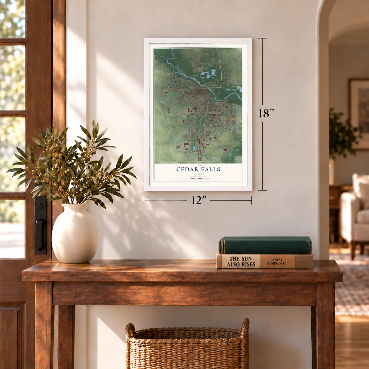
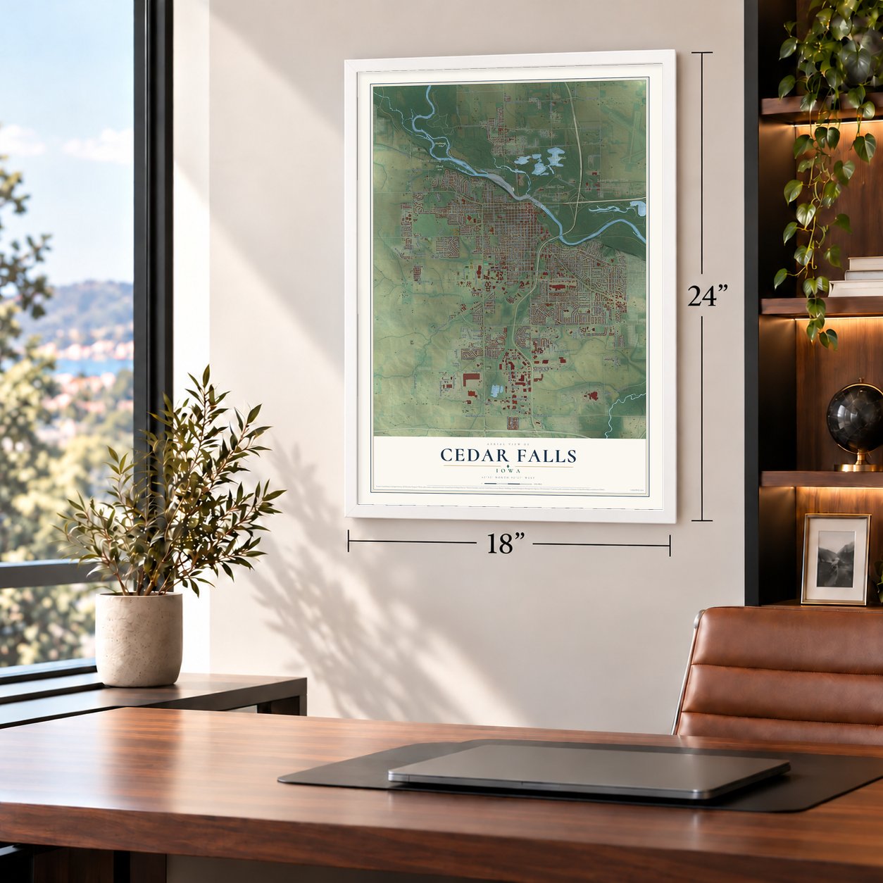
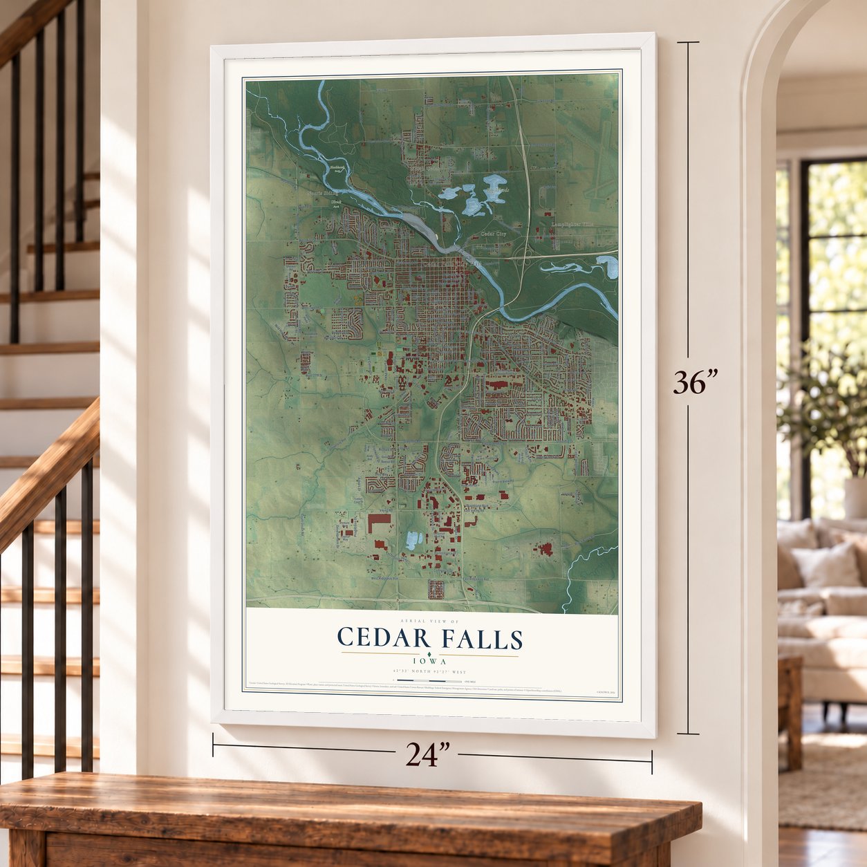
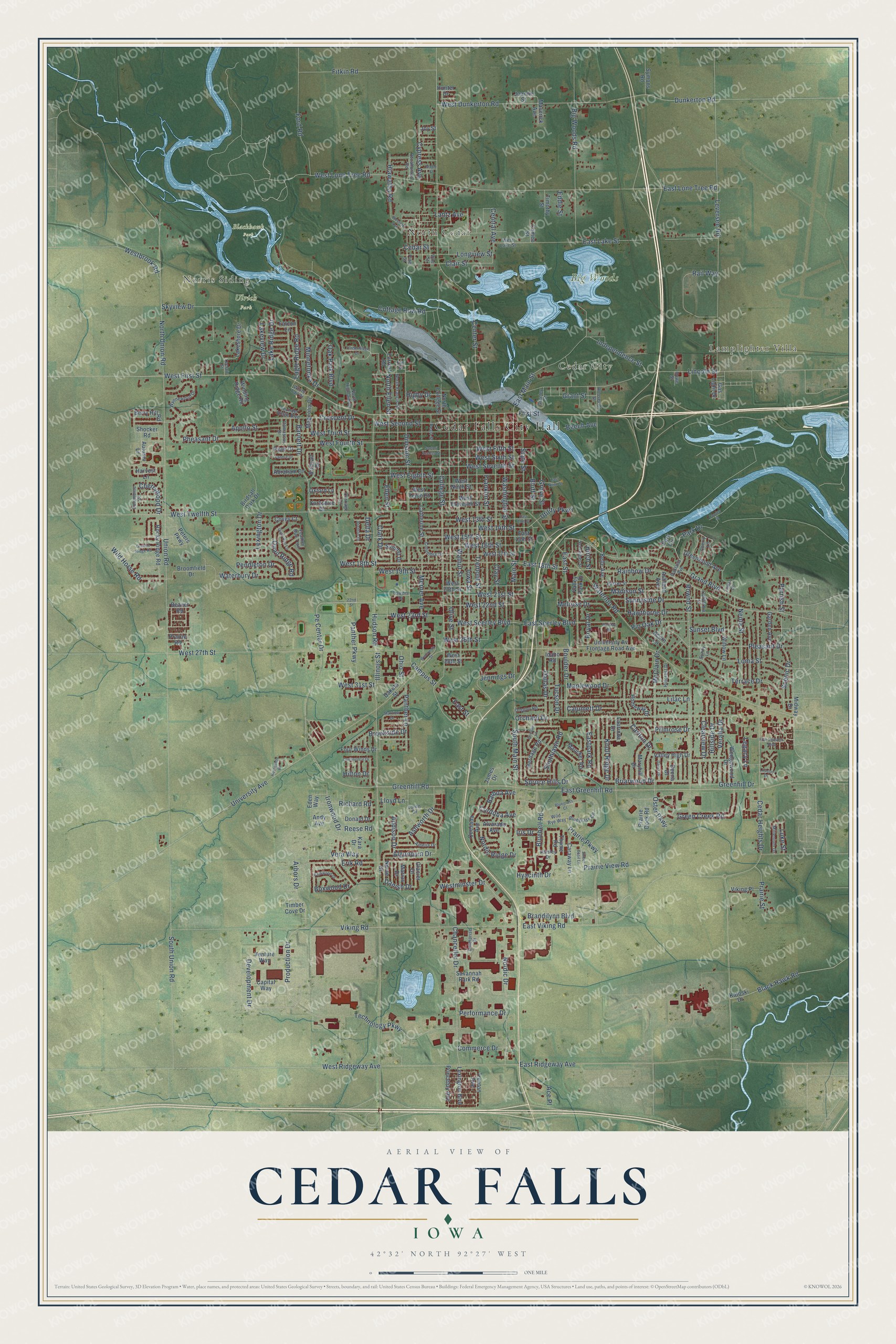
Cedar Falls, Iowa Map Art
Building by building, with labeled streets and shaded relief.
12" x 18" Archival Matte Print
A Map of Home. A Work of Art.
Explore Cedar Falls, Iowa from a whole new perspective. Created using aerial imagery and detailed geographic data, this map captures Cedar Falls building by building, with labeled streets, familiar landmarks, and shaded topographical relief that highlights the natural contours of the landscape.
Combining modern data with the timeless character of a vintage atlas, this map is just as interesting up close as it is beautiful on the wall. Whether you grew up in Cedar Falls, spent memorable years there, or call it home today, this unique map is a great way to celebrate a place that means something to you. Zoom in on the preview to look for your street, and then order a print to put your memories on the wall.
Three ways to hang it
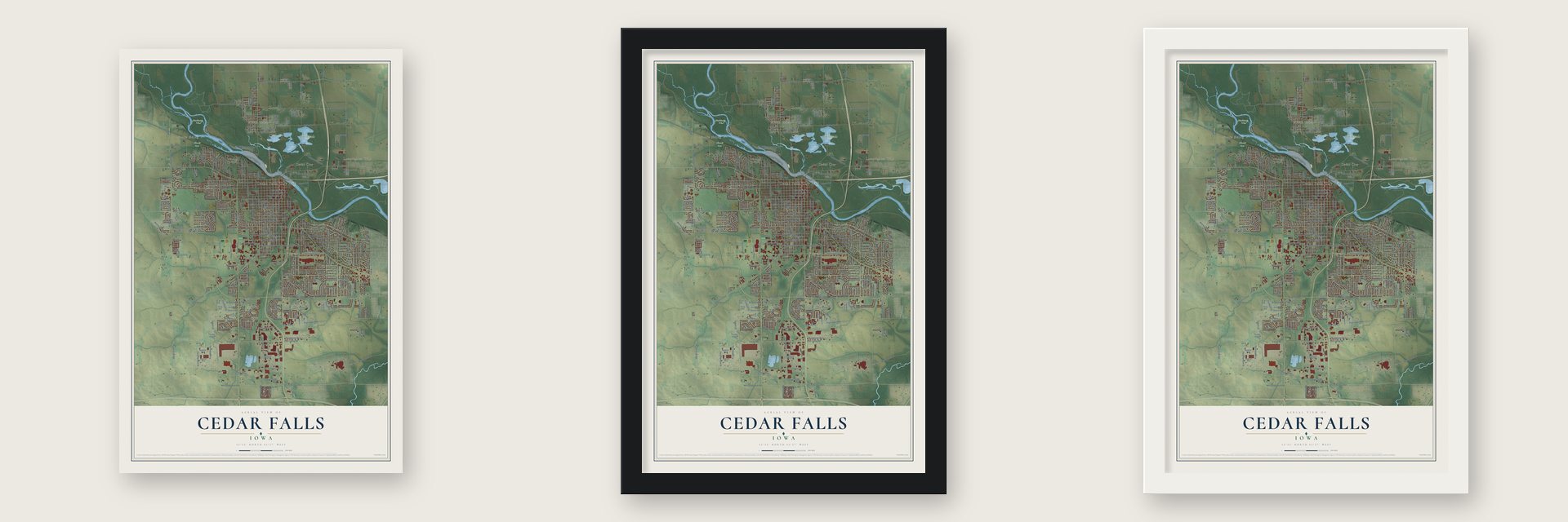
Unframed archival matte, a black wood frame or a white wood frame.
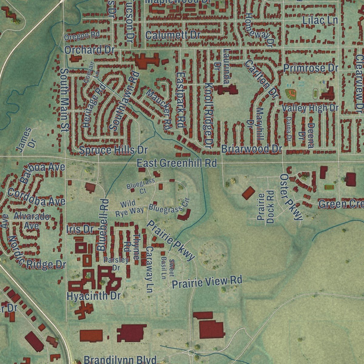
Up close
Geography Worth Displaying
This map was created using accurate cartographic data and authoritative geographic sources, including the U.S. Geological Survey and the Census Bureau. The map brings together terrain, waterways, roads, and building detail. The majority of the streets are labeled, houses are accurately depicted, and the topography is derived from government sources. Combining local data with carefully composed color and shading leads to this beautifully detailed Cedar Falls artwork for your wall.
Rather than simply showing street outlines, we’ve included as many of the street names as we could reasonably fit on the map while keeping their names legible. Zoom in on the high resolution preview to see exactly what’s on the map. We truly set out to create a statement piece for anyone who loves Cedar Falls. So whether it’s for you, or a gift for someone you love, we hope this map of Cedar Falls brings back fond memories.
Read the story behind this map of Cedar Falls, Iowa from 2026.

Find your street
Names on the Cedar Falls map
Every name below is printed on this map. Look for your street, your school, the park where you played, or the pond down the road.
Places and landmarks8
- Cedar Falls City Hall
- Norris Siding
- North Cedar
- Lamplighter Villa
- Cedar City
- Big Woods
- Blackhawk Park
- Ulrich Park
Streets and roads327
- Brandilynn Boulevard
- West 31st Street
- Technology Parkway
- Pe Center Drive
- East 18th Street
- Viking Road
- Greenhill Road
- West 15th Street
- Production Drive
- Eagle Ridge Road
- Danish Drive
- Center Street
- East Greenhill Road
- Grand Boulevard
- West Lone Tree Road
- Dunkerton Road
- University Avenue
- Hudson Road
- Union Road
- Cedar Heights Drive
- West Twelfth Street
- West First Street
- Leversee Road
- West 27th Street
- West Fourth Street
- Walnut Street
- Orchard Drive
- West Third Street
- Main Street
- South Main Street
Show all 327 streets
- Tremont Street
- Rownd Street
- Cottage Row Road
- Nordic Drive
- College Street
- Iowa Street
- Rainbow Drive
- East Viking Road
- Olive Street
- Franklin Street
- Big Woods Road
- West Ridgeway Avenue
- Clay Street
- Waterloo Road
- North Union Road
- West Eighth Street
- East Lone Tree Road
- Lincoln Street
- Washington Street
- East Lake Street
- Jennings Drive
- West 18th Street
- State Street
- Prairie Parkway
- West Seventh Street
- West Second Street
- Chancellor Drive
- Erik Road
- Fitkin Road
- Algonquin Drive
- Ashworth Drive
- Hawthorne Drive
- Terrace Drive
- Pleasant Drive
- Green Creek Road
- Maplewood Drive
- Lilac Lane
- West 22nd Street
- East Main Street
- Park Drive
- Campus Street
- McClain Drive
- Minnetonka Drive
- Briarwood Drive
- Carlton Drive
- Arbors Drive
- Crescent Drive
- West Sixth Street
- Cypress Avenue
- Ironwood Drive
- Madison Street
- West 16th Street
- Ford Road
- Oak Park Boulevard
- Greenhill Drive
- Rail Way
- Pheasant Drive
- West Fifth Street
- East Seerley Boulevard
- Division Street
- Barnett Drive
- Veralta Drive
- West 13th Street
- West 14th Street
- Longview Street
- Melrose Drive
- Loma Street
- Westminster Drive
- West 19th Street
- Panther Parkway
- Clair Street
- Clearview Drive
- South Union Road
- Neola Street
- Wild Horse Road
- West 23rd Street
- Dallas Drive
- Scenic Drive
- Quail Ridge Road
- Primrose Drive
- Sunnyside Drive
- Grove Street
- Bluebell Road
- Skyview Drive
- Black Hawk Road
- Clark Drive
- Spruce Hills Drive
- Merner Avenue
- Lantz Avenue
- Bluff Street
- West Seerley Boulevard
- West 21st Street
- West Dunkerton Road
- East Ridgeway Avenue
- Boulder Drive
- Tucson Drive
- Hillside Drive
- Panther Lane
- Independence Street
- Lake Ridge Drive
- Eastpark Road
- Hiawatha Road
- Knoll Ridge Drive
- Lexington Drive
- Richard Road
- Lakeview Drive
- Brookside Drive
- Apollo Street
- Prairie View Road
- Royal Drive
- Pin Oak Drive
- Calumett Drive
- Grant Street
- Nordic Ridge Drive
- Central Avenue
- Development Drive
- Sunset Boulevard
- Hyacinth Drive
- Pendleton Drive
- West 26th Street
- Southlawn Road
- Waterbury Drive
- Cedar Street
- Westbrook Road
- Performance Drive
- Commerce Drive
- Cherrywood Drive
- Prairie Street
- Ellen Street
- Oster Parkway
- East Street
- Vera Way
- Ace Place
- North Ellen Street
- Balboa Avenue
- Utility Parkway
- Boxwood Drive
- Addison Drive
- Cordoba Avenue
- Parrish Street
- Legacy Lane
- Higby Drive
- Illinois Street
- Ohio Street
- Beech Avenue
- Reese Road
- First Street
- Luke Street
- Delta Drive
- Lloyd Lane
- Hilton Drive
- Eddie Street
- Birch Street
- Iris Drive
- Quesada Avenue
- Norse Drive
- West Eleventh Street
- Valley High Drive
- West Ninth Street
- West Tenth Street
- West 20th Street
- Catherine Street
- Rocky Ridge Road
- Valley Park Drive
- Maryhill Drive
- Katoski Drive
- West 17th Street
- Ashland Avenue
- University Av Frontage Road Avenue
- Donald Drive
- Abraham Drive
- Heritage Road
- Capital Way
- Homeway Drive
- Birdsall Park Drive
- Savannah Park Road
- Garden Avenue
- Willow Lane
- Lakeshore Drive
- Belle Avenue
- Maucker Road
- Greenwood Avenue
- Magnolia Drive
- Princeton Avenue
- Summit Drive
- Lexington Boulevard
- Broomfield Drive
- Caraway Lane
- Dakota Street
- Wedgewood Drive
- Venture Way
- Harvest Lane
- Midway Drive
- Berry Hill Road
- Four Winds Drive
- Alvarado Avenue
- Birdsall Drive
- Shocker Road
- Prairie Dock Road
- Autumn Lane
- Viking Place
- West 28th Street
- Marius Drive
- North College Street
- Winding Ridge Road
- Symons Road
- Maverick Avenue
- Prairie Road
- Park Circle
- Gas Light Drive
- Timothy Street
- Joanne Street
- Oxford Lane
- Yorkshire Drive
- Ryan Drive
- Beaver Road
- Deena Drive
- Covey Court
- Falcon Lane
- Kara Drive
- Eden Way
- Glacier Drive
- Cameo Street
- Trenton Avenue
- Laurinda Drive
- James Drive
- Thyme Road
- Acorn Lane
- Andy Avenue
- Peters Parkway
- Forrest Road
- Idaho Road
- Timber Cove Drive
- Hunter Drive
- East 15th Street
- Joy Street
- Wynnewood Drive
- Loren Drive
- Parker Street
- Bluegrass Circle
- Pearl Street
- Roosevelt Street
- Enterprise Drive
- Pine Street
- North Francis Street
- Thunder Ridge Boulevard
- Feather Run Trail
- Millenium Drive
- Columbia Drive
- Oregon Road
- Oakland Avenue
- Amelia Drive
- White Tail Drive
- Wild Rye Way
- Columbine Drive
- Schreiber Street
- North Highland Drive
- Hillcrest Drive
- Pocahontas Road
- Damascus Drive
- Vine Street
- Cherry Lane
- West Lake Street
- California Street
- Greeley Street
- Parsley Drive
- Carriage Lane
- Towers Drive
- Leclair Street
- Elm Street
- Sunny Lane
- Howe Street
- 22nd Street
- Timberledge Drive
- Western Avenue
- Quail Run Lane
- East Ninth Street
- Five Seasons Boulevard
- Granite Ridge Road
- Starview Drive
- Barkwood Drive
- Holiday Road
- Horseshoe Drive
- Timber Drive
- Wisconsin Street
- Convair Lane
- Maple Street
- Continental Drive
- Fandre Drive
- Daina Drive
- Sweet Basil Lane
- Brenton Drive
- Bluegrass Court
- Sartori Access Street
- East 13th Street
- Cooley Street
- Lovejoy Drive
Names are listed as they appear on the printed map. Zoom into the product photos to find them.
About Cedar Falls, Iowa
The 2020 census recorded 40,713 residents in Cedar Falls, an Iowa city located in Black Hawk County.
“A town plat was surveyed, and the little settlement for the first time received the name of Cedar Falls. The plat was not recorded, however, and two years later the town was again surveyed and recorded as Independence.”
- 40,713 residentsThe 2020 census recorded this population for the community.
- Black Hawk CountyBlack Hawk County contains the Iowa city of Cedar Falls.
Keep exploring Iowa
Cedar Falls is one of 1,038 Iowa towns we've mapped. Every dot on the map is a print of its own.
The search covers every state, Iowa first.
Near Cedar Falls
Order 2 or more town maps and save 10%. Shown in the size and finish you picked above, so they hang as a set.
- Waterloo 12" x 18" / Archival Matte Print $39.99
- Hudson 12" x 18" / Archival Matte Print $39.99
- Janesville 12" x 18" / Archival Matte Print $39.99


More maps nearby: New Hartford, Dike, Evansdale, Elk Run Heights and Raymond.
The art of mapping a place
How This Map Was Made
Real places. Remarkable detail. Discover the layers that turn geographic data into a map of home.

The view from above
Aerial imagery reveals the character of the land: woodland, open fields, and the patterns of a place.

The shape of the land
Elevation data brings hills, valleys, and subtle changes in the landscape into view.

The details of home
Roads, waterways, and building footprints come together to make the map feel unmistakably local.

Geography becomes art
Considered color, shading, and typography bring the layers together in a map made for your wall.


Process illustrated with Mendon, Massachusetts. Aerial imagery: USDA NAIP. Terrain: USGS 3D Elevation Program. Map details and finished artwork: KNOWOL.
The Details
About This Print
Choose an archival matte print, or a black or white Ayous wood frame. The archival matte print is unframed.
Select your size and finish above to see the matching product image and price.
Materials & Craftsmanship
A contemporary map with the character of a classic atlas, printed on archival matte paper. Optional frames are made from Ayous wood.
Your printed map does not include the watermark shown in the full-map preview.
Shipping & Delivery
Free shipping within the United States. Every print is made to order in the USA.
Buying a gift? Add a note in your cart and we'll include it. We never put prices in the package.
Prints ship within 2 to 3 business days. Allow 7 to 10 days total from ordering for delivery. Timing may vary during holidays or periods of high order volume.
Read our shipping policy.
Returns and damaged prints
Each print is made to order. Change-of-mind refunds are not available after production.
If your print arrives damaged, misprinted or incorrect, contact support@knowol.com within 30 days of receiving it. Include your order number, photos and a description of the issue.
Read our full refund and replacement policy. For questions about your order, email support@knowol.com.