
Search for another town

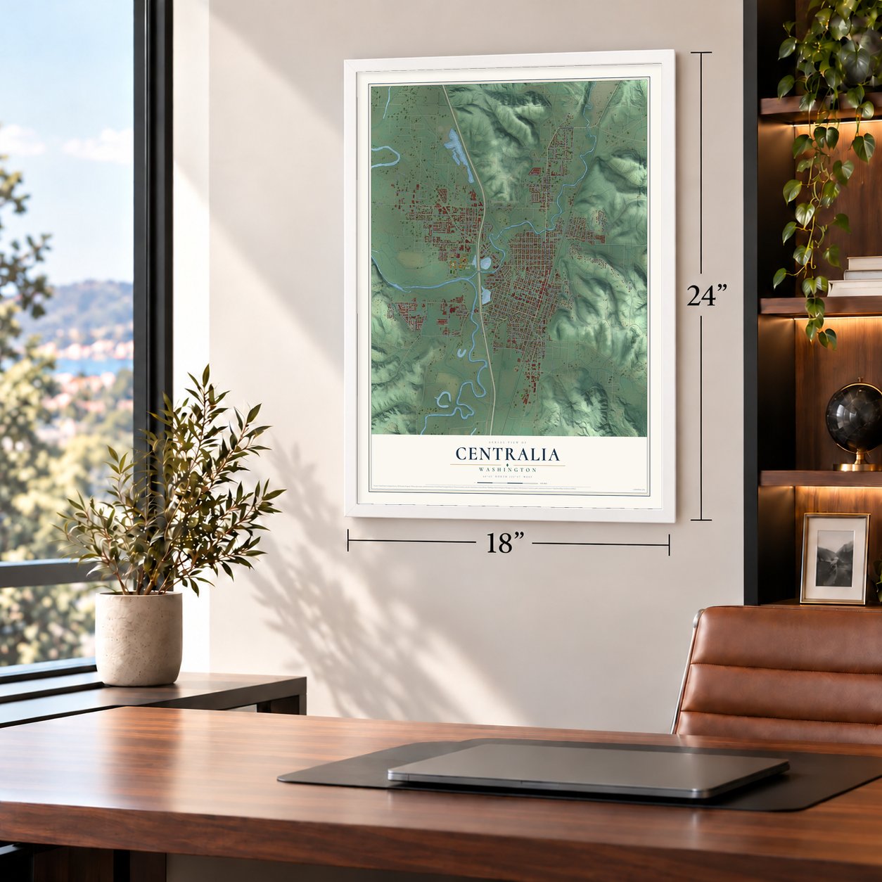

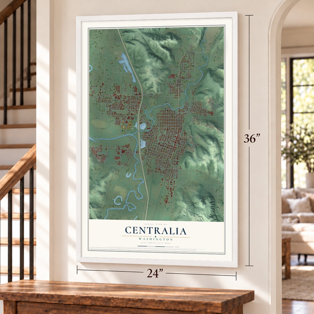

Free U.S. delivery 7 to 10 days after you order
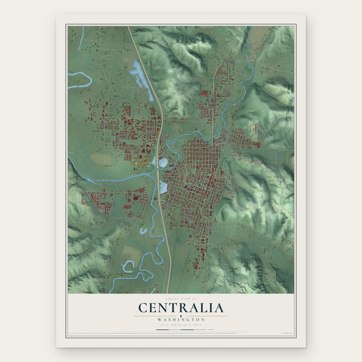
Centralia, Washington Map Art
A new map of Centralia, Washington, made in 2026 and printed to order on thick archival matte paper.
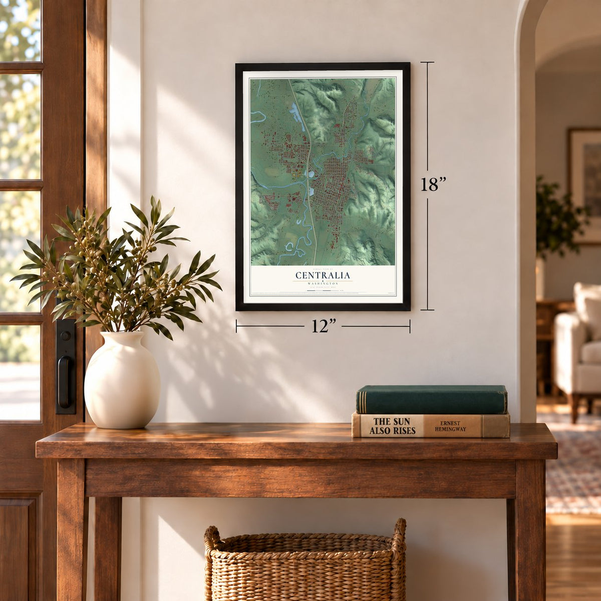
12" x 18" Archival Matte Print
A Map of Home. A Work of Art.
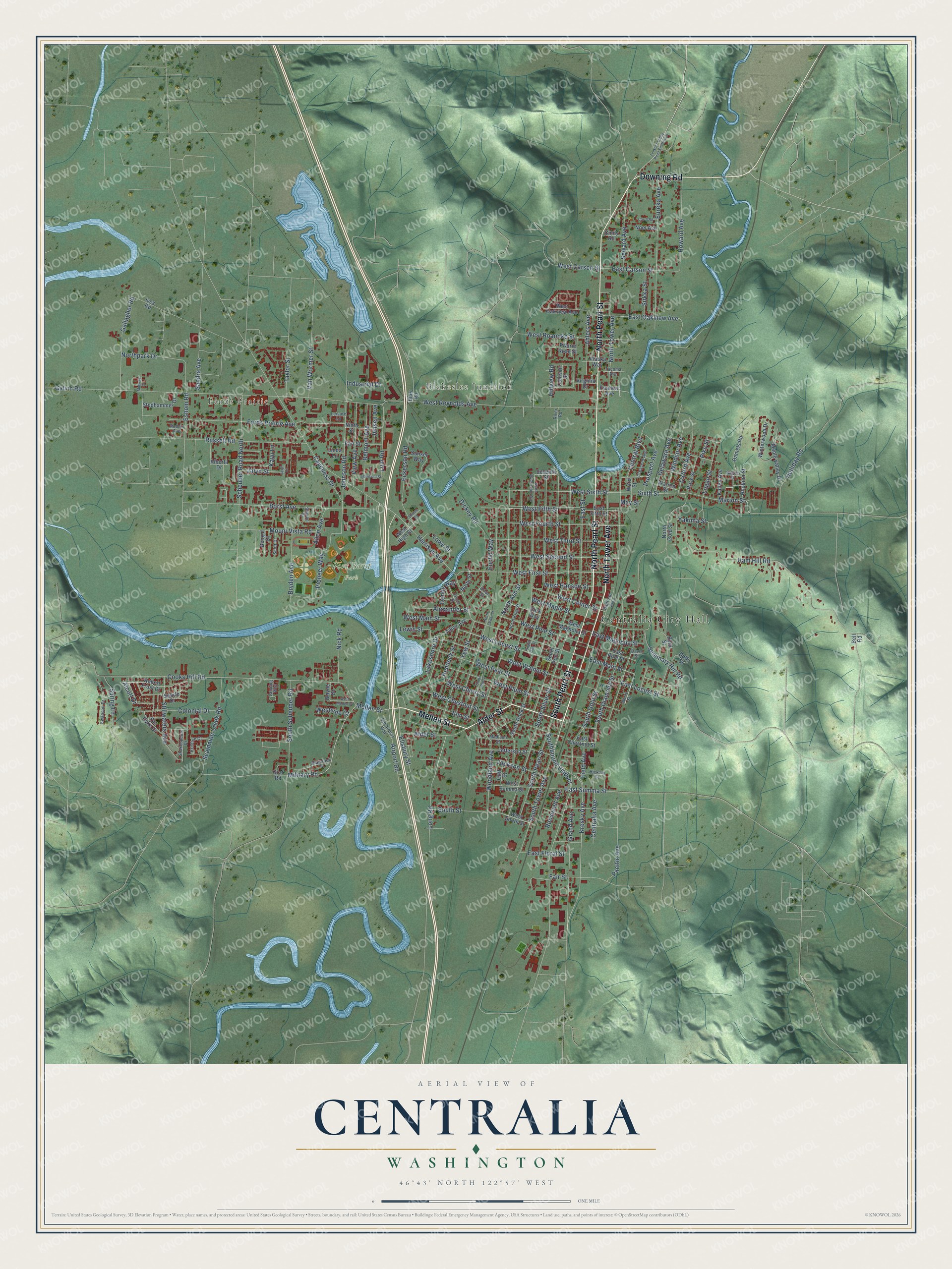
Explore Centralia, Washington from a whole new perspective. Created using aerial imagery and detailed geographic data, this map captures Centralia building by building, with labeled streets, familiar landmarks, and shaded topographical relief that highlights the natural contours of the landscape.
Combining modern data with the timeless character of a vintage atlas, this map is just as interesting up close as it is beautiful on the wall. Whether you grew up in Centralia, spent memorable years there, or call it home today, this unique map is a great way to celebrate a place that means something to you. Zoom in on the preview to look for your street, and then order a print to put your memories on the wall.
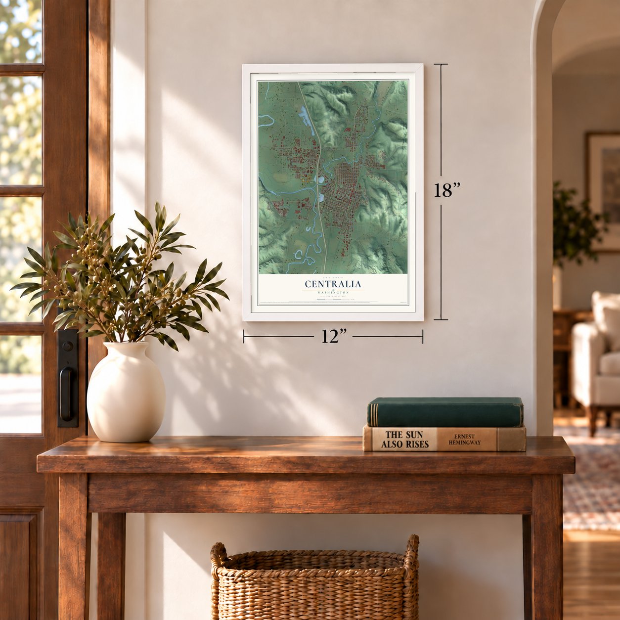
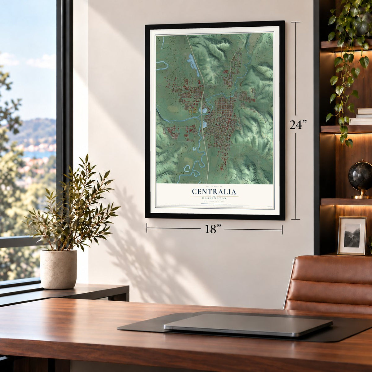
Three ways to hang it
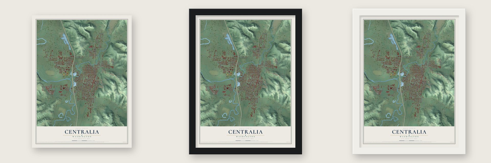
Unframed archival matte, a black wood frame or a white wood frame.
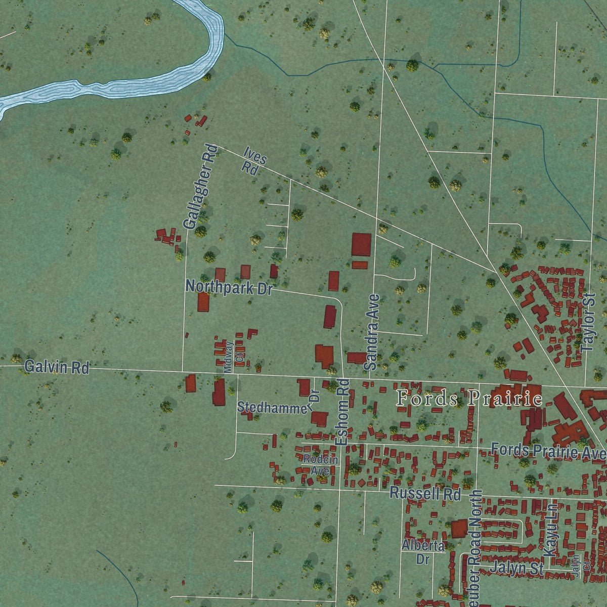
Up close
Geography Worth Displaying
This map was created using accurate cartographic data and authoritative geographic sources, including the U.S. Geological Survey and the Census Bureau. The map brings together terrain, waterways, roads, and building detail. The majority of the streets are labeled, houses are accurately depicted, and the topography is derived from government sources. Combining local data with carefully composed color and shading leads to this beautifully detailed Centralia artwork for your wall.
Rather than simply showing street outlines, we’ve included as many of the street names as we could reasonably fit on the map while keeping their names legible. Zoom in on the high resolution preview to see exactly what’s on the map. We truly set out to create a statement piece for anyone who loves Centralia. So whether it’s for you, or a gift for someone you love, we hope this map of Centralia brings back fond memories.
Read the story behind this map of Centralia, Washington from 2026.
About Centralia, Washington
Centralia is a city of 18,183 people in Lewis County, where the Skookumchuck River meets the Chehalis. Its founder, George Washington, reached this spot in 1851 and claimed land on Skookumchuck Prairie. Oregon Territory law would not let a black man own land, so he asked his former guardians, James and Anna Cochran, to file the claim for him. They sold it back to him once the laws of the new Washington Territory allowed it.
The Northern Pacific Railroad crossed his land in 1872. In January 1875 Washington, his wife Mary Jane and his stepson Stacey Coonness platted a town called Centerville, and it had 50 residents within a year. Settlers worried about another Centerville in Klickitat County, so by 1883 the town was Centralia, a name suggested by a newcomer from Centralia, Illinois. It was incorporated on February 3, 1886. When the Panic of 1893 nearly emptied the town, Washington lent money and forgave debts until business came back. He died in 1905, and 5,000 mourners came to his funeral.
“I for one thought the building of a fort not only unnecessary but injurious to our friendship with our neighboring Chehalis Indians. Therefore I did not help built the fort”
- Fort Henness in 1855The Upper Chehalis took no part in the uprising of 1855-1856, but many homesteaders feared an attack and built Fort Henness, a stockade on Grand Mound Prairie. Starting in October 1855, 224 people lived inside its 100 by 130 foot walls. George and Mary Waunch stayed on their farm, and Washington sent the Cochrans to the fort but stayed home behind a small stockade of his own.
- Joseph Borst's farmJoseph Borst settled on the Chehalis's north bank, below the rivers' meeting, the spring after the 1845 Simmons party passed. Cash was scarce, so one winter he split rails at the Hudson's Bay Company farm for 50 cents per hundred to buy wheat at four dollars a bushel. In the 1850s and 1860s his place ran a toll ferry and was the halfway stagecoach stop between Kalama and Tacoma. The Joseph Borst House joined the National Register in 1977.
- Twenty-two million shinglesCoal, lumber and dairying carried the town after the panic. In 1898 the Centralia Shingle Mills turned out twenty-two million shingles, while the Wooden Eave Gutter Factory made thousands of feet of gutters every day.
- Armistice Day, 1919On November 11, 1919, American Legionnaires broke away from the Armistice Day parade and stormed the hall of the Industrial Workers of the World, a union many of them saw as Bolshevik. The union men fought back and killed four Legionnaires. One of them, the war veteran Wesley Everest, was caught, jailed and lynched. The clash made headlines around the world, and his grave is now on the National Register.
Find your street
Names on the Centralia map
Every name below is printed on this map. Look for your street, your school, the park where you played, or the pond down the road.
Places and landmarks4
- Centralia City Hall
- Fords Prairie
- Blakeslee Junction
- Fort Borst Park
Streets and roads201
- North Pearl Street
- North Tower Avenue
- Mellen Street
- South Pearl Street
- Alder Street
- Downing Road
- South Tower Avenue
- Military Road
- East Main Street
- Kresky Avenue
- East Magnolia Street
- Alcott Drive
- West Sixth Street
- Ellsbury Street
- West Hanson Street
- Eshom Road
- South Diamond Street
- Sixth Street
- South Gold Street
- Marion Street
- West Second Street
- East Carson Street
- East Oakview Avenue
- East Summa Street
- North Ash Street
- Harrison Avenue
- Cooks Hill Road
- West Reynolds Avenue
- Ham Hill Road
- Galvin Road
Show all 201 streets
- West Main Street
- Johnson Road
- Fords Prairie Avenue
- South Silver Street
- Russell Road
- Borst Avenue
- West Fifth Street
- West First Street
- West Pear Street
- West Plum Street
- Grand Avenue
- Eureka Avenue
- West Chestnut Street
- West Locust Street
- West Walnut Street
- West Third Street
- Scheuber Road North
- Yew Street
- Central Boulevard
- West Fourth Street
- Seminary Hill Road
- Pioneer Way
- Belmont Avenue
- South Street
- Northpark Drive
- Long Road
- West Pine Street
- Gallagher Road
- South Scheuber Road
- East Street
- Woodland Avenue
- Howard Avenue
- Delaware Avenue
- Stillwaters Avenue
- East Locust Street
- Scammon Creek Road
- View Avenue
- Eckerson Road
- Seward Avenue
- Colonial Drive
- Logan Street
- Lakeshore Drive
- Prospect Avenue
- West Roanoke Street
- Halliday Road
- West Cherry Street
- Lum Road
- Airport Road
- Bryden Avenue
- West Center Street
- Jackson Street
- West Maple Street
- Fair Street
- Sandra Avenue
- Elm Street
- Southbound Viaduct
- Van Wormer Street
- Oxford Avenue
- Ahlers Avenue
- Windsor Avenue
- Mount Vista Road
- Caveness Drive
- Alexander Street
- Nick Road
- Industrial Drive
- Centralia Avenue
- Spring Lane
- Hemlock Street
- Field Avenue
- East Floral Street
- Taylor Street
- Sirkka Street
- Dickey Road
- West Carson Street
- Jalyn Street
- Lowe Street
- Roosevelt Avenue
- Allen Avenue
- Pacific Avenue
- Lewis Street
- Jensen Avenue
- Denny Way
- Yakima Street
- Westside Court
- Hillview Road
- Euclid Way
- Kayu Lane
- Pike Street
- May Street
- Robert Frost Drive
- North Gold Street
- South Rock Street
- South Iron Street
- Jefferson Street
- Maple Valley Drive
- West Oakview Avenue
- West Summa Street
- Byrd Street
- Winterwood Drive
- Tilley Avenue
- Searle Drive
- Stedhammer Drive
- West Magnolia Street
- Daniels Road
- East Fifth Street
- Earl Street
- Rose Street
- Sunset Way
- East Pine Street
- West South Street
- Park Way
- Ives Road
- Rhobina Street
- Van Dyke Drive
- Kulien Avenue
- Ninth Street
- East Chestnut Street
- Alaska Way
- Cindy Road
- Prairie Rose Street
- Duffy Street
- Ward Street
- Bengal Court
- Virginia Drive
- Goff Street
- Seventh Street
- Fremont Avenue
- Noel Avenue
- Warren Street
- Collison Street
- North Street
- Alberta Drive
- Wayne Drive
- West High Street
- Blair Road
- Linda Lane
- Graf Road
- Bell Road
- Railroad Avenue
- Crescent Avenue
- Shamrock Drive
- Swanson Drive
- Kristine Court
- North King Street
- Landing Way
- Hickory Street
- Old Airport Way
- Shakespeare Drive
- Sharon Street
- Madison Street
- Scott Drive
- Tacoma Avenue
- Bayne Street
- Leisure Lane
- Berry Street
- Rodcin Avenue
- Davis Street
- River Road
- Orton Street
- Zenkner Valley Road Southwest
- West Mellen Street
- North Washington Avenue
- South Ash Street
- South Oak Street
- Latona Street
- Haviland Street
- Carol Road
- North Cedar Street
- Midway Court
- Shirlee Street
- Jalyn Court
Names are listed as they appear on the printed map. Zoom into the product photos to find them.
The art of mapping a place
How This Map Was Made
Real places. Remarkable detail. Discover the layers that turn geographic data into a map of home.

The view from above
Aerial imagery reveals the character of the land: woodland, open fields, and the patterns of a place.

The shape of the land
Elevation data brings hills, valleys, and subtle changes in the landscape into view.

The details of home
Roads, waterways, and building footprints come together to make the map feel unmistakably local.

Geography becomes art
Considered color, shading, and typography bring the layers together in a map made for your wall.


Process illustrated with Mendon, Massachusetts. Aerial imagery: USDA NAIP. Terrain: USGS 3D Elevation Program. Map details and finished artwork: KNOWOL.
The Details
About This Print
Choose an archival matte print, or a black or white Ayous wood frame. The archival matte print is unframed.
Select your size and finish above to see the matching product image and price.
Materials & Craftsmanship
A contemporary map with the character of a classic atlas, printed on archival matte paper. Optional frames are made from Ayous wood.
Your printed map does not include the watermark shown in the full-map preview.
Shipping & Delivery
Free shipping within the United States. Every print is made to order in the USA.
Buying a gift? Add a note in your cart and we'll include it. We never put prices in the package.
Prints ship within 2 to 3 business days. Allow 7 to 10 days total from ordering for delivery. Timing may vary during holidays or periods of high order volume.
Read our shipping policy.
Returns and damaged prints
Each print is made to order. Change-of-mind refunds are not available after production.
If your print arrives damaged, misprinted or incorrect, contact support@knowol.com within 30 days of receiving it. Include your order number, photos and a description of the issue.
Read our full refund and replacement policy. For questions about your order, email support@knowol.com.
Find your town
Looking for another city?
Find a map of home in our Washington collection, or any town in the country.
Nearby
Maps of towns near Centralia
Know someone from one of these towns? Their map makes a great gift.
 Fords Prairie
, Washington
From $39.99See the map
 Chehalis
, Washington
From $39.99See the map
 Grand Mound
, Washington
From $39.99See the map
More maps nearby: Bucoda, Rochester, Napavine, Tenino and Oakville.