
Search for another town




Free U.S. delivery 7 to 10 days after you order
Clemmons, North Carolina Map Art
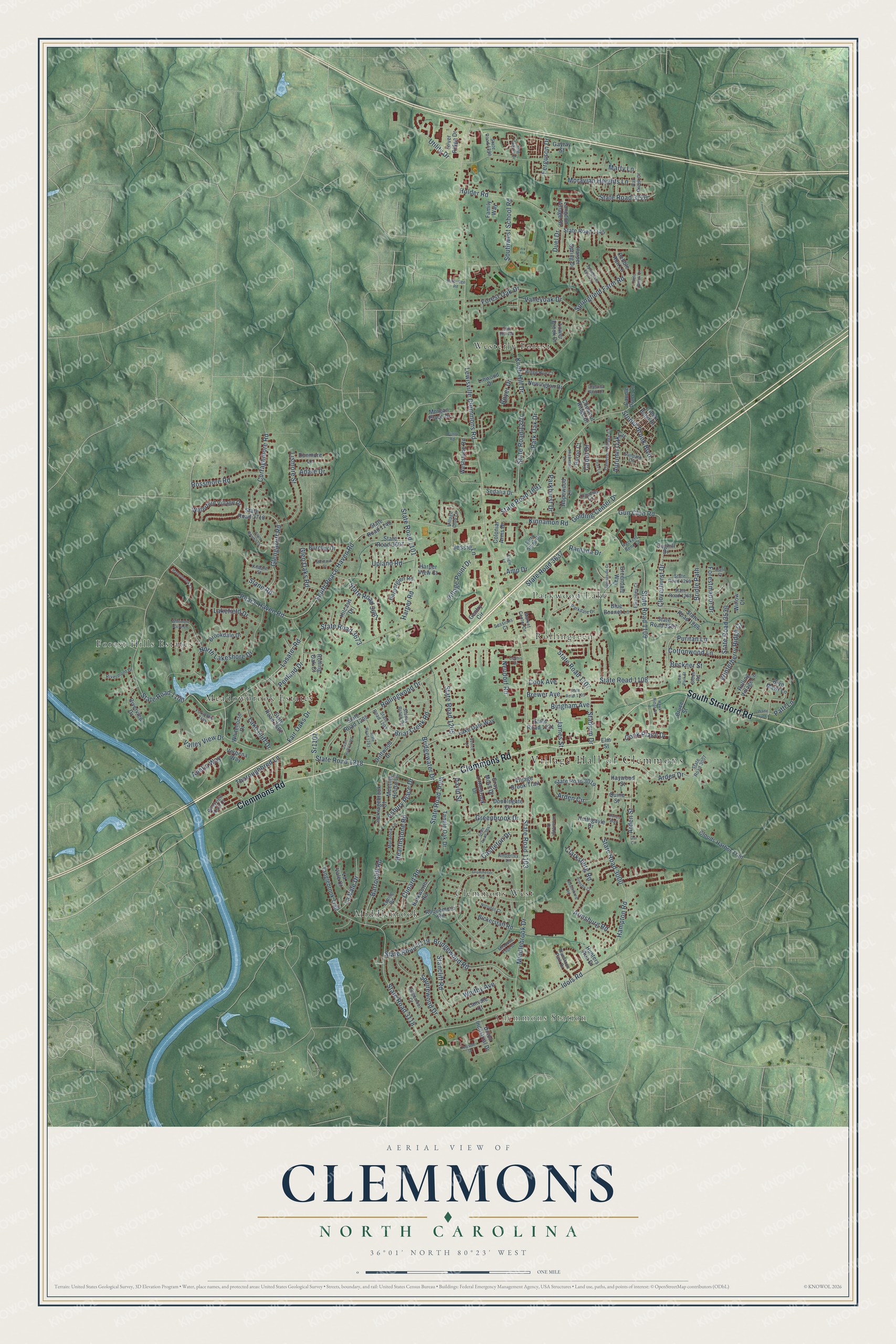
A new map of Clemmons, North Carolina, made in 2026 and printed to order on thick archival matte paper.
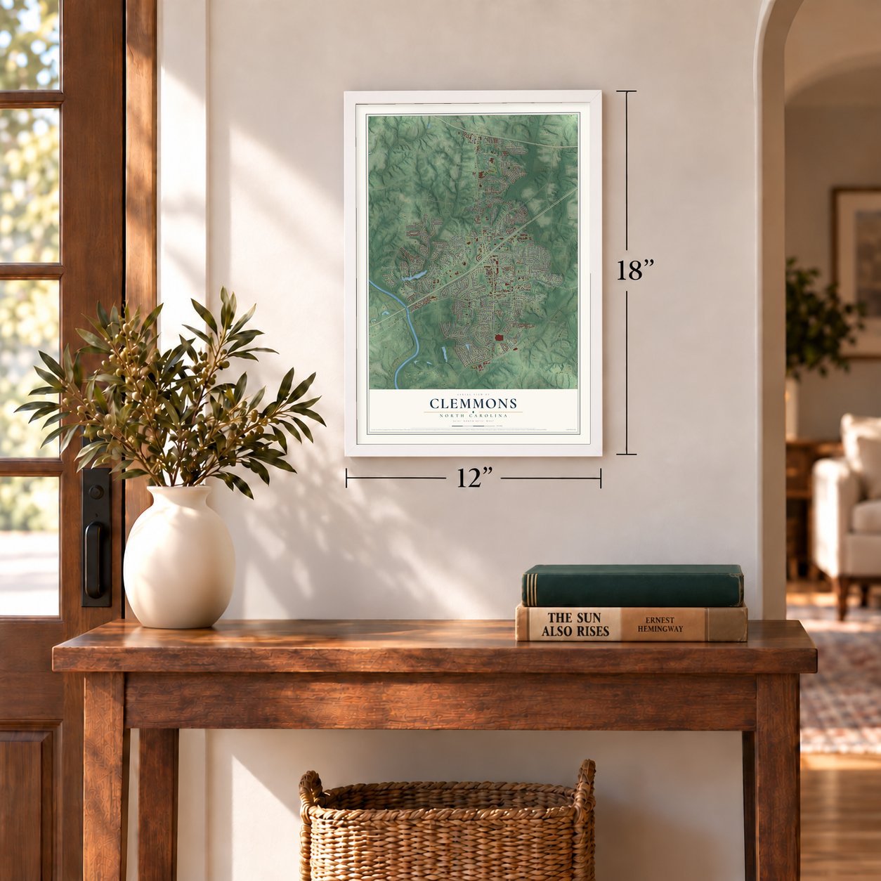
12" x 18" Archival Matte Print
A Map of Home. A Work of Art.
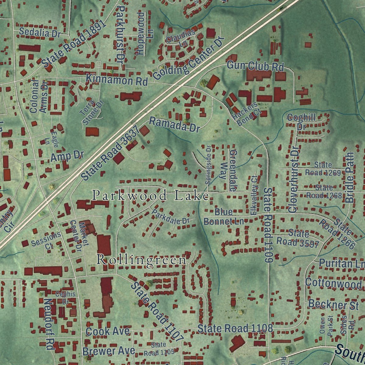
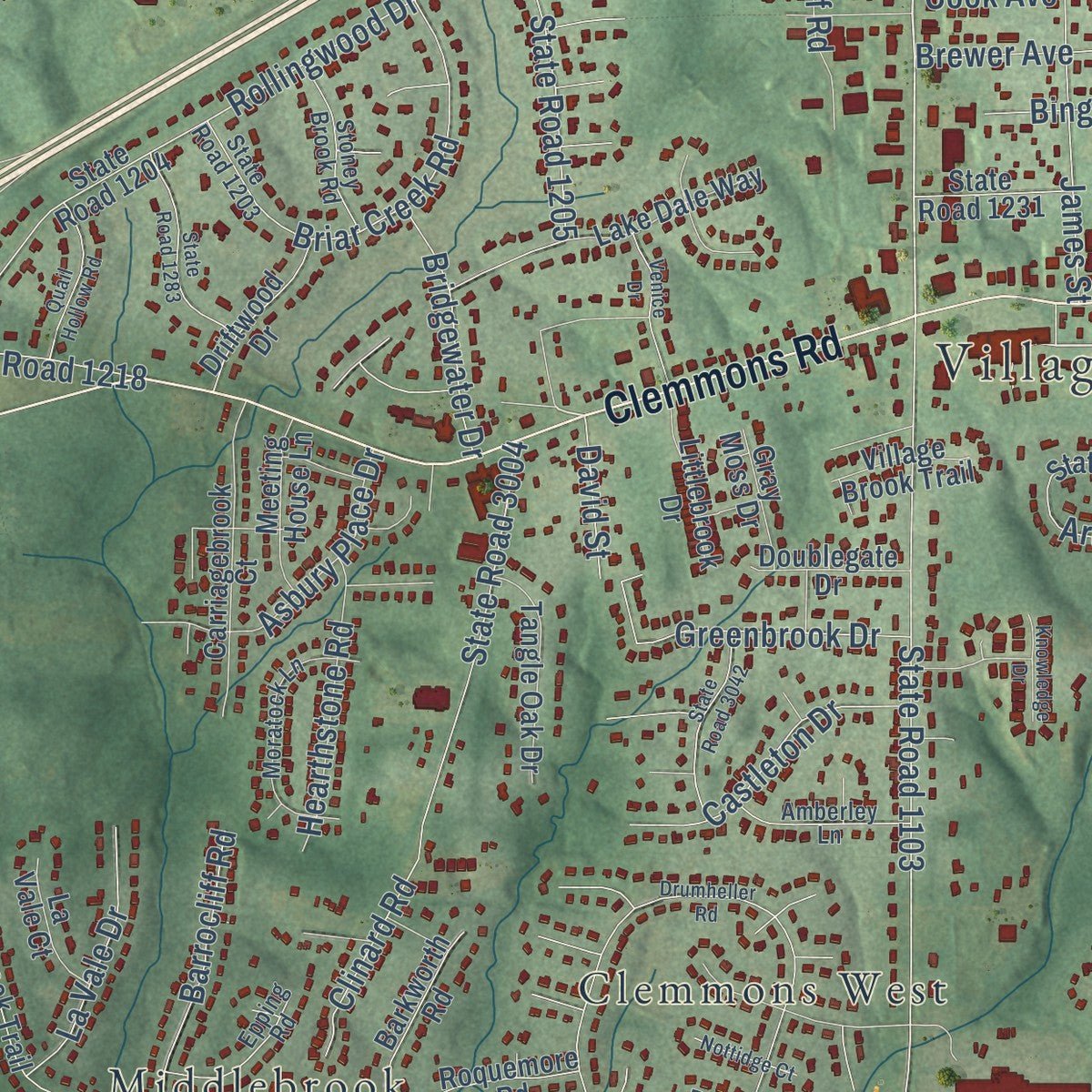
Explore Clemmons, North Carolina from a whole new perspective. Created using aerial imagery and detailed geographic data, this map captures Clemmons building by building, with labeled streets, familiar landmarks, and shaded topographical relief that highlights the natural contours of the landscape.
Combining modern data with the timeless character of a vintage atlas, this map is just as interesting up close as it is beautiful on the wall. Whether you grew up in Clemmons, spent memorable years there, or call it home today, this unique map is a great way to celebrate a place that means something to you. Zoom in on the preview to look for your street, and then order a print to put your memories on the wall.
Three ways to hang it
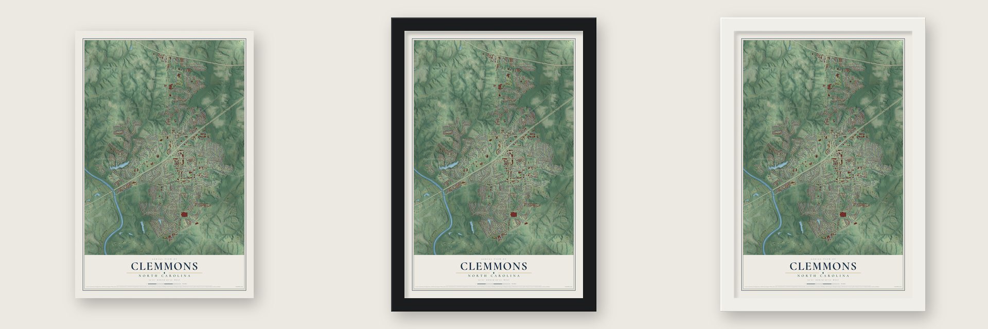
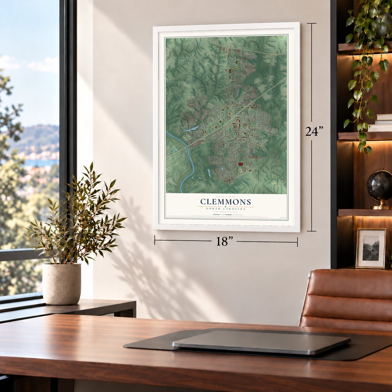
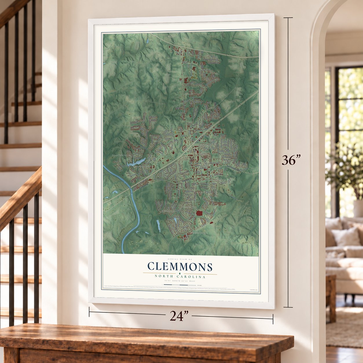
Unframed archival matte, a black wood frame or a white wood frame.
Up close
Geography Worth Displaying
This map was created using accurate cartographic data and authoritative geographic sources, including the U.S. Geological Survey and the Census Bureau. The map brings together terrain, waterways, roads, and building detail. The majority of the streets are labeled, houses are accurately depicted, and the topography is derived from government sources. Combining local data with carefully composed color and shading leads to this beautifully detailed Clemmons artwork for your wall.
Rather than simply showing street outlines, we’ve included as many of the street names as we could reasonably fit on the map while keeping their names legible. Zoom in on the high resolution preview to see exactly what’s on the map. We truly set out to create a statement piece for anyone who loves Clemmons. So whether it’s for you, or a gift for someone you love, we hope this map of Clemmons brings back fond memories.
Read the story behind this map of Clemmons, North Carolina from 2026.

About Clemmons, North Carolina
Clemmons is a village of 21,163 people in southwestern Forsyth County, just east of the Yadkin River. It shares its name with Peter Clemmons, who settled the place in 1802. Today it is a suburb of Winston-Salem, with Lewisville to the north and Bermuda Run to the west and southwest.
- Tanglewood ParkTanglewood Park is the village's best-known spot. It holds an arboretum and a rose garden, and each year it hosts a Festival of Lights for the holiday season.
- Little League World Series, 2002In 2002 the Clemmons Little League team played in the Little League World Series, representing the Southeast region, and was knocked out in pool play. Austin Dillon was on that roster. He later won the NASCAR Camping World Truck Series in 2011 and the Nationwide Series in 2013.
- The Hoehns (Hanes) HouseThe house of Philip and Johanna Hoehns, a name later spelled Hanes, stands in Clemmons. It joined the National Register of Historic Places in 2016.
- The county's largest high schoolClemmons is home to West Forsyth High School, which enrolls more students than any other high school in Forsyth County.
Find your street
Names on the Clemmons map
Every name below is printed on this map. Look for your street, your school, the park where you played, or the pond down the road.
Places and landmarks9
- Village Hall of Clemmons
- Clemmons Station
- Clemmons West
- Forest Hills Estates
- Meadowbrook Estates
- Middlebrook
- Parkwood Lake
- Rollingreen
- Westerly Forest
Streets and roads236
- Clemmons Road
- South Stratford Road
- Lewisville Clemmons Road
- South Peace Haven Road
- State Road 1103
- State Road 3000
- Harper Road
- State Road 1101
- Lasater Road
- Kinnamon Road
- State Road 1100
- State Road 1891
- Middlebrook Drive
- Hampton Road
- Idols Road
- Peace Haven Road
- State Road 3118
- Holder Road
- State Road 1109
- Rollingwood Drive
- State Road 1108
- Springfield Farm Road
- Marty Lane
- Stadium Drive
- State Road 1107
- State Road 3637
- North Lakeshore Drive
- Knob Hill Drive
- Ramada Drive
- Bridgewood Road
Show all 236 streets
- State Road 3119
- Fair Oaks Drive
- Bridle Path
- Clinard Road
- State Road 3004
- Glengarriff Road
- Curraghmore Road
- Arden Circle
- State Road 1270
- Arden Drive
- Thoroughbred Lane
- Southwest School Road
- Briar Creek Road
- Squirewood Drive
- State Road 1205
- Gun Club Road
- Village Point Drive
- Winterberry Ridge Court
- Lismore Street
- Lakefield Drive
- Moravian Heights Lane
- Rossmore Road
- Whitby Avenue
- Clarksburg Road
- Greenbrook Drive
- Stoney Brook Boulevard
- State Road 3720
- Asbury Place Drive
- Stancliff Road
- State Road 3681
- Cottonwood Lane
- Valleyoak Drive
- Castleton Drive
- Forest Oak Drive
- Barrocliff Road
- James Street
- Cabot Drive
- Lake Cliff Drive
- Hearthstone Road
- State Road 3530
- Brewer Avenue
- Glen Oaks Road
- Forestmanor Drive
- Golding Center Drive
- Slane Road
- Cook Place Drive
- Penland Drive
- Arden Street
- La Vale Drive
- Cloverhurst Drive
- Utility Drive
- Valley View Drive
- Bridgewater Drive
- Park Oak Drive
- Cook Avenue
- Armsburg Road
- Puritan Lane
- Neudorf Road
- State Road 1218
- Boyer Drive
- State Road 3673
- Bingham Avenue
- Autumn Oak Circle
- Upland Road
- Jessie Lane
- Parkhurst Drive
- Abelia Way
- Adare Drive
- Sr1101
- Ferguson Drive
- David Street
- Beckner Street
- Amp Drive
- Patti Lane
- Duel Drive
- Littlebrook Drive
- Elm Street
- State Road 1140
- Tanglebrook Trail
- State Road 1145
- State Road 1204
- State Road 3710
- State Road 3019
- Clouds Harbor Trail
- Blue Bonnet Lane
- State Road 1266
- Waterford Village Drive
- Gentry Circle
- Harper Spring Drive
- Bryn Mawr Lane
- Roquemore Road
- Lake Dale Way
- Carriagebrook Court
- State Road 3602
- Harperglen Road
- Newington Drive
- Burnley Drive
- Creek Bend Drive
- Tangle Oak Drive
- River Ridge Drive
- Bickerstaff Road
- Riverview Drive
- Barkworth Road
- Morgan Place Drive
- Linwood Drive
- Brookdale Drive
- Rolling Village Lane
- Driftwood Drive
- Harper View Court
- Meeting House Lane
- State Road 3607
- Kilcash Drive
- Verbena Way
- Weststone Road
- Whitehorse Drive
- Hunters Run Drive
- State Road 3597
- Dunmore Lane
- Sedalia Drive
- Doublegate Drive
- State Road 1231
- Dillon Industrial Drive
- Chestnut Ridge Drive
- Langdon Village Drive
- Pebble Run Lane
- Keithgayle Drive
- Gray Moss Drive
- La Vale Court
- Lower Brook Drive
- Rolling Oak Court
- Village Brook Trail
- Bruce Street
- Huron Court
- Family Way
- Greendale Way
- Hopewood Lane
- Haywood Street
- Gayray Street
- Coghill Drive
- Colonial Arms Drive
- Lanvale Court
- Caudle Place Lane
- Quinn Street
- Willow Court
- Claudias Lane
- Elm Hill Road
- State Road 3007
- State Road 1203
- State Road 1268
- Cameron Village Court
- Moratock Lane
- Forsythia Trail
- Market Center Drive
- Stoney Brook Road
- Amberley Lane
- Edgemoor Court
- Epping Road
- State Road 1269
- Bluestone Park Drive
- Ridge Run Court
- Riverview Knoll Court
- Terra Stone Drive
- Parkdale Drive
- Rivermont Drive
- Oak Creek Court
- Elkvalley Court
- Sides Road
- Sunpath Circle
- Kildare Street
- State Road 1299
- Hickman Lane
- Village Club Lane
- Sessions Court
- Hackers Bend Court
- Drumheller Road
- State Road 1105
- State Road 3737
- Whitmore Cove Lane
- State Road 1283
- Havenbrook Court
- Springfield Farm Court
- State Road 3042
- Quail Hollow Road
- Montauk Court
- Springside Drive
- Topsider Drive
- Culler Road
- Owen Park Street
- Rustinburg Road
- Wade Frye Lane
- Hawk Ridge Drive
- Hanes Way
- Meadows Edge Court
- Cephis Drive
- Nottidge Court
- Knowledge Drive
- Armsby Court
- Field Brook Drive
- King Charles Drive
- Millbridge Road
- Venice Drive
- Diaz Lane
- Chestnut Bend Drive
- Eagle Lane
- Alani Court
- Our Circle
Names are listed as they appear on the printed map. Zoom into the product photos to find them.
The art of mapping a place
How This Map Was Made
Real places. Remarkable detail. Discover the layers that turn geographic data into a map of home.

The view from above
Aerial imagery reveals the character of the land: woodland, open fields, and the patterns of a place.

The shape of the land
Elevation data brings hills, valleys, and subtle changes in the landscape into view.

The details of home
Roads, waterways, and building footprints come together to make the map feel unmistakably local.

Geography becomes art
Considered color, shading, and typography bring the layers together in a map made for your wall.


Process illustrated with Mendon, Massachusetts. Aerial imagery: USDA NAIP. Terrain: USGS 3D Elevation Program. Map details and finished artwork: KNOWOL.
The Details
About This Print
Choose an archival matte print, or a black or white Ayous wood frame. The archival matte print is unframed.
Select your size and finish above to see the matching product image and price.
Materials & Craftsmanship
A contemporary map with the character of a classic atlas, printed on archival matte paper. Optional frames are made from Ayous wood.
Your printed map does not include the watermark shown in the full-map preview.
Shipping & Delivery
Free shipping within the United States. Every print is made to order in the USA.
Buying a gift? Add a note in your cart and we'll include it. We never put prices in the package.
Prints ship within 2 to 3 business days. Allow 7 to 10 days total from ordering for delivery. Timing may vary during holidays or periods of high order volume.
Read our shipping policy.
Returns and damaged prints
Each print is made to order. Change-of-mind refunds are not available after production.
If your print arrives damaged, misprinted or incorrect, contact support@knowol.com within 30 days of receiving it. Include your order number, photos and a description of the issue.
Read our full refund and replacement policy. For questions about your order, email support@knowol.com.
Find your town
Looking for another city?
Find a map of home in our North Carolina collection, or any town in the country.
Nearby
Maps of towns near Clemmons
Know someone from one of these towns? Their map makes a great gift.
 Bermuda Run
, North Carolina
From $39.99See the map
 Lewisville
, North Carolina
From $39.99See the map
 Advance
, North Carolina
From $39.99See the map
More maps nearby: Farmington, Winston-Salem, Midway, Bethania and Yadkin College.