
Search for another town


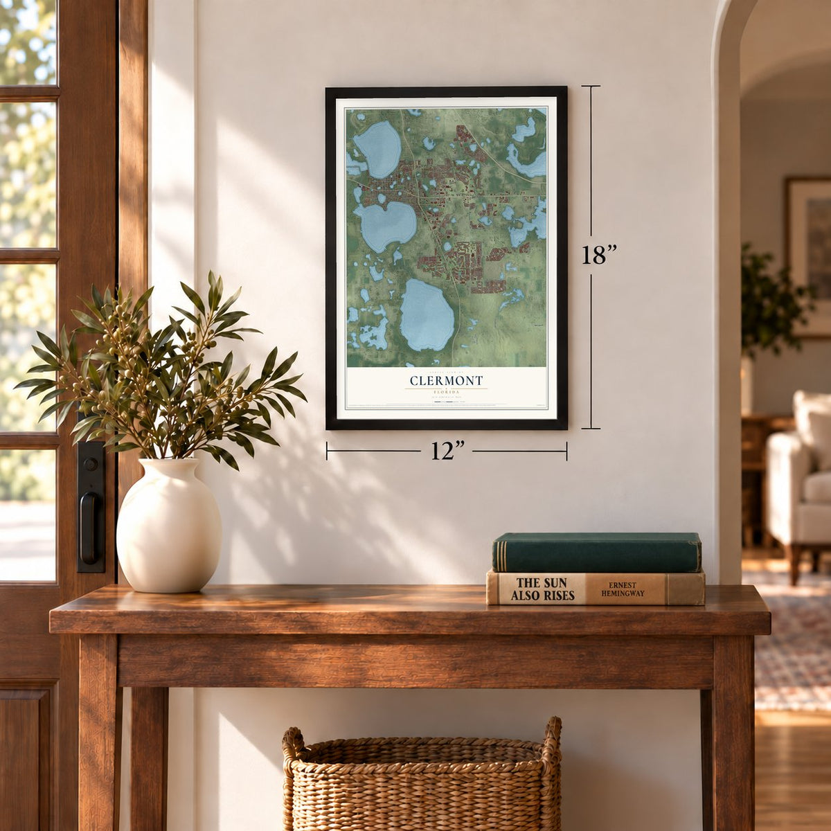
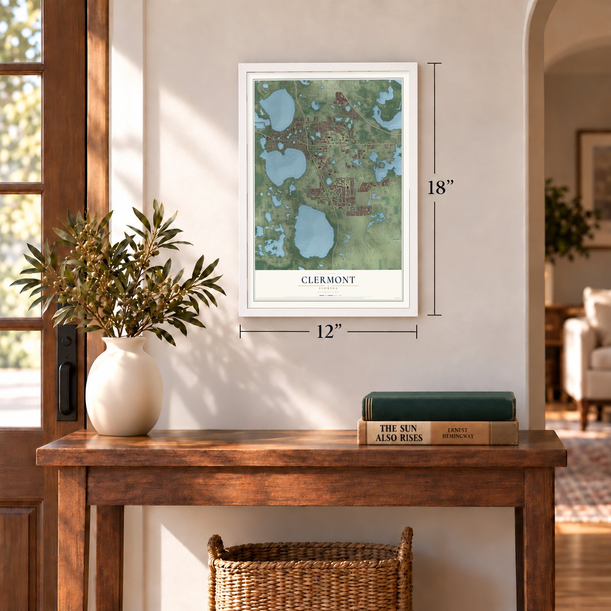
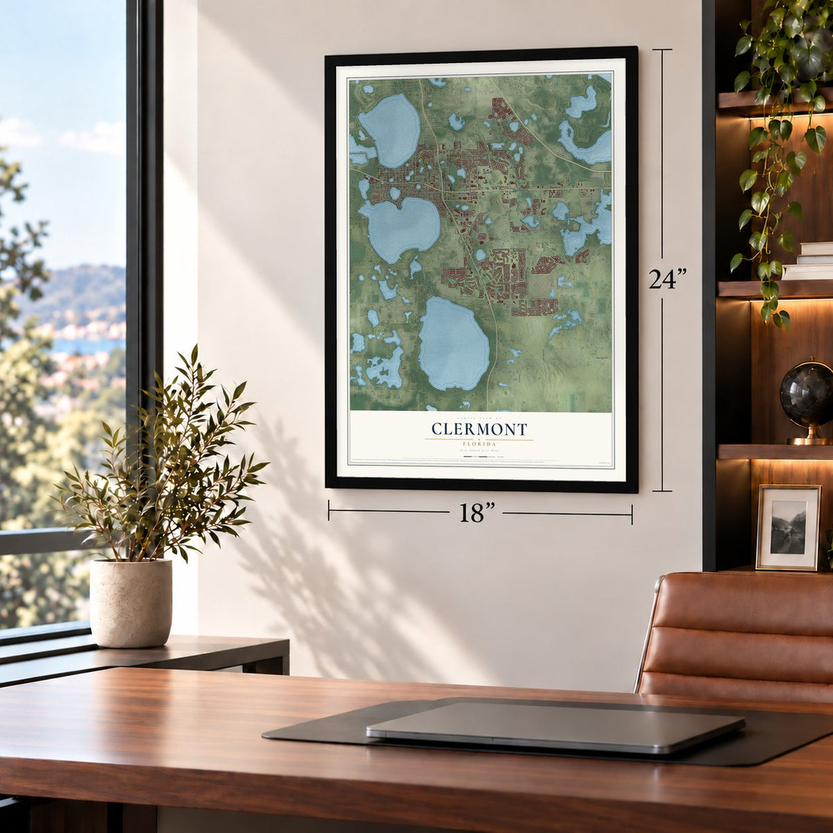
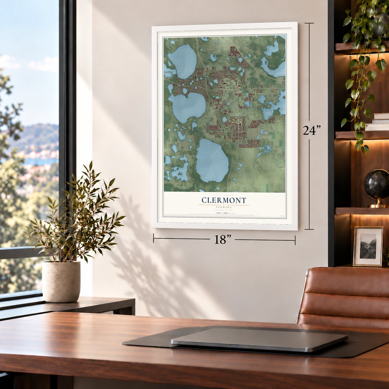
Free U.S. delivery 7 to 10 days after you order
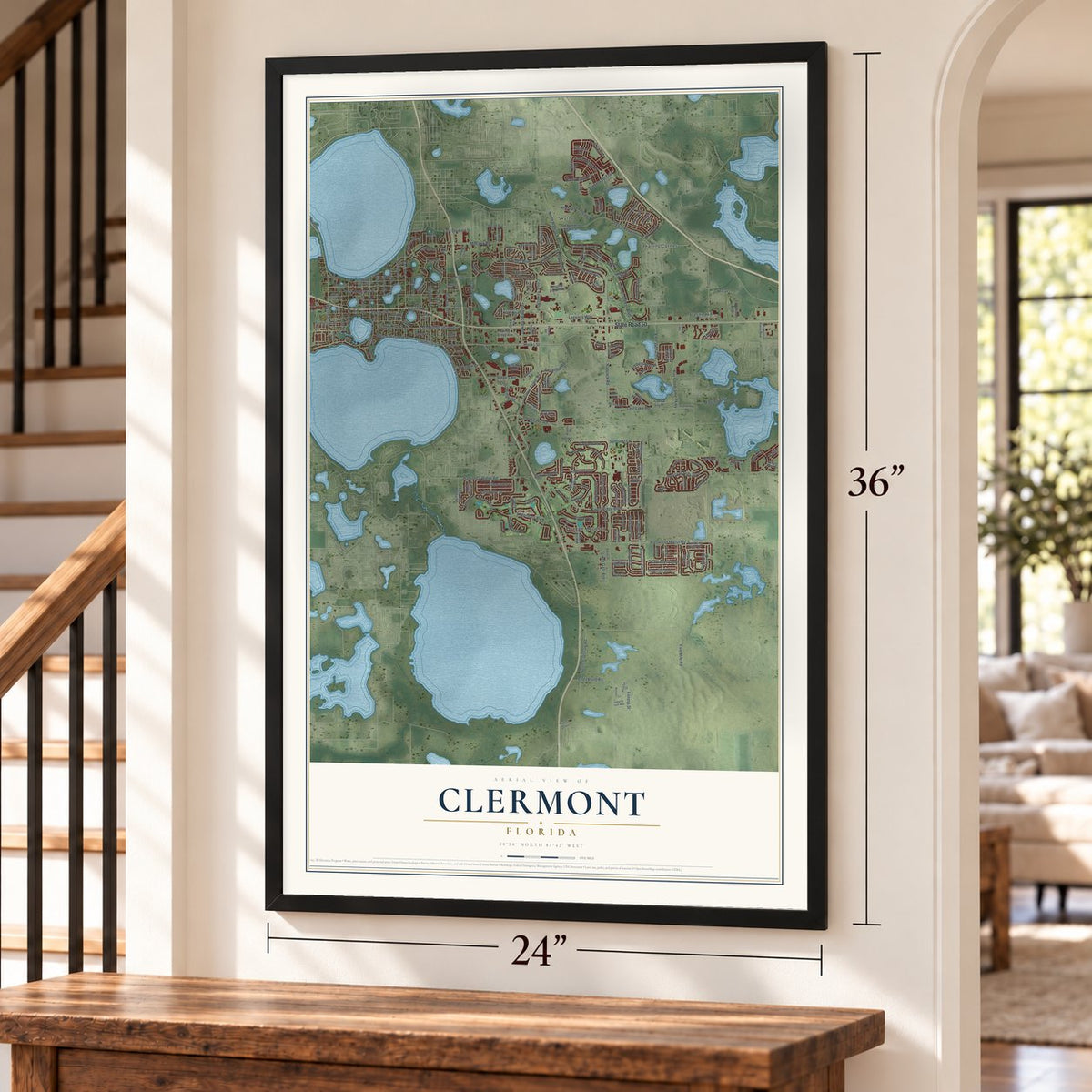
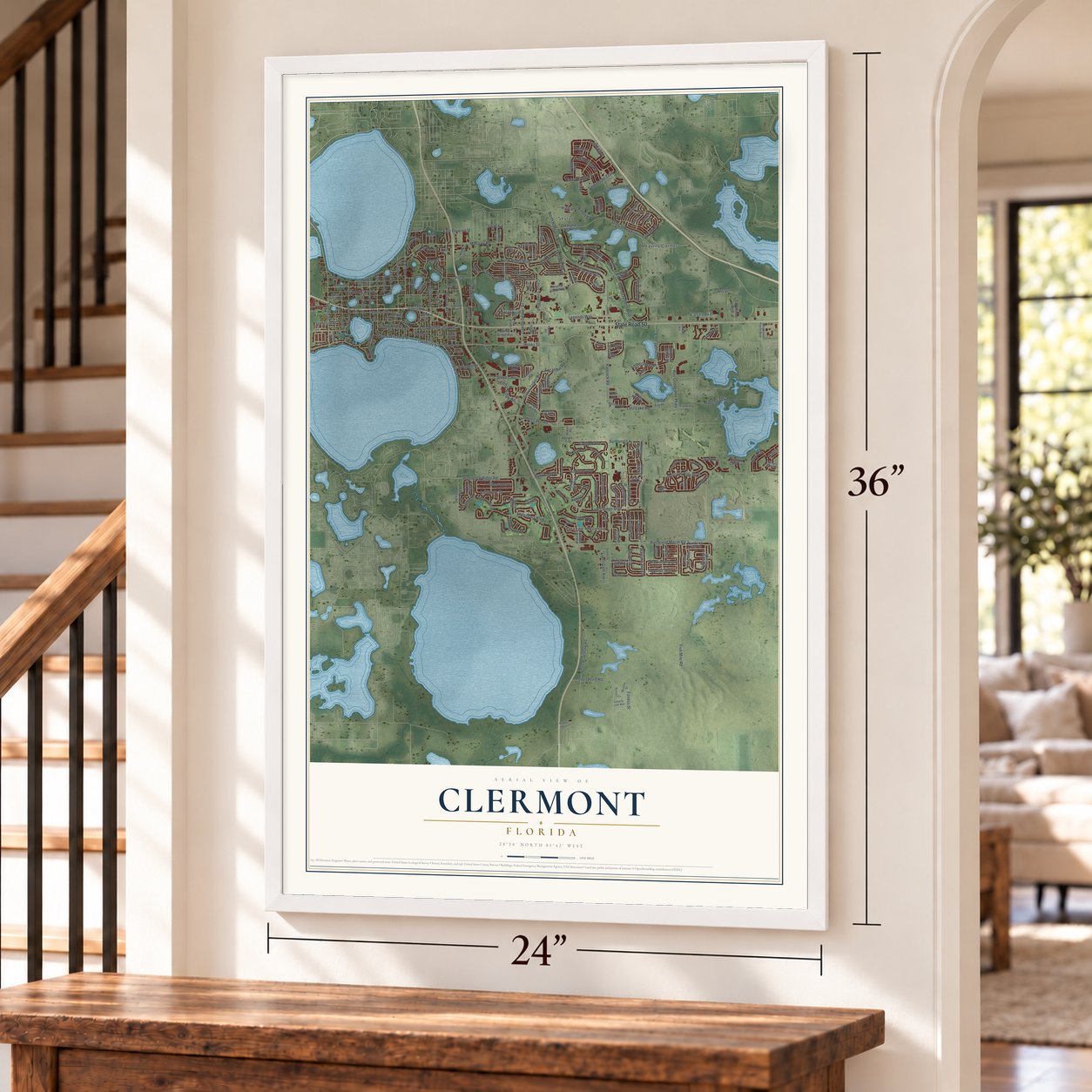
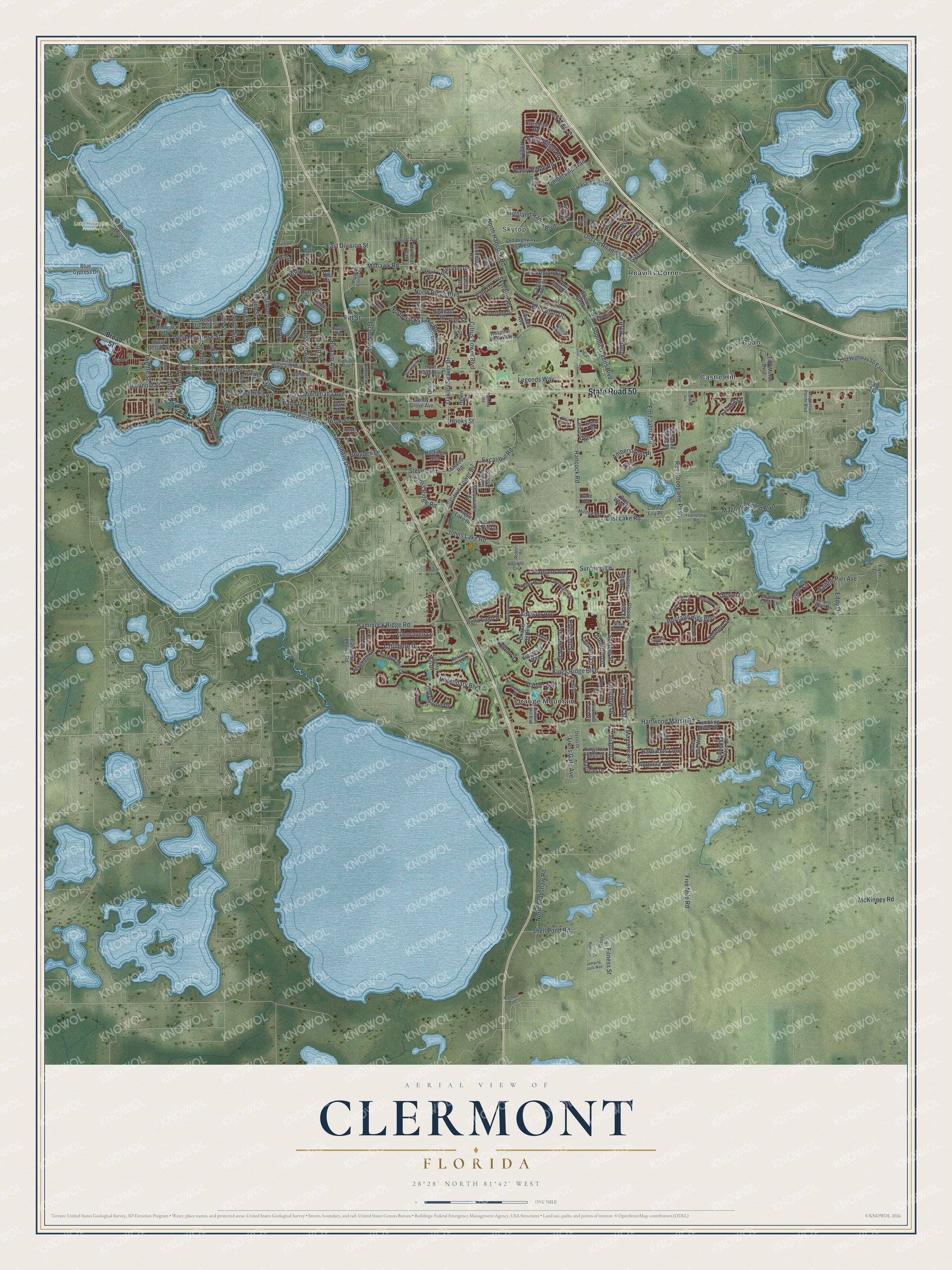
Clermont, Florida Map Art
A new map of Clermont, Florida, made in 2026 and printed to order on thick archival matte paper.
12" x 18" Archival Matte Print
A Map of Home. A Work of Art.
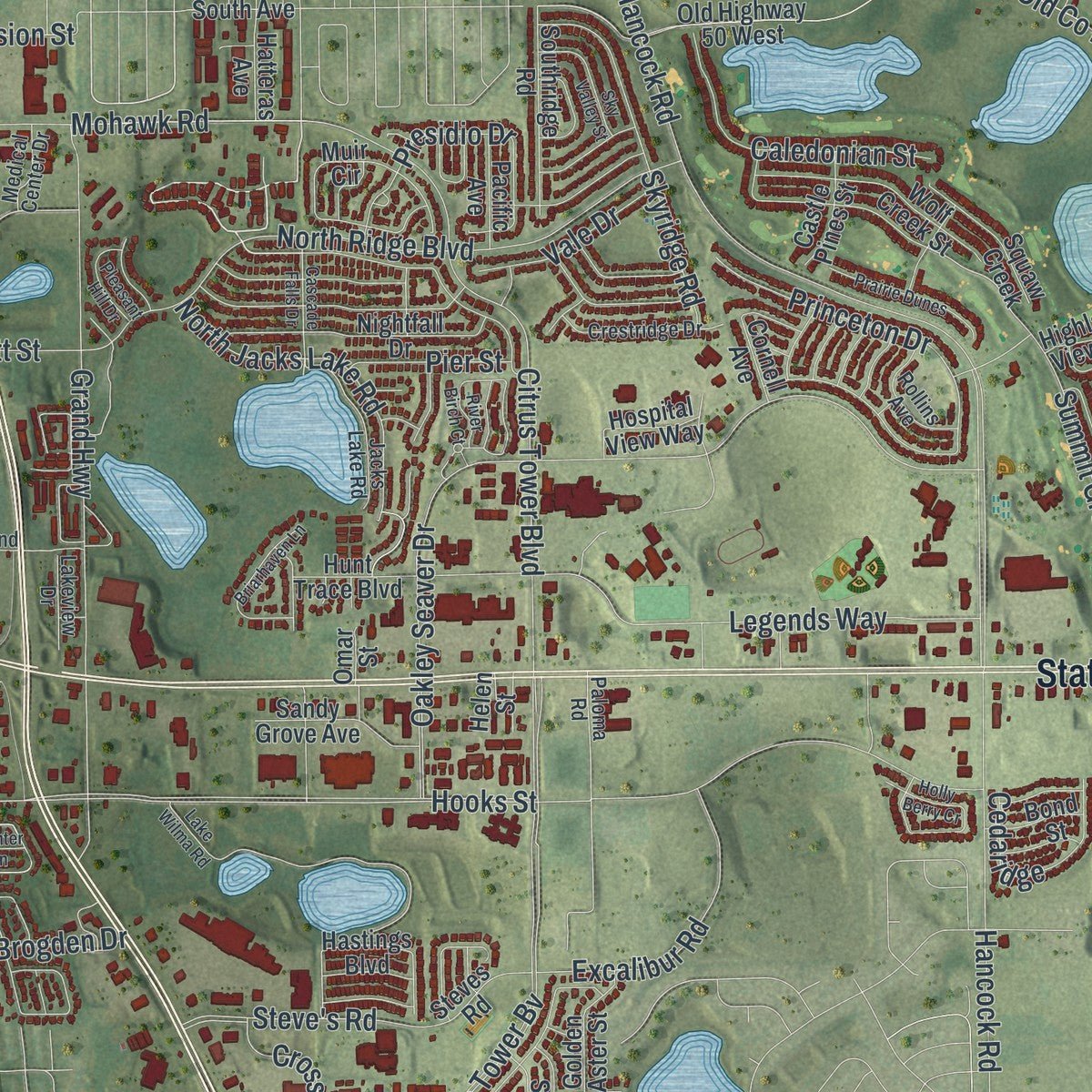
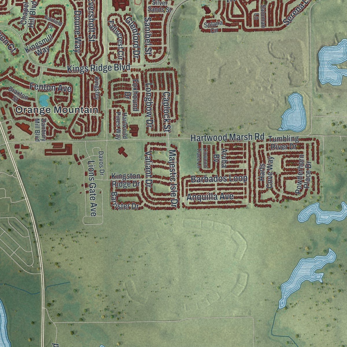
Explore Clermont, Florida from a whole new perspective. Created using aerial imagery and detailed geographic data, this map captures Clermont building by building, with labeled streets, familiar landmarks, and shaded topographical relief that highlights the natural contours of the landscape.
Combining modern data with the timeless character of a vintage atlas, this map is just as interesting up close as it is beautiful on the wall. Whether you grew up in Clermont, spent memorable years there, or call it home today, this unique map is a great way to celebrate a place that means something to you. Zoom in on the preview to look for your street, and then order a print to put your memories on the wall.
Three ways to hang it
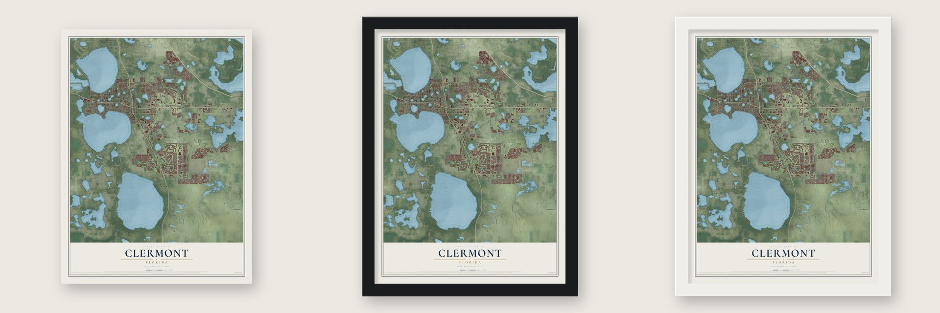
Unframed archival matte, a black wood frame or a white wood frame.
Up close
Geography Worth Displaying
This map was created using accurate cartographic data and authoritative geographic sources, including the U.S. Geological Survey (USGS) and FEMA. The map brings together terrain, waterways, roads, and building detail. The majority of the streets are labeled, houses are accurately depicted, and the topography is derived from government sources. Combining local data with carefully composed color and shading leads to this beautifully detailed Clermont artwork for your wall.
Rather than simply showing street outlines, we’ve included as many of the street names as we could reasonably fit on the map while keeping their names legible. Zoom in on the high resolution preview to see exactly what’s on the map. We truly set out to create a statement piece for anyone who loves Clermont. So whether it’s for you, or a gift for someone you love, we hope this map of Clermont brings back fond memories.
Explore the full map of Clermont, Florida and read about the local places it shows.

About Clermont, Florida
The 2020 census counted 43,021 people in Clermont, a community in Lake County.
- 43,021 peopleRecorded for Clermont in the 2020 census.
- Lake CountyClermont belongs to Lake County in Florida.
- 11.5 square milesClermont covers a total area of 11.5 square miles.
- Incorporated in 1891Clermont was incorporated in 1891.
Find your street
Names on the Clermont map
Every name below is printed on this map. Look for your street, your school, the park where you played, or the pond down the road.
Places and landmarks6
- Skytop
- Lake Hiawatha Preserve
- Castle Hill
- Orange Mountain
- Reavills Corner
- Roan
Streets and roads235
- State Road 50
- Johns Lake Road
- Lost Lake Road
- Emil Jahna Road
- Caplock Street
- East Minnehaha Avenue
- Fenton Avenue
- Citrus Tower Boulevard
- Hancock Road
- Hartwood Marsh Road
- North Hancock Road
- Hammock Ridge Road
- Hooks Street
- Grand Highway
- Five Mile Road
- Oakley Seaver Drive
- Citrus Tower Bv
- Old County Road 50
- Heritage Hills Boulevard
- Bloxam Avenue
- Summit Greens Boulevard
- West Lakeshore Drive
- Barbados Loop
- Twelfth Street
- Legendary Boulevard
- East Avenue
- Capland Avenue
- Kings Ridge Boulevard
- Lattimore Drive
- Chestnut Street
Show all 235 streets
- North Ridge Boulevard
- Shell Pond Road
- Princeton Drive
- Disston Avenue
- Serena Lane
- Longbow Drive
- Timbervale Trail
- Pitt Street
- Legends Way
- West Montrose Street
- McKinney Road
- North Bradshaw Road
- Hunt Street
- Eversholt Street
- Seminole Street
- North Jacks Lake Road
- Second Street
- Ray Goodgame Parkway
- Highland Ranch Boulevard
- Fifth Street
- Sanibel Street
- Majestic Isle Drive
- Giovani Bv
- Fourth Street
- Presidio Drive
- Skyridge Road
- Buoy Circle
- West Avenue
- Rob Roy Drive
- Mohawk Road
- Magnolia Island Boulevard
- Excalibur Road
- Caledonian Street
- Steve's Road
- Greystone Drive
- Kaley Ridge Road
- Valiant Drive
- Cross Ridge Road
- Addison Avenue
- Lakeshore Drive
- Hook Street
- Tenth Street
- Sadie Ridge Road
- Seventh Street
- Third Street
- Doune Way
- Lions Gate Avenue
- Glenraven Lane
- Ambersweet Place
- Drew Avenue
- Bella Lago Drive
- Eddy Drive
- Sunburst Lane
- East Division Street
- Sailing Pier Avenue
- Vale Drive
- Anquilla Avenue
- Cedaridge
- Fitness Street
- Laranja Street
- Scott Street
- Pier Street
- Brogden Drive
- Hidden Bluff
- Glenford Drive
- Quaint Lane
- Inca Avenue
- Palm Lane
- Avon Court
- Broad Street
- Lake Minneola Shores
- South Avenue
- Old Highway 50 West
- Zeek Ridge Street
- Tumbling River Drive
- West Minnehaha Avenue
- Eagle Lake Drive
- Minneola Drive
- West Desoto Street
- Lake Avenue
- West Osceola Street
- Fallscrest Circle
- Blackstill Lake Road
- Muir Circle
- Powderhorn Place Drive
- East Highland Avenue
- Foxhound Drive
- Liberty Hill Drive
- Highland View Circle
- Chapel Hill Boulevard
- Linden Street
- Brantley Circle
- Foxchase Drive
- La Jolla Drive
- Wolf Creek Street
- White Blossom Lane
- Nature Cove Lane
- Hunt Trace Boulevard
- Canna Lily Place
- Hastings Boulevard
- East Lake Louisa Road
- Old Highway 50 East
- Hilltop Road
- Kingston Ridge Drive
- Nautica Mile Drive
- Briar Run Drive
- Southridge Road
- East Lakeshore Drive
- Almond Street
- Shearwater Street
- Nightfall Drive
- Harts Cove Way
- Barrister Drive
- Sandy Grove Avenue
- Caxton Avenue
- Crest Wave Drive
- Columbus Avenue
- Steves Road
- Tiny Morse Bvld
- Derby Glen Drive
- Cornell Avenue
- Kingsmill Way
- Golden Aster Street
- Zeek Ridge Court
- Aruba Bv
- Hospital View Way
- Castle Pines Street
- Suwanee Banks Street
- Blue Cypress Drive
- Pacific Avenue
- Lake Boulevard
- Hatteras Avenue
- Glossy Leaf Lane
- Chavez Avenue
- Bond Street
- Autumn Ash Drive
- Clemblue Road
- Villa Court
- Shallow Cove Lane
- Flynn Court
- Settle Street
- North Street
- Trade Avenue
- Helen Street
- Omar Street
- Oak Drive
- Beacon Ridge Way
- Carroll Street
- Belland Circle
- Eighth Street
- Braxton Street
- Danbury Mill Boulevard
- Kingsley
- Chessington Street
- Solana Circle
- Aibonito Circle
- Paloma Road
- Kistler Circle
- Jacks Lake Road
- Crystal Lake Drive
- Crestridge Drive
- Sunset Lane
- Gliding Wave Street
- Blissful Street
- Magnolia Pointe Boulevard
- Davos Drive
- Hartwood Pines Way
- Rollins Avenue
- Saloman Lane
- Friendship Road
- Shady Nook Drive
- Highland Avenue
- Lakeview Drive
- Medical Center Drive
- Silver Sands Street
- Robles Road
- Linton Court
- Roane Road
- Division Street
- River Birch Court
- Linwood Trace Lane
- Rollingbrook Street
- Holly Berry Cr
- Lake Wilma Road
- Lakemist Lane
- Garden Belle Drive
- Prairie Dunes
- Briarhaven Lane
- Runners Circle
- Hickory Grove Street
- Cascade Falls Drive
- Sky Valley Street
- Winding Lake Drive
- Fairfield Drive
- Pleasant Hill Drive
- Rosewood Drive
- Olympus Boulevard
- Jumping Jack Way
- Granville Avenue
- Sixth Street
- Caspian Lane
- Ryan Street
- Center Lane
- Nina Lane
- Pine Street
Names are listed as they appear on the printed map. Zoom into the product photos to find them.
The art of mapping a place
How This Map Was Made
Real places. Remarkable detail. Discover the layers that turn geographic data into a map of home.

The view from above
Aerial imagery reveals the character of the land: woodland, open fields, and the patterns of a place.

The shape of the land
Elevation data brings hills, valleys, and subtle changes in the landscape into view.

The details of home
Roads, waterways, and building footprints come together to make the map feel unmistakably local.

Geography becomes art
Considered color, shading, and typography bring the layers together in a map made for your wall.


Process illustrated with Mendon, Massachusetts. Aerial imagery: USDA NAIP. Terrain: USGS 3D Elevation Program. Map details and finished artwork: KNOWOL.
The Details
About This Print
Choose an archival matte print, or a black or white Ayous wood frame. The archival matte print is unframed.
Select your size and finish above to see the matching product image and price.
Materials & Craftsmanship
A contemporary map with the character of a classic atlas, printed on archival matte paper. Optional frames are made from Ayous wood.
Your printed map does not include the watermark shown in the full-map preview.
Shipping & Delivery
Free shipping within the United States. Every print is made to order in the USA.
Buying a gift? Add a note in your cart and we'll include it. We never put prices in the package.
Prints ship within 2 to 3 business days. Allow 7 to 10 days total from ordering for delivery. Timing may vary during holidays or periods of high order volume.
Read our shipping policy.
Returns and damaged prints
Each print is made to order. Change-of-mind refunds are not available after production.
If your print arrives damaged, misprinted or incorrect, contact support@knowol.com within 30 days of receiving it. Include your order number, photos and a description of the issue.
Read our full refund and replacement policy. For questions about your order, email support@knowol.com.
Find your town
Looking for another city?
Find a map of home in our Florida collection, or any town in the country.
Nearby
Maps of towns near Clermont
Know someone from one of these towns? Their map makes a great gift.
 Minneola
, Florida
From $39.99See the map
 Oakland
, Florida
From $39.99See the map
 Montverde
, Florida
From $39.99See the map
More maps nearby: Ferndale, Tildenville, Winter Garden, Horizon West and Groveland.