
Search for another town




Free U.S. delivery 7 to 10 days after you order
Clinton, Mississippi Map Art
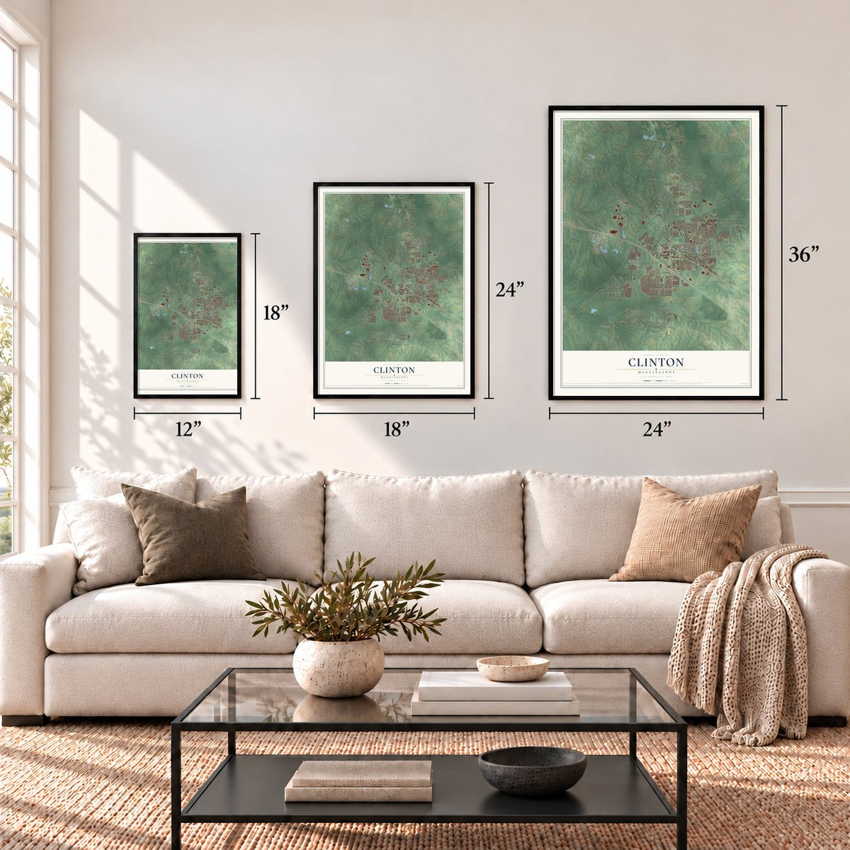
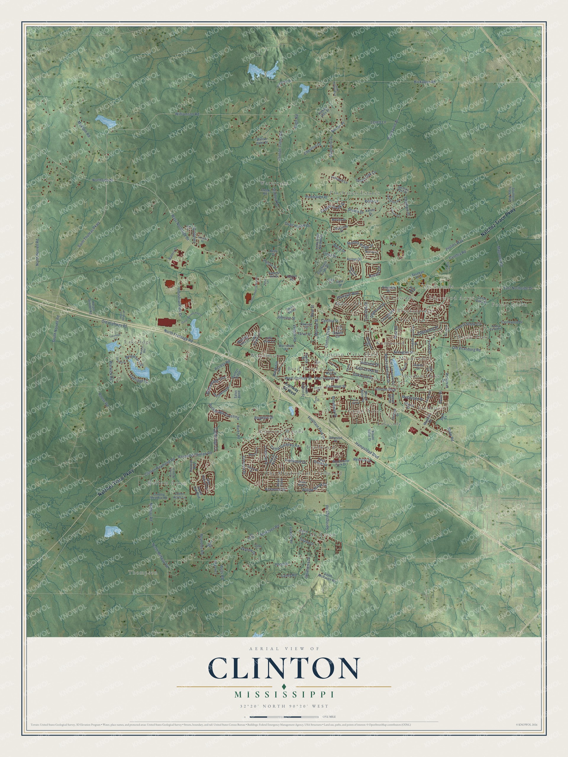
A new map of Clinton, Mississippi, made in 2026 and printed to order on thick archival matte paper.
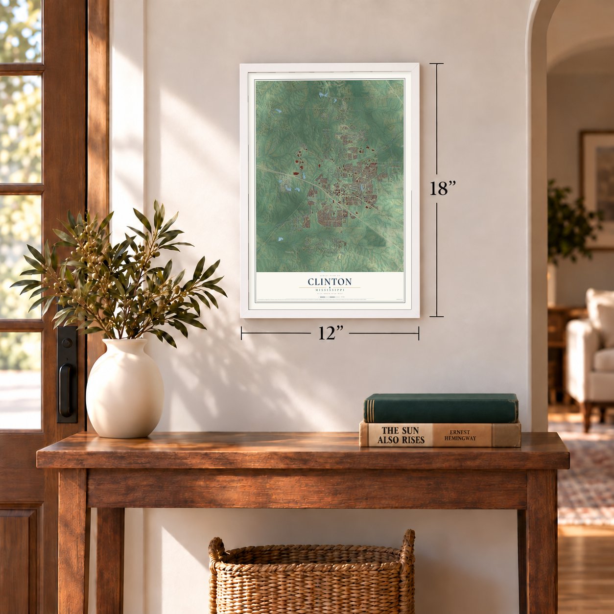
12" x 18" Archival Matte Print
A Map of Home. A Work of Art.
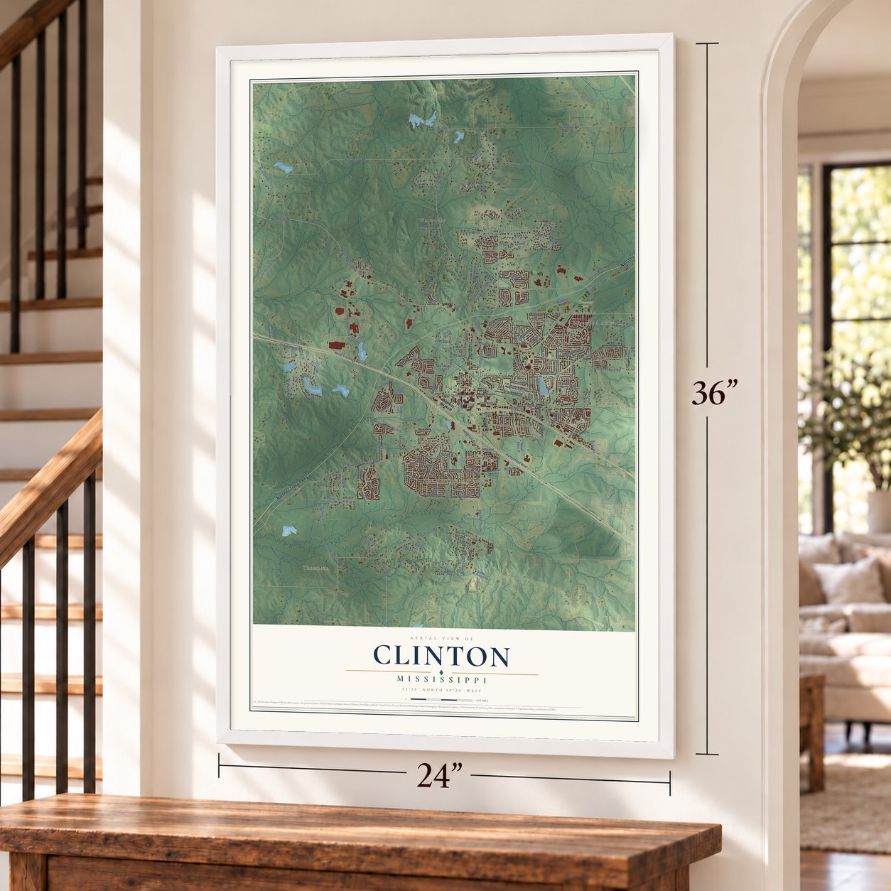
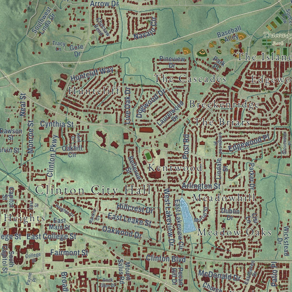
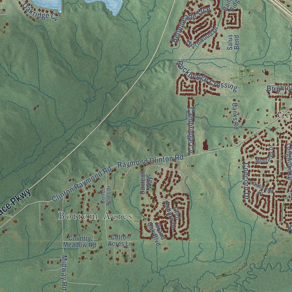
Explore Clinton, Mississippi from a whole new perspective. Created using aerial imagery and detailed geographic data, this map captures Clinton building by building, with labeled streets, familiar landmarks, and shaded topographical relief that highlights the natural contours of the landscape.
Combining modern data with the timeless character of a vintage atlas, this map is just as interesting up close as it is beautiful on the wall. Whether you grew up in Clinton, spent memorable years there, or call it home today, this unique map is a great way to celebrate a place that means something to you. Zoom in on the preview to look for your street, and then order a print to put your memories on the wall.
Three ways to hang it
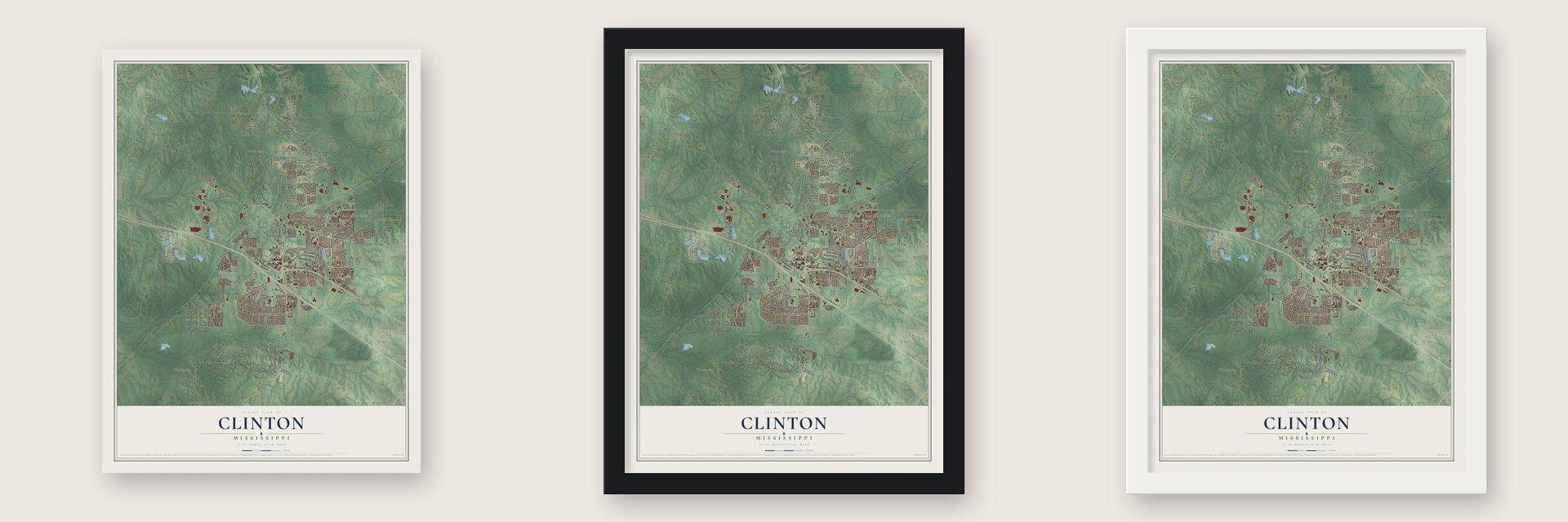
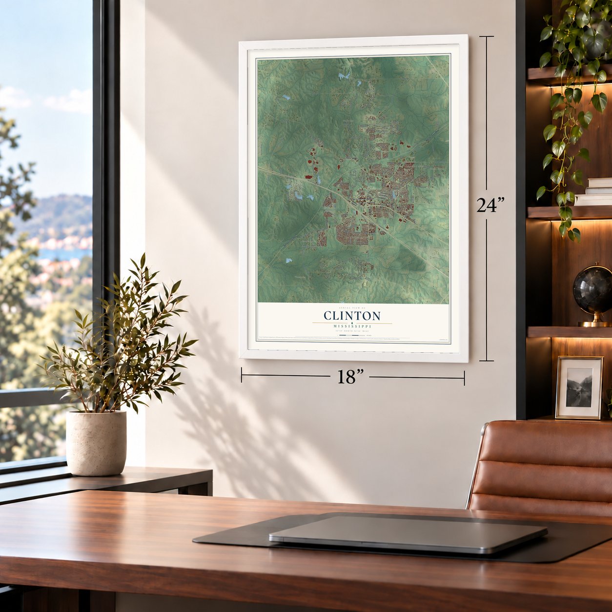
Unframed archival matte, a black wood frame or a white wood frame.
Up close
Geography Worth Displaying
This map was created using accurate cartographic data and authoritative geographic sources, including the U.S. Geological Survey and the Census Bureau. The map brings together terrain, waterways, roads, and building detail. The majority of the streets are labeled, houses are accurately depicted, and the topography is derived from government sources. Combining local data with carefully composed color and shading leads to this beautifully detailed Clinton artwork for your wall.
Rather than simply showing street outlines, we’ve included as many of the street names as we could reasonably fit on the map while keeping their names legible. Zoom in on the high resolution preview to see exactly what’s on the map. We truly set out to create a statement piece for anyone who loves Clinton. So whether it’s for you, or a gift for someone you love, we hope this map of Clinton brings back fond memories.
Read the story behind this map of Clinton, Mississippi from 2026.

About Clinton, Mississippi
Clinton is a city of 28,100 people in Hinds County, in the Jackson metropolitan area. Its first road was the Natchez Trace, improved from an old Native American path. The 1822 federal survey noted a spring called Swafford's Spring on the site. That same year the road east from Vicksburg reached the settlement, and the federal government placed the U.S. General Land Office there.
The town was founded in 1823 as Mount Salus, meaning "mountain of health." The name came from the plantation home that Walter Leake, Mississippi's third governor, built here in 1812. In 1828 the town renamed itself for DeWitt Clinton, the New York governor who led the completion of the Erie Canal. In 1831 the Clinton-Vicksburg Railroad, the state's second oldest, was incorporated. Cotton from three counties then came through town by rail to Grand Gulf on the Mississippi, and Clinton shipped 20,000 bales a year, more than any city between Vicksburg and Meridian.
- Mississippi's oldest collegeHampstead Academy opened here on January 24, 1826, the state's second men's college after Jefferson College. As Mississippi College, it became the nation's first coeducational college to grant a degree to a woman, and in 2026 it was renamed Mississippi Christian University. Central Female Institute, founded in 1853 and renamed Hillman College in 1891, later joined it. Sarah Ann Dickey opened Mount Hermon Female Seminary for Black students in 1875, and it closed in 1924.
- Grant passed through in 1863In May 1863, Confederate troops and then Union soldiers under Ulysses S. Grant and William Sherman briefly held Clinton on their way to Vicksburg. Grant wrongly believed that the Confederate general John C. Pemberton would strike him at Clinton. He went on to take Vicksburg in the same campaign.
- A deadly rally in 1875In September 1875, about 3,000 people gathered downtown for a Republican rally, hoping to hear Governor Adelbert Ames. White insurgents fired on Black residents, and more armed men came by train. Several white men and an estimated 50 Black people died that night or in the days after, including teachers, church leaders and Republican organizers. That fall, violence and voting fraud returned white Democrats to power in the legislature, and their 1876 win of the governor's office ended Reconstruction.
- 35 German generalsDuring World War II, Camp Clinton opened south of town to hold about 3,000 German prisoners, most of whom had served in the Afrika Korps. Only 40 German generals became prisoners during the war, and Camp Clinton held 35 of them. The prisoners also built a working scale model of the Mississippi's entire drainage basin, which the Army's Corps of Engineers then used to plan flood control.
- Home of WorldComFrom the mid-1990s until 2002, WorldCom kept its headquarters in Clinton, making it the smallest city ever to host a Fortune 500 company. The company went bankrupt after what was then the largest accounting scandal in U.S. history, and its CEO, Bernard Ebbers, and CFO, Scott Sullivan, were convicted of fraud. Renamed MCI, it moved its headquarters to Ashburn, Virginia, and Verizon's SkyTel still occupies the old compound.
Find your street
Names on the Clinton map
Every name below is printed on this map. Look for your street, your school, the park where you played, or the pond down the road.
Places and landmarks27
- Clinton City Hall
- Thompson
- Forest Green
- Edgewood Acres
- Traceway Park
- Bottom Acres
- Breckenridge
- Byrd Heights
- Cherry Park
- Country Woods
- Easthaven
- Green Acres
Show all 27 places
- Huntcliff
- Kentwood
- Lakeridge
- Lakeside
- McRaven
- Meadow Oaks
- Meadowhill
- Pinehaven Estates
- The Briars
- The Cascades
- The Islands
- The Meadows of Trailwood
- Trailwood
- Wateroaks
- Woodmoor
Streets and roads200
- Natchez Trace Parkway
- East Northside Drive
- Monroe Street
- Williamson Road
- West Northside Drive
- Northside Drive
- East Leake Street
- Kickapoo Road
- Saint Thomas Parkway
- Pinehaven Drive
- Old Highway 80
- Clinton Raymond Road
- Raymond Clinton Road
- Clinton-Tinnin Road
- North Frontage Road
- McRaven Road
- North Norrell Road
- Springridge Road
- Clinton Parkway
- Magnolia Road
- Old Vicksburg Road
- Cynthia Road
- Trailwood Drive
- Arrow Drive
- Industrial Park Drive
- Clinton Boulevard
- East College Street
- McAlpin Road
- Warwick Road
- Kirkwood Drive
Show all 200 streets
- Vernon Road
- Fountain Park Drive
- Midway Road
- West Lakeview Drive
- Cherry Stone Circle
- South Norrell Road
- Pinehaven Place
- Skyline Drive
- Concord Drive
- Huntcliff Way
- Hood Drive
- Hampstead Boulevard
- Post Road
- McDonald Drive
- Shaw Road
- Patton Drive
- Arlington Street
- Oakwood Drive
- Camp Garaywa Road
- Quail Hollow Drive
- North Midway Road
- Rockbridge Crossing
- Stafford Drive
- Chestnut Drive
- Navajo Circle
- Oakridge Cv
- Willow Brook Drive
- Neal Street
- Lovett Lane
- West College Street
- Fairmont Street
- Linda Drive
- Reynolds Road
- Chatham Place
- Blueberry Lane
- Tulane Drive
- Hunters Ridge Drive
- Patio Place
- Justins Way
- Dogwood Drive
- Copper Creek Drive
- Edgewood Place
- Rouse Road
- Keith Lane
- Berry Drive
- Green Oak Cv
- Cynthia Street
- Access Road
- Broadway Street
- Bellemeade Trce
- Cambridge Cv
- Laney Road
- Norton Place
- Johnson Street
- Oklahoma Drive
- Wells Road
- Live Oak Drive
- Reserve Drive
- Hillcrest Drive
- Larado Drive
- Brighton Drive
- Shadia Drive
- Pugh Road
- Highway 80 West
- Dunleith Way
- Grand Oak Boulevard
- Winding Hills Drive
- Mount Salus Drive
- Mount Salus Road
- Longwood Drive
- Lindale Street
- Parker Drive
- Southwest Linda Drive
- Castlewood Drive
- Laurelwood Drive
- Southern Trace Boulevard
- East Lakeview Circle
- Woodchase Park Drive
- Church Street
- Bellevue Street
- Johnston Place
- Lake Forest Lane
- Casa Grande Drive
- Linda Drive Northwest
- Battery Drive
- Baseball Alley
- South Capitol Street
- Thornwood Drive
- Merganser Trail
- South McRaven Road
- Jackson Road
- Harper Quarter Road
- Capitol Street
- Willow Oaks Drive
- Pecan Hill Drive
- Country Meadow Road
- Marion Drive
- Banks Road
- Hickory Hills Drive
- Creek Road
- Glen Auburn Drive
- East Main Street
- Salus Bend
- Oakhill Circle
- Maudedith Lane
- Kelvin Drive
- Wickstead Drive
- Warrenton Road
- Freeland Lane
- Baileys Ridge
- Tarvin Street
- Dawson Street
- Lake Ests
- Pineview Drive
- Royal Troon
- Cedar Oaks Drive
- Sumner Hill Drive
- Oakhurst Drive
- Sunrise Drive
- Masonic Drive
- School Road
- Cotton Acres Lane
- Dublin Drive
- Lofty Pine Lane
- Gore Drive
- Short Veron
- Gill Drive
- Joy's Cv
- Kelly Drive
- Park Place
- Lisi Lane
- Southern Oaks Drive
- Choctaw Bend
- Cotton Acres Drive
- Hobby Farms Road
- Shadow Wood Drive
- Monterey Drive
- Soccer Row
- Lake Hollow Boulevard
- Auburn Drive
- Murial Street
- Warrior Lane
- Charleston Avenue
- Knollwood Drive
- Easthaven Drive
- Leggett Road
- Cabernet Drive
- Tracy Lane
- Eva Lane
- Rosa Lane
- Clinton Business Park Drive
- Lakeridge Lane
- Pebble Brook Drive
- Clinton Industrial Park Road
- Mallard Way
- Gloucester Place
- Longwood Place
- East Street
- Lafayette Circle
- Heights Drive
- Glendale Street
- Farmer Drive
- Kent Drive
- Oakridge Drive
- Jessie Harper Drive
- College Street
- Rock Glen Drive
- Rankin Cv
- Payne Place
- Vale Circle
Names are listed as they appear on the printed map. Zoom into the product photos to find them.
The art of mapping a place
How This Map Was Made
Real places. Remarkable detail. Discover the layers that turn geographic data into a map of home.

The view from above
Aerial imagery reveals the character of the land: woodland, open fields, and the patterns of a place.

The shape of the land
Elevation data brings hills, valleys, and subtle changes in the landscape into view.

The details of home
Roads, waterways, and building footprints come together to make the map feel unmistakably local.

Geography becomes art
Considered color, shading, and typography bring the layers together in a map made for your wall.


Process illustrated with Mendon, Massachusetts. Aerial imagery: USDA NAIP. Terrain: USGS 3D Elevation Program. Map details and finished artwork: KNOWOL.
The Details
About This Print
Choose an archival matte print, or a black or white Ayous wood frame. The archival matte print is unframed.
Select your size and finish above to see the matching product image and price.
Materials & Craftsmanship
A contemporary map with the character of a classic atlas, printed on archival matte paper. Optional frames are made from Ayous wood.
Your printed map does not include the watermark shown in the full-map preview.
Shipping & Delivery
Free shipping within the United States. Every print is made to order in the USA.
Buying a gift? Add a note in your cart and we'll include it. We never put prices in the package.
Prints ship within 2 to 3 business days. Allow 7 to 10 days total from ordering for delivery. Timing may vary during holidays or periods of high order volume.
Read our shipping policy.
Returns and damaged prints
Each print is made to order. Change-of-mind refunds are not available after production.
If your print arrives damaged, misprinted or incorrect, contact support@knowol.com within 30 days of receiving it. Include your order number, photos and a description of the issue.
Read our full refund and replacement policy. For questions about your order, email support@knowol.com.
Find your town
Looking for another city?
Find a map of home in our Mississippi collection, or any town in the country.
Nearby
Maps of towns near Clinton
Know someone from one of these towns? Their map makes a great gift.
 Bolton
, Mississippi
From $39.99See the map
 Raymond
, Mississippi
From $39.99See the map
 Jackson
, Mississippi
From $39.99See the map
More maps nearby: Ridgeland, Byram, Flora, Richland and Madison.