
Search for another town





Free U.S. delivery 7 to 10 days after you order
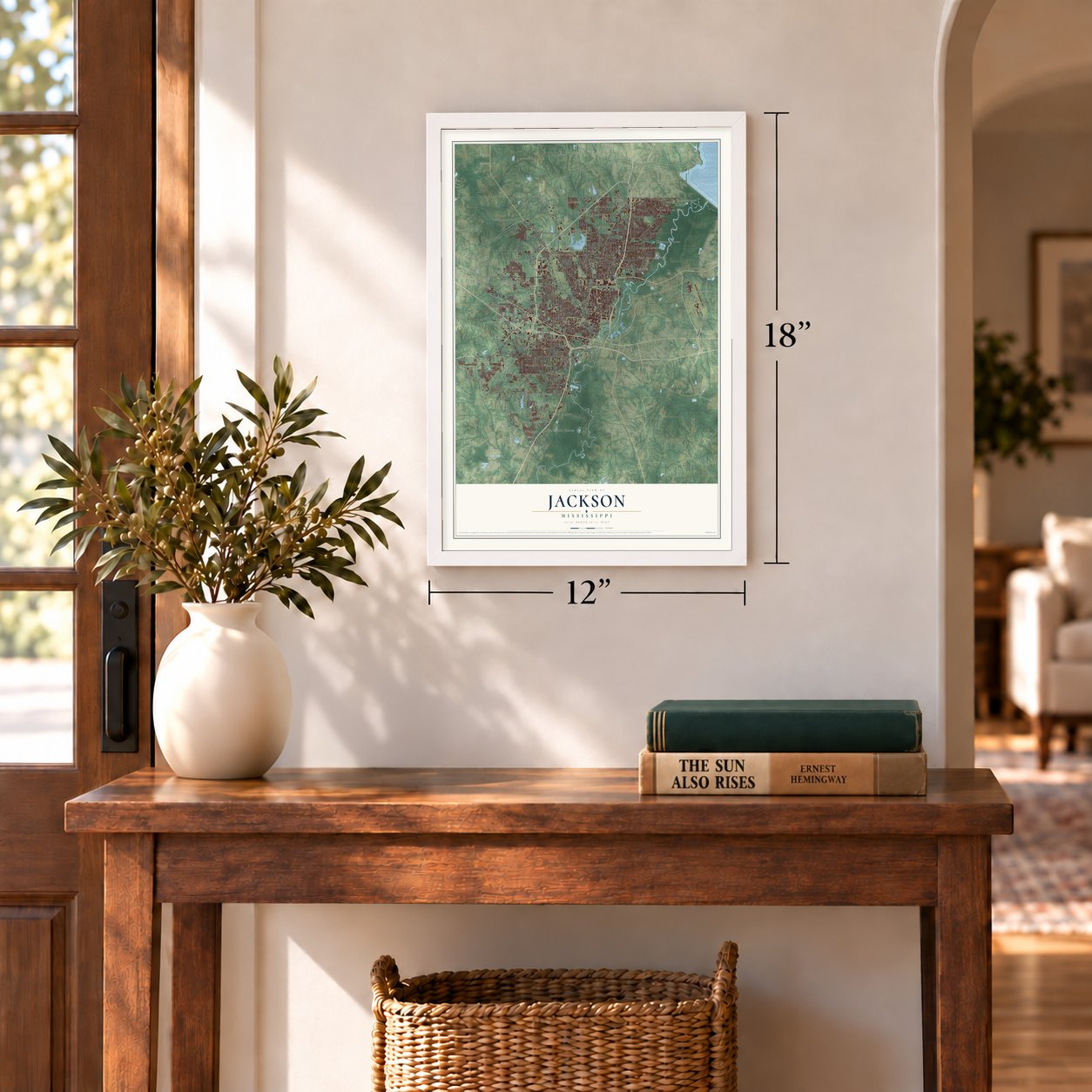
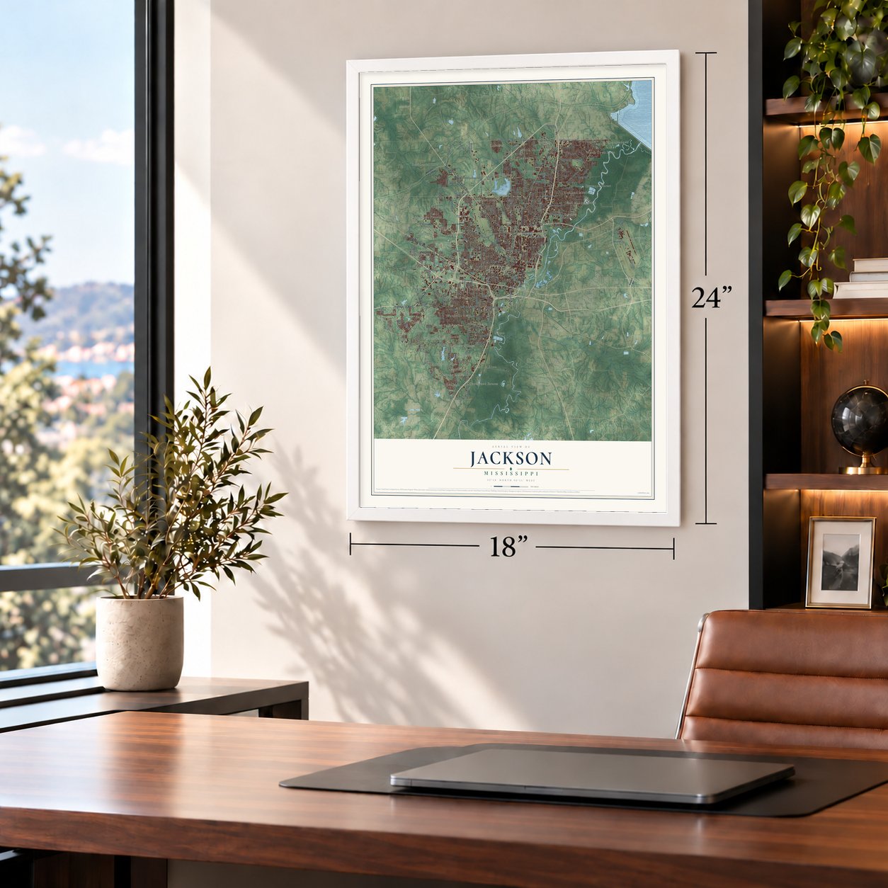
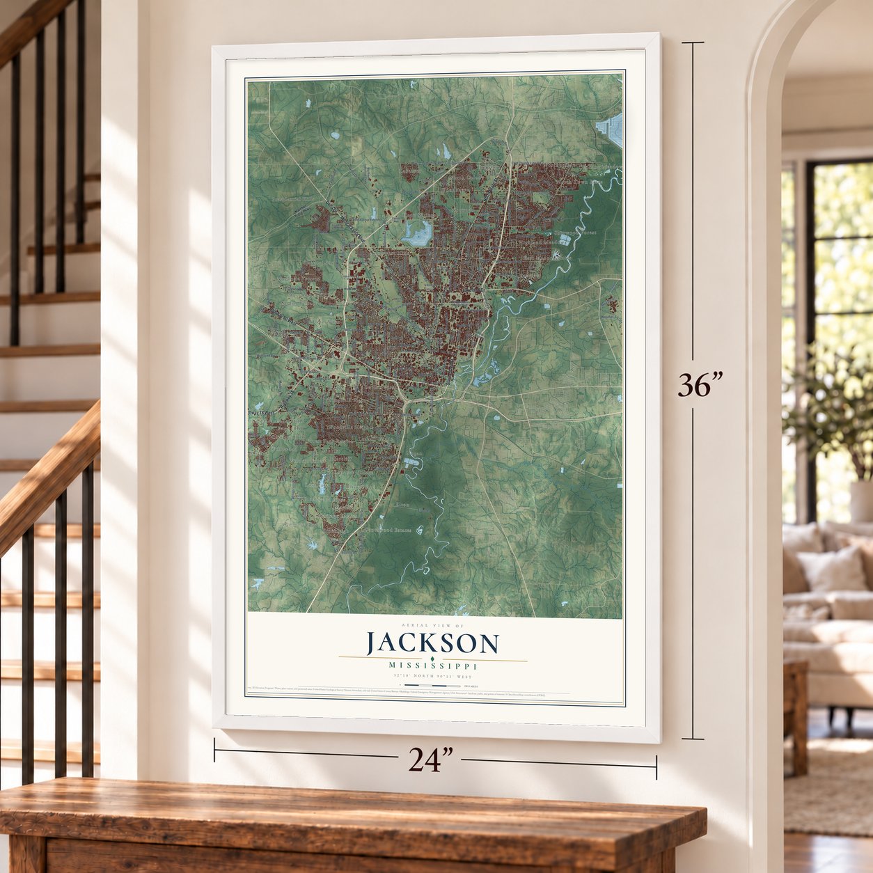
Jackson, Mississippi Map Art
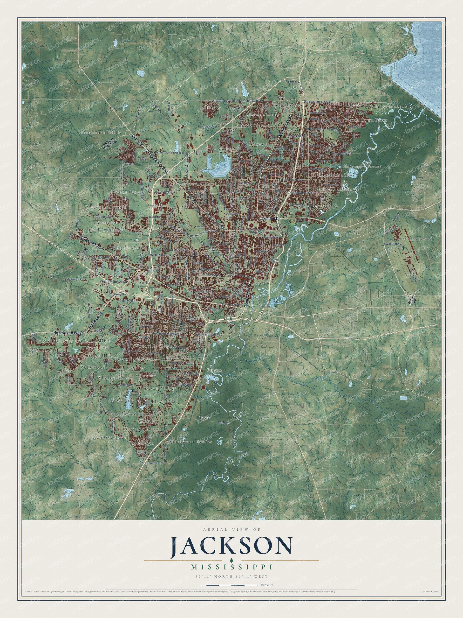
A new map of Jackson, Mississippi, made in 2026 and printed to order on thick archival matte paper.
12" x 18" Archival Matte Print
A Map of Home. A Work of Art.
Explore Jackson, Mississippi from a whole new perspective. Created using aerial imagery and detailed geographic data, this map captures Jackson building by building, with labeled streets, familiar landmarks, and shaded topographical relief that highlights the natural contours of the landscape.
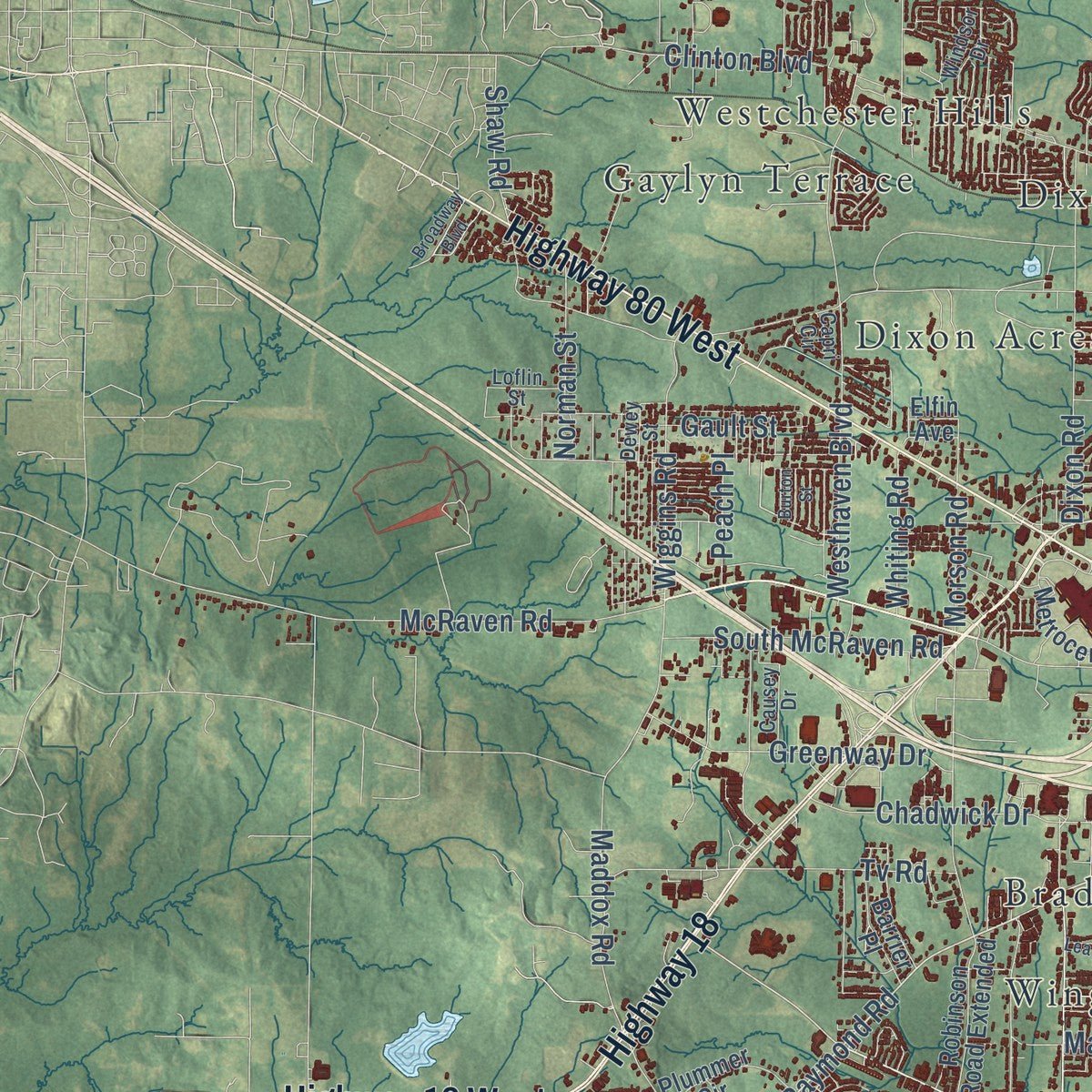
Combining modern data with the timeless character of a vintage atlas, this map is just as interesting up close as it is beautiful on the wall. Whether you grew up in Jackson, spent memorable years there, or call it home today, this unique map is a great way to celebrate a place that means something to you. Zoom in on the preview to look for your street, and then order a print to put your memories on the wall.
Three ways to hang it
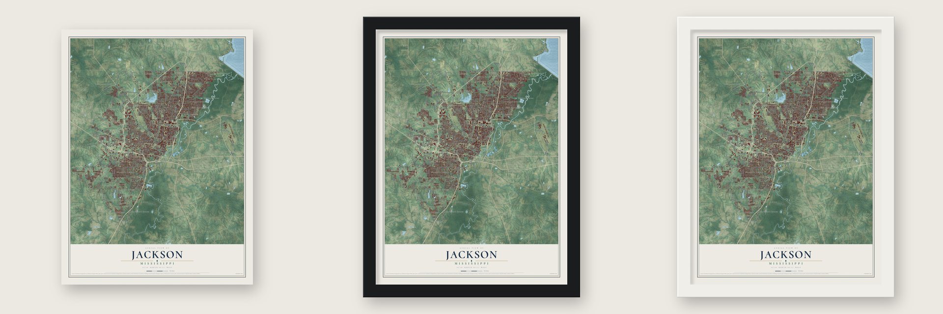
Unframed archival matte, a black wood frame or a white wood frame.
Up close
Geography Worth Displaying
This map was created using accurate cartographic data and authoritative geographic sources, including the U.S. Geological Survey and the Census Bureau. The map brings together terrain, waterways, roads, and building detail. The majority of the streets are labeled, houses are accurately depicted, and the topography is derived from government sources. Combining local data with carefully composed color and shading leads to this beautifully detailed Jackson artwork for your wall.
Rather than simply showing street outlines, we’ve included as many of the street names as we could reasonably fit on the map while keeping their names legible. Zoom in on the high resolution preview to see exactly what’s on the map. We truly set out to create a statement piece for anyone who loves Jackson. So whether it’s for you, or a gift for someone you love, we hope this map of Jackson brings back fond memories.
Read the story behind this map of Jackson, Mississippi from 2026.

About Jackson, Mississippi
Jackson is the capital of Mississippi and a city of 153,701 people in Hinds County, on the Pearl River. A Choctaw town called Chisha Foka once stood here, on the Natchez Trace. Louis LeFleur, a French-Canadian trader, later kept a trading post on the site, which came to be called LeFleur's Bluff, and the Treaty of Doak's Stand opened the land to settlers in 1820.
In 1821 the legislature, then meeting in Natchez, wanted a capital near the middle of the state. Thomas Hinds, James Patton and William Lattimore went looking, but the true center was a swamp, so they followed the Pearl River until they reached LeFleur's Bluff. Lawmakers approved the site on November 28, 1821, and named it for Andrew Jackson, the hero of New Orleans. Peter Aaron Van Dorn laid out the streets in April 1822, with city blocks trading places with parks the way Thomas Jefferson had urged, and the legislature first met here on December 23, 1822.
- Chimneyville in 1863Union troops won the first Battle of Jackson on May 14, 1863, and Sherman's men burned the city's factories and rail yards. Confederates came back to rescue Vicksburg, learned it had already surrendered on July 4, and fell back into Jackson for a siege of about a week. They slipped across the Pearl River on the night of July 16, and the Union army burned the town again, leaving only chimneys. Fortification Street follows the old Confederate line.
- The Old State CapitolWilliam Nichols designed the Greek Revival capitol, which opened in 1839. That year lawmakers passed the first state law in the country letting married women own and manage their own property, and on January 9, 1861, they voted Mississippi out of the Union in the same building. Theodore Link's New Capitol took over in 1903, and the old one became a history museum.
- Survivors of the fireNichols also designed the Mississippi Governor's Mansion, and Gov. Tilghman Tucker moved in first, in 1842. Sherman used it as his headquarters, and it outlasted the burning. City Hall, which cost less than $8,000 when it went up in 1846, came through as well, probably because the army used it as a hospital.
- Eudora Welty's BelhavenBorn in 1909, Eudora Welty lived most of her life in Jackson's Belhaven neighborhood and died there in 2001. She won the Pulitzer Prize in 1973 for The Optimist's Daughter and pictured the young city in her memoir One Writer's Beginnings. The city's main library carries her name, and her home is a National Historic Landmark.
- The first heart transplantJackson became home to the University of Mississippi Medical Center in 1955. Within ten years the surgeon James D. Hardy and his team made it famous around the world, performing the first lung transplant in 1963 and the first heart transplant in 1964.
Find your street
Names on the Jackson map
Every name below is printed on this map. Look for your street, your school, the park where you played, or the pond down the road.
Places and landmarks50
- Jackson City Hall
- Bradie
- Briarcliff
- Brookhollow Place
- Brookleigh
- Brookwood Pines
- Carriage Hills
- Cedar Hills
- Choctaw Village
- Dixon
- Dixon Acres
- East Manor Estates
Show all 50 places
- Eastover
- Elton
- Elton Place
- Forest Hill
- Forest Park Estates
- Garden Park
- Gaylyn Terrace
- Heritage Estates
- Highland Meadows
- Hope Springs
- Lakeover
- Leavell woods
- Lost Lake
- Magnolia Terrace
- Mayfair
- Nogan
- North Colony
- North Town Plaza
- Northpointe
- Northwest Hills
- Norwood
- Oak Creek
- Presidential Hills
- Queens Lane
- Raintree Place
- Rolling Meadows
- Sherwood Forest
- Siwel
- Southwood Estates
- Summerwood
- Sunkist
- Tougaloo
- Westchester Hills
- Willowood
- Windsor Forest
- Wingfield Place
- Woodhaven
- Woodville Heights
Streets and roads296
- North State Street
- Highway 18
- Medgar Evers Boulevard
- Highway 80 West
- Highway 18 West
- Lakeland Drive
- South State Street
- Delta Drive
- Raymond Road
- West County Line Road
- Old Canton Road
- County Line Road
- West Capitol Street
- West McDowell Road
- Watkins Drive
- North West Street
- Meadowbrook Road
- Hanging Moss Road
- Bailey Avenue
- Robinson Street
- Airport Road
- West Woodrow Wilson Avenue
- South Gallatin Street
- East County Line Road
- South West Street
- East McDowell Road
- Bullard Street
- Old Byram Road
- Pleasant Avenue
- Terry Road
Show all 296 streets
- East Northside Drive
- Ridgewood Road
- Beasley Road
- McCluer Road
- Livingston Road
- Eastover Drive
- Clinton Boulevard
- South Drive
- Country Club Drive
- Cynthia Road
- Elton Road
- Ellis Avenue
- Maddox Road
- North Mill Street
- Boling Street
- Hilda Drive
- McRaven Road
- Westhaven Boulevard
- Valley Street
- Rainey Road
- West Fortification Street
- Briarwood Drive
- Shaw Road
- Colonial Circle
- Plantation Boulevard
- North Lamar Street
- Dixon Road
- Manhattan Road
- Siwell Road
- High Street
- Riverside Drive
- Tv Road
- Westbrook Road
- Belvedere Drive
- Meadow Lane
- Greenway Drive
- Kirkley Drive
- South McRaven Road
- Maria Drive
- Northview Drive
- Henderson Road
- Wiggins Road
- Sheffield Drive
- Military Drive
- College Hill Drive
- Abraham Lincoln Drive
- Suncrest Drive
- Kings Highway
- Chadwick Drive
- Claiborne Avenue
- Bounds Road
- Archer Avenue
- Eminence Row
- Ford Avenue
- Greenwood Avenue
- Azalea Drive
- Skyline Drive
- Weather Svc Road
- North Street
- Methodist Farm Road
- Village Drive
- McCain Avenue
- Wayneland Drive
- Keele Street
- Poplar Boulevard
- Jayne Avenue
- Norman Street
- Culley Drive
- First Avenue
- Morson Road
- Utica Street
- Gault Street
- Hill Avenue
- Adkins Boulevard
- Mason Boulevard
- Winter Street
- Whiting Road
- Peach Place
- Sewanee Drive
- Baxter Drive
- Gibralter Drive
- Laurel Street
- El Paso Street
- Cox Street
- Erie Street
- Lelia Drive
- Main Street
- Natchez Trace Parkway
- West Amite Street
- East Amite Street
- East Woodrow Wilson Avenue
- North Farish Street
- North Flag Chapel Road
- Forest Avenue
- Woody Drive
- Highland Drive
- Robinson Road Extended
- Forest Avenue Extended
- Northwest Industrial Parkway
- Michael Avalon Street
- Central Street
- Sedgwick Drive
- Brookwood Place
- Metrocenter
- Edwards Avenue
- Sunset Drive
- Bienville Drive
- Dalton Street
- Floral Drive
- California Avenue
- South Roach Street
- Richmond Grove Road
- Robinhood Road
- Cedars of Lebanon Road
- Deer Park Street
- Woodfield Drive
- Sykes Road
- Alta Woods Boulevard
- Castle Hill Drive
- Reddoch Drive
- Monroe Street
- Crane Boulevard
- Wood Street
- Myer Avenue
- Duranville Street
- West Highland Drive
- Fredrica Avenue
- Outer Circle
- Echelon Parkway
- Hawthorne Drive
- Mobile Avenue
- Sheppard Road
- Vine Street
- Plummer Circle
- Stillwood Drive
- Angle Drive
- Barrier Place
- Western Hills Drive
- Bishop Avenue
- Gunda Street
- Dona Avenue
- Lee Street
- Dogwood Trail
- Barnett Drive
- Saratoga Drive
- Woodburn Street
- Pecan Boulevard
- Larson Street
- Peter Quinn Drive
- Welota Drive
- Coronet Place
- Liberty Hill Road
- Presto Lane
- Oak Creek Drive
- Royal Oak Drive
- Burch Street
- Fairfield Drive
- Buckley Drive
- Linde Road
- Flowood Drive
- Primos Avenue
- Trace Drive
- Beatty Street
- West Hill Drive
- Hazel Street
- Brook Drive
- Oxford Avenue
- Old River Place
- Linda Lane
- Lake Road
- Elfin Avenue
- Access Road
- Industrial Drive
- North Congress Street
- Dewey Street
- Mayes Street West
- Riverwood Drive
- Gaites Lane
- Lindsey Drive
- Southwood Road
- Forest Park Drive
- Briarfield Road
- Brecon Drive
- Houston Avenue
- Saint Ann Street
- Witsell Road
- Lakeover Road
- Northtown Drive
- Rondo Street
- South Siwell Road
- Hattiesburg Street
- Newport Street
- Lavernet Road
- Daniel Lake Boulevard
- Stonewall Street
- Livingston Lane
- Lee Drive
- Monaco Street
- Prosperity Street
- Valencia Street
- West Santa Clair Street
- Loflin Street
- Dees Road
- Windsor Drive
- Tanner Hill Drive
- Rosslyn Avenue
- Huntview Drive
- Sayles & Dixon Road
- Thousand Oaks Drive
- Tara Road
- Capri Circle
- Hooker Street
- Velma Drive
- Causey Drive
- Grove Circle
- East Bell Street
- Sunny Lane Drive
- Harley Street
- Eagle Avenue
- Troy Avenue
- River Road
- Rita Drive
- Key Street
- Greymont Avenue
- Forest Hill Road
- North Siwell Road
- Lakeshore Road
- Saint Andrews Drive
- Kristen Drive
- Cedarhurst Drive
- Swan Lake Drive
- Palmyra Street
- Albermarle Road
- West Monument Street
- Dogwood Drive
- Branch Street
- McWillie Circle
- Lea Circle
- Wild Valley Drive
- Enochs Street
- Waterford Drive
- Shirley Avenue
- Randall Street
- Valley North Boulevard
- McWillie Drive
- Broadway Boulevard
- Casteel Drive
- Romany Drive
- Oferrell Avenue
- Lynwood Drive
- Cedar Lane
- Elraine Boulevard
- Orleans Street
- Wood Dale Drive
- Warrior Trail
- Camero Drive
- Daniels Street
- Claude Drive
- Market Street
- Red Oak Drive
- Bristol Boulevard
- Burton Street
- Mattox Street
- Taylor Avenue
- Rand Street
- Eddy Street
Names are listed as they appear on the printed map. Zoom into the product photos to find them.
The art of mapping a place
How This Map Was Made
Real places. Remarkable detail. Discover the layers that turn geographic data into a map of home.

The view from above
Aerial imagery reveals the character of the land: woodland, open fields, and the patterns of a place.

The shape of the land
Elevation data brings hills, valleys, and subtle changes in the landscape into view.

The details of home
Roads, waterways, and building footprints come together to make the map feel unmistakably local.

Geography becomes art
Considered color, shading, and typography bring the layers together in a map made for your wall.


Process illustrated with Mendon, Massachusetts. Aerial imagery: USDA NAIP. Terrain: USGS 3D Elevation Program. Map details and finished artwork: KNOWOL.
The Details
About This Print
Choose an archival matte print, or a black or white Ayous wood frame. The archival matte print is unframed.
Select your size and finish above to see the matching product image and price.
Materials & Craftsmanship
A contemporary map with the character of a classic atlas, printed on archival matte paper. Optional frames are made from Ayous wood.
Your printed map does not include the watermark shown in the full-map preview.
Shipping & Delivery
Free shipping within the United States. Every print is made to order in the USA.
Buying a gift? Add a note in your cart and we'll include it. We never put prices in the package.
Prints ship within 2 to 3 business days. Allow 7 to 10 days total from ordering for delivery. Timing may vary during holidays or periods of high order volume.
Read our shipping policy.
Returns and damaged prints
Each print is made to order. Change-of-mind refunds are not available after production.
If your print arrives damaged, misprinted or incorrect, contact support@knowol.com within 30 days of receiving it. Include your order number, photos and a description of the issue.
Read our full refund and replacement policy. For questions about your order, email support@knowol.com.
Find your town
Looking for another city?
Find a map of home in our Mississippi collection, or any town in the country.
Nearby
Maps of towns near Jackson
Know someone from one of these towns? Their map makes a great gift.
 Richland
, Mississippi
From $39.99See the map
 Pearl
Pearl, Mississippi
From $39.99See the map
 Clinton
, Mississippi
From $39.99See the map
More maps nearby: Ridgeland, Flowood, Byram, Cleary and Madison.