
Search for another town


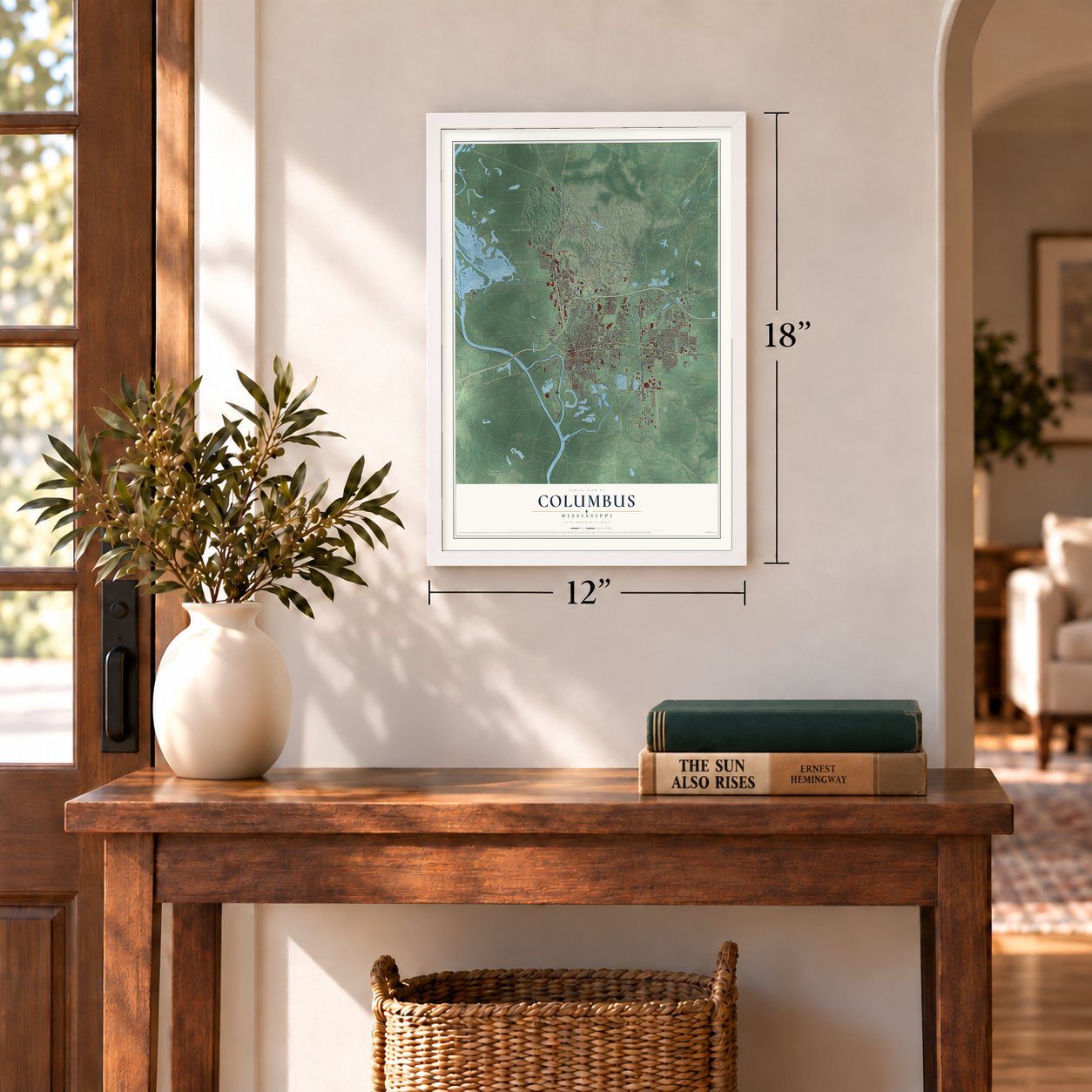

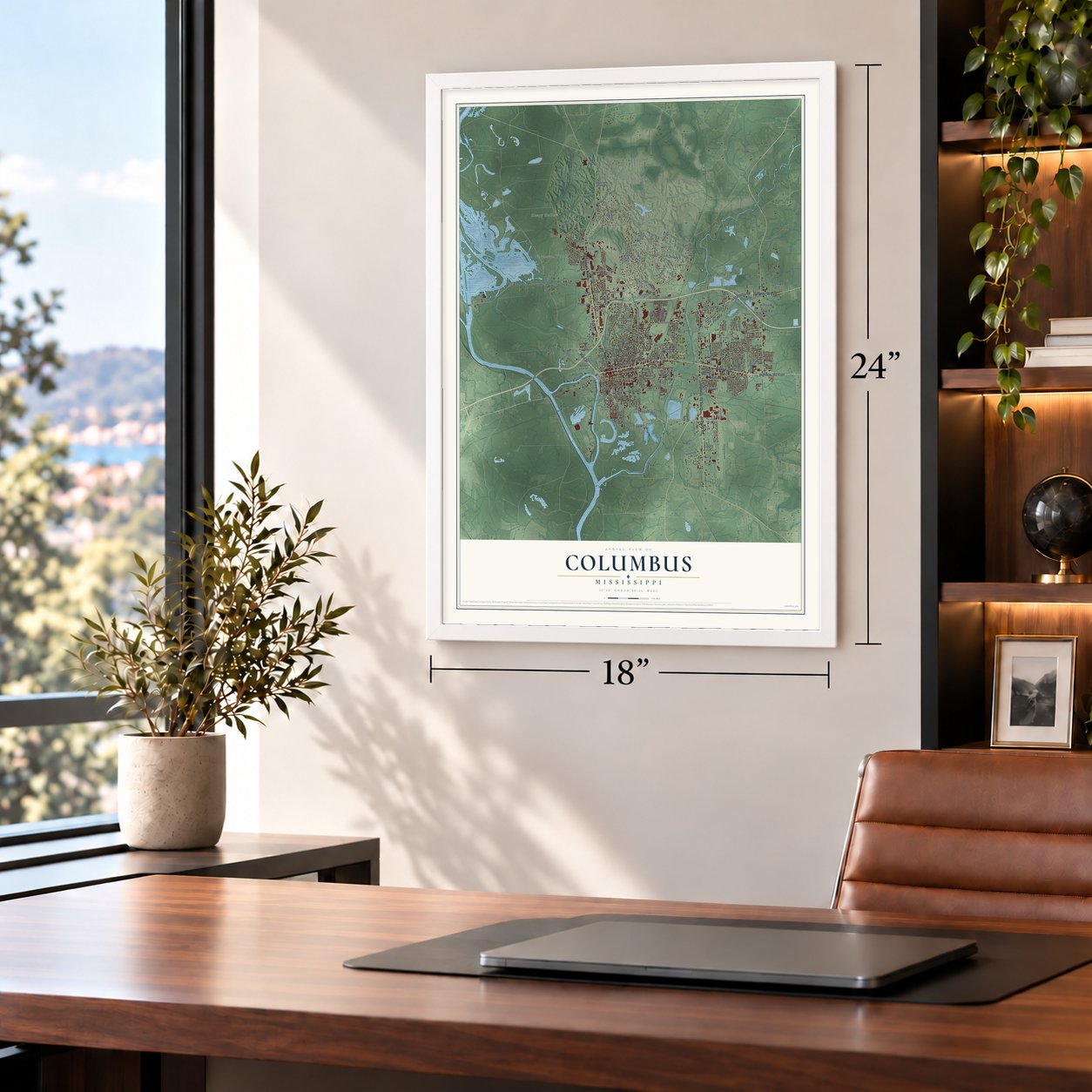

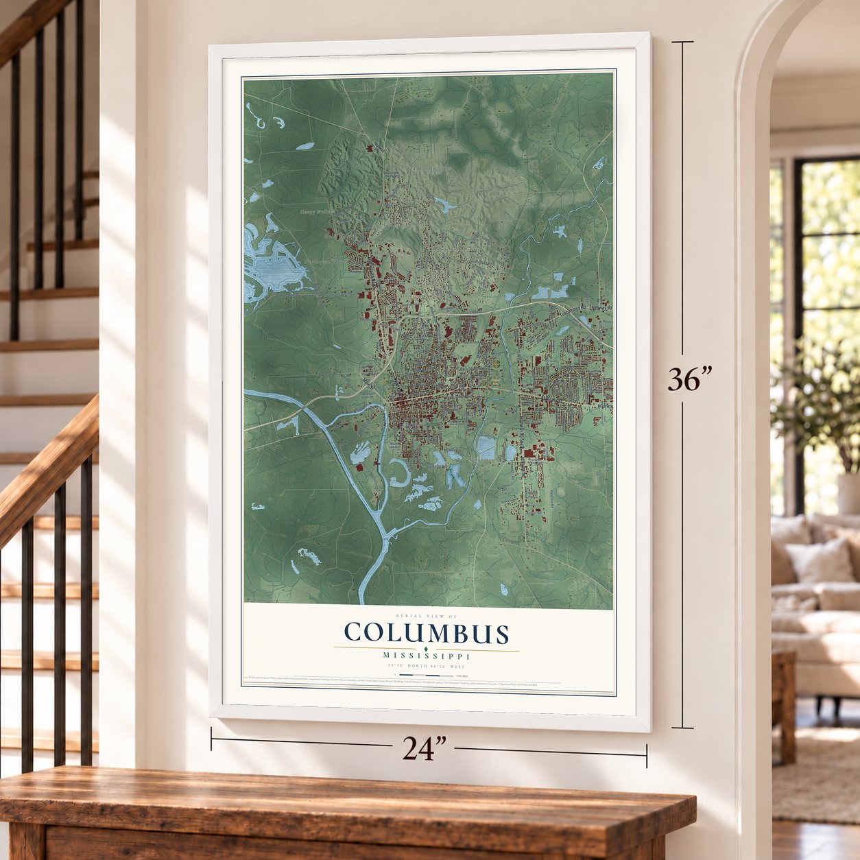
Free U.S. delivery 7 to 10 days after you order
Columbus, Mississippi Map Art
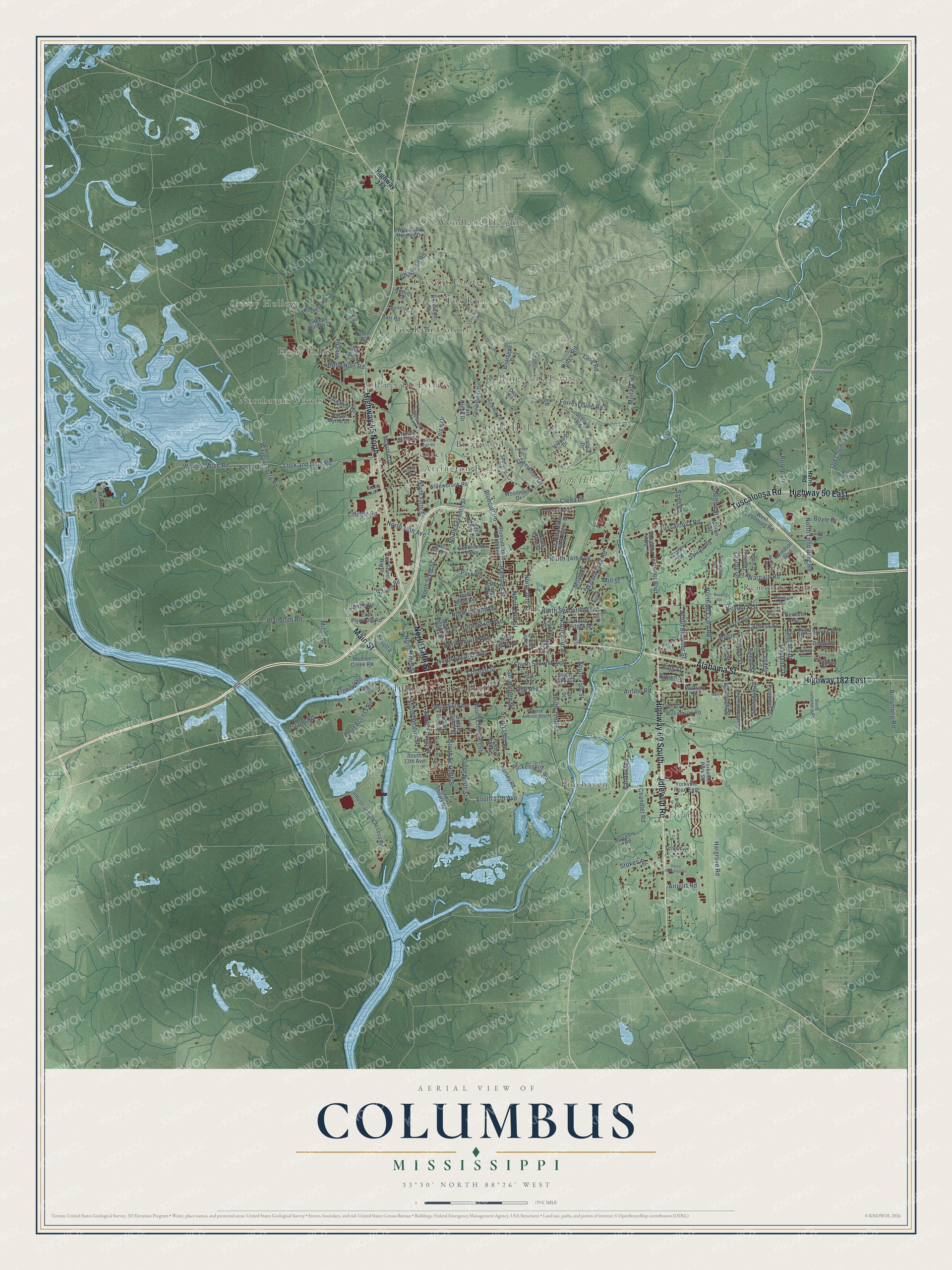
A new map of Columbus, Mississippi, made in 2026 and printed to order on thick archival matte paper.
12" x 18" Archival Matte Print
A Map of Home. A Work of Art.
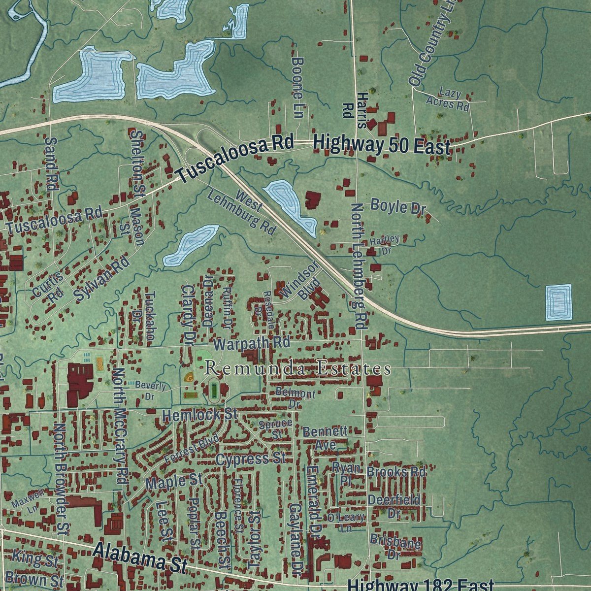
Explore Columbus, Mississippi from a whole new perspective. Created using aerial imagery and detailed geographic data, this map captures Columbus building by building, with labeled streets, familiar landmarks, and shaded topographical relief that highlights the natural contours of the landscape.
Combining modern data with the timeless character of a vintage atlas, this map is just as interesting up close as it is beautiful on the wall. Whether you grew up in Columbus, spent memorable years there, or call it home today, this unique map is a great way to celebrate a place that means something to you. Zoom in on the preview to look for your street, and then order a print to put your memories on the wall.
Three ways to hang it
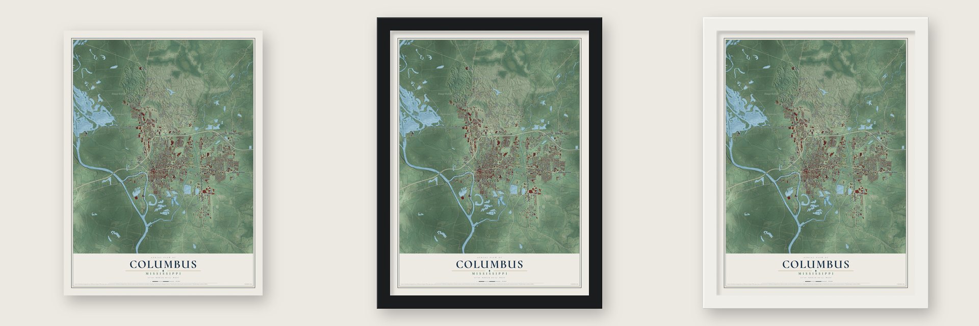
Unframed archival matte, a black wood frame or a white wood frame.
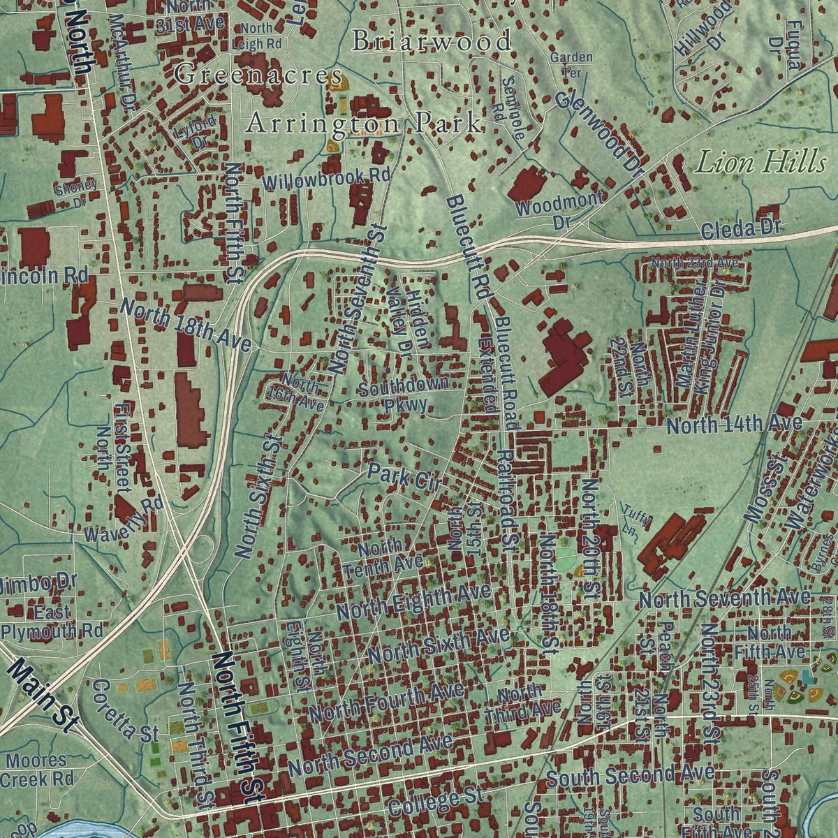
Up close
Geography Worth Displaying
This map was created using accurate cartographic data and authoritative geographic sources, including the U.S. Geological Survey and the Census Bureau. The map brings together terrain, waterways, roads, and building detail. The majority of the streets are labeled, houses are accurately depicted, and the topography is derived from government sources. Combining local data with carefully composed color and shading leads to this beautifully detailed Columbus artwork for your wall.
Rather than simply showing street outlines, we’ve included as many of the street names as we could reasonably fit on the map while keeping their names legible. Zoom in on the high resolution preview to see exactly what’s on the map. We truly set out to create a statement piece for anyone who loves Columbus. So whether it’s for you, or a gift for someone you love, we hope this map of Columbus brings back fond memories.
Read the story behind this map of Columbus, Mississippi from 2026.
About Columbus, Mississippi
Columbus is a city of 24,084 people and the seat of Lowndes County, on the Tombigbee River near the Alabama line. In 1817 Andrew Jackson wanted roads to tie New Orleans to the rest of the country, so he ordered one built from Nashville. His surveyor, Captain Hugh Young, put a ferry on the Tombigbee where high ground came down to the water on both banks, and Jackson's Military Road opened the area to settlers.
The town began in 1819 at the road's crossing, 4 miles south of Plymouth Bluff, where Choctaw agent John Pitchlynn had lived since 1810. Its settlers thought they were in Alabama, so an Alabama act recognized the Town of Columbus on December 6, 1819. The Choctaw and Chickasaw had called the site Possum Town, and locals still use that nickname. Silas McBee proposed the name Columbus, and in return a small creek was named for him.
- Flowers for both sidesColumbus was a hospital town during the Civil War, and many soldiers wounded at Shiloh were brought here. Thousands were buried in Friendship Cemetery. In 1866 a group of women laid flowers on the graves of Union and Confederate dead alike. Francis Miles Finch read about it in New York newspapers and wrote the poem "The Blue and the Grey," and Columbus is remembered as home of the first Decoration Day, an early form of Memorial Day.
- Spared by ForrestThe Briarfield Arsenal here made gunpowder, handguns and a few cannons for the Confederacy, so the Union set out to take Columbus. General Nathan Bedford Forrest stopped the attack, and the town's antebellum homes were never burned. Their collection is second only to Natchez in Mississippi, and residents open them to visitors each year during the Pilgrimage. When Union troops took Jackson, the state legislature met briefly in Columbus.
- First public college for womenThree educators, Annie Coleman Peyton, Sallie Eola Reneau and Olivia Valentine Hastings, lobbied for years until the Industrial Institute and College opened in Columbus in 1884 as the nation's first public university for women. It became Mississippi State College for Women in 1920, took its first black students in 1966 and became Mississippi University for Women in 1974. Since 1988 the Mississippi School for Mathematics and Science has also made its home in Columbus.
- Tennessee Williams's birthplaceThomas Williams III was born in Columbus in 1911, in the rectory of St. Paul's Episcopal Church, where his grandfather Walter Dakin was the minister. He later took the name Tennessee Williams and became one of America's greatest playwrights. The Old St. Paul's Episcopal Church Rectory is on the National Register and now serves as the Tennessee Williams Home Museum and Welcome Center.
- Franklin Academy since 1821The town's founders soon opened Franklin Academy, known as Mississippi's first public school. Founded in 1821, it still teaches children today as Franklin Academy Elementary, the oldest public elementary school in the state.
Find your street
Names on the Columbus map
Every name below is printed on this map. Look for your street, your school, the park where you played, or the pond down the road.
Places and landmarks19
- Columbus City Hall
- Sleepy Hollow
- Propst Park
- Arrington Park
- Bluecutt Estates
- Briarwood
- Cady Hills
- Cresent Estates
- Dean Acres
- Fox Run
- Fox Run Colony
- Greenacres
Show all 19 places
- Holly Hills
- Northaven Woods
- Pinehaven
- Remunda Estates
- Rolling Fork Estates
- Woodland Heights
- Lion Hills
Streets and roads210
- Alabama Street
- Tuscaloosa Road
- Main Street
- Idlewild Road
- North Fifth Street
- Highway 45 North
- Highway 182 East
- Highway 69 South
- Highway 50 East
- North Lehmberg Road
- Waterworks Road
- South 17th Avenue
- Park Circle
- Pickensville Road
- Wilkins-Wise Road
- Waverly Ferry Road
- Military Road
- North Fourth Avenue
- Old Country Lane
- South Eleventh Street
- North Browder Street
- South 25th Street
- Bluecutt Road
- Airline Road
- College Street
- North Seventh Avenue
- North Seventh Street
- Lock and Dam Road
- South Second Avenue
- Port Access Road
Show all 210 streets
- North Sixth Street
- North Second Avenue
- Holly Hills Road
- North Sixth Avenue
- North 18th Avenue
- Sylvan Road
- Ridge Road
- Warpath Road
- South Ninth Street
- Hemlock Street
- South Seventh Street
- Gardner Boulevard
- Island Road
- North 14th Avenue
- North Eighth Avenue
- South Fourth Street
- Railroad Street
- Plymouth Road
- South 15th Street
- North 20th Street
- Chandler Road
- Bell Avenue
- South 22nd Street
- North McCrary Road
- Forrest Glen Road
- Azalea Drive
- Lincoln Road
- North 23rd Street
- Moss Street
- South Second Street
- North 18th Street
- Stokes Road
- Maple Street
- Cypress Street
- Beech Street
- Glenwood Drive
- Sand Road
- Armstrong Road
- Gaylane Drive
- Chapman Road
- Taylor Street
- North Third Street
- South 16th Street
- Lane Road
- Mill Street
- Emerald Drive
- Boone Lane
- Boyle Drive
- Leigh Drive
- Hargrove Road
- Pandora Drive
- Jimbo Drive
- Miller Lane
- Coretta Street
- Airport Road
- Shelton Street
- Clardy Drive
- King Street
- Cleda Drive
- Brown Street
- Lee Street
- Highway 373
- Nursey Road
- Yorkville Road East
- North 22nd Street
- Waverly Road
- Deerfield Drive
- Martin Luther King Junior Drive
- North 19th Street
- Bluecutt Road Extended
- North Third Avenue
- South Fifth Avenue
- Nash Road
- Greenbriar Drive
- South Sixth Avenue
- North 15th Street
- South Eighth Street
- South Sixth Street
- North 21st Street
- Moores Creek Road
- Hickory Lane
- North Tenth Avenue
- Yorkville Park Square
- South 13th Street
- South 13th Avenue
- Shelley Road
- Woodland Heights Drive
- Industrial Park Access Road
- Northdale Drive
- West Lehmburg Road
- North Eighth Street
- Curtis Road
- Briarbend Drive
- Summerhaven Drive
- McArthur Drive
- Poplar Street
- Woolbright Street
- Willowbrook Road
- Steeplechase Drive
- North 31st Avenue
- Eastwood Drive
- First Street North
- Williamson Road
- Park Creek Drive
- Deena Drive
- North Fifth Avenue
- Gregory Road
- Sleepy Hollow Drive
- Southdown Parkway
- East Plymouth Road
- Springdale Drive
- Shepherd Road
- Bigbee Loop
- Windsor Boulevard
- Bennett Avenue
- Laws Shoals Road
- McCrary Drive
- Niles Road
- Woodmont Drive
- Brooks Road
- Temple Drive
- Crepe Myrtle Drive
- Hillwood Drive
- Hidden Valley Drive
- Tuckaho Drive
- Deer Run
- Brisbane Drive
- Peach Street
- Marina Drive
- Reeves Drive
- Carr Road
- Mason Street
- Fuqua Drive
- Ryan Place
- Oak Street
- Day Circle
- Harris Road
- Lazy Acres Road
- South Lehmberg Road
- Fifth Street North
- South Fifth Street
- Forrest Boulevard
- Seminole Road
- North 16th Avenue
- Dickerson Lane
- Puckett Parkway
- Florence Street
- Eighth Avenue South
- Spruce Street
- Belmont Drive
- Island Cv
- Ruffin Drive
- Savelle Circle
- O'Leary Lane
- Lyford Drive
- South Tenth Street
- Kennel Road
- Maxwell Lane
- Byrnes Circle
- South 19th Street
- Limbo Drive
- Datco Industrial Drive
- McHall Drive
- North 25th Street
- Fox Run Curv
- Hickory Ridge
- North 23rd Avenue
- Rosedale Drive
- Hobbs Sheffield Road
- North Court
- Dogwood Road
- Matilda Drive
- Hartley Drive
- Beverly Drive
- North Leigh Road
- Temple Cv
- Shoney Drive
- North 28th Street
- Garden Terrace
- Tuffy Lane
Names are listed as they appear on the printed map. Zoom into the product photos to find them.
The art of mapping a place
How This Map Was Made
Real places. Remarkable detail. Discover the layers that turn geographic data into a map of home.

The view from above
Aerial imagery reveals the character of the land: woodland, open fields, and the patterns of a place.

The shape of the land
Elevation data brings hills, valleys, and subtle changes in the landscape into view.

The details of home
Roads, waterways, and building footprints come together to make the map feel unmistakably local.

Geography becomes art
Considered color, shading, and typography bring the layers together in a map made for your wall.


Process illustrated with Mendon, Massachusetts. Aerial imagery: USDA NAIP. Terrain: USGS 3D Elevation Program. Map details and finished artwork: KNOWOL.
The Details
About This Print
Choose an archival matte print, or a black or white Ayous wood frame. The archival matte print is unframed.
Select your size and finish above to see the matching product image and price.
Materials & Craftsmanship
A contemporary map with the character of a classic atlas, printed on archival matte paper. Optional frames are made from Ayous wood.
Your printed map does not include the watermark shown in the full-map preview.
Shipping & Delivery
Free shipping within the United States. Every print is made to order in the USA.
Buying a gift? Add a note in your cart and we'll include it. We never put prices in the package.
Prints ship within 2 to 3 business days. Allow 7 to 10 days total from ordering for delivery. Timing may vary during holidays or periods of high order volume.
Read our shipping policy.
Returns and damaged prints
Each print is made to order. Change-of-mind refunds are not available after production.
If your print arrives damaged, misprinted or incorrect, contact support@knowol.com within 30 days of receiving it. Include your order number, photos and a description of the issue.
Read our full refund and replacement policy. For questions about your order, email support@knowol.com.
Find your town
Looking for another city?
Find a map of home in our Mississippi collection, or any town in the country.
Nearby
Maps of towns near Columbus
Know someone from one of these towns? Their map makes a great gift.
 New Hope
, Mississippi
From $39.99See the map
 Columbus AFB
, Mississippi
From $39.99See the map
 Caledonia
, Mississippi
From $39.99See the map
More maps nearby: Artesia, West Point, Hamilton, New Hamilton and Crawford.