
Search for another town





Free U.S. delivery 7 to 10 days after you order
West Point, Mississippi Map Art
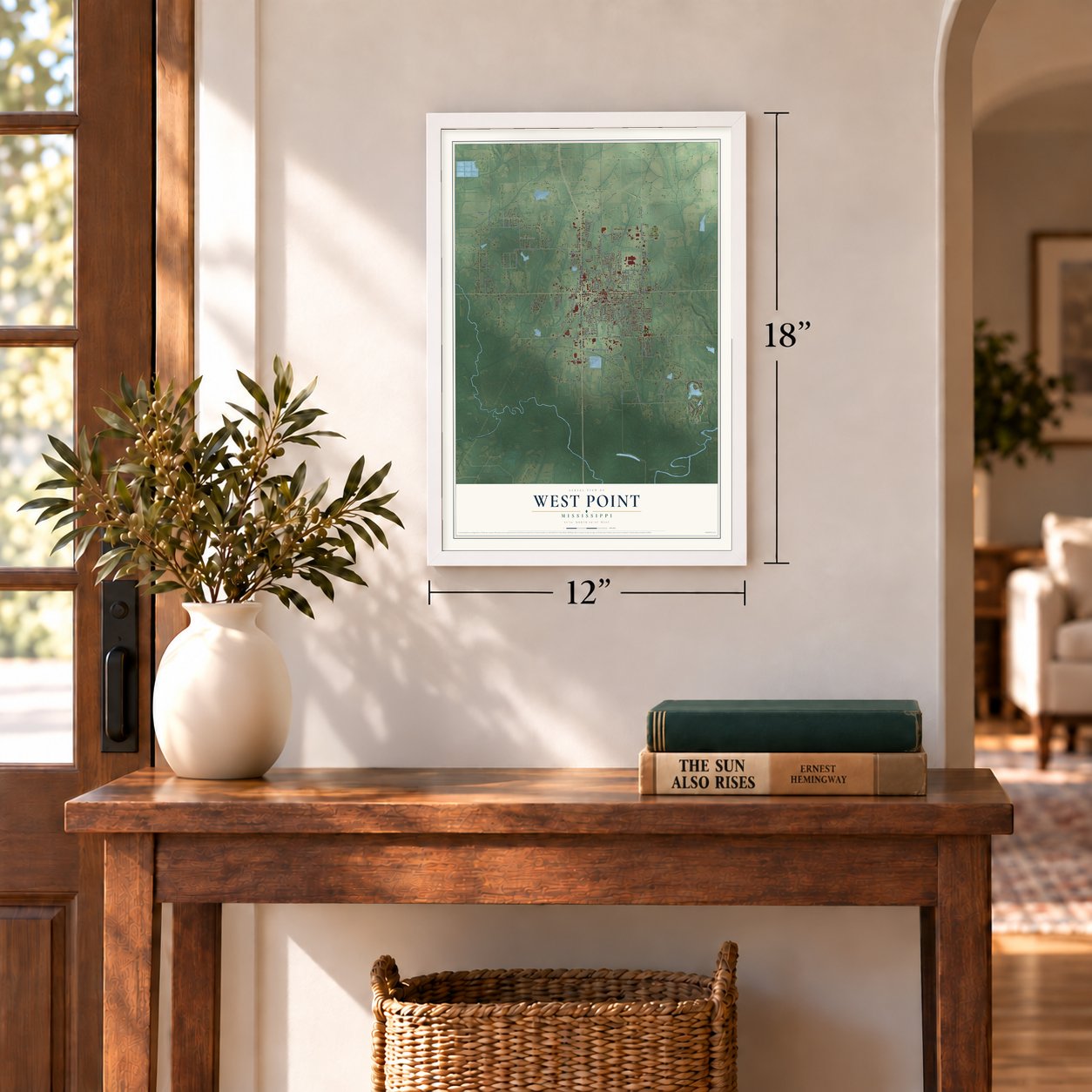
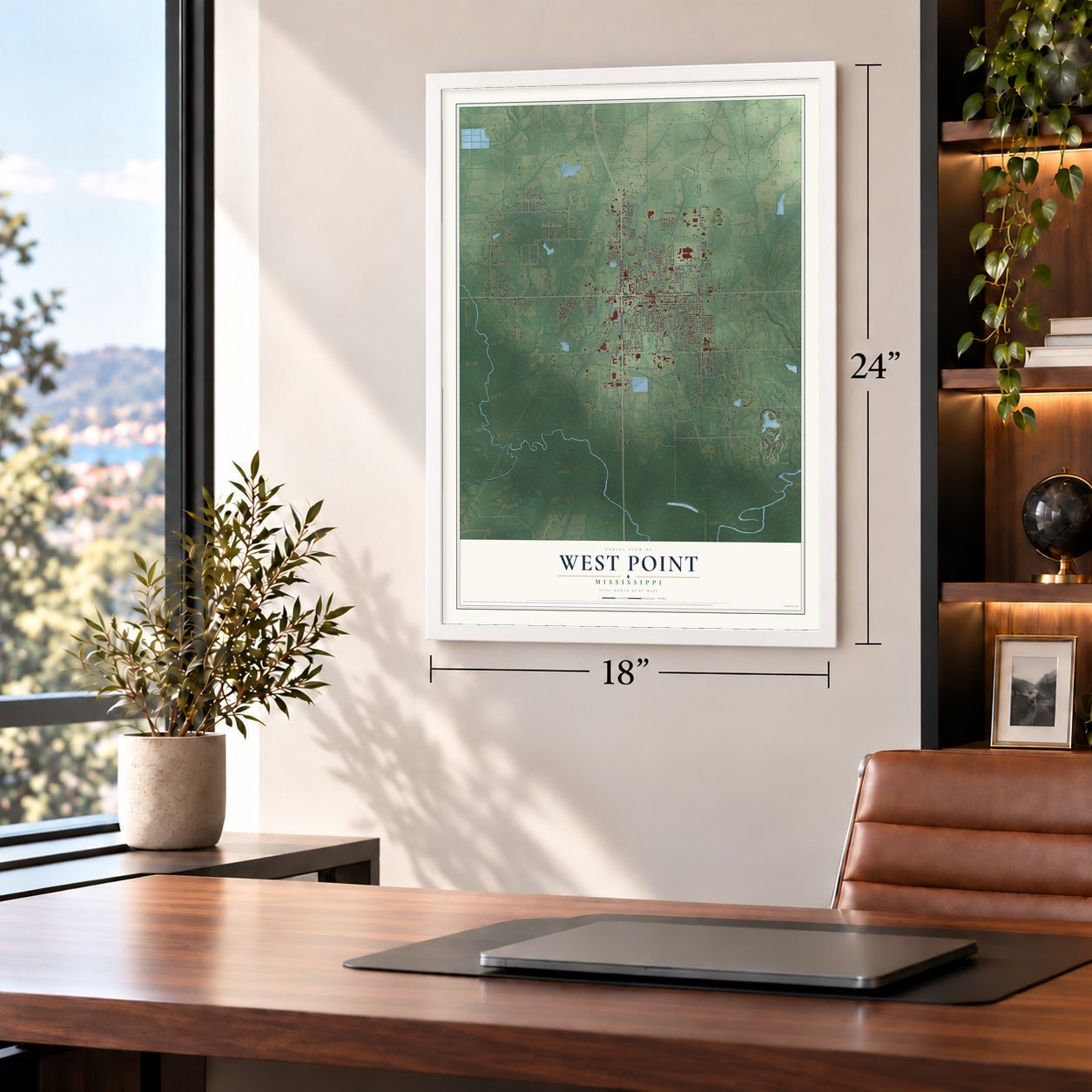
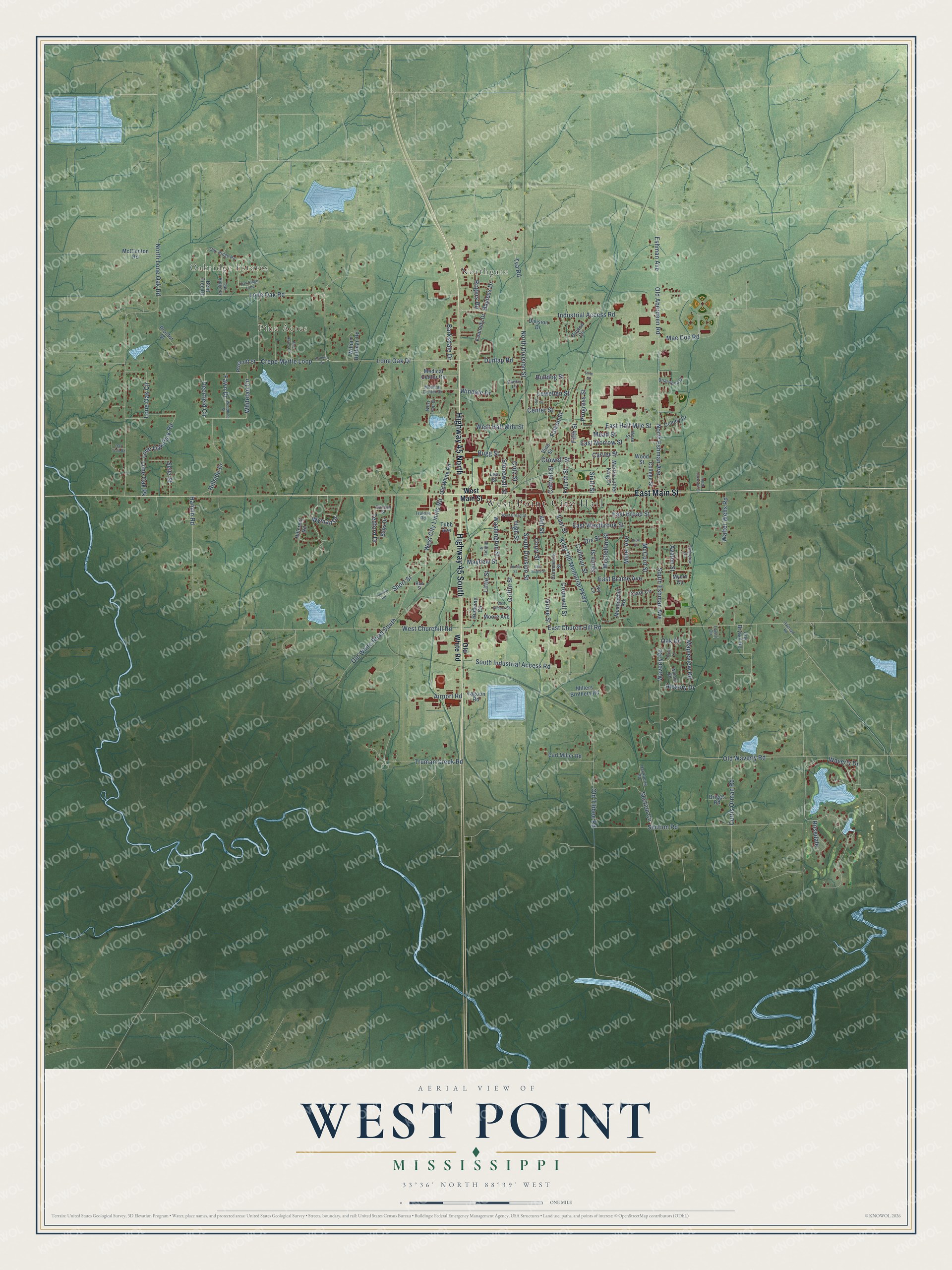
A new map of West Point, Mississippi, made in 2026 and printed to order on thick archival matte paper.
12" x 18" Archival Matte Print
A Map of Home. A Work of Art.
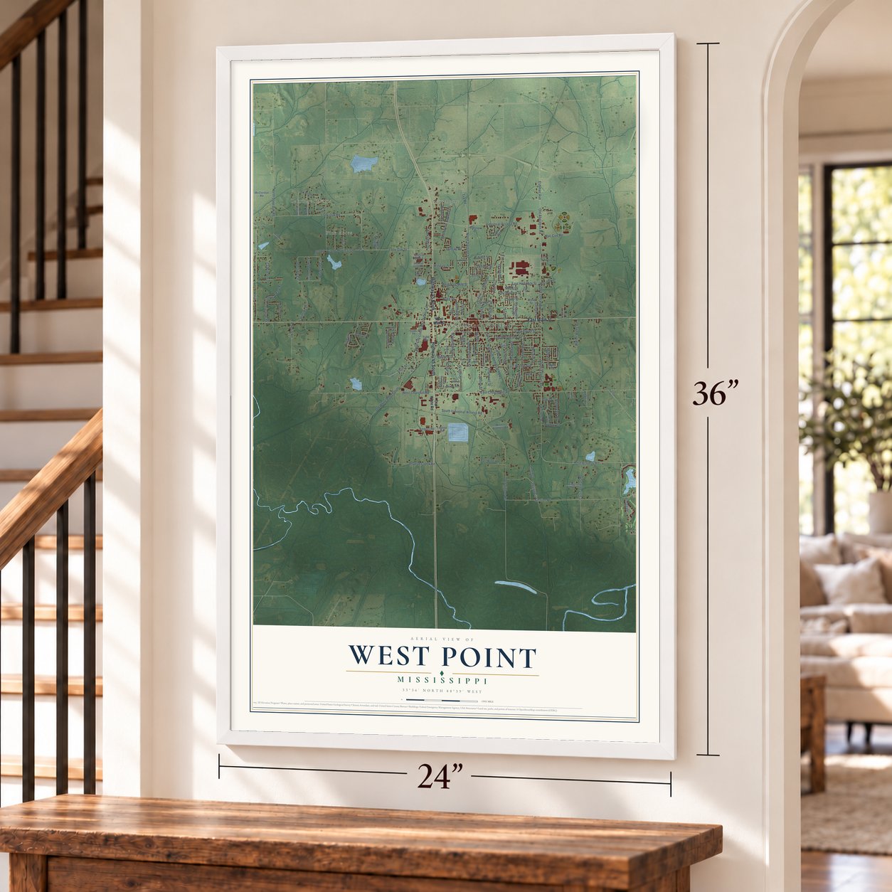
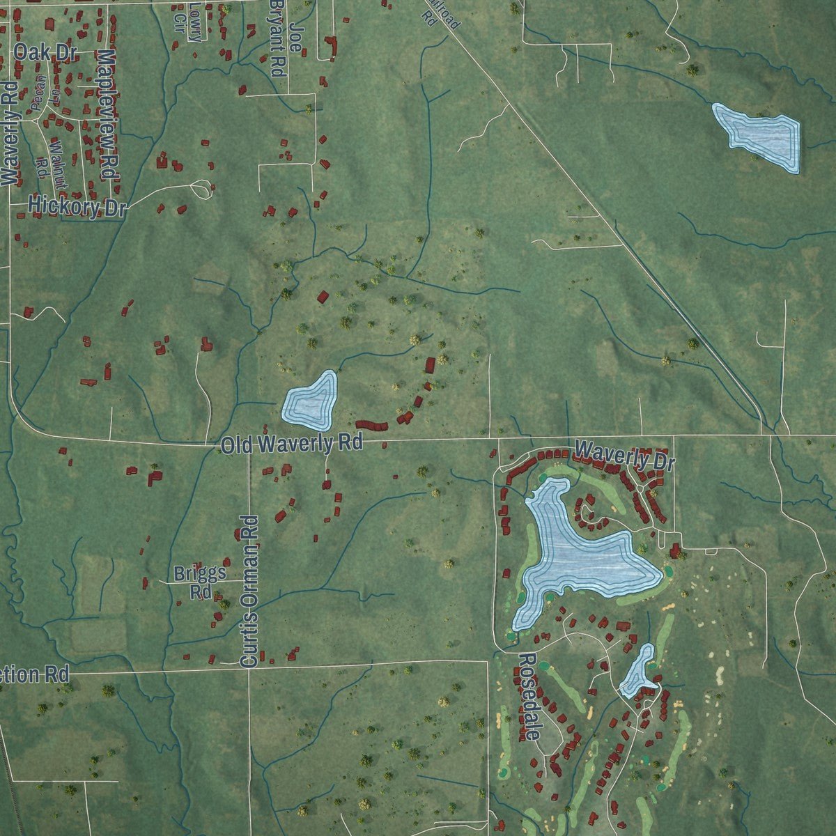
Explore West Point, Mississippi from a whole new perspective. Created using aerial imagery and detailed geographic data, this map captures West Point building by building, with labeled streets, familiar landmarks, and shaded topographical relief that highlights the natural contours of the landscape.
Combining modern data with the timeless character of a vintage atlas, this map is just as interesting up close as it is beautiful on the wall. Whether you grew up in West Point, spent memorable years there, or call it home today, this unique map is a great way to celebrate a place that means something to you. Zoom in on the preview to look for your street, and then order a print to put your memories on the wall.
Three ways to hang it
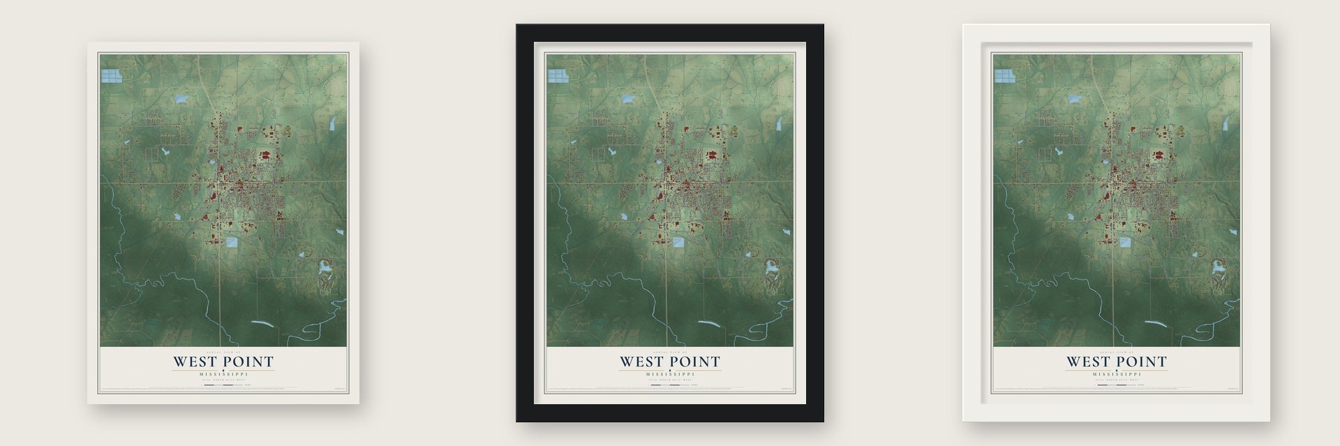
Unframed archival matte, a black wood frame or a white wood frame.
Up close
Geography Worth Displaying
This map was created using accurate cartographic data and authoritative geographic sources, including the U.S. Geological Survey and the Census Bureau. The map brings together terrain, waterways, roads, and building detail. The majority of the streets are labeled, houses are accurately depicted, and the topography is derived from government sources. Combining local data with carefully composed color and shading leads to this beautifully detailed West Point artwork for your wall.
Rather than simply showing street outlines, we’ve included as many of the street names as we could reasonably fit on the map while keeping their names legible. Zoom in on the high resolution preview to see exactly what’s on the map. We truly set out to create a statement piece for anyone who loves West Point. So whether it’s for you, or a gift for someone you love, we hope this map of West Point brings back fond memories.
Read the story behind this map of West Point, Mississippi from 2026.

About West Point, Mississippi
West Point is a city of 10,105 people and the seat of Clay County, in northeastern Mississippi. The town began as a small hamlet about half a mile west of where it stands today, and a post office opened there on September 22, 1846. When the Mobile and Ohio Railroad laid its tracks through the area a few years before the Civil War, the town's business moved over to the line, and West Point was incorporated on November 20, 1858.
In May 1871 the state carved a new county out of Chickasaw, Lowndes, Monroe and Oktibbeha counties and named it Colfax, for Schuyler Colfax, vice president under Ulysses S. Grant. West Point was chosen as its seat. After Reconstruction ended and Democrats returned to power, the county was renamed for Henry Clay, and West Point stayed the county seat. Three railroads met here, the Illinois Central, the Mobile and Ohio and the Southern, and by 1900 the town had grown to 4,400 people.
- Mississippi's first airportPayne Field opened at West Point in 1916 as a training ground for American troops in World War I, and it was Mississippi's first airport. It ran as an advanced aviation school from May 1918 to March 1920, and about 1,500 pilots learned to fly there.
- Colleges for womenWest Point became a center of learning for women in eastern Mississippi. The Southern Women's College moved here from Oxford in 1894, and the next year Mary Holmes College opened in town as a Presbyterian school for African American women. The Mary Holmes Junior College Historic District joined the National Register in 1991.
- Bryan Foods since 1936John H. Bryan Sr. and W. B. Bryan started Bryan Foods in West Point in 1936, making meat products the company sold as the Flavor of the South. Sara Lee Corporation bought the business in 1968, and it kept working in West Point until March 2007.
- Howlin' Wolf's home countyChester Burnett, the blues musician known as Howlin' Wolf, was born in 1910 at White Station, a Clay County community. West Point is home to the Howlin' Wolf Blues Museum. Every Labor Day weekend a blues festival in his name starts things off on Friday evening, and the Prairie Arts Festival fills Saturday with crafts, music, children's rides, a 5K race and a car show.
- First woman chief justiceLenore Prather was born in West Point in 1931 and started her work as a judge here in 1965. She rose to become chief justice of the Mississippi Supreme Court, the first woman ever to hold that seat.
Find your street
Names on the West Point map
Every name below is printed on this map. Look for your street, your school, the park where you played, or the pond down the road.
Places and landmarks4
- West Point City Hall
- Oakridge Estates
- Pine Acres
- Northgate
Streets and roads154
- East Main Street
- Highway 45 North
- Highway 45 South
- North Division Street
- Tva Road
- South Division Street
- Wyman Drive
- Lone Oak Road
- South Industrial Access Road
- Old White Road South
- Lone Oak Drive
- West City Limits Road
- North Eshman Avenue
- East Church Hill Road
- Old Aberdeen Road
- Crepe Myrtle Loop
- Short Street
- Dunlap Road
- West Churchill Road
- Waverly Drive
- Old Tibbee Road
- Section Road
- South Eshman Avenue
- Industrial Access Road
- Old Waverly Road
- Deerfield Circle
- Whitetail Circle
- East Brame Avenue
- East Broad Street
- East Morrow Street
Show all 154 streets
- Kitty Dill Memorial Parkway
- Lone Oak Park Road
- Sixth Street
- East Westbrook Street
- Fifth Street
- East Half Mile Street
- Waverly Road
- Mac Cox Road
- Griffin Street
- Truman Creek Road
- Hamlin Road
- Falcon Street
- Hillside Drive
- Grove Street
- Lone Oak Circle
- Section Circle
- McClellan Street
- Lone Oak Pk
- Calhoun Street
- McCord Street
- Hickory Drive
- Eshman Avenue
- Cromwell Street
- Mayhew Street
- North Lone Oak Road
- Curtis Orman Road
- Little Street
- West Half Mile Street
- Bugg Street
- East Street
- Miller Avenue
- Court Street
- Critz Street
- Mapleview Road
- Center Street
- Airport Road
- Walter Wells Road
- Seitz Street
- Progress Street
- Washington Street
- Crowell Street
- Fourth Street
- Cottrell Street
- High Street
- Fawn Drive
- Lewellen Street
- Barksdale Drive
- Stonewall Street
- Smith Street
- Rosedale
- Avalon Street
- Rogers Road
- Dix Street
- Tedford Drive
- Windale Drive
- Bayless Drive
- Bulldog Street
- Oak Drive
- Carver Street
- Mead Street
- Mill Street
- West Main Street
- Old White Road
- Hillcrest Road
- Bent Tree Drive
- Babs Drive
- Commerce Street
- Clark Circle
- Guyton Circle
- Medical Center Circle
- Meadowhill Road
- Redwine Circle
- Carl Miller Road
- William Huffman Road
- McClenton Road
- Martin Luther King Drive
- College Street
- Millers Brothers Road
- Colony Drive
- Kennedy Drive
- Wood Street
- Prescott Street
- Joe Bryant Road
- Tubb Avenue
- Briggs Road
- Division Drive
- Moore Avenue
- Vine Street
- Lee Street
- Proctor Drive
- Lagoon Road
- Myers Circle
- Ivy Lane
- Medical Center Drive
- Oak Ridge Road
- Hackberry Road
- Converse Drive
- Oak Ridge Drive
- West Loop Drive
- Illinois Street
- Lowry Circle
- Briarwood Drive
- Walnut Road
- Rae Street
- Trulove Road
- Duncan Street
- Cherry Lane
- Mose Street
- West Broad Street
- Pine Acres Circle
- Colbert Drive
- Woodbine Street
- Oak Ridge Loop
- Landfill Road
- Pecan Lane
- Hill Street
- North Jackson Street
- East Jones Street
- Oak Trail Road
- Rich Street
- East Kilburn Street
- Jones Street
- Railroad Road
- Pine Street
Names are listed as they appear on the printed map. Zoom into the product photos to find them.
The art of mapping a place
How This Map Was Made
Real places. Remarkable detail. Discover the layers that turn geographic data into a map of home.

The view from above
Aerial imagery reveals the character of the land: woodland, open fields, and the patterns of a place.

The shape of the land
Elevation data brings hills, valleys, and subtle changes in the landscape into view.

The details of home
Roads, waterways, and building footprints come together to make the map feel unmistakably local.

Geography becomes art
Considered color, shading, and typography bring the layers together in a map made for your wall.


Process illustrated with Mendon, Massachusetts. Aerial imagery: USDA NAIP. Terrain: USGS 3D Elevation Program. Map details and finished artwork: KNOWOL.
The Details
About This Print
Choose an archival matte print, or a black or white Ayous wood frame. The archival matte print is unframed.
Select your size and finish above to see the matching product image and price.
Materials & Craftsmanship
A contemporary map with the character of a classic atlas, printed on archival matte paper. Optional frames are made from Ayous wood.
Your printed map does not include the watermark shown in the full-map preview.
Shipping & Delivery
Free shipping within the United States. Every print is made to order in the USA.
Buying a gift? Add a note in your cart and we'll include it. We never put prices in the package.
Prints ship within 2 to 3 business days. Allow 7 to 10 days total from ordering for delivery. Timing may vary during holidays or periods of high order volume.
Read our shipping policy.
Returns and damaged prints
Each print is made to order. Change-of-mind refunds are not available after production.
If your print arrives damaged, misprinted or incorrect, contact support@knowol.com within 30 days of receiving it. Include your order number, photos and a description of the issue.
Read our full refund and replacement policy. For questions about your order, email support@knowol.com.
Find your town
Looking for another city?
Find a map of home in our Mississippi collection, or any town in the country.
Nearby
Maps of towns near West Point
Know someone from one of these towns? Their map makes a great gift.
 Columbus AFB
, Mississippi
From $39.99See the map
 Artesia
, Mississippi
From $39.99See the map
 Mississippi State
, Mississippi
From $39.99See the map
More maps nearby: Starkville, New Hamilton, Columbus, Aberdeen and Pheba.