
Search for another town

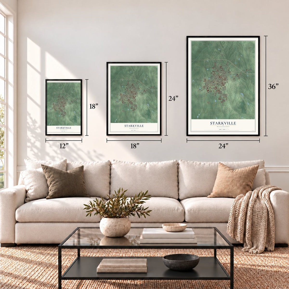

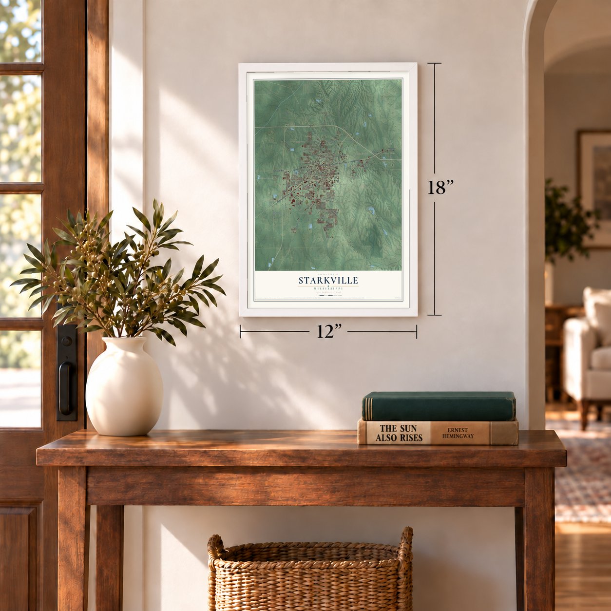

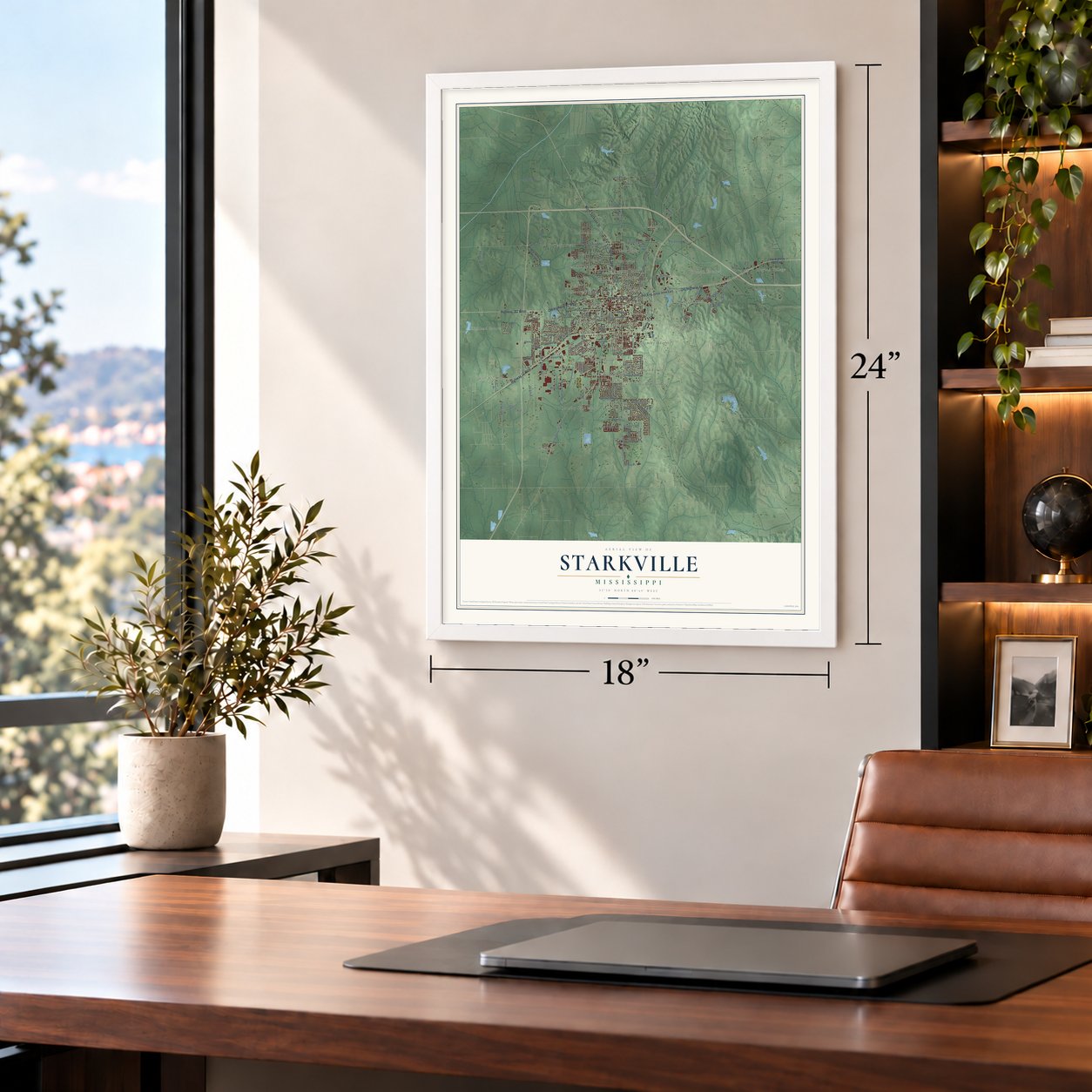


Free U.S. delivery 7 to 10 days after you order
Starkville, Mississippi Map Art
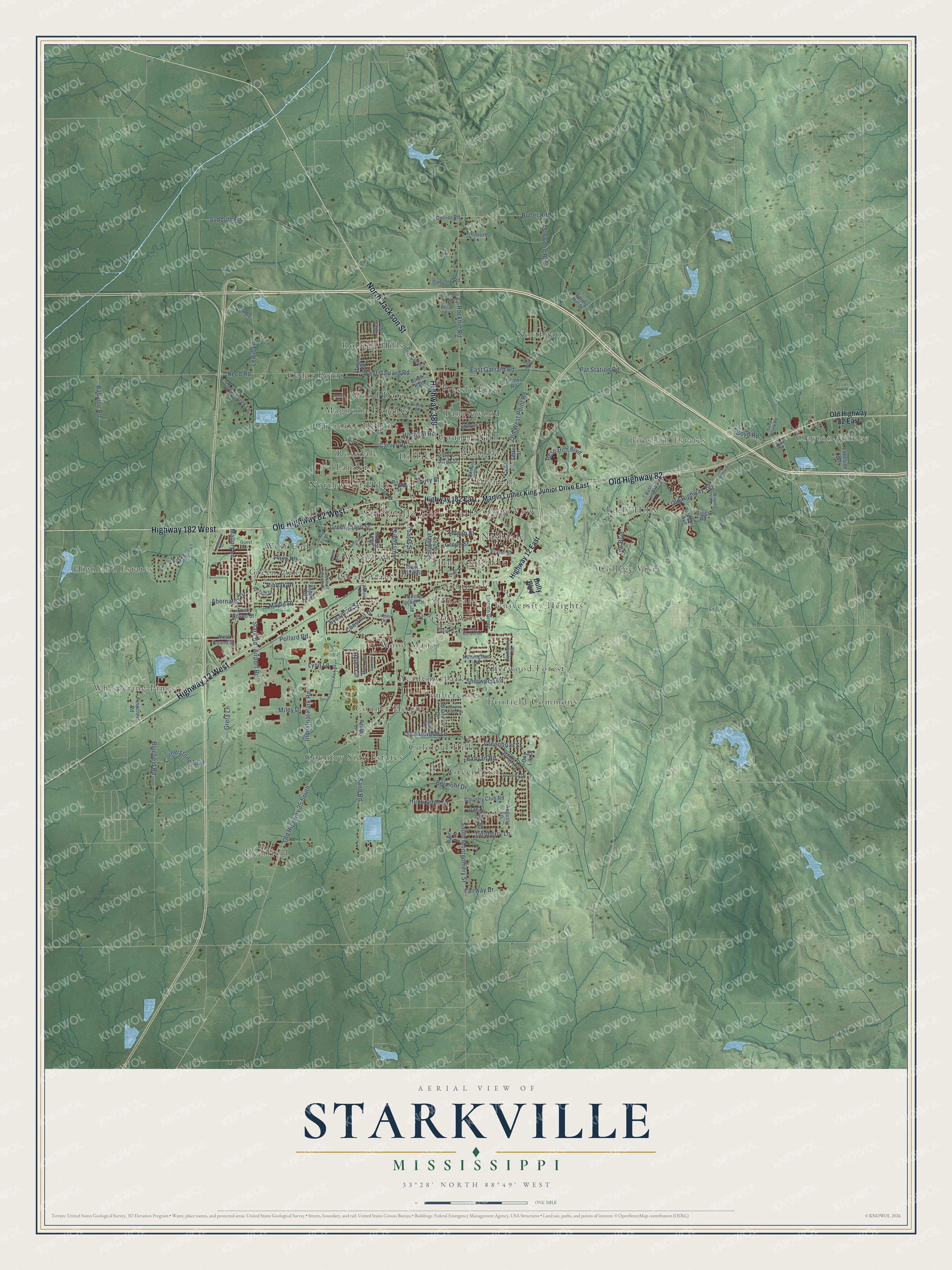
A new map of Starkville, Mississippi, made in 2026 and printed to order on thick archival matte paper.
12" x 18" Archival Matte Print
A Map of Home. A Work of Art.
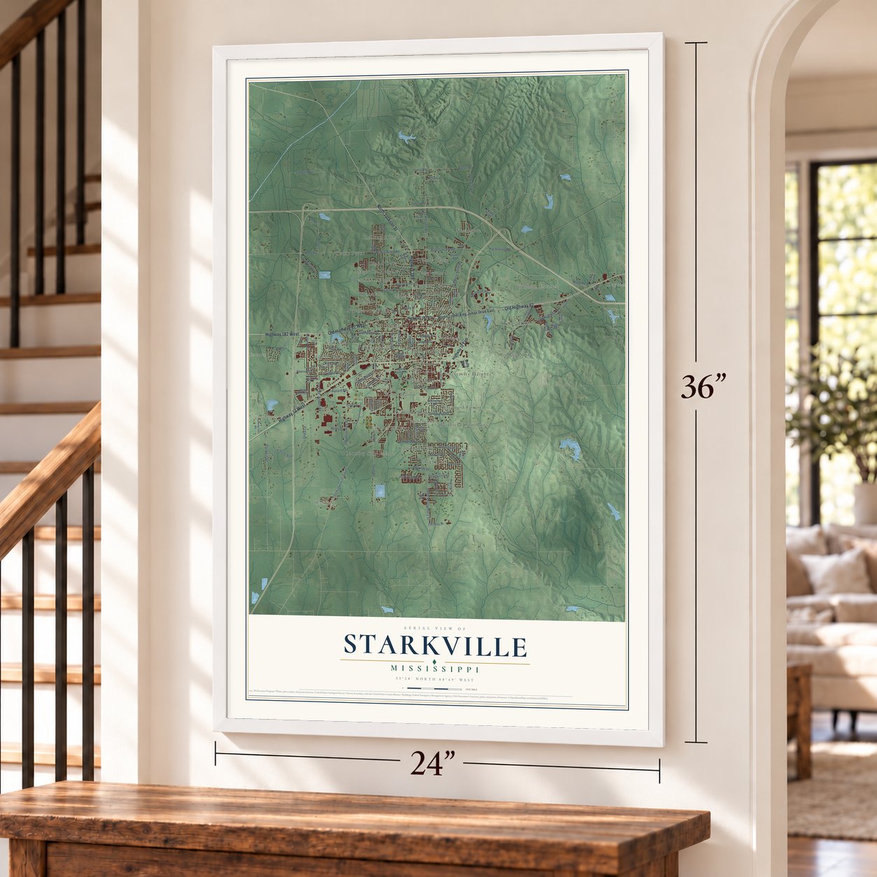
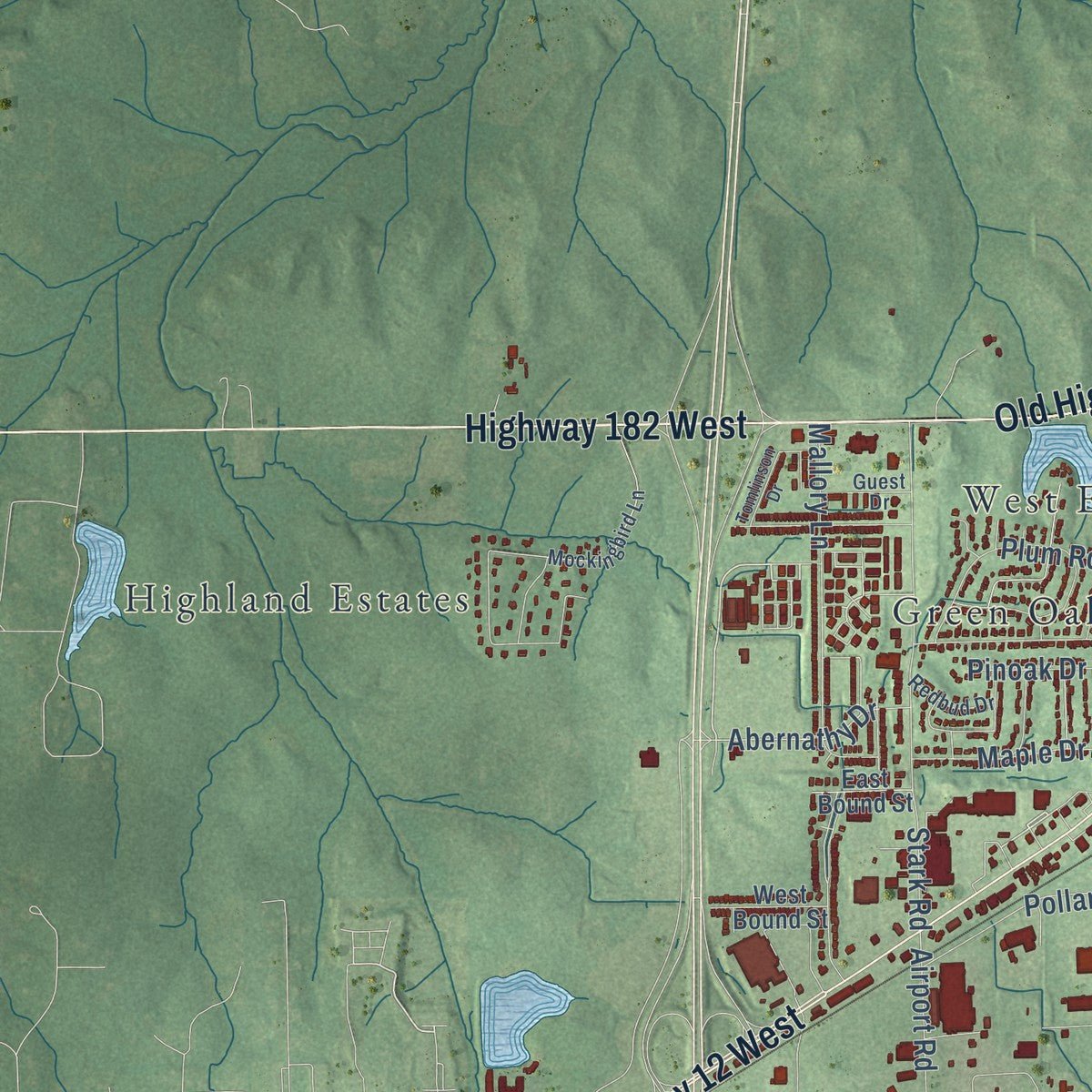
Explore Starkville, Mississippi from a whole new perspective. Created using aerial imagery and detailed geographic data, this map captures Starkville building by building, with labeled streets, familiar landmarks, and shaded topographical relief that highlights the natural contours of the landscape.
Combining modern data with the timeless character of a vintage atlas, this map is just as interesting up close as it is beautiful on the wall. Whether you grew up in Starkville, spent memorable years there, or call it home today, this unique map is a great way to celebrate a place that means something to you. Zoom in on the preview to look for your street, and then order a print to put your memories on the wall.
Three ways to hang it
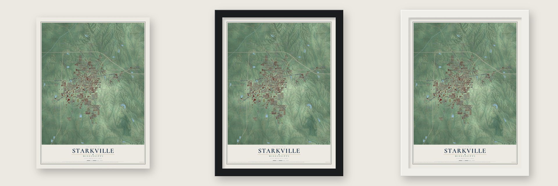
Unframed archival matte, a black wood frame or a white wood frame.
Up close
Geography Worth Displaying
This map was created using accurate cartographic data and authoritative geographic sources, including the U.S. Geological Survey and the Census Bureau. The map brings together terrain, waterways, roads, and building detail. The majority of the streets are labeled, houses are accurately depicted, and the topography is derived from government sources. Combining local data with carefully composed color and shading leads to this beautifully detailed Starkville artwork for your wall.
Rather than simply showing street outlines, we’ve included as many of the street names as we could reasonably fit on the map while keeping their names legible. Zoom in on the high resolution preview to see exactly what’s on the map. We truly set out to create a statement piece for anyone who loves Starkville. So whether it’s for you, or a gift for someone you love, we hope this map of Starkville brings back fond memories.
Read the story behind this map of Starkville, Mississippi from 2026.
About Starkville, Mississippi
Starkville is a city of 24,360 people and the seat of Oktibbeha County. The county was created on December 23, 1833, out of land the Choctaw Nation had ceded in 1830, and early the next year a hilly spot near its center was chosen for the county seat. Springs of clear water ran there, and the Choctaws had long gathered at one of them, Hickashebeha, or Sweet Gum Grove, to weave baskets.
A sawmill on the Big Black River, southwest of the site, made clapboards, so settlers first called the place Boardtown. The first town lots sold in 1834, and in 1837 the Legislature incorporated the town and named it for General John Stark, who won the battle of Bennington in the Revolution. Dr. J. T. Freeman started the county's first newspaper here in 1847, the Starkville Whig, which later took the name Broad Ax.
“Starkville is already a growing place, with two hotels, five stores, two groceries, an academy with fifty students, two churches, a Presbyterian and Methodist, and four attorneys and two physicians.”
- A jail with no doorsThe first court met in 1834 beneath a large tree. In 1835 the town built a log courthouse and a one-room jail that had neither doors nor windows. A prisoner climbed a ladder to the roof, and guards lowered him inside on a rope through a trap door.
- A college for farmers in 1878White farmers in the Grange pressed the state for a farm school, and in 1878 Mississippi Agricultural and Mechanical College was founded at Starkville, paid for with Morrill Act money as the state's first land-grant school. Classes opened in 1880. The state's first agricultural experiment station followed in 1888. In 1932 the school took the name Mississippi State College, and in 1957 it was renamed Mississippi State University. In 1965 it admitted Richard Holmes, its first African American student.
- Milk Pitcher of the SouthBefore the Civil War, Colonel Montgomery brought cattle from the isle of Jersey, and the area grew into a dairy center. A cooperative creamery opened in 1912, and in 1926 the Borden Condensery opened in Starkville, the first condensery in the southern U.S. By the 1920s the county led Mississippi in dairy production.
- The Cotton District since 1969Developer Dan Camp began the Cotton District in 1969, between downtown and the campus, as North America's first New Urbanist neighborhood. He built, owned and managed much of it, mixing Greek Revival with Classical or Victorian styles on compact, walkable streets. Each year it hosts the Starkville Derby, billed as the world's largest charity wiener dog race.
Find your street
Names on the Starkville map
Every name below is printed on this map. Look for your street, your school, the park where you played, or the pond down the road.
Places and landmarks44
- Starkville City Hall
- Clayton Village
- Bingham Estates
- McKee Park
- Academy Park
- Avondale
- Cedar Point
- Cherokee Heights
- College View
- College Vista
- Colonial Hills
- Conner Heights
Show all 44 places
- Country Hills
- Country Side Estates
- Deerfield
- Didlake
- Fairfield Commons
- Glendale
- Green Oaks
- Greenbriar
- Hancock Circle
- Highland Estates
- Landers
- Magnolia Heights
- Nashdale
- Northgate
- Northwood Hills
- Pecan Acres
- Pleasant Acres
- Pressly Place
- Rolling Hills
- Rosedale
- Sheely Hills
- Sherwood Forest
- Southdale
- Stonegate
- Tanglewood
- Timbercove
- University Heights
- West End
- Westwood
- Whispering Pines
- Wood Dale
- Wood Manor
Streets and roads132
- Highway 12 West
- North Jackson Street
- Highway 182 West
- Old Highway 82 West
- Old Highway 82
- Highway 389
- Abernathy Drive
- Reed Road
- South Montgomery Street
- Old Highway 25 South
- Louisville Street
- Old West Point Road
- Lynn Lane
- Sudduth Road
- Old Highway 12
- Industrial Park Road
- Pat Station Road
- Rockhill Road
- Bluefield Road
- Sand Road
- Stark Road
- Greensboro Street
- Hospital Road
- West Garrard Road
- Lewis Lane
- East Garrard Road
- Stowood Road
- Turnberry Lane
- Butler Road
- Greta Lane
Show all 132 streets
- Research Boulevard
- Greenbriar Street
- Plum Road
- Chestnut Drive
- Sycamore Street
- Boyd Road
- Airport Road
- Cornerstone Boulevard
- Mallory Lane
- Hogan Street
- Banyan Road
- Huntington Drive
- Pinoak Drive
- Shadowood Lane
- Pollard Road
- Miley Drive
- Maple Drive
- Carver Drive
- Helen Circle
- Babylon Road
- Sherwood Road
- Lee Boulevard
- Fairway Drive
- Green Street
- Belmont Drive
- Yeates Street
- Curry Street
- Old Highway 82 East
- Highway 12 East
- Martin Luther King Junior Drive East
- Bully Boulevard
- Highway 182 East
- Collier Road
- Yellow Jacket Drive
- Cedar Creek Lane
- Critz Street
- Lakeside Road
- South Lafayette Street
- Bridle Path
- Brook Avenue
- McKee Avenue
- Gregory Avenue
- Eutaw Street
- Nottingham Road
- Park Circle
- Aztec Street
- Country Club Road
- Biggs Road
- Oakmont Road
- Pilcher Street
- Lincoln Green
- Pinecrest Road
- Augusta Lane
- Briarwick Drive
- Geechie Road
- West Wood Street
- Treasure Lane
- Trotter Road
- West Bound Street
- Day Lily Drive
- Cedar Lane
- Azalea Lane
- Hull Road
- East Bound Street
- Setter Street
- Aspen Road
- Spring Hill Drive
- Ryan Avenue
- Canterbury Road
- Russell Street
- Seville Place
- East Lee Boulevard
- Linden Circle
- Mockingbird Lane
- Gardenia Drive
- Fire Station Road
- Vine Street
- Pecan Drive
- Wilkins Road
- Avenue of Patriots Street
- Sand Creek Road
- Redbud Drive
- Willow Road
- Ruth Road
- Guest Drive
- Boyd Drive
- Old Mayhew Road
- Whitfield Street
- Spruill Industrial Park Road
- Barnett Drive
- Catherine Street
- Oktibbeha Drive
- King Richard Road
- Tomlinson Drive
- Lakes Boulevard
- Central Avenue
- Grand Ridge Road
- Camelia Place
- Dunlap Street
- Forest Hill Drive
- Fannie Dale Road
- Reed Court
Names are listed as they appear on the printed map. Zoom into the product photos to find them.
The art of mapping a place
How This Map Was Made
Real places. Remarkable detail. Discover the layers that turn geographic data into a map of home.

The view from above
Aerial imagery reveals the character of the land: woodland, open fields, and the patterns of a place.

The shape of the land
Elevation data brings hills, valleys, and subtle changes in the landscape into view.

The details of home
Roads, waterways, and building footprints come together to make the map feel unmistakably local.

Geography becomes art
Considered color, shading, and typography bring the layers together in a map made for your wall.


Process illustrated with Mendon, Massachusetts. Aerial imagery: USDA NAIP. Terrain: USGS 3D Elevation Program. Map details and finished artwork: KNOWOL.
The Details
About This Print
Choose an archival matte print, or a black or white Ayous wood frame. The archival matte print is unframed.
Select your size and finish above to see the matching product image and price.
Materials & Craftsmanship
A contemporary map with the character of a classic atlas, printed on archival matte paper. Optional frames are made from Ayous wood.
Your printed map does not include the watermark shown in the full-map preview.
Shipping & Delivery
Free shipping within the United States. Every print is made to order in the USA.
Buying a gift? Add a note in your cart and we'll include it. We never put prices in the package.
Prints ship within 2 to 3 business days. Allow 7 to 10 days total from ordering for delivery. Timing may vary during holidays or periods of high order volume.
Read our shipping policy.
Returns and damaged prints
Each print is made to order. Change-of-mind refunds are not available after production.
If your print arrives damaged, misprinted or incorrect, contact support@knowol.com within 30 days of receiving it. Include your order number, photos and a description of the issue.
Read our full refund and replacement policy. For questions about your order, email support@knowol.com.
Find your town
Looking for another city?
Find a map of home in our Mississippi collection, or any town in the country.
Nearby
Maps of towns near Starkville
Know someone from one of these towns? Their map makes a great gift.
 Mississippi State
, Mississippi
From $39.99See the map
 Longview
, Mississippi
From $39.99See the map
 Pheba
Pheba, Mississippi
From $39.99See the map
More maps nearby: Artesia, West Point, Sturgis, Maben and Crawford.