
Search for another town



Free U.S. delivery 7 to 10 days after you order
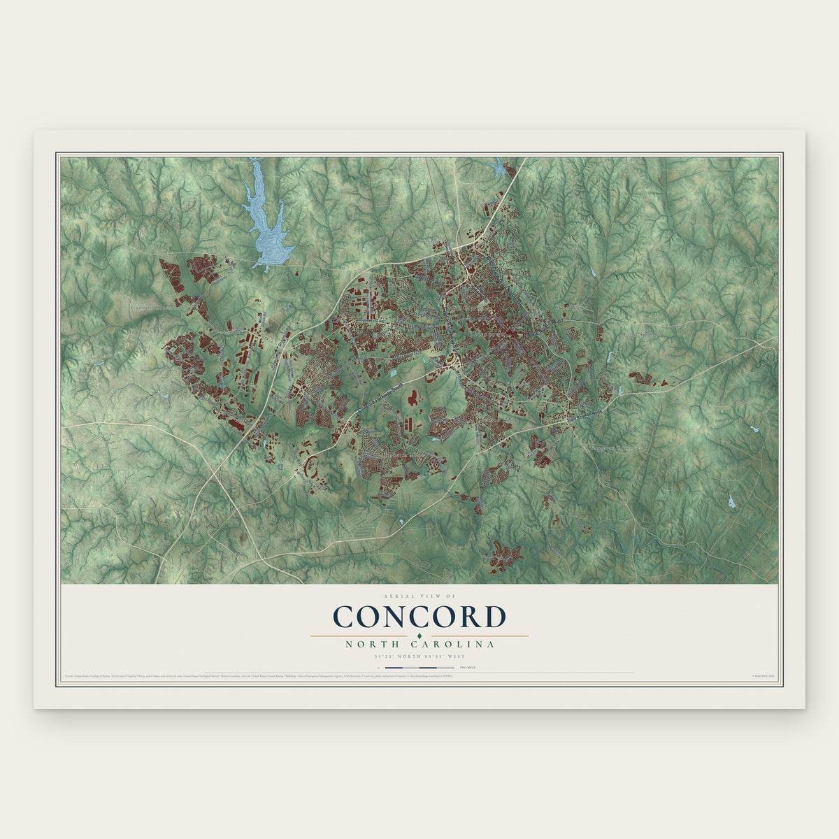
Concord, North Carolina Map Art
Building by building, with labeled streets and shaded relief.
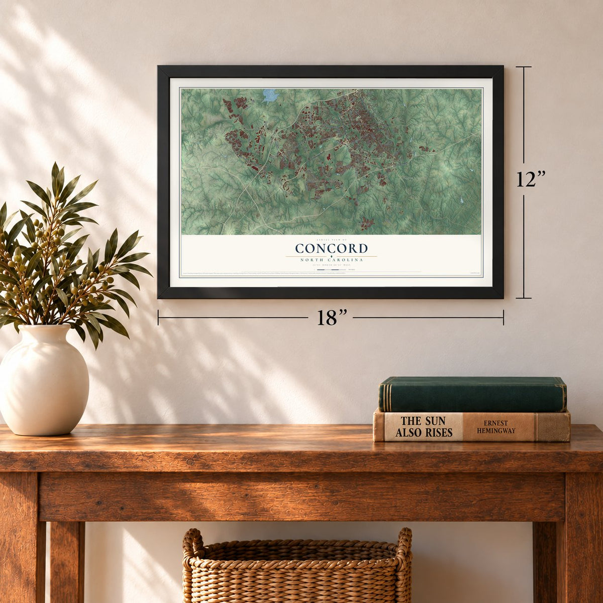
12" x 18" Archival Matte Print
A Map of Home. A Work of Art.
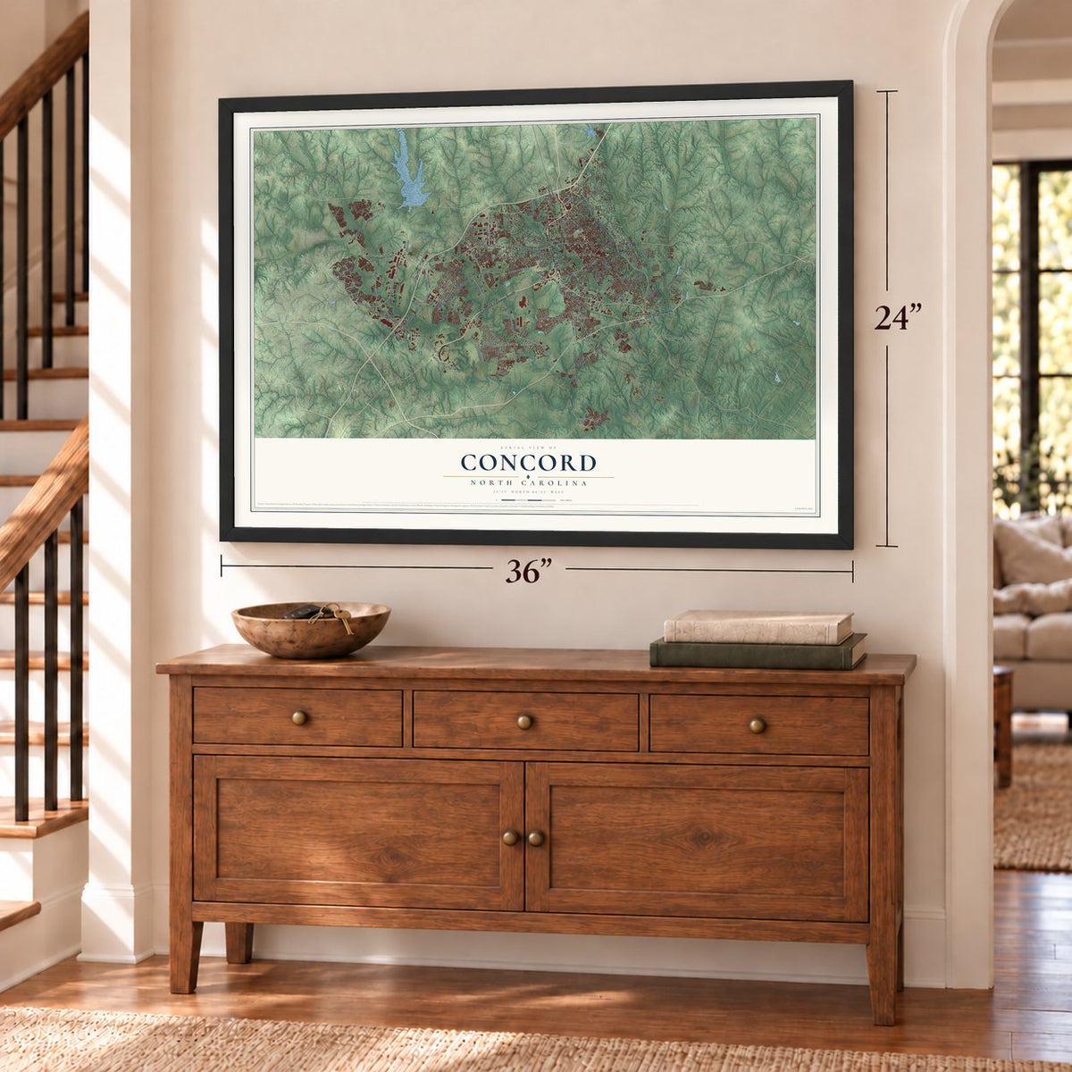
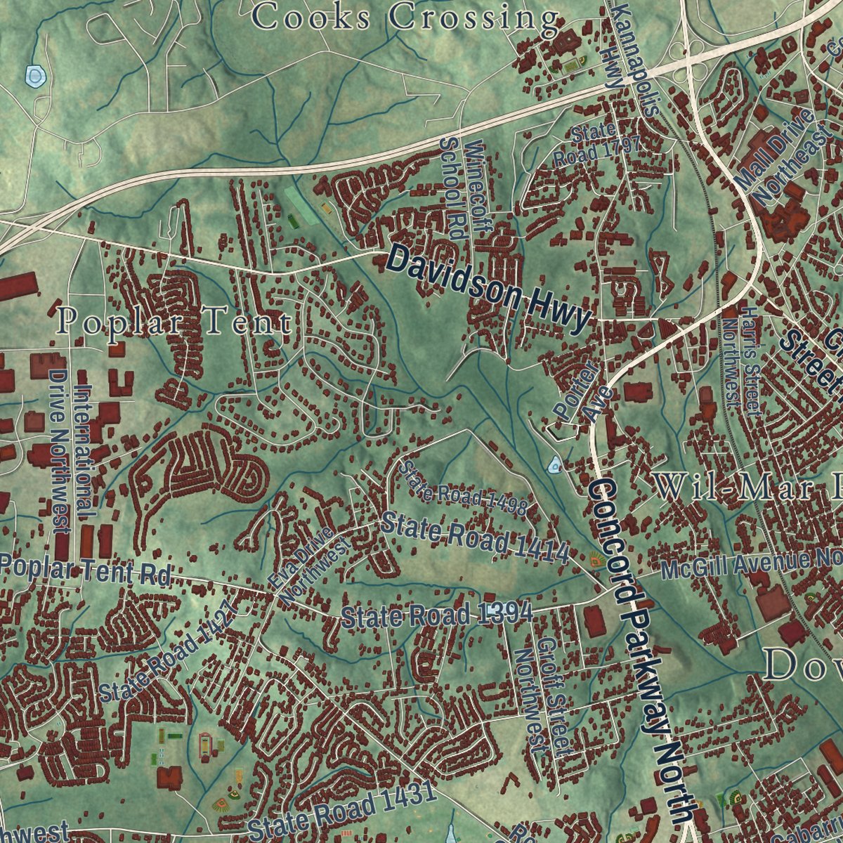
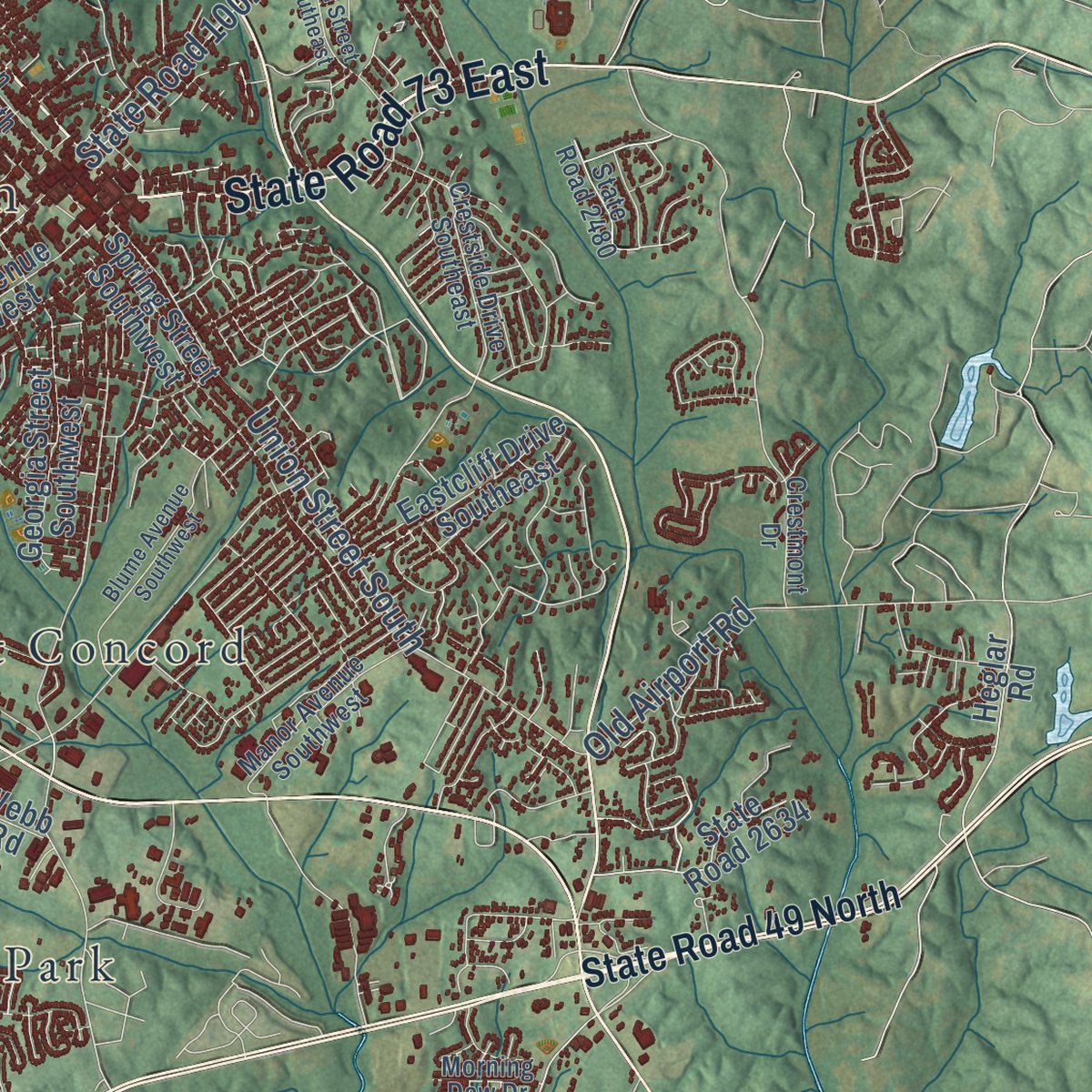
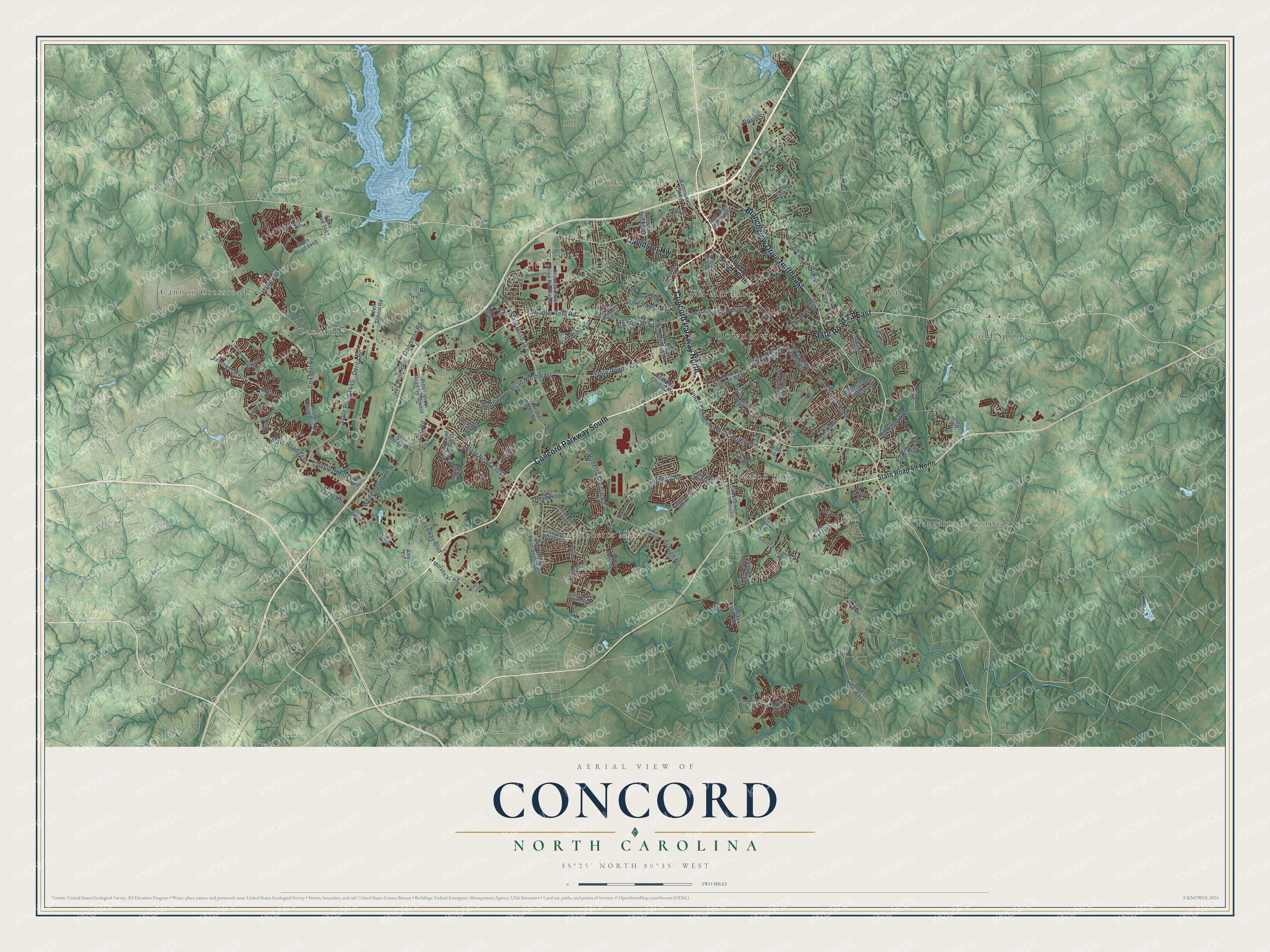
Explore Concord, North Carolina from a whole new perspective. Created using aerial imagery and detailed geographic data, this map captures Concord building by building, with labeled streets, familiar landmarks, and shaded topographical relief that highlights the natural contours of the landscape.
Combining modern data with the timeless character of a vintage atlas, this map is just as interesting up close as it is beautiful on the wall. Whether you grew up in Concord, spent memorable years there, or call it home today, this unique map is a great way to celebrate a place that means something to you. Zoom in on the preview to look for your street, and then order a print to put your memories on the wall.
Three ways to hang it

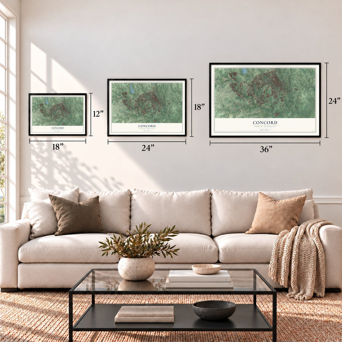
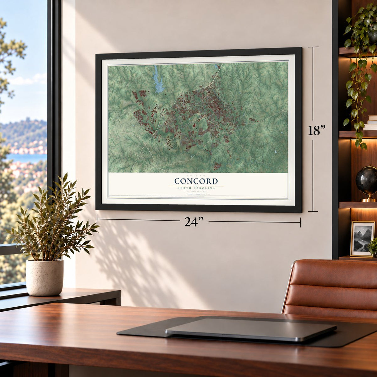
Unframed archival matte, a black wood frame or a white wood frame.
Up close
Geography Worth Displaying
This map was created using accurate cartographic data and authoritative geographic sources, including the U.S. Geological Survey and the Census Bureau. The map brings together terrain, waterways, roads, and building detail. The majority of the streets are labeled, houses are accurately depicted, and the topography is derived from government sources. Combining local data with carefully composed color and shading leads to this beautifully detailed Concord artwork for your wall.
Rather than simply showing street outlines, we’ve included as many of the street names as we could reasonably fit on the map while keeping their names legible. Zoom in on the high resolution preview to see exactly what’s on the map. We truly set out to create a statement piece for anyone who loves Concord. So whether it’s for you, or a gift for someone you love, we hope this map of Concord brings back fond memories.
Read the story behind this map of Concord, North Carolina from 2026.
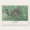
Find your street
Names on the Concord map
Every name below is printed on this map. Look for your street, your school, the park where you played, or the pond down the road.
Places and landmarks12
- Downtown
- Cannon Crossroads
- Roberta Mill
- Cold Springs
- Poplar Tent
- Faggarts Crossroads
- Jackson Park
- Cooks Crossing
- Cold Water
- West Concord
- Wil-Mar Park
- Cox Mill
Streets and roads119
- Concord Parkway South
- Concord Parkway North
- Davidson Highway
- Branchview Drive Northeast
- State Road 73 East
- Poplar Tent Road
- State Road 1394
- Weddington Road Northwest
- Derita Road
- State Road 1445
- Ellenwood Road
- Belt Road
- State Road 1305
- State Road 1431
- Roberta Road
- State Road 1002
- State Road 1414
- State Road 1430
- Union Street South
- Speedway Boulevard
- Old Airport Road
- Harris Road
- Cox Mill Road
- Union Cemetery Road Southwest
- Stough Road
- Roberta Church Road
- Weddington Road
- Concord Mills Boulevard
- Goodman Road
- State Road 1447
Show all 119 streets
- Quay Road
- Trail Road
- Quail Drive
- Roxie Street
- State Road 49 North
- Church Street North
- Morehead Road
- Odell School Road
- State Road 1438
- Pitts School Road Northwest
- State Road 1442
- Burrage Road Northeast
- Pitts School Road Southwest
- Cabarrus Avenue West
- Rock Hill Church Road
- State Road 1449
- Spring Street Southwest
- Concord Farms Road
- State Road 1448
- Clover Road Northwest
- International Drive Northwest
- State Road 1132
- McGill Avenue Northwest
- Georgia Street Southwest
- Winecoff School Road
- Central Heights Drive
- Corban Avenue Southwest
- Rocky River Road
- Eastcliff Drive Southeast
- Cochran Road
- Ivey Cline Road
- Kannapolis Highway
- State Road 1427
- Groff Street Northwest
- State Road 2634
- Heglar Road
- Hearth Lane Southwest
- State Road 1433
- Elrond Drive
- Breezy Lane
- Mall Drive Northeast
- Asherton Place
- Webb Road
- Drake Mill Lane
- Amy Lane
- Porter Avenue
- Stowe Lane
- Old Charlotte Road Southwest
- Copperfield Boulevard Northeast
- Eva Drive Northwest
- Harris Street Northwest
- State Road 1153
- Crestside Drive Southeast
- Manor Avenue Southwest
- Crestmont Drive
- State Road 2112
- Green Street Southwest
- Union Street North
- State Road 1498
- State Road 1797
- Old Holland Road
- Swink Street Southwest
- Legolas Lane
- Waltham Court
- Juanita Drive Southwest
- Artdale Drive Southwest
- State Road 2480
- Shellbark Drive
- Elendil Lane
- Marlboro Drive
- Morning Dew Drive
- Loblolly Court
- Darwin Trail
- Burris Lane
- State Road 1309
- State Road 1432
- Wrangler Drive Southwest
- Blume Avenue Southwest
- Moss Plantation Avenue Northwest
- Drake Mill Lane Southwest
- Triumph Drive Southwest
- Ruebens Road Southwest
- Village Drive Northwest
- Piney Church Road
- Faith Drive Southwest
- Deal Street Southeast
- State Road 1188
- Victory Lane
- Aragorn Lane
Names are listed as they appear on the printed map. Zoom into the product photos to find them.
About Concord, North Carolina
Concord is a city of 105,240 people and the seat of Cabarrus County, in the Piedmont. German and Scots-Irish families settled here around 1750. Later the German Lutherans and the Scotch-Irish Presbyterians argued for a long time over where the county seat should go. The name picked to end the quarrel was Concord, which means "to bring into harmony." The town was incorporated in 1806, and markers downtown still show its first limits.
As the county seat, Concord became the trading center for a cotton region. On court days, farmers, lawyers and their clients crowded the downtown. Before the Civil War, planters grew rich on cotton worked by enslaved African Americans. Cotton mills arrived in the late 19th century. Money from cotton and textiles built the big homes on North and South Union Street and on Edgewood Avenue.
“Concord has almost a score of manufacturing plants (1939), producing cotton goods, cottonseed oil, lumber, flour, mattresses, and hosiery.”
- A Black-owned mill in 1897Warren Clay Coleman, John C. Dancy and others from Wilmington's rising Black middle class organized the Coleman Manufacturing Company in 1897, hoping it would bring people of color economic security. It is believed to be the nation's first cotton mill owned by Black men. Dancy left Wilmington for good in 1900, after the massacre of 1898. The mill stayed in Black hands through 1904, struggling after Coleman died. Fieldcrest Cannon later took over and nearly doubled the brick building.
- A courthouse from 1876The Cabarrus County Courthouse was finished in 1876. In 1892 a 16-foot marble Civil War monument was dedicated on its front lawn. The courthouse joined the National Register in 1974. Today the building is home to Historic Cabarrus, the Davis Theater and the Cabarrus Arts Council.
- Racing since 1959Bruton Smith, a native of Oakboro, opened Charlotte Motor Speedway here in 1959. Concord is also home to a NASCAR research and development office. Chip Ganassi Racing, Legacy Motor Club, RFK Racing and Hendrick Motorsports all have race teams based in Concord.
Keep exploring North Carolina
Concord is one of 952 North Carolina towns we've mapped. Every dot on the map is a print of its own.
The search covers every state, North Carolina first.
Near Concord
Order 2 or more town maps and save 10%. Shown in the size and finish you picked above, so they hang as a set.
- Harrisburg 12" x 18" / Archival Matte Print $39.99
- Kannapolis 12" x 18" / Archival Matte Print $39.99
- Rocky River 12" x 18" / Archival Matte Print $39.99
More maps nearby: Enochville, Landis, Mount Pleasant, Midland and Clear Creek.
The art of mapping a place
How This Map Was Made
Real places. Remarkable detail. Discover the layers that turn geographic data into a map of home.

The view from above
Aerial imagery reveals the character of the land: woodland, open fields, and the patterns of a place.

The shape of the land
Elevation data brings hills, valleys, and subtle changes in the landscape into view.

The details of home
Roads, waterways, and building footprints come together to make the map feel unmistakably local.

Geography becomes art
Considered color, shading, and typography bring the layers together in a map made for your wall.


Process illustrated with Mendon, Massachusetts. Aerial imagery: USDA NAIP. Terrain: USGS 3D Elevation Program. Map details and finished artwork: KNOWOL.
The Details
About This Print
Choose an archival matte print, or a black or white Ayous wood frame. The archival matte print is unframed.
Select your size and finish above to see the matching product image and price.
Materials & Craftsmanship
A contemporary map with the character of a classic atlas, printed on archival matte paper. Optional frames are made from Ayous wood.
Your printed map does not include the watermark shown in the full-map preview.
Shipping & Delivery
Free shipping within the United States. Every print is made to order in the USA.
Buying a gift? Add a note in your cart and we'll include it. We never put prices in the package.
Prints ship within 2 to 3 business days. Allow 7 to 10 days total from ordering for delivery. Timing may vary during holidays or periods of high order volume.
Read our shipping policy.
Returns and damaged prints
Each print is made to order. Change-of-mind refunds are not available after production.
If your print arrives damaged, misprinted or incorrect, contact support@knowol.com within 30 days of receiving it. Include your order number, photos and a description of the issue.
Read our full refund and replacement policy. For questions about your order, email support@knowol.com.