
Search for another town





Free U.S. delivery 7 to 10 days after you order
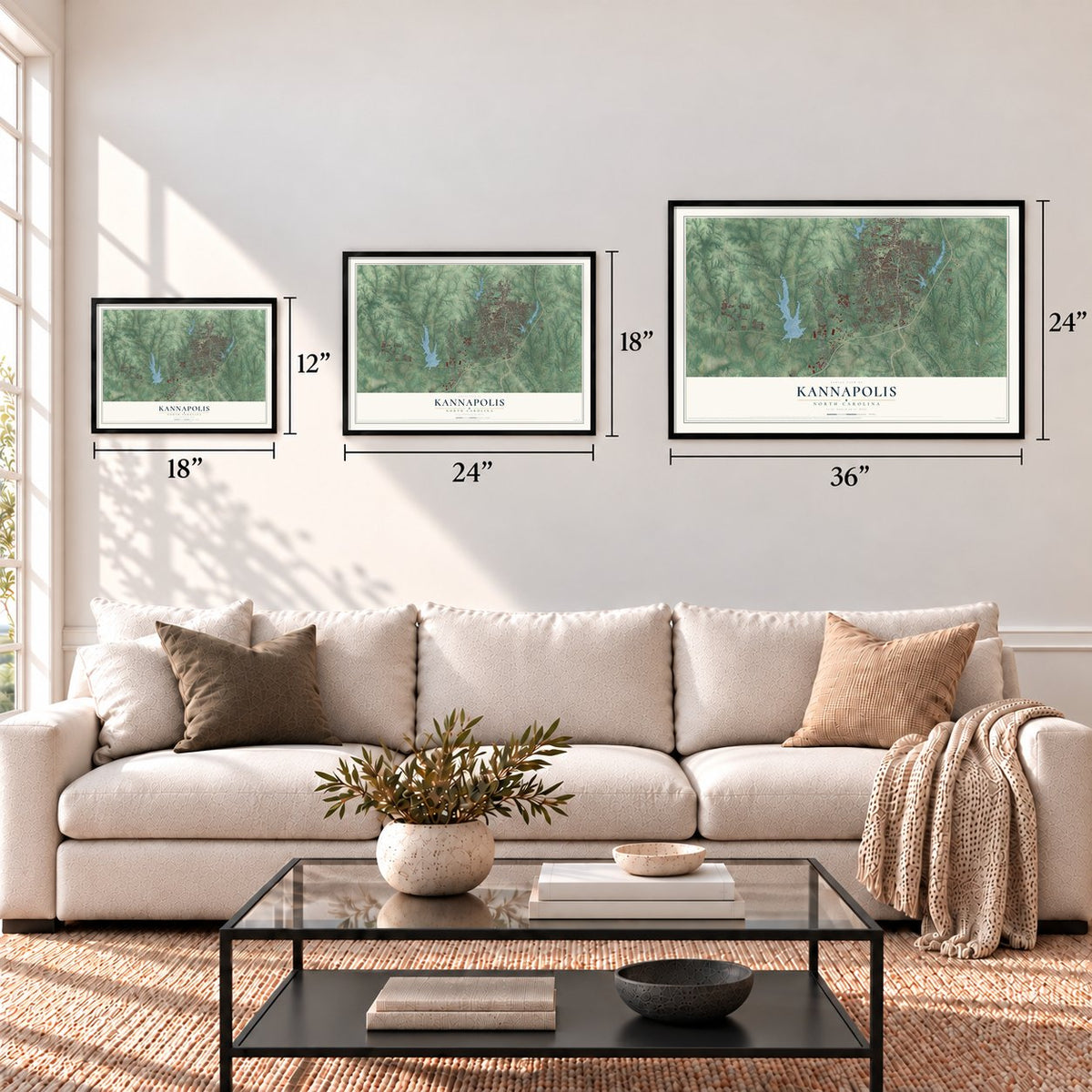
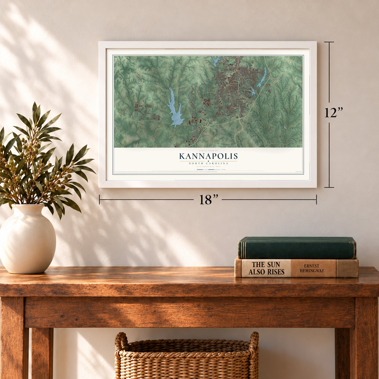
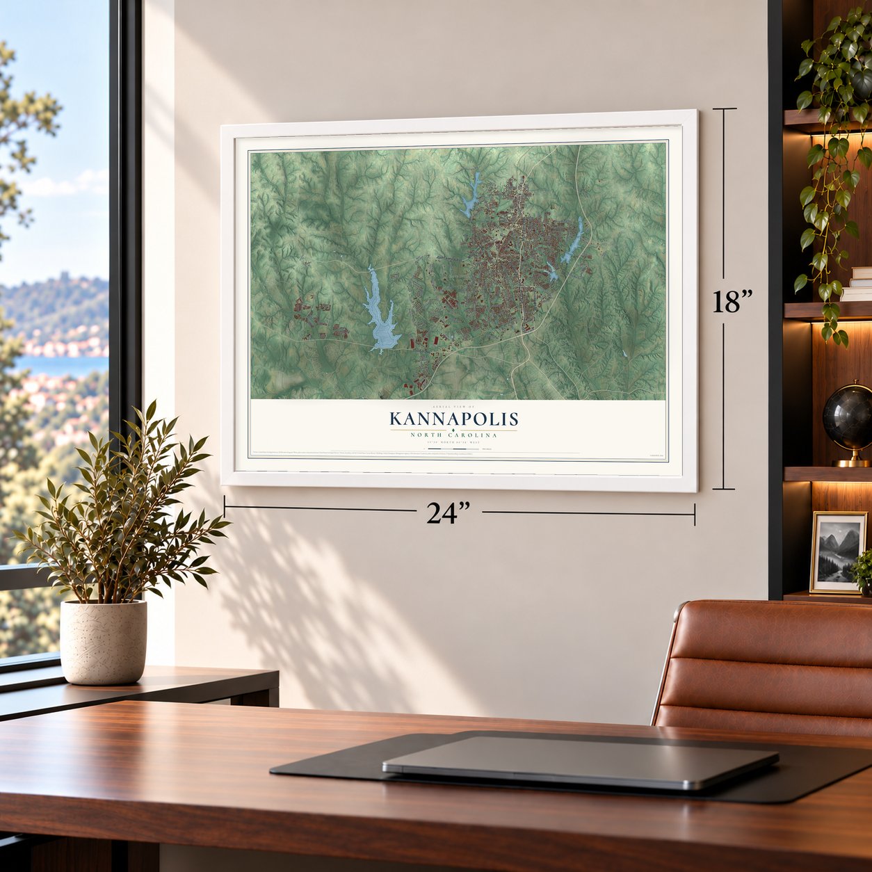
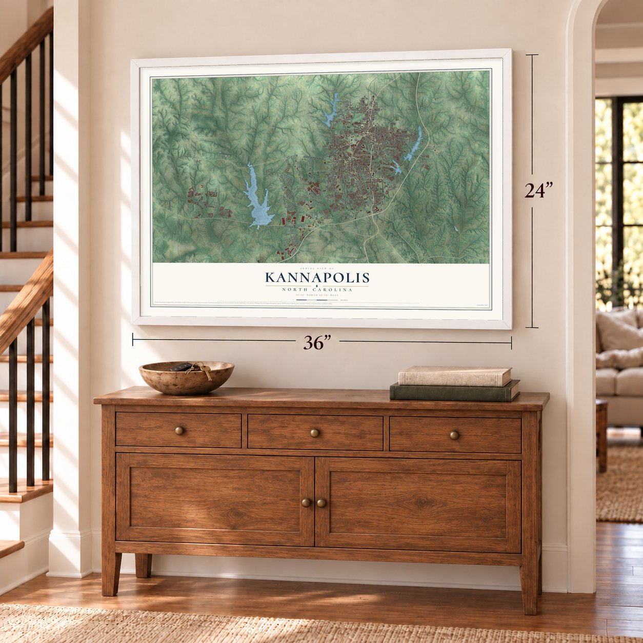
Kannapolis, North Carolina Map Art
Building by building, with labeled streets and shaded relief.
12" x 18" Archival Matte Print
A Map of Home. A Work of Art.
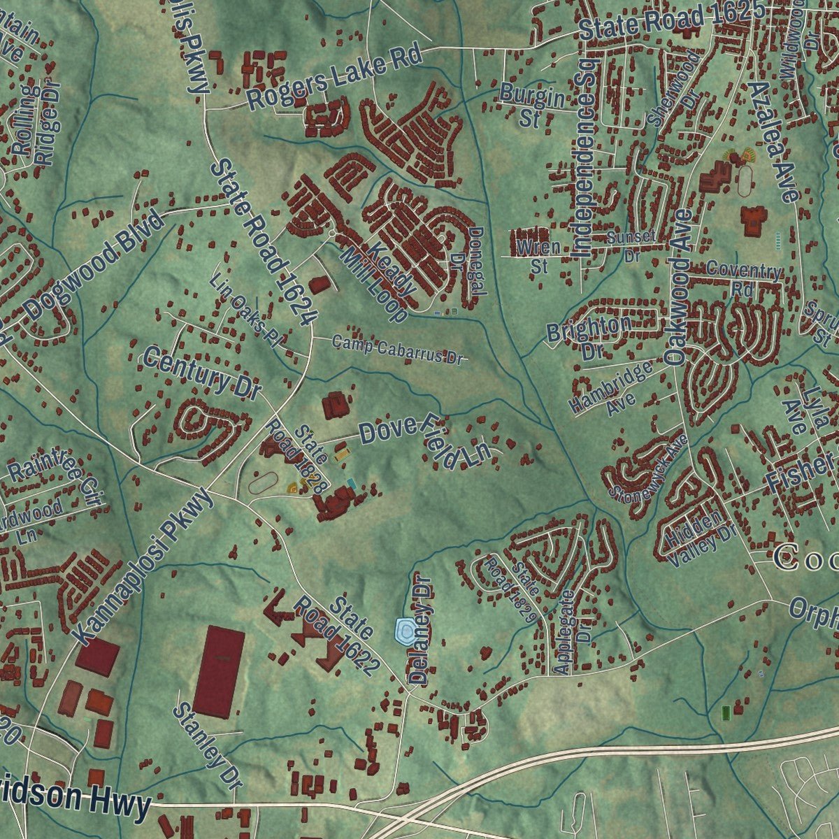
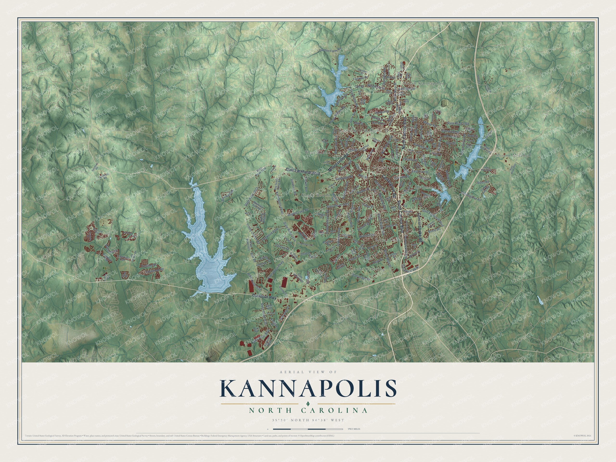
Explore Kannapolis, North Carolina from a whole new perspective. Created using aerial imagery and detailed geographic data, this map captures Kannapolis building by building, with labeled streets, familiar landmarks, and shaded topographical relief that highlights the natural contours of the landscape.
Combining modern data with the timeless character of a vintage atlas, this map is just as interesting up close as it is beautiful on the wall. Whether you grew up in Kannapolis, spent memorable years there, or call it home today, this unique map is a great way to celebrate a place that means something to you. Zoom in on the preview to look for your street, and then order a print to put your memories on the wall.
Three ways to hang it
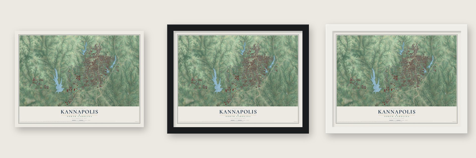
Unframed archival matte, a black wood frame or a white wood frame.
Up close
Geography Worth Displaying
This map was created using accurate cartographic data and authoritative geographic sources, including the U.S. Geological Survey and the Census Bureau. The map brings together terrain, waterways, roads, and building detail. The majority of the streets are labeled, houses are accurately depicted, and the topography is derived from government sources. Combining local data with carefully composed color and shading leads to this beautifully detailed Kannapolis artwork for your wall.
Rather than simply showing street outlines, we’ve included as many of the street names as we could reasonably fit on the map while keeping their names legible. Zoom in on the high resolution preview to see exactly what’s on the map. We truly set out to create a statement piece for anyone who loves Kannapolis. So whether it’s for you, or a gift for someone you love, we hope this map of Kannapolis brings back fond memories.
Read the story behind this map of Kannapolis, North Carolina from 2026.
Find your street
Names on the Kannapolis map
Every name below is printed on this map. Look for your street, your school, the park where you played, or the pond down the road.
Places and landmarks10
- Kannapolis City Hall
- Centerview
- Cooks Crossing
- Glass
- Heilmans Mill
- Mount Mitchell
- North Kannapolis
- Royal Oaks
- Shady Brook
- West Brook
Streets and roads212
- South Cannon Boulevard
- North Cannon Boulevard
- Dale Earnhardt Boulevard
- Davidson Highway
- Mooresville Road
- Centergrove Road
- Concord Lake Road
- South Main Street
- North Main Street
- East First Street
- Louise Avenue
- Kannapolis Parkway
- Lane Street
- State Road 1430
- Kannaplosi Parkway
- State Road 1308
- South Ridge Avenue
- State Road 1624
- Roxie Street
- Trinity Church Road
- Rogers Lake Road
- State Road 1625
- Brantley Road
- Oakwood Avenue
- Orphanage Road
- Isenhour Road
- Moose Road
- Barr Road
- Pennsylvania Avenue
- Bethpage Road
Show all 212 streets
- China Grove Road
- Enochville Road
- Pine Street
- Glenwood Street
- Fisher Street
- State Road 1623
- Midlake Avenue
- Pump Station Road
- Ruth Avenue
- Azalea Avenue
- Glen Afton Boulevard
- Dogwood Boulevard
- Pleasant Avenue
- State Road 1620
- Stirewalt Road
- Klondale Avenue
- Independence Square
- Cloverleaf Parkway
- West 22nd Street
- Grace Avenue
- Fairway Drive
- Dove Field Lane
- Westover Avenue
- Fairview Street
- Kimball Street
- Walker Street
- Glendale Avenue
- Cooper Avenue
- Cannon Farm Road
- Wright Avenue
- Biscayne Drive
- Clay Street
- Treeline Drive
- West Avenue
- Lockwood Road
- Westlake Drive
- Easy Street
- Desoto Avenue
- North Rose Avenue
- Tucker Avenue
- East 22nd Street
- Briarcliff Drive
- Elwood Street
- Oval Street
- Sides Road
- Century Drive
- Meadow Avenue
- Locust Street
- Alabaster Drive
- Gay Street
- Chipola Street
- Hyde Street
- Scott Street
- Triece Street
- Dale Avenue
- Cub Street
- Bell Street
- North Ridge Avenue
- State Road 1622
- Boy Scout Camp Road
- State Road 1621
- Keady Mill Loop
- McLain Road
- Linda Avenue
- Glenn Avenue
- State Road 2180
- Forrestbrook Drive
- Mable Avenue
- State Road 1616
- Dakota Street
- Evelyn Avenue
- Stadium Drive
- Corl Road
- Raintree Circle
- North Juniper Avenue
- Idlewood Drive
- Camp Julia Road
- Flicker Street
- Mallard Pointe Drive
- Esther Circle
- York Avenue
- Travertine Trail
- Lyla Avenue
- Sudbury Road
- Mountain Vine Avenue
- Chestnut Avenue
- Joe Street
- Ontario Drive
- Stanley Drive
- Archdale Drive
- Bayfield Parkway
- Hickory Avenue
- Sapphire Trail
- Skyway Drive
- Delaney Drive
- Corriher Street
- Brighton Drive
- Rolling Ridge Drive
- Valwood Street
- Madison Avenue
- Beaumont Avenue
- Ashe Avenue
- Afton Run
- Irene Avenue
- Rice Street
- Indiana Street
- Burgin Street
- Ivory Lane
- Echerd Street
- Fir Avenue
- Lefler Street
- V-8 Street
- Alta Way
- Jet Street
- Isaac Drive
- May Street
- Laureate Way
- Florida Avenue
- Jim Johnson Road
- Laura Avenue
- Richard Avenue
- Applegate Drive
- West 21st Street
- East 20th Street
- Englewood Street
- Lin Oaks Place
- State Road 2000
- Riverfarm Boulevard
- Castlebrook Drive
- South Chapel Street
- Springway Drive
- Hardwood Lane
- West Ninth Street
- Donegal Drive
- Cedar Hill Drive
- Wildwood Drive
- Sherwood Drive
- Hambridge Avenue
- Lakeview Street
- State Road 1828
- State Road 1002
- Coventry Road
- Samantha Drive
- Waco Avenue
- Dalewood Avenue
- Colony Drive
- Spruce Street
- Davidson Road
- Tailwater Drive
- Hidden Valley Drive
- West 16th Street
- Akron Avenue
- October Lane
- Nob Hill Drive
- Prince Street
- Wren Street
- Grove Street
- Old Beatty Ford Road
- Evergreen Avenue
- Rainbow Drive
- Franklin Avenue
- Camp Cabarrus Drive
- Coldwater Ridge Drive
- Central Avenue
- State Road 1829
- Stonewyck Avenue
- Sunset Drive
- East 18th Street
- Villa Street
- Debbie Street
- Poplarglen Drive
- Clermont Avenue
- McClenny Drive
- Helen Street
- Haven Street
- Basin Avenue
- Martha Drive
- Crusader Way
- Debbie Circle
- Angela Lane
- Larry Drive
- Bo Drive
Names are listed as they appear on the printed map. Zoom into the product photos to find them.
About Kannapolis, North Carolina
Kannapolis is a city of 53,114 people, most of it in Cabarrus County with a smaller part in Rowan County. In 1905 James William Cannon bought 600 acres of farmland beside the Southern Railway tracks. There he built a textile mill and houses for the people who would work in it. The mill started running in 1908, and by 1914 Cannon Manufacturing was known as the biggest maker of sheets and towels in the world.
Cannon went on to open plants in Rowan County, Concord and South Carolina, which together employed 20,000 workers. In 1928 his youngest son, Charles A. Cannon, joined the separate mills into one giant firm, Cannon Mills Company. The mill town had no city government of its own until 1984. When it finally incorporated that year, it was the largest unincorporated community in North Carolina and the seventeenth-largest in the country.
“Jim Cannon didn't study Greek”
- A name spelled with a KA Concord newspaper called the new mill town Cannon City in 1906, and workers and papers soon called it Cannapolis. J.W. Cannon asked the Cabarrus County commissioners to make that the name but spell it with a K. Local historian Norris Dearmon thought the K may have set it apart from Cannon's mill village in Concord. The popular meaning, City of Looms, doesn't hold up, since the Greek word kanna means reeds.
- A town on film in 1941The traveling filmmaker H. Lee Waters shot a silent film of ordinary people going about their day in Kannapolis in 1941. In 2004 the Library of Congress added it to the National Film Registry as an example of the town portraits that were popular in the 1930s and 1940s.
Keep exploring North Carolina
Kannapolis is one of 951 North Carolina towns we've mapped. Every dot on the map is a print of its own.
The search covers every state, North Carolina first.
Near Kannapolis
Order 2 or more town maps and save 10%. Shown in the size and finish you picked above, so they hang as a set.
- Enochville 12" x 18" / Archival Matte Print $39.99
- Landis 12" x 18" / Archival Matte Print $39.99
- Concord 12" x 18" / Archival Matte Print $39.99

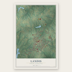

More maps nearby: China Grove, Davidson, Harrisburg, Rocky River and Mooresville.
The art of mapping a place
How This Map Was Made
Real places. Remarkable detail. Discover the layers that turn geographic data into a map of home.

The view from above
Aerial imagery reveals the character of the land: woodland, open fields, and the patterns of a place.

The shape of the land
Elevation data brings hills, valleys, and subtle changes in the landscape into view.

The details of home
Roads, waterways, and building footprints come together to make the map feel unmistakably local.

Geography becomes art
Considered color, shading, and typography bring the layers together in a map made for your wall.


Process illustrated with Mendon, Massachusetts. Aerial imagery: USDA NAIP. Terrain: USGS 3D Elevation Program. Map details and finished artwork: KNOWOL.
The Details
About This Print
Choose an archival matte print, or a black or white Ayous wood frame. The archival matte print is unframed.
Select your size and finish above to see the matching product image and price.
Materials & Craftsmanship
A contemporary map with the character of a classic atlas, printed on archival matte paper. Optional frames are made from Ayous wood.
Your printed map does not include the watermark shown in the full-map preview.
Shipping & Delivery
Free shipping within the United States. Every print is made to order in the USA.
Buying a gift? Add a note in your cart and we'll include it. We never put prices in the package.
Prints ship within 2 to 3 business days. Allow 7 to 10 days total from ordering for delivery. Timing may vary during holidays or periods of high order volume.
Read our shipping policy.
Returns and damaged prints
Each print is made to order. Change-of-mind refunds are not available after production.
If your print arrives damaged, misprinted or incorrect, contact support@knowol.com within 30 days of receiving it. Include your order number, photos and a description of the issue.
Read our full refund and replacement policy. For questions about your order, email support@knowol.com.