
Search for another town



Free U.S. delivery 7 to 10 days after you order
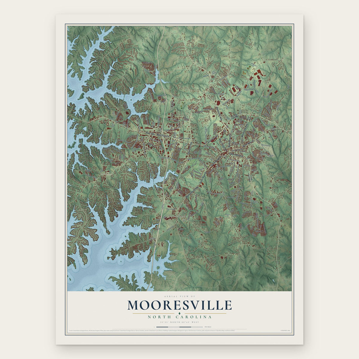
Mooresville, North Carolina Map Art
Building by building, with labeled streets and shaded relief.
12" x 18" Archival Matte Print
A Map of Home. A Work of Art.
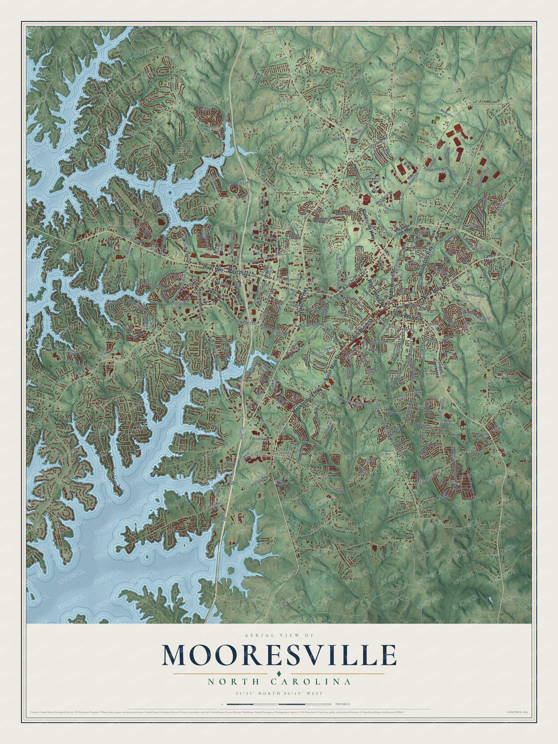
Explore Mooresville, North Carolina from a whole new perspective. Created using aerial imagery and detailed geographic data, this map captures Mooresville building by building, with labeled streets, familiar landmarks, and shaded topographical relief that highlights the natural contours of the landscape.
Combining modern data with the timeless character of a vintage atlas, this map is just as interesting up close as it is beautiful on the wall. Whether you grew up in Mooresville, spent memorable years there, or call it home today, this unique map is a great way to celebrate a place that means something to you. Zoom in on the preview to look for your street, and then order a print to put your memories on the wall.
Three ways to hang it

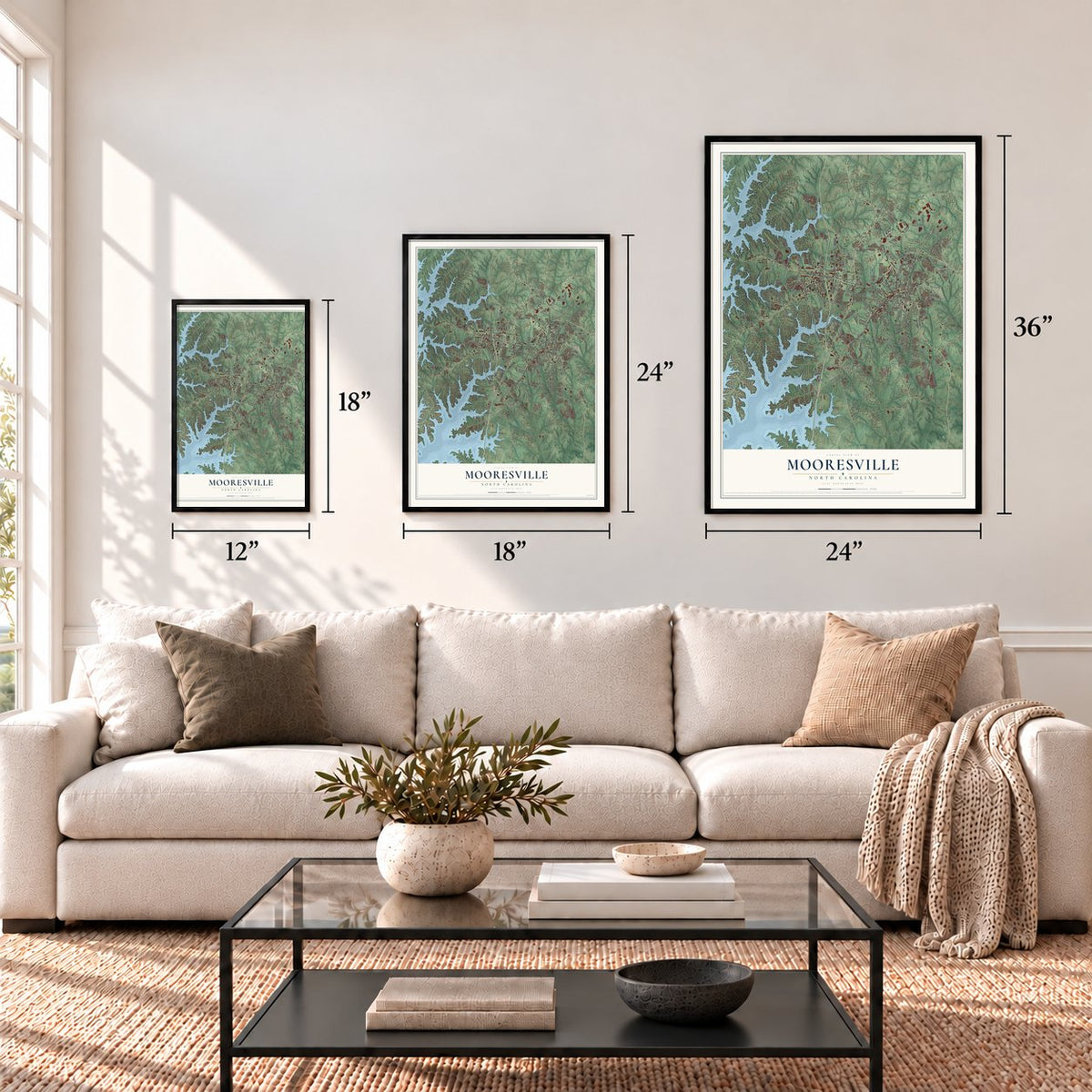
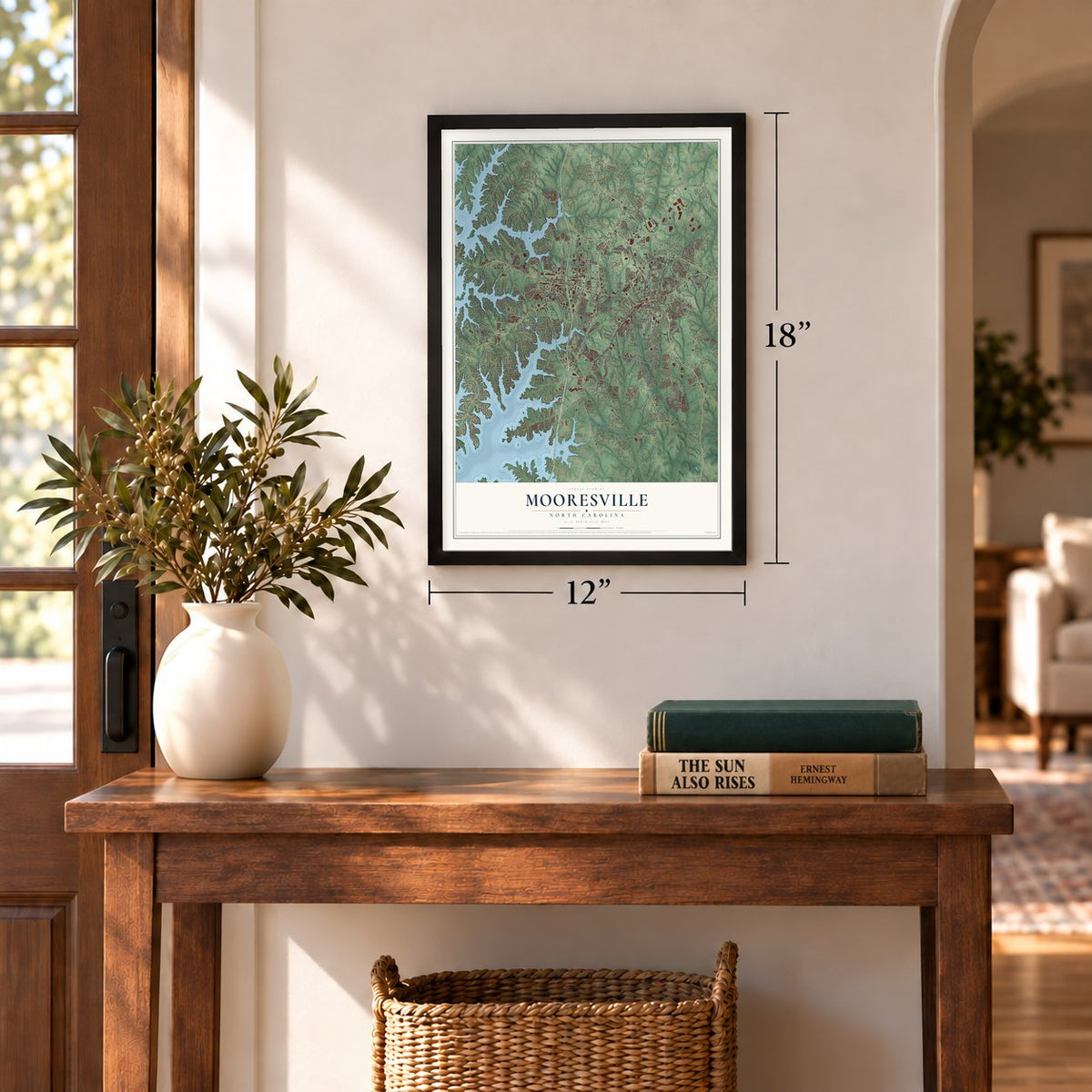
Unframed archival matte, a black wood frame or a white wood frame.
Up close
Geography Worth Displaying
This map was created using accurate cartographic data and authoritative geographic sources, including the U.S. Geological Survey and the Census Bureau. The map brings together terrain, waterways, roads, and building detail. The majority of the streets are labeled, houses are accurately depicted, and the topography is derived from government sources. Combining local data with carefully composed color and shading leads to this beautifully detailed Mooresville artwork for your wall.
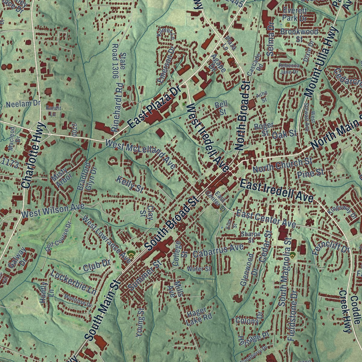
Rather than simply showing street outlines, we’ve included as many of the street names as we could reasonably fit on the map while keeping their names legible. Zoom in on the high resolution preview to see exactly what’s on the map. We truly set out to create a statement piece for anyone who loves Mooresville. So whether it’s for you, or a gift for someone you love, we hope this map of Mooresville brings back fond memories.
Read the story behind this map of Mooresville, North Carolina from 2026.
Find your street
Names on the Mooresville map
Every name below is printed on this map. Look for your street, your school, the park where you played, or the pond down the road.
Places and landmarks2
- Mount Mourne
- Lake Norman
Streets and roads241
- Charlotte Highway
- North Broad Street
- East Plaza Drive
- East Iredell Avenue
- South Broad Street
- West Iredell Avenue
- North Main Street
- West Plaza Drive
- River Highway
- Mount Ulla Highway
- Mecklenburg Highway
- South Main Street
- Statesville Highway
- State Road 1109
- Williamson Road
- East Center Avenue
- State Road 1467
- West McLelland Avenue
- Brawley School Road
- State Road 1100
- Shearers Road
- Oak Tree Road
- South Magnolia Street
- Mazeppa Road
- Fieldstone Road
- Fieldstone Drive
- State Road 1135
- Talbert Road
- Rocky River Road
- Rinehardt Road
Show all 241 streets
- West Wilson Avenue
- Plantation Ridge Drive
- Almora Loop
- Preston Road
- Langtree Road
- Morrison Plantation Pk
- Ervin Road
- River Birch Circle
- Timber Road
- Gates Road
- Oates Road
- Blueview Road
- Cayuga Drive
- Oak Street
- Perth Road
- Cedar Street
- Cabarrus Avenue
- Shinnville Road
- Selma Drive
- Glennallen Road
- Flanders Drive
- Faith Road
- Abersham Drive
- North Church Street
- Chandeleur Drive
- Castles Gate Drive
- Manufacturers Boulevard
- Glencoe Road
- Raceway Drive
- Tetcott Street
- Pine Street
- Madelia Place
- Golden Valley Drive
- East Warfield Drive
- Forest Lake Boulevard
- Grayland Road
- Singleton Road
- Welcombe Street
- Cedarcroft Drive
- Panasonic Way
- Briarcliff Road
- Gresham Lane
- Haddonsfield Drive
- Byers Creek Road
- Ferncliff Drive
- Kelly Street
- Summer Street
- Knob Hill Road
- Challenge Lane
- Lockerbie Lane
- Terrace Road
- Fairview Road
- Gabriel Drive
- Chance Road
- Belk Road
- Club Drive
- Coddle Creek Highway
- Park Avenue
- Landis Highway
- Alcove Road
- Mecklynn Road
- State Road 2395
- Bluefield Road
- State Road 1306
- State Road 1102
- Mooresville Boulevard
- Kistler Farm Road
- Rolling Hill Road
- State Road 1304
- Linwood Avenue
- Elrosa Road
- Forest Walk Way
- Wilson Lake Road
- State Road 2399
- West Lowrance Avenue
- Emerson Drive
- Bluffton Road
- Bushney Loop
- State Road 1311
- Joe Knox Avenue
- Glastonbury Drive
- Heatherly Road
- Brookwood Street
- Beech Tree Road
- Heritage Place
- Lowes Boulevard
- Eden Avenue
- Crimson Orchard Drive
- Overhill Drive
- Rankinhill Road
- Alexandria Drive
- Everett Park Drive
- Branchview Drive
- Stibbs Cross Road
- Glenwood Drive
- Corporate Center Drive
- Carriage Club Drive
- Waterlynn Ridge Road
- Pepaw Drive
- Bell Street
- College Street
- Brantley Place Drive
- Wrangell Drive
- Harris Farm Road
- Lincoln Park Drive
- Stallings Mill Drive
- Bay Laurel Drive
- Sassafras Road
- Galway Drive
- Water Oak Drive
- Bradford Glyn Drive
- Longboat Road
- Reids Cove Drive
- Mills Avenue
- Blume Road
- Pink Orchard Drive
- Huntly Lane
- Neelam Drive
- Colony Drive
- Jenkins Farm Lane
- Larragan Drive
- Misty Arbor
- Matlen Drive
- Motorplex Drive
- Agape Drive
- Coddle Way
- Hager Lake Road
- Rose Street
- Besford Lane
- Bird Dog Drive
- Boger Street
- Young Street
- Doolie Road
- Glade Valley Lane
- Kristens Court Drive
- Easy Street
- Saddle Road
- Clay Street
- Erie Road
- Oak Ridge Farm Highway
- East Center Street
- Prestwick Way
- State Road 1147
- Montibello Drive
- State Road 1254
- White Oaks Road
- Wiggins Road
- Fernbrook Drive
- State Road 1206
- Cascade Road
- Golf Course Drive
- Yellow Wood Cr
- Willow Valley Drive
- Serviceberry Way
- Kilmer Lane
- Wellshire Street
- Hampton Place
- Sharpe Street
- Caspian Place
- Dixie Drive
- Barley Park Lane
- South Iredell Ind Pk Road
- Plaza Lane
- Trotter Ridge Drive
- Kingsway Drive
- Macleod Drive
- Kingshall Road
- Stafford Lane
- Saye Place
- Town Loop
- Water Street
- Edgeway Road
- Boxtail Way
- Ridge Hill Drive
- Cole Drive
- Grove Park Drive
- Sierra Road
- Argus Lane
- Alo Drive
- Ryan Lane
- State Road 1148
- Rebecca Jane Drive
- Paradise Hill Circle
- Blossom Ridge Drive
- Silverspring Place
- Kilborne Road
- Oak Village Parkway
- Talbert Pointe Drive
- West Stewart Avenue
- Sansome Road
- Cherry Birch Street
- Woodberry Drive
- Camforth Drive
- Gallery Center Drive
- Aztec Circle
- Timberlane Terrace
- Gateway Boulevard
- Cornelius Road
- Cedar Pointe Drive
- Montrose Drive
- Coronilla Road
- Franklin Grove Road
- Fount Place
- Talbert Woods Drive
- Overhead Bridge Road
- Sweet Leaf Lane
- Doyle Farm Lane
- Bandit Lane
- Elm Street
- Azalea Road
- Ashe Street
Names are listed as they appear on the printed map. Zoom into the product photos to find them.
About Mooresville, North Carolina
Mooresville is a town of 50,193 people in southern Iredell County, near Lake Norman. Farm families of English, German and Scots-Irish descent began settling here in the mid-1700s, coming from Rowan County, Virginia and Pennsylvania. In 1857 John Franklin Moore, a small planter, gave land on his farm for a railroad depot, and work on the railroad began in 1860. A village called Moore's Siding grew up around the stop.
The Civil War stalled the village, because its rails were pulled up and sent to help the Confederacy in Virginia. They were put back after the war, and in 1873 the town was incorporated as Mooresville, with Moore as its first mayor. He started the town's first brick factory and built several of Main Street's earliest brick stores. Moore died in 1877, and Rachel Summrow Moore, his widow, carried on his work. A new depot came in 1883, then a phone company in 1893, a library in 1899 and the first textile mill in 1900.
“The people who moved to Mooresville were church-goers when they came, having been reared in rural families of strict religious background.”
- First called Deep WellBefore Moore's Siding, the farm settlements here made up a community called Deep Well, named for a big natural well found nearby. The Davidsons, Wilsons, Cowans, Sherrills and Torrances were among the families who had arrived by the mid-1700s, and by the 1850s many of their cotton farms had grown into small plantations.
- Selma Burke's RooseveltSelma Burke, born and raised in Mooresville, became a leading sculptor of the Harlem Renaissance. She sculpted Franklin D. Roosevelt's portrait for the Four Freedoms plaque, which is in Washington, D.C., at the Recorder of Deeds building. Her bust later became the model for the image on the dime.
- Race City USAMore than 60 NASCAR teams and racing businesses work in Mooresville, along with an IndyCar team. NC 3 runs through downtown carrying the number Dale Earnhardt raced under.
- A 1938 post office muralAlicia Weincek won a WPA competition to paint a mural for the town's post office. Her work, North Carolina Cotton Industry, went up on its wall in 1938.
Keep exploring North Carolina
Mooresville is one of 952 North Carolina towns we've mapped. Every dot on the map is a print of its own.
The search covers every state, North Carolina first.
Near Mooresville
Order 2 or more town maps and save 10%. Shown in the size and finish you picked above, so they hang as a set.
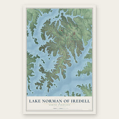
- Lake Norman of Iredell 12" x 18" / Archival Matte Print $39.99
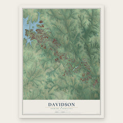
- Davidson 12" x 18" / Archival Matte Print $39.99
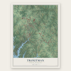
- Troutman 12" x 18" / Archival Matte Print $39.99
More maps nearby: Cornelius, Lake Norman of Catawba, Enochville, Westport and Kannapolis.
The art of mapping a place
How This Map Was Made
Real places. Remarkable detail. Discover the layers that turn geographic data into a map of home.

The view from above
Aerial imagery reveals the character of the land: woodland, open fields, and the patterns of a place.

The shape of the land
Elevation data brings hills, valleys, and subtle changes in the landscape into view.

The details of home
Roads, waterways, and building footprints come together to make the map feel unmistakably local.

Geography becomes art
Considered color, shading, and typography bring the layers together in a map made for your wall.


Process illustrated with Mendon, Massachusetts. Aerial imagery: USDA NAIP. Terrain: USGS 3D Elevation Program. Map details and finished artwork: KNOWOL.
The Details
About This Print
Choose an archival matte print, or a black or white Ayous wood frame. The archival matte print is unframed.
Select your size and finish above to see the matching product image and price.
Materials & Craftsmanship
A contemporary map with the character of a classic atlas, printed on archival matte paper. Optional frames are made from Ayous wood.
Your printed map does not include the watermark shown in the full-map preview.
Shipping & Delivery
Free shipping within the United States. Every print is made to order in the USA.
Buying a gift? Add a note in your cart and we'll include it. We never put prices in the package.
Prints ship within 2 to 3 business days. Allow 7 to 10 days total from ordering for delivery. Timing may vary during holidays or periods of high order volume.
Read our shipping policy.
Returns and damaged prints
Each print is made to order. Change-of-mind refunds are not available after production.
If your print arrives damaged, misprinted or incorrect, contact support@knowol.com within 30 days of receiving it. Include your order number, photos and a description of the issue.
Read our full refund and replacement policy. For questions about your order, email support@knowol.com.