
Search for another town





Free U.S. delivery 7 to 10 days after you order
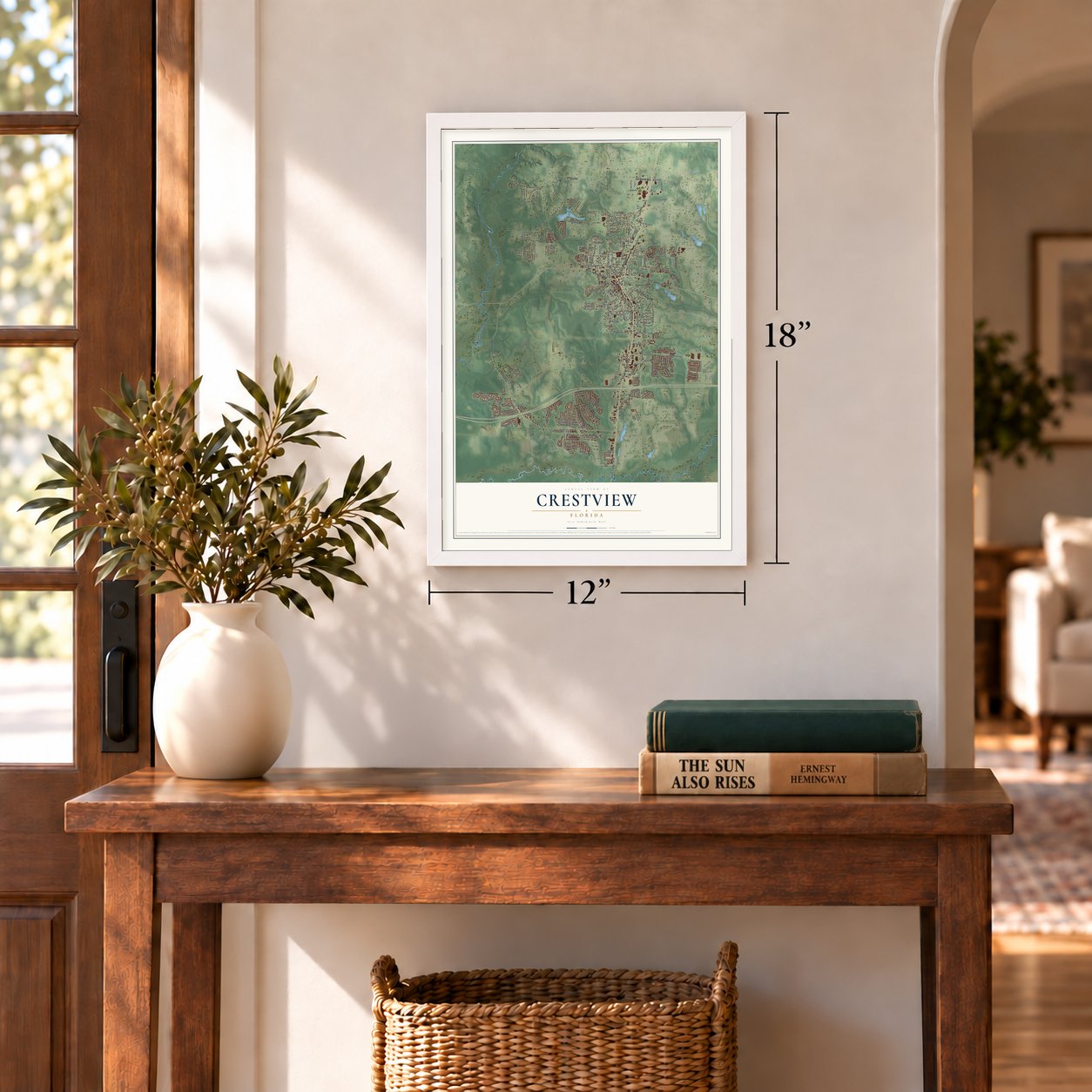
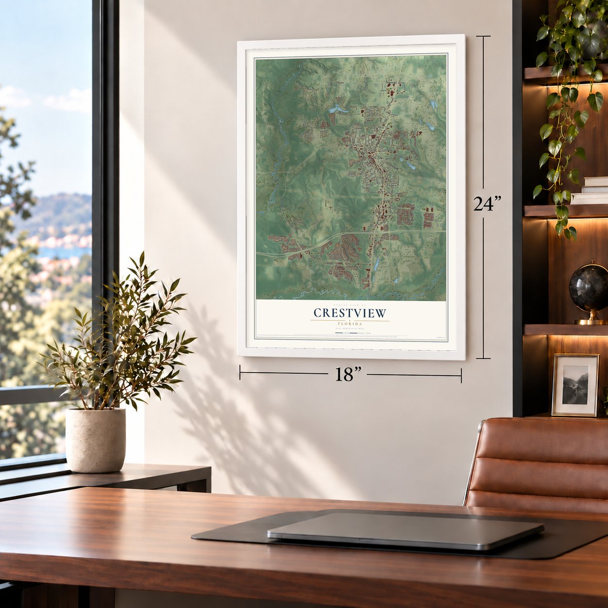
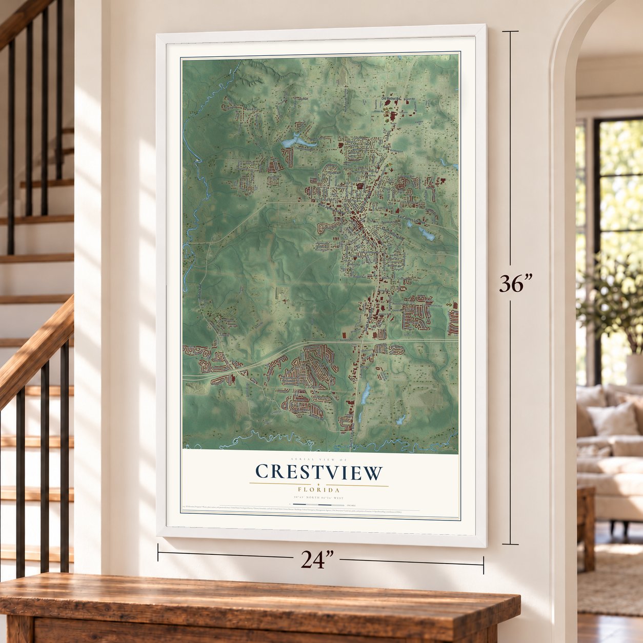
Crestview, Florida Map Art
Building by building, with labeled streets and shaded relief.
12" x 18" Archival Matte Print
A Map of Home. A Work of Art.
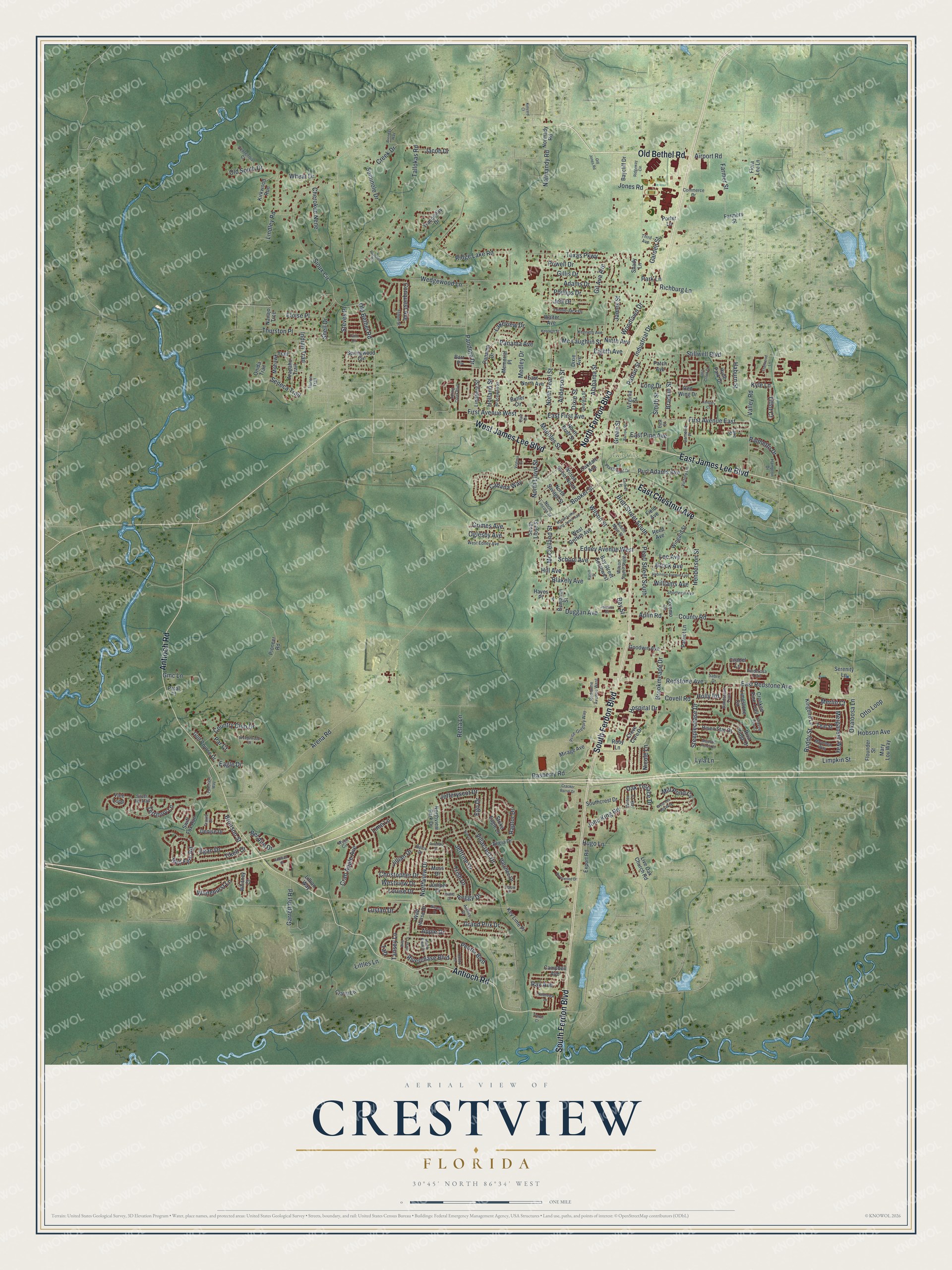
Explore Crestview, Florida from a whole new perspective. Created using aerial imagery and detailed geographic data, this map captures Crestview building by building, with labeled streets, familiar landmarks, and shaded topographical relief that highlights the natural contours of the landscape.
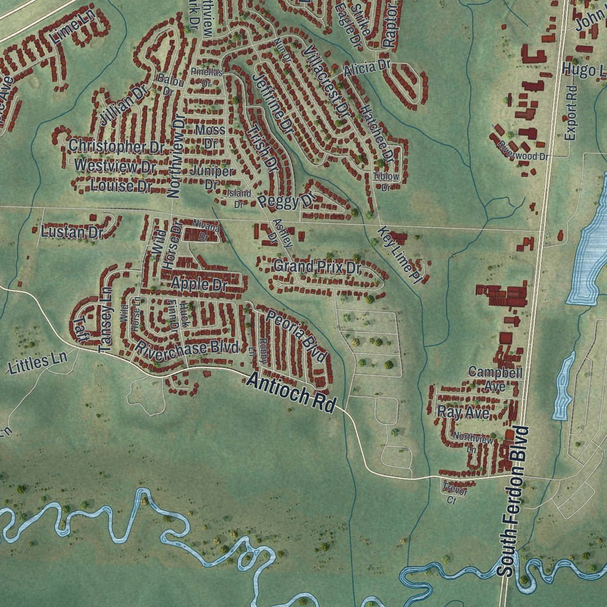
Combining modern data with the timeless character of a vintage atlas, this map is just as interesting up close as it is beautiful on the wall. Whether you grew up in Crestview, spent memorable years there, or call it home today, this unique map is a great way to celebrate a place that means something to you. Zoom in on the preview to look for your street, and then order a print to put your memories on the wall.
Three ways to hang it
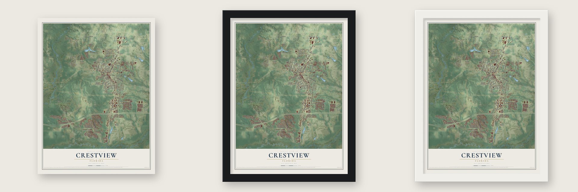
Unframed archival matte, a black wood frame or a white wood frame.
Up close
Geography Worth Displaying
This map was created using accurate cartographic data and authoritative geographic sources, including the U.S. Geological Survey (USGS) and FEMA. The map brings together terrain, waterways, roads, and building detail. The majority of the streets are labeled, houses are accurately depicted, and the topography is derived from government sources. Combining local data with carefully composed color and shading leads to this beautifully detailed Crestview artwork for your wall.
Rather than simply showing street outlines, we’ve included as many of the street names as we could reasonably fit on the map while keeping their names legible. Zoom in on the high resolution preview to see exactly what’s on the map. We truly set out to create a statement piece for anyone who loves Crestview. So whether it’s for you, or a gift for someone you love, we hope this map of Crestview brings back fond memories.
Explore the full map of Crestview, Florida and read about the local places it shows.

Find your street
Names on the Crestview map
Every name below is printed on this map. Look for your street, your school, the park where you played, or the pond down the road.
Places and landmarks1
- Twin Hills Park
Streets and roads293
- South Ferdon Boulevard
- North Ferdon Boulevard
- Old Bethel Road
- East James Lee Boulevard
- Antioch Road
- West James Lee Boulevard
- East Chestnut Avenue
- Edney Avenue West
- Pandora Drive
- East Redstone Avenue
- Booker Street
- Wilson Street
- First Avenue East
- Egan Drive
- Grimes Avenue
- Eagle Drive
- Hill Avenue
- Industrial Drive
- Rasberry Road
- Texas Parkway
- Jones Road
- Arena Road
- Villacrest Drive
- Sioux Circle
- North Lloyd Street
- North Pearl Street
- Northview Drive
- Brookmeade Drive
- Riverchase Boulevard
- East First Avenue
Show all 293 streets
- Ridge Lake Road
- Stillwell Boulevard
- Tallokas Road
- Adams Drive
- Whitehurst Lane
- Brackin Street
- Okaloosa Lane
- Cabana Way
- Jillian Drive
- Jefferyscot Drive
- Valley Road
- Redstone Avenue
- Conquest Avenue
- Aplin Road
- County Road
- Peoria Boulevard
- Seneca Trail
- Old South Drive
- Bay Street
- Henderson Street
- Pearl Street South
- Alabama Street
- Duggan Avenue
- Farmer Street
- Mapoles Street
- McClelland Street
- Lakeview Drive
- Ego Drive
- Panama Avenue
- East Pine Avenue
- Crab Apple Avenue
- Powell Drive
- Garden Street
- Red Fern Road
- Merganser Way
- First Avenue West
- John King Road
- Williams Avenue
- Grand Prix Drive
- Brett Street South
- Oak Terrace Drive
- Apple Drive
- Retta Lane
- Brock Avenue
- Dixie Street
- Anderson Street
- Steeplechase Drive
- Otto Loop
- Nicole Lane
- Indian Trail
- Hospital Drive
- School Avenue
- Thurston Place
- Blakely Avenue
- Territory Lane
- Trish Drive
- Wedgewood Lane
- Peggy Drive
- Jeffrine Drive
- Eighth Avenue
- Palmetto Drive
- Country Club Drive
- Gillis Drive
- Phillips Drive
- Hugo Lane
- Long Drive
- Creek Drive
- Seminole Drive
- Lee Avenue
- Eloise Place
- Raptor Drive
- Lindley Road
- Merlin Court
- Purl Adams Avenue
- Medley Drive
- Christopher Drive
- Tikell Drive
- Cherokee Nene
- Garrett Pit Road
- Jeff Drive
- Airport Road
- Lime Lane
- Richburg Lane
- Westview Drive
- Woodlawn Drive
- Tansey Lane
- Limpkin Street
- Bel Aire Drive
- Brunson Street
- Mc Laughlin Street
- Shell Drive
- Holly Road
- Park Lane
- Louise Drive
- Hobson Avenue
- Lustan Drive
- Mill Pond Cv
- Normandy Road
- Oglesby Avenue
- Covell Road
- Patton Street
- Haburn Street
- James Street
- Steves Place
- Ruddy Street
- Holland Street
- Wheat Drive
- Jacob Drive
- Smith Street
- Taft
- Tiffot Court
- Ray Avenue
- Gil Ava Avenue
- Gmc Lane
- Ninth Avenue
- Littles Lane
- Lyla Lane
- Kyle Lane
- Green Street
- Par Court
- Mirage Avenue
- Bay Street Southwest
- West Griffith Avenue
- Panama Drive
- Wilson Street North
- Tranquility Drive
- Alicia Drive
- Citadel Lane
- Springwood Circle
- Limestone Circle
- Lindberg Street
- Mary Lou Way
- Dixie Avenue
- Reed Avenue
- Mohawk Trail
- Risen Star Drive
- Hatchee Drive
- Hyde Park Drive
- East North Avenue
- Benjamin Street
- Crane Lane
- Strike Eagle Drive
- Golf Course Drive
- Live Oak Church Road
- Kingbird Lane
- Wingard Street
- Ruby Lane
- Creve Core Drive
- Walter Avenue
- Arapaho Trail
- Crooked Pine Trail
- Key Lime Place
- Riva Ridge Drive
- North Savage Street
- Vale Loop
- Kirkwood Run
- Swift Fox Run
- Southcrest Drive
- Goodwin Avenue
- Butler Circle
- North Brett Street
- Patriot Lane
- Flounder Street
- Denise Drive
- Export Road
- Farmers Street
- Baycliff Drive
- Navajo Trce
- Juniper Drive
- Pioneer Road
- Wild Horse Drive
- Shady Lane
- Virginia Street
- Red Wing Drive
- Patch Avenue
- Oakdale Avenue
- Teal Street
- Field Avenue
- Northview Park Drive
- Normady Road
- Campbell Avenue
- Memorial Place
- Coremo Drive
- Whitney Court
- South Lloyd Street
- Flora Lee Lane
- Serenity Lane
- Moss Drive
- Onida Trail
- Barr Place
- Lillian Way
- Petal Place
- Hayes Place
- Porter Lane
- West Edney Avenue
- Wilson Street South
- South Main Street
- Pinderosa Trail
- Playground Drive
- Redstone Avenue West
- Georgia Street
- Kenneth Avenue
- Ashley Drive
- Triton Street
- Hampton Drive
- Price-Gregory Way
- Third Avenue
- Bracewell Street
- Moorhen Way
- Shortwell Avenue
- Lonnie Jack Drive
- Sandstone Trail
- Victory Lane
- Huck Finn Drive
- Centennial Court
- North Lincoln Street
- Camellia Place
- Commerce Drive
- Water Oak Lane
- Huron Trail
- Silver Tip Trail
- Wych Circle
- Travis Court
- Lake Street
- Balou Drive
- Sabre Drive
- Carr Drive
- East Street
- Foxchase Way
- Spring Creek Boulevard
- Martin Luther King Junior Avenue
- Ridgeway Circle
- Robby Lane
- Palm Circle
- Robinson Avenue East
- Nun Drive
- Swaying Pine Court
- Addison Place
- Kenneth Street
- Northview Lane
- West Old Mill Way
- Nivana Drive
- Cracker Barrel Drive
- Virginia Court
- Tiblow Drive
- January Court
- Brendas Way
- Riverwood Drive
- Barrow Street
- Johnson Court
- Majestic Prince Court
- Trailwood Lane
- Split Creek Drive
- Wild Horse Lane
- Old Jones Road
- Caswell Place
- Wedgewood Court
- Kinyard Court
- Ratliff Street
- Island Drive
- Trevor Court
- Apachee Road
- Pinellas Drive
Names are listed as they appear on the printed map. Zoom into the product photos to find them.
About Crestview, Florida
The 2020 census counted 27,134 people in Crestview, a community in Okaloosa County.
- 27,134 peopleRecorded for Crestview in the 2020 census.
- Okaloosa CountyCrestview belongs to Okaloosa County in Florida.
- 12.8 square milesCrestview covers a total area of 12.8 square miles.
- Incorporated in 1916Crestview was incorporated in 1916.
Keep exploring Florida
Crestview is one of 1,067 Florida towns we've mapped. Every dot on the map is a print of its own.
The search covers every state, Florida first.
Near Crestview
Order 2 or more town maps and save 10%. Shown in the size and finish you picked above, so they hang as a set.
- Baker 12" x 18" / Archival Matte Print $39.99
- Mossy Head 12" x 18" / Archival Matte Print $39.99
- Niceville 12" x 18" / Archival Matte Print $39.99


More maps nearby: Laurel Hill, Harold, Valparaiso, Munson and Longwood.
The art of mapping a place
How This Map Was Made
Real places. Remarkable detail. Discover the layers that turn geographic data into a map of home.

The view from above
Aerial imagery reveals the character of the land: woodland, open fields, and the patterns of a place.

The shape of the land
Elevation data brings hills, valleys, and subtle changes in the landscape into view.

The details of home
Roads, waterways, and building footprints come together to make the map feel unmistakably local.

Geography becomes art
Considered color, shading, and typography bring the layers together in a map made for your wall.


Process illustrated with Mendon, Massachusetts. Aerial imagery: USDA NAIP. Terrain: USGS 3D Elevation Program. Map details and finished artwork: KNOWOL.
The Details
About This Print
Choose an archival matte print, or a black or white Ayous wood frame. The archival matte print is unframed.
Select your size and finish above to see the matching product image and price.
Materials & Craftsmanship
A contemporary map with the character of a classic atlas, printed on archival matte paper. Optional frames are made from Ayous wood.
Your printed map does not include the watermark shown in the full-map preview.
Shipping & Delivery
Free shipping within the United States. Every print is made to order in the USA.
Buying a gift? Add a note in your cart and we'll include it. We never put prices in the package.
Prints ship within 2 to 3 business days. Allow 7 to 10 days total from ordering for delivery. Timing may vary during holidays or periods of high order volume.
Read our shipping policy.
Returns and damaged prints
Each print is made to order. Change-of-mind refunds are not available after production.
If your print arrives damaged, misprinted or incorrect, contact support@knowol.com within 30 days of receiving it. Include your order number, photos and a description of the issue.
Read our full refund and replacement policy. For questions about your order, email support@knowol.com.