
Search for another town






Free U.S. delivery 7 to 10 days after you order
Dana, North Carolina Map Art
Building by building, with labeled streets and shaded relief.
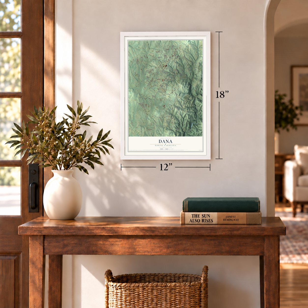
12" x 18" Archival Matte Print
A Map of Home. A Work of Art.
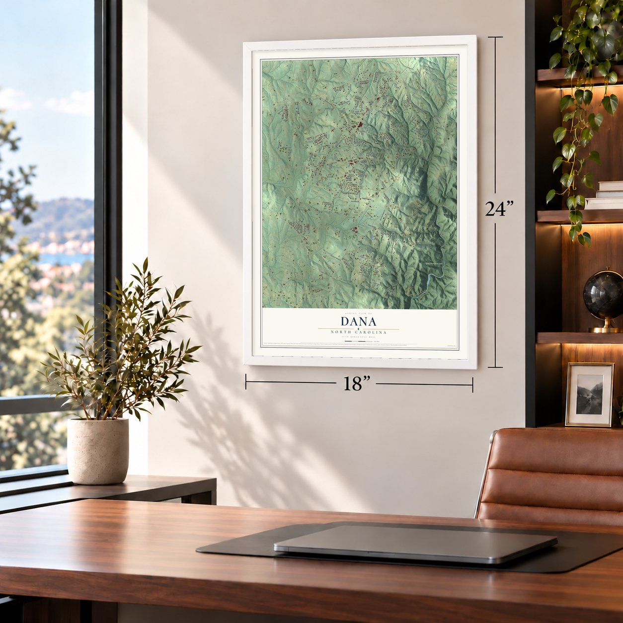
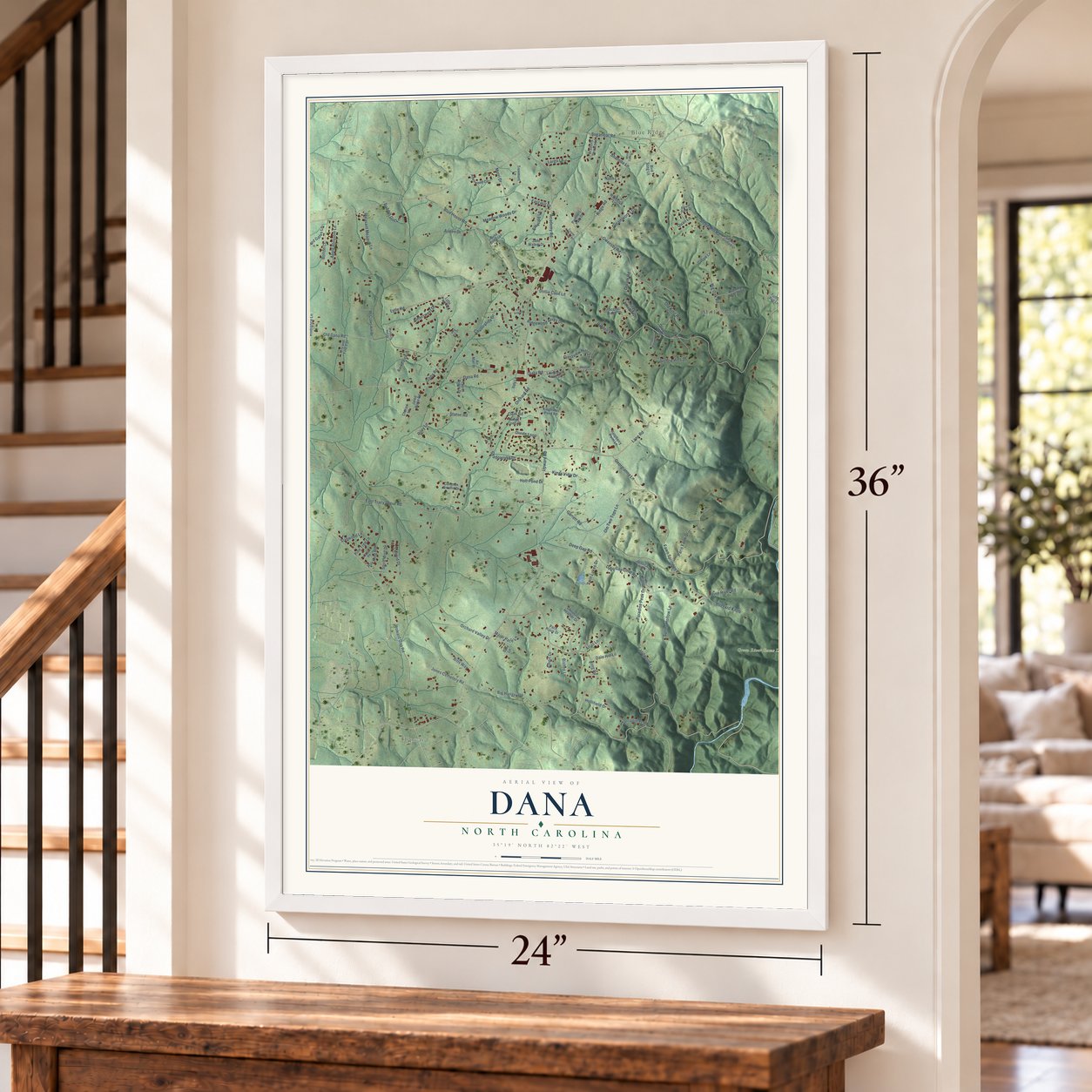
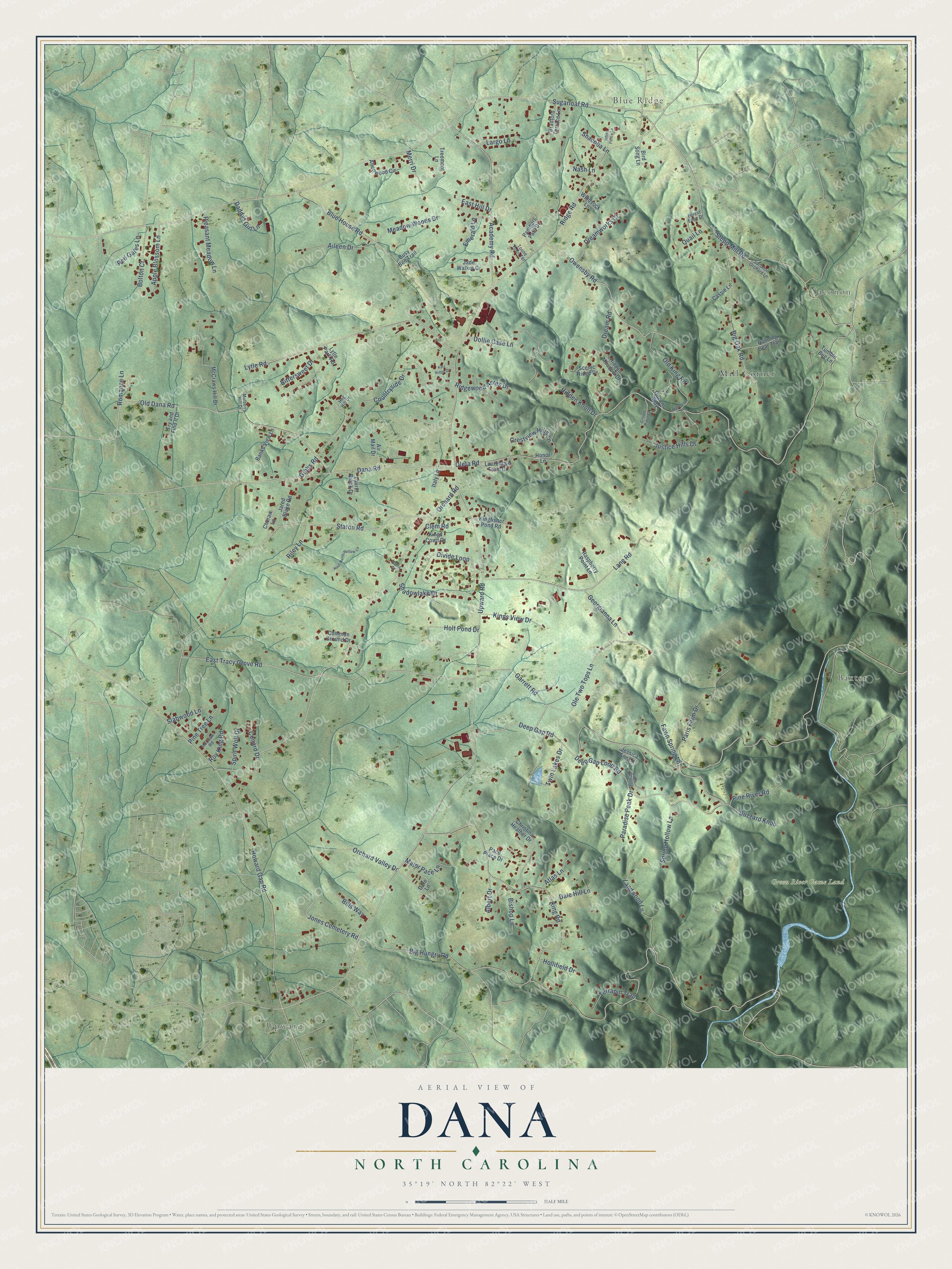
Explore Dana, North Carolina from a whole new perspective. Created using aerial imagery and detailed geographic data, this map captures Dana building by building, with labeled streets, familiar landmarks, and shaded topographical relief that highlights the natural contours of the landscape.
Combining modern data with the timeless character of a vintage atlas, this map is just as interesting up close as it is beautiful on the wall. Whether you grew up in Dana, spent memorable years there, or call it home today, this unique map is a great way to celebrate a place that means something to you. Zoom in on the preview to look for your street, and then order a print to put your memories on the wall.
Three ways to hang it
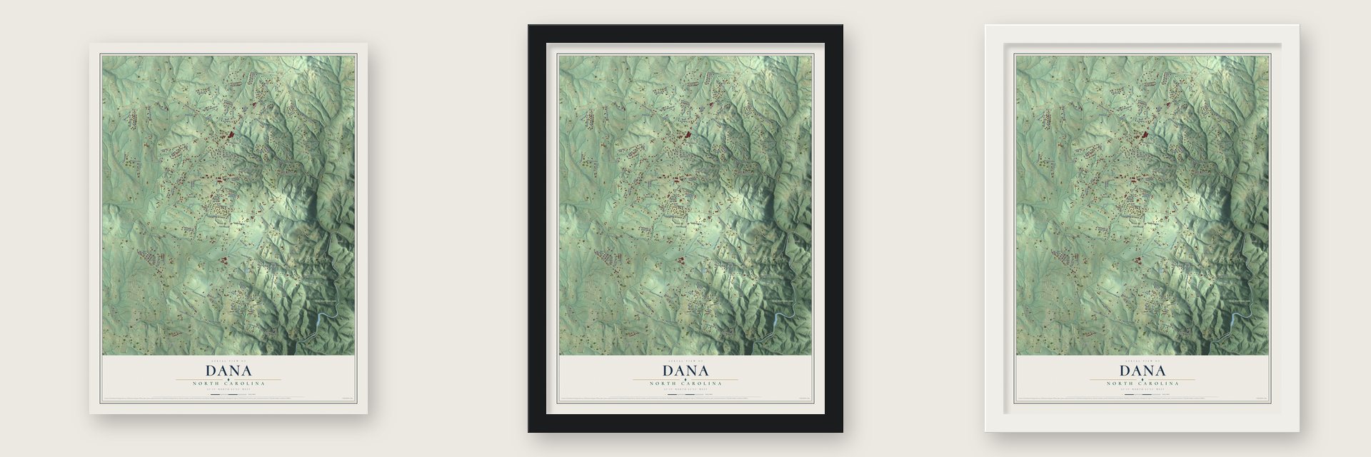
Unframed archival matte, a black wood frame or a white wood frame.
Up close
Geography Worth Displaying
This map was created using accurate cartographic data and authoritative geographic sources, including the U.S. Geological Survey and the Census Bureau. The map brings together terrain, waterways, roads, and building detail. The majority of the streets are labeled, houses are accurately depicted, and the topography is derived from government sources. Combining local data with carefully composed color and shading leads to this beautifully detailed Dana artwork for your wall.
Rather than simply showing street outlines, we’ve included as many of the street names as we could reasonably fit on the map while keeping their names legible. Zoom in on the high resolution preview to see exactly what’s on the map. We truly set out to create a statement piece for anyone who loves Dana. So whether it’s for you, or a gift for someone you love, we hope this map of Dana brings back fond memories.
Read the story behind this map of Dana, North Carolina from 2026.

Find your street
Names on the Dana map
Every name below is printed on this map. Look for your street, your school, the park where you played, or the pond down the road.
Places and landmarks6
- Upward
- Blue Ridge
- Saconon
- Baxter
- Green River Game Land
- Mill Corner
Streets and roads125
- Upward Road
- Big Hungry Road
- Oleta Road
- Sugarloaf Road
- Deep Gap Road
- Ridge Road
- Orchard Road
- Staton Road
- Howard Gap Road
- Stepp Mill Road
- East Tracy Grove Road
- King Road
- Dana Road
- Old Dana Road
- Deep Gap Loop Road
- Lytle Road
- Blue House Road
- Lane Road
- Academy Road
- Owensby Road
- Divide Loop
- Big Oak Road
- Ole Two Tops Lane
- Dollie Case Lane
- Holt Pond Drive
- Countryside Drive
- Landwood Lane
- Bittersweet Drive
- Twin Lakes Drive
- Paris Farm Drive
Show all 125 streets
- Garrett Road
- Jones Cemetery Road
- Gibbs Road
- Justice Hills Drive
- Red Gates Lane
- Aileen Drive
- Orchard Valley Drive
- Dreamworks Court
- Major Pace Lane
- Meadow Woods Drive
- Apple Blossom Lane
- Crestview Hills Lane
- Georgianna Lane
- Old King Road
- Bolton Court
- Fawn Spring Lane
- Kings View Drive
- Pleasant Meadow Lane
- Hidden Knoll Drive
- Pine River Road
- Quail Lane
- Spring Hollow Lane
- Dale Hill Lane
- Ridgewood Acres Drive
- Paradise Peak Drive
- Hollifield Drive
- Shadowlake Drive
- Buzzard Knob
- Terrapin Trail
- Riley Lane
- Emerald Lane
- Merri Drive
- Albert Drive
- Spirit Wolf Drive
- Bills Way
- Pine Tree Lane
- Bishop Lane
- Atlas Lane
- Slabwood Lane
- Daddys Girl Lane
- East Hill Drive
- Shacoba Lane
- Largo Lane
- Conard Drive
- Romance Lane
- Roy King Road
- Dream Road
- Clem Road
- Nash Lane
- McCraws Hill Drive
- Hidden Meadow Drive
- Christina Heather Drive
- Scenic Ridge Drive
- Queens Way
- Honor Lane
- Allenwood Circle
- Panthers Path Drive
- Tumble Bug Lane
- Kingfisher Pond Road
- Treemont Lane
- Bradford Terrace Lane
- Running Bear Trail
- Jessica Ann Lane
- Italy Lane
- Pace Place Drive
- Dare Lane
- Try and Find It Drive
- Air Mail Drive
- Banks View Lane
- Raspberry Point Lane
- Bird Song Lane
- Jade Walker Drive
- Laureldale Farm Drive
- Jared Blake Road
- Cheraw Lane
- Common Ground Drive
- Kings Court Drive
- Windsock Lane
- Lytle Park Road
- Laurel Brook Drive
- Busy Bee Trail
- Cassie Lane
- Saconon Orchard Lane
- Toone Town Terrace
- Forest Edge Drive
- Mulberry Hill Drive
- McCraw Road
- Hog Hill Drive
- Darla Drive
- Hoot North Hollow Lane
- Moonrise Lane
- Lively Crossing
- Gilliam Ridge Lane
- White Fence Lane
- Kerr Ridge Drive
Names are listed as they appear on the printed map. Zoom into the product photos to find them.
About Dana, North Carolina
Dana is a community of 3,683 people in Henderson County, 5 miles east of Hendersonville. The Hadley family moved here from New Hampshire in 1890 for their health, and D. G. Hadley, who was in the hotel business, bought a tract of land and put up the Summit Hotel. The hotel had 20 rooms and opened its doors on July 1, 1892.
The closest post office, at Blue Ridge, was more than a mile and a half from the hotel, so Hadley petitioned for one nearer to his guests. He asked the public to suggest a name, and people proposed his son Dana, who was well known and well liked around the community. The Dana Post Office opened in 1892 inside William S. Case's store, the first store in Dana, and a post office by that name has operated from that year on.
- The state's largest canneryJonathan Case followed his father, William, into business and took over the Dana store in the early 1900s. In 1912 he joined M. C. Toms and Charles French Toms to organize the Ottaray Canning Company. The company built a large plant, and for two seasons it was the biggest cannery in North Carolina, turning out 38,000 cans a day.
- Stepp's Mill, built in 1913In 1913 Benjamin and Alice Stepp Merrell built a grist mill that ran on water from Tumblebug Creek, which feeds the Big Hungry River, and they operated it themselves. It ground grain for the farmers nearby, and with the post office next door it became the spot where rural families in the Saconon part of Dana gathered news and information.
- Phones and power for DanaStorekeeper J. H. Stepp worked to improve Dana's telephone service, helped bring electricity to the community and pushed for consolidating its schools. He also served as Dana's postmaster from 1921 to 1947, apart from one short break.
- On the Eastern Continental DivideThe center of Dana sits at 2,256 feet, right on the divide. Rain on the eastern side runs to the Hungry River and on through the Green, Broad, Congaree and Santee rivers to the Atlantic Ocean. Rain on the western side drains to Mud Creek and travels by the French Broad, Tennessee and Mississippi rivers to the Gulf of Mexico.
Keep exploring North Carolina
Dana is one of 952 North Carolina towns we've mapped. Every dot on the map is a print of its own.
The search covers every state, North Carolina first.
Near Dana
Order 2 or more town maps and save 10%. Shown in the size and finish you picked above, so they hang as a set.
- Upward 12" x 18" / Archival Matte Print $39.99
- East Flat Rock 12" x 18" / Archival Matte Print $39.99
- Barker Heights 12" x 18" / Archival Matte Print $39.99


More maps nearby: Hendersonville, Saluda, Edneyville, Flat Rock and Fruitland.
The art of mapping a place
How This Map Was Made
Real places. Remarkable detail. Discover the layers that turn geographic data into a map of home.

The view from above
Aerial imagery reveals the character of the land: woodland, open fields, and the patterns of a place.

The shape of the land
Elevation data brings hills, valleys, and subtle changes in the landscape into view.

The details of home
Roads, waterways, and building footprints come together to make the map feel unmistakably local.

Geography becomes art
Considered color, shading, and typography bring the layers together in a map made for your wall.


Process illustrated with Mendon, Massachusetts. Aerial imagery: USDA NAIP. Terrain: USGS 3D Elevation Program. Map details and finished artwork: KNOWOL.
The Details
About This Print
Choose an archival matte print, or a black or white Ayous wood frame. The archival matte print is unframed.
Select your size and finish above to see the matching product image and price.
Materials & Craftsmanship
A contemporary map with the character of a classic atlas, printed on archival matte paper. Optional frames are made from Ayous wood.
Your printed map does not include the watermark shown in the full-map preview.
Shipping & Delivery
Free shipping within the United States. Every print is made to order in the USA.
Buying a gift? Add a note in your cart and we'll include it. We never put prices in the package.
Prints ship within 2 to 3 business days. Allow 7 to 10 days total from ordering for delivery. Timing may vary during holidays or periods of high order volume.
Read our shipping policy.
Returns and damaged prints
Each print is made to order. Change-of-mind refunds are not available after production.
If your print arrives damaged, misprinted or incorrect, contact support@knowol.com within 30 days of receiving it. Include your order number, photos and a description of the issue.
Read our full refund and replacement policy. For questions about your order, email support@knowol.com.