


Search for another town


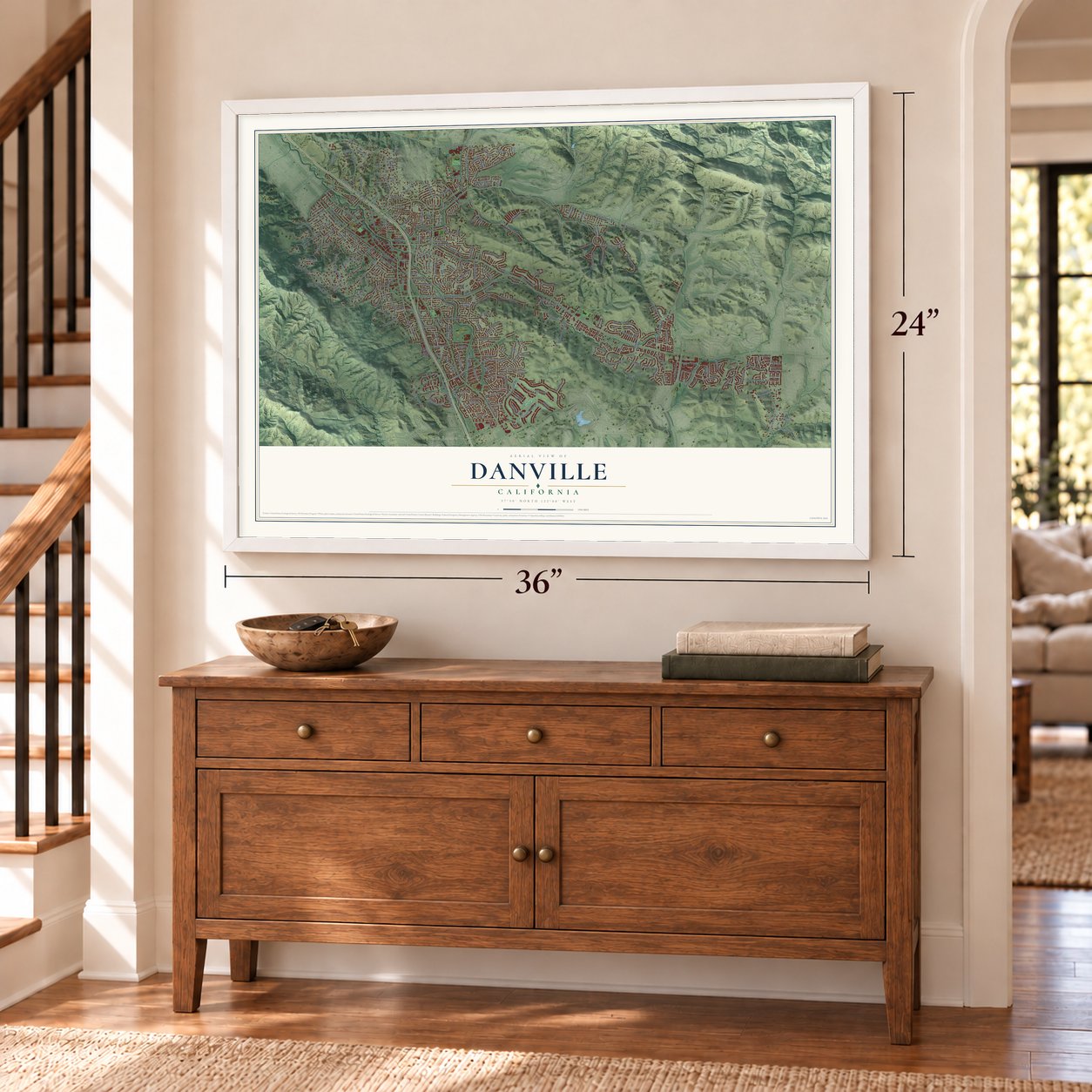

Free U.S. delivery 7 to 10 days after you order
Danville, California Map Art
Building by building, with labeled streets and shaded relief.
12" x 18" Archival Matte Print
A Map of Home. A Work of Art.
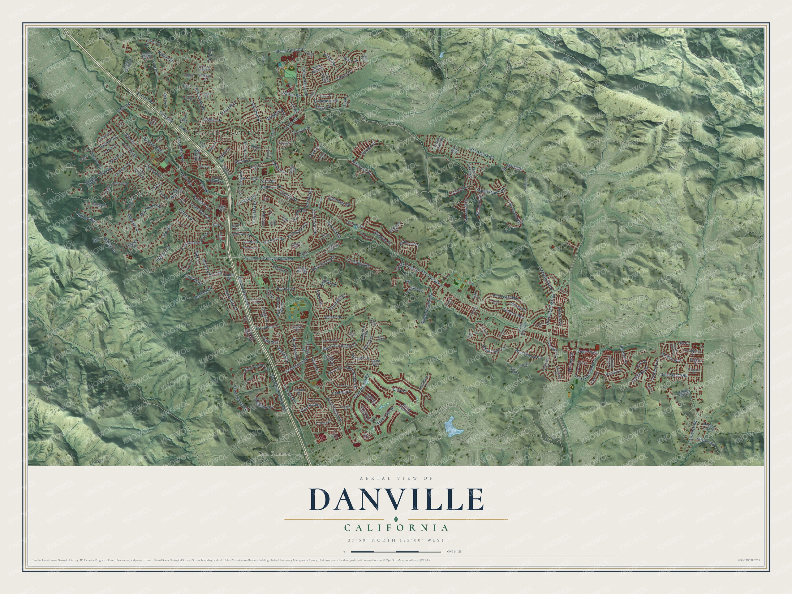
Explore Danville, California from a whole new perspective. Created using aerial imagery and detailed geographic data, this map captures Danville building by building, with labeled streets, familiar landmarks, and shaded topographical relief that highlights the natural contours of the landscape.
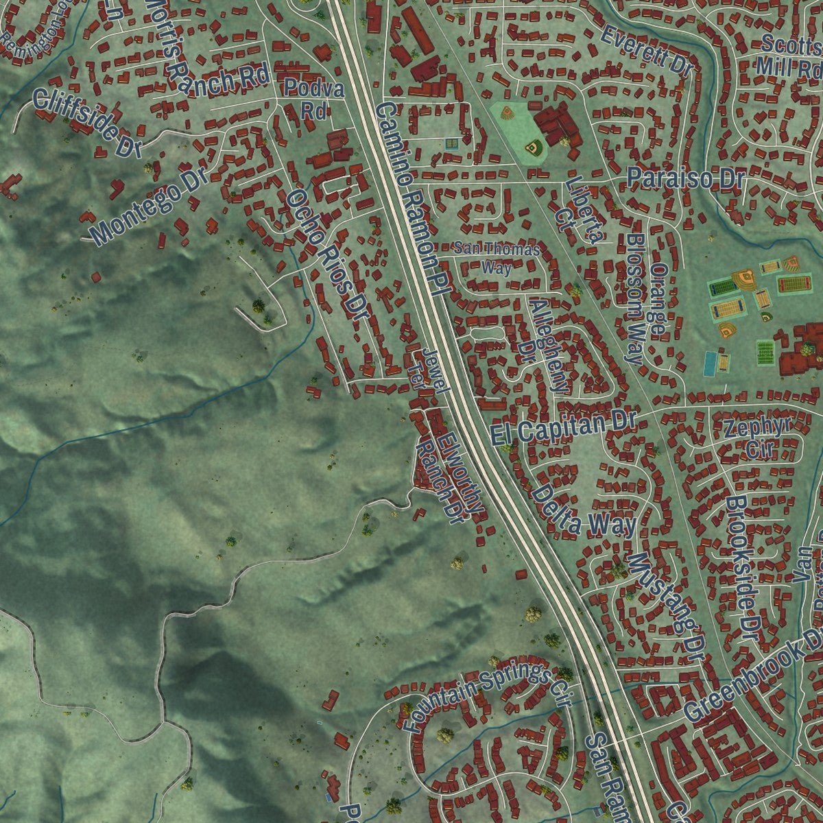
Combining modern data with the timeless character of a vintage atlas, this map is just as interesting up close as it is beautiful on the wall. Whether you grew up in Danville, spent memorable years there, or call it home today, this unique map is a great way to celebrate a place that means something to you. Zoom in on the preview to look for your street, and then order a print to put your memories on the wall.
Three ways to hang it
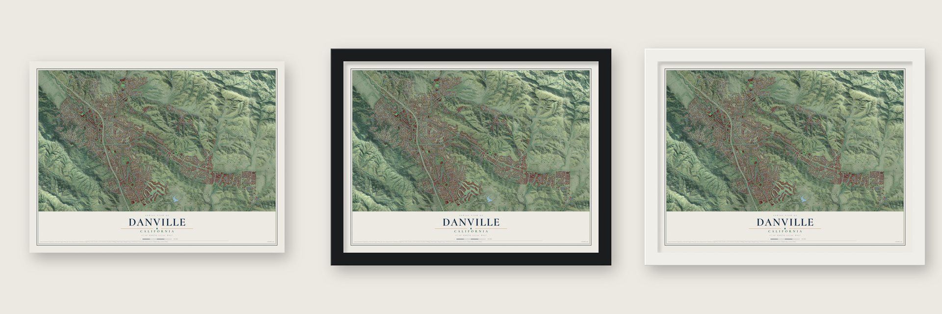
Unframed archival matte, a black wood frame or a white wood frame.
Up close
Geography Worth Displaying
This map was created using accurate cartographic data and authoritative geographic sources, including the U.S. Geological Survey and the Census Bureau. The map brings together terrain, waterways, roads, and building detail. The majority of the streets are labeled, houses are accurately depicted, and the topography is derived from government sources. Combining local data with carefully composed color and shading leads to this beautifully detailed Danville artwork for your wall.
Rather than simply showing street outlines, we’ve included as many of the street names as we could reasonably fit on the map while keeping their names legible. Zoom in on the high resolution preview to see exactly what’s on the map. We truly set out to create a statement piece for anyone who loves Danville. So whether it’s for you, or a gift for someone you love, we hope this map of Danville brings back fond memories.
Read the story behind this map of Danville, California from 2026.

Find your street
Names on the Danville map
Every name below is printed on this map. Look for your street, your school, the park where you played, or the pond down the road.
Places and landmarks2
- Danville Town Hall
- San Ramon
Streets and roads269
- Greenbrook Drive
- Saint Norbert Drive
- Windover Drive
- Center Way
- Cam Tassajara
- Diablo Road
- Cam Ramon
- El Capitan Drive
- Camino Ramon Place
- San Ramon Valley Boulevard
- El Pintado Road
- Sycamore Valley Road West
- Saint George Road
- Wood Ranch Circle
- Woodranch Circle
- Montair Drive
- La Gonda Way
- Brookside Drive
- Lawrence Road
- Contada Circle
- McCauley Road
- Highland Drive
- Paraiso Drive
- Tunbridge Road
- Silver Lake Drive
- Danville Boulevard
- Richard Lane
- Glasgow Circle
- Blackhawk Road
- Love Lane
Show all 269 streets
- Harlan Drive
- Edinburgh Circle
- Alta Vista Way
- Park Hill Road
- Green Valley Road
- Tuscany Way
- La Questa Drive
- Dunhill Drive
- Old Blackhawk Road
- Laurel Drive
- Sherburne Hills Road
- Magee Ranch Road
- Dolphin Drive
- Cameo Drive
- Ridgeland Circle
- Hartz Avenue
- Kuss Road
- Peters Ranch Road
- Railroad Avenue
- Sunhaven Road
- Ramona Road
- Tassajara Ranch Drive
- Franciscan Drive
- Parkhaven Drive
- Cam Amigo
- Mustang Drive
- Old Orchard Drive
- Tassajara Lane
- Bolero Drive
- El Pinto Road
- Town and Country Drive
- Ocho Rios Drive
- Verona Avenue
- Saint Helena Drive
- Liverpool Street
- Ackerman Drive
- Borica Drive
- Adobe Drive
- Glen Road
- El Rio
- Stone Valley Road
- Merano Street
- Hartford Road
- Jasmine Way
- Dutch Mill Drive
- Estates Drive
- Viewpoint Drive
- Cliffside Drive
- Front Street
- Old Farm Road
- Gil Blas Road
- Blemer Road
- Montego Drive
- Merrilee Place
- Culet Ranch Road
- Plaza Circle
- Saint Christopher Drive
- Sky Terrace
- Clydesdale Drive
- Matadera Way
- Sheri Lane
- El Alamo
- Macomber Road
- Pulido Road
- Shadewell Drive
- Laurelwood Drive
- Vista Drive
- Shady Creek Place
- Canfield Drive
- Thornhill Road
- El Rio Road
- Morris Ranch Road
- Indian Home Road
- Harper Lane
- Heritage Drive
- Hilferd Way
- Turrini Drive
- Stirling Drive
- Alicante Drive
- Rassani Drive
- Delta Way
- Fulton Way
- Doral Drive
- Brooktree Drive
- El Cajon Drive
- Margaret Lane
- El Dorado Avenue
- Bobbie Drive
- Ilo Lane
- Nathan Place
- Murcia Court
- Hill Road
- Molitas Road
- El Portal
- Robyn Drive
- Rima Court
- Eva
- Tim Court
- Lily Court
- Barrett Circle
- Morninghome Road
- Fountain Springs Circle
- Del Amigo Road
- Hill Meadow Place
- Everett Drive
- Clipper Hill Road
- Linda Mesa Avenue
- West El Pintado
- Victorian Lane
- Alamo Springs Drive
- Mitchell Way
- Verde Mesa Drive
- Alamatos Drive
- Meadow Lake Drive
- Valley Creek Lane
- Orange Blossom Way
- Freitas Road
- Belgian Drive
- Joaquin Drive
- La Pera Circle
- Elworthy Ranch Drive
- Starmont Court
- Zephyr Circle
- El Rincon Road
- Zenith Ridge Drive
- Still Creek Road
- Belleterre Drive
- Saint David Drive
- Glen Arms Drive
- Cordell Drive
- Shirlee Drive
- Camaritas Way
- Myrtle Beach Lane
- Fairway Drive
- Podva Road
- Briar Place
- Toyon Terrace
- Tweed Drive
- Cam Encanto
- Allegheny Drive
- Rolling Hills Lane
- Hidden Hills Place
- Diablo Creek Place
- Casablanca Street
- Wood Ranch Drive
- Kirkcrest Road
- Van Patten Drive
- Leafield Road
- El Alamo Court
- Hillside Road
- Sunset Drive
- Roan Drive
- Columbine Court
- Gerbera Street
- Campbell Place
- Shelby Hill Road
- Marian Lane
- Scotts Mill Road
- Liberta Court
- Brigham Lane
- Vis del Diablo
- Betten Court
- Hartz Way
- Como Way
- Jillian Way
- Oak Court
- Club Terrace
- Arroyo Drive
- Gwen Court
- Elati Court
- Trish Court
- Luz Court
- Mia Court
- Fire Trail
- Blackstone Drive
- Stetson Drive
- Crestridge Drive
- Montcrest Place
- Century Way
- Rancho Verde Circle West
- Conway Drive
- Northview Court
- Rutherford Drive
- Willow Drive
- Onida Circle
- Princeton Lane
- Messian Place
- Logan Lane
- Old Creek Road
- Hillmont Place
- Amigo Road
- Woodbine Lane
- Claridge Drive
- Starview Drive
- Ent Mesa
- Santiago Court
- Roberts Court
- Leeds Court East
- Westwich Street
- Provence Road
- Spring Lane
- Glen Alpine
- Buckeye Lane
- Jewel Terrace
- Lowell Drive
- Torino Court
- Hartley Drive
- Hope Lane
- Zita Court
- Fontaine Drive
- Highbridge Lane
- Remington Loop
- Fostoria Circle
- Joaquin Circle
- Rainbow Circle
- Squirrel Ridge Way
- Ynez Circle
- San Thomas Way
- El Pintado Heights Drive
- Aptos Place
- Glendora Circle
- Via Hermosa
- El Pintado Place
- Adobe Court
- Maiden Lane
- Woodside Drive
- Victoria Place
- Saddleback Drive
- Corte Dorado
- Gatetree Drive
- Ramon Court
- La Vista Way
- Heartland Street
- Barrenger Drive
- Hillview Drive
- Glenwood Court
- Scenic Court
- Dustin Lane
- Glen Court
Names are listed as they appear on the printed map. Zoom into the product photos to find them.
About Danville, California
Danville is a town of 43,582 people in Contra Costa County, set in a narrow part of the San Ramon Valley with Mount Diablo rising to the east. Native Americans lived beside its creeks and spent summers camped on the mountain. Later the land served as grazing ground for Mission San José and became part of a Mexican land grant, Rancho San Ramon.
The post office opened in 1860, and its first postmaster was Henry W. Harris, who owned a hotel. Farmers here raised wheat until the Southern Pacific built a spur line through the valley in 1891, and after that they turned to fruits and nuts. The first large housing tracts went up in 1947. The valley grew from 2,120 people in 1940 to 4,630 by 1950 and boomed again in the 1970s and 1980s, and in 1982 voters chose to incorporate Danville as a town.
- Hartz Avenue and the depotSan Ramon Branch trains began running on June 7, 1891, and the Danville depot opened late that December. John Hartz had sold 8.65 acres for the station, then split the land east of it into lots. The depot joined the National Register in 1994 and now houses the Museum of the San Ramon Valley.
- A hotel turned aroundThe Danville Hotel first stood across from the railroad station. In 1927 it was moved so that it faced Hartz Avenue, and it still stands downtown after a renovation in 2016. The Grange Hall built in 1874 also survives.
- Union Academy, 1859 to 1868The Cumberland Presbyterian Church started the Union Academy, a private high school that drew students from across the county. It ran for nine years until fire destroyed it in 1868. Danville Presbyterian Church was dedicated in 1875.
- A library of 104 booksIn 1910 the valley organized a public high school district and built San Ramon Valley Union High School, and St. Isidore's Catholic Church was founded the same year. The library opened in 1913 with 104 books. In 1915 an Improvement League paid for the town's first streetlights and paved roads.
- Parade day and the Old OakThe Kiwanis Fourth of July parade draws more than 40,000 people every year. On the Friday after Thanksgiving, crowds gather on Diablo Road for the Lighting of the Old Oak Tree.
Keep exploring California
Danville is one of 1,990 California towns we've mapped. Every dot on the map is a print of its own.
The search covers every state, California first.
Near Danville
Order 2 or more town maps and save 10%. Shown in the size and finish you picked above, so they hang as a set.
- Diablo 12" x 18" / Archival Matte Print $39.99
- Blackhawk 12" x 18" / Archival Matte Print $39.99
- Alamo 12" x 18" / Archival Matte Print $39.99


More maps nearby: San Ramon, Norris Canyon, Camino Tassajara, Tassajara and San Miguel.
The art of mapping a place
How This Map Was Made
Real places. Remarkable detail. Discover the layers that turn geographic data into a map of home.

The view from above
Aerial imagery reveals the character of the land: woodland, open fields, and the patterns of a place.

The shape of the land
Elevation data brings hills, valleys, and subtle changes in the landscape into view.

The details of home
Roads, waterways, and building footprints come together to make the map feel unmistakably local.

Geography becomes art
Considered color, shading, and typography bring the layers together in a map made for your wall.


Process illustrated with Mendon, Massachusetts. Aerial imagery: USDA NAIP. Terrain: USGS 3D Elevation Program. Map details and finished artwork: KNOWOL.
The Details
About This Print
Choose an archival matte print, or a black or white Ayous wood frame. The archival matte print is unframed.
Select your size and finish above to see the matching product image and price.
Materials & Craftsmanship
A contemporary map with the character of a classic atlas, printed on archival matte paper. Optional frames are made from Ayous wood.
Your printed map does not include the watermark shown in the full-map preview.
Shipping & Delivery
Free shipping within the United States. Every print is made to order in the USA.
Buying a gift? Add a note in your cart and we'll include it. We never put prices in the package.
Prints ship within 2 to 3 business days. Allow 7 to 10 days total from ordering for delivery. Timing may vary during holidays or periods of high order volume.
Read our shipping policy.
Returns and damaged prints
Each print is made to order. Change-of-mind refunds are not available after production.
If your print arrives damaged, misprinted or incorrect, contact support@knowol.com within 30 days of receiving it. Include your order number, photos and a description of the issue.
Read our full refund and replacement policy. For questions about your order, email support@knowol.com.